Okere Falls Track presents a 3-kilometer round trip walk (1.9-mile hike) in Okere Falls Scenic Reserve near Rotorua, New Zealand loaded with views of waterfalls, cascades, and emerald-colored pools on the Okere River, all encircled by dense native brush. The river can be explored on an exciting whitewater rafting trip, but you’ll get a great overview of its finer features and stay dry on this short walk, which is full of beauty and history.
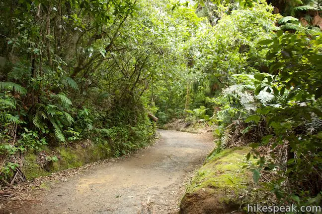
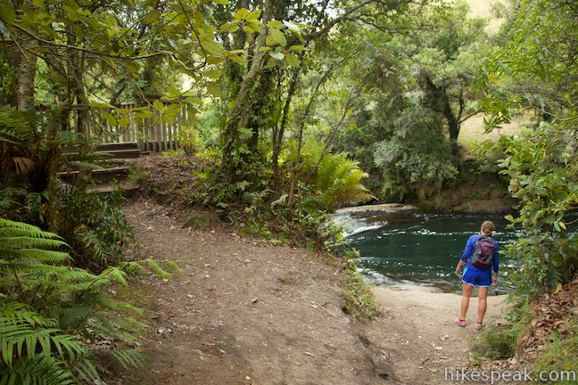
Car parks are located at the north and south ends of Okere Falls Scenic Reserve. While you could set out from either location, it makes the most sense to start upstream from the southern car park, where information panels provide an introduction to the park. On this walk, you’ll admire a few waterfalls, peer into a cave, and get an electric history lesson. A welcoming sign provides this overview:
Significant Māori and European historical sites are contained in this reserve, including the remains of the fourth hydroelectric power station even built in New Zealand. The Okere River descends through the reserve, tumbling over four waterfalls and through regeneration native bush before opening out to the Okere Trout Pools.
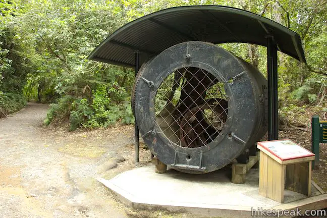
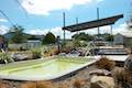
Look at the ruins of old power station by the first waterfall on the Okere River. On the way there, the track passes a large turbine placed at the first junction. The turbine was part of Okere Falls Power Station, which began producing electricity in 1901, allowing Rotorua to become the fourth town in New Zealand to have power. It must have been amazing to get electricity for the first time. The power station definitely contributed to the area’s development, and in 1907, the output was doubled to 200 kilowatts to keep up with growing demand. By 1939, this early hydroelectric power station became obsolete and was shut down. However, the turbine was not brought up from the river until the 1990s, as a panel explains:
This turbine was retrieved from the remains of the dynamo or power house which formed part of the Okere Falls Power Station on the Kaituna River. It was one of two Waverley Horizontal turbines originally installed in the dynamo house. These turbines were water driven and connected to two 50 kilowatt generators, enabling 100 kilowatt output. The turbines were brought to the site by bullock team in 1900. They were lowered to the dynamo house on the river through the excavating cutting behind you. In September 1995, the turbine was hauled from the riverbank through the same cutting to prevent its further deterioration.
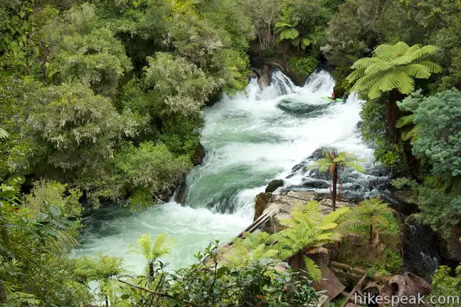
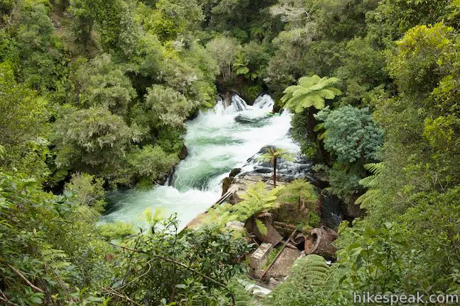
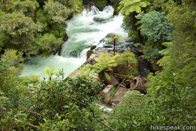
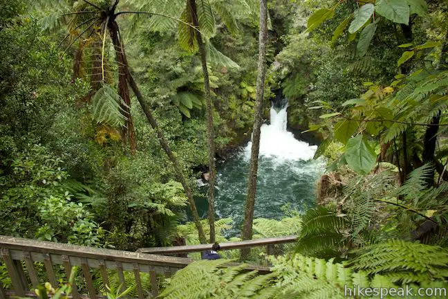
Go past the turbine to get a view of the old power station along the Okere River. After walking 75 meters up the track to this first junction, turn right, following signs for Okere Falls and power house viewing. Walk 25 meters down to a grand view of Okere Falls and a string of cascades.
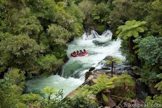
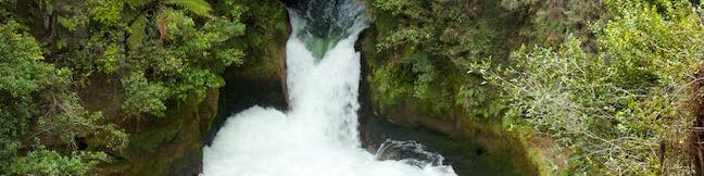
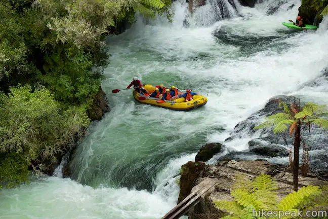
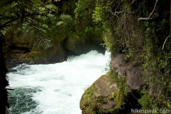
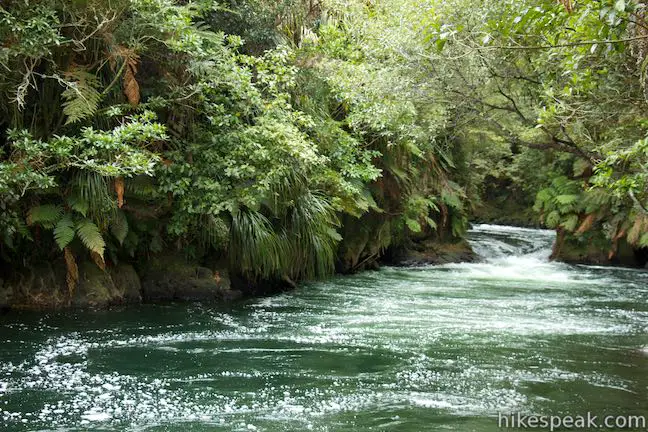
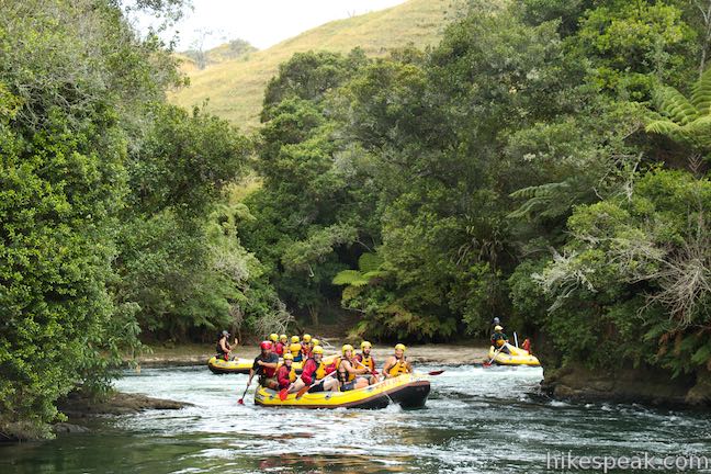
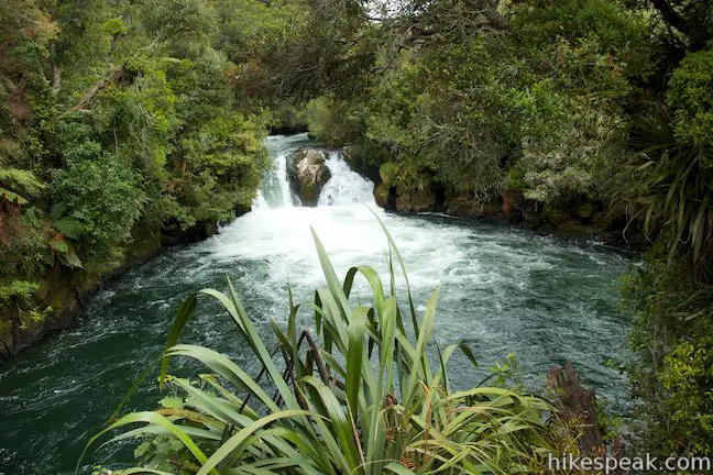
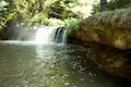
Emerald pools on Okere River are surrounded by dark green rainforest-covered cliffs. Below the waterfall, on the side of the river below the overlook, you’ll see the ruins of Okere Falls Power Station, where a mix of concrete and rusting metal is being overtaken by nature. To get an idea how the river looked during the early years of the twentieth century, imagine a long flume carrying water from the top of the falls to a spot above the power station where the water would fall over large blades to spin turbines and generate electricity. The flume is long gone, allowing for unobscured view of Okere Falls, which is a short, wide waterfall that emerges from the rainforest in channels broken up by rock islands. Watch rafts and kayaks cross over the falls on a wet and wild ride through Okere Falls Scenic Reserve.
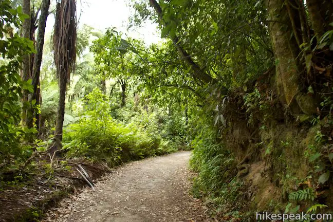
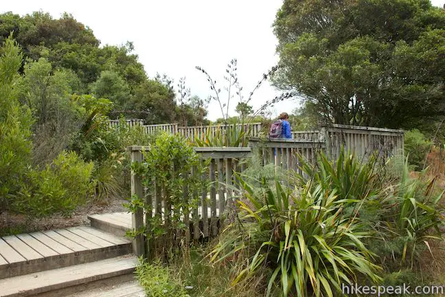
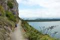
Backtrack from Power Station Lookout up to the main track and turn right to continue on Okere Falls Track. The wide and well-maintained track passes through lush, dense forest on the cliffs above the river.
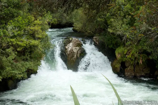
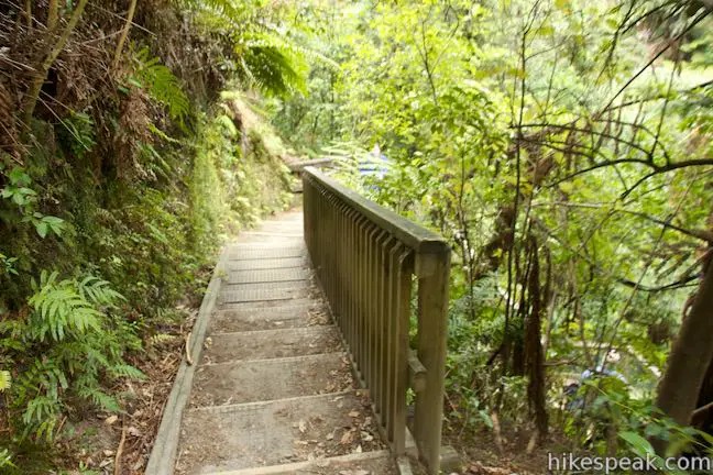
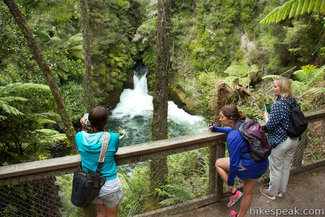
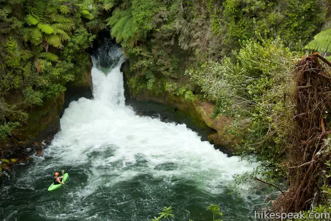
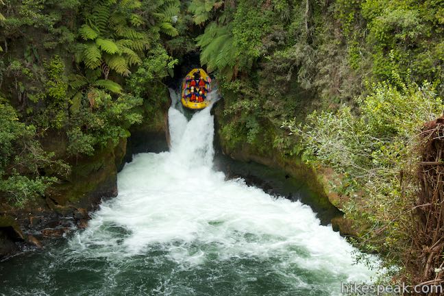
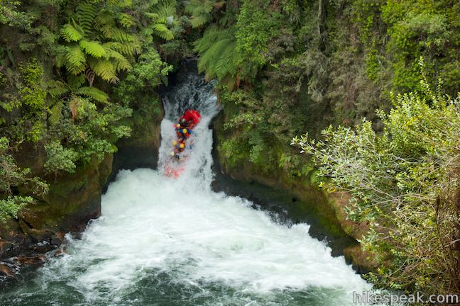
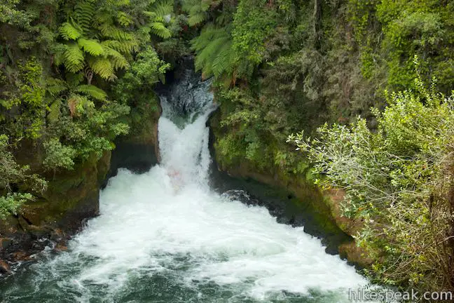
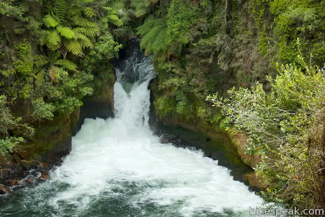
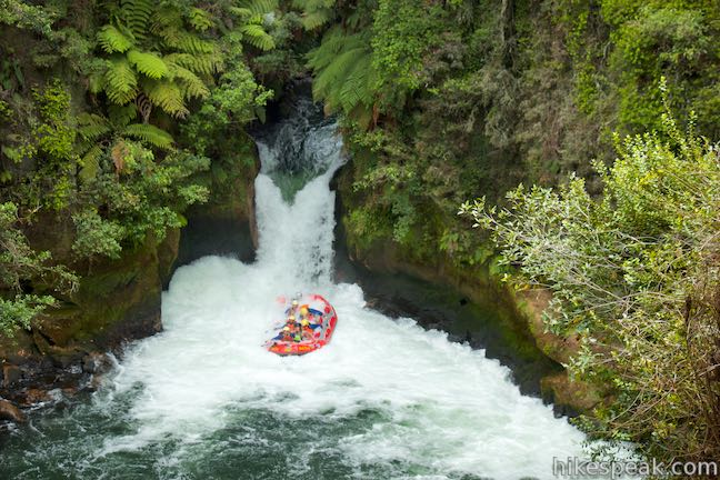
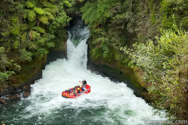
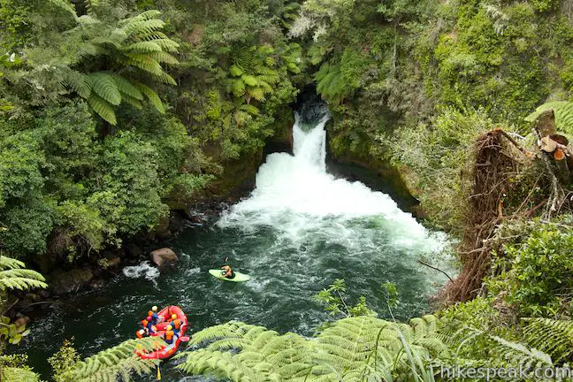
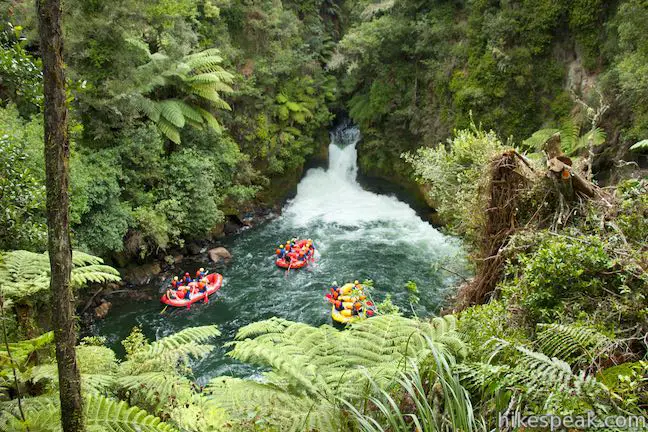
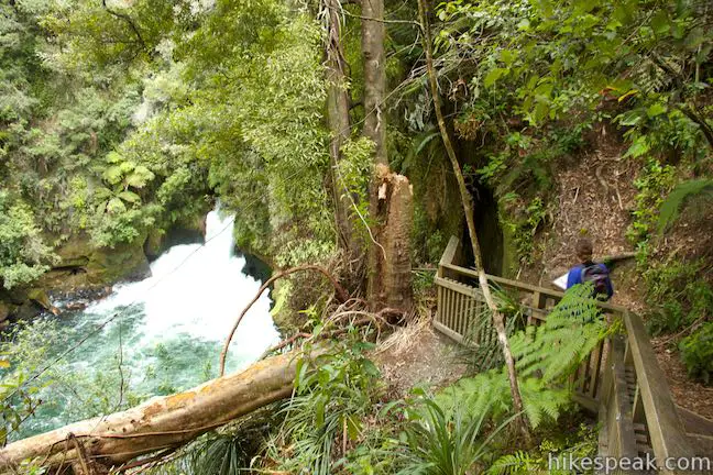
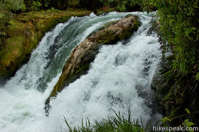
After walking a total of 550 meters, come to another junction and turn right, following a sign for Tutea Falls and Hinemoa’s Steps to Tutea’s Cave. Walk fifty meters out on this spur, taking wooden steps down to an overlook that faces upstream toward Tutea Falls. This beautiful waterfall is framed by rock walls that push the water down a chute.
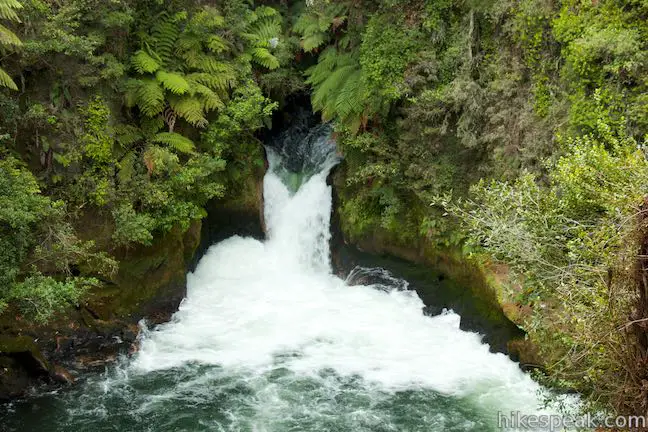
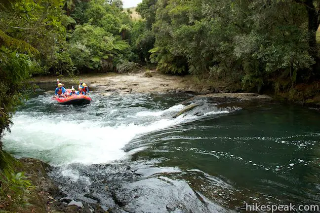
Tutea Falls measures 7 meters (23 feet) tall, splashing down in a frothy mix of spray above a green pool. If you think Tutea Falls looks too tall for whitewater rafting, you’re almost right. Tutea Falls is the tallest commercially rafter waterfall in the world. It’s a thrill to go over in a raft, and can can get a taste of the excitement watching rafts tip over the brink, turn vertical, and plunge into the spray below the falls, sometimes disappearing completely from view before popping back up.
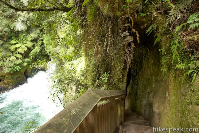
The lookout provides an excellent vantage of the waterfall, and there is even more to see. Continue down switchbacks in the trail below the lookout to get down the bluff to Hinemoa’s Steps. The steps were cut into the cliffs along the river to access Tutea’s Cave, which recedes into the rock face above the river just below the waterfall. Engineers from the power station carved out the steps in 1907 so that tourists could get to the cave. After descending through an archway in the impressive staircase, get an almost river-level view across the churning water. The steps are named after a folkloric Māori woman, Hinemoa. According to the legend Hinemoa was a chief’s daughter who swam across Lake Rotorua to be with her forbidden love, Tutanekai.
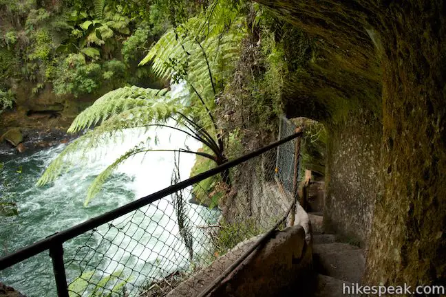
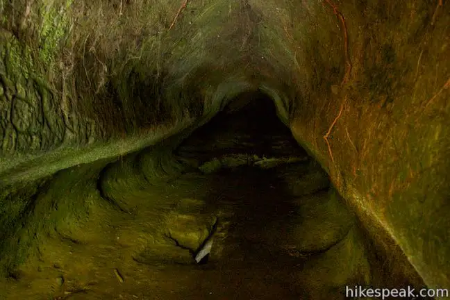
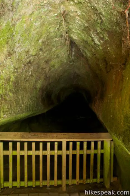
At the bottom of the steps, look into the darkness of Tutea’s Cave (also called Tutea’s Caves), where a railing keeps you from going too far back into the deep cave, which appears to have dangerous holes in the floor. While little is known for certain about the cave’s history, a panel along the track offers this interesting story:
Some sources suggest women and children may have hidden in the caves in times of war, making the treacherous descent by rope. Nowadays the occupants are occasional cave wetas.
You can take the stairs back up to the overlook (no need to rely on perilous ropes to get back up the cliffs from the cave).
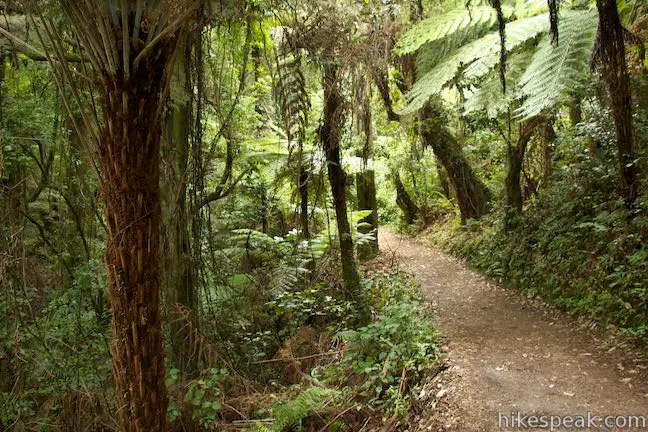
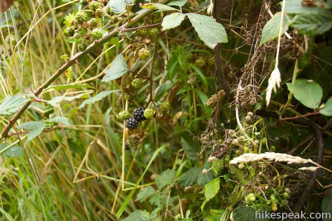
Retrace your steps to the main trail and turn right to continue heading downstream. The track goes gradually downhill through the rainforest, passing patches of blackberries in season.
After 1.5 kilometers of hiking, come to a third junction. A fifty-meter long track to the left goes to the car park at the end of Trout Pool Road. Bear right to proceed with Okere Falls Track to two more lookouts and views of Trout Pool Falls and Trout Pool. You will return to this junction after walking another 500 meters on a loop. Excluding the side tracks to the waterfall overlooks, it is one kilometer back to the starting point from this junction.
Walk a hundred meters farther to a wooden viewing platform above smaller rapids on Okere River. You can descend to the river’s edge to the left and right. To the left, a flight of steps leads down to the take-out point for rafts making the adventure down the river. If you’re wondering why they get out here, it’s because Trout Pool Falls is just downriver and that class 6 drop is too dangerous for the commercial rafting outfitters.
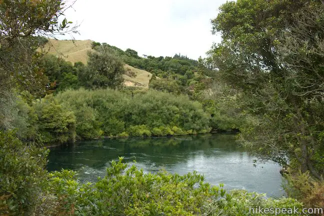
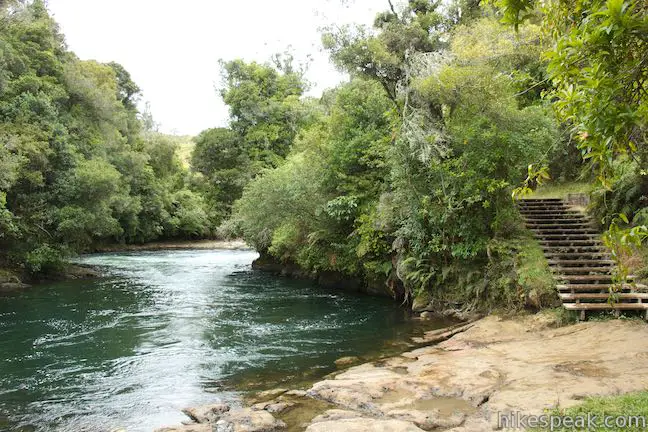
Proceed on the track along the river to see Trout Pool Falls. Footpaths off the track lead to views alongside the waterfall, and you can get a head-on view of Trout Pool Falls from farther down Okere Falls Track. The track goes along cliffs above Trout Pool, where the river widens. The pool is a popular fishing spot, where trout may be visible swimming upstream against the current. Another name for Okere River is Kaituna, which translates to eel food. Eels were a significant food source for the Ngāti Pikiao who lived here.
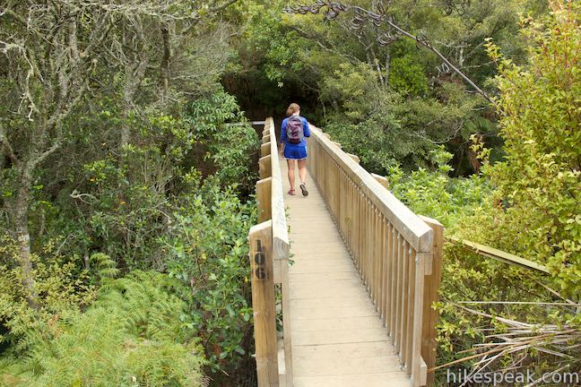
A wooden footbridge crosses the river above Trout Pool to connect to a hiking track on the opposite side of the river. Skipping that extension, the track continues up steps to a viewpoint above Trout Pool. Curve to the left to get to the car park on Trout Pool Road. This is an alternate starting point for hikers, mostly used by rafting companies to load up after the adventures down the river. Take the track heading east from the car park back toward the river and you will quickly complete the loop. Turn right up Okere Falls Track to walk one kilometer back to the start (unless you decide to revisit the overlook).
Okere Falls Track has interesting history and impressive scenery. There is 55 meters (180 feet) of elevation change on this relatively easy 3-kilometer walk with steps. The river it overlooks is a massive adventure on a raft and the trail is exciting too. If you’re inspired to get in on the rafting fun, consider whitewater rafting with Kaitiaki Adventures.
Dogs and bikes are not allowed in Okere Falls Scenic Reserve. There is a toilet near the car park by the south end of the track Okere Falls Scenic Reserve is free to visit and no permit is required for Okere Falls Track, so get out and enjoy!
Directions to the Trailhead
- From the center of Rotorua, take State Highway 30A east from State Highway 5 for a few kilometers.
- The road joins State Highway 30 and proceeds north.
- Drive 10.4 kilometers and go straight onto State Highway 33 as SH 30 turns to the right.
- Drive 7.8 kilometers to the outlet of Lake Rotoiti and turn left onto Trout Pool Road, following a sign for Okere Falls.
- Drive 350 meters and turn right into a large car park at the start of the walk.
Trailhead Location
Trailhead address: Trout Pool Road, Okere Falls, Bay of Plenty, 3074, New Zealand
Trailhead coordinates: -38.01424, 176.34396 (38° 00′ 51.26″S 176° 20′ 38.25″E)
You may also view a regional map of surrounding New Zealand tracks, campgrounds, and lodging.


 | Kaituna River Whitewater Rafting Take a memorable trip down the Kaituna River (Okere River) through Okere Falls Scenic Reserve that includes a thrilling plunge over Tutea Falls, the tallest commercially rafted waterfall in the world! |
 | Blue Lake This 6.15-kilometer circuit near Rotorua provides a pleasant loop across lakeside beaches and forests, rising to a lookout over Blue Lake and nearby Green Lake. |
 | Waimangu Volcanic Valley This 4.75-kilometer one-way route descends through a landscape of spectacular geothermal features like Frying Pan Lake, the largest hot spring in the world. Pair a walk down the valley with a Lake Rotomahana Boat Cruise for a memorable geothermal experience in Rotorua. |
 | Lake Rotomoahana Boat Cruise Take a boat tour over the lake at the bottom of Waimangu Volcanic Valley, getting close to steaming vents and geysers right along the lakeshore for a unique on-the-water experience. The cruise is reachable by bus or a hike down Waimangu Volcanic Valley. |
 | Crater Lake This 1-kilometer walk in Rainbow Mountain Scenic Reserve goes to an overlook with views of a turquoise pool below vibrant cliffs. |
 | Kerosene Creek This short walk follows Kerosene Creek down to a hot pool below a crescent-shaped waterfall. Bring your bathing suit and wade into warm, welcoming waters. |
 | Wai-O-Tapu Thermal Wonderland This thermal area full of hot pools, geysers, fumaroles, and mud pots can be explored on three successive loops for walks of 1.35 to 3.05 kilometers. |
 | Mount Maunganui This 6.8 kilometer trek combines picturesque tracks around the base and up to the summit of a 232-meter tall mountain on the tip of a peninsula in the Bay of Plenty Region of New Zealand. |
 | More trails in New Zealand Explore other destinations for walking and hiking (as well camping and lodging) in New Zealand. |
 | Rotorua Top 10 This holiday park has campsites, cabins, and motel accommodations in a fun setting near the center of Rotorua with amenities that include mineral hot pools. |
 | Murupara Motor Camp Set in a small town in the Bay of Plenty Region of New Zealand, this motor camp is half holiday park and half motor lodge, offering a variety of accommodations in a location that is both removed from busy tourist centers and close to lots of fun outdoor activities. |
- Okere Falls Scenic Reserve on newzealand.com (opens in a new tab)
- Okere Falls Track on rotorua-travel-secrets.com (opens in a new tab)
- Okere Falls Track on nzfrenzynorth.wordpress.com (opens in a new tab)
- Kaituna River on wikipedia.org (opens in a new tab)
- Whitewater Rafting from Kaitiaki Adventures (opens in a new tab)
- The official Department of Conservation webpage for Okere Falls Track (opens in a new tab)
- The official Department of Conservation webpage for Okere Falls Scenic Reserve (opens in a new tab)
Common Questions about Okere Falls Track in Okere Falls Scenic Reserve near Rotorua
- Is the trail open?
- Yes. You should expect to find that Okere Falls Track is open. There are no recent reports of trail closures. If you discover that the trail is closed, please help your fellow hikers by reporting a closure.
- Is this trail free to access?
- Yes, Okere Falls Track is free to access. No entrance fee, pass, or permit is required. If you discover that access rules have changed, please provide feedback on your experience.
- How much time does this hike take?
- It takes approximately 1 hour to hike Okere Falls Track. Individual hiking times vary. Add extra time for breaks and taking in the views.
- How long is this hike?
- The hike to Okere Falls Track is a 3 km / 1.9 mile out and back return with 55 meters / 180 feet of elevation change.
- Are dogs allowed on this trail?
- No, dogs are likely not allowed on Okere Falls Track. The trail is primarily open to hikers.
- Is Okere Falls Track good for kids?
- Yes, this hike is likely suitable for children. It is relatively short (1.9 miles) with manageable elevation gain.
- Will I see a waterfall on this hike?
- Yes, Okere Falls Track features a waterfall.
- Where is the trailhead located?
- The trailhead for Okere Falls Track is located in Okere Falls, Bay of Plenty.
Trailhead Address:
Trout Pool Road
Okere Falls, Bay of Plenty 3074
Trailhead Coordinates:
-38.01424, 176.34396 - What are the driving directions to the start of the hike?
To get to the trailhead: From the center of Rotorua, take State Highway 30A east from State Highway 5 for a few kilometers. The road joins State Highway 30 and proceeds north. Drive 10.4 kilometers and go straight onto State Highway 33 as SH 30 turns to the right. Drive 7.8 kilometers to the outlet of Lake Rotoiti and turn left onto Trout Pool Road, following a sign for Okere Falls. Drive 350 meters and turn right into a large car park at the start of the walk.
View custom Google Maps directions from your current location.
- Are there other trails near Okere Falls Track?
- Yes, you can find other nearby hikes using the Hikespeak Hike Finder Map.

Go the extra miles...
Submit a rating of this hike to go with your comment. Contribute to the average trail rating.