Waimangu Volcanic Valley
in Rotorua
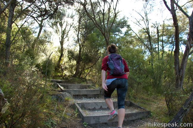
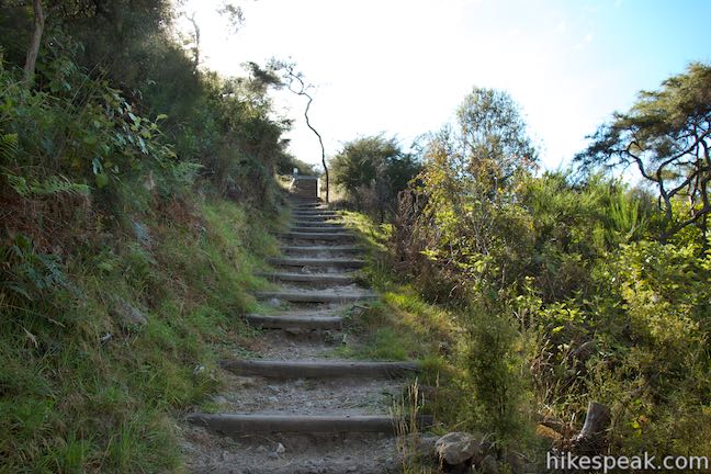
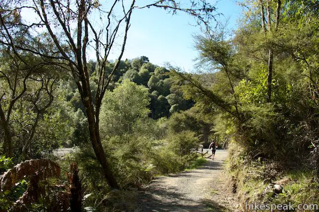
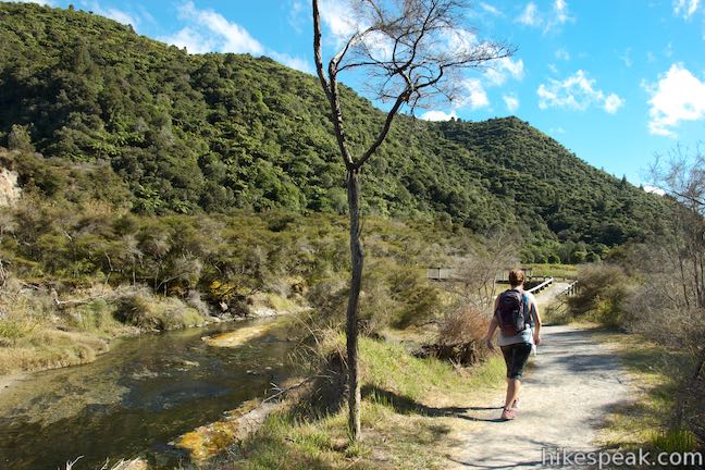
Waimangu Volcanic Valley is an incredible hydrothermal area near Rotorua in the Bay of Plenty Region of New Zealand. Walk down the valley to get close to Frying Pan Lake, a mesmerizing blue pool that is the largest hot spring in the world. Cross a landscape shaped by a volcanic eruption in 1886, passing hydrothermal features and the site of what had been world’s tallest geyser. An easy walkway goes from a visitor center at the top of Waimangu Volcanic Valley down to the shore of Lake Rotomahana. To maximize your visit, take a 4.75-kilometer (2.95-mile) trek with 115 meters (380 feet) of elevation change that uses a side trail off Main Valley Walkway to cross Mount Haszard and see more craters and panoramic views. At the end of the walk, extend your visit with a Lake Rotomahana Boat Cruise, take a bus back to the visitor center, or walk back through the hydrothermal creations.
The story of Waimangu Volcanic Valley starts with Mount Tarawera, an active member of the Taupo Volcanic Zone that has erupted five times in the last 18,000 years. While its eruption in 1886 could be considered small compared to older eruptions, it was the largest eruption anywhere in New Zealand since the beginning of European settlement. When the eruption began, craters burst on Tarawera Volcano. A 16-kilometer long rift running southwest from the mountain then opened up with 22 craters exploding from the land, discharging molten lave and other ground materials. Ash covered the entire area and plants and animals were exterminated. Several villages were destroyed and around 120 people died.
Fifteen of the craters are now underwater in Lake Rotomahana, which expanded drastically to fill a valley that was locked off by the eruption. The seven remaining craters became Waimangu Volcanic Valley. After the craters appeared, geothermal fluids found their way to the surface. Geothermal activity has developed ever since, bringing about major changes around the craters. Waimangu Volcanic Valley is considered the world’s newest hydrothermal area. Eruption Chronicles, a document available at the visitor center explains:
For visitors to Waimangu, one of the most interesting consequences of the 1886 outbreak is that it initiated a new region of surface hydrothermal activity. Indeed, Waimamangu Hydrothermal System is renowned for the fact that it is the only major system in the world whose surface activity commenced within historic times, at a time that can be pinned down to the actual day.
Waimangu Volcanic Valley is a privately run scenic reserve and wildlife refuge under lease from the Department of Conservation. Purchase tickets from the visitor center for the walk (or the walk and the boat cruise) and set out from the head of the valley.
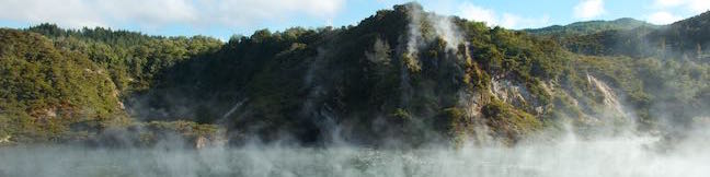
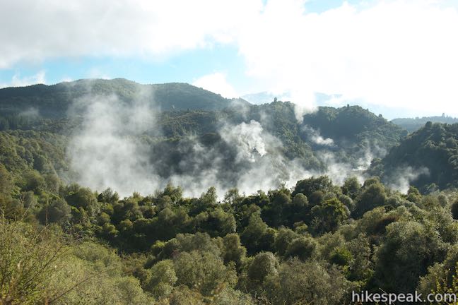
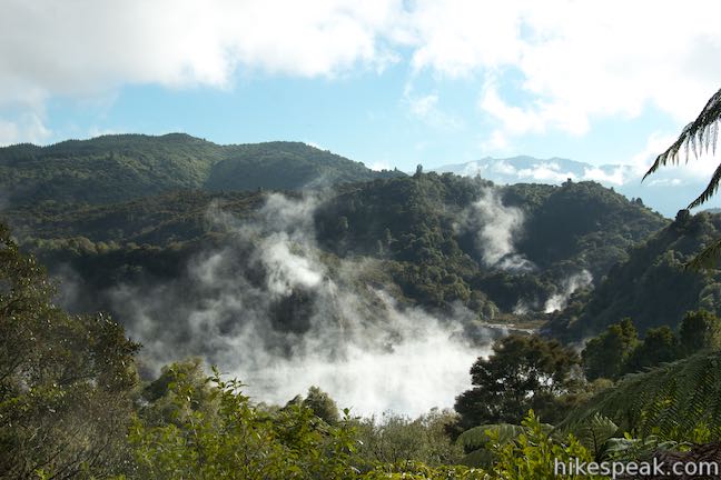
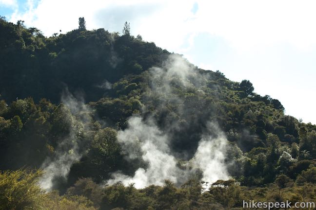
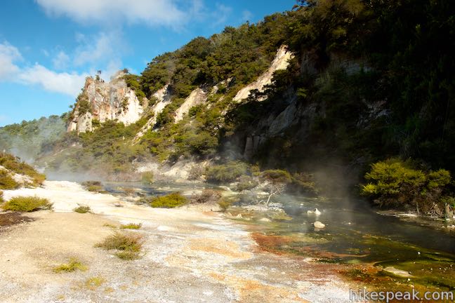
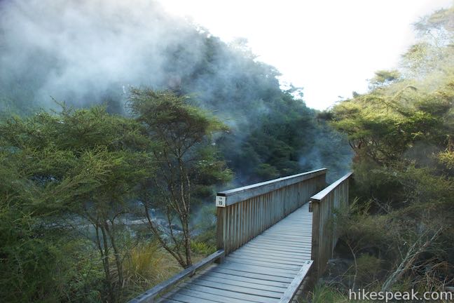
You’ll only have to go about 70 meters to reach the first of 39 markers that correspond to entries in the “wanderers guide,” which you should take from the visitor center. Panels along the trail offer additional information. A panel at the first marker describes the Waimangu Accommodations House, which was built near this spot and fell victim to valley’s largest hydrothermal eruption. In 1917, Frying Pan Flat erupted (making way for Frying Pan Lake). The burst ripped the roof right off the house and plastered what was left with sand and steam. Burns from the steam killed the wife and child of the guide who lived in the house, and he alone managed to survive. From the site today, get a panoramic view over Waimangu Volcanic Valley, looking over the treetops toward steam-covered craters and Mount Haszard, which rises above the rest of the forest-covered landscape.
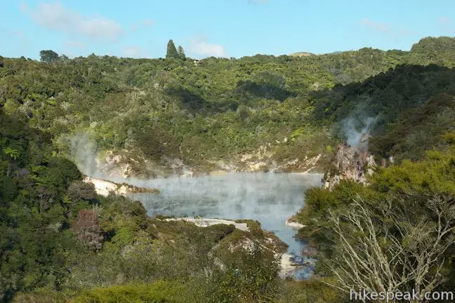
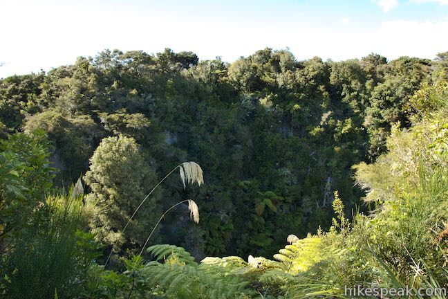
At the 200-meter mark, reach the second marker at an overlook on the side of Southern Crater. On the right side of the walkway, there is a 50-meter deep plunge in the forest. Walk across a narrow ridge between the crater and the rest of the valley and come to another view into the crater that offers a better view of Emerald Pool, a cold, shallow pool at the bottom that is filled by rainwater. Southern Crater is the furthest crater from Mount Tarawera in the string of craters that erupted across Waimangu Volcanic Valley in 1886. The next two craters you cross have seen the most intense geothermal activity in the years since.
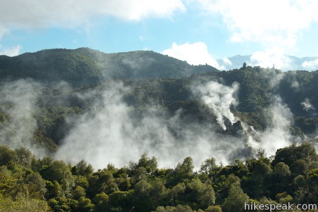
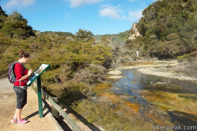
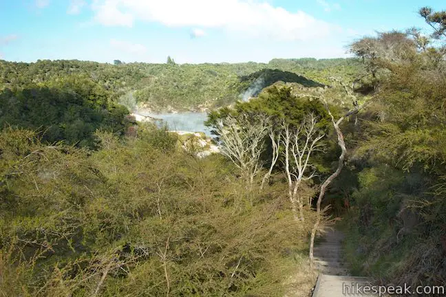
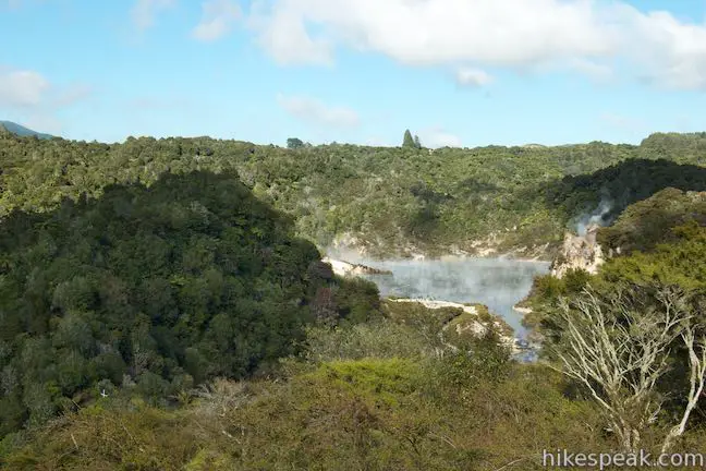
At 450 meters from the start, pass the fifth marker on the walkway, which points out eruption deposits created by the 1917 eruption of Frying Pan Flat. You’ll get your first good view of Echo Crater, the home of Frying Pan Lake, at 600 meters from the start, by marker six, labeled Panorama.
In the years following the 1886 eruption of Echo Crater, a small pond formed at the bottom. Rainwater washed ash back into the crater and filled the pond to create a flat sandy basin called Frying Pan Flat, a name that makes more sense than Frying Pan Lake. The flat had holes in its surface with hot springs and fumaroles that made sounds like eggs frying in a pan.
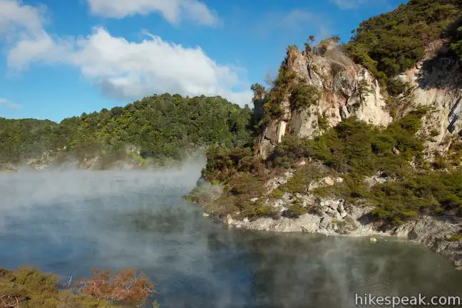
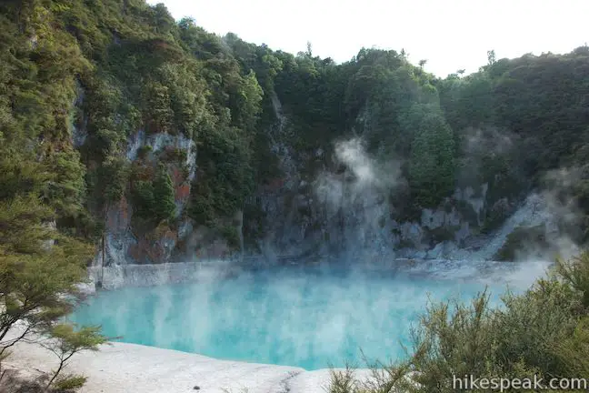
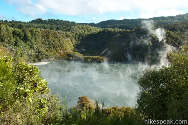
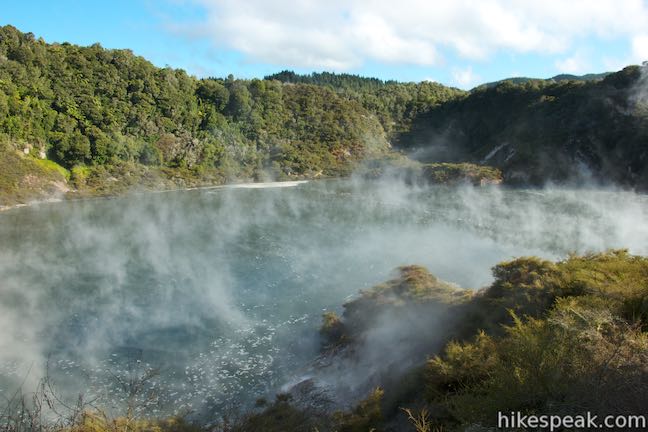
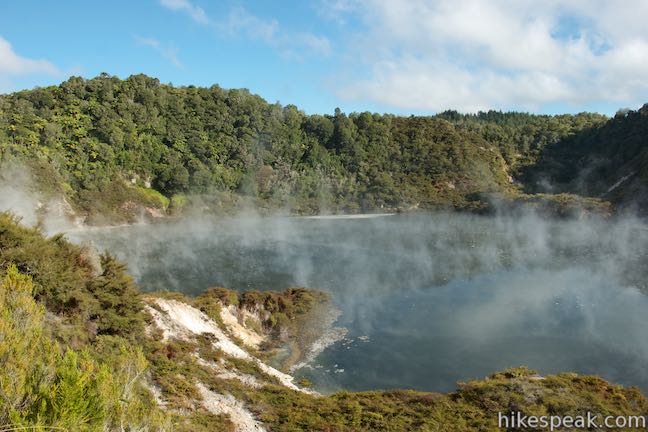
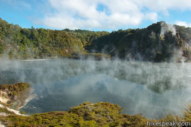
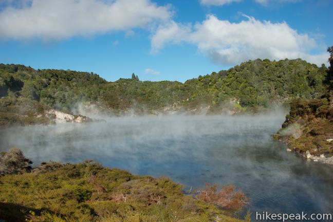
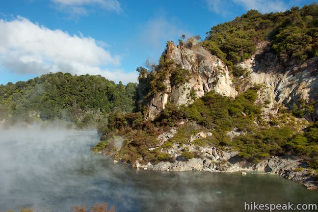
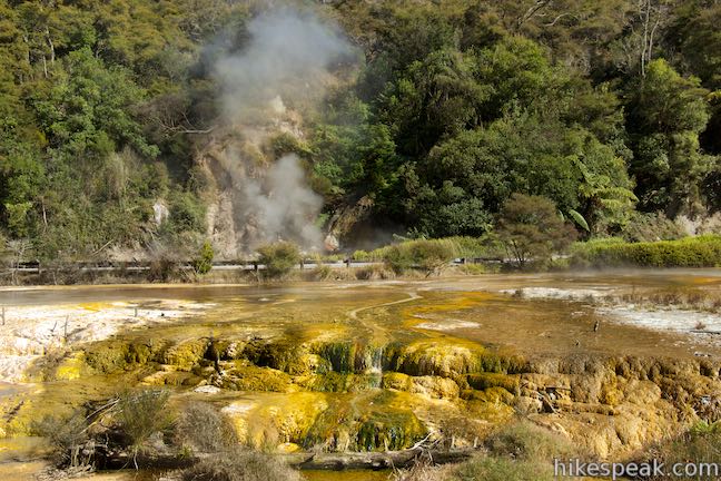
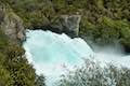
Echo Crater jumped out of the frying pan and into the fire when it erupted again in 1917. The eruption re-excavated the southwestern end of the crater and blew apart Frying Pan Flat. Instead of filling with sediments again, the new basin in Echo Crater filled with rainwater and geothermal water from vents at the bottom of the crater, forming Frying Pan Lake. The lake has remained since then and is the largest hot spring in the world with a surface of 38,500 square meters (over 400,000 square feet). Its averages depth is just 6 meters with a deep spot of 21 meters. Surface temperatures on the lake are typically 55 degrees Celsius (131 degrees Fahrenheit), but have been measured as high as 67 degrees Celsius (152 degrees Fahrenheit) when the burners below the frying pan are really cooking.
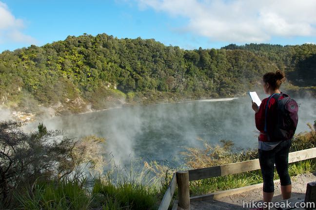
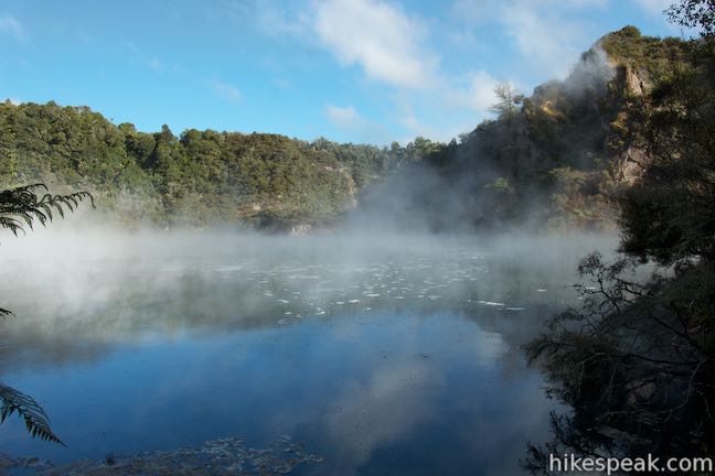
Pass the bus road and take steps up to Frying Pan Lake Lookout (marker 7) for a fine overview of Frying Pan Lake. Pause at a bench and a picnic table at this overlook, 800 meters from the start, and look down on the reflective blue of the beautiful hot spring lake, which is shrouded in a veil of steam.
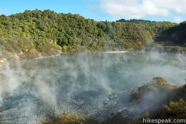
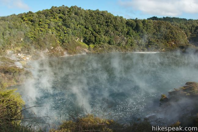
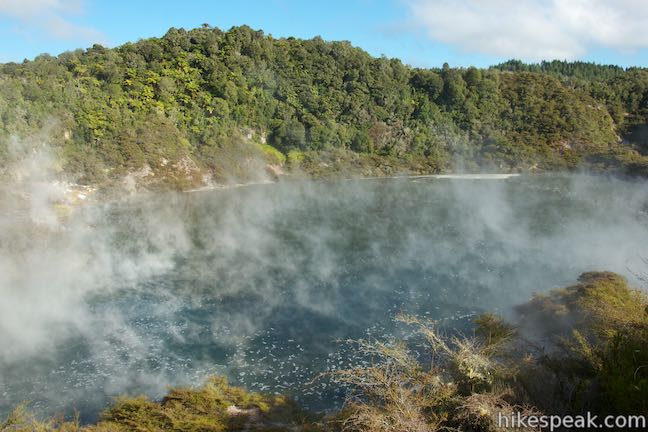
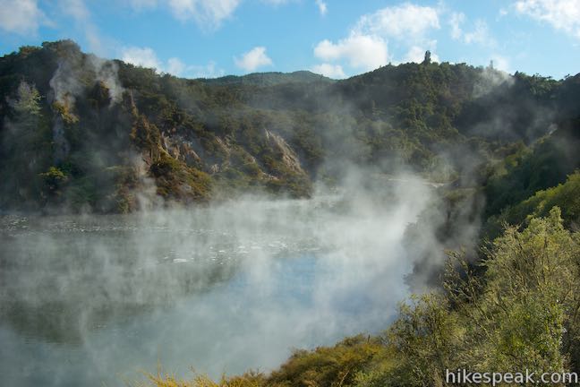
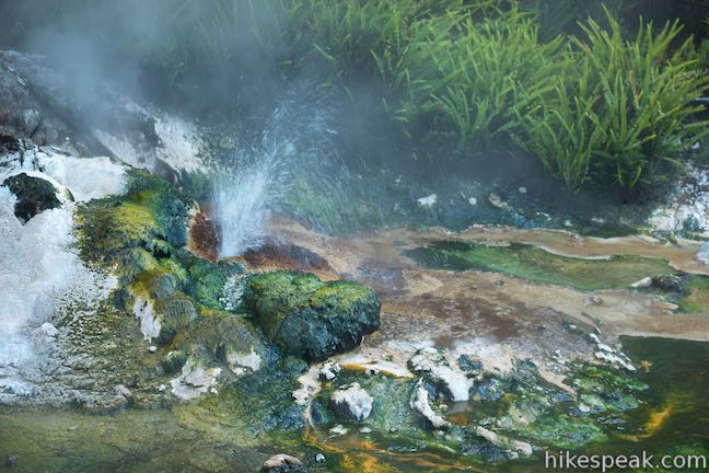
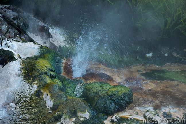
Get closer to the lake and continue down the walkway. At 0.95 kilometers from the start, reach the eighth marker, where the guide advices that you stop and listed to “eerie sounds coming from hot springs and fumaroles” located around the lake. While you linger, you might also see bubbles of carbon dioxide and hydrogen sulfide bursting on the surface that come from boiling vents at the bottom of Frying Pan Lake. Just ahead, pass the site of the 1973 Trinity Terrace Eruption, which was the last major eruption in Echo Crater, shooting mud over a 100-meter wide area.
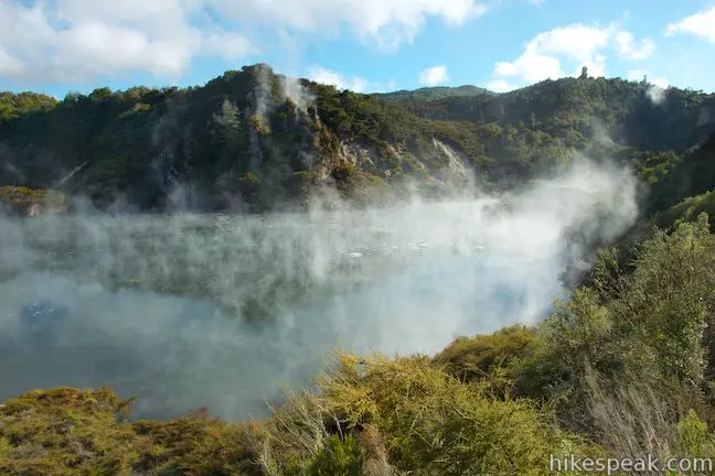
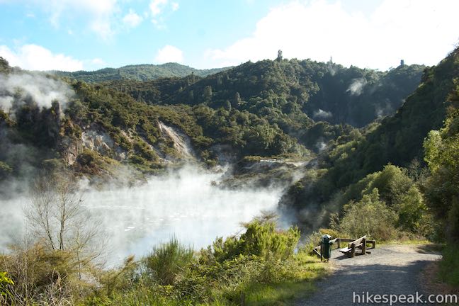
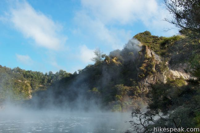
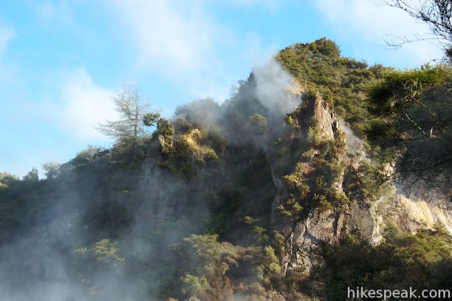
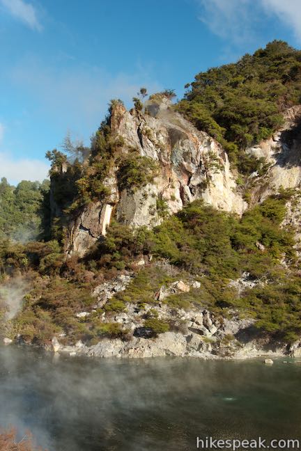
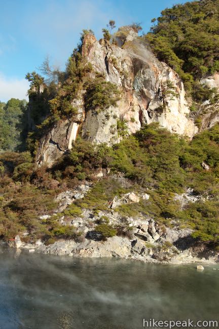
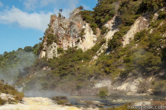
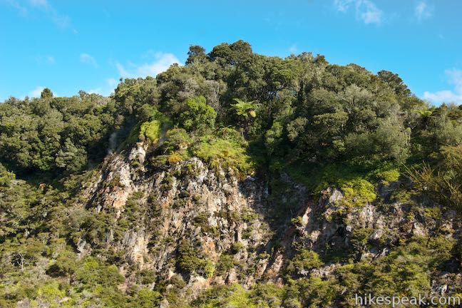
Enjoy more views over Frying Pan Lake as you walk to the northeast end, across from Cathedral Rocks, which is a daunting steaming pinnacle standing over the outflow of the lake. Cathedral Rocks are a short, sharp peak composed of rhyolite lava estimated at over 60,000 years old. The shape of the monolith is imposing enough, but consider the steam that escapes from vents around the crown and you get a spire that’s as sinister looking as it is beautiful. Wind sweeps steam around the base of its cliffs, adding to its mystical quality.
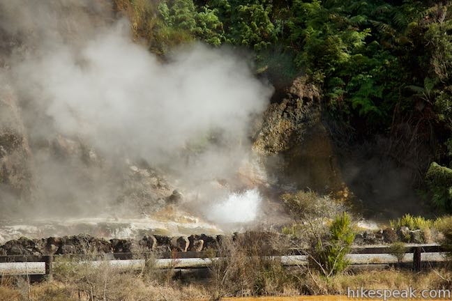
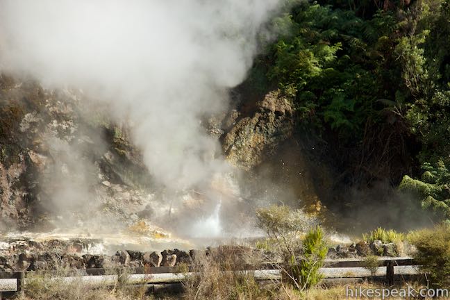
At 1.2 kilometers from the start, turn away from Cathedral Rocks (marker 11) and Frying Pan Lake and look toward the northeast end of the crater at the former site of Waimangu Geyser. A panel at the site has archival photos of this amazing geyser, which had bursts that resemble detonated explosions. The geyser was born and began erupting in 1900, settling into a cycle of erupting every 36 hours for periods of up to six hours at a time. Typically, the geyser reached heights of 100 meters but was capable of having 400-meter (1,300-foot) tall blasts, which is basically unfathomable. The violent geyser sent up columns of black sand, mud, and rocks, along with large amounts of water and earned the name “black water” or Waimangu.
For one Olympiad, Waimangu Geyser erupted predictably and was a major tourist draw as the tallest geyser in the world (a title that currently belongs to Steamboat Geyser in Yellowstone National Park). In 1904, the geyser suddenly weakened, stopped completely, and went dormant, at a time coinciding with the surface level drop of a lake several kilometers away (although an actual link to that lake has never been be proven). When Waimangu Geyser called it quits, hydrothermal activity in the surrounding area increased, leading to the Echo Crater eruption in 1917 when Frying Pan Lake was created.
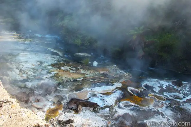
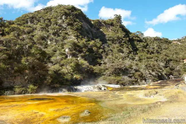
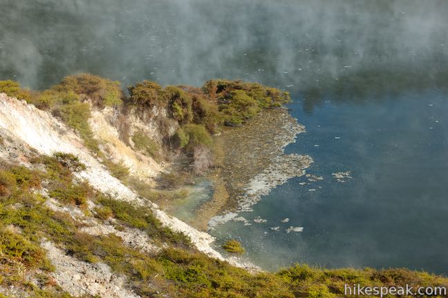
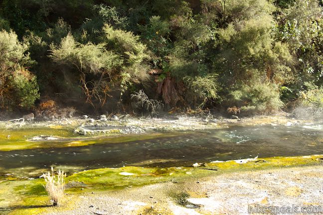
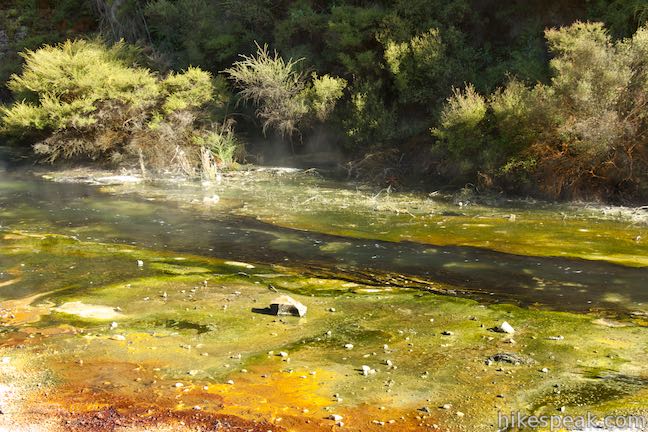
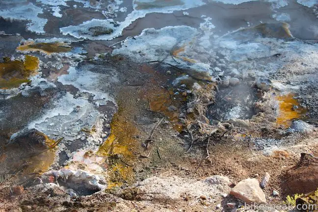
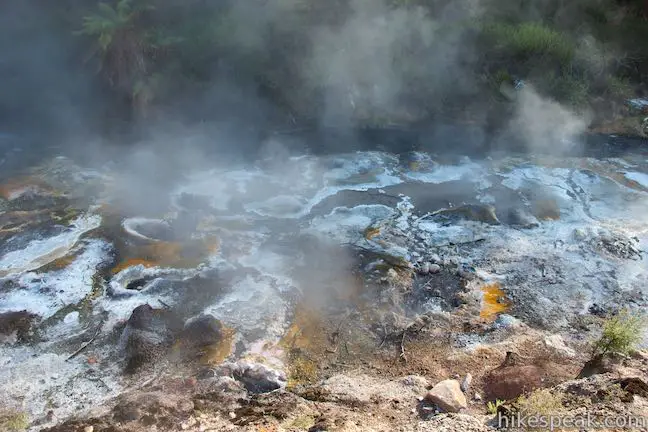
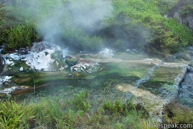
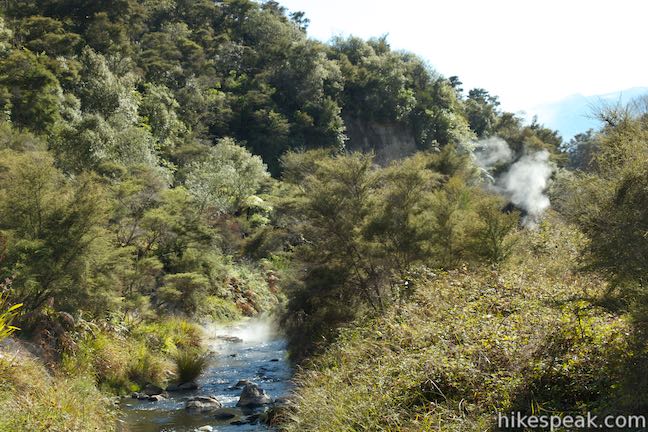
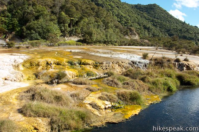
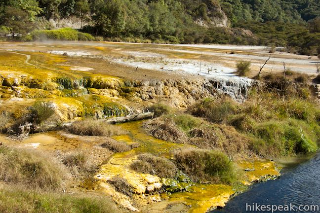
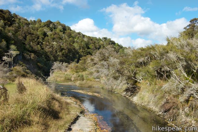
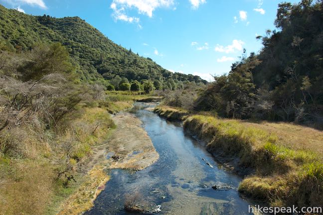
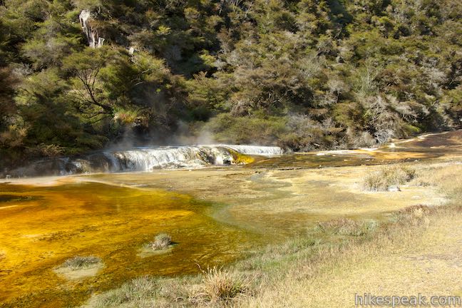
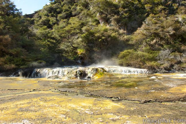
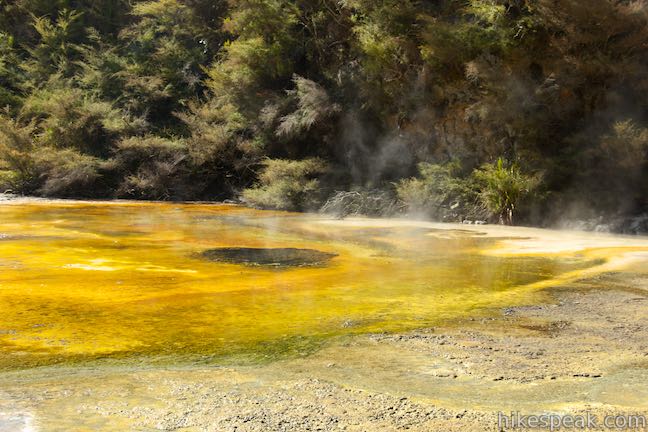
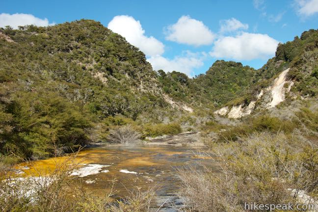
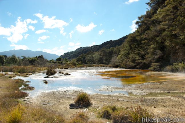
At marker thirteen, 1.3 kilometers from the start, watch water flow out of Frying Pan Lake at a temperature of fifty degrees Celsius at an average rate of 110 liters per second. Take the walkway down along a stream full of small, colorful geothermal features. As the water slows and cools, it deposits minerals like antimony, arsenic, and tungsten that combine with algae to form a tapestry of yellows, oranges, browns, greens, and blues along the stream.
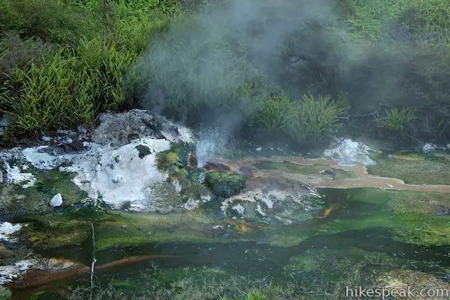
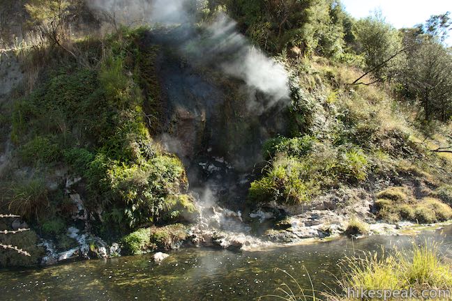
Pass Hot Springs of Mother Earth, a cluster of boiling hot springs on a small sinter formation along the stream. Look up to see a white cross on the hillside above. This marks the spot where, in 2003, four people who got too close to Waimangu Geyser during a violent eruption were swept to their deaths in a river of hot mud and water.
Walk down the stream to marker sixteen for Te Ara Mokoroa Terrace, which translates to the poetic name, “long abiding path of knowledge” and is a collection of silica terraces created by a spring that leaped to life in 1975. Initially, it was thought that this spring might represent the return of Waimangu Geyser, but the hot spring remained small.
At 1.45 kilometers from the start, reach the first real junction on the walk where a decision must be made. Main Valley Walkway continues to the right, maintaining a gradual course down the valley past hydrothermal features. To the left, Mount Haszard Hiking Trail ascends to Inferno Crater Lake and continues up over a rise on Mount Haszard past three more craters and panoramic views. Mount Haszard Hiking Trail is 1.2 kilometers long with a 65-meter ascent followed by a 75-meter descent. It rejoins Main Valley Walkway farther down the valley, near marker 25.
Before deciding on your route, first walk a couple meters farther down the main walkway onto a footbridge where you can see Bird’s Nest Terrace (marker 19). A small boiling spring has built up a terrace that resembles the shape of a bird’s nest. Algae are painted across the terrace in a mix of greens and browns.
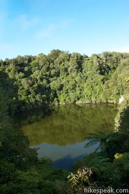
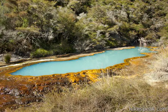
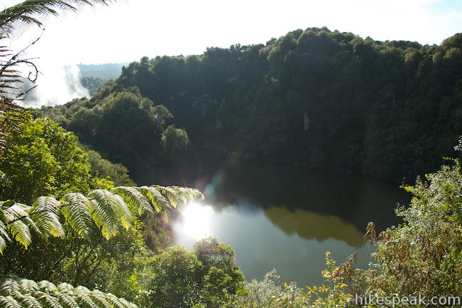
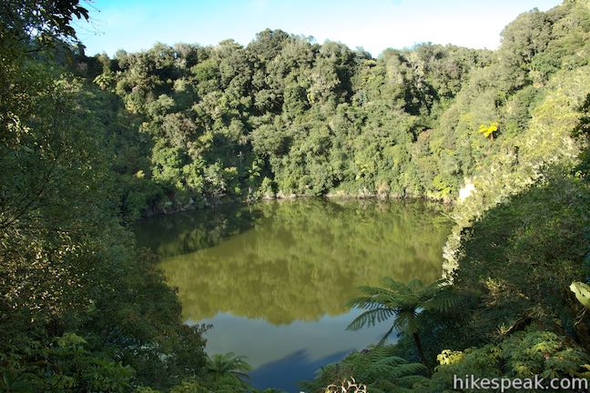
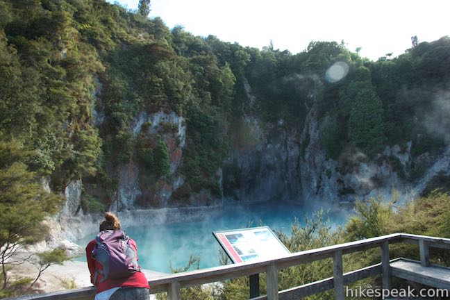
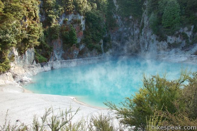
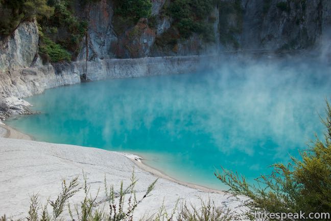
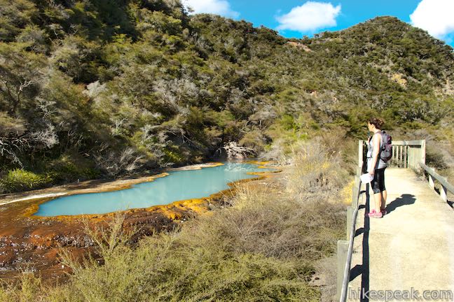
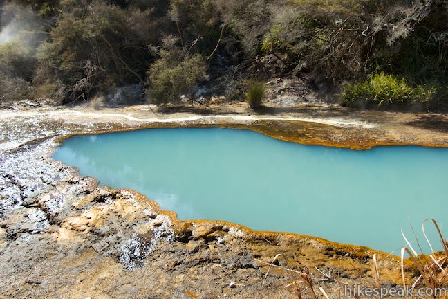
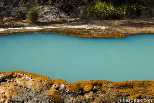
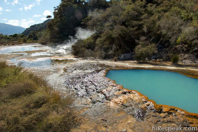
Even if you decide to continue down Main Valley Walkway, you should step back to the junction and take the wooden steps at the bottom of Mount Haszard Hiking Trail that lead up to Inferno Crater Lake. Reach the beautiful lake after fifty meters, where a turquoise pool sits below steep cliffs behind a bank of pale mud.
Inferno Crater Lake gets its intense blue color from silica particles suspended in the water. It is a unique geothermal feature that overflows regularly before 30,000,000 liters of water recede back into the mountain. Inferno Crater is described as the world’s largest geyser-like feature. It is only geyser-like because the geyser is at the bottom of the pool. A panel by Inferno Crater Lake explains that:
Inferno Crater Lake has a unique cyclic rise and fall in water level, ranging between overflow and as much as 12 meters below that (although often it does not recede more than about 6 meters). Four stages can be recognized in its intriguing cycle. First it rises steadily from its lowest level. Then it commences oscillating but with its average level still rising. Then (perhaps with some occasional preliminary spills) it commences a steady outflow. Finally it abruptly stops overflowing and steadily recedes until it reaches some low point and a new cycle commences.
The lake will look different depending on when you visit during the cycle. Inferno Crater Lake overflows for a couple days, recedes for a couple weeks, refill over three of four weeks, oscillates for a period, and then overflow again. When the lake is low, the temperate drops to 35 degrees Celsius (95 degrees Fahrenheit). The temperature rises to over 75 degrees Celsius (167 degrees Fahrenheit) when it is overflowing. Inferno Crater Lake has an underground connection to Frying Pan Lake with a measurable influence. When Inferno Crater Lake overflows, the outflow from Frying Pan Lake decreases. When Inferno Crater Lake recedes, the outflow of Frying Pan Lake becomes higher than normal. The inner workings of the valley’s hydrothermal features are an intriguing mystery.
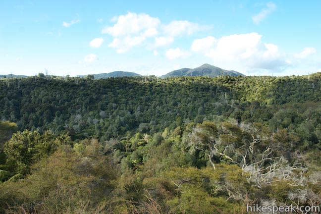
Unless you choose to return to Main Valley Walkway, keep climbing up steps on Mount Haszard Hiking Trail. The markers on this track are lettered instead of numbered. Along the ascent, you’ll pass marker A for Echo Crater Panorama, 1.7 kilometers from the start. Catch your breath and look back toward Frying Pan Lake in Echo Crater. Cathedral Rocks rise above the right side of the misty blue lake. The white cross stands on the bluff to the left. Areas beyond Echo Crater are visible as well and you can look farther to the left over forest-covered ridges and valleys that have completely regrown since the 1886 eruption.
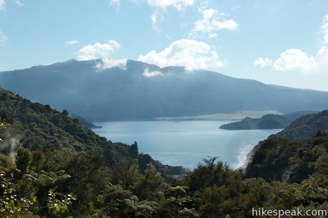
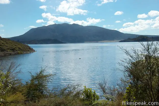
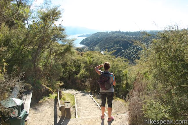
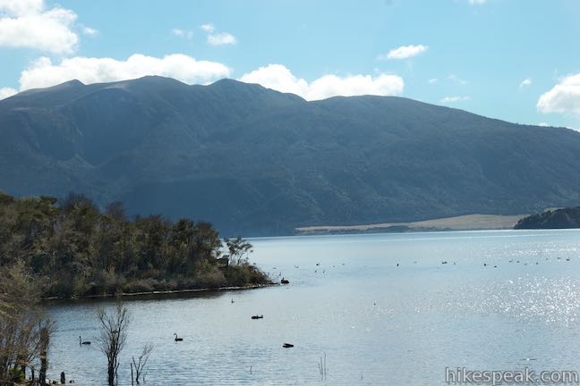
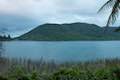
Hike up wooden steps for another 250 meters to a crest on Mount Haszard, reaching the Shelter Hut Site (marker B), which is followed immediately by Rift Valley Panorama (marker C). A shelter built here in 1902 gave tourists a place to watch Waimangu Geyser erupt. Look in the other direction to find a new view down the other end of the valley toward Lake Rotomahana. In the foreground, you might spot Raupo Pond Crater, the only crater that the trail doesn’t really get close to. Your eyes will be drawn down the valley toward the large lake formed by the 1886 eruption. A smaller version of Lake Rotomahana existed before 1886, when 15 craters erupted in the current lake’s basin and blocked any outflow from the valley. As a result, the level of the lake rose by forty meters and the surface area increased by a factor of 20. On the far end of the lake is the reason for it all, Tarawere Volcano, which rises to 1,111 meters (3,645 feet).
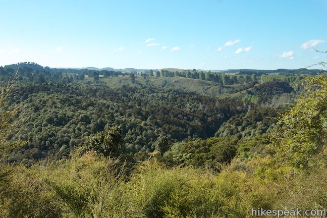
The hiking trail turns downhill and passes along the side of Fairy Crater. This crater is dull compared to the previous dynamos and hasn’t been very active since 1886, with minor steaming vents and no major subsequent outburst. Descending toward Black Crater, the trail passes another marker (E) for Eastern Valley Panorama. Expanding on the view from the top, you can look down the steaming terrain bordering Waimangu Stream at the bottom of the valley and gaze out toward Lake Rotomahana.
Cross Black Crater Saddle (marker F) at 2.3 kilometers from the start and look into Black Crater, which has a wall of lava outcroppings. Black Crater has intermittent fumaroles and mud pools. Steaming vents can be seen on cliffs that are colored a pinkish red instead of black. One more marker (G) comes as Mount Haszard Hiking Trail descends from the craters. Look out from the overlook labeled Lower Rift Valley. Like the previous perches, this spot allows you to look down the valley toward Lake Rotomahana while getting a closer look at several geothermal hot spots churning out steam.
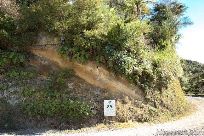
After 1.2 kilometers of cross-mountain exercise, and 2.65 kilometers from the start, Mount Haszard Hiking Trail drops to the valley floor and meets the paved bus road. To return to Main Valley Walkway, turn right along the road and walk another 50 meters to a meeting with the other trail. At this junction, you should turn left to continue down the valley. You could also turn right to walk twenty meters up the valley to marker 25, called Soil Layers, where you can look at the side of a cliff that was cut out for the bus road. This cutting exposes a profile of the soil layers, with mud from the 1886 eruption near the top.
With more time, you could continue backtracking up Main Valley Walkway to see the other five markers that you missed (Hot and Cold Streams, Kaolin Slope, Buried Soil, Silica Stalactites, and Clamshell Spring). However, there is another 2.05 kilometers on Main Valley Walkway between the end of Mount Haszard Hiking Trail and Lake Rotomahana. If you plan to catch a boat cruise, you might need to skip that small part of the valley and keep moving toward the lake.
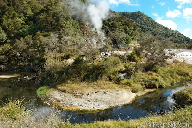
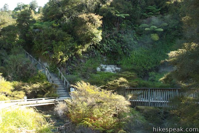
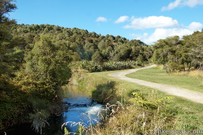
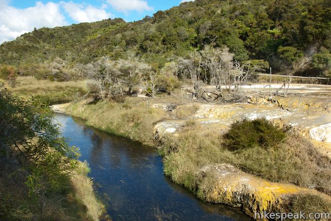
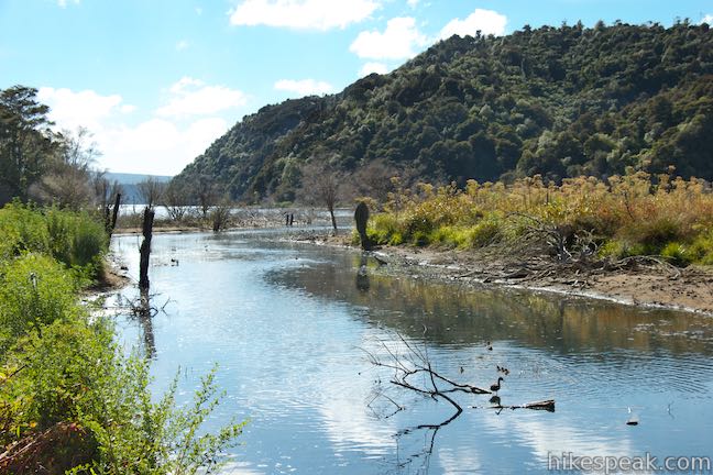
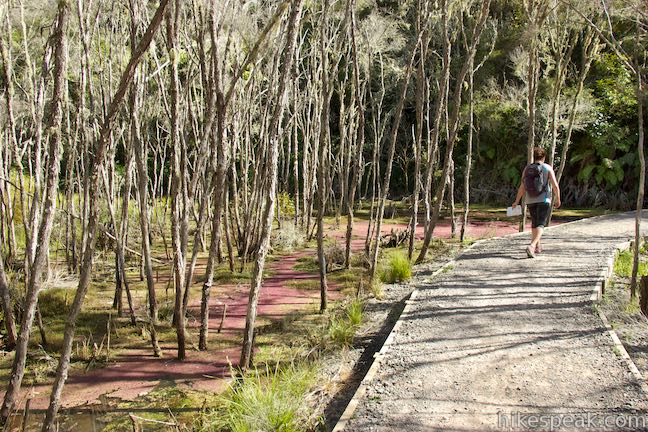
Leave the Soil Layers site, pass back through the junction with the end of Mount Haszard Hiking Trail, and proceed down the valley toward Lake Rotomahana. The walkway is nearly level now, following Waimangu Stream on an easy course toward the lake. Cross the stream over footbridges as you go. At marker 26, simply labeled Hot Springs, you’ll see steaming vents on the opposite bank of the stream surrounded by mosses, ferns, and lichens. You’ve put in 3 kilometers and there is another 1.75 kilometers to go.
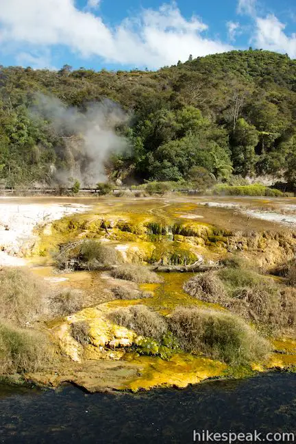
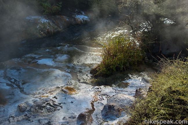
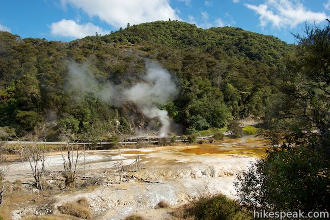
In another 150 meters, you’ll have yet another fantastic hydrothermal feature to admire. A fan-shaped staircase of sinter deposits covers the inside of a bend on the other side of the stream. The Marble Terrance and Buttresses (marker 27) are colored white and orange. They formed over time by silica-rich water that flows from Iodine Pool, a hot spring on the top of the terrace. Steam rises from the active pool as water bubbles to the surface.
Come to a junction at 3.5 kilometers from the start and turn left up a 150-meter long sidetrack leading to Warbrick Terrace (marker 28). The terrace is definitely worth examining and there is also a bathroom and a picnic area along the track by the terrace. Warbrick Terrace formed in this sixth crater in the line from Southern Crater, which is called Rainbow Crater. The northeast wall of the crater is missing, so the contour is less distinct than some other craters. Warbrick Terrace is made up of sinter deposits covered in algae that add splashes of color. The area continues to grow and change. At the top of the path up Rainbow Crater, look into an oval-shaped milky blue pool contained by an orange-colored rim of silica.
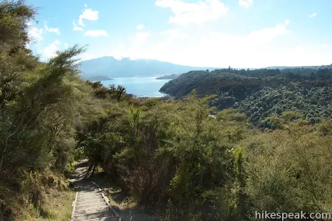
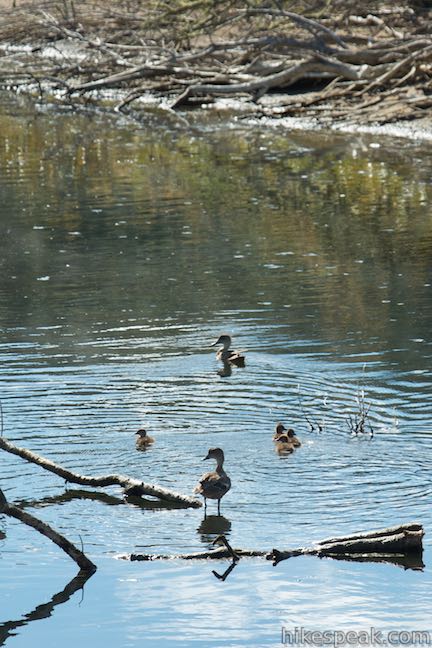
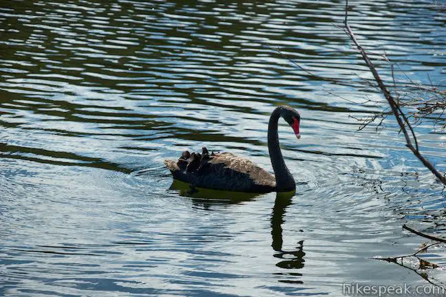
Return to Main Valley Walkway and continue toward the lake. To explore another side trail, take a path on the right, called Nature Trail, which walks along the old lake floor through trees to the shore of Lake Rotomahana. Proceed down Main Valley Walkway and get views across the lake toward Mount Tarawera. Reach marker 30, labeled Tarewera Volcano and Lake View, with 400 meters remaining in the walkway. Look out over the lake to spot Australia black swans and other water foul. Cross a footbridge and pass the road to reach a picnic area at the water’s edge near the boat jetty. You’ve reached the end of the track after putting in 4.75 dynamic kilometers. Relax, look out over the lake, and reflect on everything you’ve seen.
The end of this walk down Waimangu Volcanic Valley leaves you with a few options:
- To see it all again, you could hike back up Waimangu Volcanic Valley. Skipping Mount Haszard Hiking Trail and the spur to Warwick Terrace will provide a walk back that’s about 3.6 kilometers long, gradually gaining 115 meters.
- For something easier, take a bus back up to the visitor center, which leaves the bottom of the valley about once an hour.
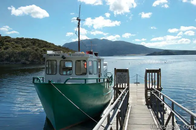
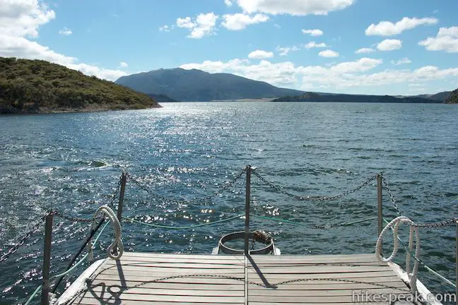
- The most rewarding course of action is to move the adventure from land to lake and get on the Lake Rotomahana Boat Cruise. A posted sign indicates that the boat leaves the jetty each day at 9:25 a.m., 10:25 a.m., 11:25 a.m. 1:10 p.m., 2:00 p.m., 2:50 p.m., and 3.40 p.m., but the departure times may change so confirm with the visitor center. The boat cruise lasts about 45 minutes and gets close to steaming vents and geysers right along the shoreline to provide a unique on-the-water experience.
Waimangu Volcanic Valley opens daily at 8:30 a.m. You will need a ticket to enter the valley and explore the attractions. Tickets to walk through the valley are $65 for adults, $35 for children ages six to sixteen, and free for younger children. The price for both the boat cruise and the walk through the valley is $180 for adults, $90 for children six to sixteen, and free for younger children (all prices in New Zealand Dollars as of 2025). When combining the walk and boat cruise, be mindful of the time as you venture down the valley so that you arrive at the jetty before the cruise departs. There should be no need to rush, but you will have to evaluate how much time to spend at each feature. If you don’t make it to the jetty on time, you should be able to transfer your tickets to a later cruise unless the boat is full.
To visit a nearby area with its own impressive geothermal features, check out Wai-O-Tapu Thermal Wonderland.
Directions to the Trailhead
- From the center of Rotorua, take State Highway 5 (Thermal Explorer Highway) south from the intersection with State Highway 30A.
- Drive 18.3 km kilometers on SH 5 and turn left onto Waimangu Road.
- Drive just under six kilometers up Waimangu Road to a large parking area near the visitor center for Waimangu Volcanic Valley.
Trailhead Location
Trailhead address: Waimangu Volcanic Valley, 587 Waimangu Road, Waimangu, Bay of Plenty, 3073, New Zealand
Trailhead coordinates: -38.2857, 176.387 (38° 17′ 08.51″S 176° 23′ 13.20″E)
View Rotorua Area in a larger map
Or view a regional map of surrounding New Zealand tracks, campgrounds, and lodging.


 | Wai-O-Tapu Thermal Wonderland This thermal area full of hot pools, geysers, fumaroles, and mud pots can be explored on three successive loops for walks of 1.35 to 3.05 kilometers. |
 | Kerosene Creek This short walk follows Kerosene Creek down to a hot pool below a crescent-shaped waterfall. Bring your bathing suit and wade into warm, welcoming waters. |
 | Crater Lake This 1-kilometer walk in Rainbow Mountain Scenic Reserve goes to an overlook with views of a turquoise pool below vibrant cliffs. |
 | Blue Lake This 6.15-kilometer circuit near Rotorua provides a pleasant loop across lakeside beaches and forests, rising to a lookout over Blue Lake and nearby Green Lake. |
 | Okere Falls Track This scenic 3-kilometer walk through Okere Falls Scenic Reserve has views of multiple waterfalls, cascades, and pools on the Okere River near Rotorua. |
 | Kaituna River Whitewater Rafting Take a memorable trip down the Kaituna River (Okere River) through Okere Falls Scenic Reserve that includes a thrilling plunge over Tutea Falls, the tallest commercially rafted waterfall in the world! |
 | Spa Thermal Park - Huka Falls Walkway This 7.3-mile round trip walk follows the Waikato River from hot springs at Spa Thermal Park to the rapids and waterfall at Huka Falls in New Zealand's most visited scenic reserve. |
 | More trails in New Zealand Explore other destinations for walking and hiking (as well camping and lodging) in New Zealand. |
 | Rotorua Top 10 This holiday park has campsites, cabins, and motel accommodations in a fun setting near the center of Rotorua with amenities that include mineral hot pools. |
 | Murupara Motor Camp Set in a small town in the Bay of Plenty Region of New Zealand, this motor camp is half holiday park and half motor lodge, offering a variety of accommodations in a location that is both removed from busy tourist centers and close to lots of fun outdoor activities. |
 | Whakaipo Lodge This lodge near Lake Taupo blends comfort with luxury and has welcoming owners who can help you take advantage of the area's abundant outdoor opportunities. |
- Waimangu Volcanic Valley on newzealand.com (opens in a new tab)
- Waimangu Volcanic Valley on wikipedia.org (opens in a new tab)
- Frying Pan Lake on wikipedia.org (opens in a new tab)
- Inferno Crater Lake on wikipedia.org (opens in a new tab)
- Waimangu Volcanic Valley on facebook.com (opens in a new tab)
- The official website for Waimangu Volcanic Valley (opens in a new tab)
Common Questions about Waimangu Volcanic Valley in Rotorua
- Is the trail open?
- Yes. You should expect to find that Waimangu Volcanic Valley & Mount Haszard Hiking Trail is open. There are no recent reports of trail closures. If you discover that the trail is closed, please help your fellow hikers by reporting a closure.
- Do I need a permit for this hike?
- Yes. Entry fee.
- How much time does this hike take?
- It takes approximately 1 hour 30 minutes to hike Waimangu Volcanic Valley & Mount Haszard Hiking Trail. Individual hiking times vary. Add extra time for breaks and taking in the views.
- How long is this hike?
- The hike to Waimangu Volcanic Valley & Mount Haszard Hiking Trail is a 4.75 km / 2.95 mile one way with 115 meters / 380 feet of elevation change.
- Are dogs allowed on this trail?
- No, dogs are likely not allowed on Waimangu Volcanic Valley & Mount Haszard Hiking Trail. The trail is primarily open to hikers.
- Are there hot springs on this hike?
- Yes, there are hot springs located along Waimangu Volcanic Valley & Mount Haszard Hiking Trail.
- Where is the trailhead located?
- The trailhead for Waimangu Volcanic Valley & Mount Haszard Hiking Trail is located in Waimangu, Bay of Plenty.
Trailhead Address:
587 Waimangu Road
Waimangu, Bay of Plenty 3073
Trailhead Coordinates:
-38.2857, 176.387 - What are the driving directions to the start of the hike?
To get to the trailhead: From the center of Rotorua, take State Highway 5 (Thermal Explorer Highway) south from the intersection with State Highway 30A. Drive 18.3 km kilometers on SH 5 and turn left onto Waimangu Road. Drive just under six kilometers up Waimangu Road to a large parking area near the visitor center for Waimangu Volcanic Valley.
View custom Google Maps directions from your current location.
- Are there other trails near Waimangu Volcanic Valley & Mount Haszard Hiking Trail?
- Yes, you can find other nearby hikes using the Hikespeak Hike Finder Map.

Go the extra miles...
Submit a rating of this hike to go with your comment. Contribute to the average trail rating.