Tongariro National Park
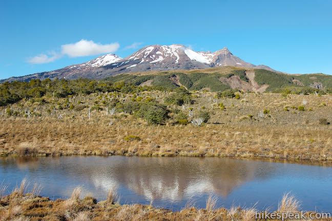
Tongariro National Park was established in 1887 as New Zealand’s first national park. The park preserves 79,000 hectares (305 square miles) at the center of New Zealand’s North Island, surrounding three large volcanoes: Mount Ngauruhoe, Mount Ruapehu, and Mount Tongariro. New Zealand’s largest volcano is Mount Ruapehu, which is also the highest peak on the North Island at 2,797 meters. Lord of the Rings fans will be keen to see Mount Ngauruhoe, a cone-shaped volcano that assumed the role of Mount Doom in the film trilogy. There are campground and holiday parks within the national park (see Mangawhero Campground and Whakapapa Holiday Park). The most famous day hike in the park is Tongariro Alpine Crossing, which crosses spectacular volcanic landscapes and is considered one of the greatest single day treks in the world.
Tracks in Tongariro National Park
This is a list of some of the walking tracks (hiking trails) in Tongariro National Park. The tracks are listed alphabetically and include a star rating based on hiker feedback (after you’ve completed one of these tracks, you can come back and give it a star rating). Each track links to a full write-up with photos and directions. The location of each track is shown on the map below.
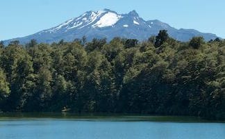


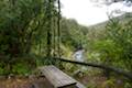
 This 2-kilometer return hike lies just outside Tongariro National Park (but close enough to be included on this list). The track reaches a peaceful blue lake that reflects a view of Mount Ruapehu.
Trailhead coordinates: -39.437782, 175.519195 (39° 26′ 16.01″S 175° 31′ 09.10″E)
Tongariro National Park Visitor Centre: +64 7 892 3729
Access Fee: $0
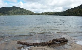 This 6.4-kilometer loop around Lake Rotopounamu (a.k.a. Greenstone Lake) visits tranquil beaches on a forest-wrapped lake in Tongariro National Park.
Trailhead coordinates: -39.01716, 175.73165 (39° 01′ 01.77″S 175° 43′ 53.94″E)
Tongariro National Park Visitor Centre: +64 7 892 3729
Access Fee: $0
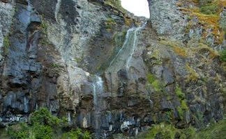
This easy 0.3-kilometer hike leads to a viewpoint for a 25-meter tall waterfall below Mount Ruapehu in Tongariro National Park.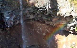
Trailhead coordinates: -39.319218, 175.502732 (39° 19′ 09.18″S 175° 30′ 09.83″E)
Tongariro National Park Visitor Centre: +64 7 892 3729
Access Fee: $0
This short, level walk explores a Rimu forest along the Mangawhero River near the town of Ohakune at the south end of Tongariro National Park.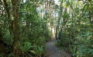
Trailhead coordinates: -39.39984, 175.41498 (39° 23′ 59.42″S 175° 24′ 53.92″E)
Tongariro National Park Visitor Centre: +64 7 892 3729
Access Fee: $0
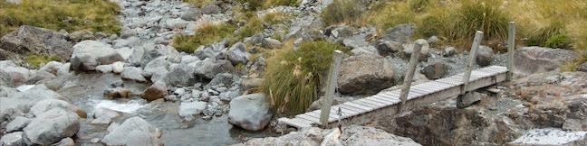
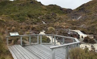 This 5.15-kilometer point-to-point hike or 7.15 kilometer loop leaves from Whakapapa Village in Tongariro National Park and crosses alpine bogs, forests, streams, and ridges of volcanic rock to reach creamy cascades on silica terraces.
Trailhead coordinates: -39.2036, 175.54015 (39° 12′ 12.96″S 175° 32′ 24.54″E)
Tongariro National Park Visitor Centre: +64 7 892 3729
Access Fee: $0
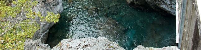
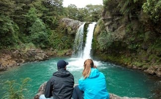
 This 6.45-kilometer loop crosses a variety of volcano-influenced landscapes to reach a beautiful 20-meter tall waterfall in Tongariro National Park.
Trailhead coordinates: -39.19955, 175.5429 (39° 11′ 58.38″S 175° 32′ 34.44″E)
Tongariro National Park Visitor Centre: +64 7 892 3729
Access Fee: $0
 This 0.8-kilometer return hike visits a short but enticing single-drop waterfall near Whakapapa Village in Tongariro National Park.
Trailhead coordinates: -39.175314, 175.5136 (39° 10′ 31.13″S 175° 30′ 48.95″E)
Tongariro National Park Visitor Centre: +64 7 892 3729
Access Fee: $0
This 19.4-kilometer long through-hike ventures across dynamic volcanic landscapes in Tongariro National Park and ranks among the world’s greatest day hikes.
Trailhead coordinates: -39.144398, 175.580942 (39° 08′ 39.83″S 175° 34′ 51.39″E)
Tongariro National Park Visitor Centre: +64 7 892 3729
Access Fee: $0
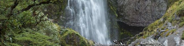
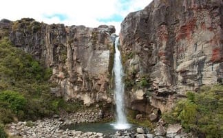
This 4-kilometer return hike reaches Tongariro National Park’s tallest waterfall and passes through an alpine wetland that reflect views of Mount Ruapehu.
Trailhead coordinates: -39.32958, 175.49579 (39° 19′ 46.48″S 175° 29′ 44.84″E)
Tongariro National Park Visitor Centre: +64 7 892 3729
Access Fee: $0
Camping in Tongariro National Park
Places to camp can be found throughout New Zealand, including Department of Conservation campgrounds and holiday parks that are usually run privately. Holiday Parks offer powered sites where campervans and RVs can plug in. They also offer kitchens and dining areas, bathrooms with showers, and other amenities. Most Department of Conservation campgrounds are fairly basic, but some offer extra amenities as well. There are also huts for backpacks throughout New Zealand’s parks. Pricing in New Zealand is done per person and not per site. Checkout time is typically 10 a.m. and you can check in in the afternoon.
 | Mangawhero Campground This campground in Tongariro National Park near Ohakuna, New Zealand has twelves sites on two loops with views of Mount Ruapehu. |
 | Whakapapa Holiday Park This holiday park in Whakapapa Village offers tent sites, campervan sites, cabins, and a backpackers lodge along a stream below Mount Ruapehu in Tongariro National Park. |
Or view New Zealand tracks, campgrounds, and lodging in a larger map