Otira Valley Track
in Arthur’s Pass National Park
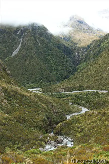
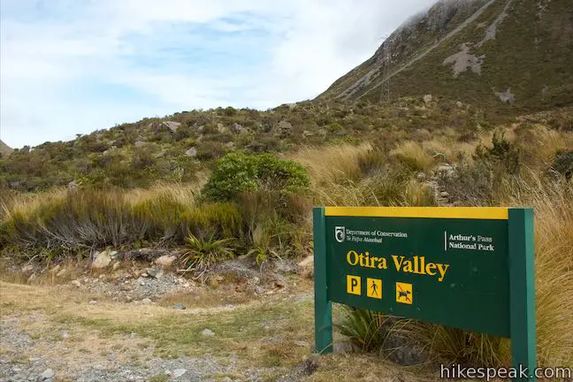
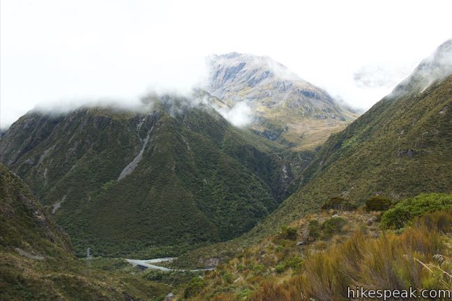
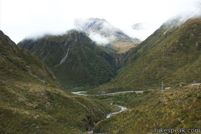
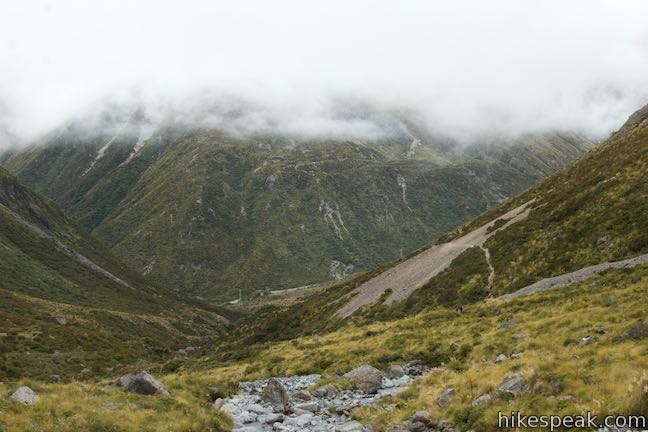
Just over the north side of Arthur’s Pass and 5 kilometers from Arthur’s Pass Village, you’ll find Otira Valley Track, which ascends a trough-shaped valley off the west side of the pass. The track ends at Otira River Footbridge. Under normal circumstances, a bridge would be an odd place to end a hike (since a bridge lead to something on the other side). The route beyond Otira River Footbridge is for experienced mountaineers only, so that’s where the track stops, but the bridge is not a disappointing place to turn around. Views up and down the alpine valley are framed by jagged peaks and enchanting cascades. The hike up Otira Valley Track is 3.8 kilometers round trip with 125 meters of elevation change (or 2.35 miles round trip with 410 feet of elevation change).
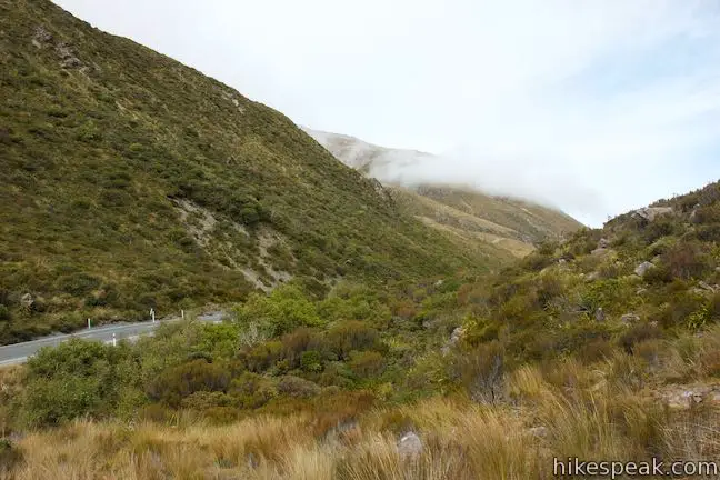
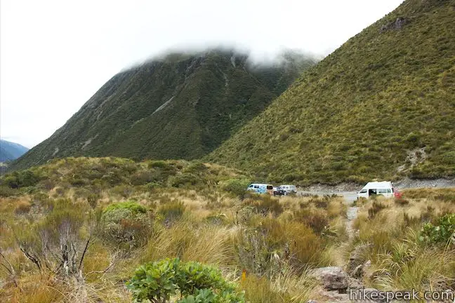
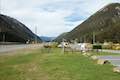
The track sets out from a car park on the west side of State Highway 73. Coming from Arthur’s Pass Village, the car park is on the left, not far past Dobson Memorial and Lake Misery.
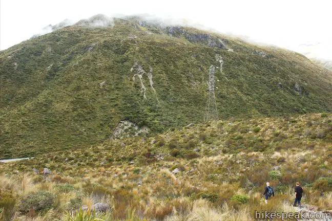
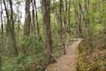
Otira Valley Track begins up a grassy slope and you will realize immediately that this track is not as manicured as the other walking tracks to the south. After just 130 meters, come to an early junction with Lake Misery Track, which ascends to the left toward Lake Misery. A sign at the junction says that it is a 20-minute walk up Lake Misery Track to Arthur’s Pass Lookout. Turn right to stay on Otira Valley Track. The bridge is 30 minutes away, according to the sign at the junction.
There aren’t any junctions from here to the bridge, so you won’t have to worry about that. You may have to worry about avalanches, as another sign warns:
One or more avalanche paths cross this track. Avalanches are more likely to cross the track during and after heavy snow or rain when there is already a lot of snow on the high mountains. The avalanche paths on this track are not marked.
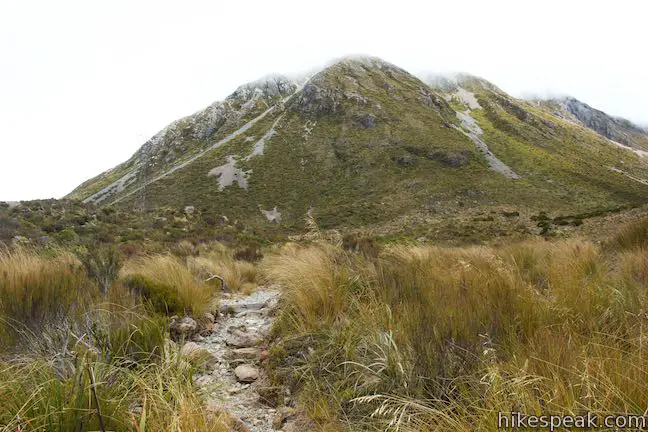
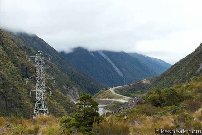
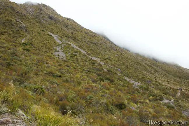
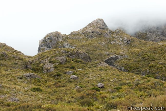
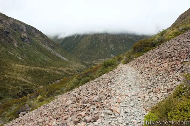
Assuming conditions are safe, continue up the track, which ascends at a leisurely grade. Looking over your right shoulder, you’ll have big views down the pass to the north. A ridge of peaks between 1,800 and 2,000 meters tall rise rapidly above the opposite side of Highway 73. There are no trees along this track, so you’ll find open views every step of the way. Looking south across Arthur’s Pass you should be able to spot buildings on Temple Basin Skifield.
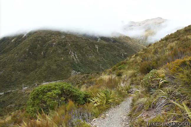
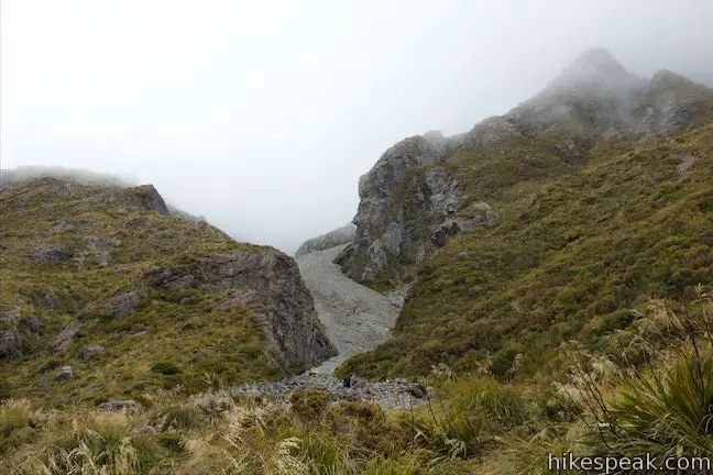
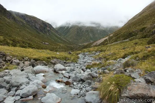
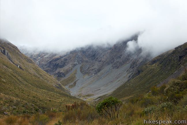
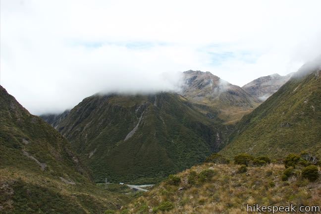
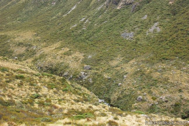
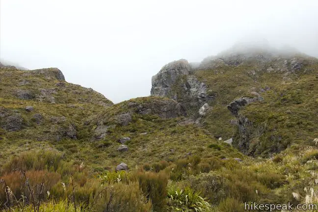
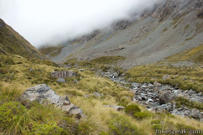
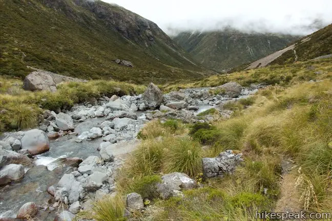
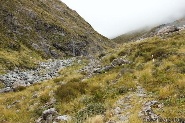
Otira Valley Track angles north around the end of Goldney Ridge and comes over a rise to enter Otira Valley. The track stays on the south side of the valley, well above a ravine carved by Otira River. Only at the footbridge does the track finally reach the valley floor.
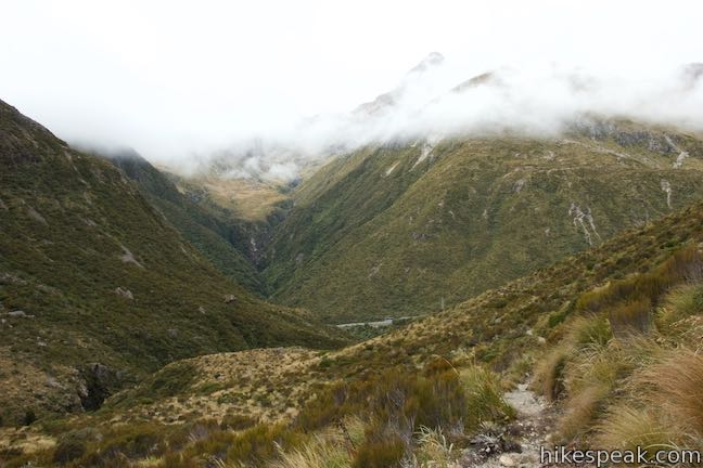
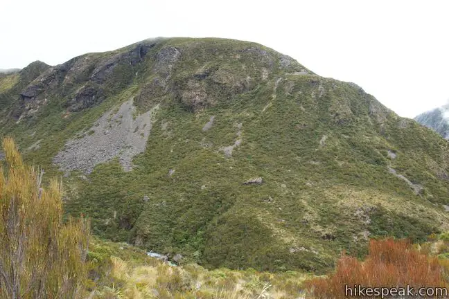
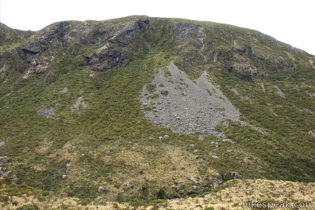
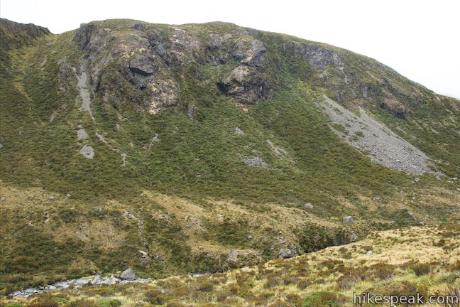
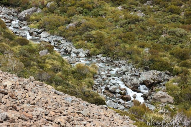
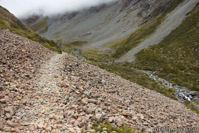
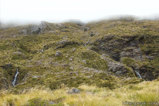
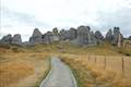
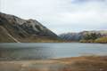
At 500 meters from the start, find nice views over the river below and across the valley toward the rocky mass of Warnocks Knob, which stands over the end of the valley on the north side of the river.
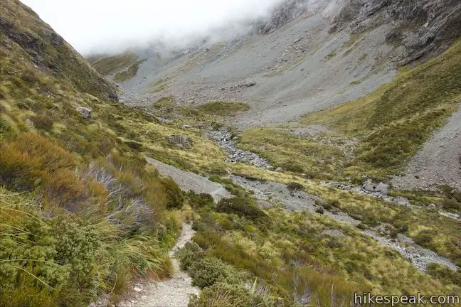
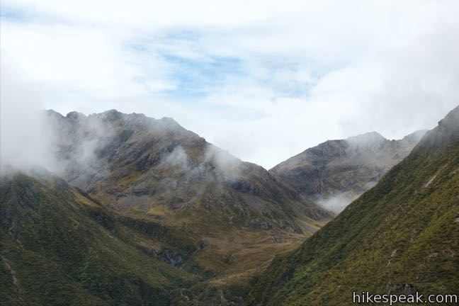
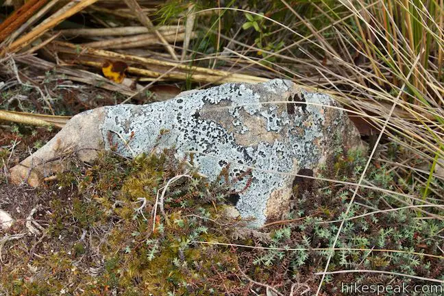
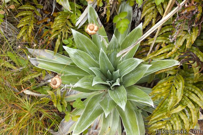
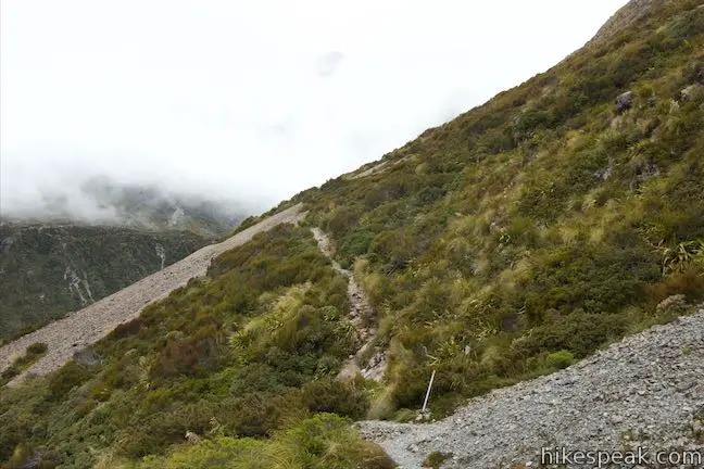
Hike though tussock grasses, a mix of scrubs, and possibly summer wildflowers. Patches of verdant moss cling to boulders along the track, which cuts a fairly level and straight path across the sloped side of the valley. The terrain rises steeply to your left up to Goldney Ridge, which is topped by rocky cliffs that get more impressive as you go.
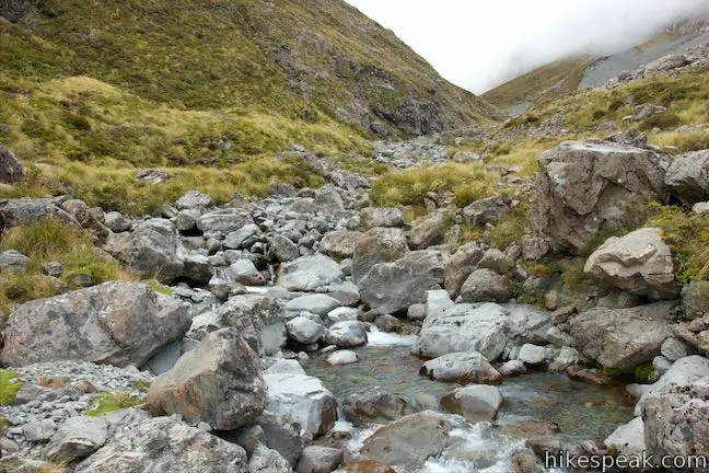
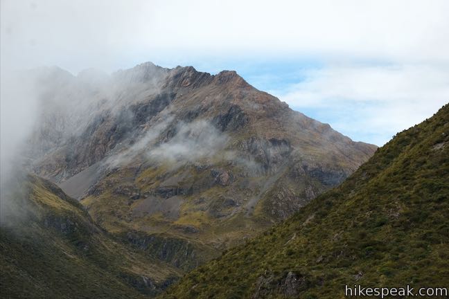
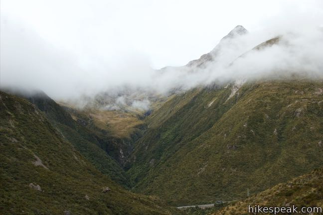
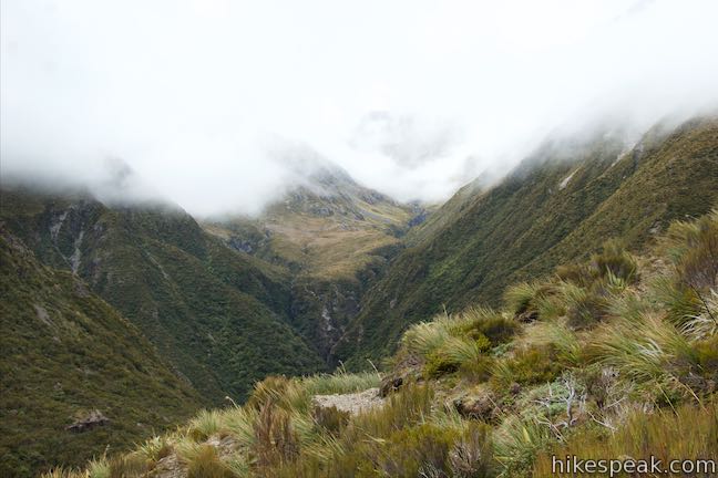
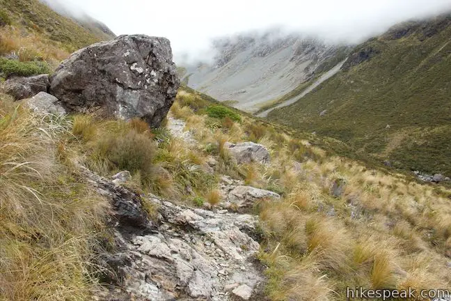
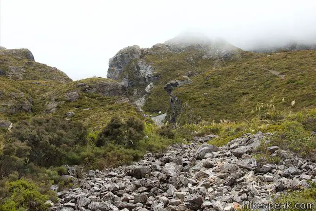
Hop across a stream at 950 meters from the start. In another 400 meters, when you again cross a stream, look up to your left toward a daunting gap between jagged rocks on the cliffs above. The steepness of the valley wall seems to create a bit of an optical illusion where the cliffs overhead appear to be beyond vertical and overhanging from the side of the valley.
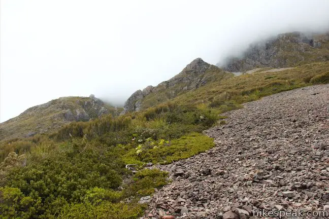
Pass through a thin section of the track, narrowed by waist-high alpine grasses, and make your way across a slope of scree (loose rocks). This might be one of the avalanche areas during dangerous conditions. While the track progresses at a fairly level elevation, the valley floor inclines so that you get closer to Otira River. At a point, the track turns downhill, bringing you nearer to the river.
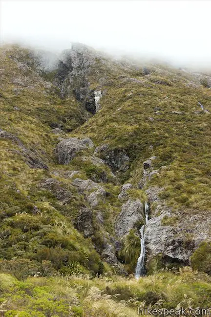
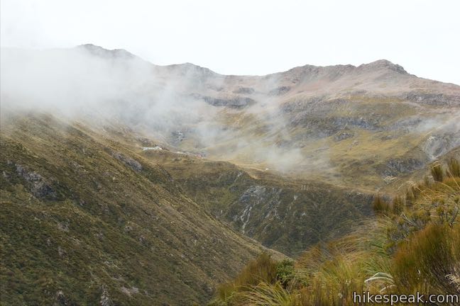
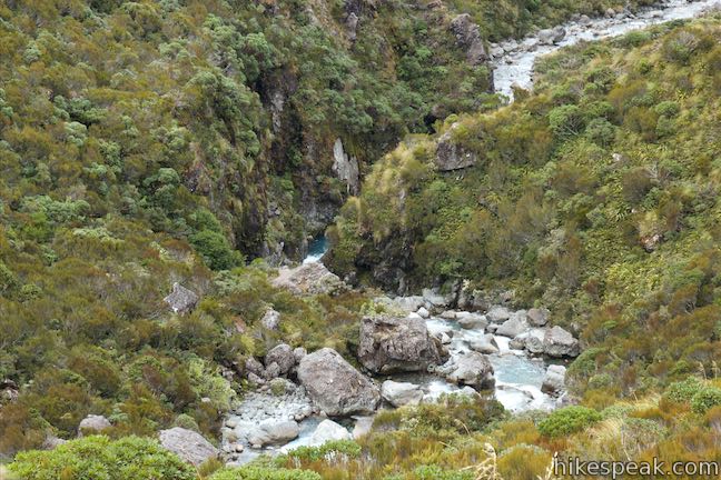
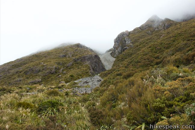
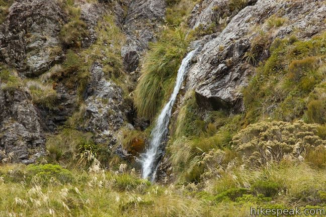
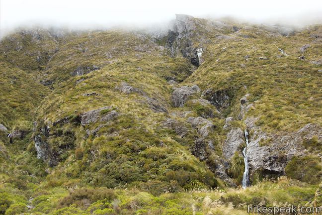
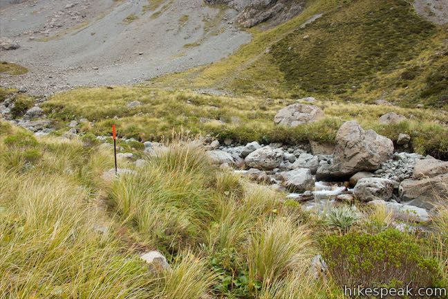
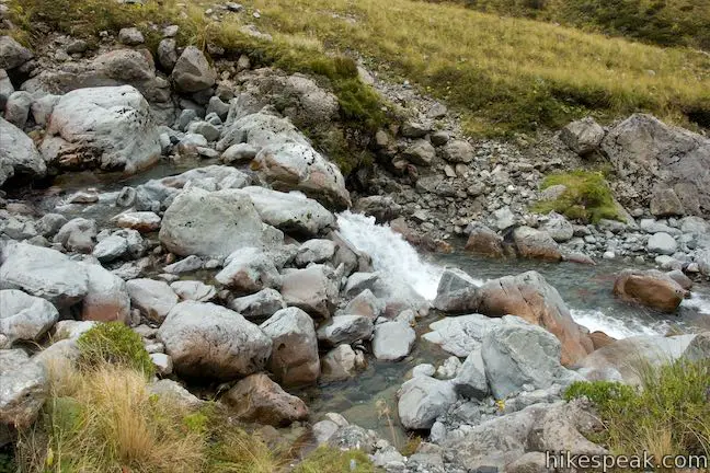
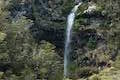
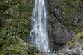
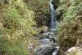
After hiking for 1.7 kilometers, you will spot a narrow stream cascading down the side of the valley to your left. Short waterfalls spill down a rough crease with rock shelves draped in grasses. Fifty meters farther up the track, you will come to a bigger stream flowing over the trail that may require you to get a boot wet if it’s been raining recently. Ahead on your left, spot a second stream of cascades flowing down the side of the valley.
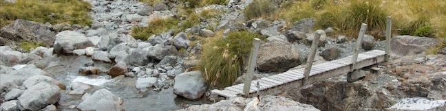
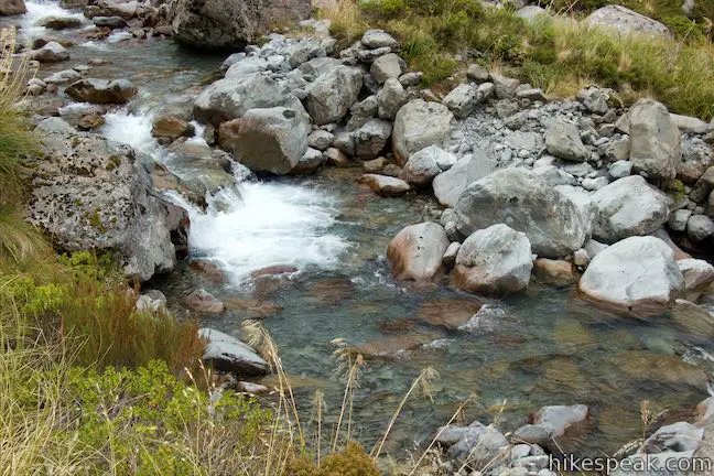
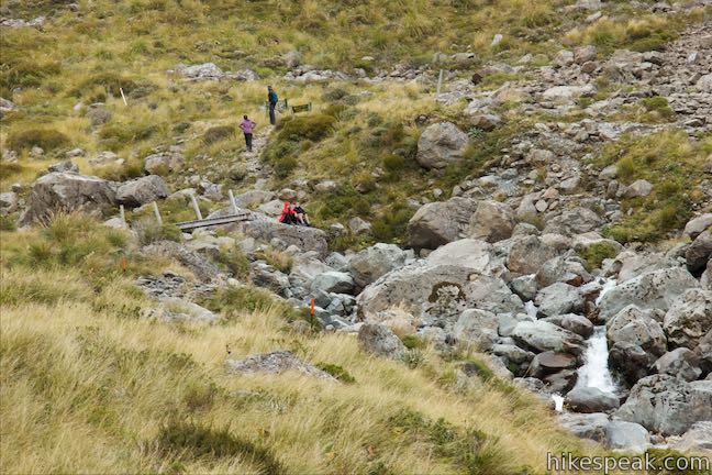
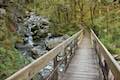
After the waterfalls, the track runs up along the side of Otira River and you can see the footbridge just up the valley. Walk along the tumbling water as it courses down to the valley floor through a collection of boulders. After 1.9 kilometers of hiking, arrive at Otira River Footbridge and the end of Otira Valley Track.
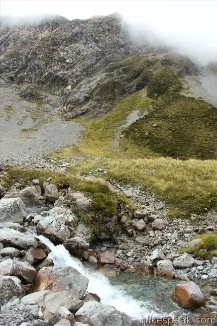
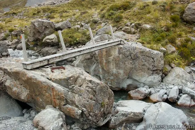
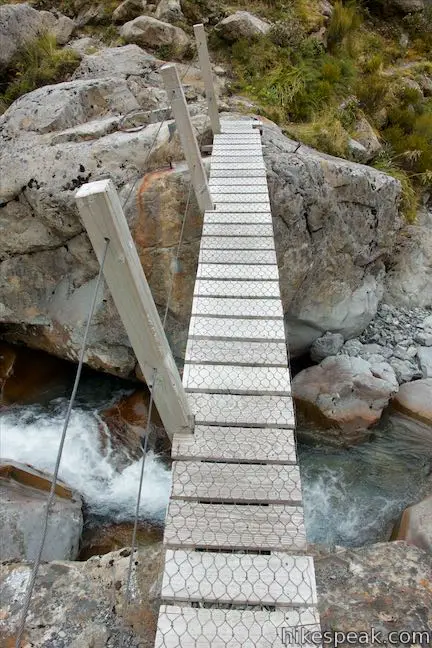
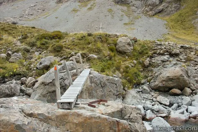
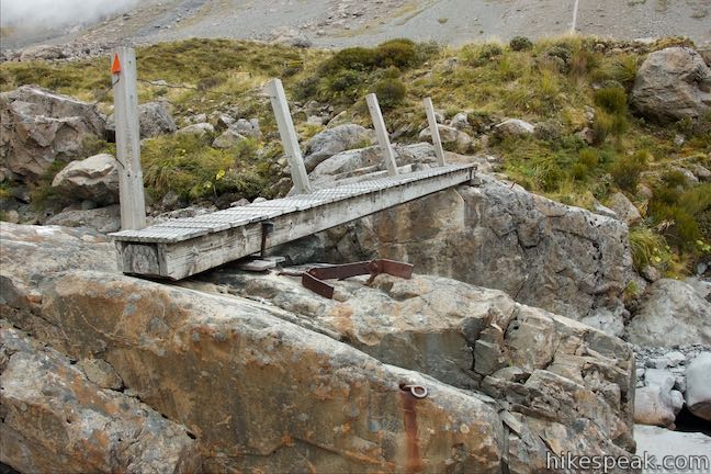
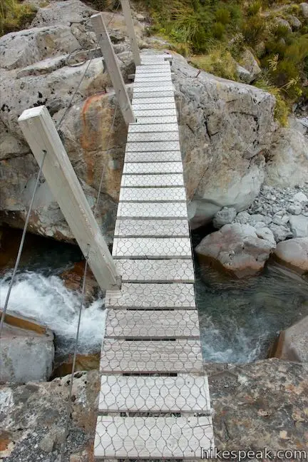
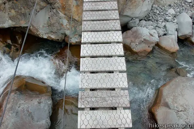
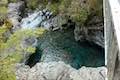
Otira River Footbridge is about 4 meters long and 30 centimeters (1 foot) wide. The wooden bridge is fastened to a pair of boulders on opposite sides of the river. The bridge only has a hand railing on one side, which you can cling to as you look down on a narrow cascade where the river is pinched between the boulders. The bridge is interesting and minimalist, but will get you to the other side.
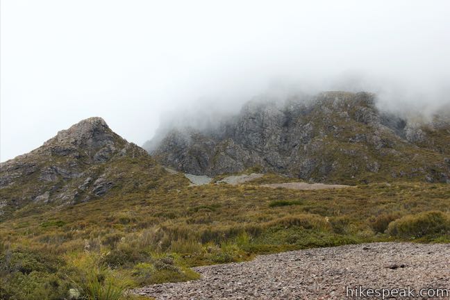
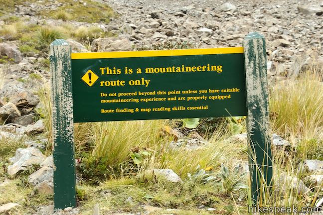
The track continues a few meters up the other side of the river, leading to a pair of warning signs. One says that rock falls are likely beyond the bridge. The other cautions that:
This is a mountaineering route only. Do not proceed beyond this point unless you have suitable mountaineering experience and are properly equipped. Route finding and map reading skills essential.
Before taking the sign’s advice and turning around, consider walking just a few meters up the marked route to get a good perspective of a third cascading stream on the south side of the valley with a cord of white water careening down short drops.
If you wish to take a break, and maybe stop for lunch, the large boulders around Otira River Footbridge make excellent seats. Usually a bridge would be an anticlimactic place to turn around, but the views up and down Otira Valley from this unique bridge enable it to function as a fulfilling turnaround point for a 3.8-kilometer round trip hike. Head back the way you came, enjoying big views looking out the bottom of the valley as you go. The junction with Lake Misery Track is the only intersection on the hike, so you should not have any trouble staying on course. Long pants are recommended because sections of Otira Valley Track are narrow and overgrown by tall tussock grasses. Dogs and bikes are not allowed. Arthur’s Pass National Park is free to visit and does not have an entrance fee. No permit is required for Otira Valley Track, so get out and enjoy!
Directions to the Trailhead
- From Sheffield (which is just over 50 kilometers west of Christchurch), take State Highway 73 northwest for 97.3 kilometers.
- The car park at the start of Otira Valley Track is on the left, just over the north side of Arthur's Pass and 5 kilometers from Arthur's Pass Village.
- From Greymouth, on the west coast, drive south on State Highway 6 for 17.5 kilometers to Kumara Junction.
- Turn inland on SH 73 and drive 72.4 kilometers southeast to reach the car park at the start of the track.
- The car park for Otira Valley Track is on the right side of the road on the north side of Arthur's Pass.
Trailhead Location
Trailhead address: Otira Highway (State Highway 73), Arthur’s Pass Village, Canterbury, 7875, New Zealand
Trailhead coordinates: -42.8986, 171.5587 (42° 53′ 54.96″S 171° 33′ 31.31″E)
View Arthur's Pass National Park in a larger map
Or view a regional map of surrounding New Zealand tracks, campgrounds, and lodging.


 | Bealey Chasm Walk This short walk passes through moss-covered beech trees to a bridge over Bealey River where it slips through a ravine. |
 | Jacks Hut to Bridal Veil Falls Lookout This 2.5-kilometer round trip hike on Arthur's Pass Walking Track crosses beech forests and alpine shrublands, dropping across a canyon to arrive at a view of Bridal Veil Falls. |
 | Arthur's Pass Village to Bridal Veil Falls Lookout This 1.8 kilometer round trip hike up Arthur's Pass Walking Track takes a gradual approach to a viewpoint with a perspective of Bridal Veil Falls and surrounding mountains. |
 | Devils Punchbowl Falls This 2-kilometer round trip hike ascends to a viewing platform near the base of an impressive waterfall that should be a top priority for Arthur's Pass National Park visitors. |
 | Millennium Walk to Avalanche Creek Waterfall This 500-meter round trip walk goes from Arthur's Pass National Park Visitor Centre to a bridge and viewpoint below a waterfall on Avalanche Creek as it approaches Arthur's Pass Village. |
 | Old Coach Road Walk If you stay overnight at Greyneys Shelter Campground, start the day with this 1 to 1.4-kilometer loop that leaves the campground and travels through the surrounding forest along an old roadbed. |
 | Kura Tawhiti / Castle Hill Conservation Area This 2 to 3-kilometer hike explores a fascinating jumble of limestone boulders close to Arthur's Pass National Park. |
 | More trails in New Zealand Explore other destinations for walking and hiking (as well camping and lodging) in New Zealand. |
 | Avalanche Creek Shelter Campground This 10-site campground in Arthur's Pass Village has a large shelter and easy access to the park visitor center and nearby hiking tracks. |
 | Greyneys Shelter Campground Camping is free around this small 3-wall stone shelter along State Highway 73 south of Arthur's Pass Village. |
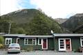 | Arthur's Pass Alpine Motel This lodging option in Arthur's Pass Village offers self-contained cabin accommodations that are convenient for visiting Arthur's Pass National Park. |
 | Lake Pearson (Moana Rua) Campground This campground has about 20 sites along the shore of a peaceful lake between mountains in the Canterbury Region near Arthur's Pass National Park. |
- The Department of Conservation webpage for for Arthur's Pass Half-day Walks (opens in a new tab)
- The Department of Conservation brochure for Arthur's Pass National Park (opens in a new tab)
- Arthur's Pass National Park on wikipedia.org (opens in a new tab)
- Arthur's Pass National Park on newzealand.com (opens in a new tab)
- The Department of Conservation webpage for Otira Valley Track (opens in a new tab)
- The Department of Conservation webpage for Arthur's Pass National Park (opens in a new tab)
- Otira Valley Track on meowtainpeople.com (opens in a new tab)
Common Questions about Otira Valley Track in Arthur’s Pass National Park
- Is the trail open?
- Yes. You should expect to find that Otira Valley Track is open. There are no recent reports of trail closures. If you discover that the trail is closed, please help your fellow hikers by reporting a closure.
- Is this trail free to access?
- Yes, Otira Valley Track is free to access. No entrance fee, pass, or permit is required. If you discover that access rules have changed, please provide feedback on your experience.
- How much time does this hike take?
- It takes approximately 1 hour 15 minutes to hike Otira Valley Track. Individual hiking times vary. Add extra time for breaks and taking in the views.
- How long is this hike?
- The hike to Otira Valley Track is a 3.8 km / 2.35 mile out and back return with 125 meters / 410 feet of elevation change.
- Are dogs allowed on this trail?
- No, dogs are likely not allowed on Otira Valley Track. The trail is primarily open to hikers.
- Where is the trailhead located?
- The trailhead for Otira Valley Track is located in Arthur's Pass Village, CA.
Trailhead Address:
State Highway 73
Arthur's Pass Village, CA 7875
Trailhead Coordinates:
-42.8986, 171.5587 - What are the driving directions to the start of the hike?
To get to the trailhead: From Sheffield (which is just over 50 kilometers west of Christchurch), take State Highway 73 northwest for 97.3 kilometers. The car park at the start of Otira Valley Track is on the left, just over the north side of Arthur's Pass and 5 kilometers from Arthur's Pass Village.
From Greymouth, on the west coast, drive south on State Highway 6 for 17.5 kilometers to Kumara Junction. Turn inland on SH 73 and drive 72.4 kilometers southeast to reach the car park at the start of the track. The car park for Otira Valley Track is on the right side of the road on the north side of Arthur's Pass.
View custom Google Maps directions from your current location.
- Are there other trails near Otira Valley Track?
- Yes, you can find other nearby hikes using the Hikespeak Hike Finder Map.

Go the extra miles...
Submit a rating of this hike to go with your comment. Contribute to the average trail rating.