Kura Tawhiti Castle Hill Conservation Area
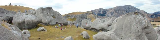
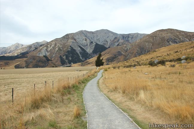
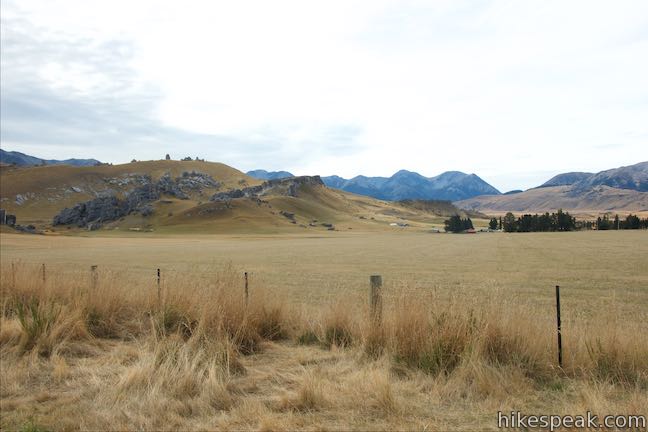
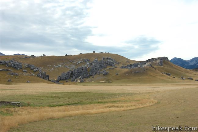
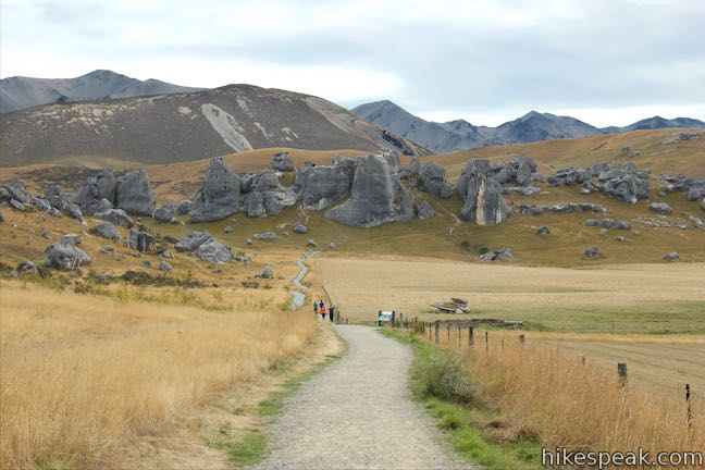
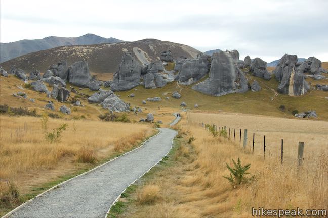
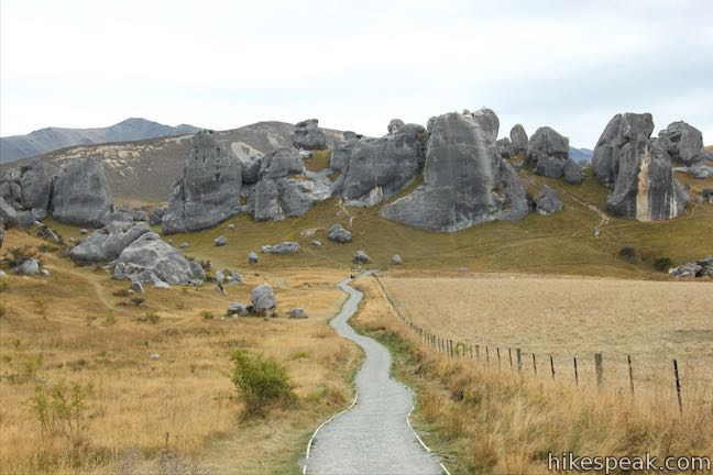
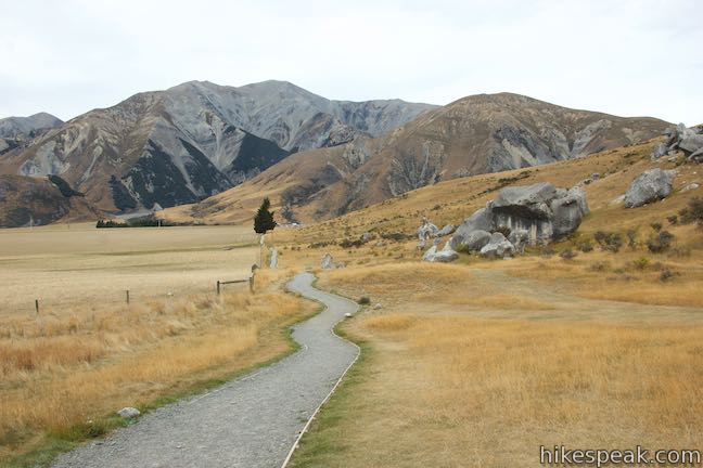
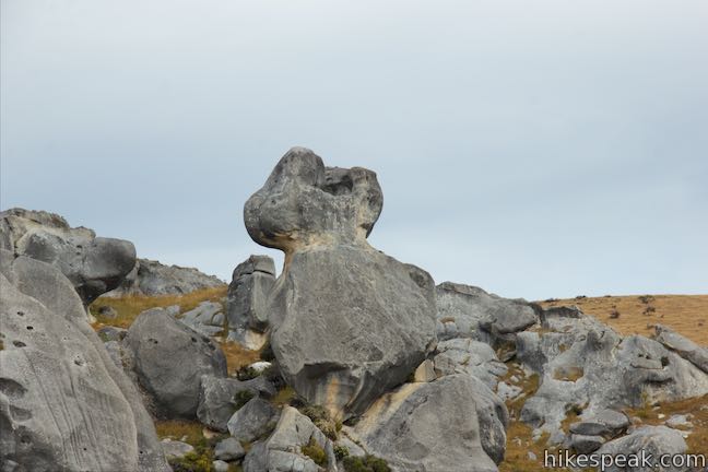
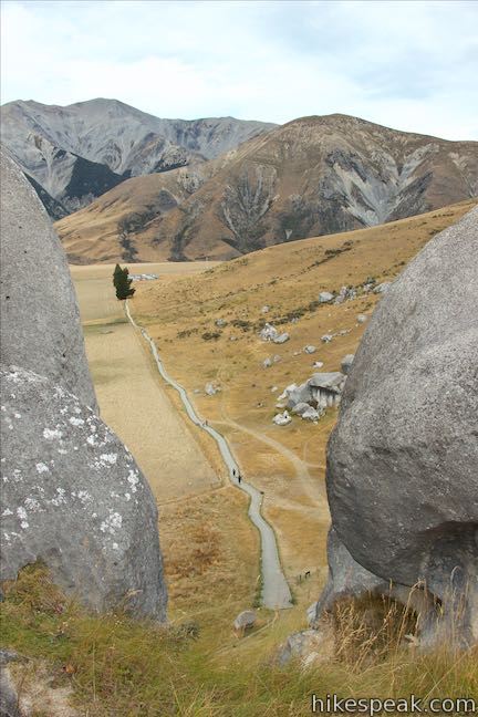
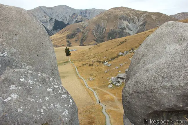
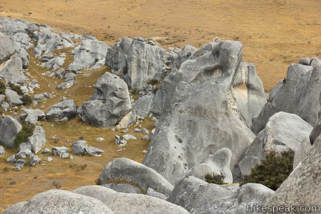
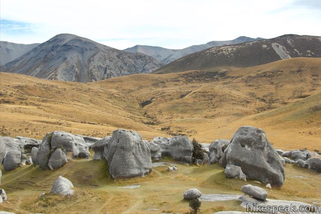
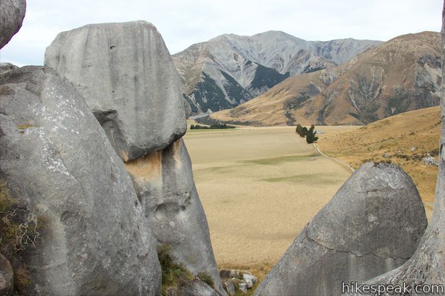
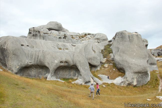
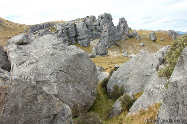
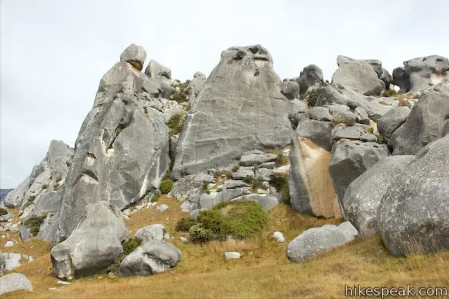
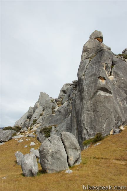
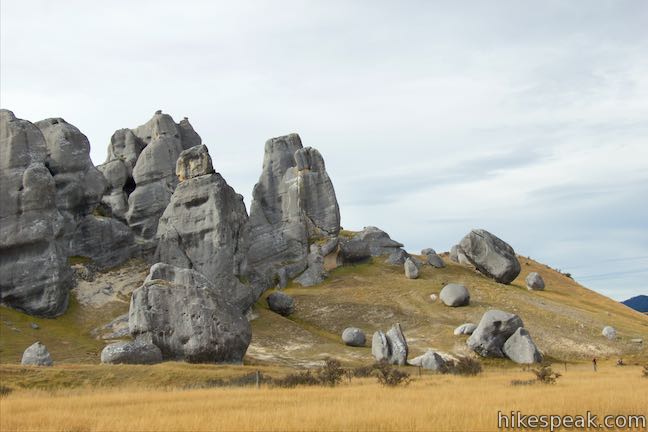
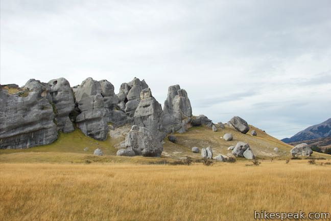
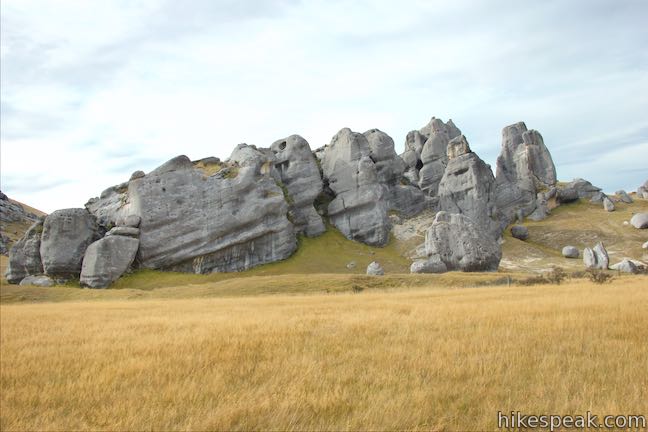
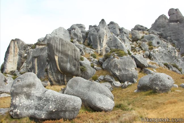
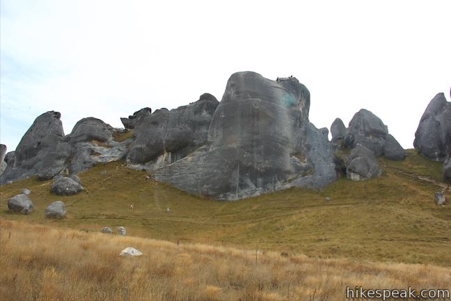
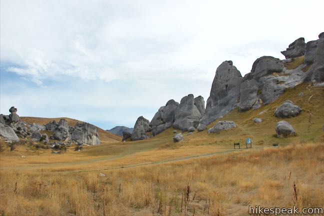
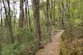
Not far from Arthur’s Pass National Park in the Canterbury Region of New Zealand, you’ll come across an alluring playground of limestone boulders in Kura Tawhiti / Castle Hill Conservation Area. Mountain climbers have fun scaling its many misshapen boulders and hikers will enjoy venturing through the area as well. A level 600-meter long track leads to the foot of a grassy hill covered with a crown of misshapen rocks. From there, forge a DIY route between the boulders for a fun outing of two to three kilometers round trip.
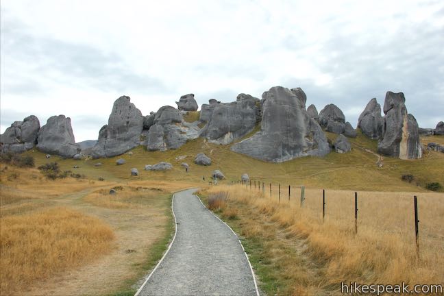
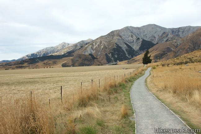
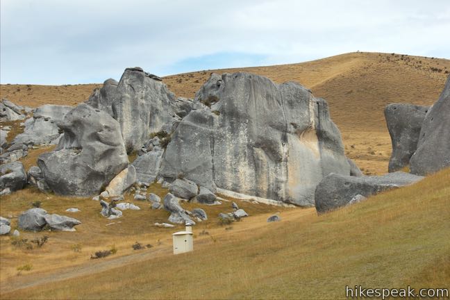
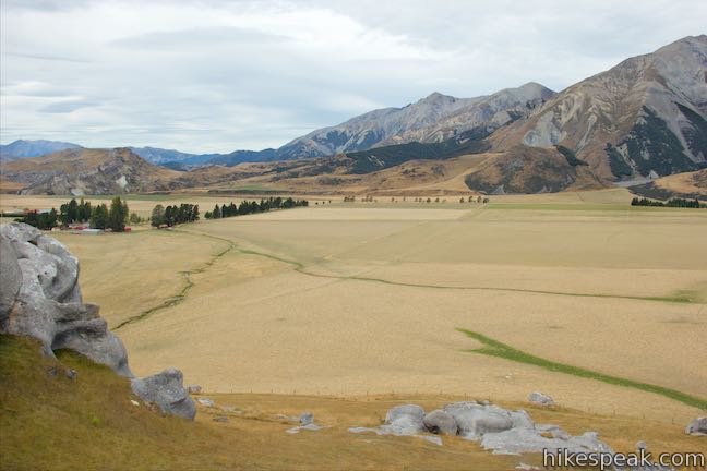
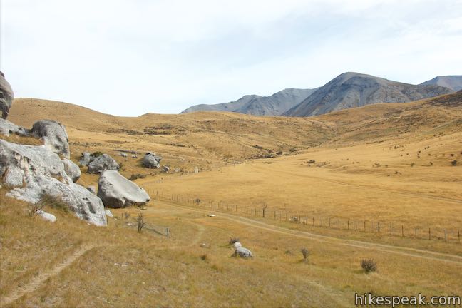
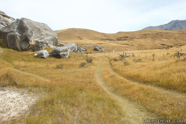
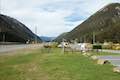
State Highway 73 passes Kura Tawhiti / Castle Hill Conservation Area as it approaches Arthur’s Pass from Christchurch. This out-of-place collection of boulders does not match the surrounding grassy valleys and barren peaks. Pull into a car park along the road and take a level track heading straight toward the mass of boulders. A fenced-off pasture abuts the trail to the right. On the left, you’ll come up alongside a ridge dotted with boulders that could be explored in addition to the main area.
A panel along Kura Tawhiti Access Track reads:
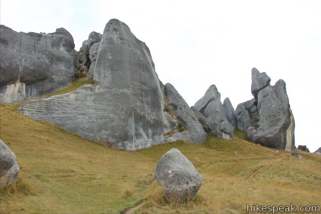
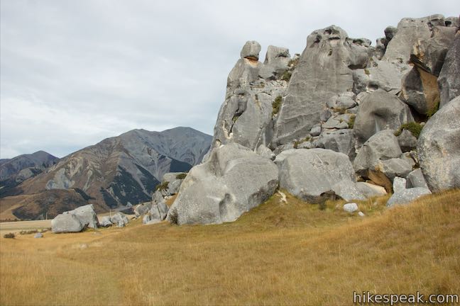
These spectacular rocks are natural outcroppings of soft limestone, not the ruins of some ancient city. Their sculptured forms have attracted the attention and awe of travelers, past and present. This scenic limestone landscape supports a variety of significant natural and cultural values. Rock shelters amongst the limestone outcrops were used by early Māori. They were travelers on a network of trails that gave access to rich food and fiber resources in the Waimakariri Basin. Some shelters contain rock art drawn by these first occupants.
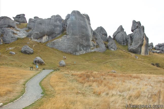
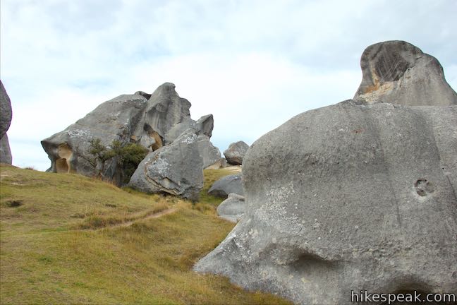
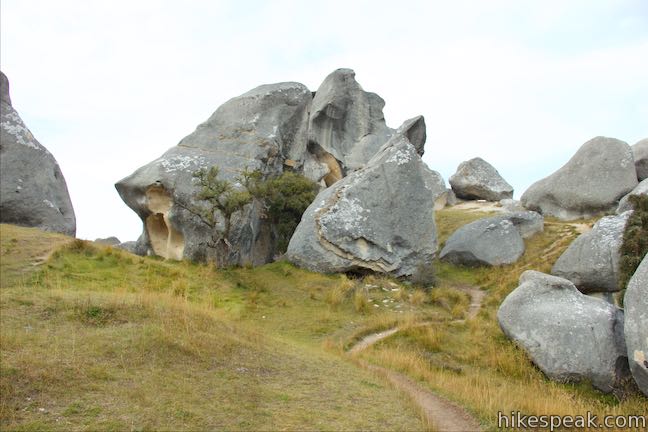
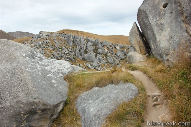
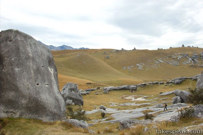
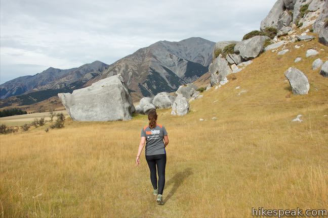
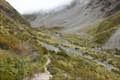
After 600 meters, Kura Tawhiti Access Track ends alongside a panel at the base of a grassy slope below tall gray boulders. From here you have a few options. A short distance before the end of the track, a path breaking off to the right goes along another side of the pasture below the boulder-covered hill. This path goes around the perimeter of the rocky area and makes a nice return route after exploring the boulders. By making a hard left at the end of the track, you’ll find a path leading up a grassy draw that separates the rocky area on the left from the main area above the trail. A toilet is visible in this direction. Several other paths make there way toward the rocky fortress ahead of you. The easiest way to get up into the rocks is to turn left at first and then veer right up into an obvious gap between the boulders.
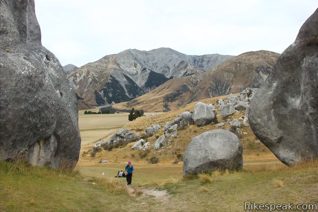
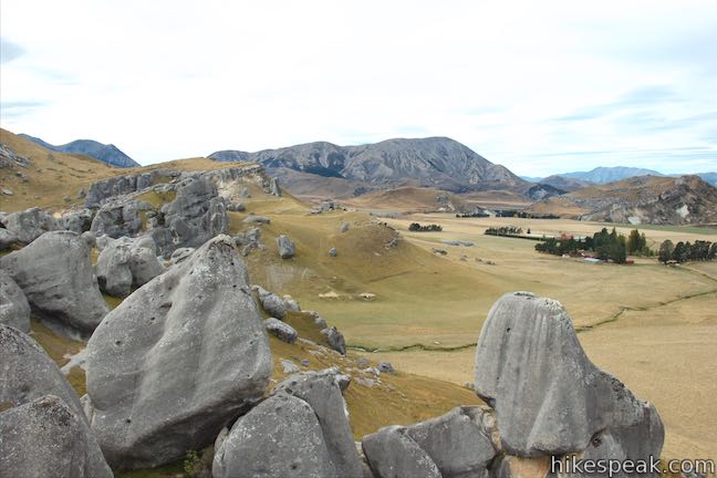
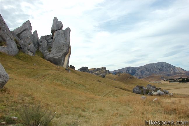
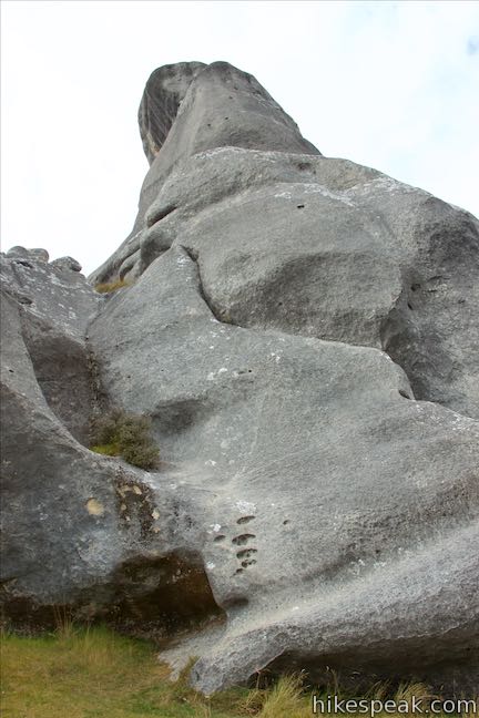
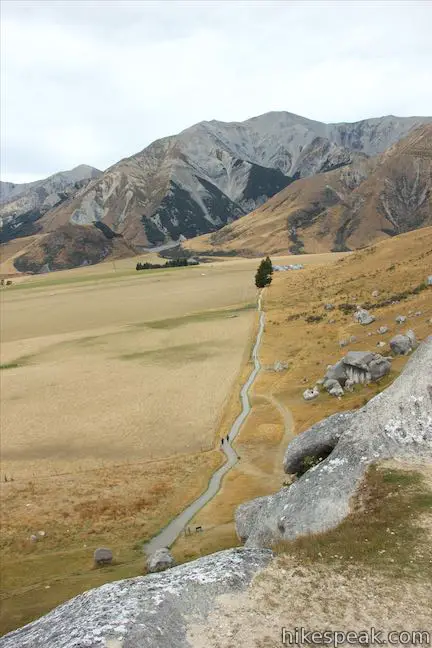
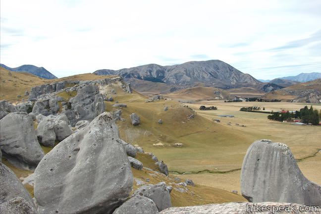
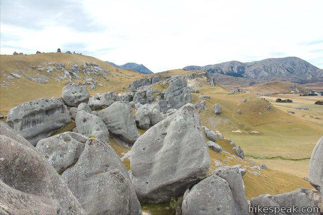
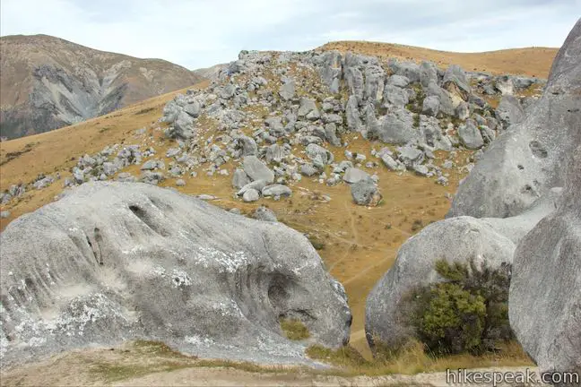
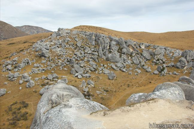
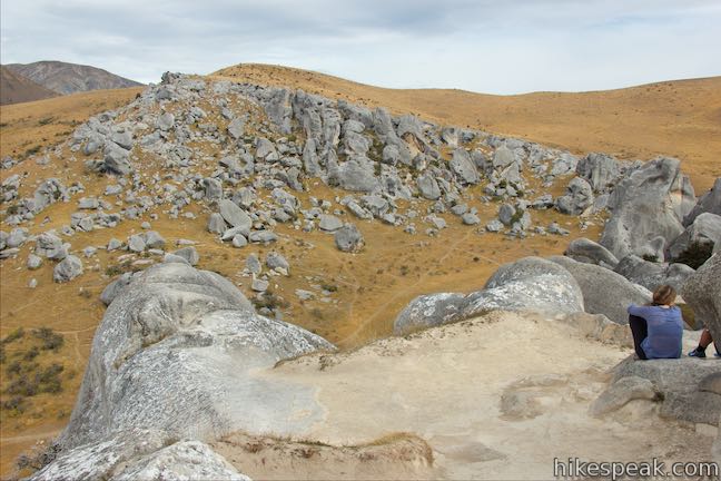
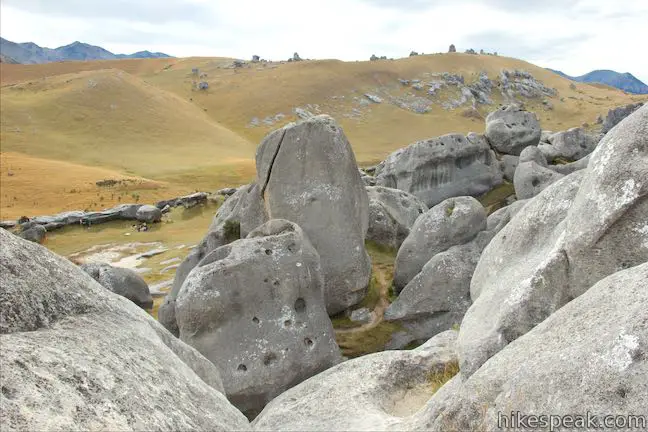
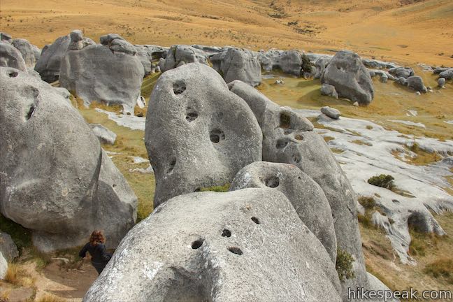
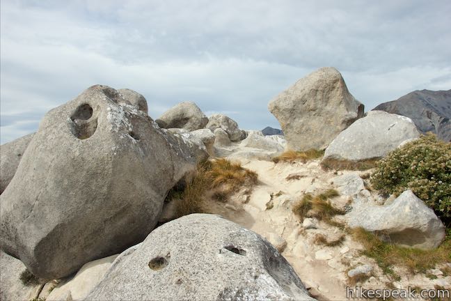
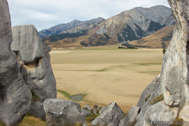
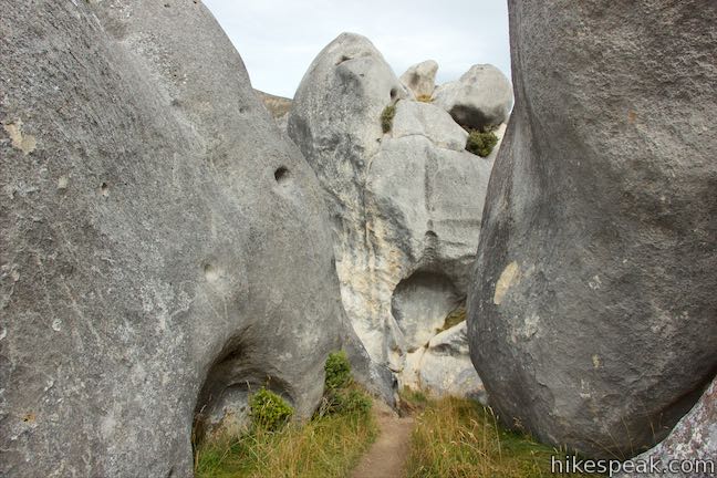
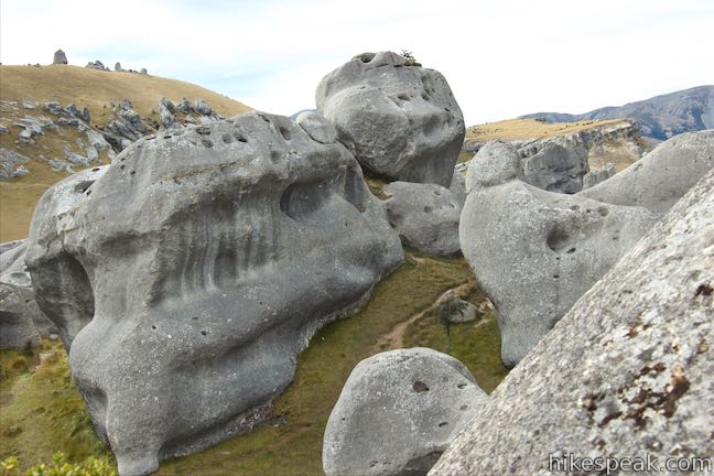
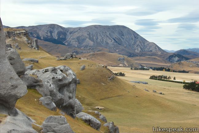
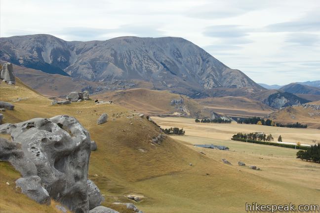
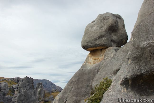
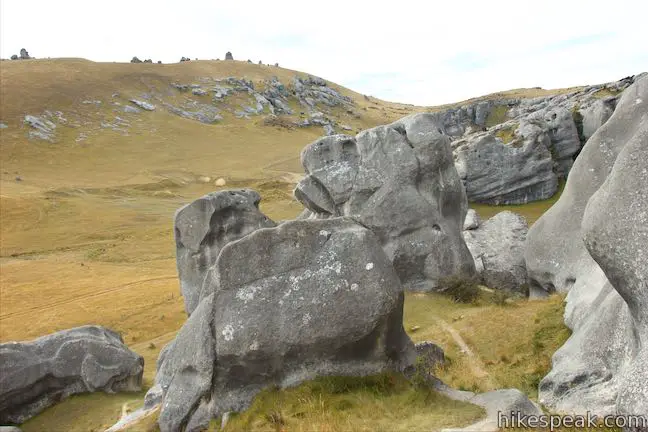
Take a worn path between limestone monoliths. When you get higher up the hillside, turn right and make your way around more of the boulders. Soon you’ll be able to move across the tops of the boulders that you looked up at from the end of the Kura Tawhiti Access Track. Look back down the track toward Mount Plenty and Castle Hill Peak to the southwest.
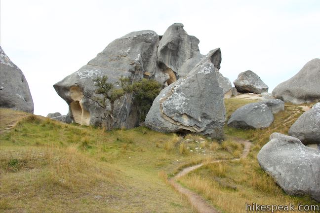
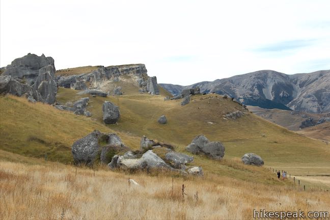
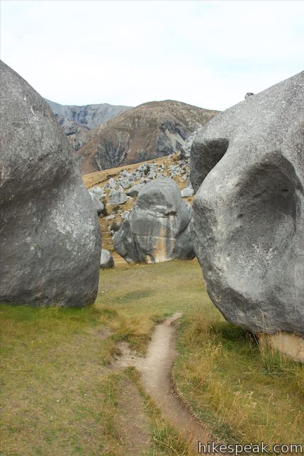
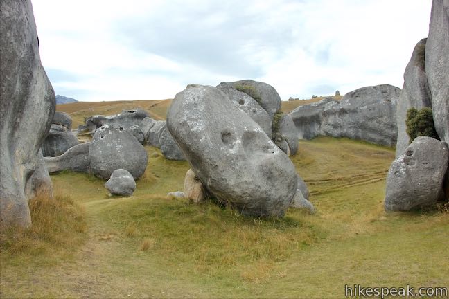
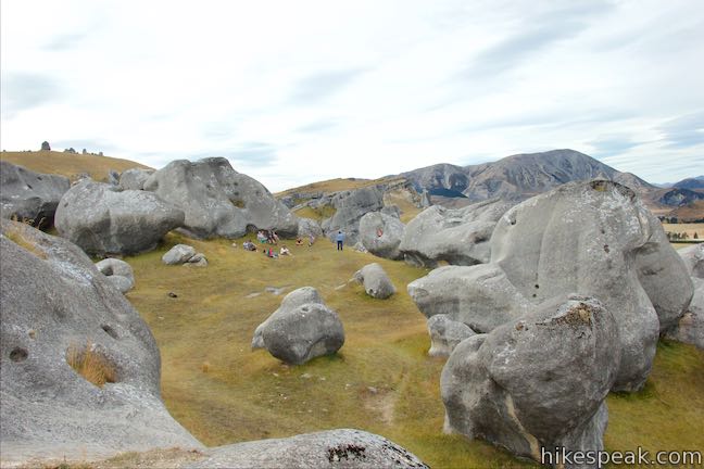
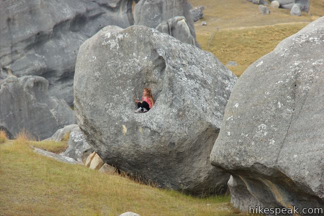
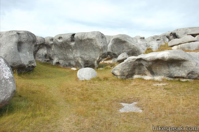
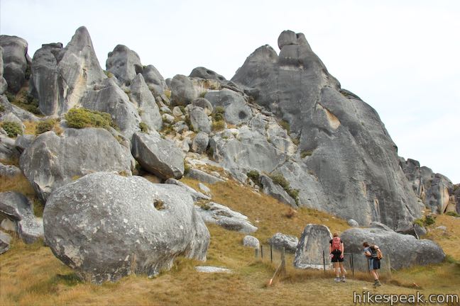
A village of boulders extends to the north for you to walk through. There’s not single defined track, so have fun making your own route, picking up worn paths leading between the interesting boulders. You can stick to walking on your two feet or scramble around to have more fun. Spend twenty minutes or all afternoon making your way through the labyrinth of boulders.
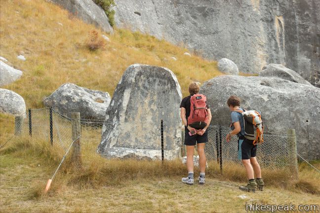
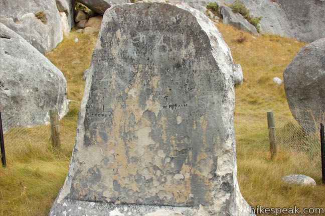
Eventually you’ll start to head downhill and reach the other side of the hill. A double-track trail wraps around the north side of the boulder area. Depending on exactly where you exit the rocks, you’ll have 500 meters or more to walk along this path to return to Kura Tawhiti Access Track. To the left, you’ll see a toilet below the west side of the boulder area. Turn right to begin making your way back. After about 200 meters, you’ll pass a fenced-in stone memorial that looks like a large gravestone.
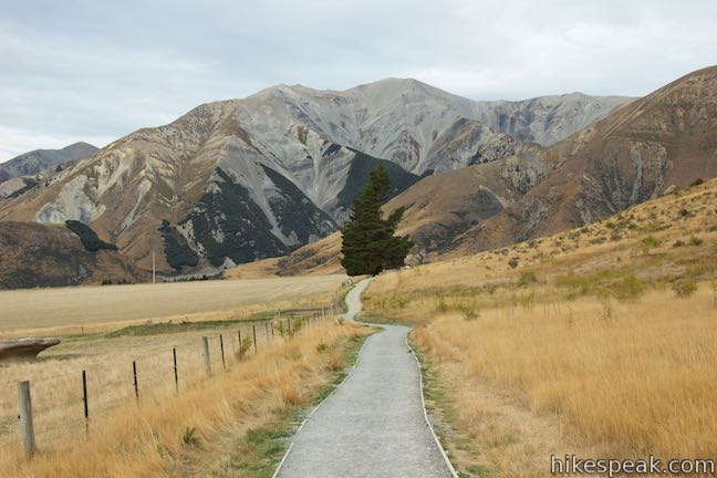
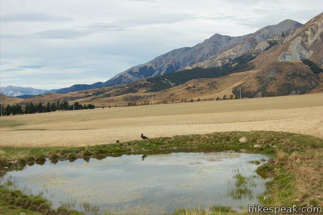
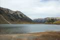
Just ahead, the path comes to a junction. Turn right and go south along the east side of the boulder-covered hill. Enjoy views up at the tower-like boulders to your right. A small pond in the pasture on your left offers a nice reflection of the mountain beyond. In another 300 meters, you will meet Kura Tawhiti Access Track.
Turn left when you reach the main track and walk back to the car park (where there are additional toilets). If you follow the rough directions above, expect to walk about 2.6 kilometers on a hike through Kura Tawhiti / Castle Hill Conservation Area. You will only tackle about 65 meters of elevation change along the way. Bikes and dogs are not permitted. Kura Tawhiti / Castle Hill Conservation Area is free to visit and no permit is required to walk among the boulders.
Directions to the Trailhead
- From Sheffield (which is just over 50 kilometers west of Christchurch), take State Highway 73 northwest for 40 kilometers.
- At 7.5 kilometers past Lake Lyndon, turn left into the car park for Kura Tawhiti / Castle Hill Conservation Area.
- Coming from the other direction, the parking area is 53.5 kilometers from Arthur's Pass Village, 20.5 kilometers past Lake Pearson (Moana Rua) Campground, and 3.5 miles past the small town of Castle Hill.
Trailhead Location
Trailhead address: 8557 West Coast Road (State Highway 73), Castle Hill, Canterbury, 7580, New Zealand
Trailhead coordinates: -43.23335, 171.7222 (43° 14′ 00.06″S 171° 43′ 19.91″E)
You may also view a regional map of surrounding New Zealand tracks, campgrounds, and lodging.


 | Old Coach Road Walk If you stay overnight at Greyneys Shelter Campground, start the day with this 1 to 1.4-kilometer loop that leaves the campground and travels through the surrounding forest along an old roadbed. |
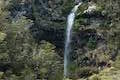
 | Millennium Walk to Avalanche Creek Waterfall This 500-meter round trip walk goes from Arthur's Pass National Park Visitor Centre to a bridge and viewpoint below a waterfall on Avalanche Creek as it approaches Arthur's Pass Village. |
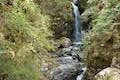
 | Devils Punchbowl Falls This 2-kilometer round trip hike ascends to a viewing platform near the base of an impressive waterfall that should be a top priority for Arthur's Pass National Park visitors. |
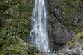
 | Arthur's Pass Village to Bridal Veil Falls Lookout This 1.8 kilometer round trip hike up Arthur's Pass Walking Track takes a gradual approach to a viewpoint with a perspective of Bridal Veil Falls and surrounding mountains. |
 | Jacks Hut to Bridal Veil Falls Lookout This 2.5-kilometer round trip hike on Arthur's Pass Walking Track crosses beech forests and alpine shrublands, dropping across a canyon to arrive at a view of Bridal Veil Falls. |
 | Bealey Chasm Walk This short walk passes through moss-covered beech trees to a bridge over Bealey River where it slips through a ravine. |
 | Otira Valley Track This 3.8-kilometer round trip hike ventures up a valley on the north side of Arthur's Pass, finding a footbridge over Otira River and broad views of surrounding mountains. |
 | More trails in New Zealand Explore other destinations for walking and hiking (as well camping and lodging) in New Zealand. |
 | Lake Pearson (Moana Rua) Campground This campground has about 20 sites along the shore of a peaceful lake between mountains in the Canterbury Region near Arthur's Pass National Park. |
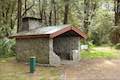 | Greyneys Shelter Campground Camping is free around this small 3-wall stone shelter along State Highway 73 south of Arthur's Pass Village. |
 | Avalanche Creek Shelter Campground This 10-site campground in Arthur's Pass Village has a large shelter and easy access to the park visitor center and nearby hiking tracks. |
- Kura Tawhiti Conservation Area on castlehill.net.nz (opens in a new tab)
- Kura Tawhiti Conservation Area on stokedforsaturday.com (opens in a new tab)
- Kura Tawhiti Conservation Area on tracks.org.nz (opens in a new tab)
- Kura Tawhiti Conservation Area on arthurspass.com (opens in a new tab)
- Kura Tawhiti Conservation Area on wikipedia.org (opens in a new tab)
- The Department of Conservation webpage for Kura Tawhiti Conservation Area (opens in a new tab)
Common Questions about Kura Tawhiti Castle Hill Conservation Area
- Is the trail open?
- Yes. You should expect to find that Kura Tawhiti Castle Hill Conservation Area is open. There are no recent reports of trail closures. If you discover that the trail is closed, please help your fellow hikers by reporting a closure.
- Is this trail free to access?
- Yes, Kura Tawhiti Castle Hill Conservation Area is free to access. No entrance fee, pass, or permit is required. If you discover that access rules have changed, please provide feedback on your experience.
- How much time does this hike take?
- It takes approximately 45 minutes to hike Kura Tawhiti Castle Hill Conservation Area. Individual hiking times vary. Add extra time for breaks and taking in the views.
- How long is this hike?
- The hike to Kura Tawhiti Castle Hill Conservation Area is a 2.6 km / 1.6 mile lollipop loop with 65 meters / 215 feet of elevation change.
- Are dogs allowed on this trail?
- No, dogs are likely not allowed on Kura Tawhiti Castle Hill Conservation Area. The trail is primarily open to hikers.
- Is Kura Tawhiti Castle Hill Conservation Area good for kids?
- Yes, this hike is likely suitable for children. It is relatively short (1.6 miles) with manageable elevation gain.
- Where is the trailhead located?
- The trailhead for Kura Tawhiti Castle Hill Conservation Area is located in Castle Hill, Canterbury.
Trailhead Address:
State Highway 73
Castle Hill, Canterbury 7580
Trailhead Coordinates:
-43.23335, 171.7222 - What are the driving directions to the start of the hike?
To get to the trailhead: From Sheffield (which is just over 50 kilometers west of Christchurch), take State Highway 73 northwest for 40 kilometers. At 7.5 kilometers past Lake Lyndon, turn left into the car park for Kura Tawhiti / Castle Hill Conservation Area. Coming from the other direction, the parking area is 53.5 kilometers from Arthur's Pass Village, 20.5 kilometers past Lake Pearson (Moana Rua) Campground, and 3.5 miles past the small town of Castle Hill.
View custom Google Maps directions from your current location.
- Are there other trails near Kura Tawhiti Castle Hill Conservation Area?
- Yes, you can find other nearby hikes using the Hikespeak Hike Finder Map.

Go the extra miles...
Submit a rating of this hike to go with your comment. Contribute to the average trail rating.