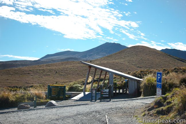
Tongariro Alpine Crossing
in Tongariro National Park
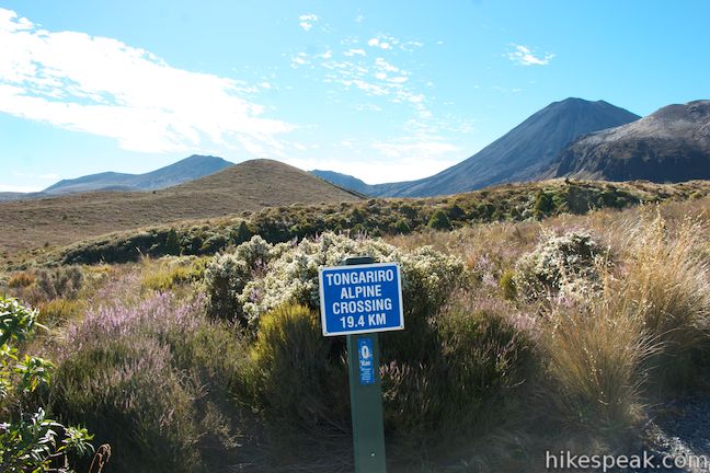
Tongariro Alpine Crossing is widely consider one of the greatest day hikes in New Zealand, which puts it on the shortlist of the world’s greatest hikes. This 19.4-kilometer long track rises to its reputation and then some, crossing through an active volcanic area in Tongariro National Park at the center of New Zealand’s North Island. It is one of the most dynamic and dramatic hikes that you will come across, with stunning scenery that reinvents itself over every leg of the journey.
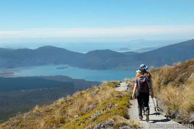
Tongariro Alpine Crossing is a one-way through hike along a 19.4-kilometer (12-mile) track. Transportation can be arranged to and from both ends of the track (more transportation information below). Tongariro Alpine Crossing can be hiked in either direction, but it is recommend that you start from Mangatepopo Car Park at the southwest end of the track and finish at Ketetahi Car Park at the northeast end of the track. Hiking this direction, you will ascend 765 meters (2,510 feet) over the first 8.3 kilometers and then descend 1,125 meters (3,690 feet) over the final 11.1 kilometers, including a steep slope of loose rock that would be tiring to hike up in the opposite direction. Starting from the higher southwest end of the track, you’ll be treated to a seemingly endless string of impressive head-on views.
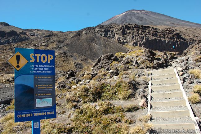
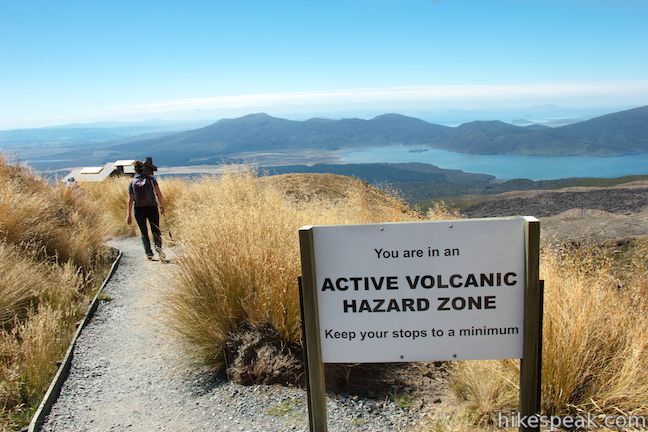
This trail passes active volcanoes and significant eruption along the Crossing occurred as recently as August 2012. Hikers assume a risk when attempting this track. Warning lights have been installed along Tongariro Alpine Crossing to alert you of potential hazards, but eruptions can happen suddenly and without warning. In an effort to minimize the danger, there are warning signs in some areas advising you to pass through quickly without stopping. A sign near the start of the track reads:
You are about to enter an area with volcanic risks. Signs are placed at the edge of the volcanic hazard zone. You could be in serious danger in a volcanic eruption if you enter this zone. An eruption could happen with no warning. If you are not comfortable with this, turn back at Red Crater.
Despite the volcanic risks, Tongariro Alpine Crossing is one of the most hiked tracks in New Zealand.
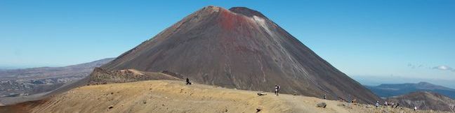
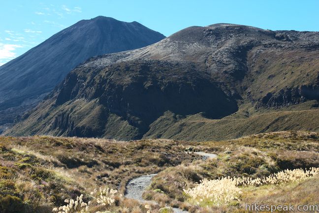
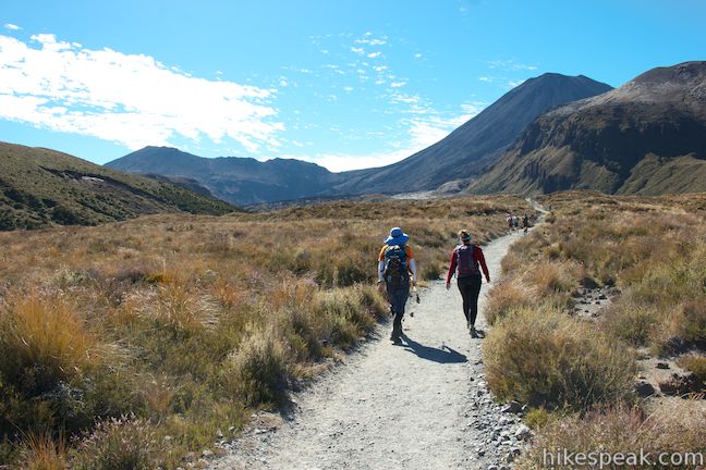
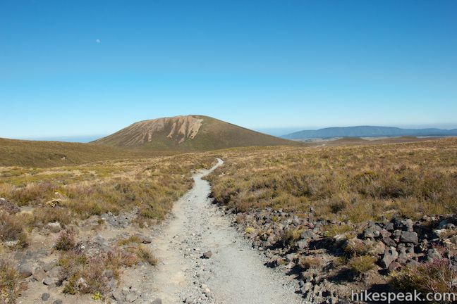
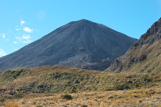
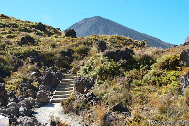
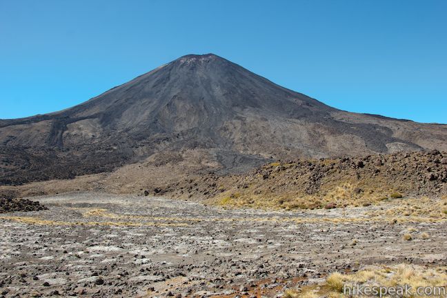
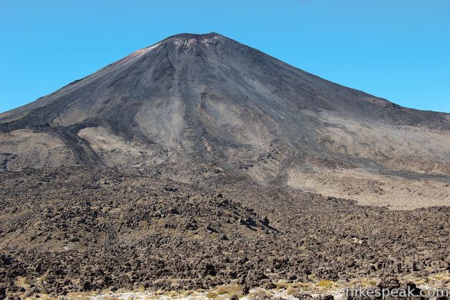
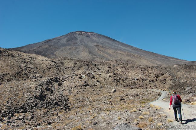
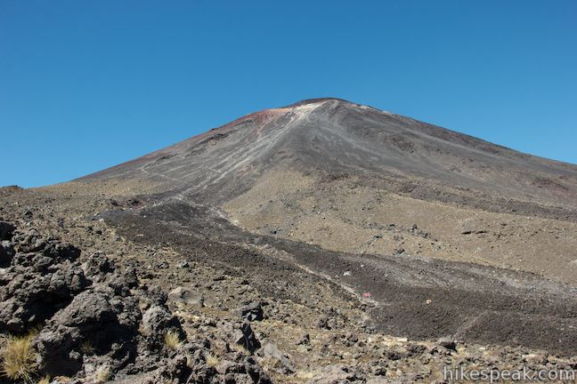
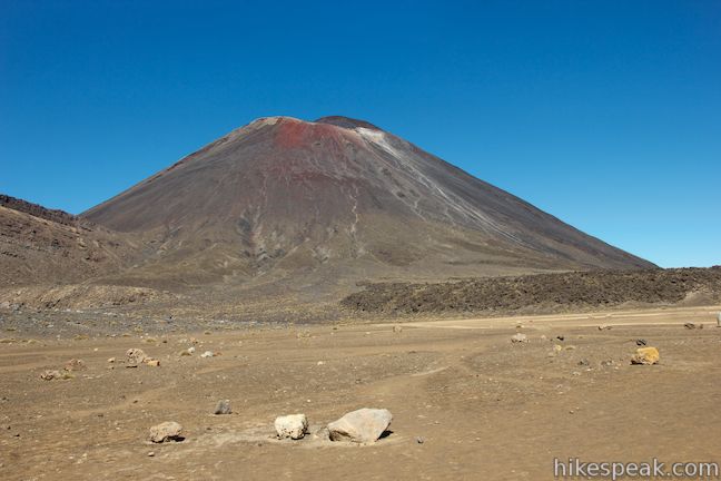
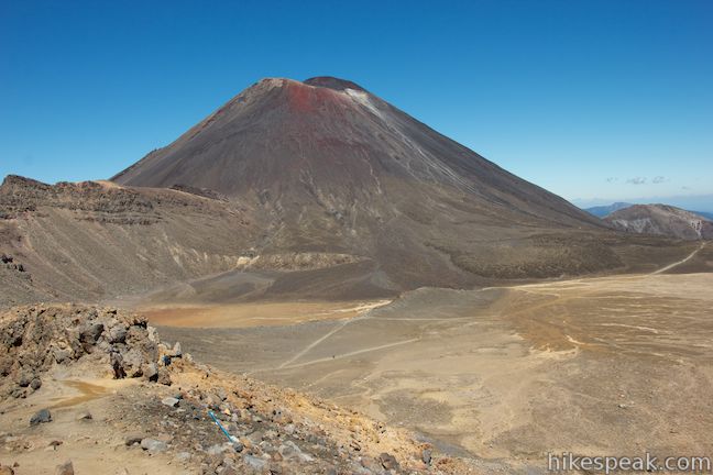
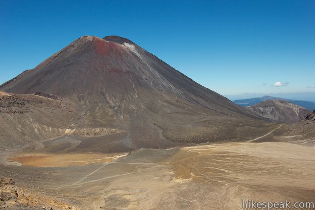
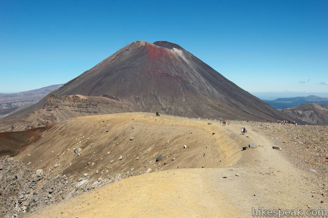
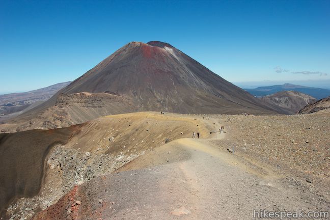
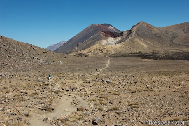
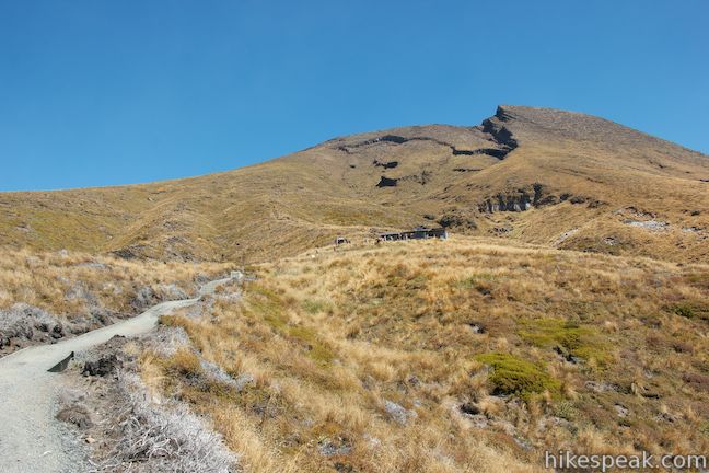
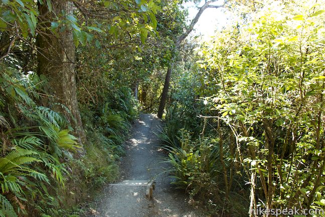
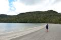
The hike starts gradually from Mangatepopo Car Park, heading east through grassland toward Mangatepopo Valley beneath two imposing volcanoes, Mounts Tongariro and Ngauruhoe. Mount Tongariro is 1,967 meters tall and Mount Ngauruhoe, which played the role of Mount Doom in the Lord of the Rings Trilogy, is 2,291 meters tall.
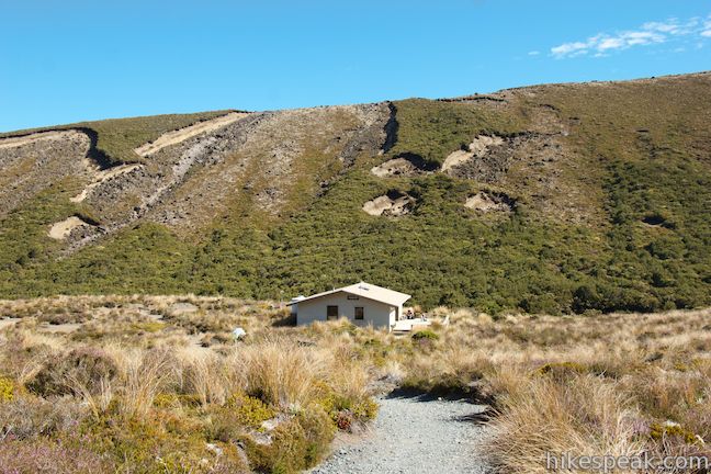
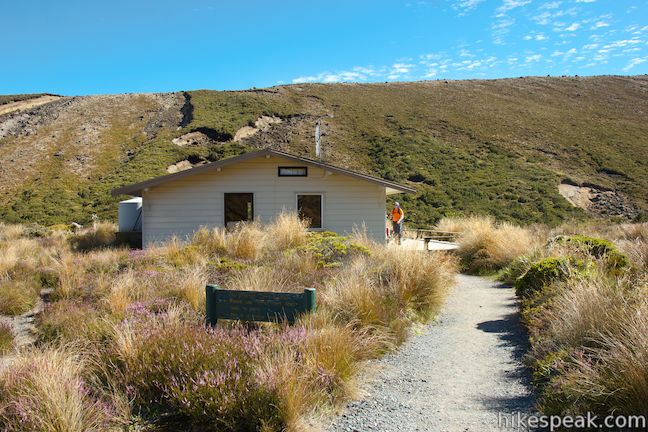
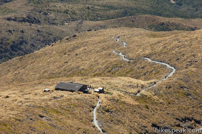
After an easy 1.3 kilometers, pass through a junction with a track that heads southwest to Whakapapa Village. This track, like most of Tongariro Alpine Crossing ahead of you, is part of Tongariro Northern Circuit, a multi-day Great Walk in Tongariro National Park. In another 300 meters, a track breaks off to the left, venturing a short distance to Mangatepopo Hut, the first of two huts along Tongariro Alpine Crossing, with 20 bunks used by trekkers on Tongariro Northern Circuit.
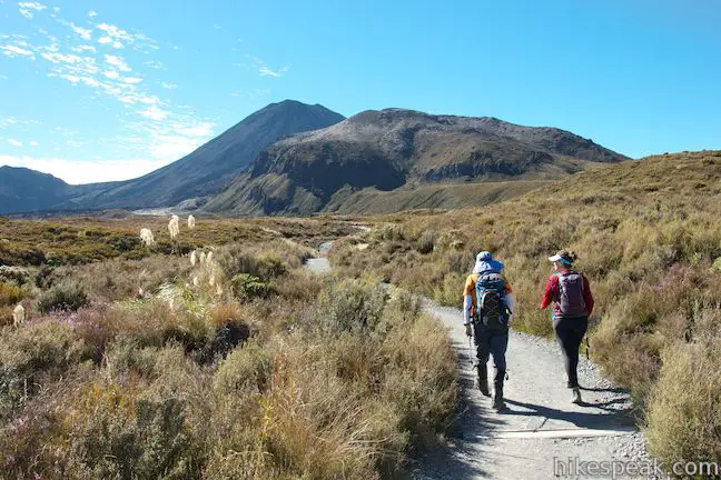
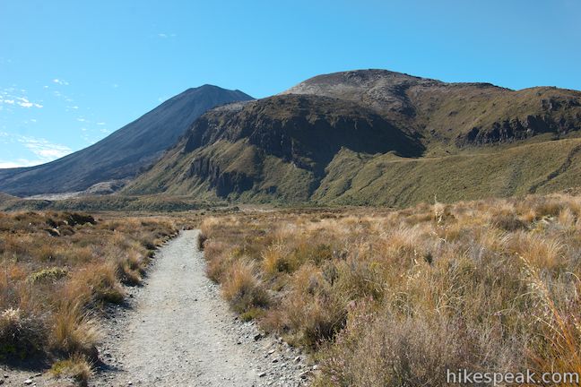
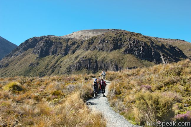
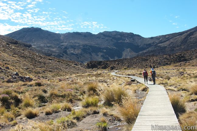
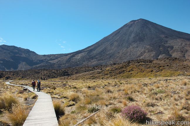
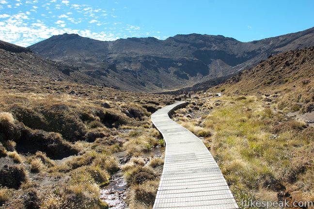
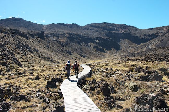
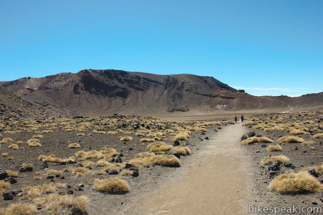
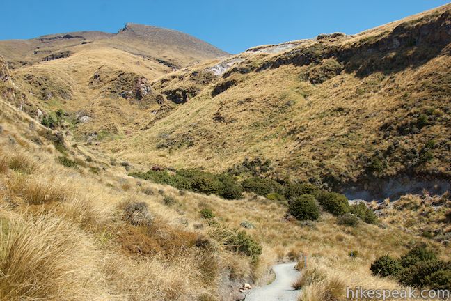
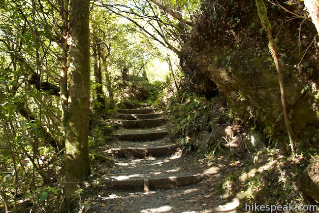
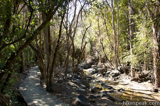
Past the hut, the track continues up Mangatepopo Valley, which leaves the grasses behind to enter a barren volcanic landscape covered in pyroclastic flows from various eruptions of Mount Ngauruhoe. The dark cone-shaped volcano looks massive, rising 1,000 meters above the valley floor. There are boardwalks and wooden steps built into the track, which runs alongside a stream that flows down the valley from a source on the side of Mount Tongariro, the volcano on the north (left) side of the trail.
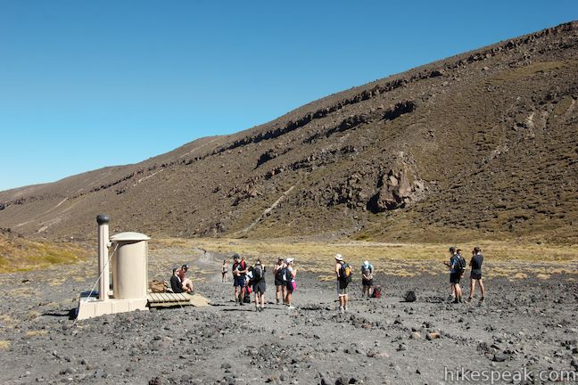
At 4.25 kilometers, reach a toilet along the track. This is the last bathroom until Ketetahi Hut, which does not come for another 8.75 kilometers, so stop if you need to. Just ahead, a spur track breaks off to the left and extends 300 meters to Soda Springs, a cascade coming down Mount Tongariro that feeds the stream below.
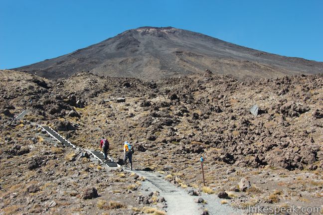
Now the track begins to climb more earnestly. You’ve gained 240 meters so far, and will ascend 280 meters over the next two kilometers as the track climbs out of Mangatepopo Valley, up the lower slopes of Mount Ngauruhoe to Central Crater, a large basin (and not an actual crater) between the two volcanoes. Ascend flights of wooden steps built into the well-established track and enjoy views up at Mount Ngauruhoe and back down Mangatepopo Valley, which is covered in several different colored bands left behind by large lava flows over the past centuries.
Take a final look over Mangatepopo Valley before coming to a junction with Ngauruhoe Summit Track, 6.3 kilometers from the start. This side track ascends another 650 meters to the top of Mount Ngauruhoe and adds about three hours to Tongariro Alpine Crossing. If you name was Frodo Baggins and you had a ring to destroy in Mount Doom, this would be the trail to take.
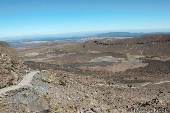
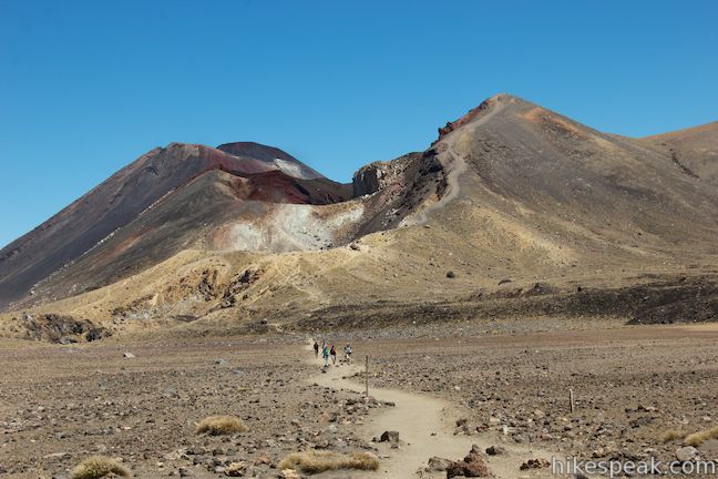
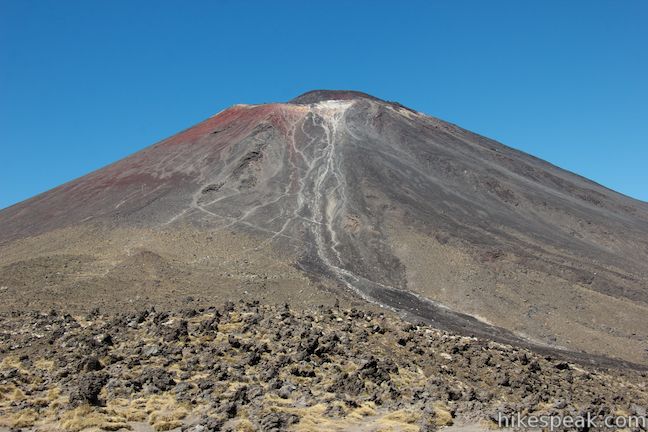
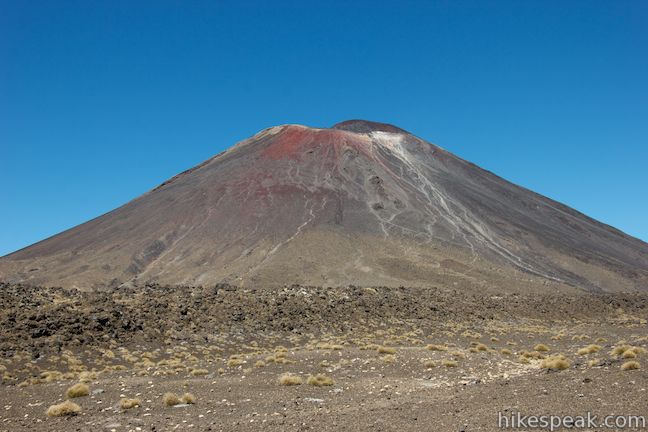
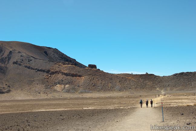
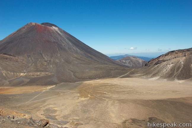
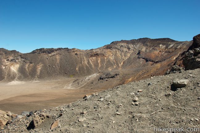
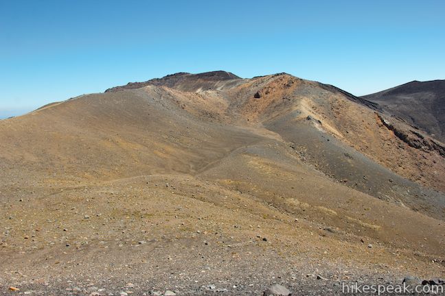
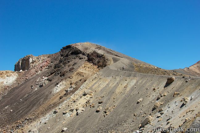
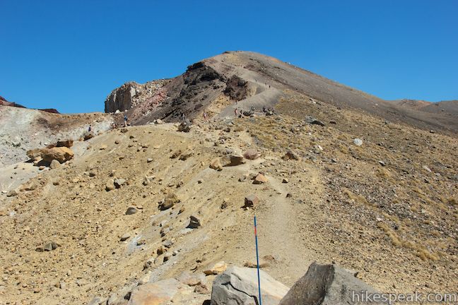
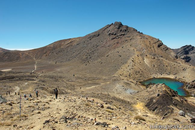
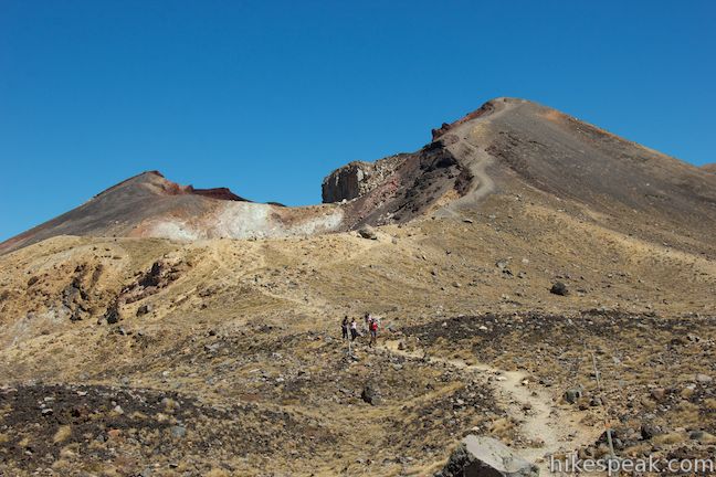
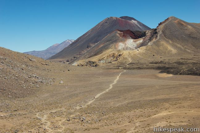
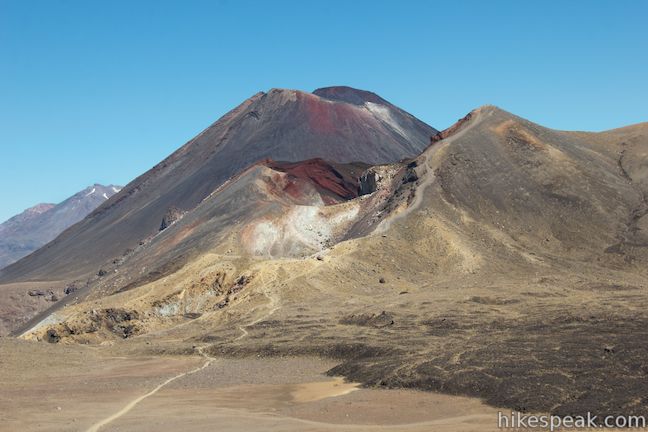
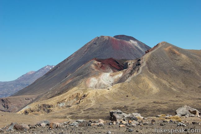
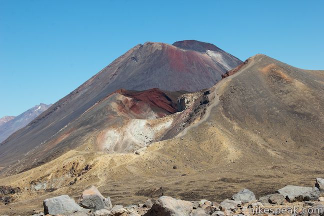
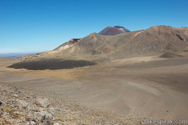
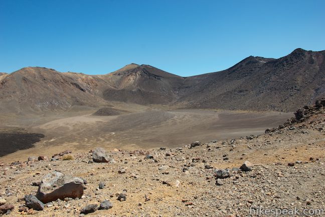
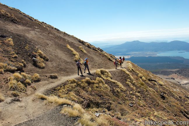
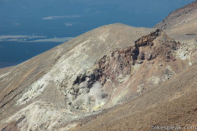
Pushing on, Tongariro Alpine Crossing gives you a break from climbing with a level walk across South Crater. There are great over-the-shoulder views of Mount Ngauruhoe as you cross the flat expanse of brown soil. The track proceeds up the ridge to the east. When it reaches the crown of the ridge, at 7.3 kilometers from the start, the track curves to the left and climbs even higher up the spine of the ridge. Any time you need to catch your breath, take a moment to look back across South Crater toward Mount Ngauruhoe. From this perspective, you’ll see a large area of vibrant red earth near the top of the volcano, along with a chalky white strip. Steam rises from a fumarole near the top, in case you needed a reminder that this is an active volcanic area.
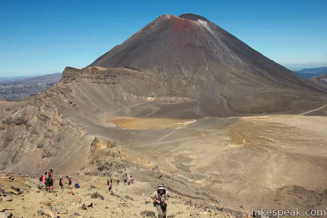
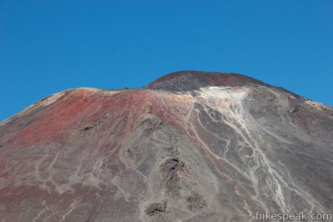
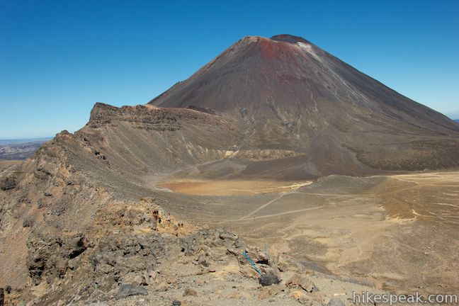
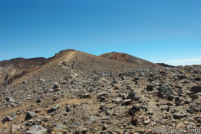
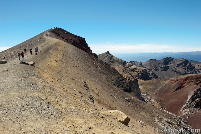
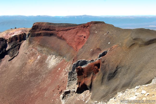
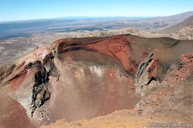
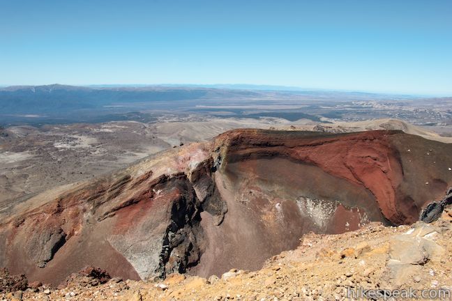
The ascent tapers out as you approach a junction with a track to the top of Mount Tongariro. Mount Tongariro Summit Track is 3 kilometers round trip and adds about 80 minutes to Tongariro Alpine Crossing. As you pass this junction on the left, there are views to the right over Red Crater, a deep U-shaped crater with iron-rich earth that is a mix of vivid reds and dark chocolaty browns. The crater’s color comes from oxidized iron (rust) in the soil.
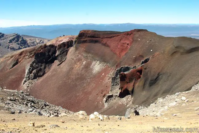
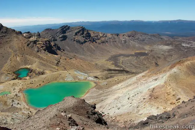
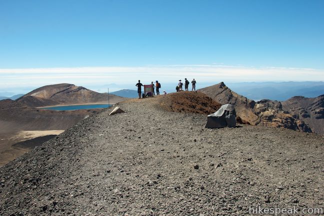
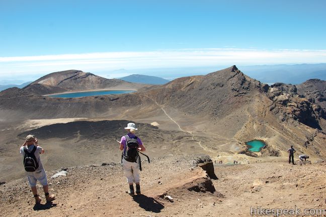
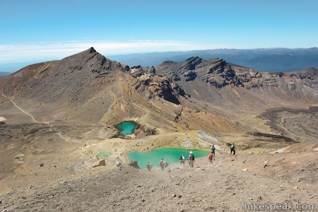
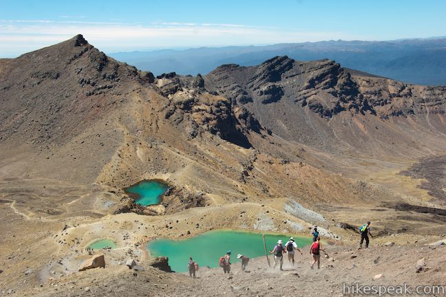
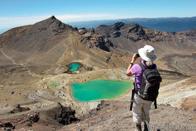
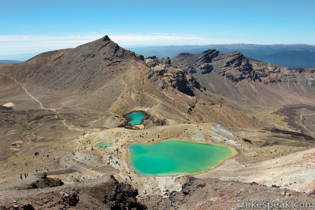
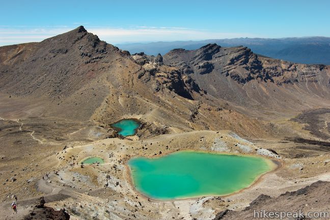
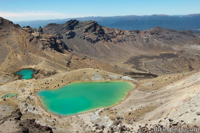
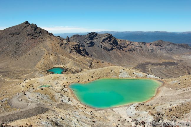
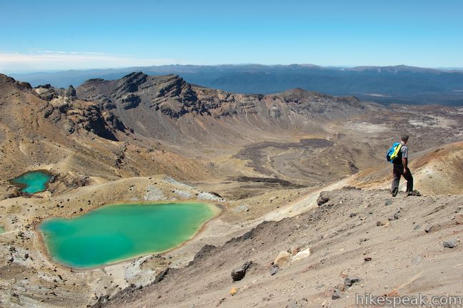
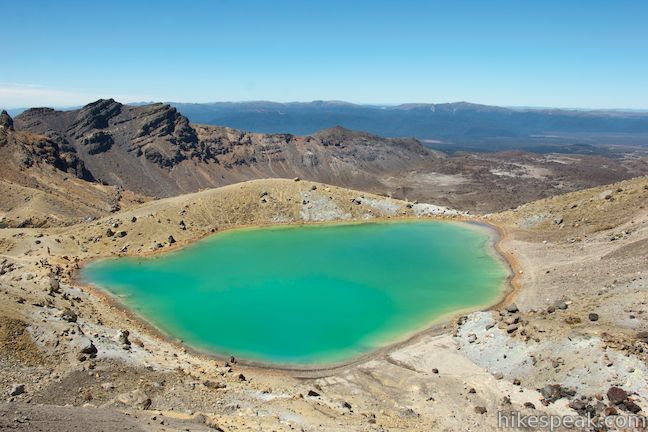
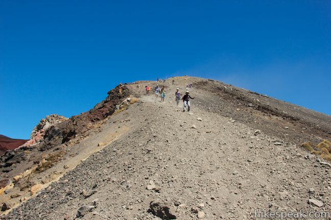
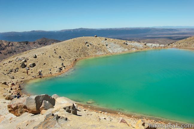
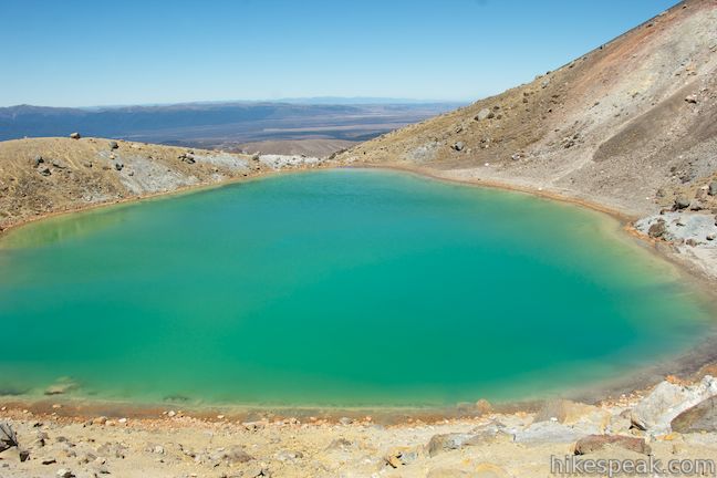
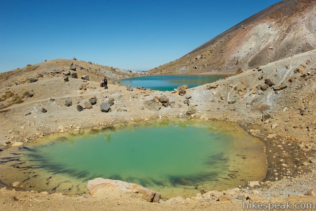
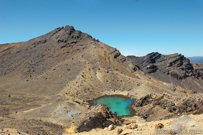
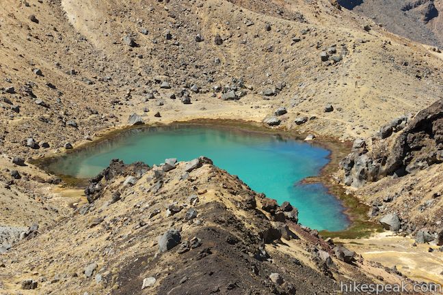
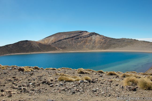
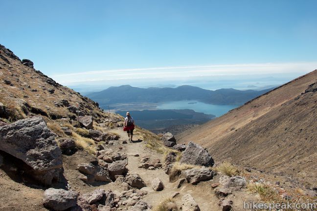
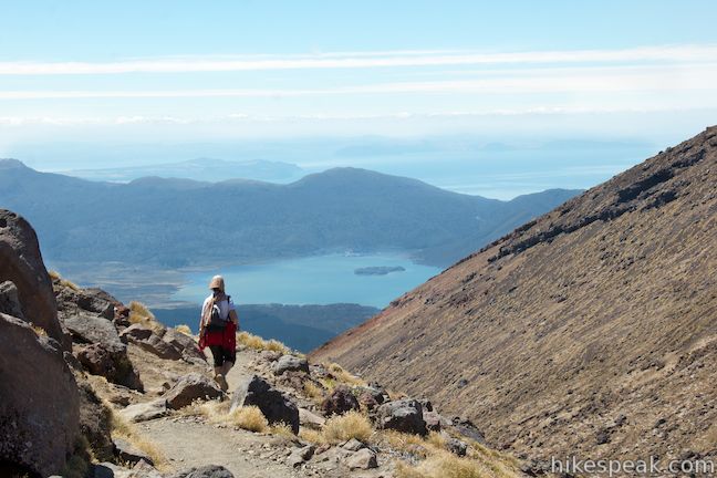
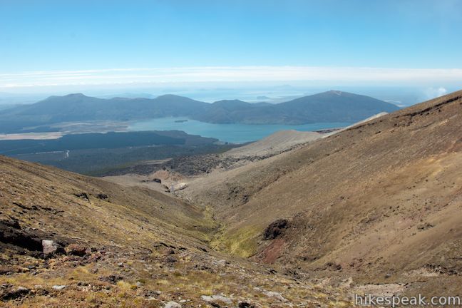
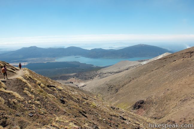
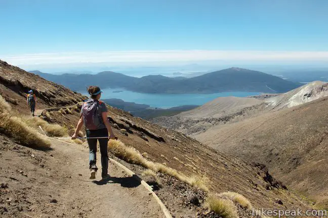
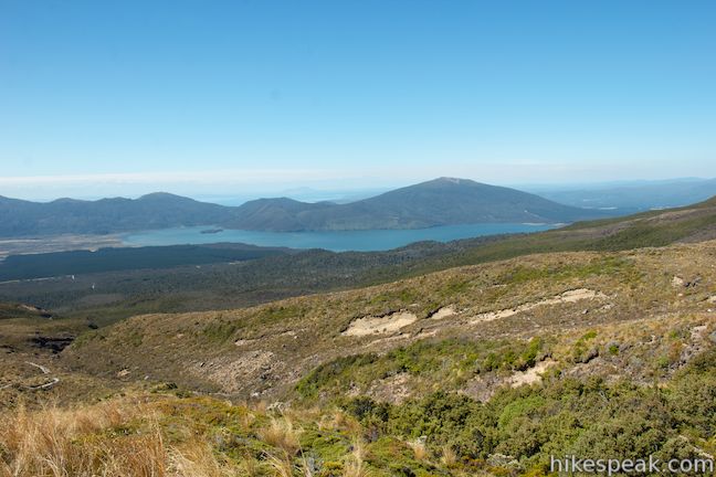
In another 0.3 kilometers, and 8.3 kilometers from the start, you will reach the high point of the hike, at 1,886 meters above sea level, called Red Crater Summit. This trek-topper offers incredible panoramic views. Peer south into Red Crater. Look back to the southwest toward Mount Ngauruhoe and northwest toward the tapered summit of Mount Tongariro. Finally, look down over Central Crater and the grand lake-filled valleys beyond the park to the north. Blue Lake sits above Central Crater to the northeast. The Emerald Lakes glisten below the slopes to the east, and the dazzling trio of turquoise pools really pop out from the surrounding orange volcanic terrain. You can look farther east beyond the boundary of Tongariro National Park toward the Kaimanawa Mountain Ranges.
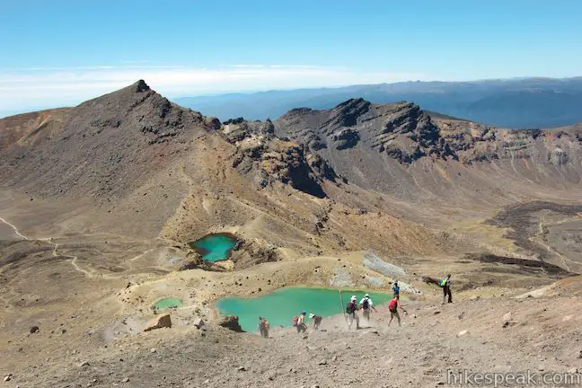
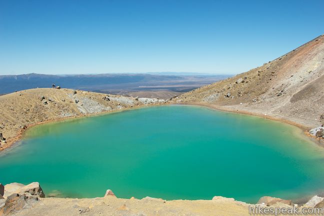
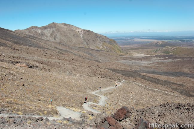
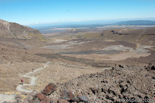
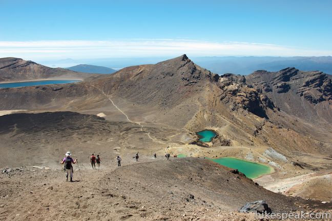
From Red Crater Summit, Tongariro Alpine Crossing turns down a steep slope of loose scree toward the Emerald Lakes. This would be a tiresome mountainside to hike up, which is one reason not to hike the Crossing in the opposite direction. Rapidly drop 145 meters in 0.4 kilometers to reach the highest and the largest of the Emerald Lakes, which is accompanied by a smaller pool. The lake’s unique color comes from the high concentration of minerals in the water.
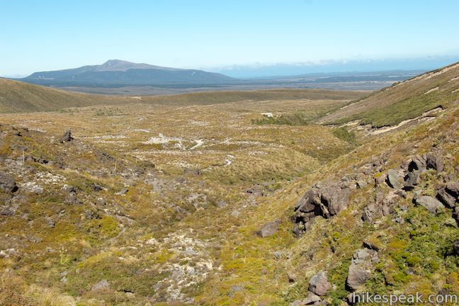
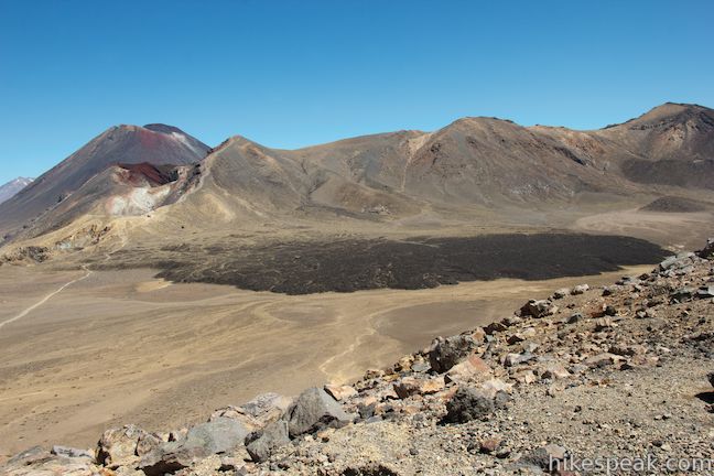
Tongariro Alpine Crossing keeps descending toward the eastern end of Central Crater. Past the third lake, there comes a junction where Tongariro Northern Circuit separates from Tongariro Alpine Crossing. The circuit heads to the right toward Oturere Hut, which is 4.8 kilometers away. Stay to the left to continue on Tongariro Alpine Crossing, having now completed the first 9 kilometers of the Crossing.
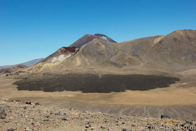
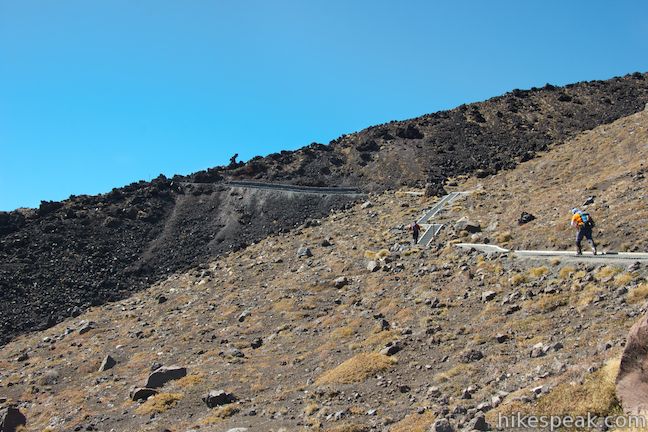
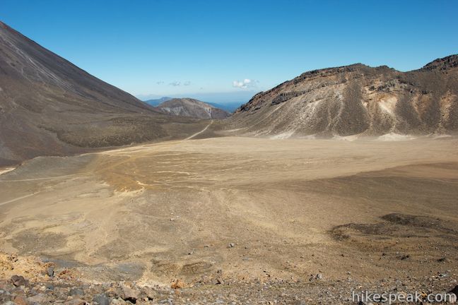
The track crosses Central Crater, another barren basin of orange earth. There is a fan-shaped flow of black lava spread out across the floor of the crater to your left. Over your shoulder there are views up into Red Crater. The dark cone of Mount Ngauruhoe rises up behind the crater.
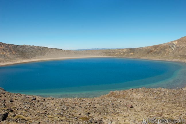
Hike up the rim on the northeast side of the crater to reach a ridge bordering Blue Lake. Blue Lake is a beautiful freshwater lake that formed in an old lava vent and has a natural blue color that somehow looks out of place in this setting. Like the Emerald Lakes, the water in Blue Lake is acidic with a PH around five. This lake is sacred to the Māori, so do not swim in or eat food around the lake.
Follow the track north along Blue Lake above Central Crater. You can look down across the crater, which is partially coated by the dark lava flow, toward Red Crater and Mount Ngauruhoe.
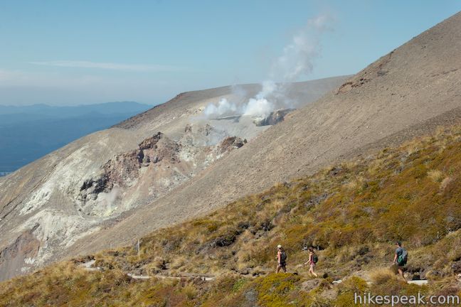
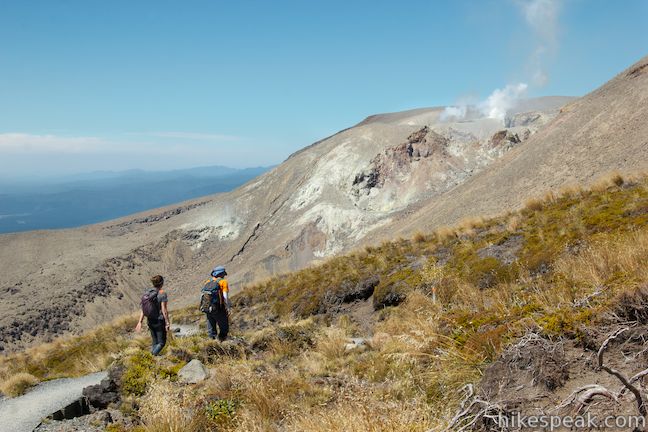
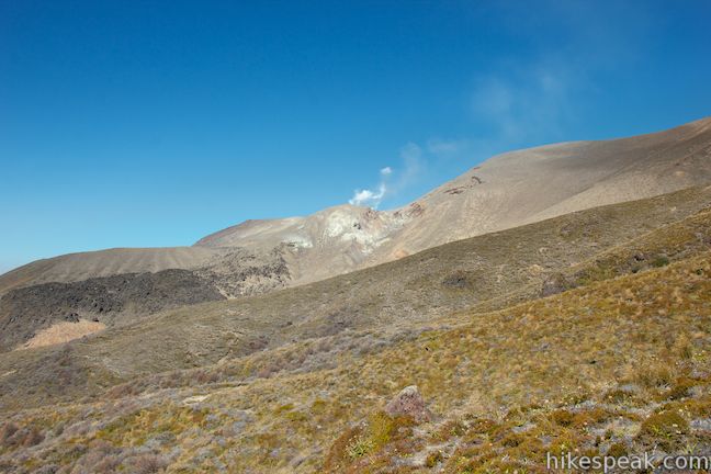
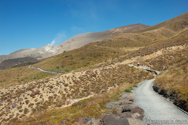
The trail turns gradually downhill as you angle north toward a gap in the volcanic terrain. Progress down the left (west) side of this valley on slopes below Mount Tongariro, across from an area that erupted in 2012. As a result of this volcanic activity, there are several unique warning signs over this section of the track, with solar-powered colored lights. Green means volcanic risk is normal, orange means there is an elevated risk, and red means that the track is closed. If you see a red light or flashing lights along this track, it is important to turn around and return to safer ground. If you are in the green, proceed to the next section of the trek.
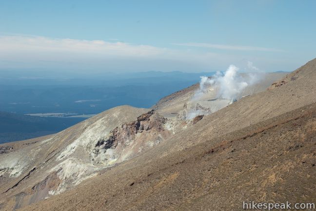
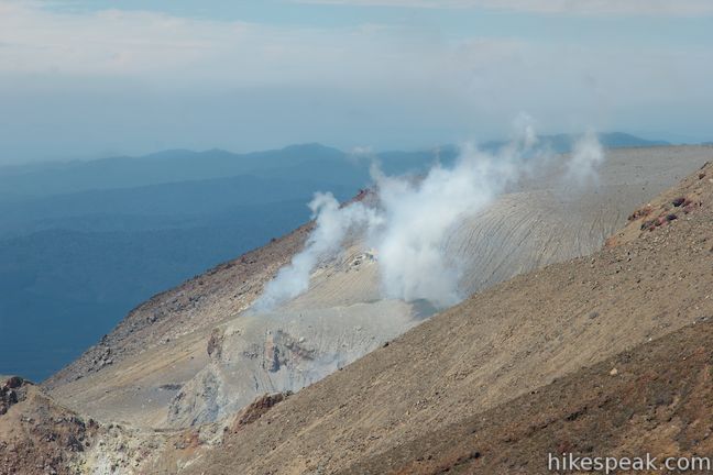
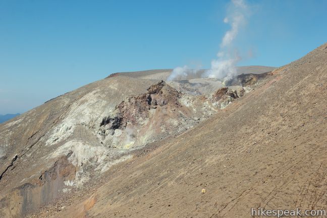
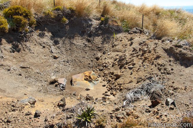
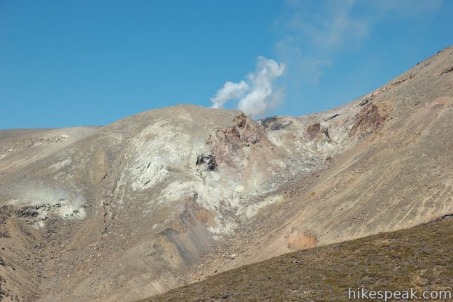
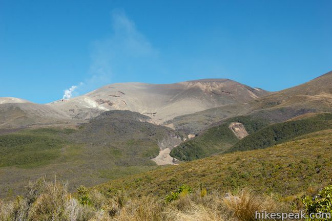
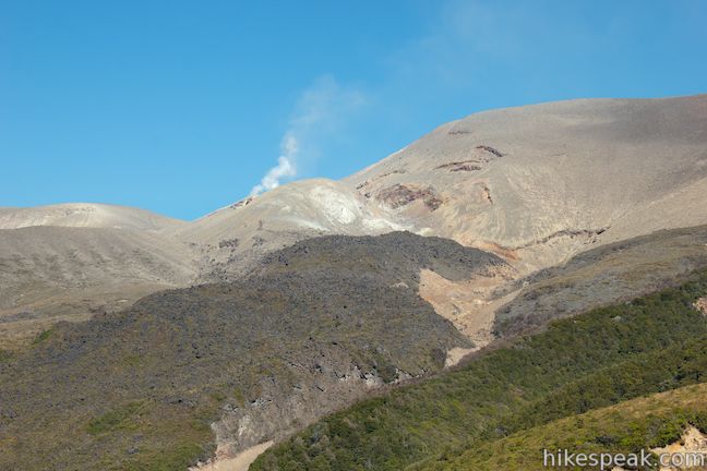
As Tongariro Alpine Crossing descends toward Ketetahi Hut, you’ll get some pretty incredible views that are unlike those you’ve already seen. To your left, plumes of steam escape from Te Maari Crater, which erupted near midnight on the sixth of August, 2012. The trail passes close enough to the crater, a large area blown out of the mountainside, for you to spot bright patches of yellow sulfuric soil alongside steaming vents. The geologic forces at work at Te Maari Crater are impressive to witness.
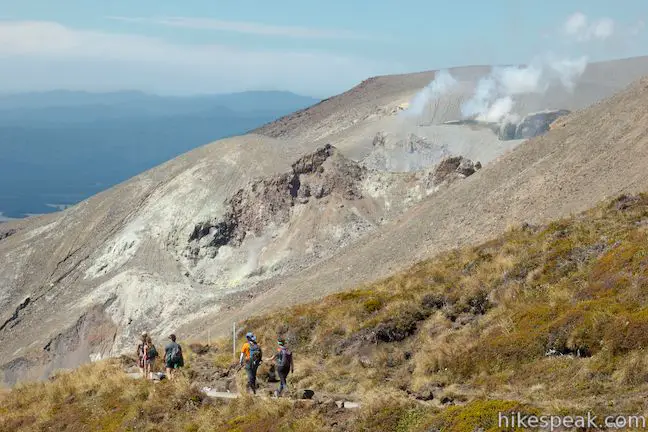
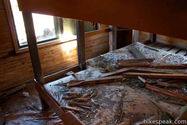
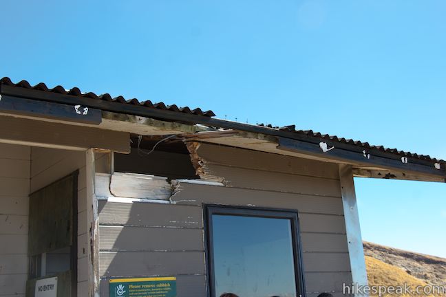
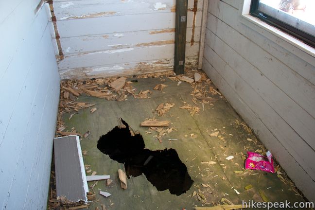
When the crater erupted, rocks were hurled over 1.5 kilometers. Some of these new rocks and impact craters can be spotted along the trail. Ketetahi Hut was struck with rocks when the crater erupted and boulders ripped through the wooden structure. Fortunately, no one was staying in the hut on the winter weekday evening when the eruption took place. Prior to 2012, the last significant eruption at Te Maari Crater was in 1896.
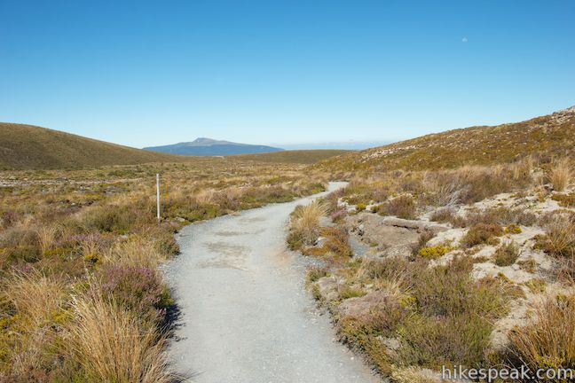
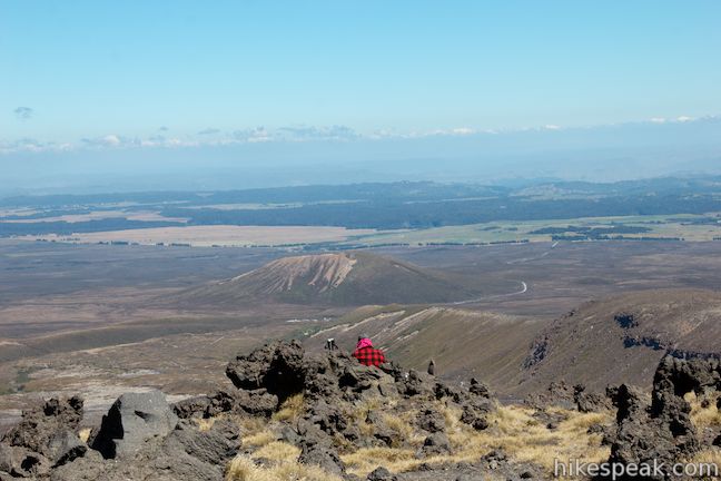
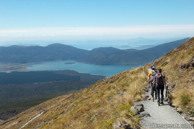
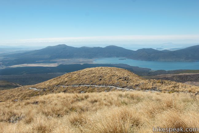
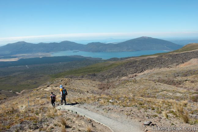
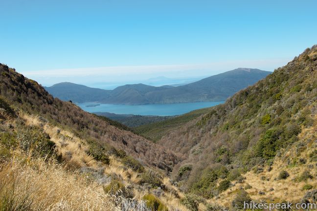
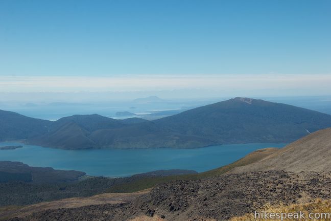
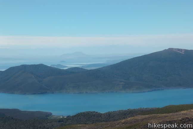
This stretch of Tongariro Alpine Crossing also features beautiful views north toward Lake Rotoaira and Lake Taupo. Both lakes are cradled by green mountains. Lake Taupo is the largest lake in New Zealand, and Tongariro Alpine Crossing offers a lofty perspective to take it all in.
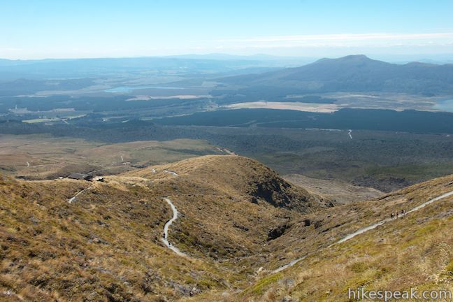
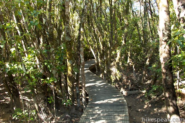
The track leaves the barren volcanic terrain and descends switchbacks into grassland similar to the vegetation at the start of the track. After 13 kilometers of hiking, the track passes Ketetahi Hut. Take a break here and step inside the hut, which is now just a day-use shelter for hikers. Missile-like rocks ripped holes through the roof and floor of the hut, destroying cots that were fortunately empty on the night of the eruption. Had Te Maari Crater exploded during a summer day, the results would have been a lot more tragic. Areas of the hut that were damaged by the eruption have been closed off so that they can be preserved and interpreted.
Ketetahi Hut has toilets, but no drinking water. A closed trail goes west from the hut toward Ketetahi Springs, a thermal area on the slopes of Mount Tongariro on private Māori land that is not open to hikers on Tongariro Alpine Crossing. As you continue down the track, look up the mountain and you may see steam rising from Ketetahi Springs.
Below the hut, Tongariro Alpine Crossing continues for another 6.4 kilometers, or about 4 miles. After a few switchbacks, the track drops into a gully and crosses a stream (don’t drink this water or any of the water along this track). Progress northward through grassy brush with views of the lakes below and back up the mountainside toward Te Maari Crater. From here, damage caused by landslides from the crater is more evident.
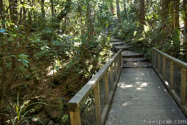
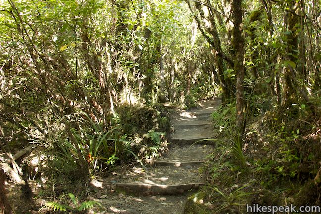
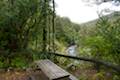
With 2.8 kilometers to go, the track passes a bench just above the bush line. Ahead, the track drops into the trees and provides a shaded woodland walk for the final 45 minutes of the trek. The track passes through a dense forest that is typical to New Zealand, but not found anything else on this unique hike. There are lots of wooden steps to assist with the descent and several bridges crossing streams through the forest.
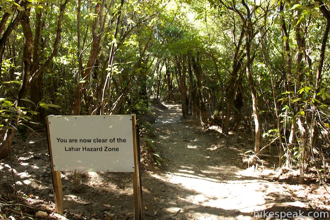
While the volcanoes are behind you, the warning signs are not. Seven hundred meters of the track pass through the Lahar Hazard Zone, where signs advise you to turn back if there is noise coming from upstream. Otherwise move quickly through without stopping. As you cross the stream, you will see washed out areas where debris from Te Maari Crater flooded through the forest. Continue down to Ketetahi Car Park at the north end of Tongariro Alpine Crossing, completing the 19.4-kilometer trek.
As the volcanic warning signs indicate, this track passes through an amazing, and potentially violent landscape. Every few kilometers, the landscape changes completely, offering something new and amazing to see. Dogs, bikes, fires, and camping are prohibited along this trek. No permit is required to day hike on Tongariro Alpine Crossing. You can hike independently or with a guide.
Transportation: Because this is a through hike, you will need to make transportation arrangements to and from both ends of the track. There are several transportation and shuttle services. Mountain Shuttle has secure parking lots near both ends of the Tongariro Alpine Crossing, but you will need to be mindful of their timetable so that you can complete the trek without rushing to make the shuttles. If you are interested in transportation from beautiful Lake Taupo, consider using Adventure Shuttles, which will take you to Mangatepopo Car Park and pick you up from Ketetahi Car Park on your schedule (no timetables). Your driver, Garth London, is a friendly Taupo local and an enthusiastic outdoorsman who will share tips and information to help you make the most of this incredible hike. In addition to Adventure Shuttles, Garth and Angie London are the owners of Whakaipo Lodge, a fantastic bed and breakfast where hikers can relax and recharge before or after the Tongariro Alpine Crossing.
The basic directions of Tongariro Alpine Crossing are:
- Set out from Mangatepopo Car Park (0 km/0 mi)
- Pass through a junction with a section of Tongariro Northern Circuit heading to Whakapapa Village (1.3 km/0.8 mi)
- Pass a side track to Mangatepopo Hut (1.6 km/1 mi)
- Pass a side track to Soda Springs (4.3 km/2.65 mi)
- Pass the Ngauruhoe Summit Track (6.3 km/3.9 mi)
- Pass the Tongariro Summit Track (8 km/5 mi)
- Cross the Red Crater Summit (8.3 km/5.15 mi)
- Pass the Emerald Lakes (8.7 km/5.4 mi)
- Pass through a junction with a section of Tongariro Northern Circuit heading to Oturere Hut (9 km/5.6 mi)
- Pass Blue Lake (9.7 km/6 mi)
- Pass Ketetahi Hut (13 km/8.1 mi)
- Descend below the bush line (16.6 km/10.3 mi)
- Reach the Ketetahi Car Park (19.4 km/1.2 mi)
Directions to the Trailhead
- From Taupo, head south on State Highway 1 for about 50 kilometers to Turangi.
- Turn right on State Highway 41.
- Drive 2.7 kilometers and turn left on State Highway 47.
- Take this road for 33 kilometers and turn left up Mangatepopo Road, which ends at a car park for the start of the Tongariro Alpine Crossing after 6 kilometers.
- To reach the other end of the track, drive 13 kilometers north of Mangatepopo Road on State Highway 47 to State Highway 46.
- Head east for 6 kilometers on SH 46 to Ketetahi Road.
- Go one kilometer up this road to the car park at road's end.
Trailhead Location
Trailhead address: Mangatepopo Road, Tongariro National Park, Manawatu-Wanganui, 4691, New Zealand
Trailhead coordinates: -39.144398, 175.580942 (39° 08′ 39.83″S 175° 34′ 51.39″E)
View Tongariro Alpine Crossing in a larger map
Or view a regional map of surrounding New Zealand tracks, campgrounds, and lodging.

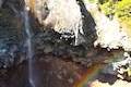
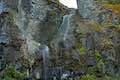
 | Tawhai Falls This 0.8-kilometer return hike visits a short but enticing single-drop waterfall near Whakapapa Village in Tongariro National Park. |
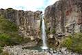 | Taranaki Falls This 6.45-kilometer loop crosses a variety of volcano-influenced landscapes to reach a beautiful 20-meter tall waterfall in Tongariro National Park. |
 | Silica Rapids This 5.15-kilometer point-to-point hike or 7.15 kilometer loop leaves from Whakapapa Village in Tongariro National Park and crosses alpine bogs, forests, streams, and ridges of volcanic rock to reach creamy cascades on silica terraces. |
 | Lake Rotopounamu This 6.4-kilometer loop visits tranquil beaches on a forest-wrapped lake in Tongariro National Park. |
 | Mangawhero Falls This easy 0.3-kilometer hike leads to a viewpoint for a 25-meter tall waterfall below Mount Ruapehu in Tongariro National Park. |
 | Waitonga Falls This 4-kilometer return hike reaches Tongariro National Park's tallest waterfall and passes through an alpine wetland that reflect views of Mount Ruapehu. |
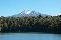 | Lake Rotokura This 2-kilometer return hike reaches a peaceful blue lake that reflects a view of Mount Ruapehu, the tallest mountain in the North Island. |
 | More trails in New Zealand Explore other destinations for walking and hiking (as well camping and lodging) in New Zealand. |
 | Whakapapa Holiday Park This holiday park in Whakapapa Village offers tent sites, campervan sites, cabins, and a backpackers lodge along a stream below Mount Ruapehu in Tongariro National Park. |
 | Whakaipo Lodge This lodge near Lake Taupo blends comfort with luxury and has welcoming owners who can help you take advantage of the area's abundant outdoor opportunities. |
 | Mangawhero Campground This campground at the south end of Tongariro National Park near Ohakuna, New Zealand has twelves sites on two loops with views of Mount Ruapehu. |
- Tongariro Alpine Crossing on wikipedia.org (opens in a new tab)
- Tongariro Alpine Crossing on newzealand.com (opens in a new tab)
- Tongariro Alpine Crossing on tongarirocrossing.org.nz (opens in a new tab)
- Tongariro Alpine Crossing on summitpost.org (opens in a new tab)
- Tongariro Alpine Crossing on theprofessionalhobo.com (opens in a new tab)
- Tongariro Alpine Crossing on walkopedia.net (opens in a new tab)
- Transportation information for Tongariro Alpine Crossing from Adventure Shuttles (opens in a new tab)
- The Department of Conservation webpage for Tongariro Alpine Crossing (opens in a new tab)
Common Questions about Tongariro Alpine Crossing in Tongariro National Park
- Is the trail open?
- Yes. You should expect to find that Tongariro Alpine Crossing is open. There are no recent reports of trail closures. If you discover that the trail is closed, please help your fellow hikers by reporting a closure.
- Is this trail free to access?
- Yes, Tongariro Alpine Crossing is free to access. No entrance fee, pass, or permit is required. If you discover that access rules have changed, please provide feedback on your experience.
- How much time does this hike take?
- It takes approximately 7 hours 15 minutes to hike Tongariro Alpine Crossing. Individual hiking times vary. Add extra time for breaks and taking in the views.
- How long is this hike?
- The hike to Tongariro Alpine Crossing is a 19.4 km / 12 mile through hike with 1125 meters / 3690 feet of elevation change.
- Are dogs allowed on this trail?
- No, dogs are likely not allowed on Tongariro Alpine Crossing. The trail is primarily open to hikers.
- Is Tongariro Alpine Crossing a difficult hike?
- This hike should be considered strenuous. Hikers should be prepared for a workout covering 12 miles and 3690 feet of climbing.
- Where is the trailhead located?
- The trailhead for Tongariro Alpine Crossing is located in Tongariro National Park, CA.
Trailhead Address:
Mangatepopo Road
Tongariro National Park, CA 4691
Trailhead Coordinates:
-39.144398, 175.580942 - What are the driving directions to the start of the hike?
To get to the trailhead: From Taupo, head south on State Highway 1 for about 50 kilometers to Turangi. Turn right on State Highway 41. Drive 2.7 kilometers and turn left on State Highway 47. Take this road for 33 kilometers and turn left up Mangatepopo Road, which ends at a car park for the start of the Tongariro Alpine Crossing after 6 kilometers.
To reach the other end of the track, drive 13 kilometers north of Mangatepopo Road on State Highway 47 to State Highway 46. Head east for 6 kilometers on SH 46 to Ketetahi Road. Go one kilometer up this road to the car park at road's end.
View custom Google Maps directions from your current location.
- Are there other trails near Tongariro Alpine Crossing?
- Yes, you can find other nearby hikes using the Hikespeak Hike Finder Map.

Hi!
Me and my girlfriend are traveling around New Zealand and we have limited money. We want to now how can we hike the Alpine Crossing day hike 19.4km and not carry all our stuff from Mongatepopo to Ketetahi. How can we leave our stuff in Mogatepopo and have someone to take it to Ketetahi?
We will like to spend Sunday,s night in a hostel near Mongatepopo, so where do you recomend us to stay that offers good prices and transport to the carpark of Mongatepopo Rd and can take our bags to Ketetahi?
Thank you very much
Esteban and María
[…] https://www.hikespeak.com/trails/tongariro-alpine-crossing-nz/ […]
[…] The Tongariro Crossing was 19.4km of pure New Zealand beauty. I couldn’t get enough of it. Seriously, the views were like nothing I have ever experienced. Pictures of the volcanic alpine landscape just don’t do it justice. We parked our car at the Ketetahi car park and a shuttle picked us up. It was about a 25 minute drive to Mangatepopo carpark. Apparently they prefer that you start from this area and work your way back to Ketetahi, I think due to the steep hills at the beginning. The first 2 hours consists of stairs and trekking uphill between Mt Ruapehu and Mt Ngauruhoe. We made it to a rest spot where most people were eating. We decided to wait until at least the halfway mark to stop for lunch. The highest point reached about 1,886m at Red Crater. I could write out all the facts about the hike or you could just check out this nifty brochure: Tongariro Alpine Crossing and Hikespeak […]