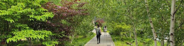
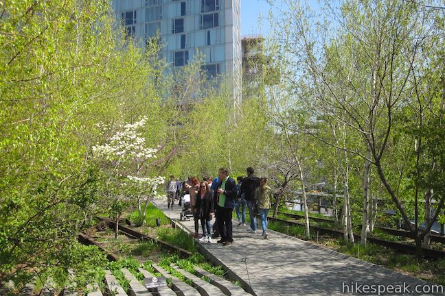
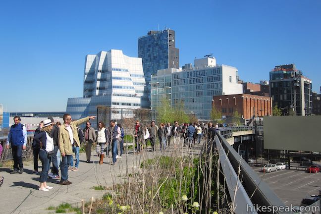
On the lower west side of Manhattan, an old raised rail line that was headed for demolition has been transformed into an attractive asset, a surprising park that hovers above city streets. The High Line has become a New York City landmark, offering a one-of-a-kind walk with a refreshing perspective of NYC.
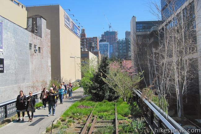
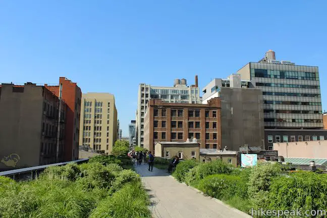
Like the rest of New York City, the High Line Trail has something for everyone, whether you need a bit of nature, crave art, enjoy bird watching or people watching. This flat 1.5-mile long, wheelchair-accessible trail follows a historic freight rail line on a raised route running along 10th Avenue between Gansevoort Street and West 34th Street. Walk 3 miles round trip for a full tour of the High Line or use the numerous access points for something shorter. The superbly configured trail has plenty of benches and tables for breaks as you stroll through gardens and art installations. The trail is a unique experience and the views impress too, looking out over the city and the Hudson River.
About the park
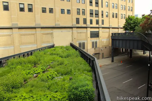
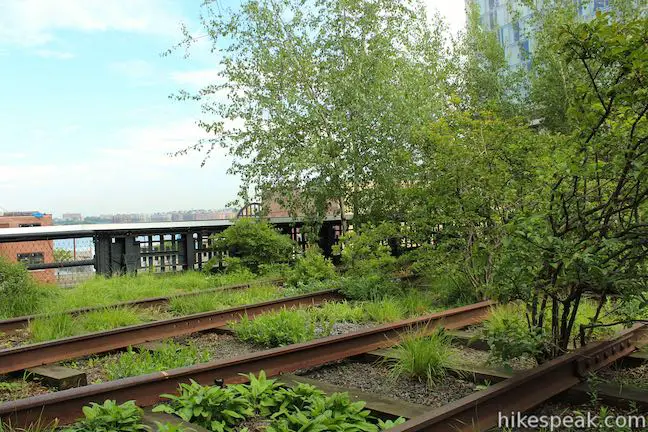
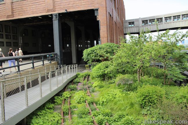
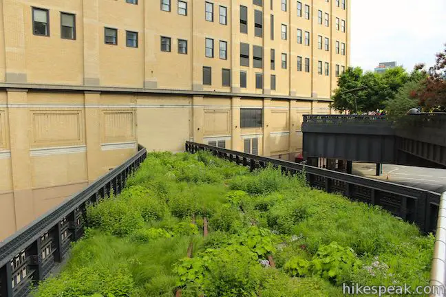
The elevated rail line opened in 1934 in order to reduce accidents along 10th avenue. The rail was designed to run down the center of the block so that spurs off the line could provide direct access to factories and warehouses without disturbing traffic. Notable warehouses included Bell Laboratories and Nabisco (where the Oreo cookie was created). The last train ran in 1980. After that, the line was largely abandoned and parts were demolished. While the rail line was being neglected, plants crept in and claimed the urban structure, creating a new natural space in an unexpected place. In 1999 the nonprofit, Friends of the High Line, was established with the goal of preserving and re-purposing the line as a public space. Ten years later, the first part of the High Line Trail opened and it has gradually expanded since.
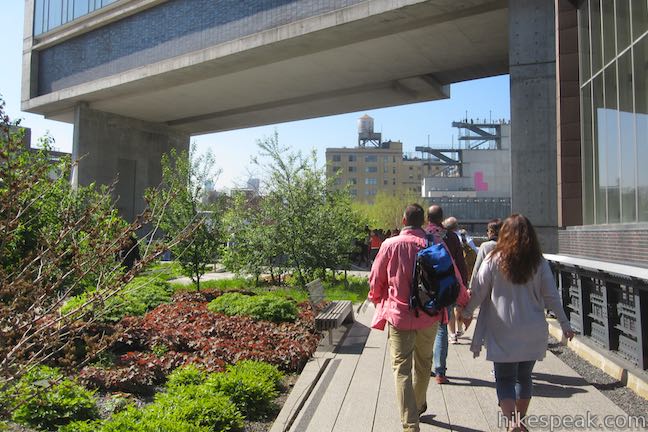
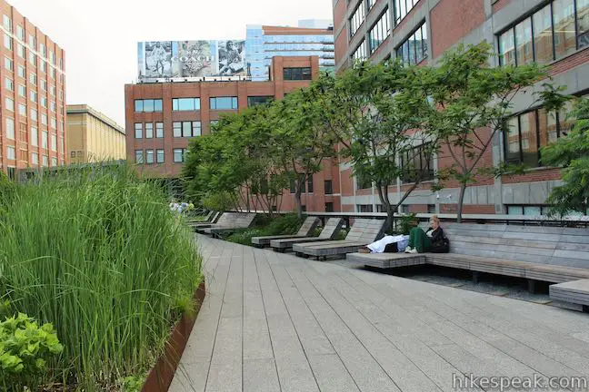
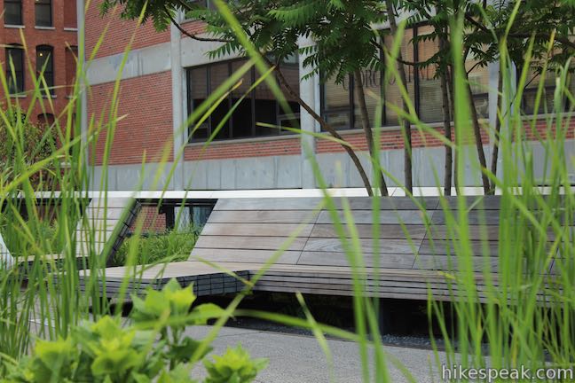
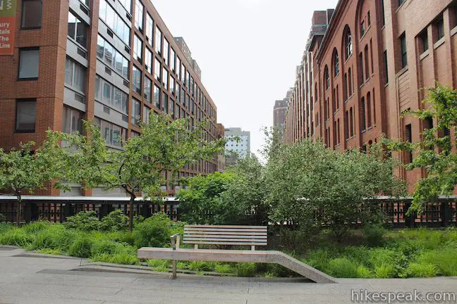
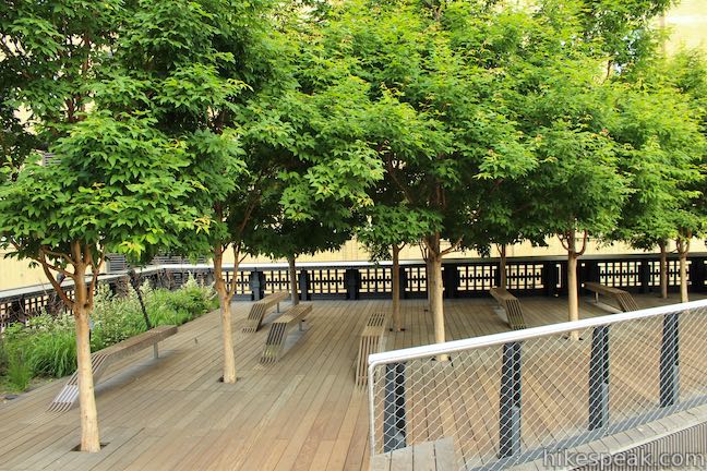
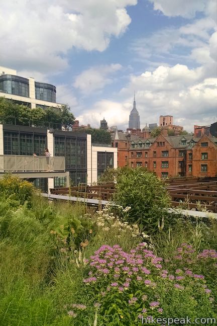
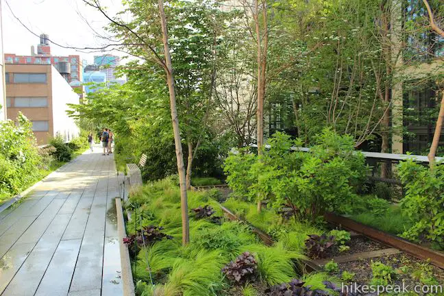
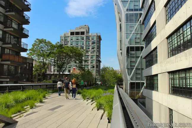
Nature and New York are integrated along the aerial greenway, with viewpoints that either emphasize or minimize the urban setting. While on the trail, you won’t forget you are in the city but you will feel like you’ve gotten away for a bit. Sounds of cars are quieter than they would be at street level and other city noises drift into the background so you can hear leaves rustle and birds chirp. Abundant seating areas provide quiet spots for conversations or reading.
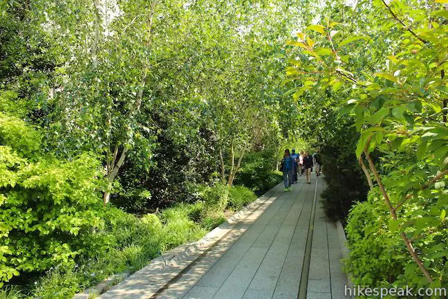
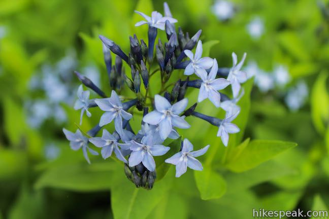
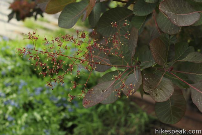
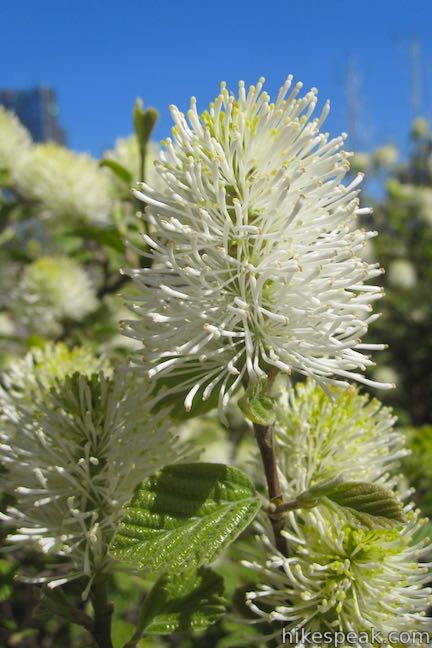
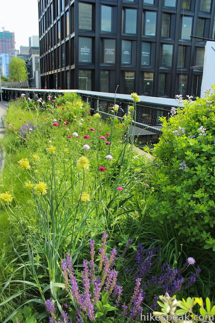
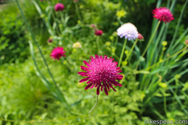
The diverse gardens along the trail feature native, sustainable species and mimic the natural ecological progression after the rail line was abandoned.
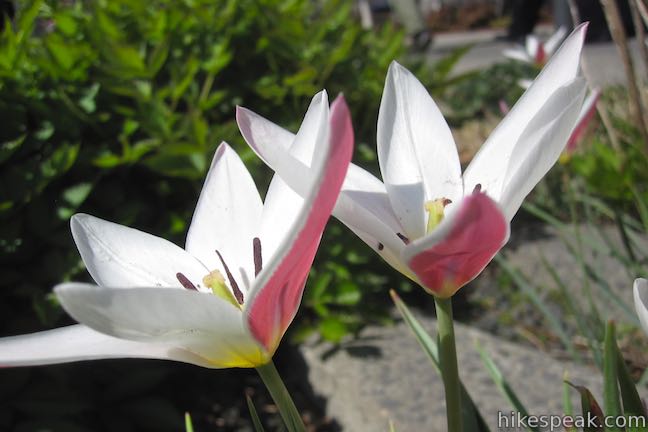
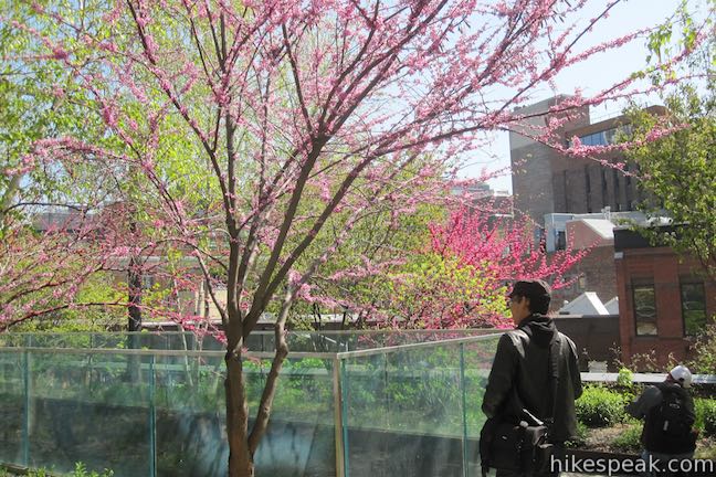
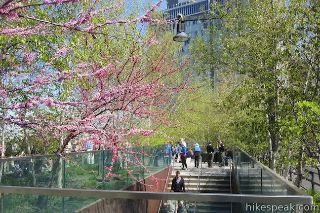
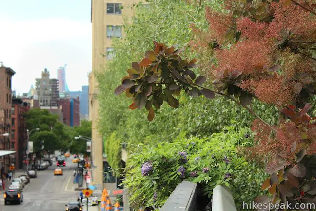
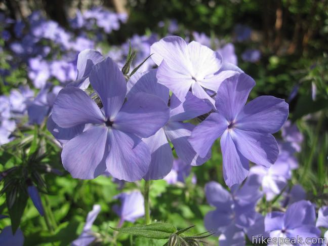
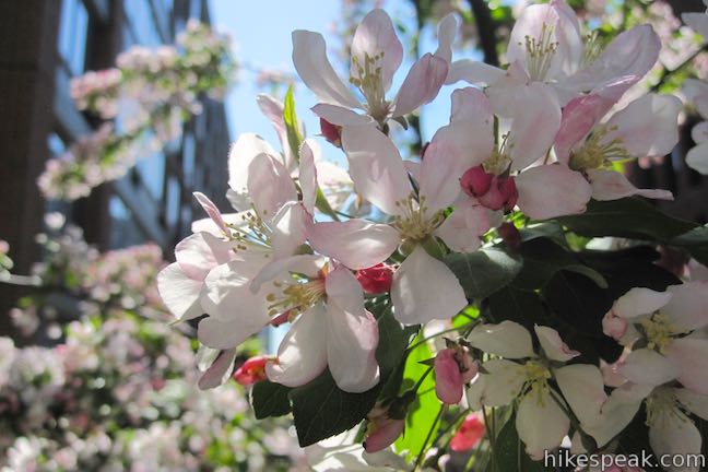
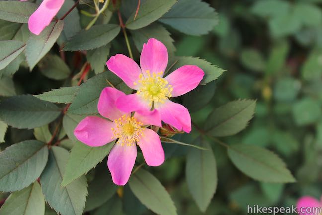
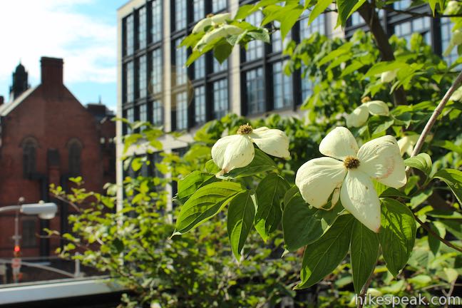
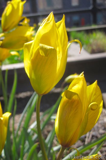
Something unique about the gardens is that they offer year-round color through blooms and berries, making the High Line a bird and pollinator paradise. Spring brings many flowering trees including redbud, spicebush, sassafras, dogwood, and crab apple. The summer months provide a burst of flowers while the fall boasts an array of asters and changing leaves on deciduous trees. Even in the winter, the trail contributes a colorful relief from the gray with blue juniper and vibrant red holly berries along with witch-hazel flowers, crocuses, winter sun mahonia, and viburnum. If you are interested in plants, take a look at the bloom guide for timely tips for enjoying the gardens.
About the trail
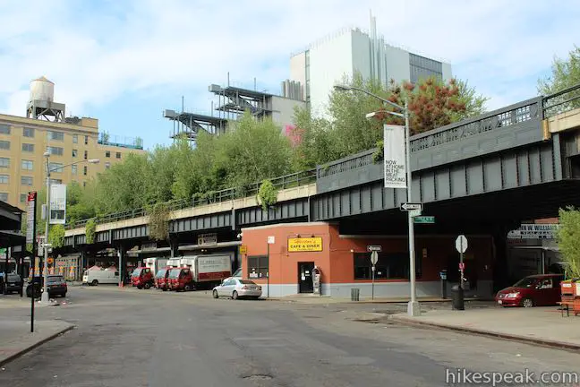
The trail has many access points along 10th Avenue, allowing you to chose how much you’d like to walk. The southernmost access point is in the heart of the Meatpacking District, adjacent to the Whitney Museum of American Art, and it is an ideal place to begin your adventure on the High Line Trail.
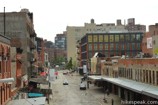
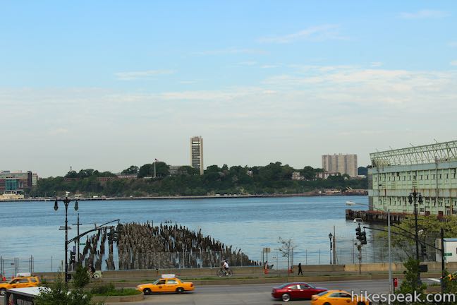
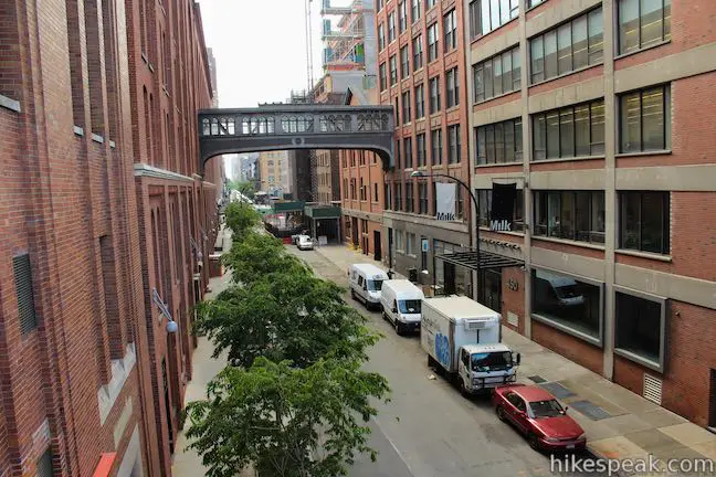
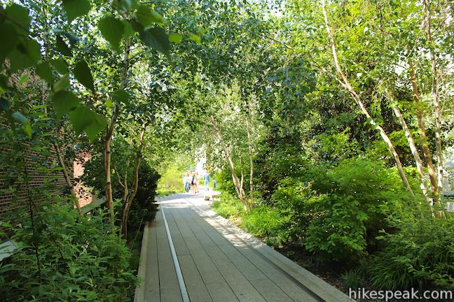
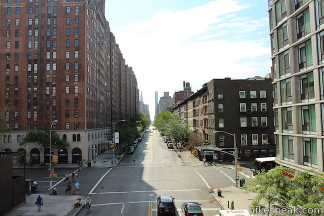
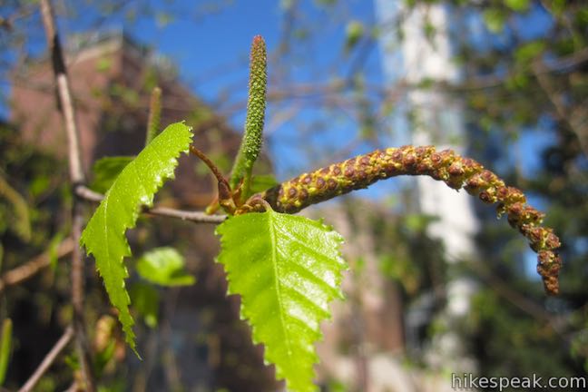
From the intersection of Gansevoort Street and Washington Street, take the elevator or stairs up to the raised trail, which is about two stories above the sidewalk. Backtrack 100 feet south through the Gansevoort Woodlands, a setting that is quite different than the city below, full of redbuds and birch trees growing at the end of the High Line. At the south end of the High Line, look out over the historic Meatpacking District with its cobblestone streets and brick warehouses.
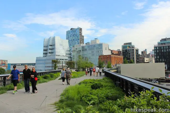
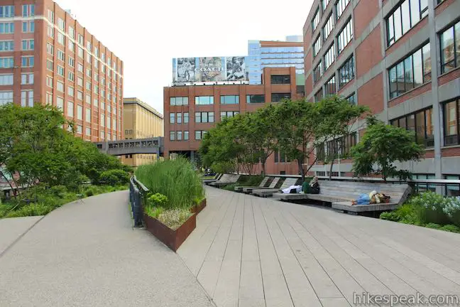
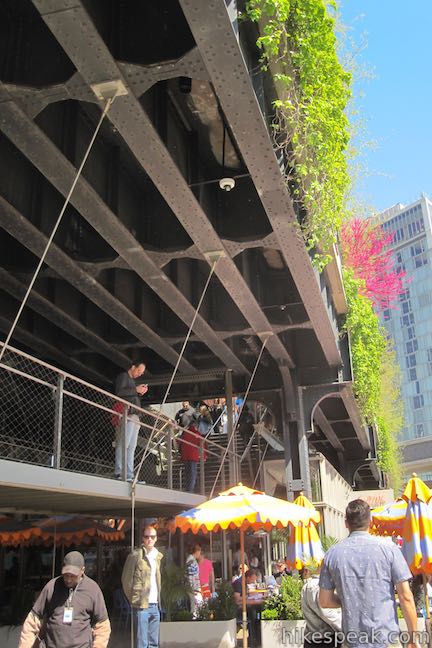
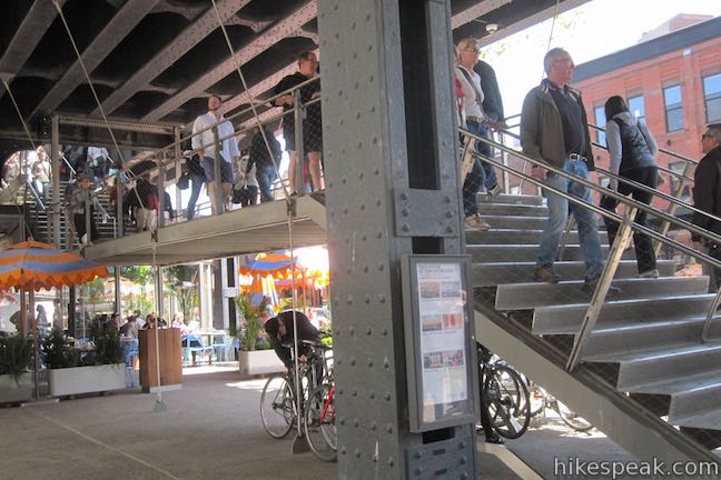
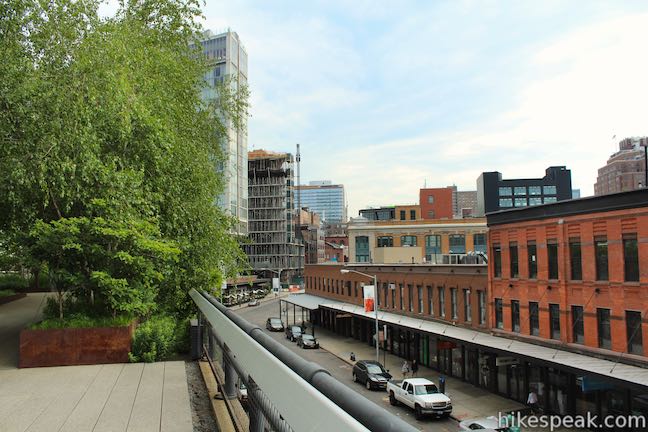
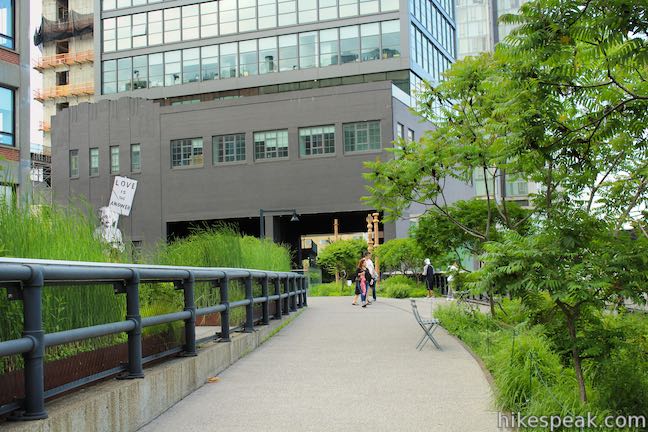
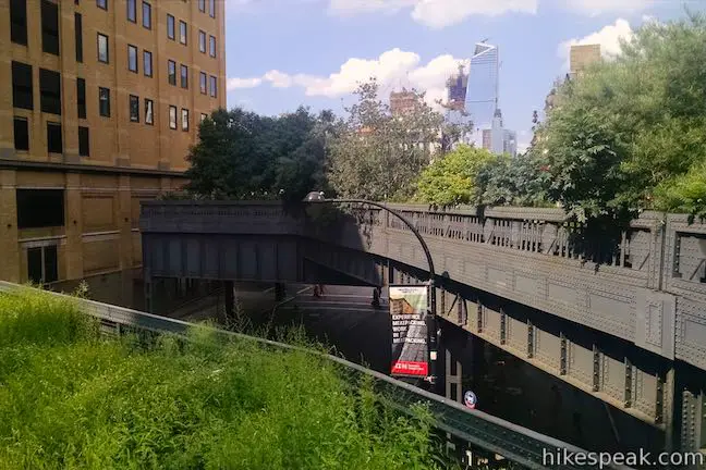
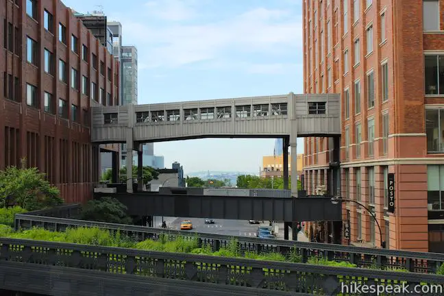
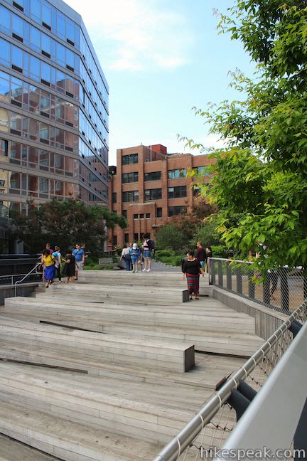
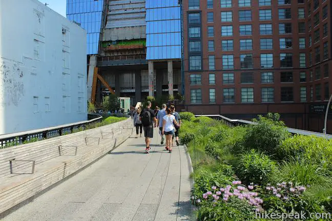
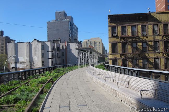
Walk north through more birch trees and grasslands, passing the High Line Headquarters. New York City has built around and even over the High Line. Walk below the Standard Hotel south of 13th Street and then slip through a semi-enclosed passage between West 13th and 14th Streets, 0.15 miles from the start. Here you can enjoy art exhibits, picnic tables, and some shade before continuing on. Just ahead, the trail splits, providing two parallel routes for the next tenth of a mile up to the end of Chelsea Market Passage. Take the lower route on the left to enjoy a quieter path along sumacs and small tables. Keep right on the slightly higher trail to appreciate the Diller-von Furstenberg Sundeck, complete with benches, lounge chars, and a water feature in the summer to help keep cool. Both trails allow you to enjoy the tulips, milkweed, cattails and cranberries while taking in views of the Hudson River. You will also find access to Chelsea Market through staircases that connect the side-by-side sections of the trail at the beginning of the market.
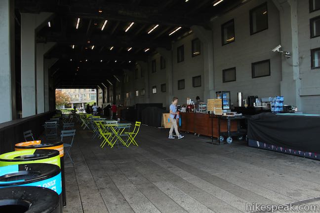
Enter the semi-enclosed Chelsea Market Passage which hosts sunny and shaded picnic tables, food carts, an open-air cafe, and souvenir shops. This covered space was once the loading dock for Nabisco and was converted into a public space in the 1990s. The lower trail avoids the crowds and shops.
Once you exit the passage, the trails rejoin near West 16th Street. This is the location of the Northern Spur Preserve, which crosses 10th Avenue. The preserve is on a fork of the old rail line, full of wild plants that grew on the line when it was closed. Northern Spur Preserve offers an interesting glimpse at what the High Line looked like after it was abandoned before becoming a park. This spur is closed to the public, but it can be enjoyed through an overlook.
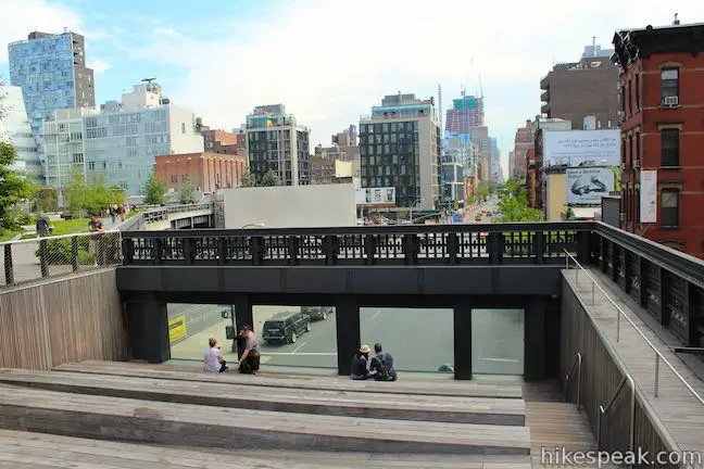
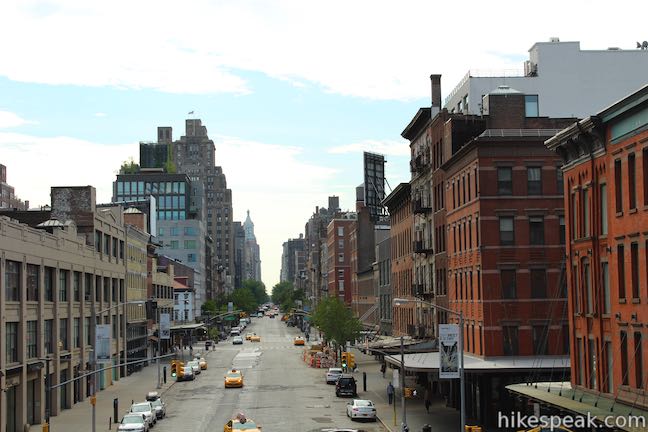
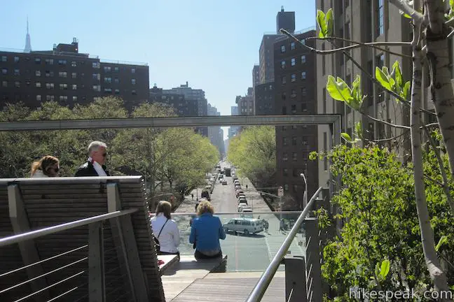
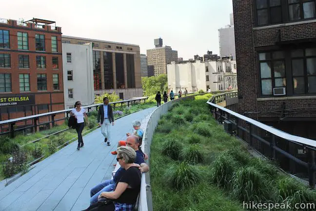
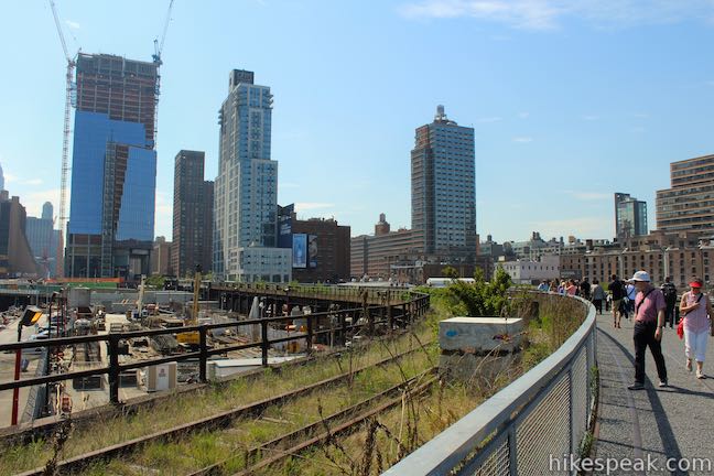
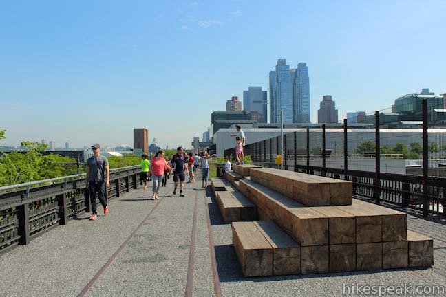
Only 50 yards past Northern Spur Preserve, and a third of a mile from the start, reach 10th Avenue Square, an amphitheater with plenty of sunny seating and a large glass window looking north up the center of 10th Avenue. If you haven’t done so already, this is a good place to take a close look at the guardrails and admire the High Line’s industrial art deco design, built upon riveted steel beams. Tenth Avenue Square is a popular place to read, catch up with friends, and just admire the city. If you have a seat and look through the glass, it is almost like being at theater where the performer is New York City. Watching people go about their day feels like that old Shakespeare quote come to life, “All the world’s a stage, And all the men and women merely players.”
Speaking of the bard, did you know that an eccentric Shakespeare fan named Eugene Schieffelin introduced every bird mentioned in a Shakespearean play to New York City in the 1800s? Starlings that flutter along the High Line Trail came to the city this way. They are not native to New York City, but thrive like so many other immigrants. The High Line Trail boasts more birds than you might expect. Common sightings include swallows, cardinals, mocking birds, ravens, finches, warblers, thrush, and cedar waxwing. How many can you spot? An area of benches shaded by box elder trees next to Tenth Avenue Square is a good place to begin looking.
Don’t leave 10th Avenue Square until you’ve turned around and looked south for a distant view of Ellis Island and the Statue of Liberty. After crossing 17th Street, the High Line passes gardens with views of the Empire State Building.

Proceed up the walkway past oak trees and sage-filled grasses to Chelsea Thicket near West 21st Street, just over half a mile from the start of the walk. This dense thicket is an explosion of interwoven vegetation like holly, serviceberry, Chinese fringe trees, quince, and willows. In the spring, keep an eye out for American robin and other birds nesting in the well protected juniper trees.
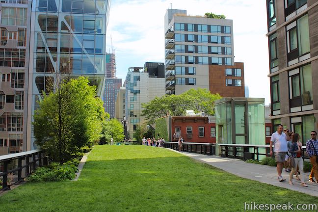
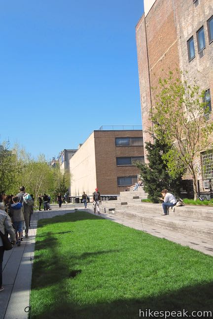
Just past Chelsea Thicket and 0.6 miles from the start, reach the 23rd Street Lawn and seating steps, a wide gathering space on a 4,900 square-foot lawn. This area is popular for lounging, picnics and summer programs. Challenge the notion that you need to be on the ground level to sit on a lawn, and take a moment and relax in the grass before you continue.
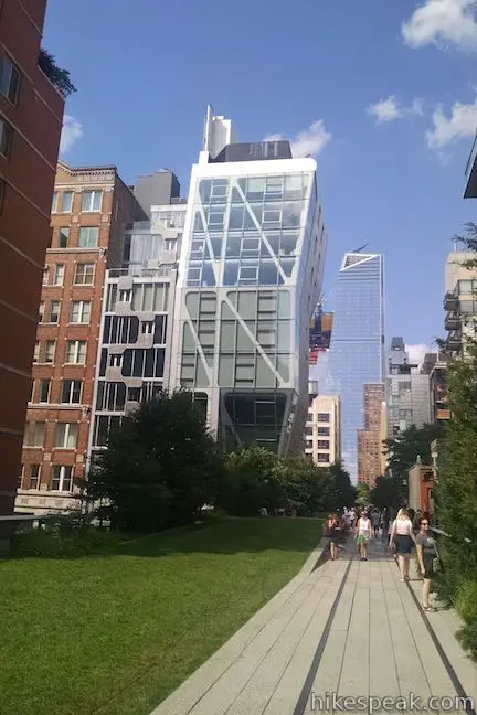
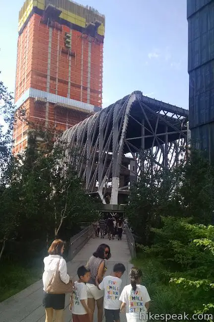
Go up to West 25th Street and the Philip A. and Lisa Maria Falcone Flyover, which hosts a slight incline that allows you to get even higher and look down on the tracks as you walk among tree branches. This portion of the trail offers shade between tall buildings and magnolia trees. Spurs off the trail are set up with seating for appreciating city and river views.
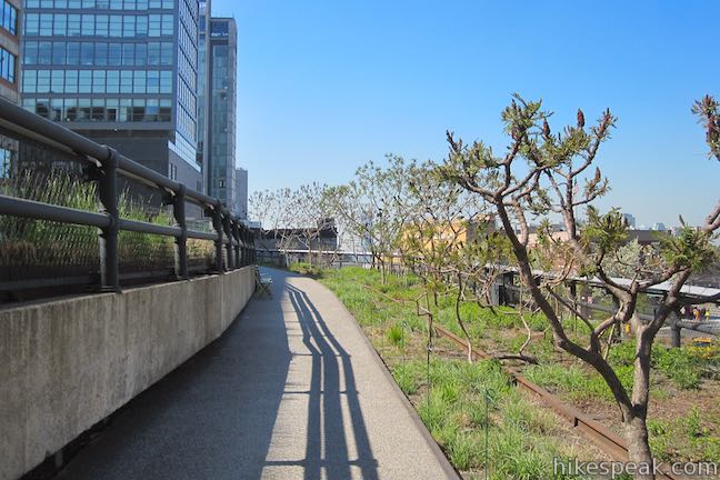
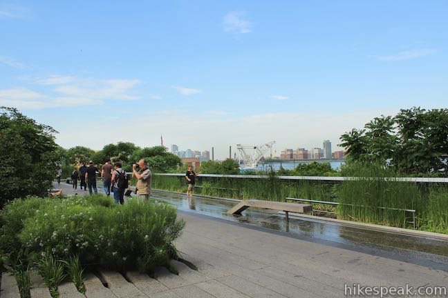
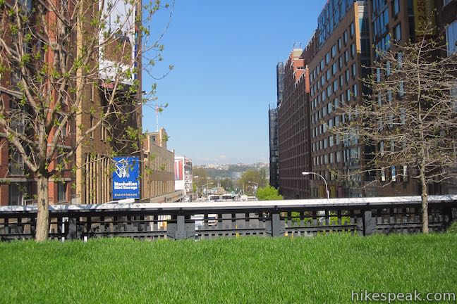
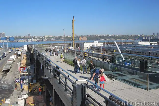
After the flyover, descend to wildflower beds along a left-bending pathway lined with a long, curved, wooden bench. At a mile from the start (and half a mile from the north end), the trail crosses 30th Street and turns left toward the Hudson River. In this open space, adjacent to both tall buildings and the river, keep an eye out for falcons soaring above. The park is expanding to include a spur nestled in buildings off to the right toward 10th Avenue.
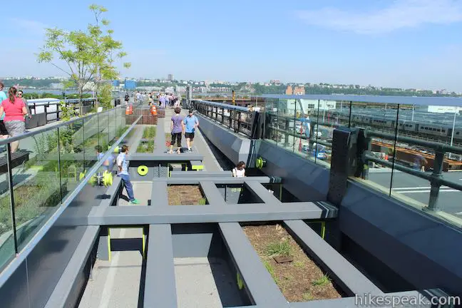
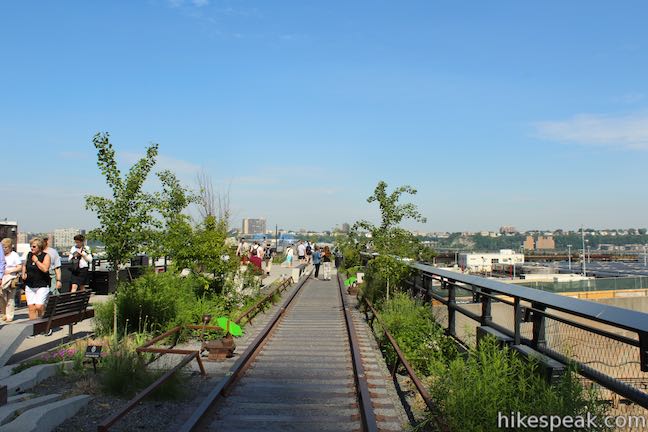
Once the trail turns toward the river, you can walk on original rail tracks past beautiful flowerbeds and quaking aspens. The trail crosses 11th Avenue, two stories up from the street. Children will want to run around in the Pershing Square Beams Play Area, 0.3 miles from the north end of the track. This interactive space allows little ones to play and climb while supervising adults relax in an adjacent seating area.
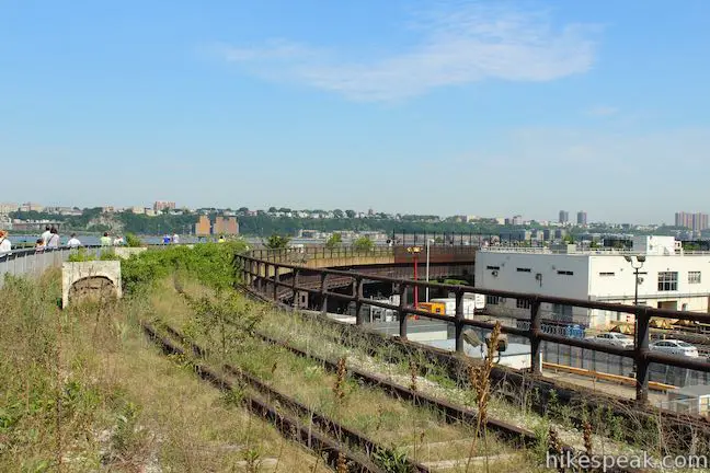
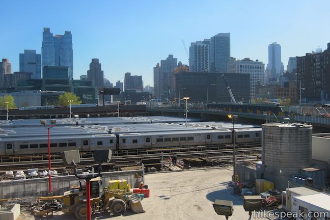
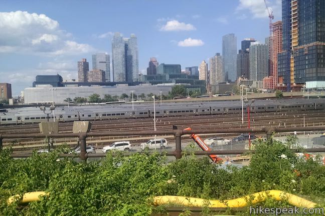
The final portion of the trail borders the Hudson River up to West 34th Street and offers wide-open views of both the city and the river. This area lacks large buildings and trees, providing an unobstructed view of the river in full sun. The trail follows self-seeded gardens as it bends around the MTA West Side Yards, nearing the river.
The High Line Trail gradually ramps downhill and comes to an end at street level at 34th Street, 1.5 miles from the start. If you are not ready to leave the High Line Trail, retrace your steps back to Gansevoort Street at the south end of the trail to complete the 3-mile round trip hike. You can also exit the High Line here and continue your urban adventure at street level. Walking back along the High Line Trail is no re-run, offering new perspectives with a few views that you probably missed on the hike north. There are no major junctions along the High Line Trail, so you won’t have any problem staying on track.
High Line Trail is for walking and running only. Dogs, bicycles, skateboards and roller blades are not permitted. Be sure to stay on the designated path to protect the plants, as they provide an urban refuge to many insects and birds. Smoking and picking flowers are also prohibited. Two public restrooms are located at the southern end of the trail, one at the High Line Headquarters (Gansevoort Street) and the other at Chelsea Market (Between West 15th and 16th Streets). Multiple water fountains are provided along the trail.
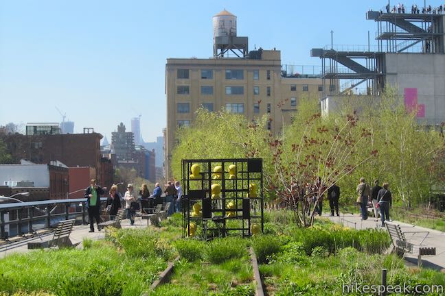
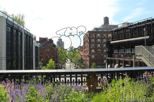
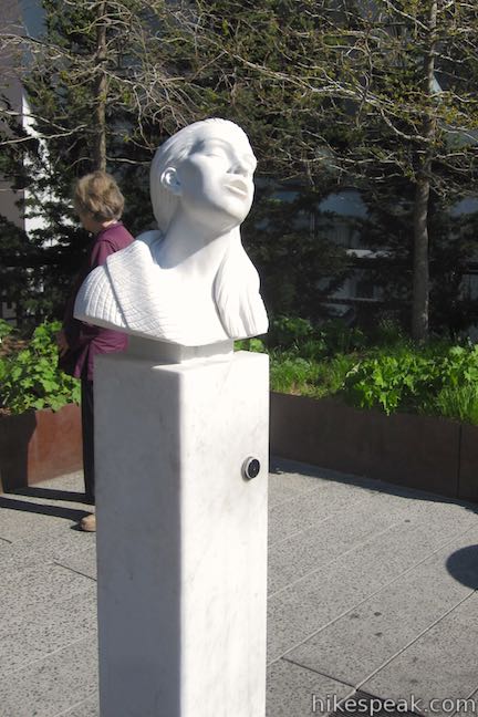
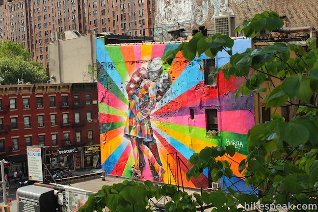
High Line Trail is a popular destination for tourists and locals alike so the trail is quite busy after 10 a.m. on nice weekends. If you are looking for a more serene experience, consider going early or plan your hike on a weekday. Before your visit, be sure to check the Friends of the High Line events calendar for information on group tours, stargazing, classes, talks, and performances. The Friends of the High Line events are geared to a variety of ages and interests and are a great way to get more out of your visit. The art on display along the High Line Trail is always changing. Visit the Friends of the High Line art page for descriptions of the current exhibits dispersed along the trail.
Trail hours
- December 1 to March 31 from 7 a.m. to 7 p.m.
- April 1 to May 31 from 7 a.m. to 10 p.m.
- June 1 to September 30 from 7 a.m. to 11 p.m.
- October 1 to November 30 from 7 a.m. to 10 p.m.
Trail access points
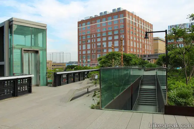
Elevators and stairs provide access to the High Line in five locations (at Gansevoort Street and Washington Street and along 10th Avenue at West 14th, 16th, 23rd, and 30th Streets). The northernmost entrance at West 34th Street is a long ramp, gradually climbing two stories until West 30th Street. Five additional stairwell entrances are located at 10th Avenue and West 18th, 20th, 26th, and 28th Streets and at 11th Avenue and West 30th Street. Entry locations are shown on the map below and the address for the south and north ends of the High Line Trail are given below.
Transportation to High Line Trail
Arriving by metro: The most convenient subway stop at 14th Street/8th Avenue (servicing lines L, A, C, and E) is a 6-minute walk from the southernmost entrance at Gansevoort Street. Alternatively, Penn Station (Lines 1, 2, 3, A, C, and E) is a 10-minute walk from the northernmost entrance. To access the middle of the trail, take the C or E train to the 8th Avenue/23rd Street stop or use the 1, 2, or 3 trains on 7th Avenue at 18th, 23rd, and 28th Streets. Cross-town buses (M14, M23, & M34) provide access to the trail via 14th Street, 23rd Street and 34th Street.
Arriving by bike: Although bikes are not allowed on the High Line, biking is a convenient way to access the trail. There are numerous bike racks near the entrance at Gansevoort Street and Washington Street and many other entrances have convenient bike racks too. Citi Bikes offers 14 bike racks adjacent to the trail.
Arriving by car: Parking garages can be found around the trail, as well as limited street parking. Friends of the High Line recommend Edison ParkFast with three locations convenient to the trail (71 11th Avenue, between West 17th and West 18th Streets, 161 10th Avenue at West 20th Street, and 507 West 21st Street).
Directions to the Trailhead
Directions to the southern end of the High Line Trail:
- The High Tine Trail begins near the intersection of Gansevoort Street and Washington Street in the Meatpacking District of Manhattan.
- Ascend stairs from the northwest corner of the intersection.
Directions to the northern end of the High Line Trail:
- The entrance at the north end of the High Line Trail is on the south side of West 34th Street between 11th Avenue and 12th Avenue.
Trailhead Location
Trailhead address: Southern End of High Line Trail, Gansevoort Street & Washington Street, New York, NY 10014
Trailhead coordinates: 40.7395, -74.0082 (40° 44′ 22.19″N 074° 00′ 29.52″W)
Trailhead address: Northern End of High Line Trail, 600 Block, West 34th Street, New York, NY 10001
Trailhead coordinates: 40.756375, -74.00355 (40° 45′ 22.94″N 074° 00′ 12.78″W)
You may also view a regional map of surrounding New York trails and campgrounds.


 | Green Lake & Round Lake This easy 3.25-mile loop explores a pair of aquamarine glacial lakes in Green Lakes State Park in Central New York. |
 | Cliff Trail – Long Trail – Mildred Faust Trail Loop This 1.95 miles loop crosses limestone cliffs above a glacial lake and combines several trails to explore Clark Reservation State Park. |
 | Tinker Falls This gradual 0.5-mile hike follows Tinker Falls Creek to the base of a lovely 50-foot waterfall. A trail to the top of Tinker Falls can be added to create a 1.3-mile trek in Labrador Hollow Unique Area. |
 | More trails in New York Explore other hikes in the Empire State, including Central New York and the Adirondack Mountains. |
- The official website for Friends of the High Line (opens in a new tab)
- The High Line Trail on nationalgeographic.com (opens in a new tab)
- The High Line on wikipedia.org (opens in a new tab)
- A video about High Line Trail on greatmuseums.org (opens in a new tab)
- The High Line Trail on traillink.com (opens in a new tab)
- The New York City Parks page for High Line Park (opens in a new tab)
Common Questions about High Line Trail in New York City
- Is the trail open?
- Yes. You should expect to find that High Line Trail is open. There are no recent reports of trail closures. If you discover that the trail is closed, please help your fellow hikers by reporting a closure.
- Is this trail free to access?
- Yes, High Line Trail is free to access. No entrance fee, pass, or permit is required. If you discover that access rules have changed, please provide feedback on your experience.
- How much time does this hike take?
- It takes approximately 1 hour 15 minutes to hike High Line Trail. Individual hiking times vary. Add extra time for breaks and taking in the views.
- How long is this hike?
- The hike to High Line Trail is a 3 mile out and back with 40 feet of elevation change.
- Are dogs allowed on this trail?
- No, dogs are likely not allowed on High Line Trail. The trail is primarily open to hikers.
- Is this trail wheelchair accessible?
- Yes, High Line Trail is designated as wheelchair-friendly.
- Where is the trailhead located?
- The trailhead for High Line Trail is located in New York, New York.
Trailhead Address:
Gansevoort Street & Washington Street
New York, New York 10014
Trailhead Coordinates:
40.7395, -74.0082 - What are the driving directions to the start of the hike?
To get to the trailhead: Directions to the southern end of the High Line Trail: The High Tine Trail begins near the intersection of Gansevoort Street and Washington Street in the Meatpacking District of Manhattan. Ascend stairs from the northwest corner of the intersection.
Directions to the northern end of the High Line Trail: The entrance at the north end of the High Line Trail is on the south side of West 34th Street between 11th Avenue and 12th Avenue.
View custom Google Maps directions from your current location.
- Are there other trails near High Line Trail?
- Yes, you can find other nearby hikes using the Hikespeak Hike Finder Map.

Go the extra miles...
Submit a rating of this hike to go with your comment. Contribute to the average trail rating.