Hi Mountain Trail
in Arroyo Grande
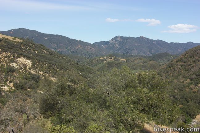
Hi Mountain Trail is located in the Santa Lucia Mountains east of Lopez Lake. The San Luis Obispo County-run trail is quite different from the area’s coastal hikes and covers a variety of environments in a short distance. Start with a nice-and-easy stream-side trail through a dense woodland. Bust up a ridge and suddenly you’re in a grassy landscape with panoramic views. Then drop to oak-spotted ranch land along Hi Mountain Road.
Hi Mountain Trail is 1.4 miles long and connects to Hi Mountain Road at both ends allowing you to walk 1.85 miles on the road to form a loop (the little-traveled road is unpaved for 1.15 miles, so it feels like a hiking trail). In total, the loop on Hi Mountain Trail is 3.25 miles round trip with 575 feet of elevation change and open to hikers (with dogs), horses, and mountain bikes.
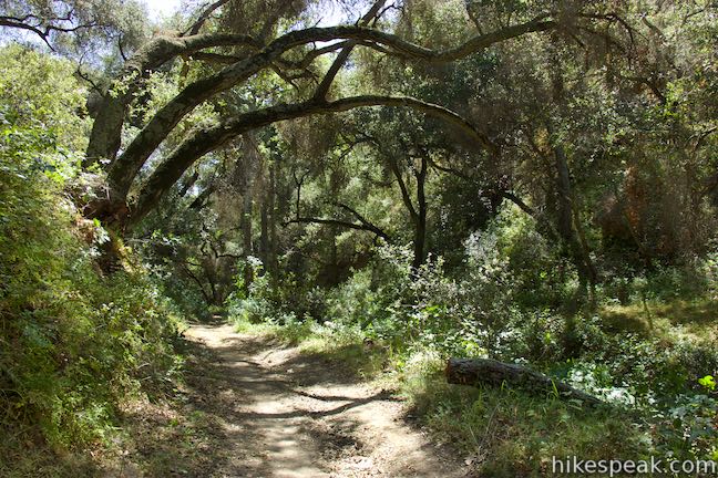
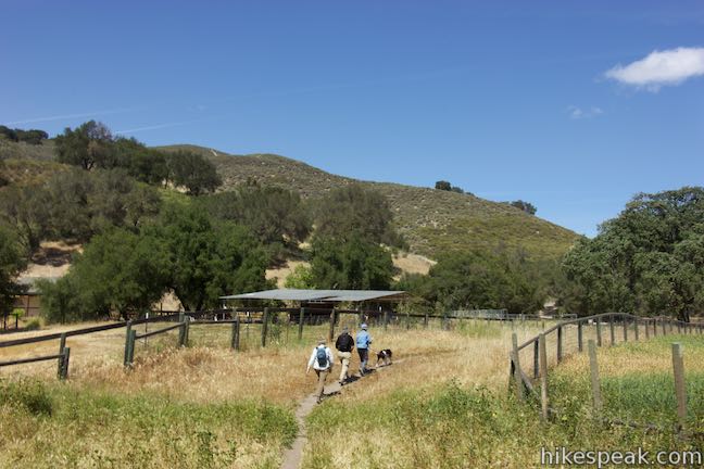
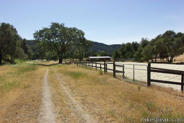
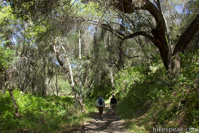
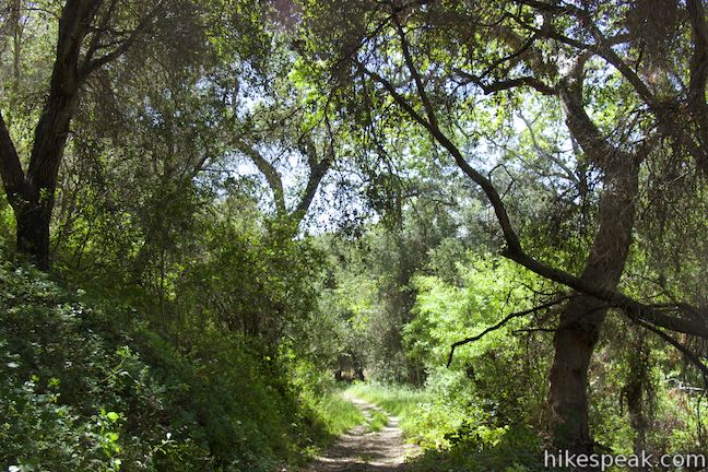
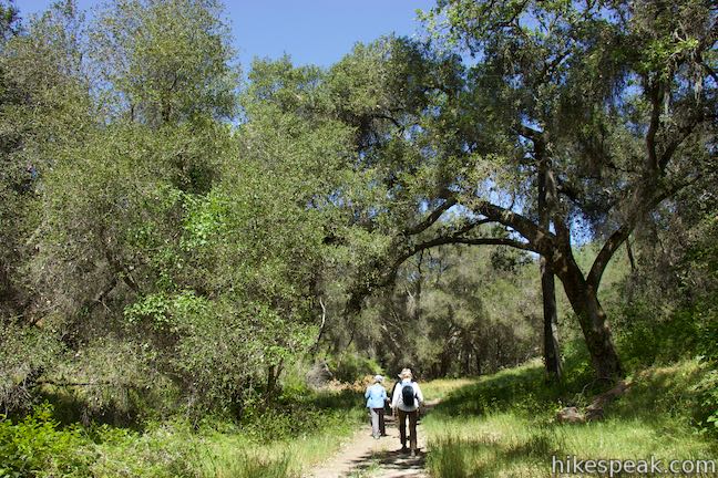
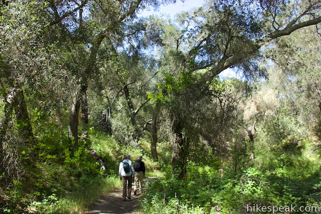
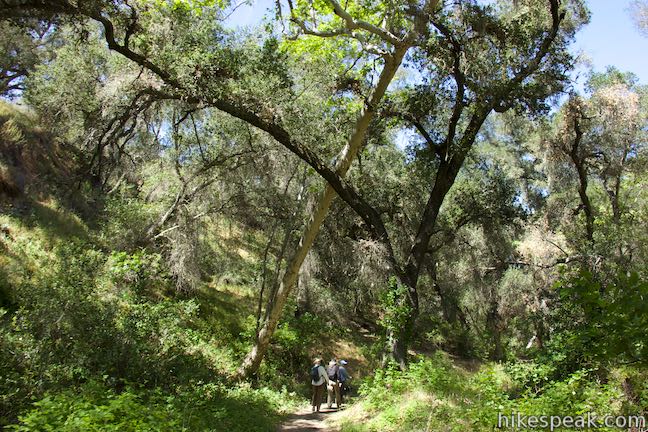
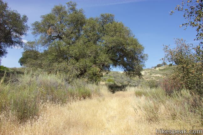
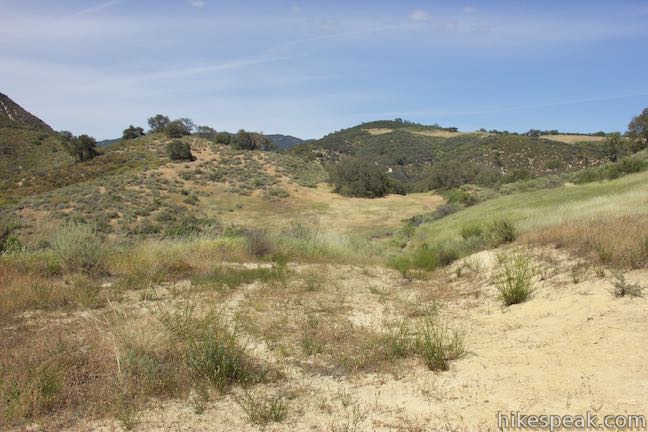
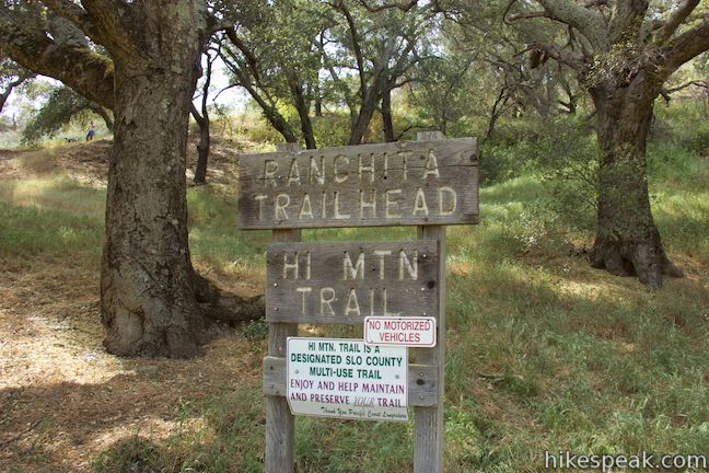
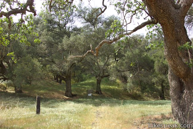
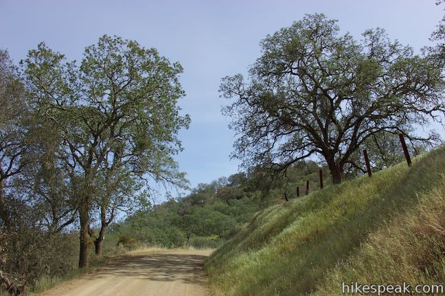
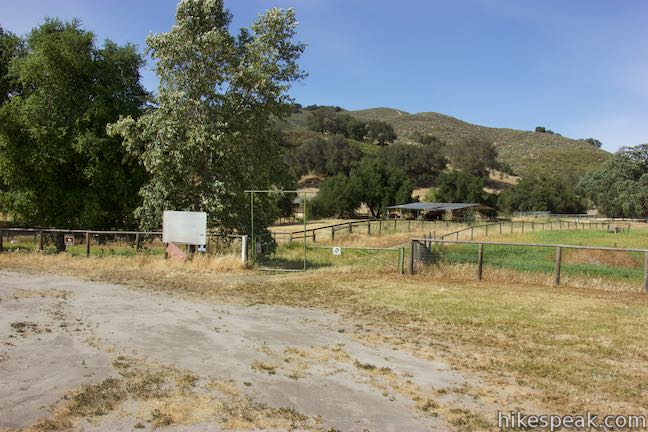
Start from a trailhead about thirty minutes from Highway 101 in Arroyo Grande and forty minutes from San Luis Obispo. Take the single-track trail north between a couple ranches and quickly enter a riparian forest along a branch of Arroyo Grande Creek. Babbling water flows past tall oaks that provide plentiful shade and greenery. Things are gradual over this early part of Hi Mountain Trail as you make your way up the canyon bottom. After 0.35 miles, stay to the left past a path that breaks off the main trail. Cross the stream just after that and continue up the pleasant, shaded canyon. Watch out for poison oak tough, which lines the trail in places. Hop across the stream again to switch back to the right bank and continue up the canyon.
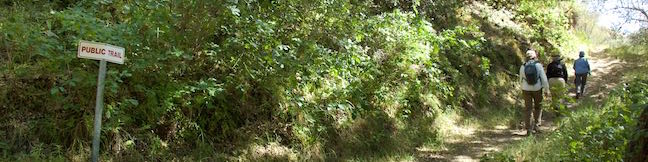
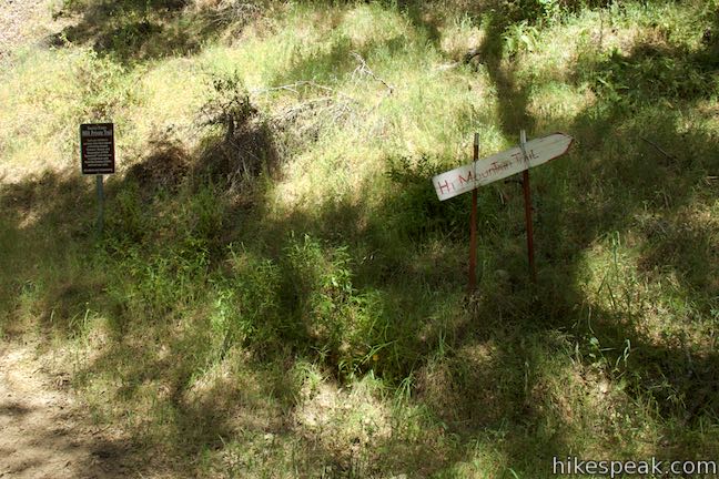
Come to a marked junction at 0.7 miles from the start. A private trail operated by Ranchita Estates (a nearby development) goes to the left and requires a permit from Ranchita Estates for entry. To continue on Hi Mountain Trail, make a sharp right turn, following a sign for the public trail. Hi Mountain Trail leaves the canyon floor and takes on a new personality.
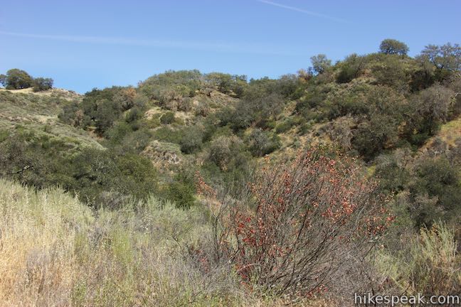
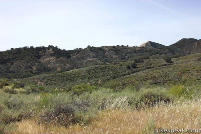
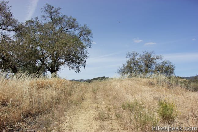
Hike uphill for the next half mile. After rounding a curve to the left, you will see a straight climb up a grass and brush-covered ridge. This is the part of the hike that feels like a workout (the creek-side stroll is definitely over).
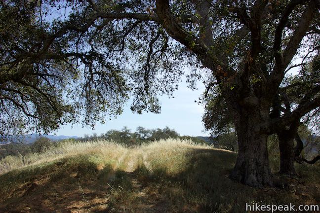
Soon enough, you’ll near the top of the ridge where the trail tapers out. Pass below a couple shade-providing trees above the steep grade and come to a split in the trail, one mile from the start. This junction is unmarked and you could actually proceed in either direction. The goal is to reach a jeep trail on the ridge to the east and both tracks can get you there.
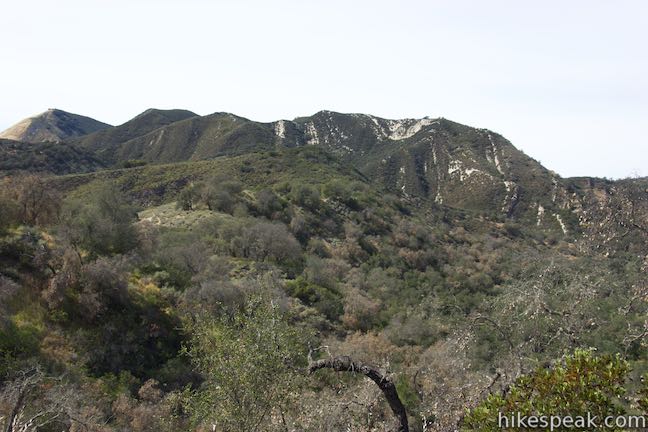
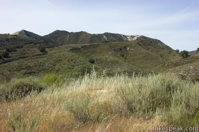
Proceeding to the left, you can hike another 0.05 miles to a crest on the east-west running ridge. Take in clear views of Big Baldy, a 2,686-foot peak in the Santa Lucia Wilderness of Los Padres National Forest to the northwest.
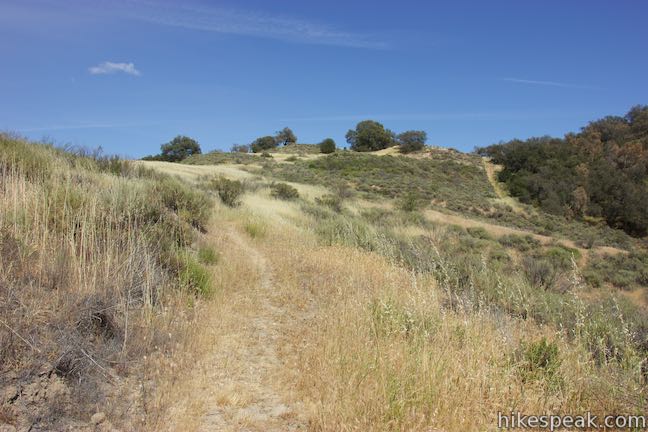
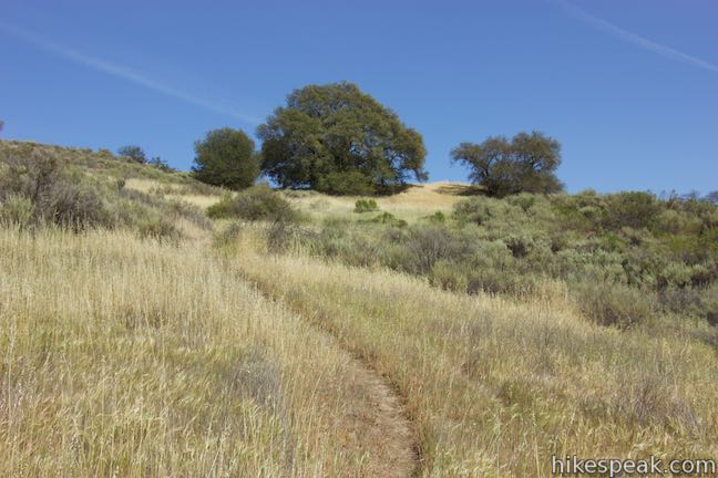
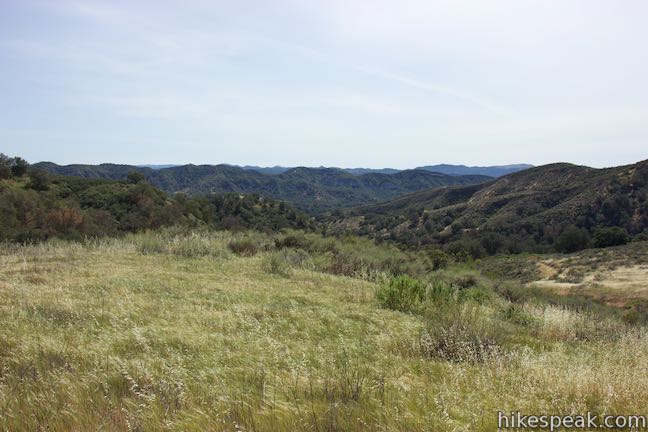
Don’t hike down the other side of this ridge. Instead, turn right and ascend to the higher north-south running ridge to the east, which is topped by a scattering of oaks. Reach the ridge after another tent of a mile and catch your breath below the big oak tree. Turn left and go a bit farther up the ridge, reaching the highest point of the hike, 1.2 miles from the start.
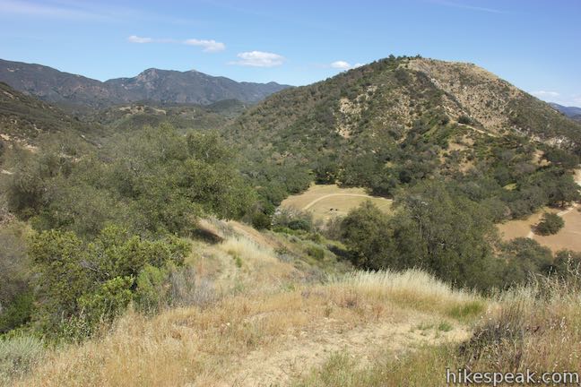
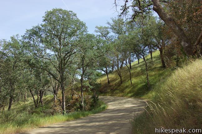
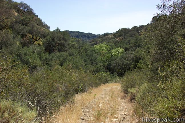
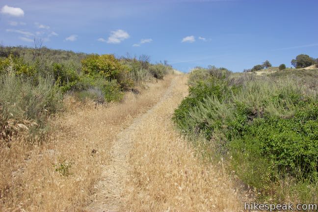
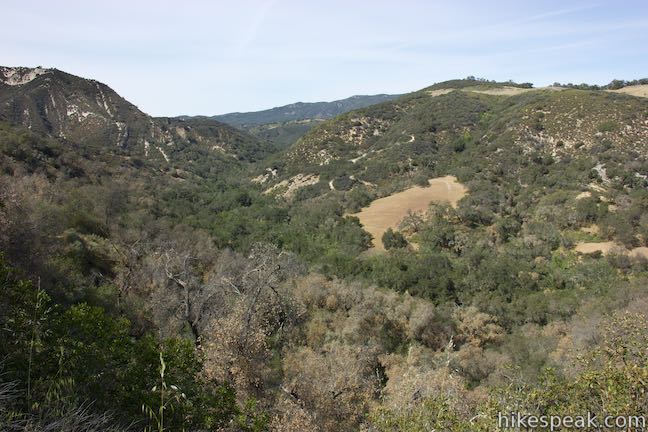
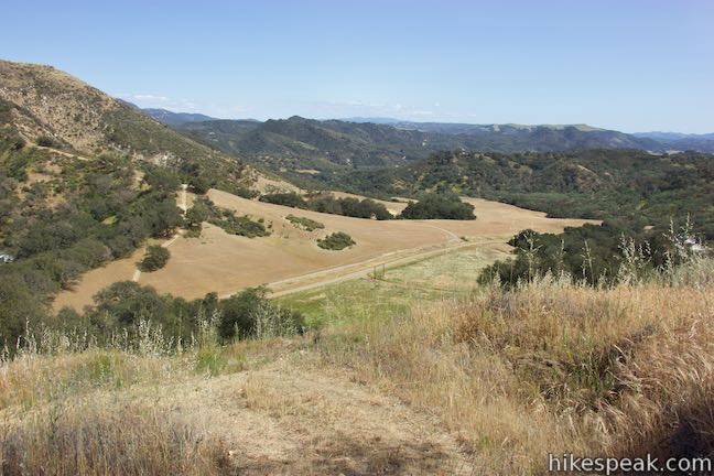
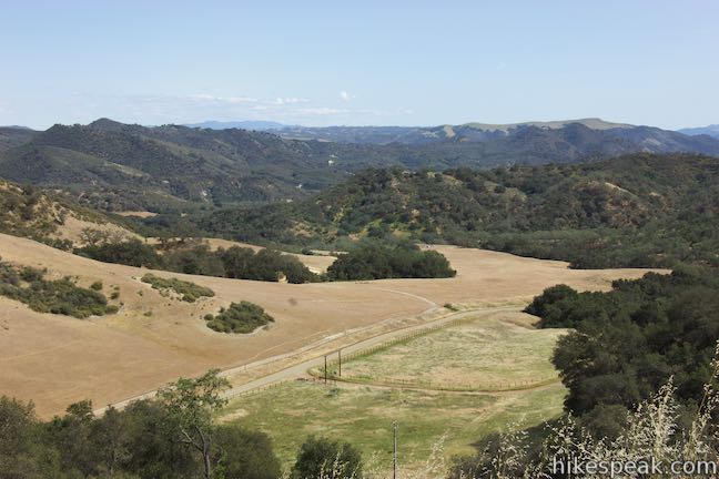
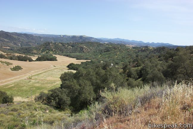
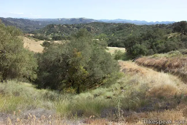
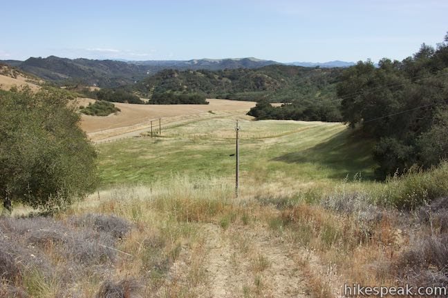
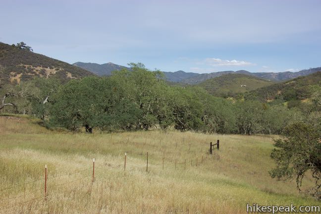
You’re not going any higher, so begin the scenic 0.2-mile descent to the end of High Mountain Trail. The trail is now a double-track jeep road that weaves down the side of the ridge, providing the hike’s biggest views. To the north and east, look out over canyons carved by Salt Creek. Ranch land and more mountain ridges roll out to the southeast, filling a grand view. Savor the sights as you come down the trail, passing through and oak grove to meet Hi Mountain Road which is a nicely maintained dirt road at this end of the trail. After 1.4 miles on Hi Mountain Trail, you now have the option to loop back along the road.
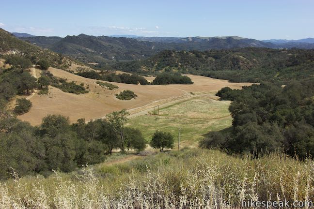
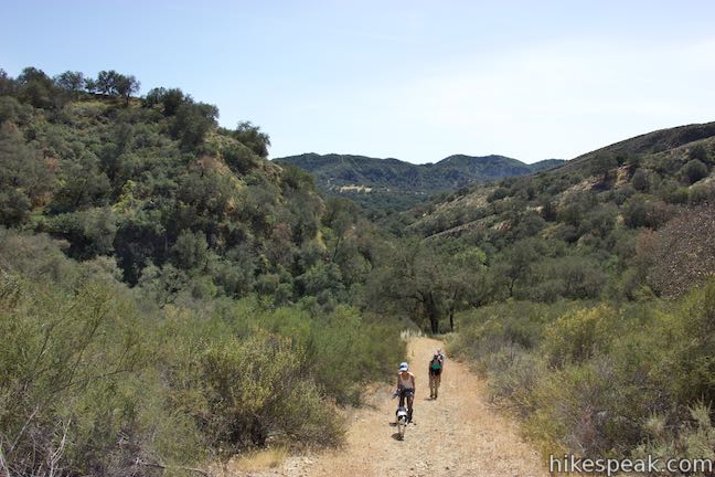
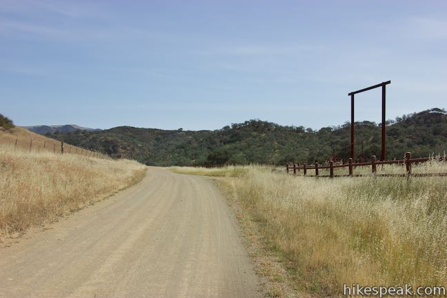
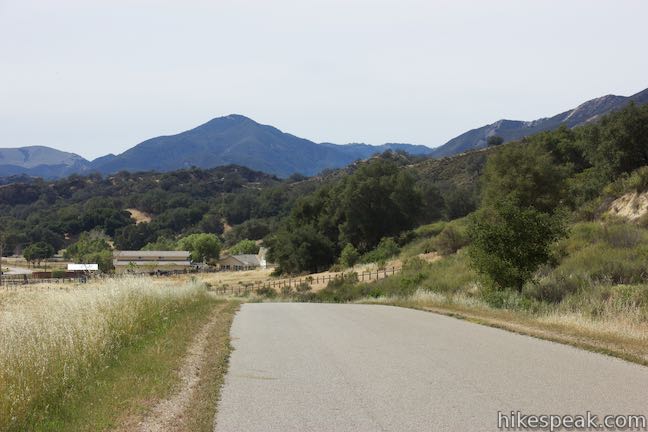
Turn right on Hi Mountain Road. The country road passes a few ranch gates, crossing pastures and oak groves. Will you see a vehicle as you walk 1.85 miles down the road? You might see one or two, but probably not many. The road takes a rolling course south for 1.15 miles and then becomes paved. Cross a crest in the road and walk downhill for the final 0.7 miles to return to the trailhead.
Hi Mountain Trail and Hi Mountain Road combine for a 3.25-mile loop. Dogs, bikes, and horses are allowed. Long pants are recommended. No fee or permit is required to hike Hi Mountain Trail, so get out and enjoy!
Directions to the Trailhead
- From San Luis Obispo, starting on California Boulevard near Highway 101, head south on California for half a mile and turn right on San Luis Drive.
- Drive a third of a mile and turn left onto Johnson Avenue.
- Make a left turn after 1.7 miles onto Orcutt Road.
- Drive a mile and turn left to stay on Orcutt Road.
- Continue another 8 miles across Edna Valley and turn left onto Lopez Drive.
- Go 5.5 miles and bear right onto Hi Mountain Road after passing Lopez Lake.
- Drive another 5.5 miles to the trailhead parking area, which is on the left across from 1840 Hi Mountain Road.
- A faded sign for Hi Mountain Trail is posted next to the large turnout.
- From Arroyo Grande, take Highway 101 to exit 187A for Grand Avenue (Route 227).
- At the end of the offramp, turn right on Grand Avenue.
- Drive a mile and turn right on Hausna Road, which becomes Lopez Drive after a mile and a half.
- Go another eight miles, passing Lopez Lake and bear right on Hi Mountain Road.
- Drive 5.5 miles farther to the trailhead parking area on the left.
Trailhead Location
Trailhead address: 1855 Hi Mountain Road, Arroyo Grande, CA 93420
Trailhead coordinates: 35.2075, -120.38237 (35° 12′ 27.00″N 120° 22′ 56.53″W)
View Hi Mountain Trail in a larger map
Or view a regional map of surrounding Central Coast trails and campgrounds.


 | Rinconada Trail This 3 to 3.25-mile hike near Santa Margarita ascends past an old mercury mine and bucolic views to a grassy saddle with a sweeping perspective over the Santa Lucia Mountains. Extend the outing to the nearby summit of Bell Mountain for even grander vistas. |
 | Oso Flaco Lake Trail This hike of 2 miles or more takes a boardwalk over a coastal lake and across sand dunes to an out-of-the-way beach. |
 | Islay Hill This 1.8-mile out and back hike climbs 550 feet to the top of San Luis Obispo's easternmost Morro. |
 | Johnson Ranch Loop This 2.5 to 3.7-mile loop explores a grassy open space just south of San Luis Obispo. |
 | Bob Jones Bike Trail This easy 5-mile out and back hike or ride follows San Luis Obispo Creek to Avila Beach. |
 | Sycamore Crest Trail This 1.75-mile hike departs from Sycamore Mineral Springs Resort and ascends the north slope of Ontario Hill, arriving at a scenic ocean perch. Extend the hike down the ridge and create a 3.25-mile one-way hike. |
 | Shell Beach Bluff Trail - Ontario Ridge Trail Loop This 2.8-mile loop explores the coast between Shell Beach and Avila Beach, on and below a 700-foot ridge. |
 | More Central Coast Hikes Explore other destinations along the California coast between Ventura and Monterey, including trails in San Luis Obispo County. |
Common Questions about Hi Mountain Trail in Arroyo Grande
- Is the trail open?
- Yes. You should expect to find that Hi Mountain Trail Loop is open. There are no recent reports of trail closures. If you discover that the trail is closed, please help your fellow hikers by reporting a closure.
- Is this trail free to access?
- Yes, Hi Mountain Trail Loop is free to access. No entrance fee, pass, or permit is required. If you discover that access rules have changed, please provide feedback on your experience.
- How much time does this hike take?
- It takes approximately 1 hour 45 minutes to hike Hi Mountain Trail Loop. Individual hiking times vary. Add extra time for breaks and taking in the views.
- How long is this hike?
- The hike to Hi Mountain Trail Loop is a 3.25 mile loop with 575 feet of elevation change.
- Are dogs allowed on this trail?
- Yes, dogs are allowed on Hi Mountain Trail Loop. The trail is open to hikers, dogs, bikes, horses.
- What mountain range is this trail in?
- Hi Mountain Trail Loop is located in the Santa Lucia Mountains.
- Where is the trailhead located?
- The trailhead for Hi Mountain Trail Loop is located in Arroyo Grande, CA.
Trailhead Address:
1855 Hi Mountain Road
Arroyo Grande, CA 93420
Trailhead Coordinates:
35.2075, -120.38237 - What are the driving directions to the start of the hike?
To get to the trailhead: From San Luis Obispo, starting on California Boulevard near Highway 101, head south on California for half a mile and turn right on San Luis Drive. Drive a third of a mile and turn left onto Johnson Avenue. Make a left turn after 1.7 miles onto Orcutt Road. Drive a mile and turn left to stay on Orcutt Road. Continue another 8 miles across Edna Valley and turn left onto Lopez Drive. Go 5.5 miles and bear right onto Hi Mountain Road after passing Lopez Lake. Drive another 5.5 miles to the trailhead parking area, which is on the left across from 1840 Hi Mountain Road. A faded sign for Hi Mountain Trail is posted next to the large turnout.
From Arroyo Grande, take Highway 101 to exit 187A for Grand Avenue (Route 227). At the end of the offramp, turn right on Grand Avenue. Drive a mile and turn right on Hausna Road, which becomes Lopez Drive after a mile and a half. Go another eight miles, passing Lopez Lake and bear right on Hi Mountain Road. Drive 5.5 miles farther to the trailhead parking area on the left.
View custom Google Maps directions from your current location.
- Are there other trails near Hi Mountain Trail Loop?
- Yes, you can find other nearby hikes using the Hikespeak Hike Finder Map.

Go the extra miles...
Submit a rating of this hike to go with your comment. Contribute to the average trail rating.