Sycamore Crest Trail is a wide dirt road on the north slope of Ontario Hill, which runs east to west between Shell Beach and Avila Beach. Beginning from Sycamore Mineral Springs Resort in Avila Valley, the trail climbs through a lush oak grove to reach a junction with Ontario Ridge Trail at a south-facing saddle with lofty ocean views. Sycamore Crest Trail serves as a 1.75-mile out and back hike with 575 feet of elevation gain, and the trek can be extended by exploring more of Ontario Ridge.
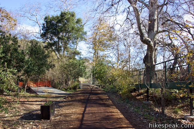
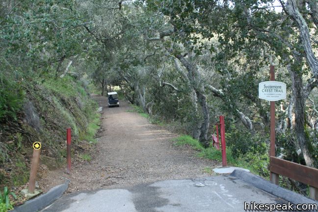
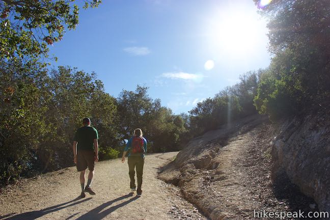
Sycamore Crest Trail is fairly straightforward. Once you leave Sycamore Springs, there are no junctions until the top of the hill. From the parking lot, look for a sign marked Sycamore Trail to the right of Gardens of Avila Restaurant, and follow the road up a steep switchback to the trailhead.
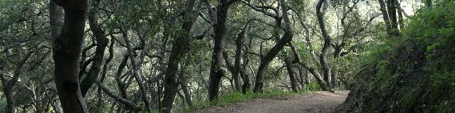
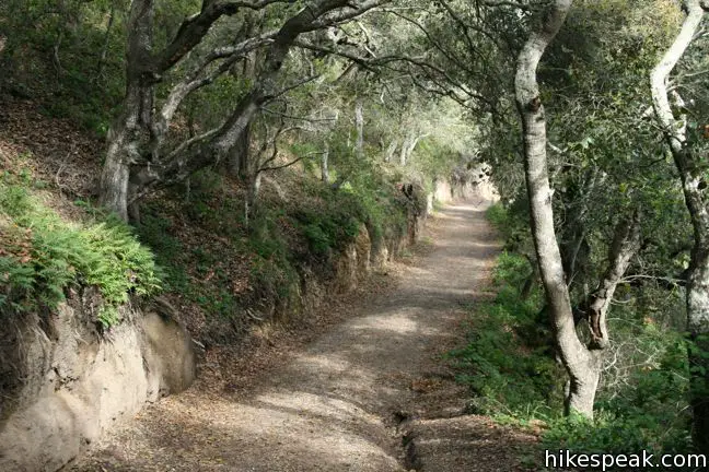
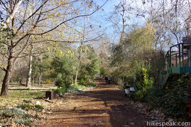
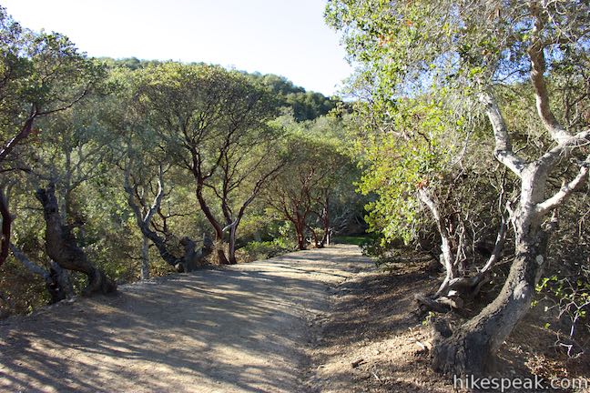
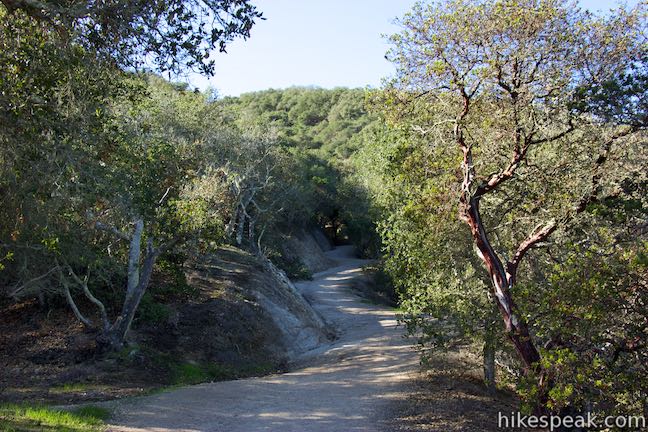
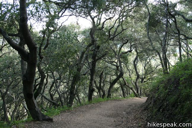
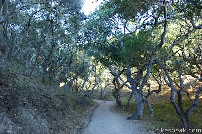
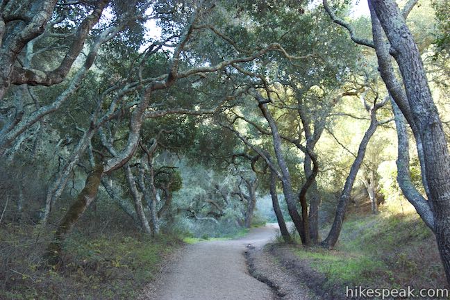
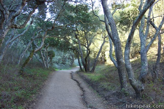
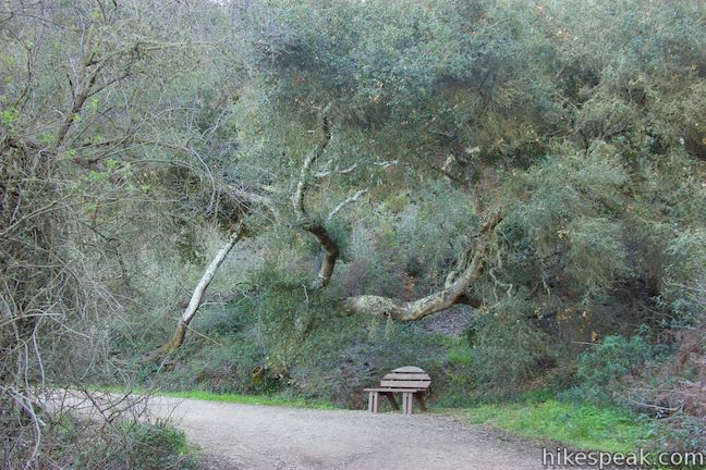
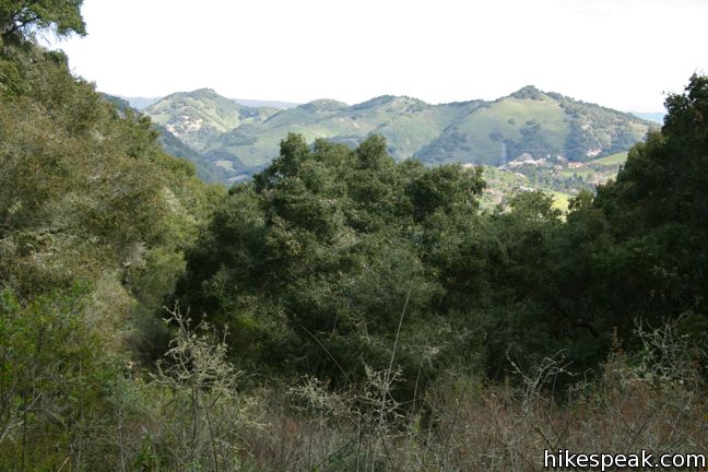
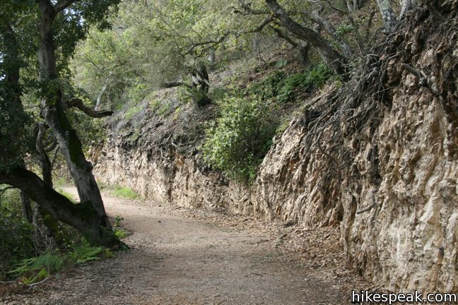
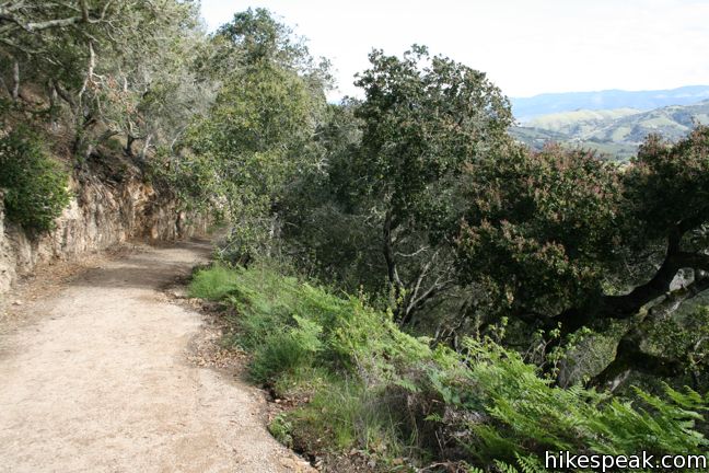
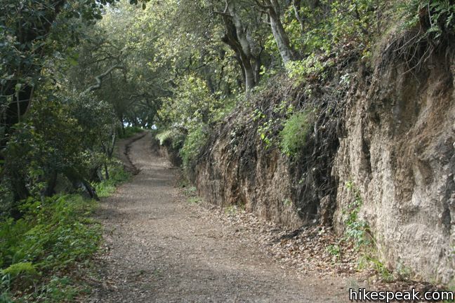
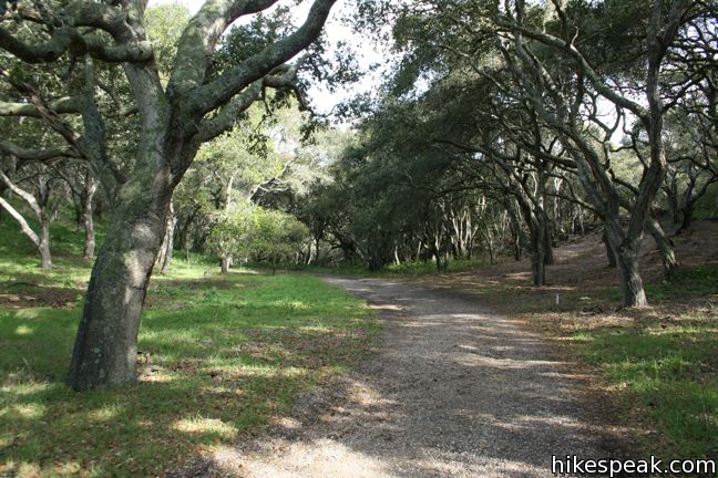
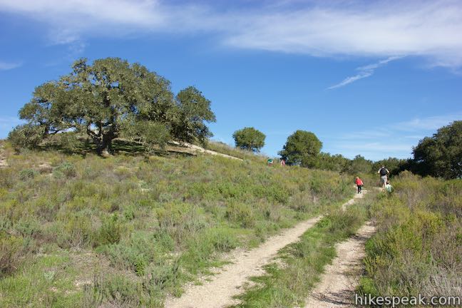
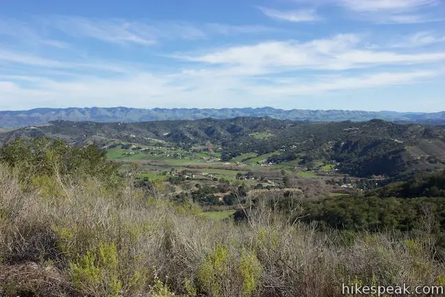
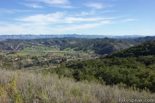
When the pavement ends, pick up the well-maintained service road climbing steadily up a broad ridge lined with red-barked Manzanita trees and coast live oaks. Through the forest are obstructed views of the Irish Hills to the north, and the Santa Lucia Mountains beyond.
As you ascend, the oaks grow taller and the forest becomes lusher, filled with ferns and mossy undergrowth. Despite limited views, the landscape is quite pleasant. This is a suitable hike for a warm day, minus the steady elevation gain, thanks to generous shade from the canopy overhead.
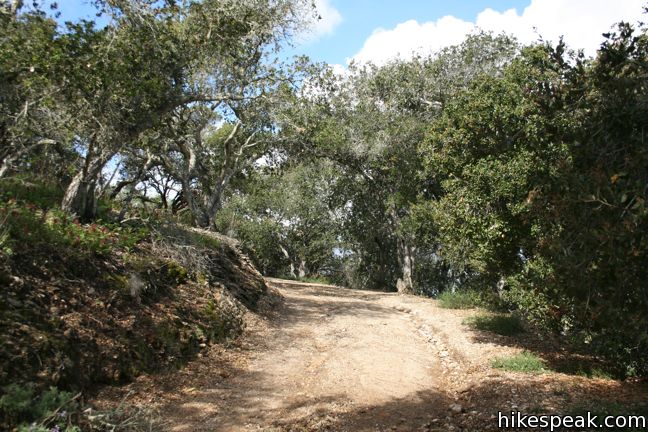
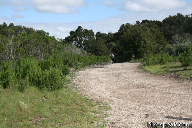
After progressing east up the side of a draw in Ontario Hill, Sycamore Crest Trail tapers out and comes to an end at a T-junction with Ontario Ridge Trail.
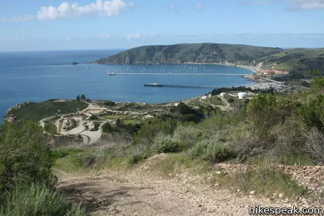
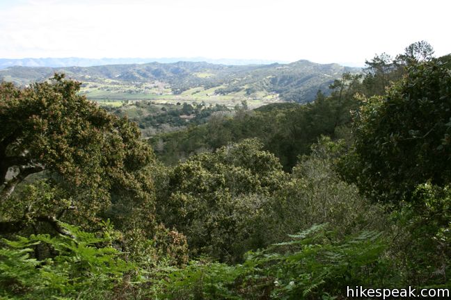
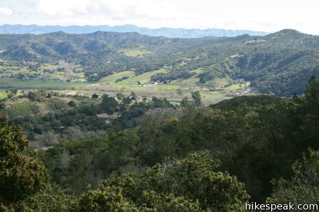
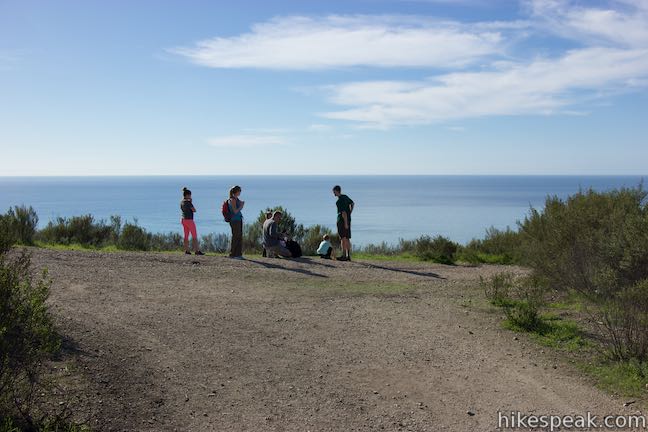
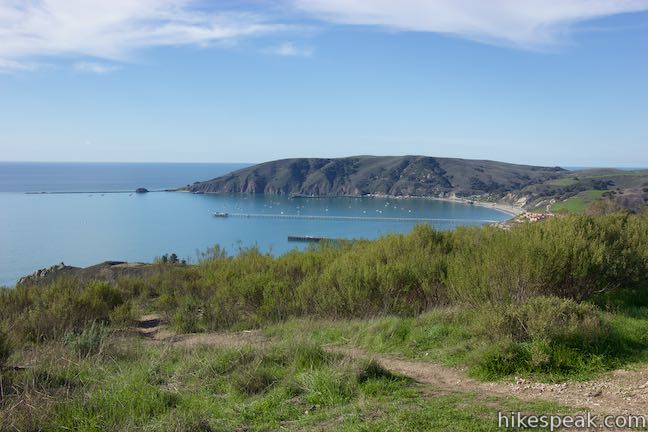
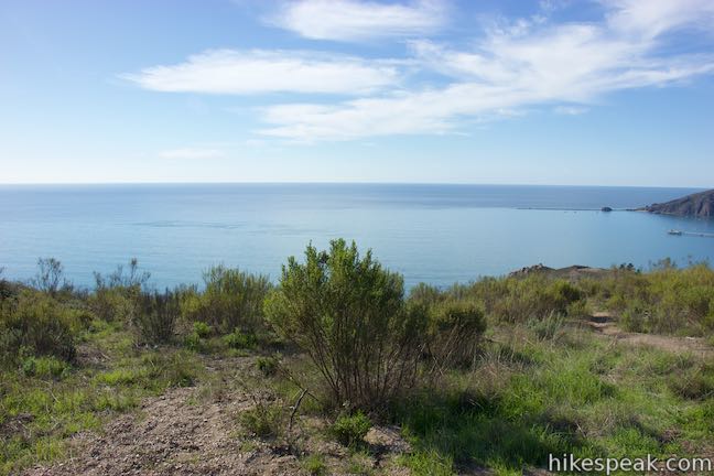
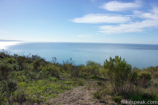
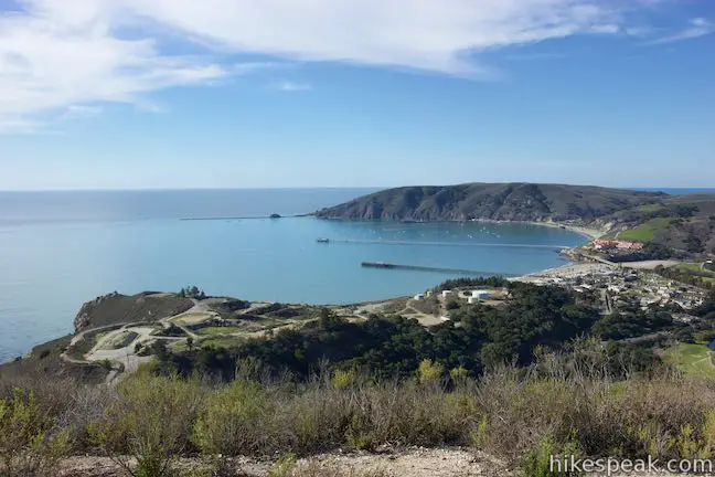
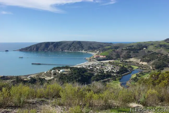
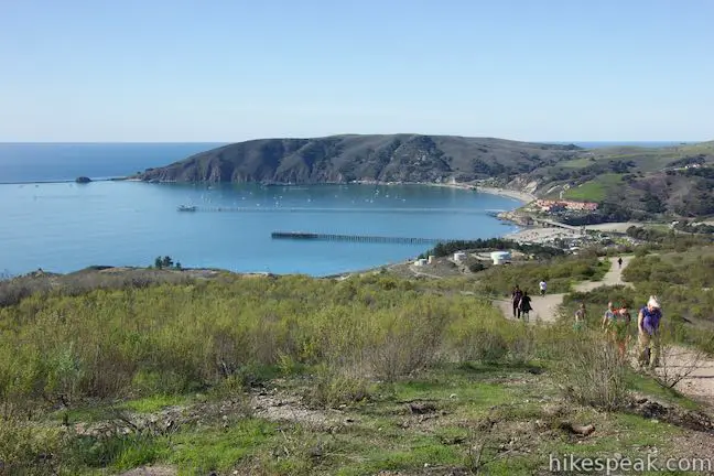
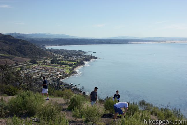
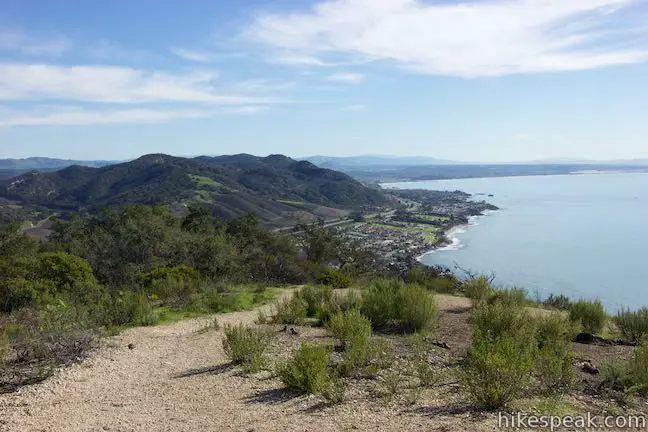
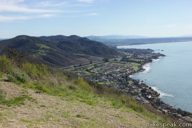
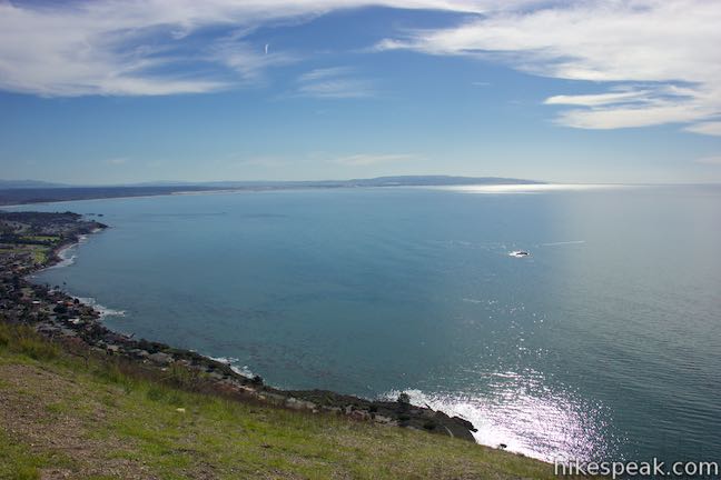
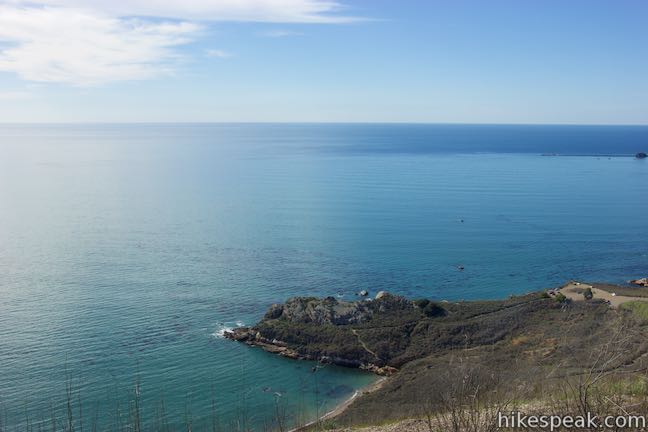
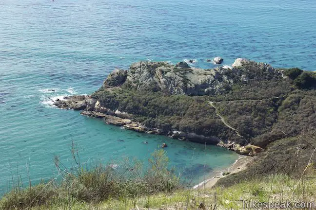
The trees break, giving way to dramatic south-facing views down a sage-covered slope. Below the hill are Pirate’s Cove, Cave Landing, and a whole lot of turquoise water. To the west are Avila Beach and San Luis Harbor. It is quite a sight! Before returning down Sycamore Crest Trail, take a moment to explore the ridge, and redeem the ocean vistas earned on the ascent.
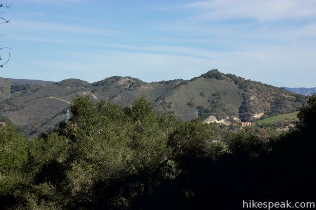
To the right, a short but steep trail ascends to a summit on the west end of Ontario Hill. This addition is 0.15 miles long, one way, ascending to just over 700 feet. From the top are excellent views over Avila Beach. Along this trail to the top, and just west of the top of Sycamore Crest Trail, a short, steep trail descends the other side of ridge to Cave Landing. East of the top of Sycamore Crest Trail, Ontario Ridge Trail rises to the 735-foot summit of Ontario Hill, reaching it a quarter mile from the top of Sycamore Crest Trail. Bagging both peaks will add about 0.8 miles round trip to your trek up Sycamore Crest Trail.
An elaborate extension to this hike, which requires a car shuttle, is to continue east from Sycamore Crest Trail down Ontario Ridge Trail to Shell Beach, and then hike back up the coast on Shell Beach Bluff Trail to the trailhead at Cave Landing. This is a scenic 3.25-mile one-way hike. Without the shuttle, you could hike up the steep track from Cave Landing to Ontario Hill and return down Sycamore Crest Trail for a 4.5-mile lollipop loop with some serious ups and downs.
Sycamore Mineral Springs Resort has been in business for over a century and offers more than just hiking trails. No fee or permit is required to hike Sycamore Crest Trail, and dogs are welcome. Free parking can often be found in the resort’s main lot. While there is a history of parking at Sycamore Mineral Springs Resort to hike Sycamore Crest Trail, the resort may ask you to park elsewhere. For a longer hike, connector trail allows you to reach Sycamore Crest Trail from Bob Jones Bike Trail.
Bob Jones Bike Trail to Sycamore Crest Trail
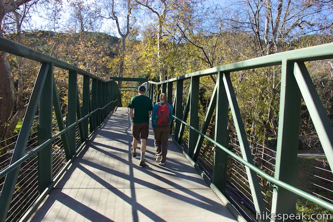
A trail connects to Sycamore Mineral Springs Resort, 3/4 of a mile from the east end of Bob Jones Bike Trail, just west of See Creek. You can reach it from either end of Bob Jones Bike Trail or from a starting point near the middle. Park in one of the spaces along Bay Laurel Place near Woodstone Market (don’t use the most convenient customer parking), just of San Luis Bay Drive. A path from the parking area outside the marker quickly meets Bob Jones Bike Trail. Turn left, walk 0.3 miles up Bob Jones Trail, and turn right on a dirt trail (before crossing the bridge over Sea Creek).
Pass through some cabins in Sycamore Mineral Springs Resort and walk a tenth of a mile to a bridge. Turn right and take the bridge over San Luis Obispo Creek. Cross the bridge to reach the resort and continue walking 1/8 of a mile uphill on the paved road to the start of Sycamore Crest Trail, adding half a mile (one way) to Sycamore Crest Trail.
Directions to the Trailhead
Sycamore Mineral Springs Resort:
- From Highway 101 seven miles south of San Luis Obispo, exit on Avila Beach Drive and head west for 0.8 miles to Sycamore Mineral Springs Resort.
- Turn left into the large parking lot, find a space, and walk up the road to the right of Gardens of Avila Restaurant to reach the trail.
- Woodstone Market Trailhead: Take Highway 101, 6.5 miles south of San Luis Obispo to exit 196 for San Luis Bay Drive.
- Drive 1.4 miles southwest on San Luis Bay Drive and, before reaching Avila Beach Drive, turn left on Bay Laurel Place.
- Pass Woodstone Market & Deli and drive a tenth of a mile to one of the parking spaces on either side of the road.
Trailhead Location
Trailhead address: Sycamore Mineral Springs Resort, 1215 Avila Beach Drive, San Luis Obispo, CA 93405
Trailhead coordinates: 35.186, -120.7146 (35° 11′ 09.6″N 120° 42′ 52.6″W)
Trailhead address: Woodstone Market, 6675 Bay Laurel Place, Avila Beach, CA 93424
Trailhead coordinates: 35.1894, -120.72 (35° 11′ 21.83″N 120° 43′ 11.99″W)
View Avila Beach in a larger map
Or view a regional map of surrounding Central Coast trails and campgrounds.
Bob Jones Bike Trail to Sycamore Mineral Springs Resort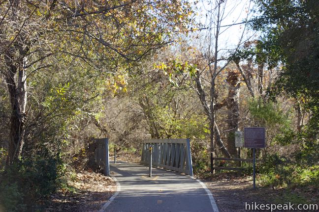

Sycamore Crest Trail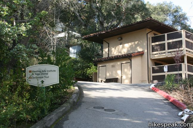


Western peak of Ontario Hill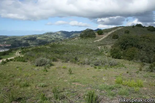


Central peak of Ontario Hill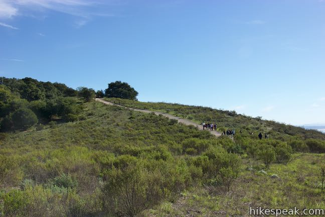


 | Bob Jones Bike Trail This easy 5-mile round trip hike or ride follows San Luis Obispo Creek to Avila Beach. |
 | Shell Beach Bluff Trail - Ontario Ridge Trail Loop This 2.8-mile loop explores the coast between Shell Beach and Avila Beach, on and below a 700-foot ridge. |
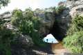 | Cave Landing This half-mile round trip hike descends 100 feet to a natural rock bridge at the end of a headland east of Avila Beach. |
 | Point San Luis Lighthouse via Pecho Coast Trail This docent-led 3.5-mile out and back hike crosses scenic coastal bluffs to reach the historic lighthouse on Point San Luis. |
 | Oso Flaco Lake Trail This hike of 2 miles or more takes a boardwalk over a coastal lake and across sand dunes to an out-of-the-way beach. |
 | More hikes in San Luis Obispo Explore other trails around San Luis Obispo including Morro Bay State Park, Montaña de Oro State Park, and the Morros. |
Common Questions about Sycamore Crest Trail to Ontario Ridge Trail in Avila Valley
- Is the trail open?
- Yes. You should expect to find that Bob Jones Bike Trail & Sycamore Crest Trail to Ontario Ridge is open. There are no recent reports of trail closures. If you discover that the trail is closed, please help your fellow hikers by reporting a closure.
- Is this trail free to access?
- Yes, Bob Jones Bike Trail & Sycamore Crest Trail to Ontario Ridge is free to access. No entrance fee, pass, or permit is required. If you discover that access rules have changed, please provide feedback on your experience.
- How much time does this hike take?
- It takes approximately 1 hour to hike Bob Jones Bike Trail & Sycamore Crest Trail to Ontario Ridge. Individual hiking times vary. Add extra time for breaks and taking in the views.
- How long is this hike?
- The hike to Bob Jones Bike Trail & Sycamore Crest Trail to Ontario Ridge is a 1.75 mile out and back with 575 feet of elevation change.
- Are dogs allowed on this trail?
- Yes, dogs are allowed on Bob Jones Bike Trail & Sycamore Crest Trail to Ontario Ridge. The trail is open to hikers, dogs.
- Are there ocean views on this hike?
- Yes, Bob Jones Bike Trail & Sycamore Crest Trail to Ontario Ridge offers views of the ocean.
- Where is the trailhead located?
- The trailhead for Bob Jones Bike Trail & Sycamore Crest Trail to Ontario Ridge is located in San Luis Obispo, CA.
Trailhead Address:
1215 Avila Beach Drive
San Luis Obispo, CA 93405
Trailhead Coordinates:
35.186, -120.7146 - What are the driving directions to the start of the hike?
To get to the trailhead: Sycamore Mineral Springs Resort: From Highway 101 seven miles south of San Luis Obispo, exit on Avila Beach Drive and head west for 0.8 miles to Sycamore Mineral Springs Resort. Turn left into the large parking lot, find a space, and walk up the road to the right of Gardens of Avila Restaurant to reach the trail.
Woodstone Market Trailhead: Take Highway 101, 6.5 miles south of San Luis Obispo to exit 196 for San Luis Bay Drive. Drive 1.4 miles southwest on San Luis Bay Drive and, before reaching Avila Beach Drive, turn left on Bay Laurel Place. Pass Woodstone Market & Deli and drive a tenth of a mile to one of the parking spaces on either side of the road.
View custom Google Maps directions from your current location.
- Are there other trails near Bob Jones Bike Trail & Sycamore Crest Trail to Ontario Ridge?
- Yes, you can find other nearby hikes using the Hikespeak Hike Finder Map.

11 Comments on Sycamore Crest Trail to Ontario Ridge Trail in Avila Valley
What hikers are saying:
✨ Generated summary of user commentsHikers find this trail to be a rewarding challenge that offers inspirational views of Avila Beach and San Luis Bay. The steep climb serves as a great workout, though many prefer warming up on the Bob Jones Trail first. Peter suggests bringing a camera to capture the unique geological formations and contorted rock layers found along the path. Visitors must avoid parking at the Sycamore Mineral Springs Resort to prevent being towed, as this lot is strictly for hotel guests.
“The view is inspirational no matter how many times you see it.” Jump to comment ↓
We do this hike a couple times a week. Start at Bob Jones and you can add two flat miles to the hike. It’s a good butt-kicker if you charge up the hill without stopping…..sweat! This is good hike for dogs too. The view is inspirational no matter how many times you see it.
Great idea to start on Bob Jones Trail and let your legs warm up before the steep climb!
Yes. I agree! The view of Avila Beach and San Luis Bay and then to Point Sal across the bay is awsome! I hiked this trail and spent 45 minutes at the top just enjoying the peaceful quiet and views…..will definitely go again!
Did this as part of the Ontario Ridge loop – great idea adding Bob Jones to the route! Thanks for all the info!
[…] hiking. I was on my own this week and didn’t want to hit an all-new spot, so I chose the Sycamore Crest Trail. This trail is the backside trail to one of our first hikes – the Ontario Ridge. […]
Wonderful roadcut outcrops of Miocene Monterey formation, fine ss, shale & diatomite, many intricately contorted. Must bring camera next time, & try for after a rain. Rocks toward the top were impure diatomite = deep-sea beds composed of the silica shells of diatoms, microscopic plankton. Lift a piece — very light rock! The pure stuff is bright-white, used in toothpaste & scouring powder, and is quarried near Lompoc.
Is the gate to road usually unlocked? Was today. Fabulous views at the top!
[…] Check out this article to get more information on how to get to Avila Ridge. […]
Can you ride a bike on trail?
Parking at Sycamore Mineral Springs Resort in Avila Beach for hiking is strictly illegal. In the text on this site it is indicated that there is a history of parking at Sycamore. That is not true. We’ve made it clear there is no parking except for hotel guests We are towing cars that park at Sycamore for hiking. Hikers can access the trail by parking at the end of the Bob Jones Trail and walk to the Sycamore Crest Trail. There simply isn’t enough parking for our guests, let alone for dozens of cars parking in our lot for hiking. Thank you for your understand.
Is there still a swing hanging from an Oak at the top of the Sycamore Crest Trail? Does anybody know the history of it– who put it there and how long ago?
if you park ANYWHERE at Sycamore Mimeral Sprngs Resort you WILL BE TOWED.