Shell Beach Bluff Trail – Ontario Ridge Trail Loop
in Avila Beach and Shell Beach
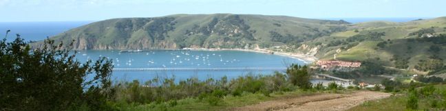
Two parallel but varied trails explore the coast between Shell Beach and Avila Beach in San Luis Obispo County. Shell Beach Bluff Trail is an easy, wheelchair-friendly paved trail overlooking a picturesque cove. Ontario Ridge Trail is a rugged, sometimes-steep track crossing a 700-foot hill above the bluff. Put these two together for a 2.8-mile loop with 675 feet of elevation change and spectacular ocean views.
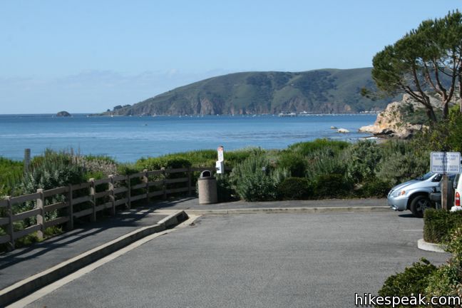
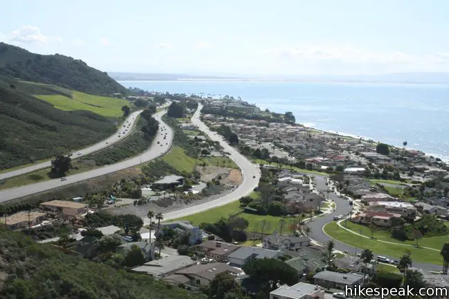
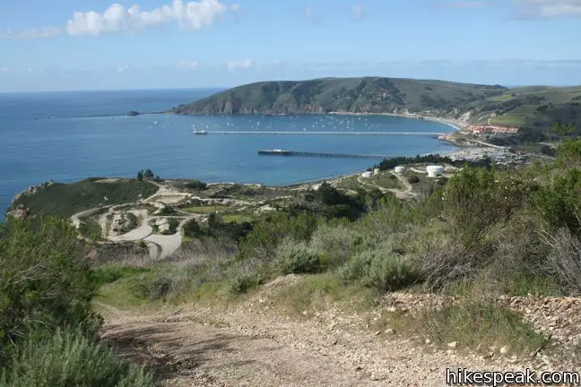
There are two potential starting points for this hike, from the east in Shell Beach, and from the west at Cave Landing near Avila Beach. The Shell Beach trailhead is the best place to start if you are only interested in a short casual stroll on the Bluff Trail. For those hiking the full loop, more parking id available at Cave Landing, making it an optimum place to start. The short path from Cave Landing up to the spine of Ontario Ridge is remarkably steep, so it is preferable to end the hike by descending that slope, rather than starting out with such a tough climb. This counter-clockwise loop heads east down Shell Beach Bluff Trail to the other trailhead, mounts the lower east end of Ontario Hill, and climbs the ridge to the 735-foot crown before dropping down to Cave Landing.
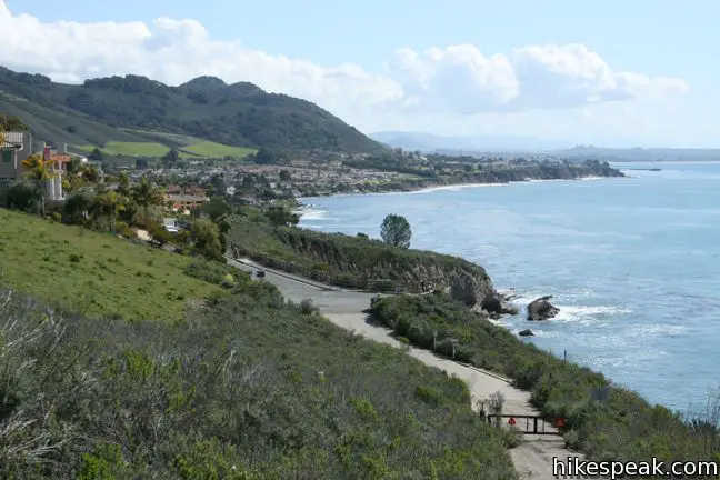
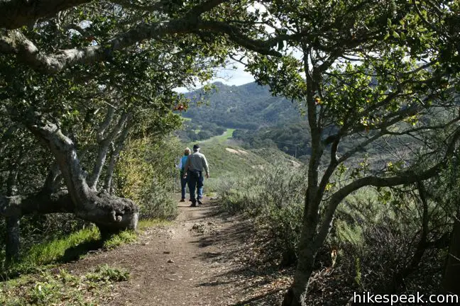
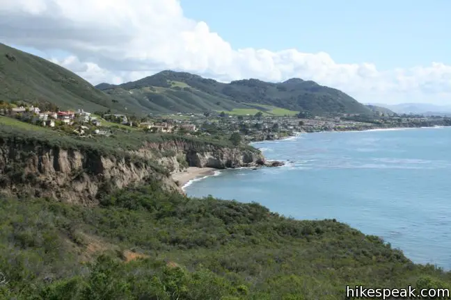
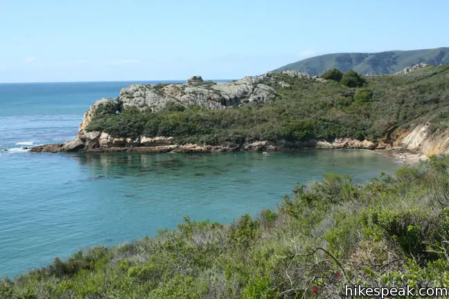
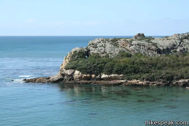
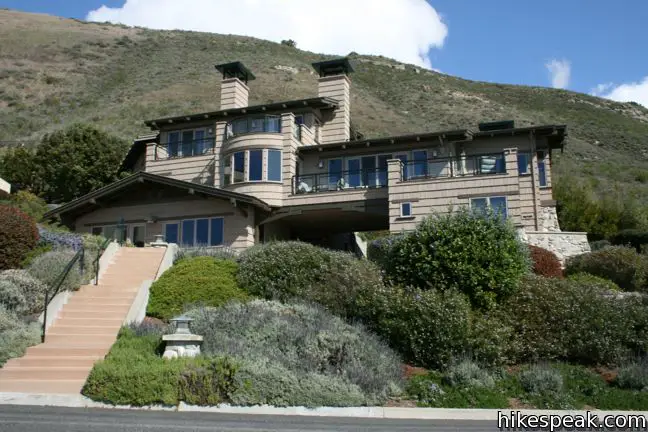
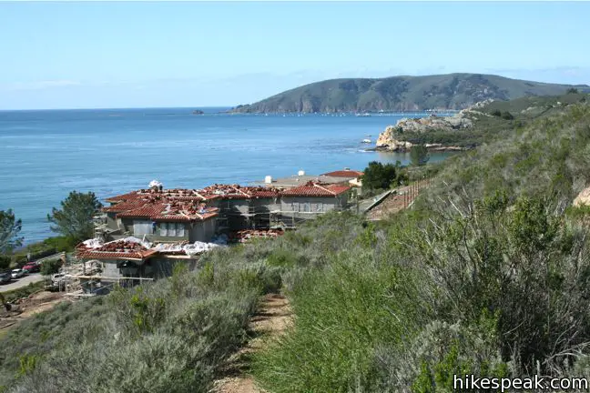
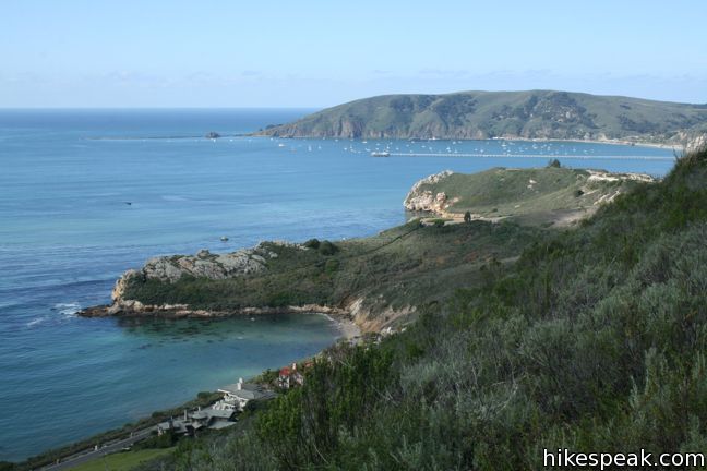
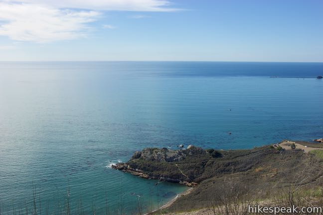
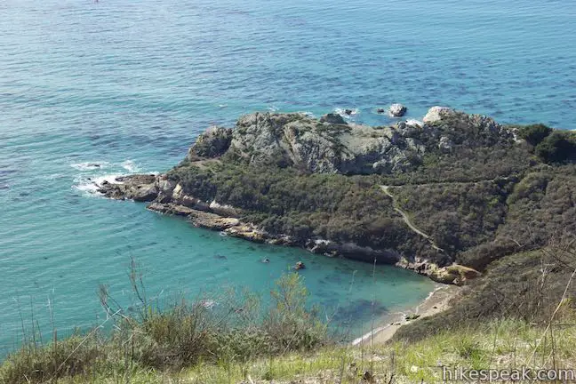
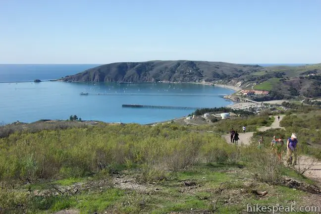
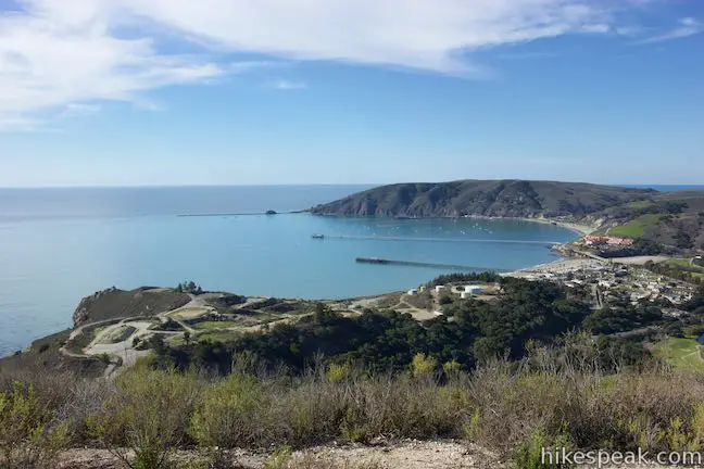
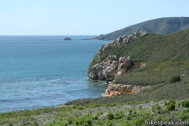
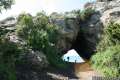
From the trailhead at the end of Cave Landing Road, walk around the gate and up a short rise overlooking Pirate’s Cove. The rocky headland on the opposite side of this clothing-optional beach features a natural tunnel that forms a window on the ocean beyond (hike Cave Landing Trail to explore the tunnel). When the wide road drops down to Shell Beach Drive, continue on the paved Bluff Trail, tracing the ocean side of this mansion-lined road. A short spur trail, 0.6 miles from the start, leads to a dramatic bluff where a rope has been tied to allow bold hikers down to the shore. Shell Beach Bluff Trail continues for about a quarter mile to the second trailhead.
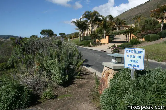
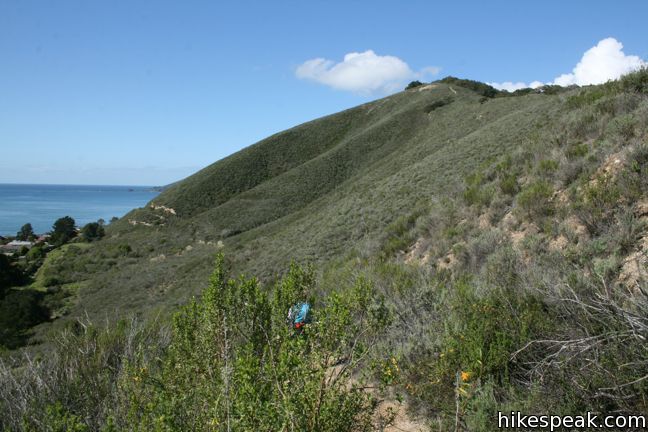
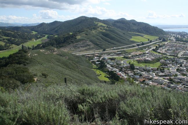
Cross the paved parking area and the cul-de-sac above. Walk across the area in the road made of bricks and find a chained-off driveway at the end of a stone wall to the right of the last house on the street (don’t walk out to the blacktop area of Indio Drive). The driveway is actually a public access road that leads to the next trail, so use it. Step over the chain and walk up to the top of the pavement where an unmarked single-track trail starts to the left. Take this trail, which is Ontario Ridge Trail, and it will lead you up onto Ontario Hill. Follow Ontario Ridge Trail as it curves to the right and progresses along the base of the hill parallel to the edge of the Shell Beach neighborhood below. Mount a low saddle on the east end of the ridge. A spur to the right brings you to a short overlook, while the ridge trail heads to the left, delivering a 400-foot climb over 0.9 miles to summit of Ontario Hill.
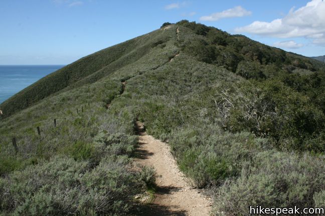
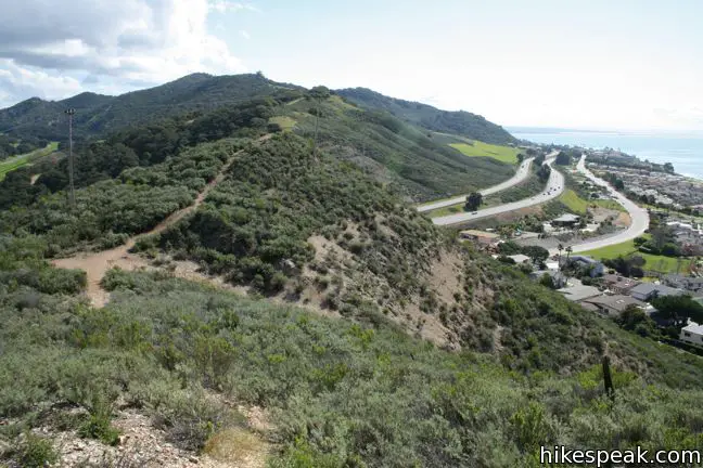
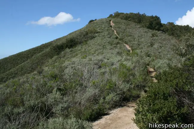
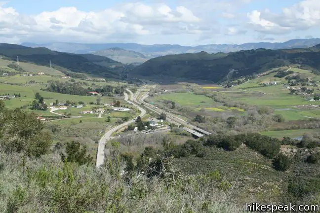
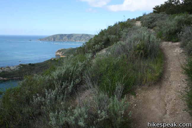
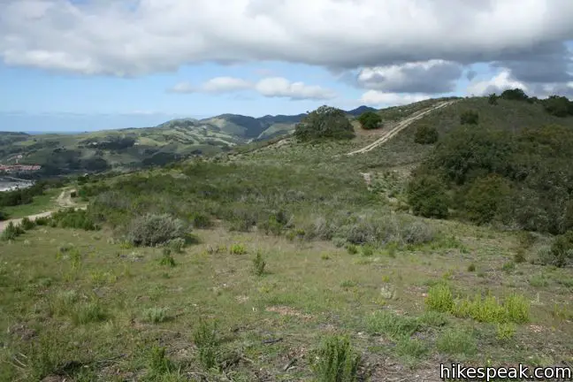
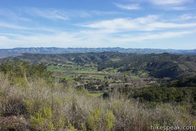
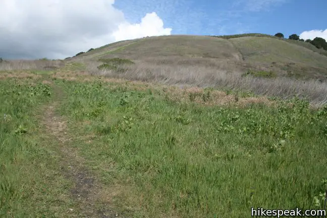
Begin climbing the hillside of coastal sage. The rugged single-track is steep and rutted in areas, and level in others – delivering an arduous ascent. The east end of the ridge is close to Highway 101, which can be seen to the north, crossing Avila Valley toward San Luis Obispo, and to the south, passing behind Shell Beach and the other beach cities.
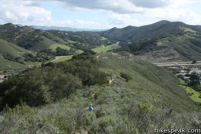
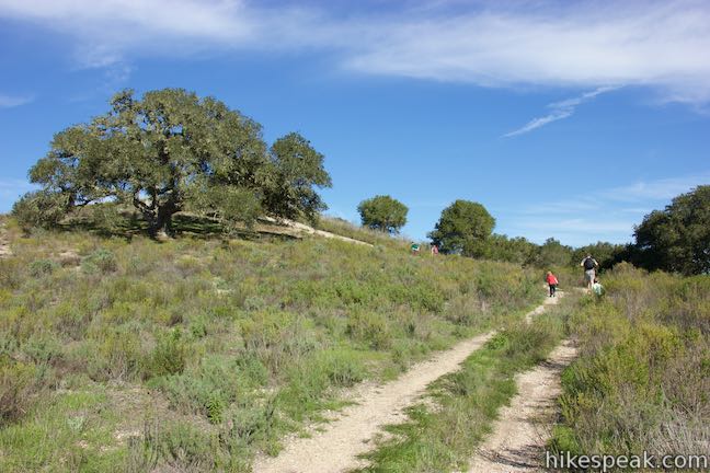
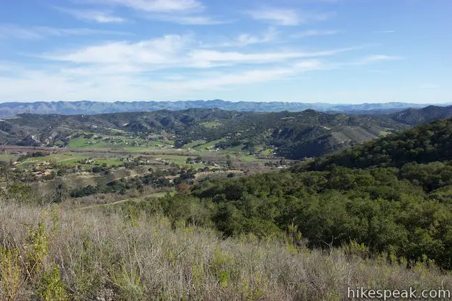
The freeway disappears as you continue, being replaced by sweeping coastal views. In the spring, blue dicks, lupines, crimson pitcher sage, and monkeyflower bloom amongst the sagebrush. Coast live oaks spread down the north slope of the hill and provide pockets of shade along the trail.
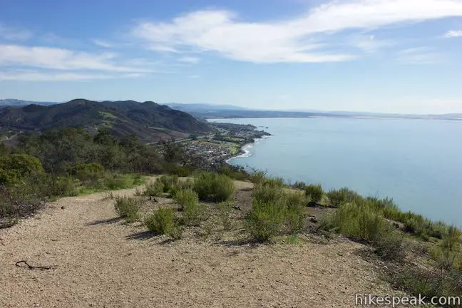
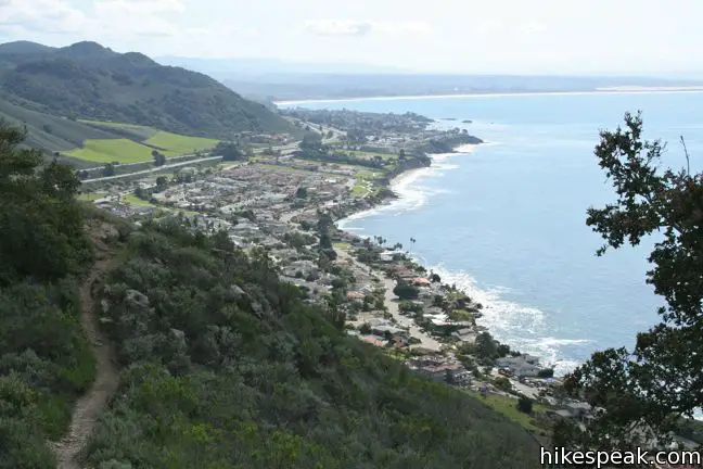
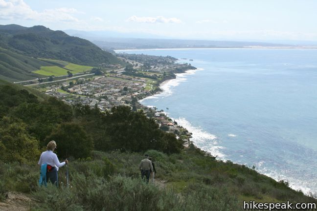
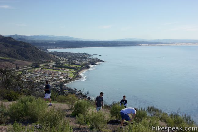
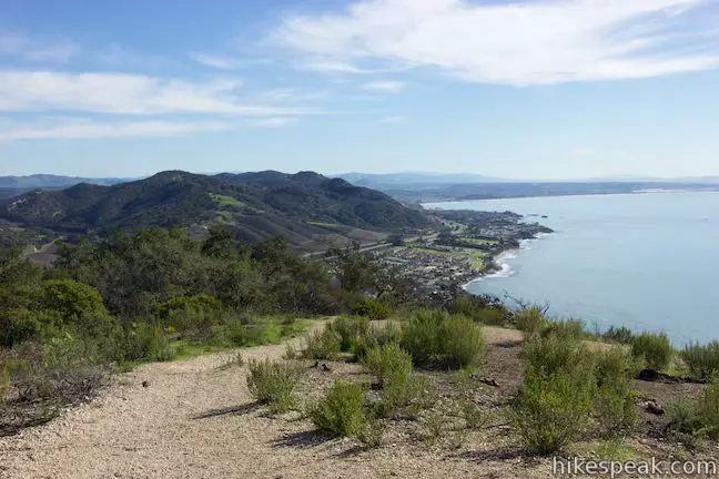
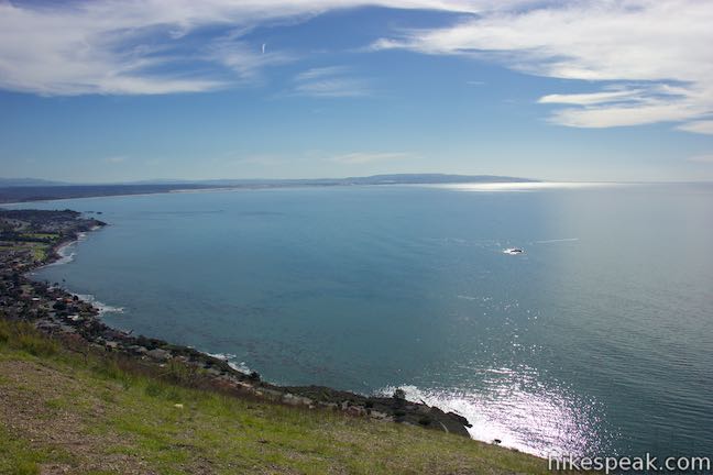
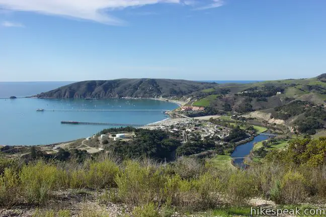
To the southeast, one can see clear across Pismo Beach toward the Guadalupe Dunes and Point Sal. Avila Beach appears to the west gracing San Luis Harbor. Pass through an installation of radio towers at the top of Ontario Hill and head down the other side.
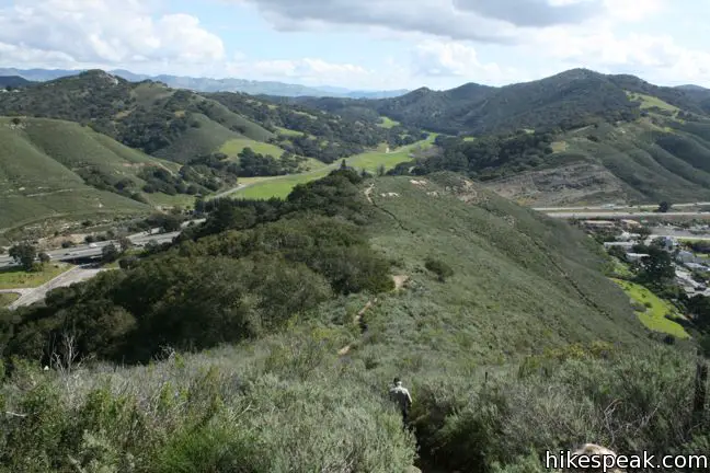
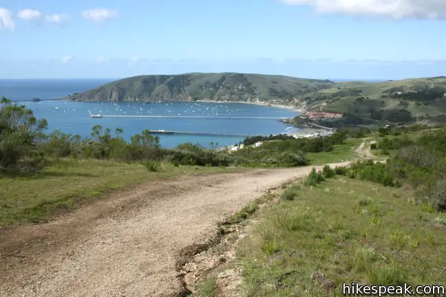
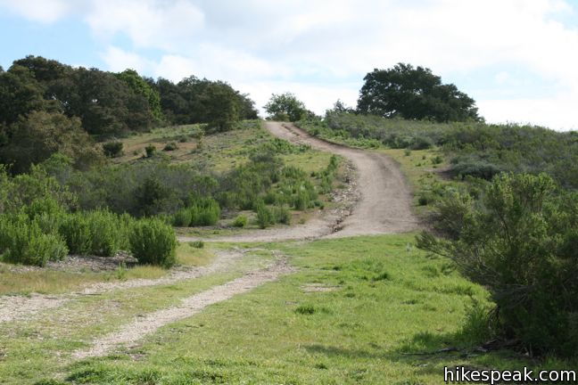
A quarter mile below the 735-foot summit, Ontario Ridge Trail arrives at a junction with Sycamore Crest Trail, a wide trail that travels down the north side of Ontario Hill to Sycamore Mineral Springs Resort in Avila Valley. This is a major junction, but is not marked with any trail signs.
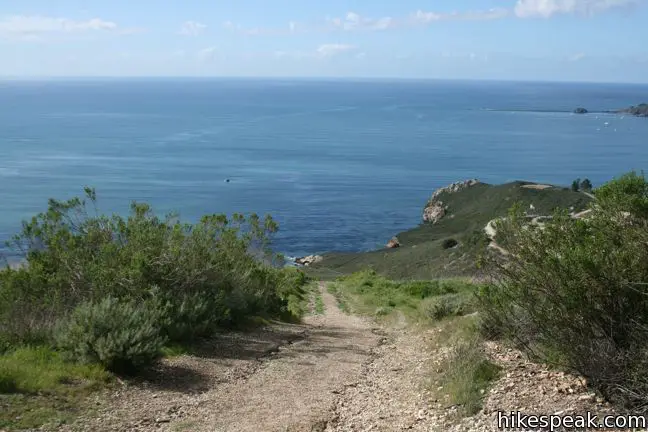
Beyond Sycamore Crest Trail, the trail along the ridge continues for 0.15 miles, ascending to a lower summit on the west end of Ontario Hill that has great views over Avila Beach. Just past the junction with Sycamore Crest Trail, another trail on the left drops back down to Cave Landing. To complete the loop, take this trail, which rapidly descends 500 feet toward Cave Landing Road over the last 0.4 miles. Upon returning to the trailhead, you could take a short half-mile hike to the end of Cave Landing to explore Pirate’s Cave
An ideal hike over Ontario Hill, which involves a car shuttle, begins by taking Sycamore Crest Trail up from the resort, and hiking east on Ontario Ridge Trail to Shell Beach, and then using the Bluff Trail to reach Cave Landing, where a second vehicle is used to drive 1.6 miles back to the resort. This route takes the most gradual ascent up Ontario Hill, avoiding challenging climbs from the east and west.
Directions to the Trailhead
Cave Landing Trailhead:
- From Highway 101, seven miles south of San Luis Obispo, take exit 195 on to Avila Beach Drive and head west for two miles toward Avila Beach.
- A mile before the beach town, turn left up Cave Landing Road.
- Drive half a mile to the end of the road and pull into the large dirt parking area on the left.
Shell Beach Drive Trailhead:
- From Highway 101, exit on Avila Beach Drive and turn south on Shell Beach Road, which runs down the west side of the freeway.
- Drive 1/3 of a mile and turn right on El Porto Drive.
- Continue west for 0.4 miles to the end of the road, and make a slight right on Indio Drive.
- Continue up to the cul-de-sac outside the private Bluff Drive, and turn left down to the parking lot.
Trailhead Location
Trailhead address: Cave Landing Trailhead, Cave Landing Road, San Luis Obispo, CA 93401
Trailhead coordinates: 35.1758, -120.7192 (35° 10′ 32.9″N 120° 43′ 09.1″W)
Trailhead address: Shell Beach Drive Trailhead, Indio Drive & Bluff Drive, Pismo Beach, CA 93449
Trailhead coordinates: 35.174558, -120.707748 (35° 10′ 28.40″N 120° 42′ 27.89″W)
View Avila Beach in a larger map
Or view a regional map of surrounding Central Coast trails and campgrounds.


 | Cave Landing This half-mile round trip hike descends 100 feet to a natural rock bridge at the end of a headland east of Avila Beach. |
 | Sycamore Crest Trail This 1.75-mile hike departs from Sycamore Mineral Springs Resort and ascends the north slope of Ontario Hill, arriving at a scenic ocean perch. Extend the hike down the ridge and create a 3.25-mile one-way hike. |
 | Bob Jones Bike Trail This easy 5-mile round trip hike or ride follows San Luis Obispo Creek to Avila Beach. |
 | Point San Luis Lighthouse via Pecho Coast Trail This docent-led 3.5-mile out and back hike crosses scenic coastal bluffs to reach the historic lighthouse on Point San Luis. |
 | Oso Flaco Lake Trail This hike of 2 miles or more takes a boardwalk over a coastal lake and across sand dunes to an out-of-the-way beach. |
 | More hikes in San Luis Obispo Explore other trails around San Luis Obispo including Morro Bay State Park, Montaña de Oro State Park, and the Morros. |
Common Questions about Shell Beach Bluff Trail – Ontario Ridge Trail Loop in Avila Beach and Shell Beach
- Is the trail open?
- Yes. You should expect to find that Shell Beach Bluff Trail – Ontario Ridge Trail Loop is open. There are no recent reports of trail closures. If you discover that the trail is closed, please help your fellow hikers by reporting a closure.
- Is this trail free to access?
- Yes, Shell Beach Bluff Trail – Ontario Ridge Trail Loop is free to access. No entrance fee, pass, or permit is required. If you discover that access rules have changed, please provide feedback on your experience.
- How much time does this hike take?
- It takes approximately 1 hour 30 minutes to hike Shell Beach Bluff Trail – Ontario Ridge Trail Loop. Individual hiking times vary. Add extra time for breaks and taking in the views.
- How long is this hike?
- The hike to Shell Beach Bluff Trail – Ontario Ridge Trail Loop is a 2.8 mile loop with 675 feet of elevation change.
- Are dogs allowed on this trail?
- Yes, dogs are allowed on Shell Beach Bluff Trail – Ontario Ridge Trail Loop. The trail is open to hikers, dogs.
- Are there ocean views on this hike?
- Yes, Shell Beach Bluff Trail – Ontario Ridge Trail Loop offers views of the ocean.
- Does this trail go to a summit?
- Yes, Shell Beach Bluff Trail – Ontario Ridge Trail Loop reaches a summit with panoramic views.
- Where is the trailhead located?
- The trailhead for Shell Beach Bluff Trail – Ontario Ridge Trail Loop is located in San Luis Obispo, CA.
Trailhead Address:
Cave Landing Road
San Luis Obispo, CA 93401
Trailhead Coordinates:
35.1758, -120.7192 - What are the driving directions to the start of the hike?
To get to the trailhead: Cave Landing Trailhead: From Highway 101, seven miles south of San Luis Obispo, take exit 195 on to Avila Beach Drive and head west for two miles toward Avila Beach. A mile before the beach town, turn left up Cave Landing Road. Drive half a mile to the end of the road and pull into the large dirt parking area on the left.
Shell Beach Drive Trailhead: From Highway 101, exit on Avila Beach Drive and turn south on Shell Beach Road, which runs down the west side of the freeway. Drive 1/3 of a mile and turn right on El Porto Drive. Continue west for 0.4 miles to the end of the road, and make a slight right on Indio Drive. Continue up to the cul-de-sac outside the private Bluff Drive, and turn left down to the parking lot.
View custom Google Maps directions from your current location.
- Are there other trails near Shell Beach Bluff Trail – Ontario Ridge Trail Loop?
- Yes, you can find other nearby hikes using the Hikespeak Hike Finder Map.

29 Comments on Shell Beach Bluff Trail – Ontario Ridge Trail Loop in Avila Beach and Shell Beach
What hikers are saying:
✨ Generated summary of user commentsHikers find the magnificent ocean views and 360-degree coastal vistas to be a primary highlight of this trek. Jon warns that the terrain is sandy with coarse stones, creating a significant slipping hazard on downhill sections. Navigating the loop by climbing the steepest hills first helps prevent dangerous falls on the loose ground. Be mindful of poison oak along the Sycamore Crest trail, particularly during the spring months.
“Sycamore Crest and the Ontario Ridge are absolutely gorgeous trails, but the steep trail down to Cave Landing is VERY steep.” Jump to comment ↓
Great website for central coast hikes. Thanks for the good info and photos!
This is fantastic information. I’m going to try it today. Thanks for sharing.
Are leashed dogs allowed?
Did you end up finding out if leashed dogs are allowed? Thx!
While visiting the area, we walked the Shell Beach Bluff trail from Pirates Cave parking lot, as well as the trail to Pirate’s Cave, with our dog on leash; along the way, we passed several others (presumably locals) with dogs — both on and off-leash. Once on the neighborhood streets, we passed a few more dog walkers (all with dogs on leash). Not conclusive necessarily, but I think dogs are OK. (Of course I’d recommend that they stay under control, leashed or otherwise, and of course we should all pick up after them!)
I took my dog with me on this hike pretty often, and we always ran into other dogs. I would unleash my dog because she preferred to hike without a leash and wouldn’t wander too far from me, but I’ve seen plenty of dogs both on and off-leash.
Yes, leased dogs are allowed. Heads up, many people hike with their dogs unleased. I hike this once a week.
I love this trail!
Ontario Ridge contains a network of trails offering a variety of hikes. I use it as a tuneup hike to keep in shape. I try to do it at least once or twice a week since it’s close to my house. The views are magnificent. You can see albums of hikes including two of Ontario Ridge on my polecats.org website.
[…] Week 1 – Shell Beach Bluff Trail – Ontario Ridge Trail Loop […]
the ontario ridge is a beautiful hike for people of all ages and great for families….i hike this ridge with my 9 year old daughter and we see other families doing the same every weekend ….this is also my work out area during the week…this beautiful ridge is being closed to the public….what can we do
The public has acquired a prescriptive easement over this wonderful hiking trail on Ontario Ridge. Unfortunately, the new property owners are trying to close public access, and have started building a fence to block the trail. The California Coastal Commission is in the position to enforce our public access and require the property owners to keep the trail open, and is asking hikers to submit a declaration of public use. You can find the declaration here: OntarioRidge_PrescriptiveRights.pdf
It’s imperative that we all print the declaration, fill in the information, sign it and mail it to the Coastal Commission ASAP. Tell your friends and fellow hikers. Help the Coastal Commission fight this closure!
This is (was) a great short hike. The fences blocking the trail need to be removed. The Coastal Commission will be conducting a hearing on the illegal fencing on February 13, 2014, for those that cannot make it to the hearing what can be done to convince the Coastal Commission to force the property owner to take down this Gestapo like fence. I have used this trail for years and filled out the declaration of public use, is there anything else that we can do to keep this trail open?
Are dogs allowed on this trail?
Did this hike today – took about 2 hours for the full loop from Sycamore Resort’s parking lot. Sycamore Crest and the Ontario Ridge are absolutely gorgeous trails, but the steep trail down to Cave Landing is VERY steep. If you have any knee problems (or younger kids) it would be best to avoid this leg of the loop. There is also a LOT of poison oak on the Sycamore Crest Trail, and it is in full bloom during the spring. Besides those minor inconveniences, this is a primo hike to get 360 views of SLO, Avila, and Pismo Beach. Gorgeous flowers dot the trail, and there is a dynamic amount of full sun and full shade. A great place to go as a visitor of the area.
Hike
[…] This trail is the backside trail to one of our first hikes – the Ontario Ridge. The Ontario Ridge trail will forever be one of my favorite hikes with its heart-pounding course and stunning views, […]
Great description of what looks like an excellent place to hike! Also it has tons of scenic views of the water! Loved all of the pictures. Will definitely check out more on this website
Is the full loop available or do the fences mentioned in the prior posts remain? If the fencing remains, what section is blocked?
I believe progress has been made in the battle to keep this trail open to the public (permanently) and the fencing should all be removed. Please share if you have any issues accessing the trail.
Parked at Pirates Cove and started at the STEEP hill. The rest of the hike was primarily down hill. Beautiful views of the ocean all along the way. Going to start the hike next time heading south along Shell Beach.
We started at sycamore trail, went down the steep trail to Cave’s landing, continued on Bluff trail and then up on Ontario ridge, on the crests. For me it was better to do it this way since I have bad knees and climbing up from Cave landing at the end would have killed me, since I am a beginning hiker. I saw a man trying to climb up that steep hill with his mountain bike but he gave up after 5 minutes….
This is probably my favorite hike in SLO county so far. Here is my encounter with the trail, including where we parked, personal advice for the trek, and lots of pictures!
https://adulthoodinslo.wordpress.com/2016/02/10/bucketlist-post-19-hike-the-avila-ridge-trail/
URGENT! THE HEARING TO MOVE THE TRAIL HAS BEEN CONTINUED TO JANUARY 12! ALERT! Ontario Ridge Trail faces closure, RETURN OF BARBED WIRE FENCES! The SLO County Planning Commission will hold a hearing January 12, 9 AM. Stand up! Show up! Write letters to planning commissioners to keep trail where it is! Don’t let this be a “don’t know what you’ve got til it’s gone” story! The views we love, and the trail we cherish will be lost forever to the public if we don’t join together to stop this travesty! WRITE THE PLANNING COMMISSION TO TELL THEM WE NEED THE TRAIL TO STAY WHERE IT IS! Use this form https://www.slocounty.ca.gov/planning/staff/PCForm.htm
And please attend the hearing on January 12!
[…] Here is a link to what we were trying to hike: https://www.hikespeak.com/trails/shell-beach-bluff-trail-ontario-ridge-avila/ […]
The trail is completely safe, the owners Kevin McCarthy are bullying people telling everybody the trail is unsafe because they want to build a mega million dollar mansion directly on the trail area facing the pirates cove side. It is a community access trail which they bought the property in 2008 with acknowledgement that the property has to be continued to be allowed for public access but here we are in 2017 and they making false claims the trail is dangerous when there has never been one injury reported and two, they are not responsible for injury anyway because it is public access anyway which is on the hiker not the property owners.
So shame on you Kevin McCarthy
Is the trail still open? We’d like to hike it next week (July 31, 2018).
Amazing hike! However I 100% disagree with the author on the optimal direction to take on the loop. Yes, it is tough to climb up to Ontario Ridge right off the bat, but it is a lot tougher for most people to safely descend down from Ontario Ridge if they take the opposite route. The ground is very sandy with course stones mixed in, so it’s very common for people to slip/fall on the way down. I’ve done it that way twice, and it involved either a fall or severe frustration from my hiking partner. You end up having to do a zig zag pattern to get down safely. Yesterday I did the opposite of what is suggested and it was great, aside from the first 15 minutes being pretty tough, the rest of the hike comparitively easy with pleasant downhill slopes and views.
What about EBikes on the trails. We are heading up there soon.