Froom Creek Trail Irish Hills San Luis Obispo hike Froom Canyon
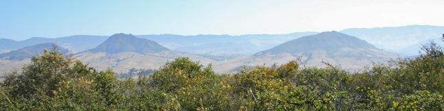
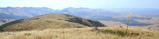
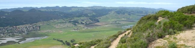
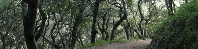
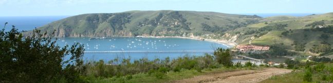
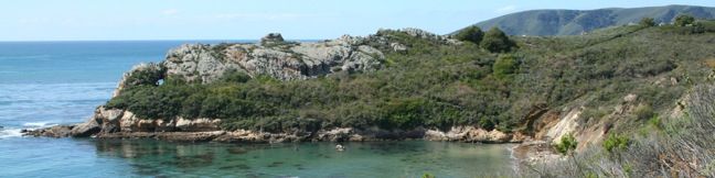
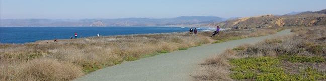
On the east side of the Irish Hills, there is a canyon with a surprisingly southwestern feel. Though surrounded by traditional coastal chaparral, the trail follows an old road up a canyon akin to the old mining roads converted into hiking trails found in the California desert. Above the canyon, there are broad views of San Luis Obispo's most prominent Morros, Bishop Peak and Cerro San Luis. ... Read more.
OK! Add to trails I’ve hiked
OK! Add to trails I want to hike
Tagged with · Free Trails · Irish Hills
Distance: 3 miles · Elevation change: 500 feet
By: Published: Last updated: April 2, 2019
Morro View Irish Hills hike San Luis Obispo Mariposa Trail Prefumo Canyon Irish Hills Natural Reserve hiking SLO
An expansive network of trails explore the thousand-foot ridges that make up the Irish Hills southwest of San Luis Obispo. While the regions notable chain of volcanic peaks gather greater attention from hikers, you can actually get a great view of the Morros from the Irish Hills, with smaller crowds. From Prefumo Canyon, one of the two main trailheads in the Irish Hills Natural Reserve,... Read more.
OK! Add to trails I’ve hiked
OK! Add to trails I want to hike
Tagged with · Free Trails · Irish Hills
Distance: 3.15 miles · Elevation change: 850 feet
By: Published: Last updated: April 2, 2019
Reservoir Canyon Trail summit hike Reservoir Creek Falls San Luis Obispo California Reservoir Canyon Natural Reserve hiking Murray Hill
From a less heralded summit in the Santa Lucia Foothills northeast of San Luis Obispo, you will find triumphant views of the peaks and valleys surrounding this gem on the Central Coast. The hike from Reservoir Canyon to this 1,715-foot crown is not for the meek. The 5.35-mile round trip hike ascends 1,350 feet, and over 800 of those feet come in the final grueling mile. The effort is... Read more.
OK! Add to trails I’ve hiked
OK! Add to trails I want to hike
Tagged with · Creeks · Free Trails · Reservoir Canyon Natural Reserve · Summits · Waterfalls
Distance: 5.35 miles · Elevation change: 1350 feet
By: Published: Last updated: February 13, 2019
Lemon Grove Loop Trail San Luis Obispo hike Cerro San Luis Madonna Mountain Lemon Grove Loop Trail Hike
This 2.2-mile loop explores a 120-acre open space between Cerro San Luis and downtown San Luis Obispo. With just three hundred feet of elevation gain, this is a quick hike on its own, or an easy extension to the steeper trek up Cerro San Luis. The abandoned lemon grove that gives the trail its name is becoming more of a destination thanks to the planting of new trees. The open skies and... Read more.
OK! Add to trails I’ve hiked
OK! Add to trails I want to hike
Tagged with · Free Trails · Morros
Distance: 2.2 miles · Elevation change: 300 feet
By: Published: Last updated: May 13, 2025
Cerro San Luis Mountain Summit trail San Luis Obispo Hike Madonna Mountain
Located just west of downtown San Luis Obispo, the 1,292-foot Cerro San Luis (or San Luis Mountain) offers sweeping views over the city and surroundings. Cerro San Luis is a member of the Morros, or Nine Sisters, a chain of prominent volcanic peaks stretching east from Morro Bay. These beautiful peaks set the postcard-like backdrop for San Luis Obispo and are excellent places to hike. ... Read more.
OK! Add to trails I’ve hiked
OK! Add to trails I want to hike
Tagged with · Free Trails · Morros · Summits
Distance: 4 miles · Elevation change: 1100 feet
By: Published: Last updated: May 13, 2025
Sycamore Crest Trail - Ontario Hill - Avila Valley - Sycamore Mineral Springs Resort hike
Sycamore Crest Trail is a wide dirt road on the north slope of Ontario Hill, which runs east to west between Shell Beach and Avila Beach. Beginning from Sycamore Mineral Springs Resort in Avila Valley, the trail climbs through a lush oak grove to reach a junction with Ontario Ridge Trail at a south-facing saddle with lofty ocean views. Sycamore Crest Trail serves as a 1.75-mile out and back... Read more.
OK! Add to trails I’ve hiked
OK! Add to trails I want to hike
Tagged with · Avila Valley · Free Trails · Ocean Views
Distance: 1.75 miles · Elevation change: 575 feet
By: Published: Last updated: May 13, 2025
Ontario Hill Ridge Trail Shell Beach Bluff Trail Avila hike ontario ridge to pirate's cove
Two parallel but varied trails explore the coast between Shell Beach and Avila Beach in San Luis Obispo County. Shell Beach Bluff Trail is an easy, wheelchair-friendly paved trail overlooking a picturesque cove. Ontario Ridge Trail is a rugged, sometimes-steep track crossing a 700-foot hill above the bluff. Put these two together for a 2.8-mile loop with 675 feet of elevation change and... Read more.
OK! Add to trails I’ve hiked
OK! Add to trails I want to hike
Tagged with · Free Trails · Ocean Views · Pismo Beach · Summits
Distance: 2.8 miles · Elevation change: 675 feet
By: Published: Last updated: June 2, 2017
Pirates Cave Trail Avila Beach Cave Landing Pirate Cove Whales Cave hike
This half-mile round trip hike visits a small rock bridge at the end of a dramatic headland east of Avila Beach. The hike down Cave Landing to the natural tunnel sometimes called Pirate's Cave provides outstanding coastal views over the beach cities of San Luis Obispo County. This is a short, easy, and enjoyable trek with 100 feet of elevation change - a perfect excursion for anyone staying... Read more.
OK! Add to trails I’ve hiked
OK! Add to trails I want to hike
Tagged with · Avila Beach · Free Trails · Ocean Views
Distance: 0.5 miles · Elevation change: 100 feet
By: Published: Last updated: June 2, 2017
Point Buchon Trail Los Osos Montaña de Oro State Park PG&E opened Point Buchon Trail headland Point Buchon San Luis Obispo California
South of Los Osos and Montaña de Oro State Park is a stunning stretch of coastline that includes the historic headland Point Buchon. The area was closed to the public until 2007 when the landowner, Pacific Gas and Electric Company, opened Point Buchon Trail and began allowing hikers to access the picturesque waterfront. Similar to the Bluff Trail in Montaña de Oro State Park, Point Buchon... Read more.
OK! Add to trails I’ve hiked
OK! Add to trails I want to hike
Tagged with · California State Parks · Free Trails · Los Osos · Ocean Views · Montaña de Oro State Park
Distance: 6.8 miles · Elevation change: 75 feet
By: Published: Last updated: June 2, 2017
Bluff Trail in Montaña de Oro State Park Bluff Trail Hike Montana de Oro State Park
Montaña de Oro State Park preserves 8,000 acres along the picturesque coast of San Luis Obispo County. This park is like a slice of Big Sur, located between Avila Beach and Morro Bay. Montaña de Oro State Park is a popular destination for beach-goers, hikers, mountain bikers, and horseback riders. The dramatic shoreline and thousand-foot mountains provide scenic setting for a host of great... Read more.
By: Published: Last updated: April 16, 2022