Santa Paula Canyon Trail The Punchbowl Hike Santa Paula Canyon Punch Bowls Big Cone Camp East Fork Trail Los Padres National Forest Topatopa Mountains California
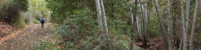
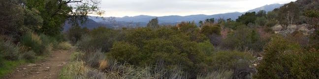
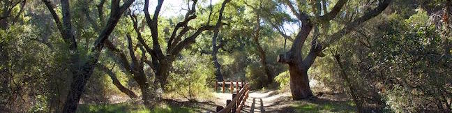
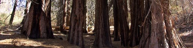
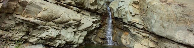
Framed by tall, rugged ridges in the Topatopa Mountains, Santa Paula Creek slices through the rockbed of Santa Paula Canyon, carving out alluring pools and cascades called the Punchbowl (or Punch Bowls). Finishing with a flourish, the Punchbowl has a 25-foot waterfall and a pool that you can relax beside. The Punchbowl is located between Big Cone Camp and Cross Camp, two Los Padres... Read more.
My Hikes: Completed hikeA green icon of shows a picture of a landscape with a check mark in the upper right corner, signifying that this is a hike you would like to put on your completed list.OK! Add to trails I've hiked
My Hikes: Want to hikeA green icon of shows a picture of a landscape with a heart in the upper right corner, signifying that this is a hike you would like to put on your to-do list.OK! Add to trails I want to hike
TagsA green icon depicting a tags represents a list of words and phrases that this content is tagged with Tagged with · Creeks · Free Trails · Los Padres National Forest · Off Trail · Santa Paula · Topatopa Mountains · Trail Camp · Waterfalls
Hike DistanceA green icon of a hiker used to label information about the length of the hike Distance: 8 miles · Elevation change: 800 feet
By: Published: Last updated: May 13, 2025
Sisar Canyon Trail Hike Sisar Canyon Road Summit Ojai Santa Paula California Los Padres National Forest Sisar Creek Hike
Sisar Canyon cuts into the mountains above Upper Ojai Valley, halfway between Ojai and Santa Paula. A wide dirt trail travels up the canyon toward Topatopa Ridge, a striking bluff of striped rock. Rather than taking Sisar Canyon Trail (also known as Sisar Canyon Road) deep into the Topatopa Mountains, turn around at an overlook 2.75 miles up the trail for a picturesque day hike. Limited... Read more.
My Hikes: Completed hikeA green icon of shows a picture of a landscape with a check mark in the upper right corner, signifying that this is a hike you would like to put on your completed list.OK! Add to trails I've hiked
My Hikes: Want to hikeA green icon of shows a picture of a landscape with a heart in the upper right corner, signifying that this is a hike you would like to put on your to-do list.OK! Add to trails I want to hike
TagsA green icon depicting a tags represents a list of words and phrases that this content is tagged with Tagged with · Creeks · Free Trails · Los Padres National Forest · Ojai · Santa Paula · Topatopa Mountains · Upper Ojai Valley
Hike DistanceA green icon of a hiker used to label information about the length of the hike Distance: 6.5 miles · Elevation change: 1200 feet
By: Published: Last updated: April 17, 2017
Horn Canyon Trail Hike Ojai California Los Padres National Forest Thacher Creek Canyon Thacher School Trailhead
Horn Canyon Trail rises into the frontcountry of the Topatopa Mountains from Ojai, California. While you can spend a full day (and a full workout) hiking up Horn Canyon Trail, you can also opt for the shorter option described here, trekking up the trail's moderate opening mile, past multiple creek crossings and views down Ojai Valley, before venturing off trail up the canyon bottom past... Read more.
My Hikes: Completed hikeA green icon of shows a picture of a landscape with a check mark in the upper right corner, signifying that this is a hike you would like to put on your completed list.OK! Add to trails I've hiked
My Hikes: Want to hikeA green icon of shows a picture of a landscape with a heart in the upper right corner, signifying that this is a hike you would like to put on your to-do list.OK! Add to trails I want to hike
TagsA green icon depicting a tags represents a list of words and phrases that this content is tagged with Tagged with · Creeks · Free Trails · Los Padres National Forest · Off Trail · Ojai · Topatopa Mountains
Hike DistanceA green icon of a hiker used to label information about the length of the hike Distance: 2.9 miles · Elevation change: 750 feet
By: Published: Last updated: April 17, 2017
Oak Creek Canyon Loop Trail Los Robles Open Space Thousand Oaks California Santa Monica Mountains
Oak Creek Canyon Trail is a rather special trail in Los Robles Open Space that is designed for the blind as well as the sighted. The all-access nature trail has a dozen and a half signs in English and Braille. While blind hikers will probably want to turn around at the end of the guide fence, for a 0.55 mile hike with 50 feet of elevation change, others may continue on to a loop trail for a... Read more.
My Hikes: Completed hikeA green icon of shows a picture of a landscape with a check mark in the upper right corner, signifying that this is a hike you would like to put on your completed list.OK! Add to trails I've hiked
My Hikes: Want to hikeA green icon of shows a picture of a landscape with a heart in the upper right corner, signifying that this is a hike you would like to put on your to-do list.OK! Add to trails I want to hike
TagsA green icon depicting a tags represents a list of words and phrases that this content is tagged with Tagged with · Free Trails · Los Robles Open Space · Nature Trails · Thousand Oaks · Dog-Friendly Trails · Mountain Biking Trails · Santa Monica Mountains
Hike DistanceA green icon of a hiker used to label information about the length of the hike Distance: 0.8 miles · Elevation change: 100 feet
By: Published: Last updated: December 7, 2018
Cedar Grove and Vista View Point Hike Vista Del Valle Drive Griffith Park Helipad Los Angeles California
Away from many of the tourists drawn to Griffith Park's great landmarks (like Griffith Observatory and the Hollywood Sign), you'll find locals enjoying views of their city from Vista View Point, also know as the helipad site. This overlook along Vista Del Valle Drive presents a broad perspective over downtown Los Angeles, Hollywood, and Griffith Park sites like the Greek Theater and the... Read more.
My Hikes: Completed hikeA green icon of shows a picture of a landscape with a check mark in the upper right corner, signifying that this is a hike you would like to put on your completed list.OK! Add to trails I've hiked
My Hikes: Want to hikeA green icon of shows a picture of a landscape with a heart in the upper right corner, signifying that this is a hike you would like to put on your to-do list.OK! Add to trails I want to hike
TagsA green icon depicting a tags represents a list of words and phrases that this content is tagged with Tagged with · Free Trails · Hollywood · Dog-Friendly Trails · Griffith Park · Santa Monica Mountains
Hike DistanceA green icon of a hiker used to label information about the length of the hike Distance: 2.3 miles · Elevation change: 400 feet
By: Published: Last updated: May 13, 2025
Yurok Loop Trail Hidden Beach Hike California Coastal Trail Redwood National Park Klamath Lagoon Creek Picnic Area
Up near the Oregon border, the north coast of California has beautiful unrefined features like driftwood-covered coves and mossy forests. Explore this inviting area on Yurok Loop Trail, a short hike through scenic surroundings. This 1.15-mile circuit passes an ocean vista along a dramatic coastline that faces a cluster of rock islands. The loop crosses a small wooded ridge, overlooking a... Read more.
My Hikes: Completed hikeA green icon of shows a picture of a landscape with a check mark in the upper right corner, signifying that this is a hike you would like to put on your completed list.OK! Add to trails I've hiked
My Hikes: Want to hikeA green icon of shows a picture of a landscape with a heart in the upper right corner, signifying that this is a hike you would like to put on your to-do list.OK! Add to trails I want to hike
TagsA green icon depicting a tags represents a list of words and phrases that this content is tagged with Tagged with · Beaches · California Coastal Trail · Crescent City · Free Trails · Klamath · Ocean Views
Hike DistanceA green icon of a hiker used to label information about the length of the hike Distance: 2.25 miles · Elevation change: 120 feet
By: Published: Last updated: May 13, 2025
Drury-Chaney Loop Trail Hike Humboldt Redwoods State Park California
Drury-Chaney Loop Trail (also known simply as Drury-Chaney Trail) presents a easy and well graded hike through redwoods in Humboldt Redwoods State Park. The trail is a lollipop loop suitable for wheelchairs and strollers, crossing a surface of compact gravel with 100 feet of elevation change. The 2.4-mile length of this hike splits neatly into three sections: a 0.8-mile long access trail to... Read more.
My Hikes: Completed hikeA green icon of shows a picture of a landscape with a check mark in the upper right corner, signifying that this is a hike you would like to put on your completed list.OK! Add to trails I've hiked
My Hikes: Want to hikeA green icon of shows a picture of a landscape with a heart in the upper right corner, signifying that this is a hike you would like to put on your to-do list.OK! Add to trails I want to hike
TagsA green icon depicting a tags represents a list of words and phrases that this content is tagged with Tagged with · California State Parks · Free Trails · Humboldt Redwoods State Park · Pepperwood · Redwood Groves
Hike DistanceA green icon of a hiker used to label information about the length of the hike Distance: 2.25 miles · Elevation change: 120 feet
By: Published: Last updated: April 1, 2017
Grieg-French-Bell Trail Girdled Tree Hike Humboldt Redwoods State Park California
Grieg-French-Bell Trail provides access to lovely grove of coast redwoods in Humboldt Redwoods State Park. The ground in this area is covered by a carpet of redwood sorrel that is incredibly beautiful to walk through. Within French Grove, you'll find the Girdled Tree, which had its bark removed to 1901 so that it could be displayed in San Francisco. Use Grieg-French-Bell Trail for a... Read more.
My Hikes: Completed hikeA green icon of shows a picture of a landscape with a check mark in the upper right corner, signifying that this is a hike you would like to put on your completed list.OK! Add to trails I've hiked
My Hikes: Want to hikeA green icon of shows a picture of a landscape with a heart in the upper right corner, signifying that this is a hike you would like to put on your to-do list.OK! Add to trails I want to hike
TagsA green icon depicting a tags represents a list of words and phrases that this content is tagged with Tagged with · California State Parks · Free Trails · Humboldt Redwoods State Park · Pepperwood · Redwood Groves
Hike DistanceA green icon of a hiker used to label information about the length of the hike Distance: 0.5 miles · Elevation change: 25 feet
By: Published: Last updated: April 1, 2017
Griffith Observatory to the Hollywood Sign Directions Griffith Park hike Los Angeles California
Are you trying to get from the Griffith Observatory to the Hollywood Sign? Perhaps Google Maps lead you to Griffith Observatory when you were trying to get driving directions to the Hollywood Sign or maybe you are just eager to hike between Griffith Park's two biggest landmarks. It is possible to walk from Griffith Observatory to the Hollywood Sign. However, the route is not direct and... Read more.
My Hikes: Completed hikeA green icon of shows a picture of a landscape with a check mark in the upper right corner, signifying that this is a hike you would like to put on your completed list.OK! Add to trails I've hiked
My Hikes: Want to hikeA green icon of shows a picture of a landscape with a heart in the upper right corner, signifying that this is a hike you would like to put on your to-do list.OK! Add to trails I want to hike
TagsA green icon depicting a tags represents a list of words and phrases that this content is tagged with Tagged with · Free Trails · Summits · Griffith Park · Santa Monica Mountains
Hike DistanceA green icon of a hiker used to label information about the length of the hike Distance: 8.8 miles · Elevation change: 575 feet
By: Published: Last updated: May 13, 2025
Heaps Peak Arboretum Sequoia Trail San Bernardino Mountains Nature Trail San Bernardino National Forest Arboretum hike Lake Arrowhead California
Get to know the plants, animals, and natural history of Southern California at Heaps Peak Arboretum. Located near Lake Arrowhead, the arboretum is a developed piece of San Bernardino National Forest. Sequoia Trail is the main trail through Heaps Peak Arboretum, covering 3/4 of a mile with 90 feet of elevation change. The star of the trail is a planted grove of sequoiadendron giganteum, or... Read more.
My Hikes: Completed hikeA green icon of shows a picture of a landscape with a check mark in the upper right corner, signifying that this is a hike you would like to put on your completed list.OK! Add to trails I've hiked
My Hikes: Want to hikeA green icon of shows a picture of a landscape with a heart in the upper right corner, signifying that this is a hike you would like to put on your to-do list.OK! Add to trails I want to hike
TagsA green icon depicting a tags represents a list of words and phrases that this content is tagged with Tagged with · Adventure Pass · Arboretums · Lake Arrowhead · Nature Trails · San Bernardino Mountains · San Bernardino National Forest · Skyforest
Hike DistanceA green icon of a hiker used to label information about the length of the hike Distance: 0.75 miles · Elevation change: 90 feet
By: Published: Last updated: May 13, 2025