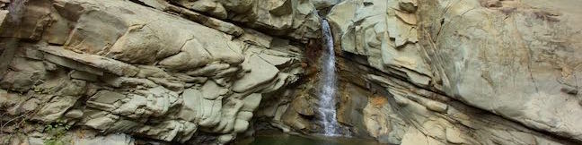
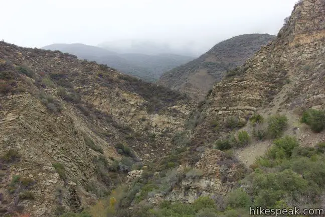
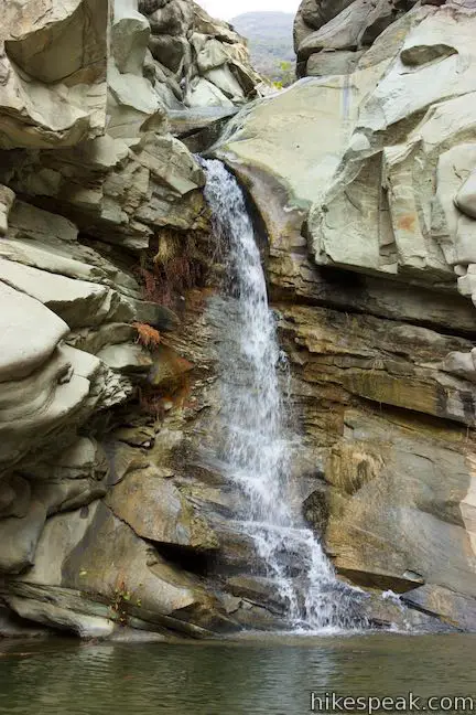
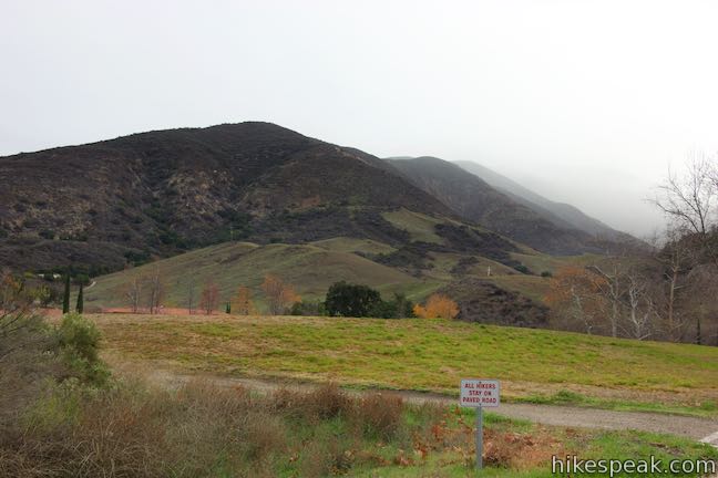
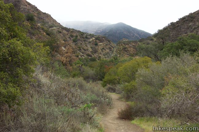
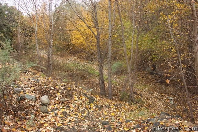
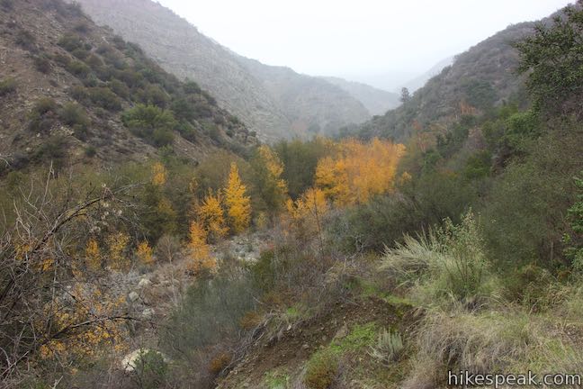
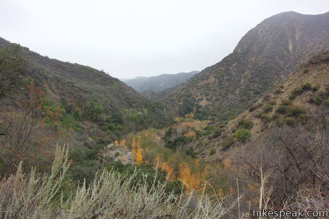
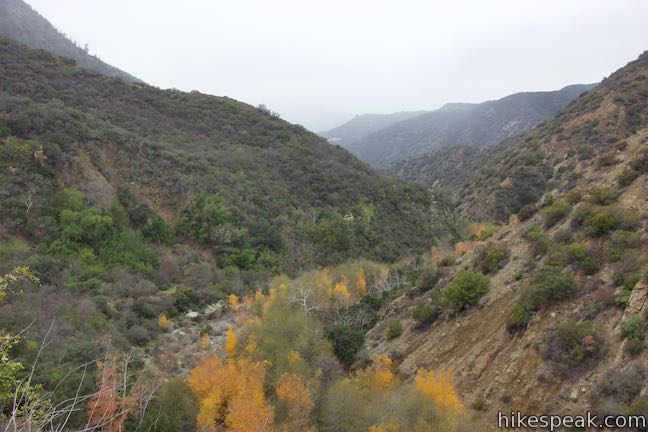
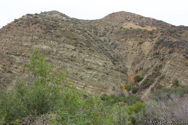
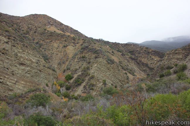
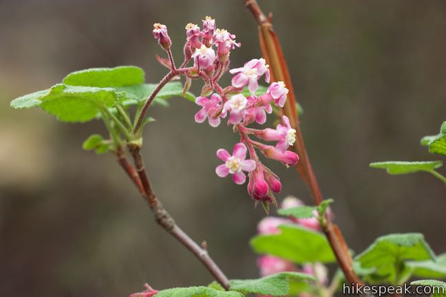
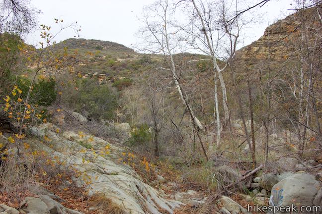
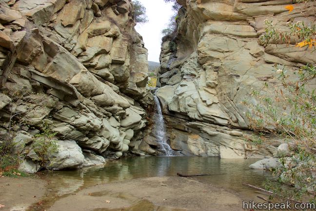
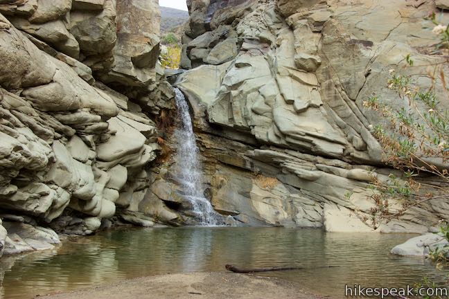
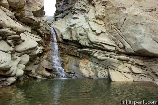
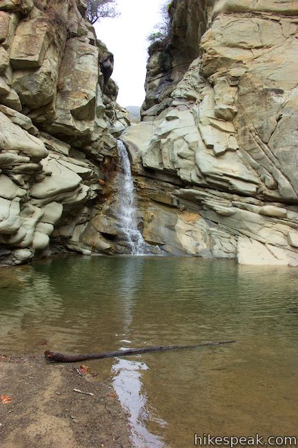
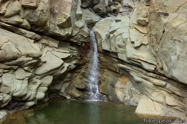
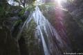
Framed by tall, rugged ridges in the Topatopa Mountains, Santa Paula Creek slices through the rockbed of Santa Paula Canyon, carving out alluring pools and cascades called the Punchbowl (or Punch Bowls). Finishing with a flourish, the Punchbowl has a 25-foot waterfall and a pool that you can relax beside.
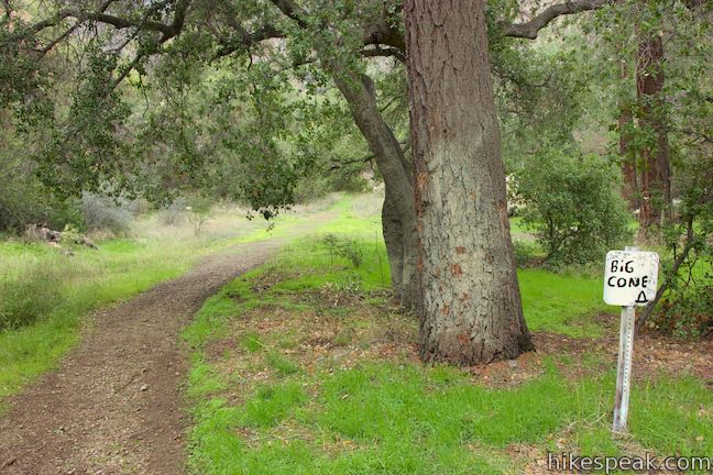
The Punchbowl is located between Big Cone Camp and Cross Camp, two Los Padres National Forest Campgrounds on the East Fork of Santa Paula Canyon. Take an 8-mile round trip hike from Route 150 in Santa Paula up Santa Paula Canyon Trail to Big Cone Camp and the Punchbowl. Eight hundred vertical feet separate the high and low points of this hike, but several undulations in the trail demand extra effort.

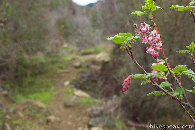
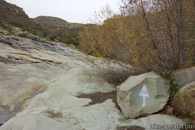
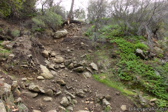
Despite the popularity of Santa Paula Canyon, sections of the trail are hard to follow, so pay closes attention to the direction.
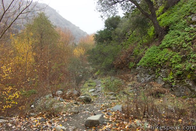
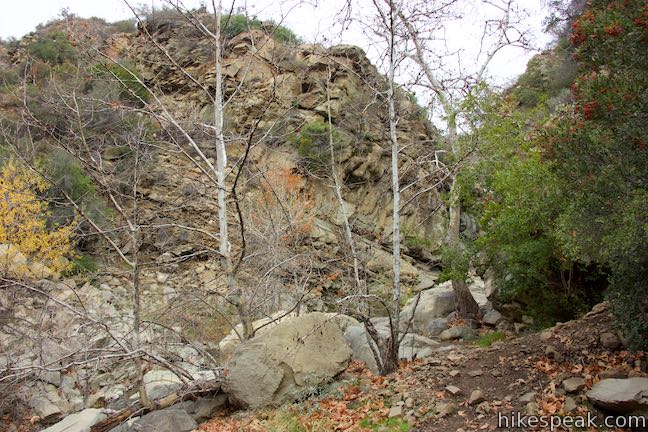
After bordering its creek, Santa Paula Canyon Trail rises to Big Cone Camp, which is cradled on a shaded terrace on the side of the canyon. Instead of following the trail all the way, hikers may persist up the canyon bottom and forge a route up Santa Paula Creek to Punchbowl Falls. Though this popular alternative trims about a third of a mile from the distance to the waterfall, progress is slower than taking the actual trail.
A major drawback for Santa Paula Canyon Trail was that you had to walk 1.3 miles over pavement from Route 150, around the campus of Thomas Aquinas College, and through ranch properties to reach the start of the trail. This wasn’t so bad for day hikers, but for anyone carrying a heavy pack to stay overnight, the long, paved prelude to Santa Paula Canyon Trail could be a real kill joy. Not Anymore!
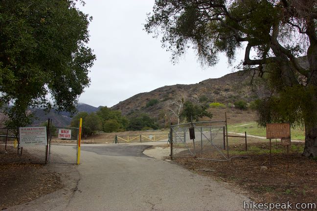
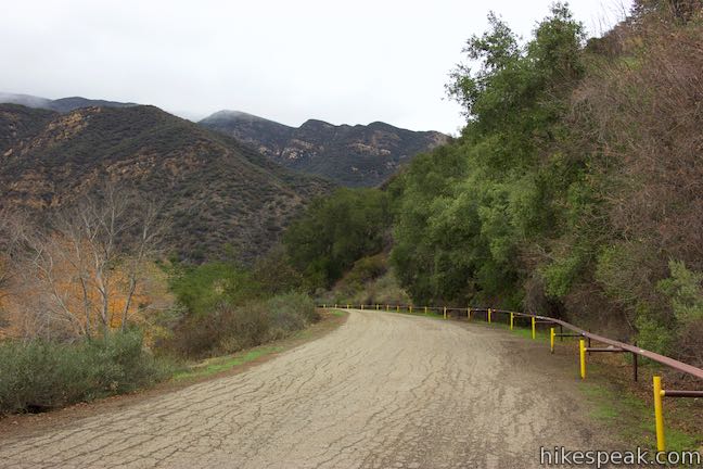
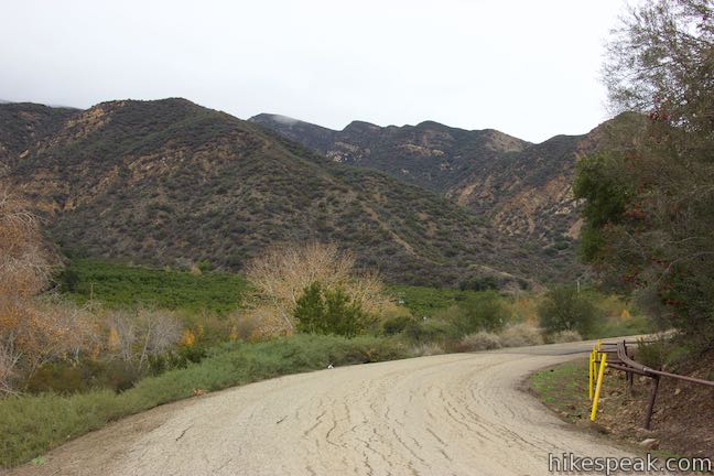
Update: Thomas Aquinas College obtained more land along Santa Paula Canyon and established a trail that starts at Route 150 (North Ojai Road) and goes right up the wooded canyon along the creek instead of taking a tour around the campus. A new parking area was added on the north side of Route 150, so hikers no longer need to cross the road after parking.
- Read a VC Star article about the trail upgrade.
More information about the new trail will be added to this write-up as soon as possible. Please ignore any directions that no longer apply. The 2017 Thomas Fire also have altered aspects of this hike.
The turn-by-turn directions for the hike to the Punchbowl are:
- Leave the parking area, cross Route 150, and walk west across a bridge over Santa Paula Creek (0 miles)
- Turn right to enter Thomas Aquinas College (0.08 miles)
- Turn right on the road around the east side of campus (0.15 miles)
- Turn right up another paved road to Ferndale Ranch (0.67 miles)
- Pass through a gate and bear left (0.7 miles)
- Stay to the left past a road on the right (0.8 miles)
- Descend a hillside and bear right at a split in the road (0.87 miles)
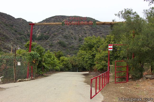
- Follow the road through Rancho Recuerdo avocado grove, making a right turn just after the identifying gate (1.05 miles)
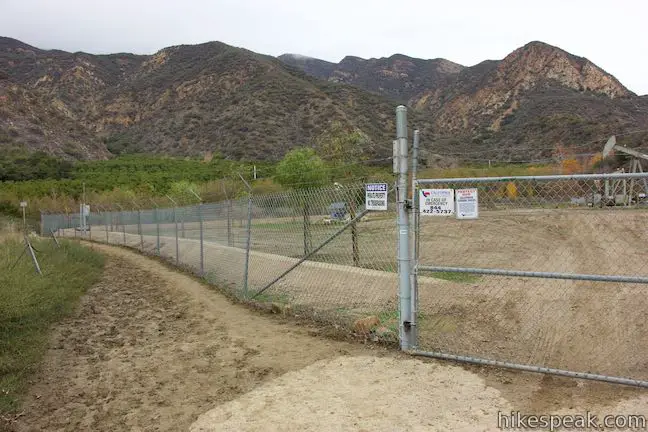
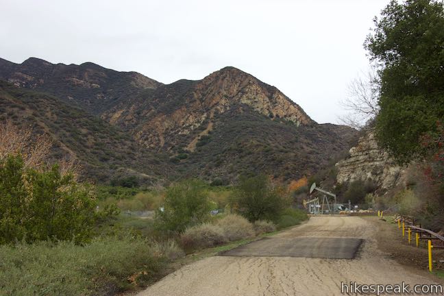
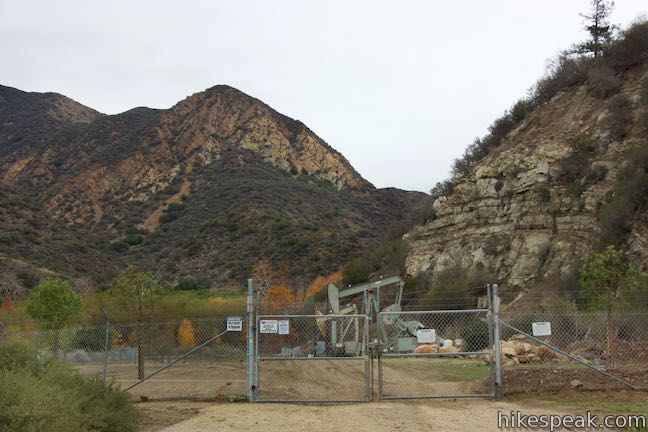
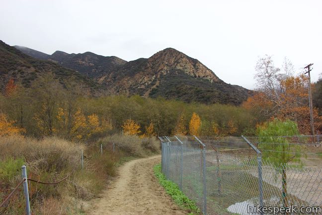
- When the pavement ends, bear left and follow a dirt trail along the side of a fenced-off drilling area (1.3 miles)
- Meet Santa Paula Canyon Trail on the far side of the fence (1.45 miles)
- Cross Santa Paula Creek and bear right to head upstream (1.5 miles)
- Cross a road rising to the left to remain along the creek (1.75 miles)
- Pass through an oaky area and turn left up the wide, gravel canyon bottom (2.15 miles)
- Follow the trail as it rises to the left and then bear right on a wider trail (2.35 miles)
- Reach a shaded log at the end of the wide stretch of trail, coming just before an important, but faint junction (2.5 miles)
- Bear right, cross Santa Paula Creek, and proceed up the trail on the other side alternatively, you can remain on the west side of the canyon and forge a route to Punchbowl Falls (2.53 miles)
- Bear right at a split to head up the side of the canyon (2.73 miles)
- Bear right again to continue up the side of the canyon (3 miles)
- Pass through Big Cone Camp (3.65 miles)
- Descend to a junction with trails to the bottom and top of the Punchbowl (3.75 miles)
- Bear left to descend a ravine toward the main fork of Santa Paula Canyon just below Punchbowl Falls. Explore the waterfall (3.85 miles) and then return to the junction or take a steep path connecting to the next part of the trail to the Punchbowl
- Bear right, cross the bottom of the ravine, and head up to a junction at a switchback. Bear left and follow the trail across a ledge above Santa Paula Canyon to the top of the cascades and chutes called the Punchbowl (4 miles)
Combining the two last options will barely change the distance.
The new parking area for Santa Paula Canyon Trail is located on the north side of Route 150, just east of the entrance of Thomas Aquinas College on the other side of the creek.
Old directions through Thomas Aquinas College
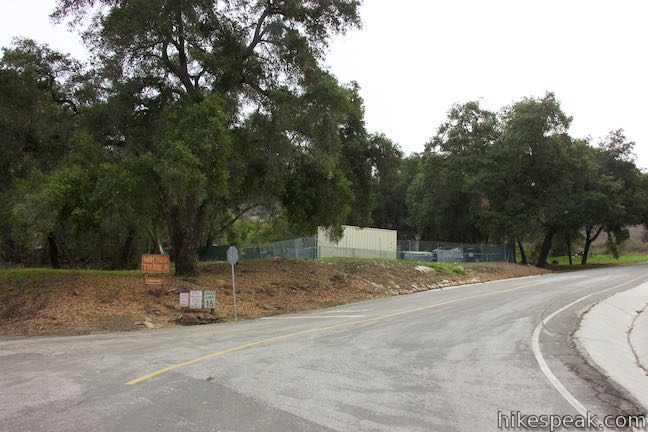
The old parking area was a dirt pullout on the south side of Route 150, just east of the entrance of Thomas Aquinas College. Leave your vehicle, safely cross the road, turn left and walk west for 100 yards, crossing a bridge over Santa Paula Canyon to the college entrance.
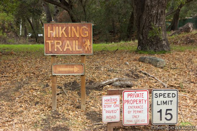
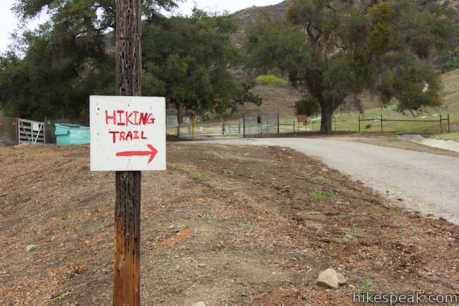
Turn right up the paved road to the right of a stone arch and walk up to a split in the road. Turn right, following a “Hiking Trail” sign with an arrow to the right.
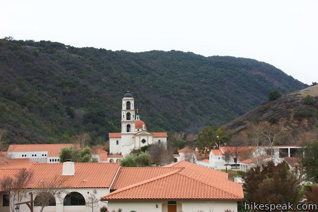
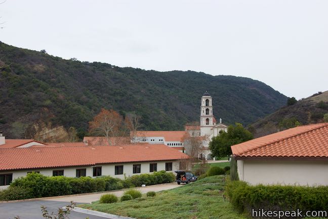
Proceed up a paved road that wraps around the campus of Thomas Aquinas College. Tempting as it might be to cut across the school, respectfully observe the numerous signs with messages like, “all hikers stay on paved road” and stick with the road as it curves around the east side of the orange-roofed Roman Catholic college.
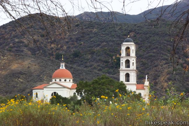
A broad curve to the left offers views of the college’s Our Lady of the Most Holy Trinity Chapel, which has a belfry that stand out elegantly against the surroundings mountains.
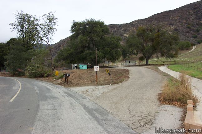
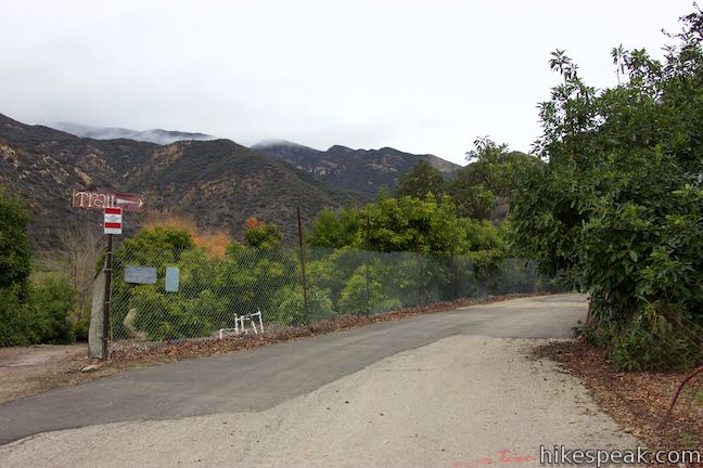
After 2/3 of a mile of effort, bear right at an intersection that is marked with a white and red hiking trail sign. Take this trail uphill away from the campus to a gate at the edge of Ferndale Ranch. Go through the gate and turn left, crossing a private ranch as the trail descends a hillside behind the college. Pass a road parting on the right and hike down the hill to an intersection marked with another sign telling hikers to make a right turn.
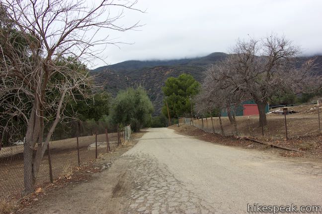
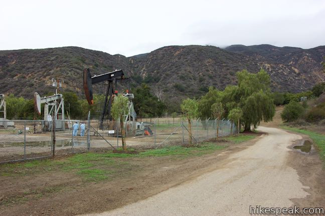
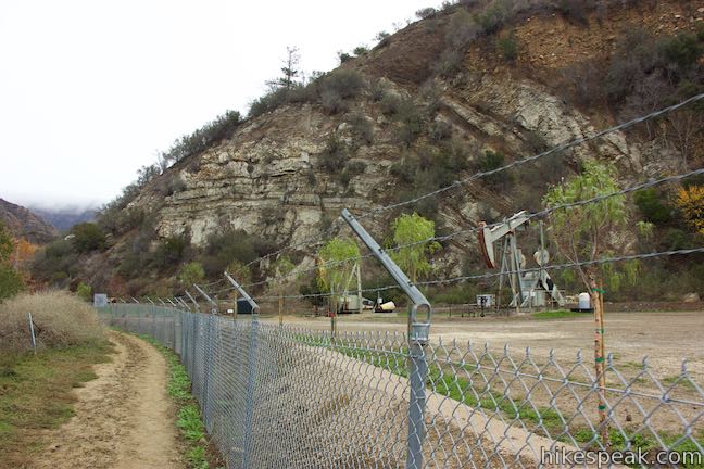
Turn right and take the paved road past a cluster of oil derricks up to an entry gate for Rancho Recuerdo, 1.05 miles from the start. Unwelcoming dogs may greet you as you proceed on the road into an avocado grove. Just past the entrance sign, bear right at a split, following one last sign for hikers. Resist the urge to grab an avocado (which would be unlawful), and proceed down the road into Santa Paula Canyon.
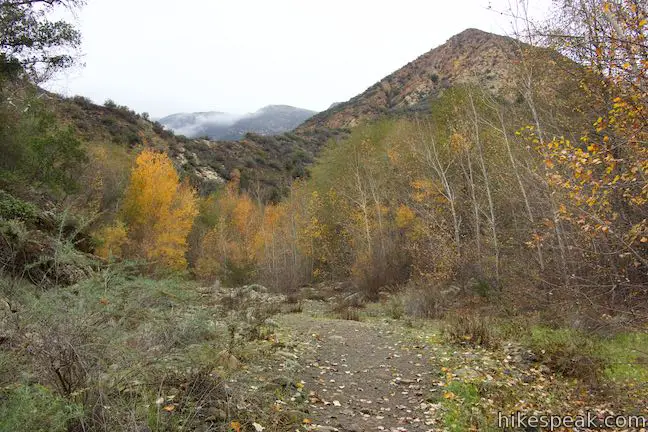
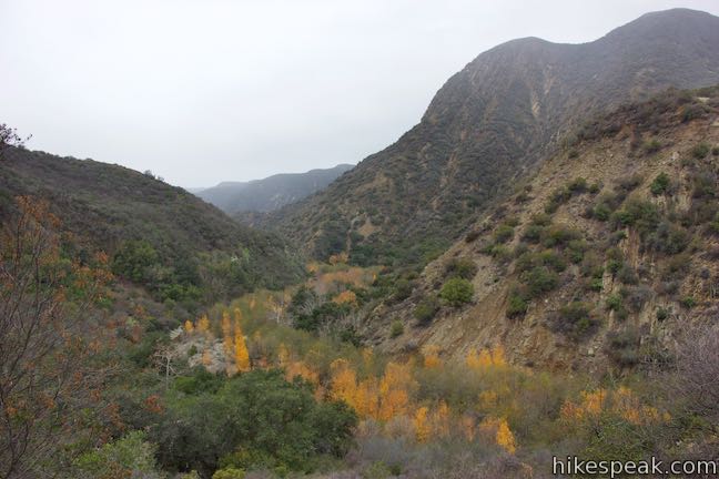
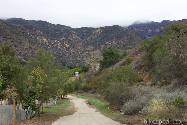
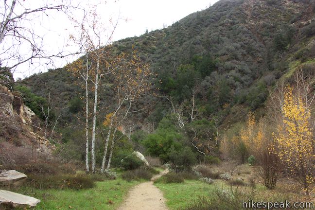
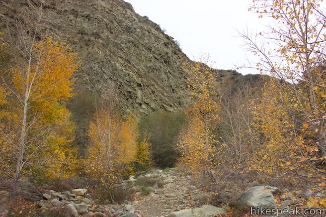
The road exits the avocado trees and delivers views up Santa Paula Canyon where steep ridges tower over a sycamore-lined drainage in the Topatopa Mountains. Hike down the road along a pipe labeled Ferndale Flow.
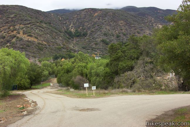
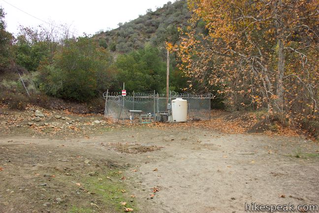
After 1.3 miles on pavement, you will strike dirt trail for the first time. The road comes to an end in front of a fenced off pair of oil derricks. Walk around the left side of the chain-link fencing to find the start of a wider legitimate trail on the other side. At long last, and 1.45 miles from Route 150, you have made it to Santa Paula Canyon Trail, also know as East Fork Trail (21W11).
Santa Paula Canyon Trail
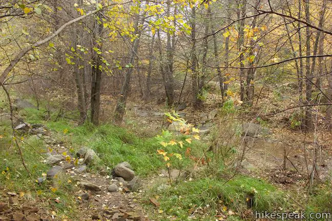
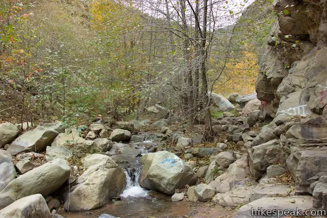
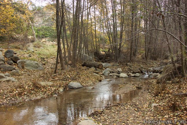
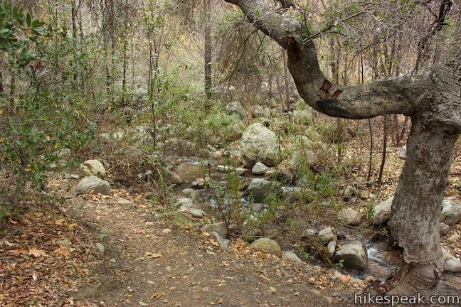
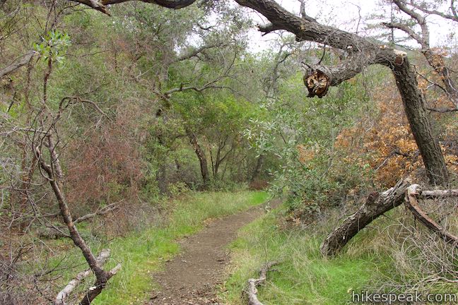
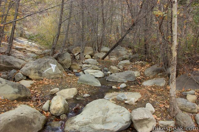
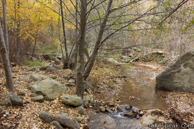
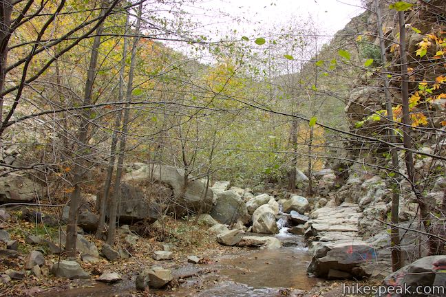
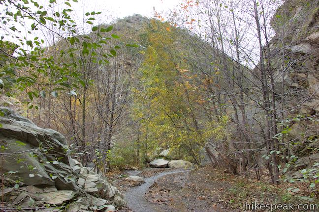
Hike down the trail into the riparian woodland along Santa Paula Creek and quickly come to a bridge-less crossing. The sights and sounds of Santa Paula Creek should erase your memory of all the pavement you hiked over in order to finally become immersed in actual nature.
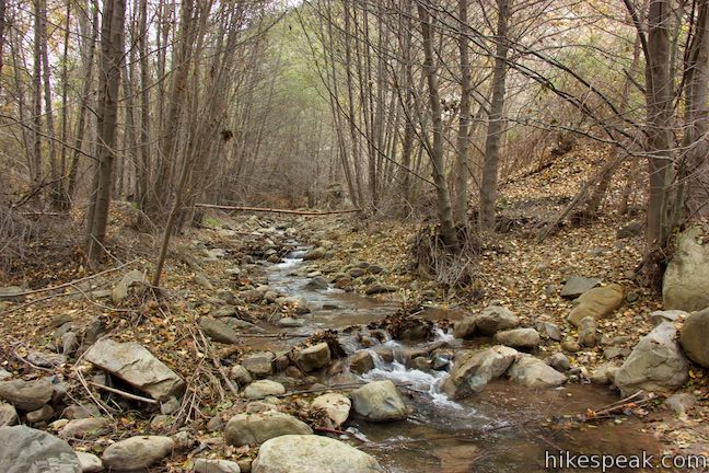
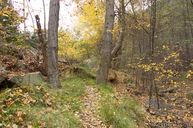
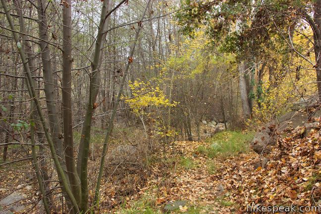
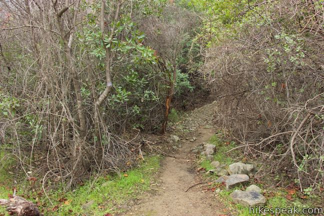
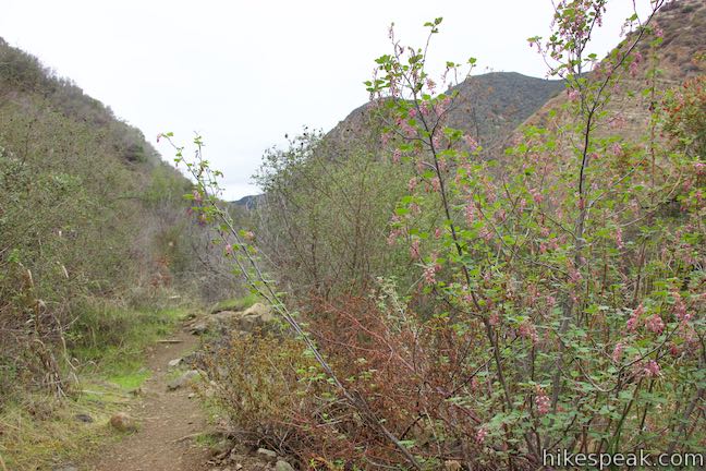
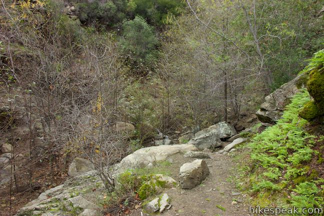
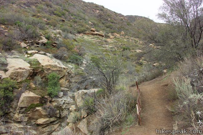
Rock hop across the lovely stream and bear right up the path on the other side. Head up the canyon through trees along Santa Paula Creek. The trail is narrow through this stretch, so make your way around boulders and trees on this creek-hugging path.
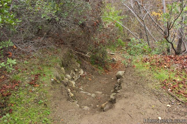
A tenth of a mile up the trail, hike across a rocky washed out area that has eroded down the west side of the canyon. In another 0.2 miles, the trail pops out of the trees to meet the end of a dirt road that rises to the left. Don’t take it. Instead, angle to the right past a fenced off tank and machinery to find the trail again as it dips back into the forest on the northwest side of Santa Paula Creek.
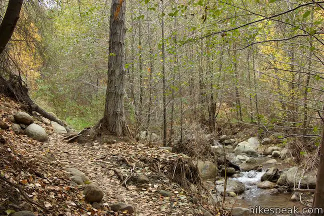
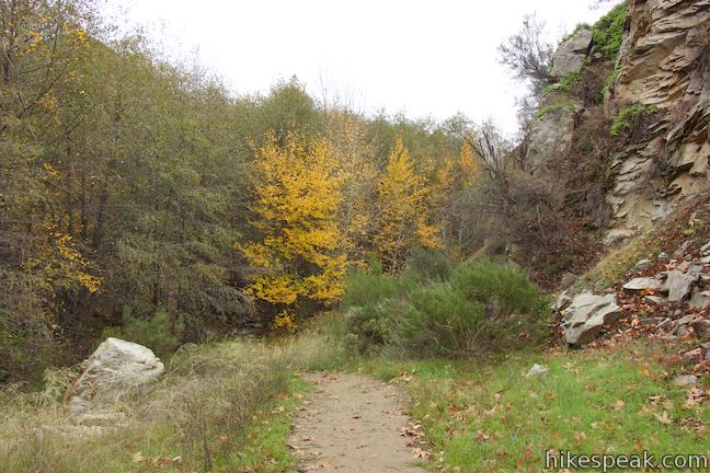
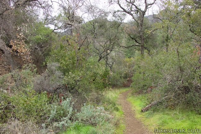
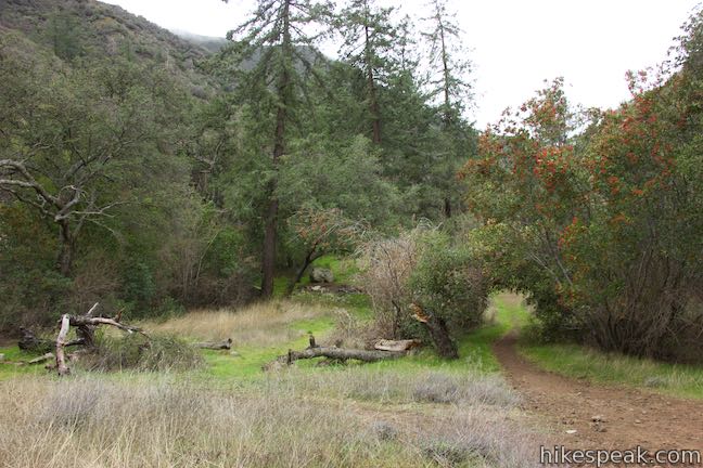
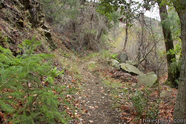
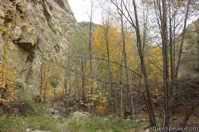
Hike up along the left side of the creek for a tenth of a mile. At this point, the trail curves to the left, distancing itself from the creek. Pass a pool of water below steep cliffs and go through an oak grove. The trail progresses alongside a wide rut that looks like the eroded remains of a washed away roadbed.
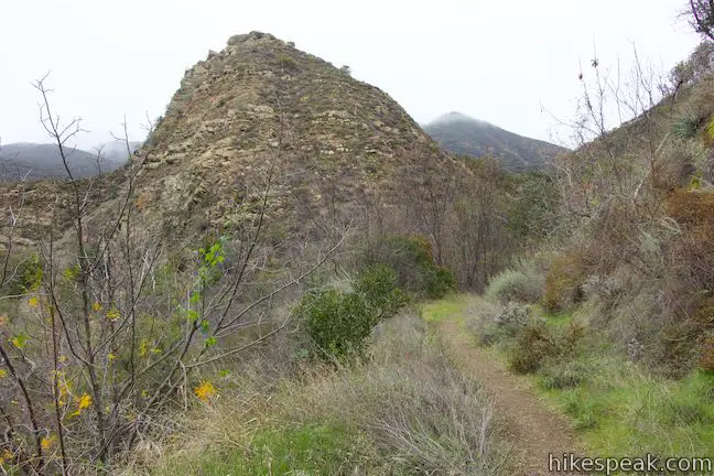
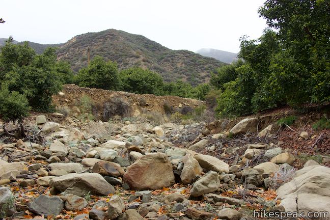
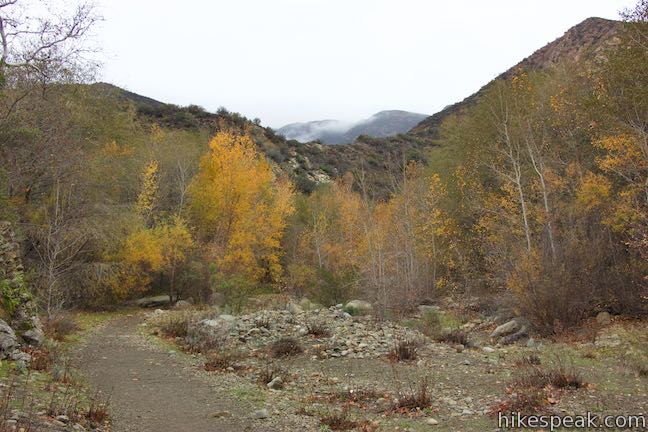
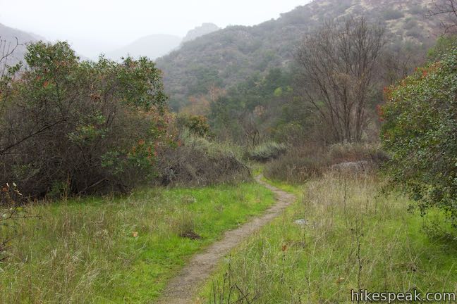
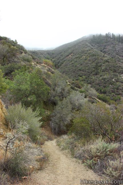
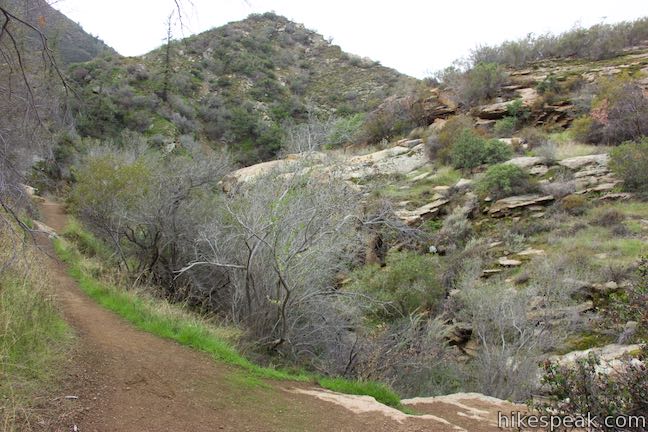
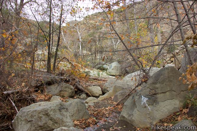
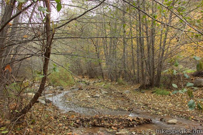
Santa Paula Canyon Trail angles back to the right, leaving the trees to drop into a broad gravel area on the bottom of the canyon. Turn left and take a wide, stone-lined trail up this open stretch of the canyon. Enjoy easy hiking and nice views up Santa Paula Canyon for 0.2 more miles, when the trail turns to the left and rises up to a broader trail, where you’ll turn right. This point is 2.35 miles into the hike and has a perch looking down Santa Paula Canyon.
Proceed up the trail for 0.15 well-established miles. When you come to the end of this wide section of trail, it’s time to pay close attention and make a choice. The most critical junction is just ahead and unmarked.
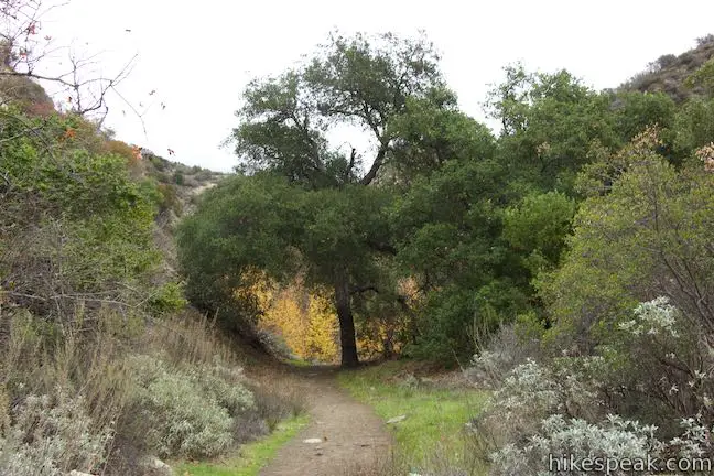
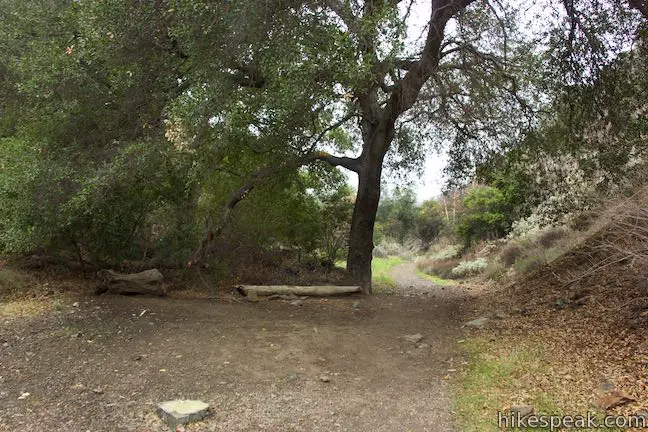
At 2.5 miles from Route 150, you will pass under a tree that arches over the trail. In the shade behind it, look for a log bench to the right. Ahead the trail narrows and slips into a tight area between cliffs that rise to your left and the stream that flows to your right. Just 50 yards past the log bench, the narrowed trail comes to a critical but easy-to-miss split.
To continue up the trail to Big Cone Camp and on to the Punchbowl, turn right and cross Santa Paula Creek. You’ll find a more defined trail as soon as you reach the other side. Turn left and continue up Santa Paula Canyon.
For those who prefer to forge a route up the canyon along Santa Paula Creek instead of benefiting from the trail, skip ahead to the alternative directions below. This boulder-hopping and creek-scrambling adventure goes up the canyon bottom all the way to the waterfall below the Punchbowl where you can reconnect with the trail to Big Cone Camp and the Punchbowl.
Continue up Santa Paula Canyon Trail
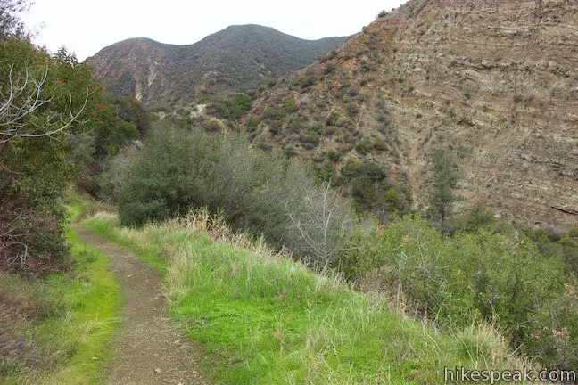
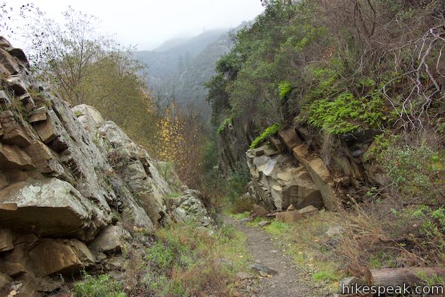
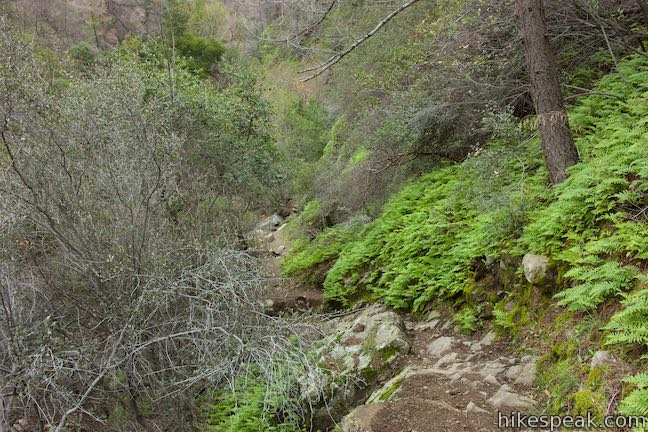
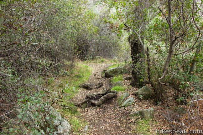
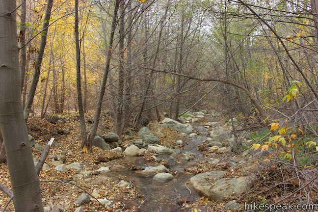
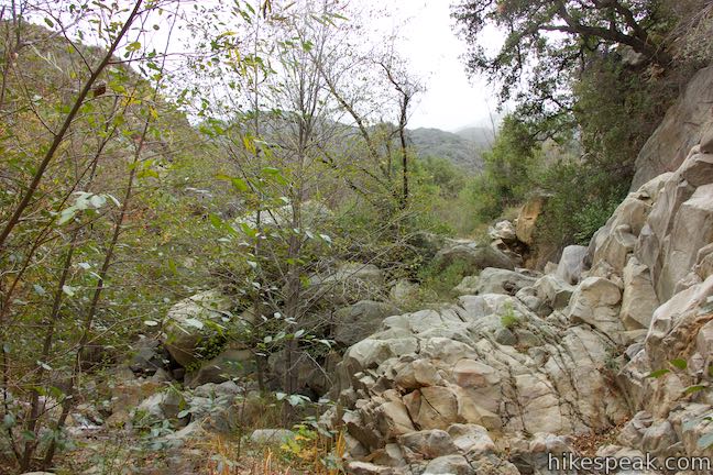
After crossing Santa Paula Creek, turn left up a trail along the east side of Santa Paula Creek. Pass rock formation and ferny cliffs as you stay along the creek.
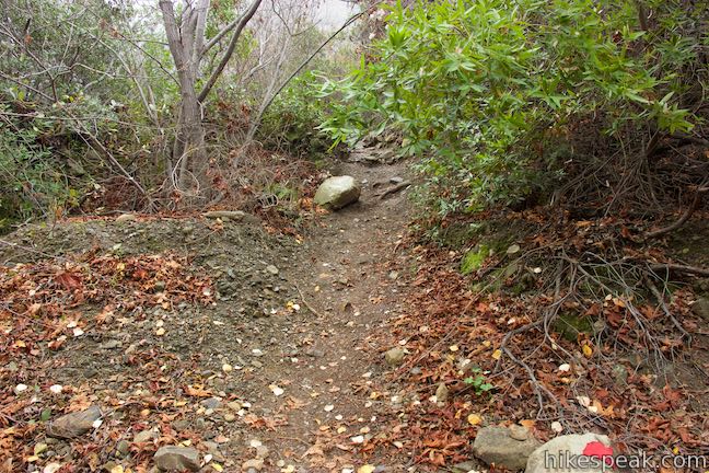
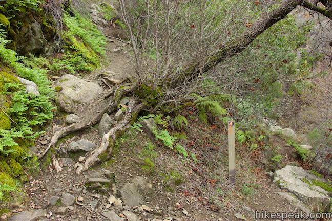
At 0.2 miles from the creek crossing, you will see a rutted trail heading up the embankment to your right. Take it. The trail will split, and while the path to the left might get you where you want to go, proceed to the right and head straight up through a thicket of brush. Hike up a single track through chaparral and bear right past a path parting to the left (seemingly connecting with the trail from the previous split).
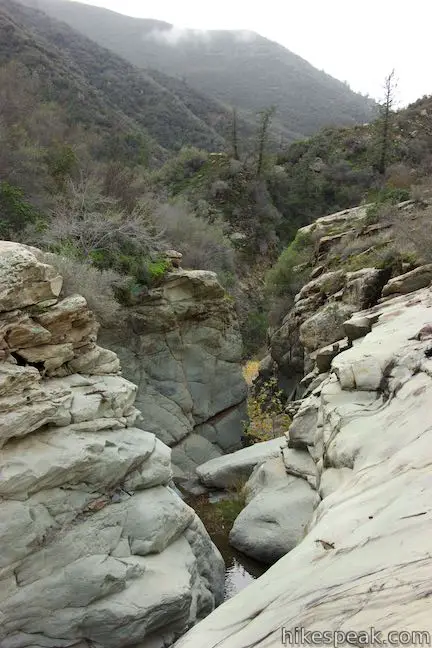
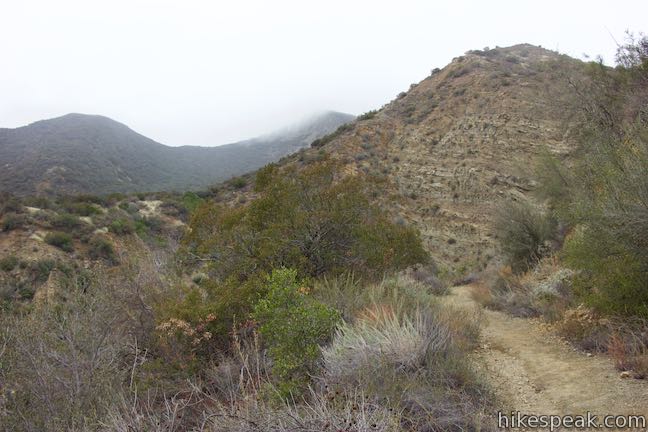
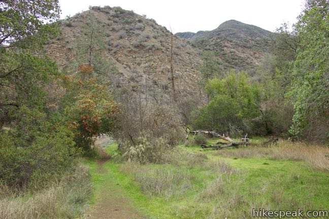
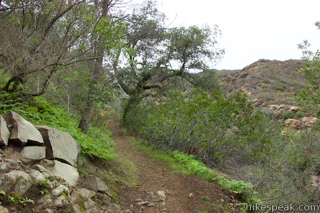
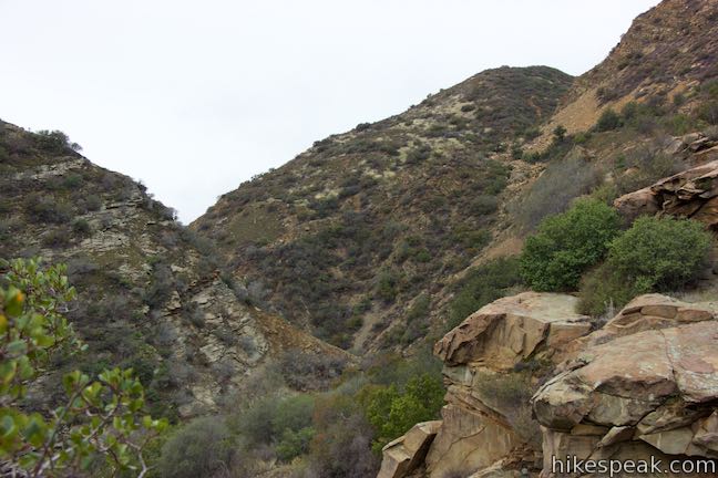
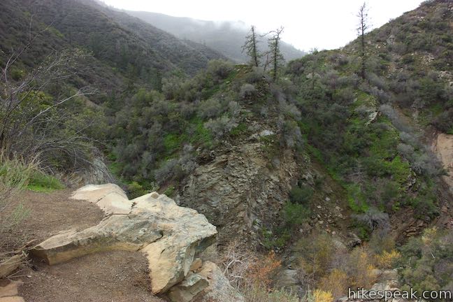
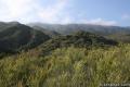
Santa Paula Canyon Trail rises above the creek to offer broad perspectives over the canyon toward the rugged ridges rising to the west to an elevation of 2,500 feet.
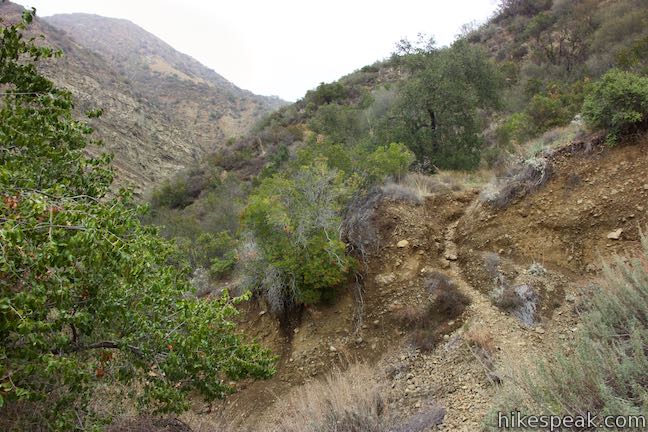
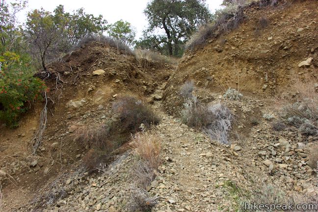
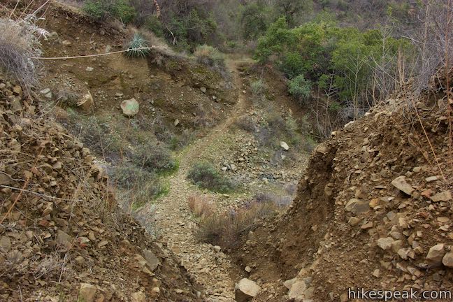
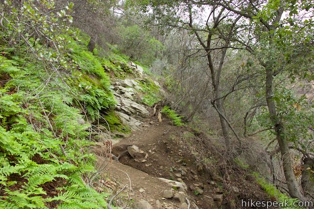
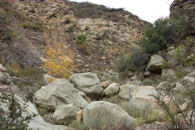
At one point in the trail, it will cross an eroded area where the side of the canyon was washed out by a landslide. Cross this dip, 3.05 miles from Route 150, and continue up the trail, which grows wider and easier to follow.
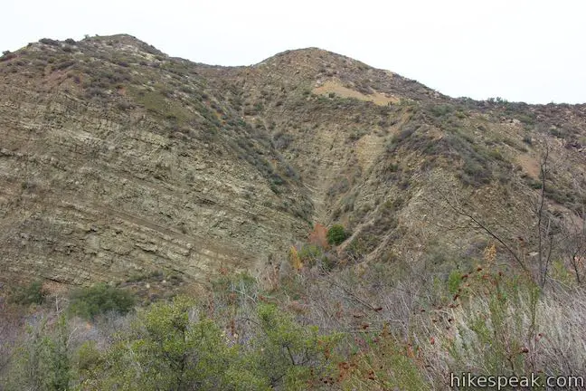
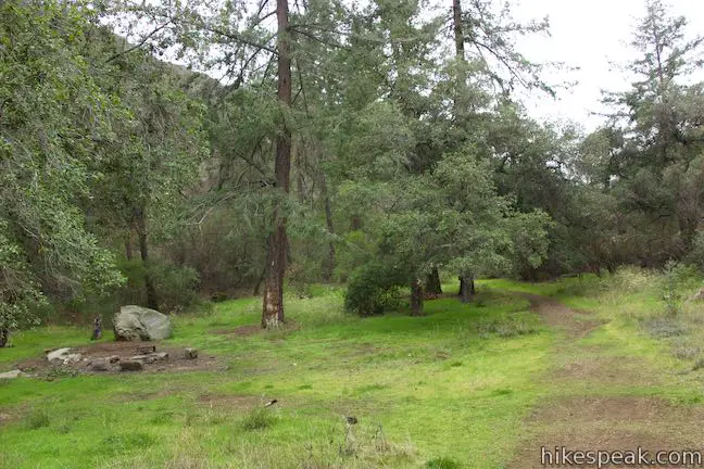
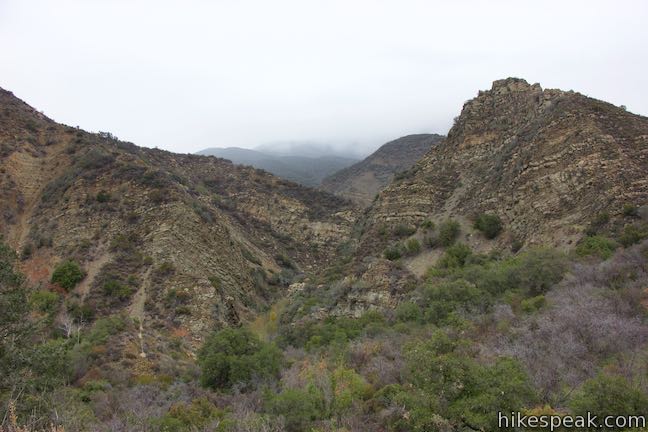
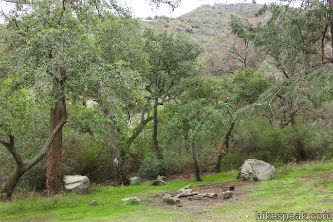
A couple switchbacks take you higher out of the canyon, expanding the views. Crest the high point of the trail at around 1,750 feet and approach Big Cone Camp. On the left side of the trail, a rocky point rises to 1,989 feet and shields Big Cone Camp from the broader canyon. The trail leads through a gap in the ridge to a landing above Santa Paula Canyon that cradles the trail camp.
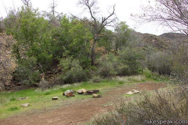
The trail slips through Big Cone Camp, 3.65 miles from Route 150. Find grassy plots on both sides of the trail, accompanied by four grills for campfires. If you’ve lugged in your camping gear, congratulations. This seems like a fine place to camp.
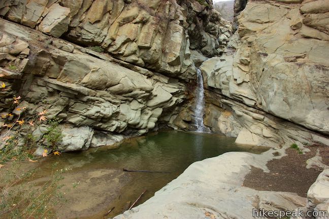
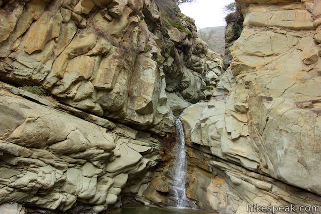
Now its time to check out the Punchbowl. Santa Paula Canyon Trail passes out the back of the campground and tips down into a ravine on the other side, entering a side canyon off Santa Paula Canyon. Go down to a switchback to the right where you can catch a glimpse of the 25-foot waterfall at the base of the Punchbowl.
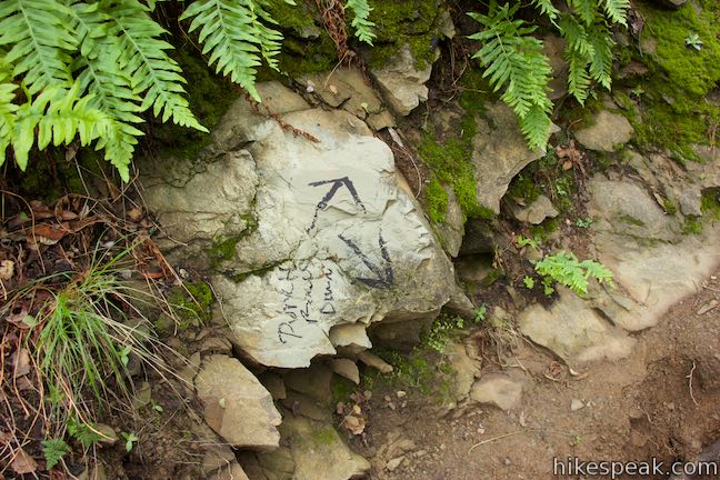
Drop down the trail to a junction with an official trail marker and an unofficial pair of arrows painted on a rock. This split presents two options.
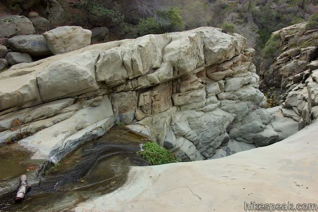
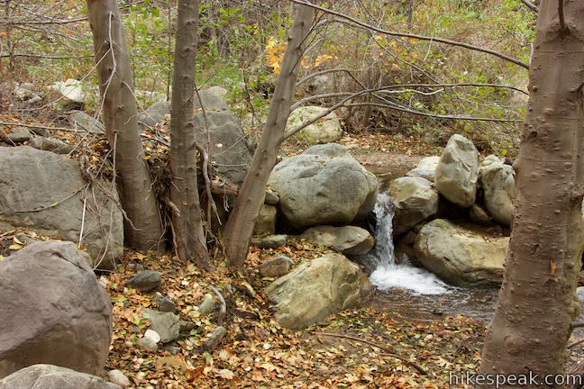
Option One: Bear left at the split to head down the ravine to the main fork of Santa Paula Canyon just below Punchbowl Falls. Curve to the right at the end of the ravine and walk up to the base of the waterfall, which gushes from a narrow passage and drops to a shallow pool.
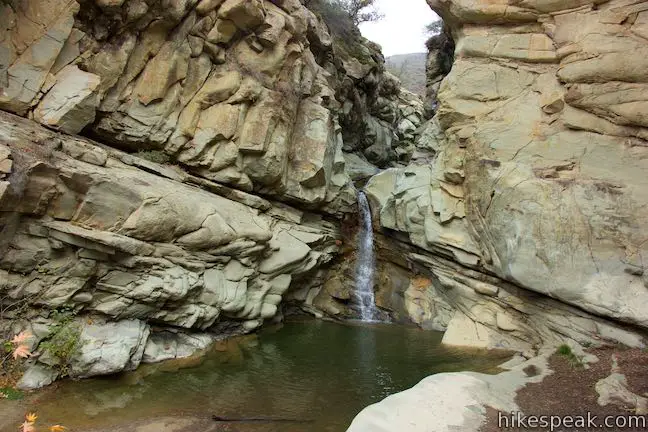
This Santa Paula Canyon waterfall is neighbored by boulders that make inviting places to take a seat and chill. On the right side of the waterfall, set just a bit downstream, you’ll find a steep path that ascends to the trail to the top of the Punchbowl, which is a tenth of a mile to the left.
Option Two: If you bear right at the junction just below Big Cone Camp, the trail scoots across the bottom of the ravine and rises up the opposite side to a junction. A fainter path parts to the right up this fork of the canyon. Stay to the left to proceed toward the Punchbowl.
As the trail levels out above the canyon, and about a quarter mile from the trail camp, you’ll pass a path on the left pushing out of the brush above Santa Paula Canyon by the waterfall. This steep track makes it possible to visit the waterfall in a small loop.
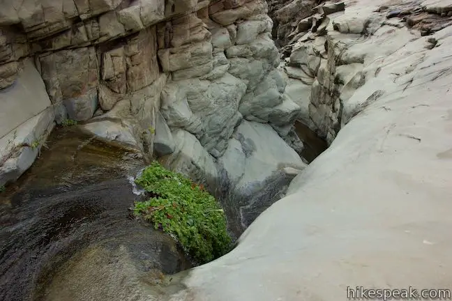
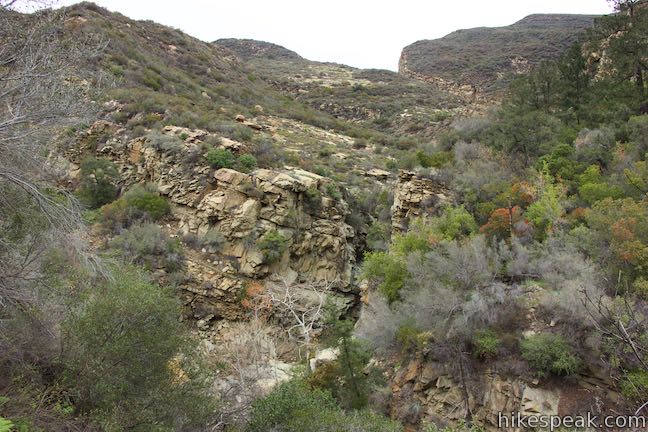
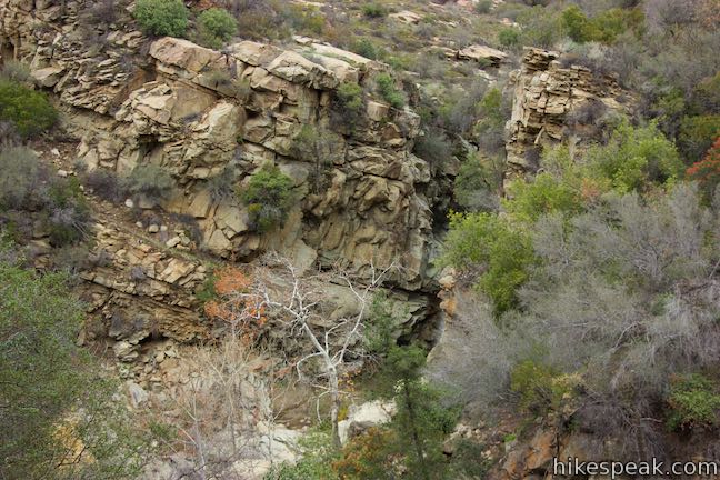
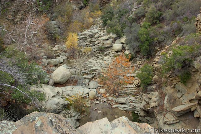
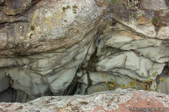
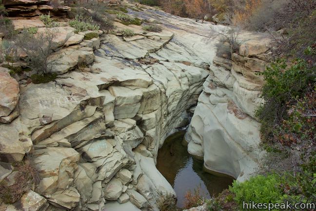
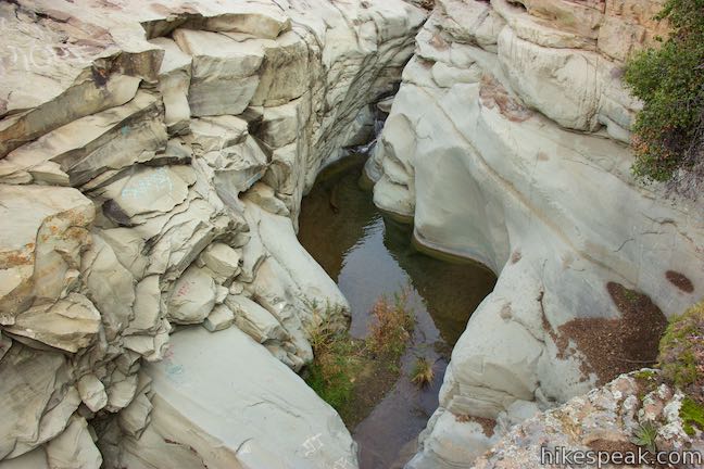
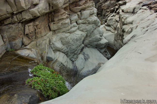
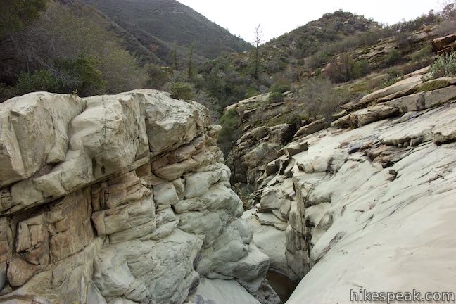
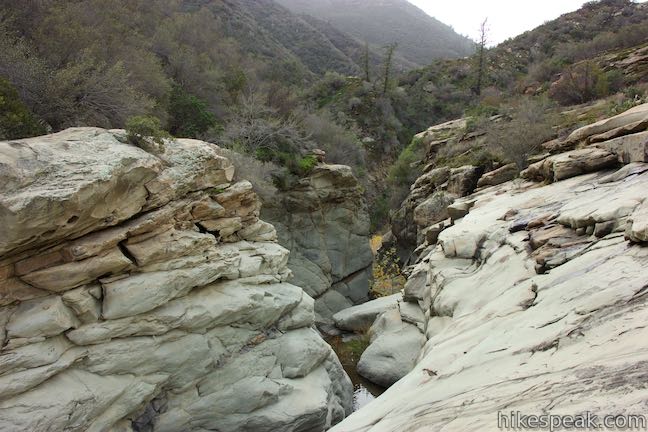
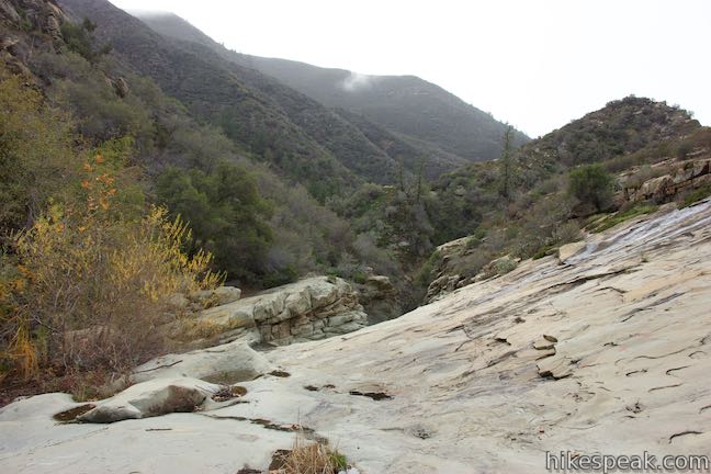
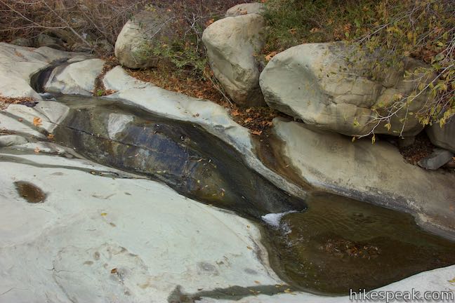
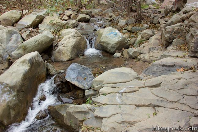
Just past this path, the trail crosses a ledge atop Punchbowl Falls. Gaze down the rocky canyon and then continue up the trail. Above the waterfall, Santa Paula Creek slices through the bedrock, flowing down chutes and swirling through pools. This is the Santa Paula Canyon Punchbowl (also called the Punch Bowls).
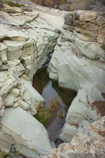
Peer down over a snaking staircase of cascades that resemble a natural water slide. Any canyoneering folks that repel down the Punchbowl must have a fun time! Cross a ledge that offers a great (if precarious) bird’s eye view over the Punchbowl.
Ahead, the trail comes to the top of the first big chute in the Punchbowl. Look down the slide and trace the water’s path as it dips in and out of view and hurls over the top of the waterfall. On the other side of the narrow creek is a large, sloped rock face that is open for relaxing in the sun.
The Punchbowl is a great point to turn around, 0.35 miles past Big Cone Camp and 4 miles from Route 150. Upstream, the creek slides down smaller dips and pools. The trail is less defined above the Punchbowl, but seems to run along the right side of the creek. You can venture upstream past boulders with spray-painted arrows. Cross Camp is about half a mile up the canyon and the creek offers additional impressive features for those who press on.
Leaving the Punchbowl, hike back down Santa Paula Canyon Trail the way you came. If you hike down to the waterfall on the way to the top of the Punchbowl, your round trip distance will barely be altered (8 miles round trip).
Now what if you took a different path up Santa Paula Canyon and didn’t cross the creek at the important unmarked junction?
Plot a course up Santa Paula Canyon Creek
So you’re feeling adventurous! Instead of crossing the creek at the faint junction just past that log bench at the end of the defined stretch of trail (2.5 miles from Route 150), you can stay to the left and hug the cliffs on the west side of the canyon. Follow paths and make your own to border Santa Paula Creek as it heads up the canyon.

After a third of a mile bushwhacking up the west side of the canyon, the contours of the canyon will persuade you to cross part of the creek and walk up the center of the canyon along the water. Footpaths wander up the canyon, helping you find less obstructed routes. Progress is slow going without a real trail to follow.
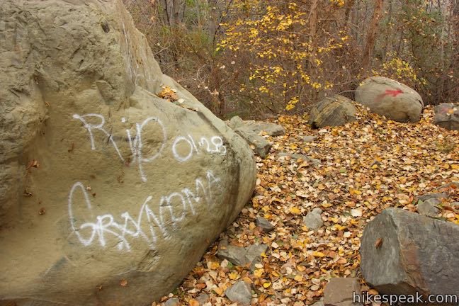
Graffiti is tagged to many of the boulders along the canyon. While the graffiti is an eye sour, the numerous spray-painted arrows do offer some reassurance that you are staying on course. The canyon would be better off without the other spray-painted messages, including the unusual tribute “RIP grandma” on one large boulder by the creek.
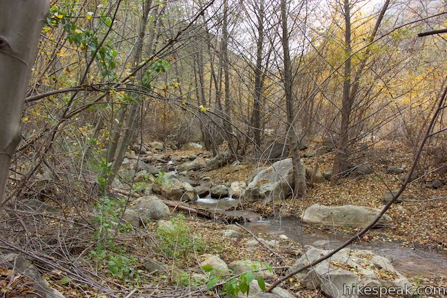
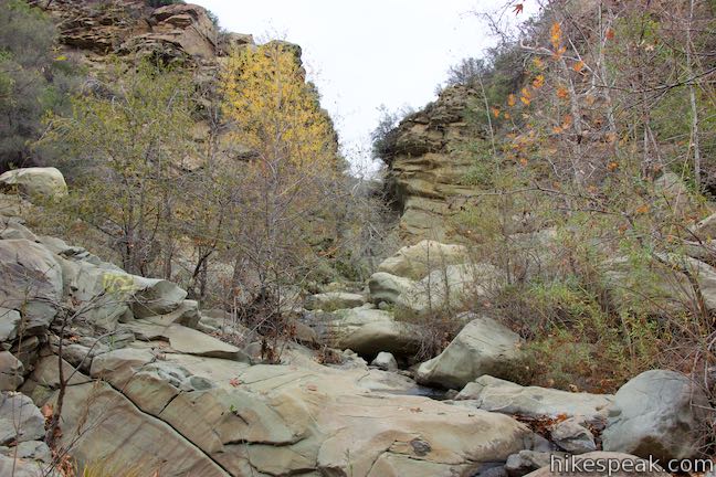
Climb over boulders, splash through mud, push through brush, and rustle through leaves to forge a route up the canyon along Santa Paula Creek. Steep rock walls box you in as you follow the tumbling creek. At about 0.6 miles from the trail, stay to the right along the main branch of Santa Paula Creek as it passes a side canyon.
The canyon twists higher into the mountains and the going gets tougher, with more climbing over boulders. After over a mile of arduous off-trail trekking, you will come to a confluence in the creek (which appears like a split as you look upstream). The flow from the fork to the left is the strongest, so follow it. Climb up and over a few more boulders to find the welcoming sight of the waterfall at the bottom of the Punchbowl.
Make your way up to this 25-foot waterfall. Above the falls, the canyon walls pinch into a gap that is just a few feet wide. The top of Punchbowl Falls flows through this cataract and splashing down into a wide, shallow pool. Boulders below the waterfall and along the right side of the pool provide good seating. After a hike through the thick of things up the canyon, and 3.6 miles from Route 150, it will be welcoming to see the canyon open up when you reach the waterfall. Take a break and enjoy the beauty.

From Punchbowl Falls, you can follow a steep path up the side of the canyon to Santa Paula Canyon Trail on its path to the top of the Punchbowl (bear left when you reach the trail). You can also amble up the other fork of the canyon on a path that meets Santa Paula Canyon Trail on its descent from Big Cone Camp (bear right when you reach the trail to get to the campground or turn left to reach the Punchbowl). Both destinations are about 0.15 miles from the waterfall.
You will probably be happy to see the trail again after the slog to Punchbowl Falls. Assuming you return to the trailhead via Santa Paula Canyon Trail, the excursion up Santa Paula Creek will trim the distance of this hike by about 1/3 of a mile (or 2/3 of a mile of you take the creek both ways).
To explore nearby canyons in the Topatopa Mountains within Los Padres National Forest, check out Sisar Canyon and Horn Canyon Trail to the west.
Dogs are welcome on leashes for this outing, but bikes do not appear to be allowed. No permit or pass is needed to park at the trailhead or hike up Santa Paula Canyon Trail in Los Padres National Forest. Keep valuables out of sight in your parked vehicle and report vandalism.
Directions to the Trailhead
- Take the 101 Freeway to exit 66 in Ventura and head inland on Highway 126.
- Drive 12 miles to exit 12 for 10th Street (Route 150).
- Head north on 10th Street, cross Santa Paula Street, and bear right onto Route 150 (North Ojai Road) toward Ojai.
- Drive 5.3 miles up this road and pull off into the parking area on the right, just after the entrance of Thomas Aquinas College, on the right.
- Coming from Ojai, from the intersection of Route 33 and Route 150, travel east on Route 150 (North Ojai Road) for 12 miles to the parking area on the left side of the road just before the college.
Trailhead Location
Trailhead address: Santa Paula Canyon Trailhead, North Ojai Road (Route 150), Santa Paula, CA 93060
Trailhead coordinates: 34.4276, -119.0913 (34° 25′ 39.4″N 119° 05′ 28.7″W)
View Santa Paula Canyon in the Topatopa Mountains in a larger map
Or view a regional map of surrounding Central Coast trails and campgrounds.
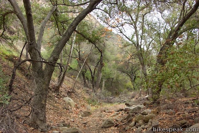
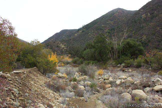
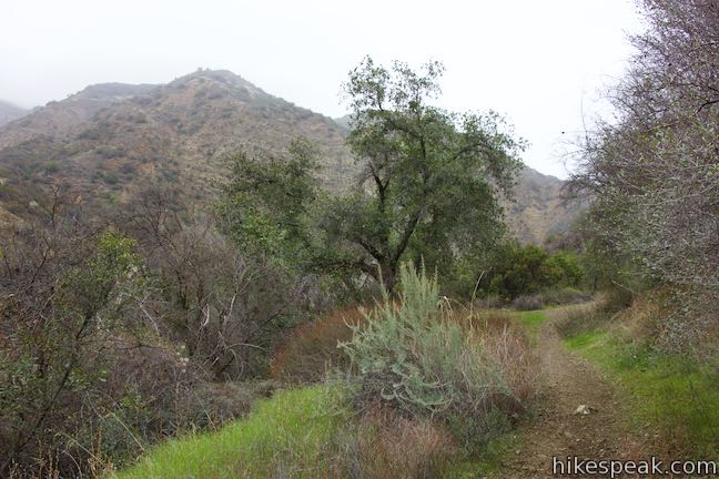
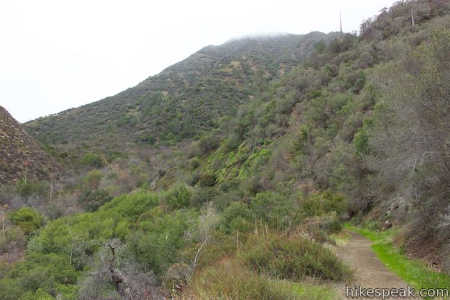
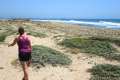
The approach to Santa Paula Canyon Trail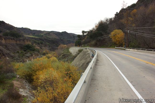
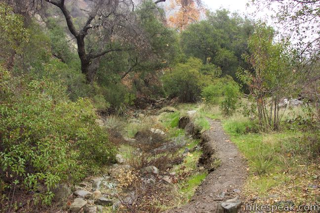
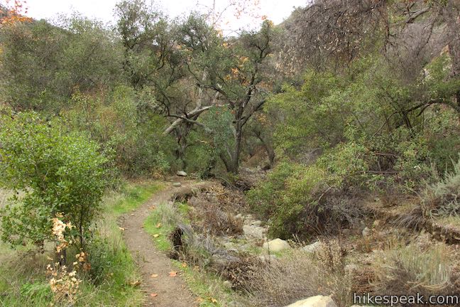
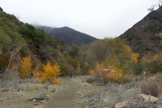
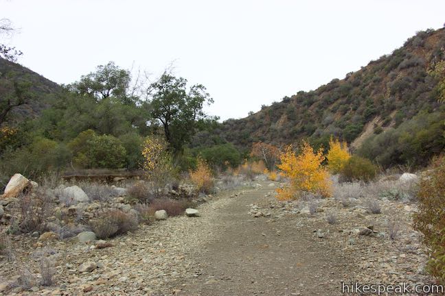
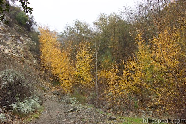
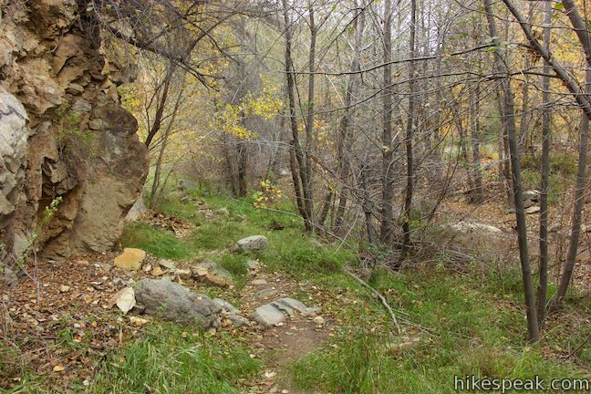
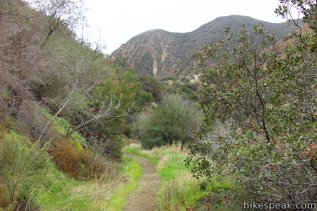
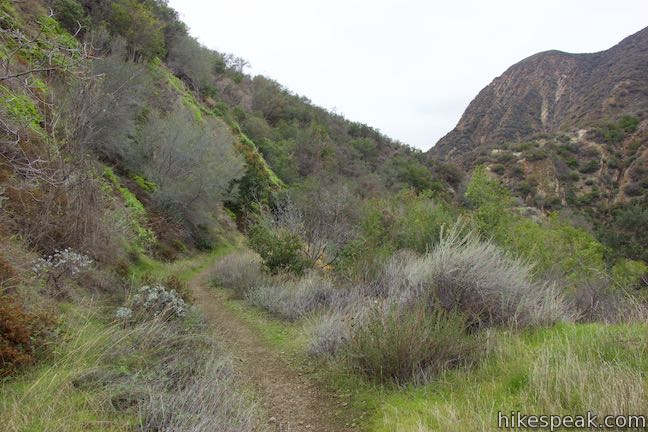
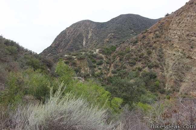
Santa Paula Canyon Trail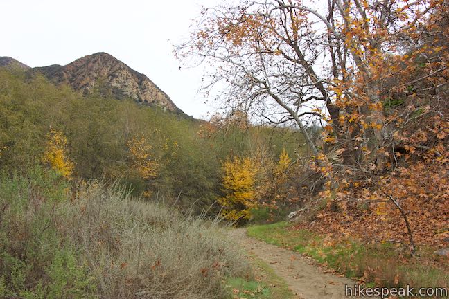
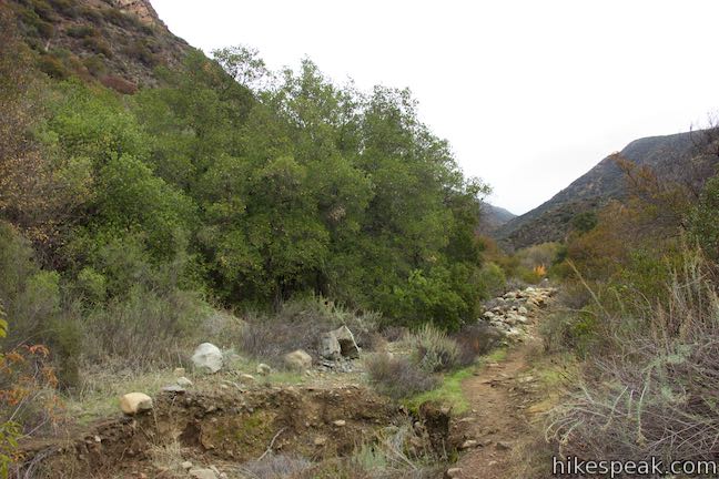
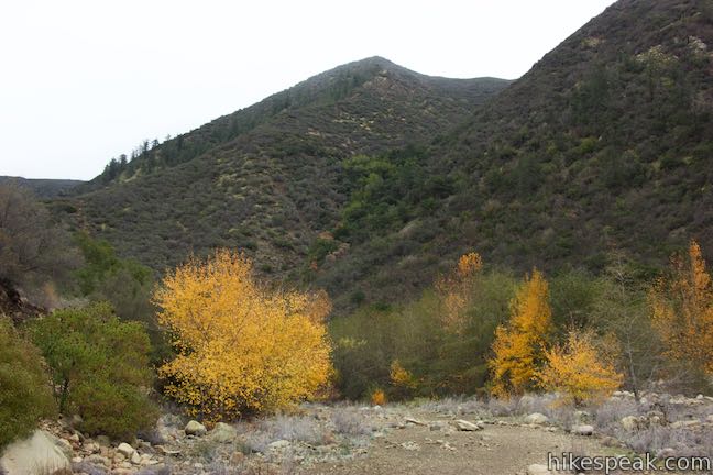
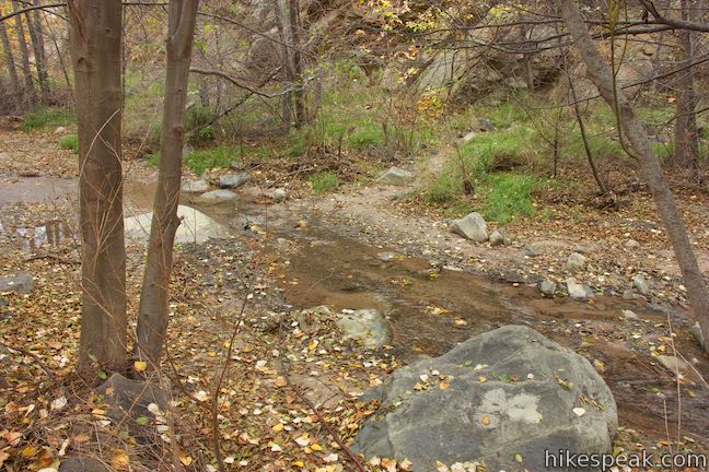

Santa Paula Creek Route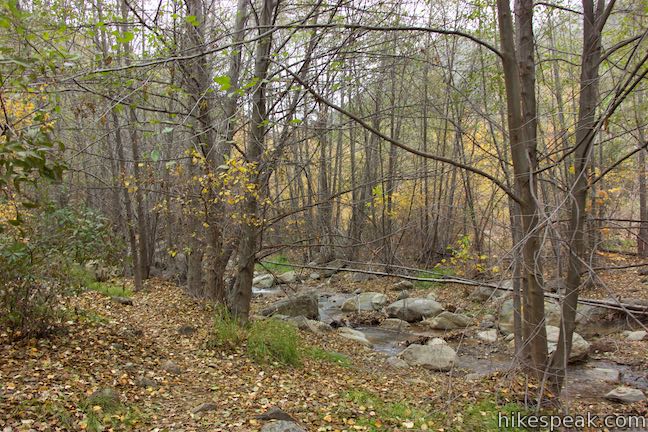
 | Sisar Canyon Trail This 5.5 to 6.5-mile hike travels up a canyon to a viewpoint in the Topatopa Mountains between Ojai and Santa Paula. |
 | Horn Canyon Trail This 2.9-mile hike in Ojai goes up a canyon in the frontcountry of the Topatopa Mountains and ventures off trail along the soothing waters of Thacher Creek. |
 | Wheeler Gorge This 1-mile loop explores the forest around this 70-site Campground. |
 | Rose Valley Falls This 1-mile round trip trail leads to the lower tier of a lovely two-tier 300-foot waterfall. |
 | Sespe Creek to Willett Hot Springs This 19-miles round trip follows Sespe Creek to a relaxing hot springs. |
 | Ocean's Edge and River's Edge Trails Loop This level and easy 1.5-mile loop in Emma Wood State Beach borders the Pacific Ocean, the Ventura River, and an estuary flocked by seabirds. |
 | More Central Coast Hikes Explore other destinations along the California coast between Ventura and Monterey, including trails in Los Padres National Forest. |
- Santa Paula Canyon on calihike.blogspot.com (opens in a new tab)
- Santa Paula Canyon on venturacountytrails.org (opens in a new tab)
- Santa Paula Canyon on hikelospadres.com (opens in a new tab)
- Santa Paula Canyon on conejovalleyguide.com (opens in a new tab)
- Santa Paula Canyon on alltrails.com (opens in a new tab)
- The official Los Padres National Forest webpage for Santa Paula Canyon Trail (opens in a new tab)
- The official website for the Los Padres National Forest (opens in a new tab)
Common Questions about Santa Paula Canyon Trail to the Punchbowl in Santa Paula & Los Padres National Forest
- Is the trail open?
- Yes. You should expect to find that Santa Paula Canyon is open. There are no recent reports of trail closures. If you discover that the trail is closed, please help your fellow hikers by reporting a closure.
- Is this trail free to access?
- Yes, Santa Paula Canyon is free to access. No entrance fee, pass, or permit is required. If you discover that access rules have changed, please provide feedback on your experience.
- How much time does this hike take?
- It takes approximately 3 hours 45 minutes to hike Santa Paula Canyon. Individual hiking times vary. Add extra time for breaks and taking in the views.
- How long is this hike?
- The hike to Santa Paula Canyon is a 8 mile out and back with 800 feet of elevation change.
- Are dogs allowed on this trail?
- Yes, dogs are allowed on Santa Paula Canyon. The trail is open to hikers, dogs.
- Will I see a waterfall on this hike?
- Yes, Santa Paula Canyon features a waterfall.
- Where is the trailhead located?
- The trailhead for Santa Paula Canyon is located in Santa Paula, CA.
Trailhead Address:
8500 North Ojai Road
Santa Paula, CA 93060
Trailhead Coordinates:
34.4276, -119.0913 - What are the driving directions to the start of the hike?
To get to the trailhead: Take the 101 Freeway to exit 66 in Ventura and head inland on Highway 126. Drive 12 miles to exit 12 for 10th Street (Route 150). Head north on 10th Street, cross Santa Paula Street, and bear right onto Route 150 (North Ojai Road) toward Ojai. Drive 5.3 miles up this road and pull off into the parking area on the right, just after the entrance of Thomas Aquinas College, on the right.
Coming from Ojai, from the intersection of Route 33 and Route 150, travel east on Route 150 (North Ojai Road) for 12 miles to the parking area on the left side of the road just before the college.
View custom Google Maps directions from your current location.
- Are there other trails near Santa Paula Canyon?
- Yes, you can find other nearby hikes using the Hikespeak Hike Finder Map.

10 Comments on Santa Paula Canyon Trail to the Punchbowl in Santa Paula & Los Padres National Forest
What hikers are saying:
✨ Generated summary of user commentsHikers find the natural water slide to be a highlight of the journey despite the strenuous final climb and disturbing graffiti. Mark notes that the entrance has moved to Highway 150 north of the college, so visitors must follow neon flags and rock arrows to navigate washed-out areas. Carrying plenty of water is essential to prevent heat exhaustion while traversing the steep terrain.
This trail is closed due to fire and will be for weeks, please note this st the top of this webpage. Thanks
Trail is not closed but there is a lot of fire and landslide damage.
Trail is open to hikers again. Some parts are washed out so we had to divert from what looked like the old trail, around piles of debris from past flooding. Lost of arrows on rocks and neon flags in the trees. Easy in and out if you’re paying attention.
I saw what I thought looked like people sleeping in their cars on route 150 when I arrived last Sunday. Is this okay? I want to crash in my car there Saturday night to hike early Sunday morning, if so. Anyone know if there are “No Overnight Parking” signs anywhere? Help. I dont want to waste money actually car camping down the road at the KOA campground.
No mention of the natural water slide in your description? It’s one of the best parts! So glad this place is reopened.
https://youtu.be/JHZGxkYMtJY
Can one pull a wagon full of gear up this trail?
no its very step in places
Is it safe for my pregnant wife to go?
The trail entrance has moved. The Trail no longer goes through Thomas Aquinas College. It starts off highway 150 north of the college entrance and follows Santa Paula creek up the canyon.
Thanks for sharing the information, Mark. It looks like an excellent change to the trail!
Bring lots of water right now.
The last 0.5 mile is steep and very strenuous.
There are stories floating around of people getting airlifted out because of the extreme heat and exhaustion. Graffiti is disturbing