Runyon Canyon Loops
in Runyon Canyon Park
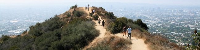
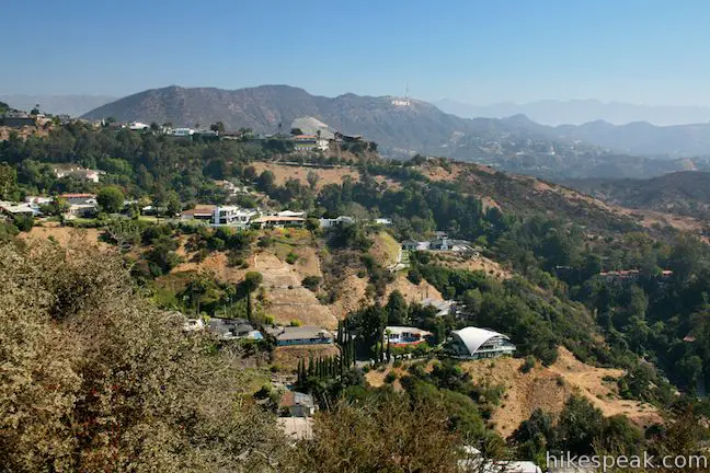
Runyon Canyon Park is one of the most popular hiking destinations in Los Angeles and often shows up on publishers’ lists of best hikes in LA. This 130-acre dog park is located in Hollywood on the east end of the Santa Monica Mountains, providing hikers with a few overlapping loops and great views over Hollywood.
- For a quick Runyon Canyon hike, try a 1.9-mile loop with 500 feet of elevation change
- Get more of a workout on a larger 2.65-mile loop with 700 feet of elevation change
- Really stretch your legs on a 3.3-mile hike top the top of the park with 800 feet of elevation change
- Start from Mulholland Drive for an easier 0.85-mile hike to the top of the park with 200 feet of elevation change
Runyon Canyon Park a crowded park, so if you are a trail snob expecting peace and quiet, modify your expectations for Runyon Canyon or check out another hike around Los Angeles. If you are looking for a bit of outdoor exercise with added people watching, Runyon Canyon is perfect.
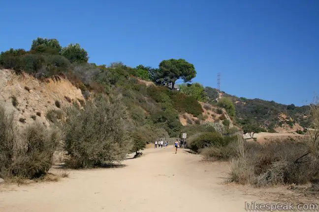
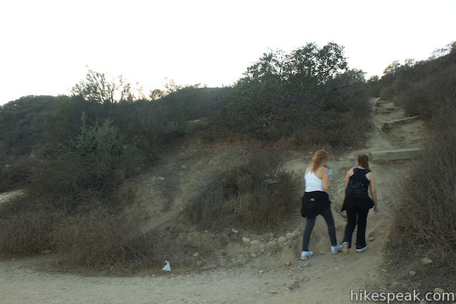
The majority of the trails in Runyon Canyon Park are wide dirt and paved fire roads, but single-track trails are also present, presenting steeper and less maintained hiking. Runyon Canyon is officially a dog park and has off-leash areas where canines run free. Plenty of hikers and joggers hit the trail without dogs, and Runyon Canyon clearly receives more foot (and paw) traffic that any other park in Los Angeles. The landscape is well trodden and the trails can easily feel congested.
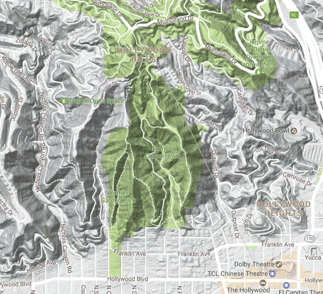
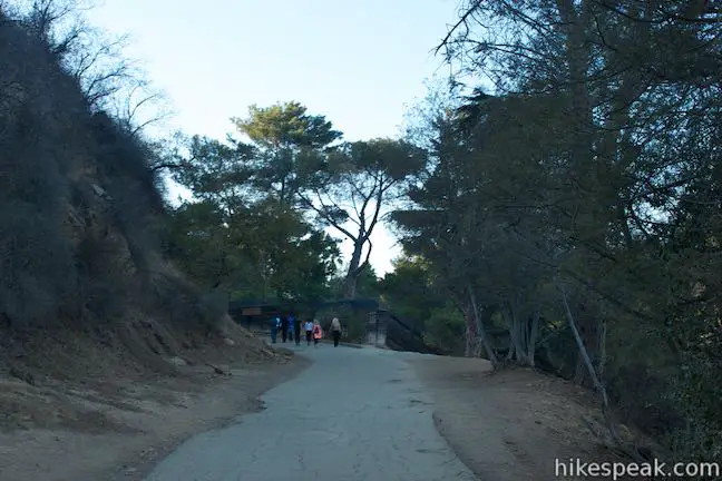
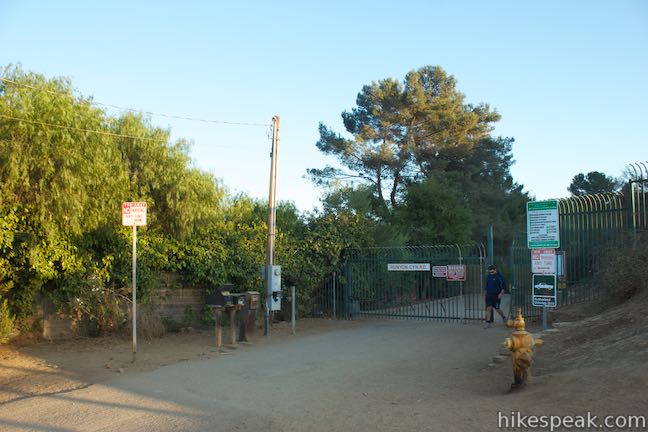
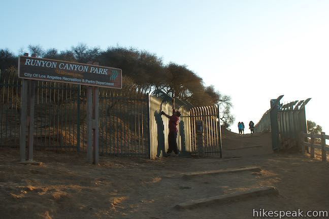
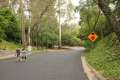
The Runyon Canyon hikes described here begin from the main entrance at the top of Fuller Avenue, two blocks north of Hollywood Boulevard (directions to the trailhead are below). The loops be modified to begin from some of the park’s other entrances.
For something really short and easy (0.85 miles and 200 feet of elevation change), hikers can begin from the top of Runyon Canyon Park, using a trailhead along Mulholland Drive for a short loop to the park’s high point. This trailhead effectively removes the 2.65-mile loop from the grandest 3.3-mile loop starting from Fuller Avenue.
Those looking to hike even farther, can connect Runyon Canyon Park to nearby Trebek Open Space. Take a look at the map below to see the trail options in and around Runyon Canyon Park.
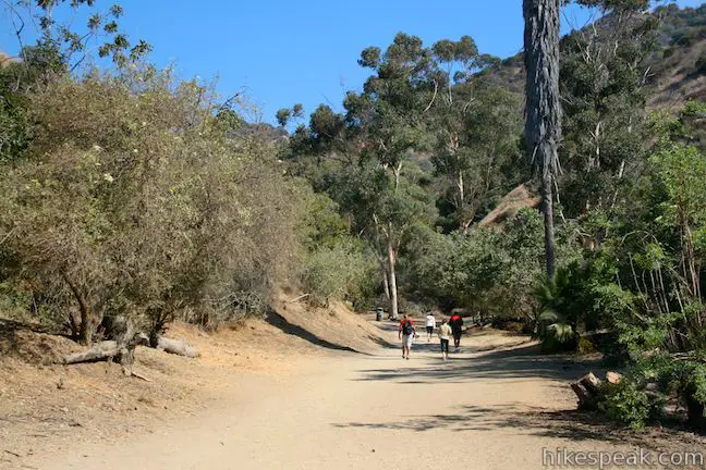
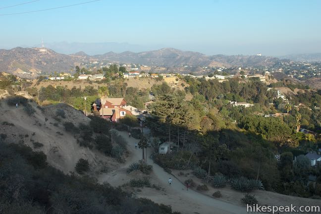
Pass through the large gate at the top of North Fuller Avenue and begin hiking up Runyon Canyon. To the left, you will see an open lawn where outdoor yoga classes are often held.
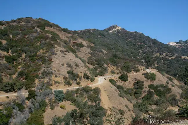
Next, reach a trail junction that marks the beginning of the loops. A wide dirt road heads to the left, going west toward the nearby Vista Street Gate where it joins Runyon Canyon Fire Road, the gradual half of the smaller loop in the park. For a steeper more scenic climb, continue straight through the intersection and hike the loop in a counter-clockwise direction.
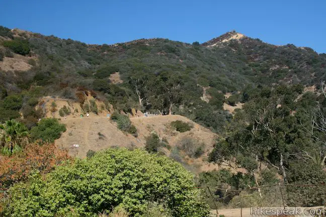
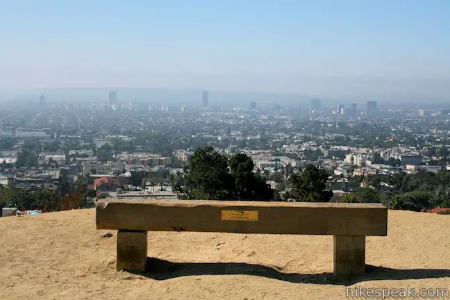
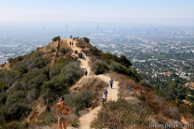
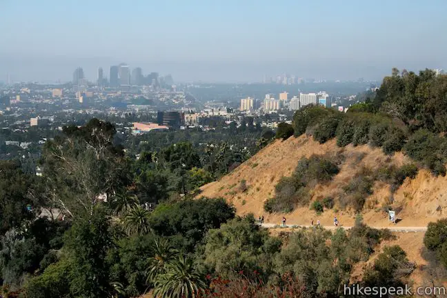
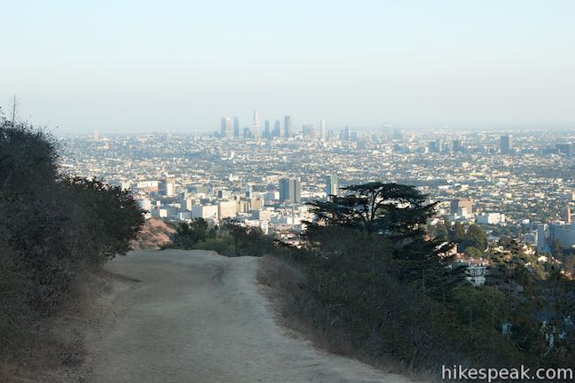
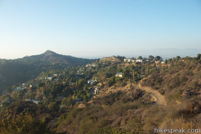
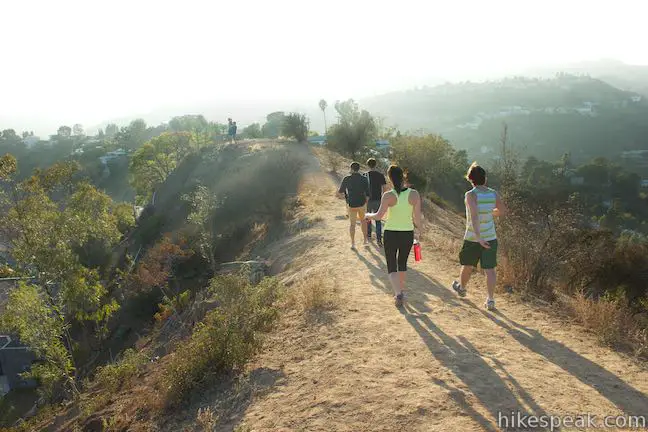
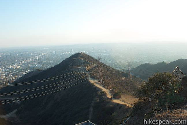
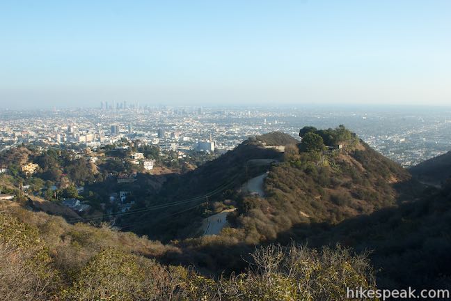
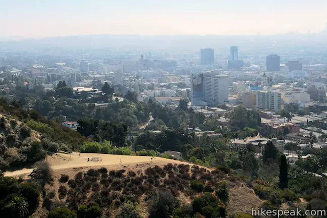
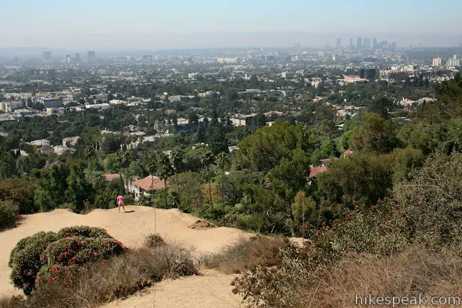
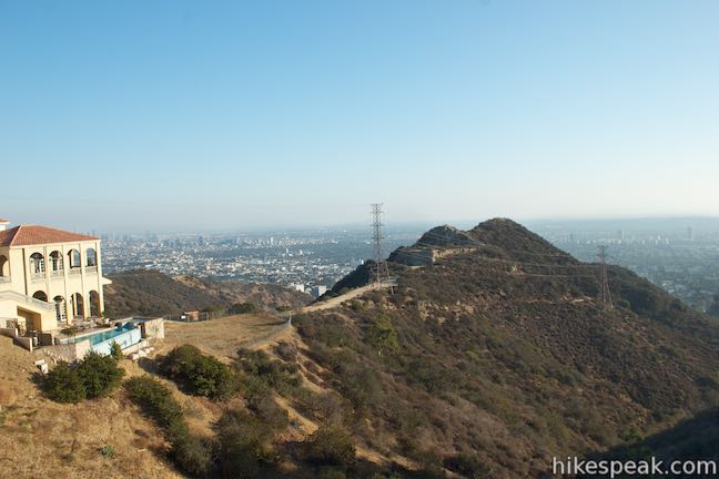
The trail progresses gradually up the bottom of the canyon through an off-leash area, before turning sharply to the right up the east side of the canyon. Just 0.45 miles from the start, the fire road arrives at Inspiration Point. A bench offers a place to relax and take in scenics view over Hollywood.
The hike is about to become more challenging.
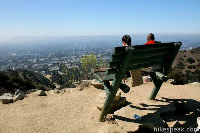
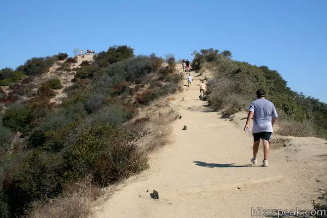
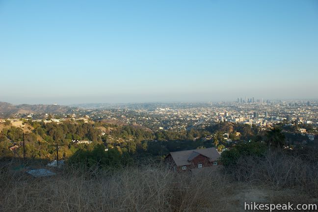
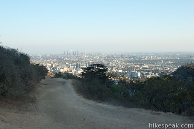
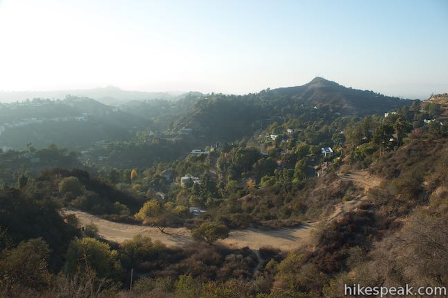
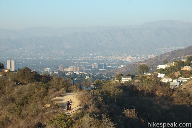
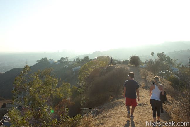
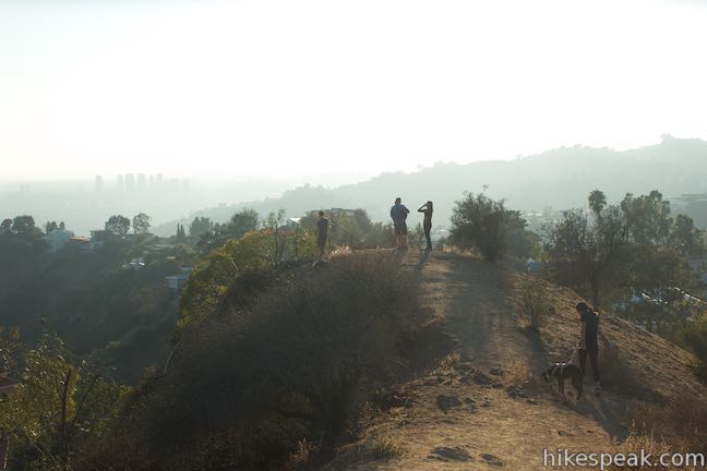
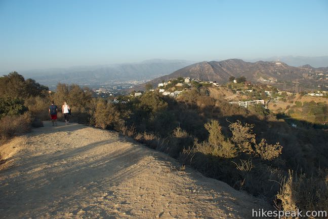
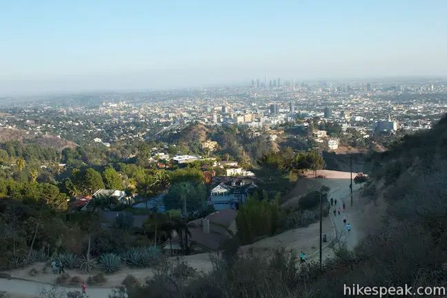
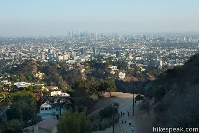
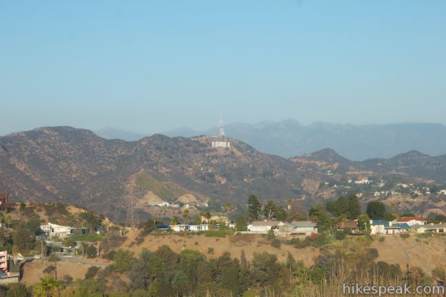
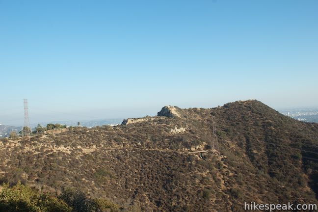
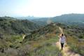
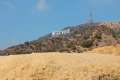
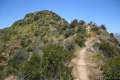
From Inspiration Point, the road is reduced to a wide single-track that makes a steep ascent up the ridgeline. Wooden steps assist in the climb as you gain another 340 feet over a third of a mile. East Ridge Trail levels out and provides eastern views toward Griffith Park and the Hollywood Sign. Continue up the ridge to a second viewpoint, Clouds Rest, which overlooks Los Angeles from an elevation of 1,040 feet.
Not far past this perch, the trail unites with Runyon Canyon Fire Road, 0.95 miles from the start of the hike. Now it is time to make a decision.
- Turn left to take the gradual Runyon Canyon Fire Road down the other side of Runyon Canyon for a 1.9-mile loop hike with 500 feet of elevation change
- Turn right to ascend to Western High Way Trail, which travels up, over, and down the ridge on the west side of Runyon Canyon for a 2.65-mile trek with 700 feet of elevation change
- If you hike all the way to the top of Runyon Canyon Fire Road, you can visit the highest point in Runyon Canyon Park before descending Western High Way Trail for a 3.3-mile hike with 800 feet of elevation change
If you select the shorter outing, simply take the fire road down into the canyon toward the Vista Street Gate. Turn left on the road just before the gate to return to junction with the original trail down the center of Runyon Canyon. Then turn right to exit through the Fuller Avenue Gate.
If you opt for one of the longer loops, keep in mind that the trail on the opposite ridge is less maintained with several steep sections and no wooden steps. Turn right on Runyon Canyon Fire Road and head up the mountain toward Mulholland Drive. After 0.4 miles, just past a house with a goat pen, you will reach an unmarked junction with a fire road heading uphill to the left. Turn left here for the 2.65-mile loop.
3.3-mile loop in Runyon Canyon Park
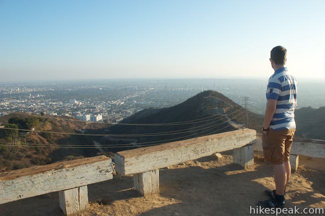
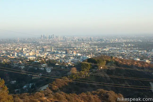
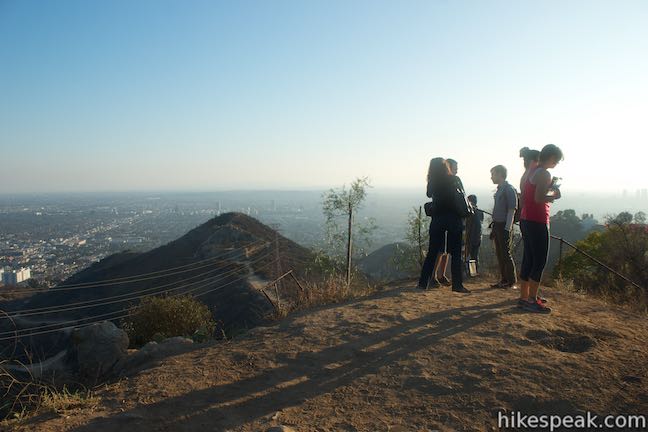
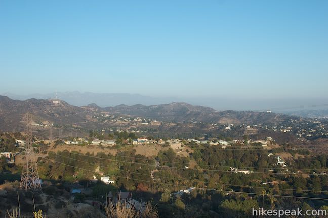
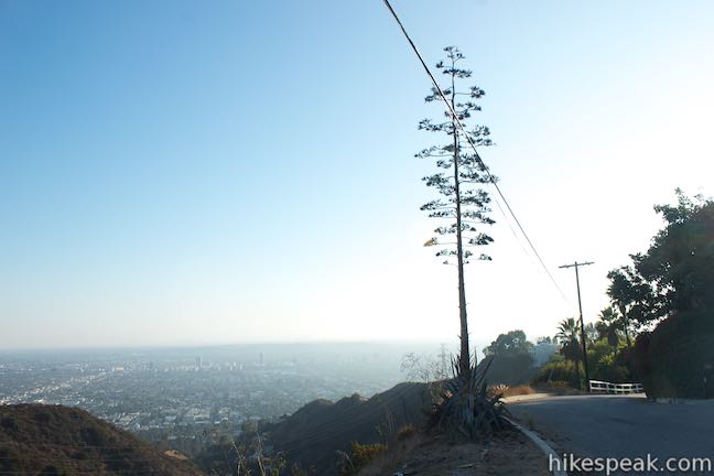
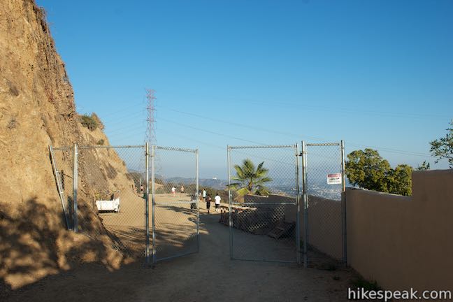
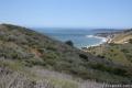
For the big loop to the top of the park, stay to the right and continue another 0.2 miles up Runyon Canyon Fire Road to the trailhead on Mulholland Drive. Come to the large gate at the trailhead and turn left to follow a dirt trail west that turns south toward the park’s high point. Pass through a switchback and come to another junction after 0.15 miles. Turn right to hike another 0.15 miles out to the park’s high point at 1,325 feet where you’ll get a sweeping view over Hollywood. The Hollywood Sign and the Griffith Observatory are easy to spot in Griffith Park to the east and the Pacific Ocean should be visible to the west beyond Santa Monica.
After taking in the views, backtrack to the junction and head the other way (to the right), hiking southwest for a tenth of a mile down to a junction on Western High Way Trail, a tenth of a mile from Runyon Canyon Fire Road where the extension to the top of the park began. Turn right to head toward Western High Way Trail.
2.65-mile loop in Runyon Canyon Park
For the 2.65 mile loop, turn left at the junction between Western High Way Trail and Runyon Canyon Fire Road. After a tenth of a mile, you will pass the trail coming down from the park’s high point on the right.
In another 0.15 miles, stay to the left past a dirt trail that connects to Solar Drive. This road can be used to connect Runyon Canyon Park to the top of Trebek Open Space, 0.4 miles away (hike 0.25 miles down Solar Drive to Astral Drive and turn left to reach Astral Drive Trail).
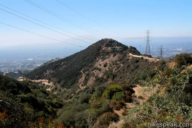
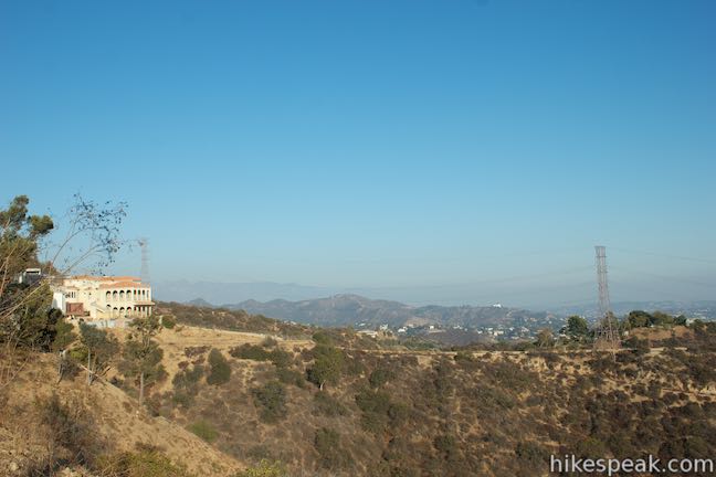
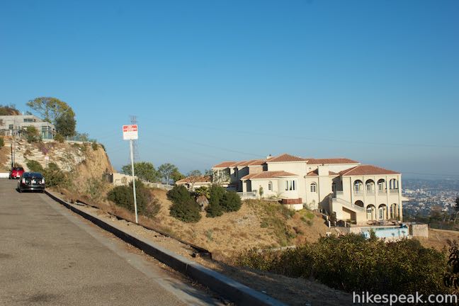
Beyond this junction Western High Way Trail passes a mansion and descends toward a ridge on the west side of Runyon Canyon Park, narrowing to a southbound single track. A short steep spurt brings you up a distinct rock outcropping near the 1,200-foot high point of the ridge. To the west are nice views over Trebek Open Space and Nichols Canyon.
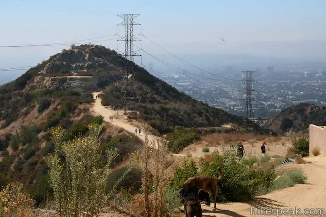
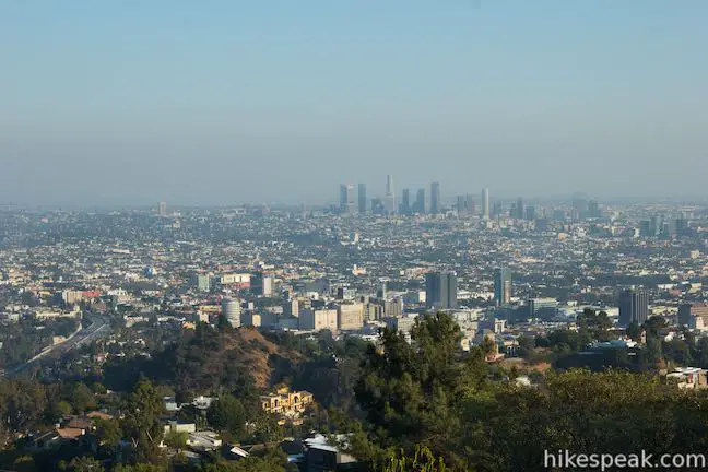
From this lofty vantage, the congestion of hikers below look like ants marching up the mountainside. Most trails around Los Angeles offer the opportunity to escape city life. At Runyon Canyon, hikers trade solitude for community.
Take in the towering view of the cityscape to the south before making a steep decent into the canyon. Be careful coming down off the ridge. The dirt is loose in places and the precipitous trail drops 600 feet in just half a mile.
The rough trail ends just above the Vista Street Entrance, meeting up with Runyon Canyon Fire Road. A short distance up the road from the gate, take an immediate right and drop down to the original trail in the center of Runyon Canyon. The loop is complete. Turn right to exit the park through the Fuller Avenue Gate.
Runyon Canyon Park has additional short trails that you may wish to explore. The 0.85-mile 1.9-mile, 2.65-mile, and 3.3-mile hikes all offer great overviews of Runyon Canyon. No fee or permit are required to hike in Runyon Canyon Park, so get out and enjoy.
Use these turn-by-turn directions for the loop that interests you:
The 1.9-mile loop in Runyon Canyon Park
- Enter the park from the main trailhead at the top of North Fuller Avenue (0 miles)
- Pass a connector trail on the left and continue straight to begin the loop (0.05 miles)
- Reach Inspiration Point at the top of the wide trail and turn left up narrower East Ridge Trail (0.45 miles)
- Pass Clouds Rest and another view over Hollywood (0.8 miles)
- Turn left down Runyon Canyon Fire Road (0.95 miles)
- Turn left on a connector trail in front of the Vista Street Gate (1.75 miles)
- Turn right down the main trail back to the Fuller Avenue Entrance (1.85 miles)
- End where the hike began (1.9 miles)
The 2.65-mile loop in Runyon Canyon Park
- Enter the park from the main trailhead at the top of North Fuller Avenue (0 miles)
- Pass a connector trail on the left and hike straight up the center of the park (0.05 miles)
- Reach Inspiration Point at the top of the wide trail and turn left up East Ridge Trail (0.45 miles)
- Pass Clouds Rest and another view over Hollywood (0.8 miles)
- Turn right up Runyon Canyon Fire Road (0.95 miles)
- Turn left on Western High Way Trail (1.35 miles)
- Turn left down the ridge before reaching Solar Drive (1.6 miles)
- At the bottom of the ridge, cross Runyon Canyon Fire Road and take the connector trail east (2.5 miles)
- Turn right down the main trail back to the Fuller Avenue Entrance (2.6 miles)
- Finish where you began (2.65 miles)
The 3.3-mile loop in Runyon Canyon Park
- Enter the park from the main trailhead at the top of North Fuller Avenue (0 miles)
- Pass a connector trail on the left and begin the loop, hiking up the center of the park (0.05 miles)
- Reach Inspiration Point at the top of the wide trail and turn left up East Ridge Trail (0.45 miles)
- Pass Clouds Rest and another view over Hollywood (0.8 miles)
- Turn right up Runyon Canyon Fire Road (0.95 miles)
- Continue past Western High Way Trail (1.35 miles)
- Reach the gate at the top of the trail by Mulholland Drive and turn left on a trail heading back into the park (1.55 miles)
- Come to a split and bear right (1.7 miles)
- Reach a vista at the high point of the park (1.85 miles)
- Return to the trail split and bear right to descend toward Western High Way Trail (2 miles)
- Turn right on Western High Way Trail (2.1 miles)
- Turn left down the ridge, before reaching Solar Drive (2.25 miles)
- At the bottom of the ridge, cross Runyon Canyon Fire Road and take the connector trail east (3.15 miles)
- Turn right down the main trail back to the Fuller Avenue Entrance (3.25 miles)
- End where the hike began (3.3 miles)
The 0.85-mile loop in Runyon Canyon Park
- Begin from the Mulholland Drive Trailhead and take the trail to the right (west) of the wider trail, which is Runyon Canyon Fire Road (0 miles)
- Come to a split and bear right (0.15 miles)
- Reach a vista at the high point of the park (0.3 miles)
- Return to the trail split and bear right to descend toward Western High Way Trail (0.45 miles)
- Turn left down Western High Way Trail (0.55 miles)
- Meet Runyon Canyon Fire Road and turn left (0.65 miles)
- Return to the Mulholland Drive Trailhead (0.85 miles)
Can you take dogs to Runyon Canyon?
Yes. Runyon Canyon is a dog-friendly park that even has off-leash areas. Los Angeles has many other dog-friendly trails.
How long does it take to hike Runyon Canyon?
You can spend anywhere from 15 minutes to a couple hours exploring Runyon Canyon Park on hikes from 0.85 to 3.3 miles.
Directions to the Trailhead
Fuller Avenue Trailhead:
- From Hollywood Boulevard, travel 0.2 miles west of La Brea Ave. and head north on North Fuller Avenue.
- The entrance to Runyon Canyon Park is at the top of Fuller Avenue.
- Begin searching for street parking across Franklin Avenue.
- Street parking can be scarce.
Mulholland Drive Trailhead (Upper Trailhead):
- From Hollywood, take the 101 Freeway north to Cahuenga Pass and exit 11A for Barham Boulevard.
- The offramp joins Cahuenga Boulevard East.
- Before reaching Barham, turn right up Lakeridge Place (don't speed past).
- Go through one intersection and turn right onto a bridge over the 101 Freeway.
- Across the bridge, turn left up Mulholland Drive and travel 1.5 miles to the trailhead parking area, which will be on the left.
- Coming south down the 101 Freeway, take exit 12A for Lankershim Boulevard.
- At the end of the offramp, turn left and head south on Cahuenga Boulevard.
- Drive 1.3 miles to Mulholland Drive.
- Turn right and go the 1.5 miles up the trailhead.
Trailhead Location
Trailhead address: Fuller Avenue Trailhead, 1854 North Fuller Avenue, Los Angeles, CA 90046
Trailhead coordinates: 34.105259, -118.348933 (34° 06′ 18.93″N 118° 20′ 56.15″W)
Trailhead address: Runyon Canyon North Entrance, 7317 Mulholland Drive, Los Angeles, CA 90046
Trailhead coordinates: 34.1194, -118.3531 (34° 07′ 09.8″N 118° 21′ 11.2″W)
View Santa Monica Mountains in a larger map
Or view a regional map of surrounding Los Angeles trails and campgrounds.


Solar Drive to West Ridge

 | Trebek Open Space This 2.5-mile hike incorporated Bantam Trail and Castair Trail in a park adjacent to Runyon Canyon. |
 | Fryman Canyon Loop This 3-mile loop follows Betty B. Dearing Trail through Wilacre Park and Coldwater Canyon Park around Fryman Canyon in the Studio City side of the Hollywood Hills. |
 | Hastain Trail This pair of short loops explore Franklin Canyon Park and ridges in the Santa Monica Mountains above Beverly Hills. |
 | Franklin Canyon Lake Loop & Chaparral Trail This 2.5-mile hike loops around Franklin Canyon Lake and ascends Chaparral Trail (optionally) for an overview of Franklin Canyon. |
 | Bronson Cave This short easy hike visits a man-made cave recognizable as the Batcave from the 1960s Batman TV series and hundreds of other locations on TV and film. |
 | Mount Lee and the Hollywood Sign via Hollyridge Trail This 3.5-mile hike ascends 750 feet to reach the summit of Mount Lee behind the Hollywood Sign. |
 | Mount Lee and the Hollywood Sign via Brush Canyon Trail This 6.4-mile hike crosses Griffith Park from Canyon Drive to the top of Mount Lee directly behind the landmark Hollywood Sign. |
 | Cahuenga Peak This 3-mile hike on Burbank Peak Trail and Aileen Getty Ridge Trail ascends to Cahuenga Peak and the adjacent Mount Lee, home of the Hollywood Sign. |
 | Lake Hollywood Reservoir Walking Trail This 3.5-mile loop circles a peaceful fence-enclosed reservoir in the hills below the Hollywood Sign. |
 | More trails in the Santa Monica Mountains Explore other destinations in the range. |
 | Talepop Loop This 4.75-mile hike climbs 500 feet over a scenic mountain between Liberty Canyon and Las Virgenes Canyon on the north end of Malibu Creek State Park. |
 | Zuma Canyon Ocean View Trail - Canyon View Trail Loop This 3.1-mile loop demands more effort than Zuma Canyon Trail and provides great ocean and canyon views. |
 | Corral Canyon This 2.5-mile loop offers ocean and canyon views from a unspoiled section of the Santa Monica Mountains in Malibu. |
 | Temescal Canyon This 2.6-mile loop offers a variety of scenery and decent exercise, despite its relative brevity. |
- Runyon Canyon Park on alltrails.com (opens in a new tab)
- Runyon Canyon Park on wikipedia.org (opens in a new tab)
- Runyon Canyon on hikingguy.com (opens in a new tab)
- Runyon Canyon on thehikersway.com (opens in a new tab)
- A Hollywood Reporter article on "Why Hiking Runyon Canyon Is the Best Way to See the Stars" (opens in a new tab)
- The National Park Service webpage for Runyon Canyon Park (opens in a new tab)
- The Los Angeles Department of Recreation and Parks webpage for Runyon Canyon Park (opens in a new tab)
Common Questions about Runyon Canyon Loops in Runyon Canyon Park
- Is the trail open?
- Yes. You should expect to find that Runyon Canyon: East Ridge Trail - West High Way Trail Loop is open. There are no recent reports of trail closures. If you discover that the trail is closed, please help your fellow hikers by reporting a closure.
- Is this trail free to access?
- Yes, Runyon Canyon: East Ridge Trail - West High Way Trail Loop is free to access. No entrance fee, pass, or permit is required. If you discover that access rules have changed, please provide feedback on your experience.
- How much time does this hike take?
- It takes approximately 1 hour 30 minutes to hike Runyon Canyon: East Ridge Trail - West High Way Trail Loop. Individual hiking times vary. Add extra time for breaks and taking in the views.
- How long is this hike?
- The hike to Runyon Canyon: East Ridge Trail - West High Way Trail Loop is 0.85 to 3.3 miles (loop) with 500 to 800 feet of elevation change.
- Are dogs allowed on this trail?
- Yes, dogs are allowed on Runyon Canyon: East Ridge Trail - West High Way Trail Loop. The trail is open to hikers, dogs.
- What mountain range is this trail in?
- Runyon Canyon: East Ridge Trail - West High Way Trail Loop is located in the Santa Monica Mountains.
- Where is the trailhead located?
- The trailhead for Runyon Canyon: East Ridge Trail - West High Way Trail Loop is located in Los Angeles, CA.
Trailhead Address:
1854 North Fuller Avenue
Los Angeles, CA 90046
Trailhead Coordinates:
34.105259, -118.348933 - What are the driving directions to the start of the hike?
To get to the trailhead: Fuller Avenue Trailhead: From Hollywood Boulevard, travel 0.2 miles west of La Brea Ave. and head north on North Fuller Avenue. The entrance to Runyon Canyon Park is at the top of Fuller Avenue. Begin searching for street parking across Franklin Avenue. Street parking can be scarce.
Mulholland Drive Trailhead (Upper Trailhead): From Hollywood, take the 101 Freeway north to Cahuenga Pass and exit 11A for Barham Boulevard. The offramp joins Cahuenga Boulevard East. Before reaching Barham, turn right up Lakeridge Place (don't speed past). Go through one intersection and turn right onto a bridge over the 101 Freeway. Across the bridge, turn left up Mulholland Drive and travel 1.5 miles to the trailhead parking area, which will be on the left. Coming south down the 101 Freeway, take exit 12A for Lankershim Boulevard. At the end of the offramp, turn left and head south on Cahuenga Boulevard. Drive 1.3 miles to Mulholland Drive. Turn right and go the 1.5 miles up the trailhead.
View custom Google Maps directions from your current location.
- Are there other trails near Runyon Canyon: East Ridge Trail - West High Way Trail Loop?
- Yes, you can find other nearby hikes using the Hikespeak Hike Finder Map.

29 Comments on Runyon Canyon Loops in Runyon Canyon Park
What hikers are saying:
✨ Generated summary of user commentsHikers appreciate this trail for its convenient access and sweeping views of the city and ocean. While the atmosphere is social and energetic, visitors should prepare for heavy crowds and the absence of public restrooms. Jeff warns to read parking signs carefully, as many residential streets prohibit weekend parking or have street cleaning on Mondays and Tuesdays starting at 11 a.m. To find a more peaceful experience, look for narrow dirt footpaths that branch off the main fire road.
giant dog bathroom.
What happened to the bench at Runyon Canyon? That is the BEST bench in the whole world! It made the hike special because you could sit on the bench, look out at the whole city, the bench had a certain tilt that made a person feel that they were flying out over the city…I LOVED that bench!!!!!!
PLEASE BRING IT BACK! PLEASE? Please? please????
Hi Dana! Do you know if they ever brought the bench back or replaced it with something else? What was so special about that spot? Why did they take it away in the first place?
i want to go to the trails tomorrow april 20, 2013, what is the address to put in for mapquest. thank you
kim
Trailhead address: 1854 North Fuller Avenue, Los Angeles, CA 90046
Trailhead coordinates: 34.105259, -118.348933
[…] Hiking directions: Pass through the large gate at the top of Fuller Ave. and hike up the canyon to a junction at the beginning of the loop. The wide road heading to the left offers a gradual route up the canyon, so continue straight ahead for more of a workout. Proceed up the canyon through an off-leash area and follow the sharp bend to the right up the east side of the canyon. Reach the bench at Inspiration Point and continue up the ridge to the second viewpoint, Clouds Rest. The ridge trail meets Runyon Canyon Fire Road just above the viewpoint, about a mile from the start. Turn left and take the gradual trail down the other side of Runyon Canyon. Turn left on the road just before the Vista Street Gate to return to the first junction in Runyon Canyon. Turn right to exit the park through the Fuller Avenue Gate. To see more photos and information about this hike, visit Runyon Canyon Park on hikespeak.com. […]
Poor, poor Runyon Canyon gets a bad rap, but how else can I get a 3.5 mile hike in seven days a week? The trailhead is only two blocks away from my front door, so it can’t be beat for ease of access. Yes, there are the major drawbacks of overcrowding and terribly inexperienced and unprepared tourists jamming up even the easiest of descents with their bad shoes and fear of falling. However, if you’re willing to explore the trails that are off the beaten path, there are some real hidden gems! There’s a secret path with no identifiable trailhead in Wattles Garden Park that is very steep, very isolated, and will lead you right up to the Prayer Box summit. Also, there are a few great isolated footpaths that snake through the canyons and can make for a much more challenging and enjoyable hike. My advice is to visit the park a few times and follow the dirt trails that the tanned hardbodies are ignoring, then craft your own hike!
Tanned hardbodies? That sounds great
[…] apartment resident who loves to get out and about and has yet to glimpse the Hollywood sign on a hike near the Hollywood Hills, make plans to visit Runyon Canyon. Here are a few of the highlights of this urban nature […]
[…] 1. Runyon Canyon: This was my first hiking spot in LA and is the closest to where I live. My husband and I used to do Sunday morning hikes here every weekend before we had kids. It is easily accessible, provides great views of the city, and also is pretty good for celeb spotting. It is also popular with dog owners. The one downside to this hike for me is that it is always busy — there are a lot of people and dogs to dodge. It’s a great place for a social hike, but when I hike alone I prefer a quieter place. You can find more details about the trail and how to get there here. […]
[…] Hollywood Boulevard and head up to Runyon Canyon Park where Angelenos and celebrities alike head to escape the concrete jungle. One of the city’s most […]
Loved the experience however got a parking ticket. The signs for parking are not really clear to understand. Where is the best place to park. They should be clearly marked.
Some of the streets around there like Vista, Gardner, and a couple of blocks of Franklin had new parking restrictions put in a few years ago, so you need to read the signs carefully. People are so used to seeing those green 2-hour 8am-6pm signs all over town, that many don’t notice that sometimes those signs also say “Monday thru Friday” – which means you are NOT allowed to park on Saturday and Sunday without a local permit. Thus, you will get a parking ticket as it also says “No Parking anytime except for…” If the 2-hour green signs don’t indicate M-F, then you can park there on the weekends. I’ve seen so many people get tickets on the weekends because they don’t notice the M-F part on the green signs, and I’ve also told so many people as they were parking and saved them from getting a ticket.
I find that on the weekends, it’s very hard to find parking close by regardless, so I just find a spot on any of the streets just south of Hollywood Blvd. None of those streets have the weekend permit restriction, either. On Hollywood Blvd itself is also no permit parking. And besides the permits, there is street cleaning all over that entire area on Mondays and Tuesdays starting at 11am or 12 noon depending on the block – so make sure to check those signs as well.
Anyway, happy hiking!!
Runyon Canyon Park Loops was recommended by a friend as I visited LA area this past weekend. I got in a great walk with my wife and took in the views from the high points. The park has No parking, no bathrooms and is not well kept compared to others parks I have visited. Also the dog owners need to do a better job of picking up poop! There was a lot of poop on the trail but not as much as I saw in a one block radius on the sidewalks while walking up to the trail. All the more reason to keep dogs on a leash!
Is Runyon Canyon open to the public, I heard there were gonna close the park for a short period of time? When I visit LA I love going for a hike there.
Runyon Canyon is scheduled to be closed through July. In the meantime, try hiking ‘next door’ in Trebek Open Space.
Can I get to the walking trail from the north side off the 101 freeway?
[…] trail”, the east or “steps” trail, and the west or “spine” trail. I remembered reading at hikespeak.com to go counterclockwise for a steeper, more scenic climb, so we continued straight (and did not take […]
How would you rate the hike in terms of moderate to difficult
East Ridge Trail and West High Way Trail are moderate trails with steep section. Runyon Canyon Fire Road, the wide trail up the park between those two ridge trails is the easiest.
[…] hikespeak.com — learn about the trails and see what it looks like there. […]
[…] Skip Hollywood Boulevard and head up to Runyon Canyon Park where Angelenos and celebrities alike head to escape the concrete jungle […]
Hi, my corporation would like to set up a table to give away free samples of our Eco-Friendly & compostable Pet bags to the hikers. Are we allowed to do that? Do we need to sign up for permission?
The location is easy to reach, but parking in the residential area can be a challenge. Runyon Canyon is fun, easy, and may be crowded depending on the day of week and time.
If you’re looking for solitude, pristine pine trees, and high elevation, quiet rails, then this isn’t for you. This is an easy access and very popular trail in the middle of Hollywood, CA. So accept it for what it is, enjoy it for an easy outdoor treat for yourself and pets, and be happy.
If you want more challenging hikes, away from the hustle and crowds, look up hiking trails in the Angeles National Forest, San Gabriel Mountains. You will find what you’re looking for but with a little more driving up the Angeles Crest Highway 2 (Calif SR-2).
This is a recommended hike if you don’t have all day and want some sun with nice views over Hollywood, Santa Monica mountains, and the Ocean.
Make the best of it, enjoy it, and if you have a dog remember to bring water for your pet, and poop bags.
[…] who live in Los Angeles don’t seem to know how easy it is to go hiking. Sure, they know about Runyon Canyon. (We all know about Runyon Canyon, as the crowds and lack of parking will confirm.) Some of them […]
[…] Runyon Canyon – One of Hollywood’s most popular hiking trails, Runyon Canyon is often crowded with locals […]
Visiting Runyon Canyon for first time. 68 years old who does not do a lot of walking. Will I be able to do any of the routes. I will be with other people so if not is there a place to just hang out
My dad took me there when I was a kid. It wasn’t a park then. He told me stories of how that was once Errol Flynn’s property and he showed me the tennis court and the burned wreckage of Errol Flynns house at the top of his drive. There used to be guest houses and workers quarters just rotting away in 1978 when he spent a summer in those hills off of Fuller.
[…] Runyon Canyon offers two main hikes—don’t go left at the start unless you want to partake in what my friend Jenn and I jokingly dubbed the Suicide Trail. Veering left is a harder trail that you want for a casual morning hike. […]