Parker Mesa Overlook via East Topanga Fire Road and Los Liones Trail in the Santa Monica Mountains
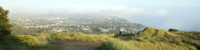
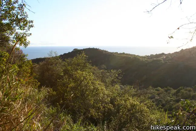
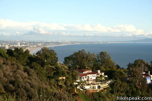
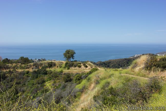
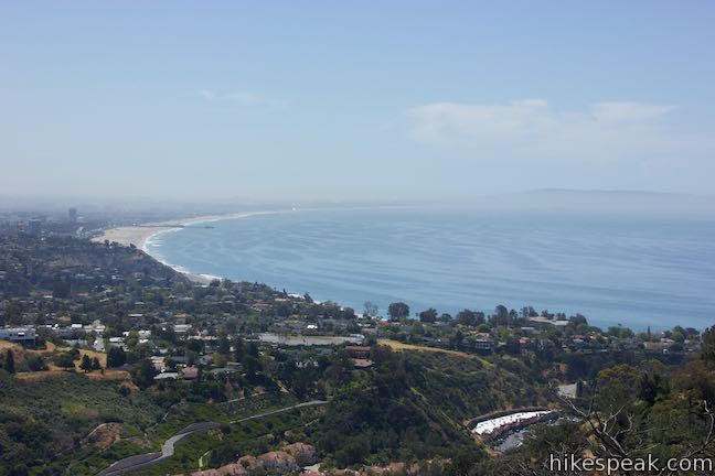
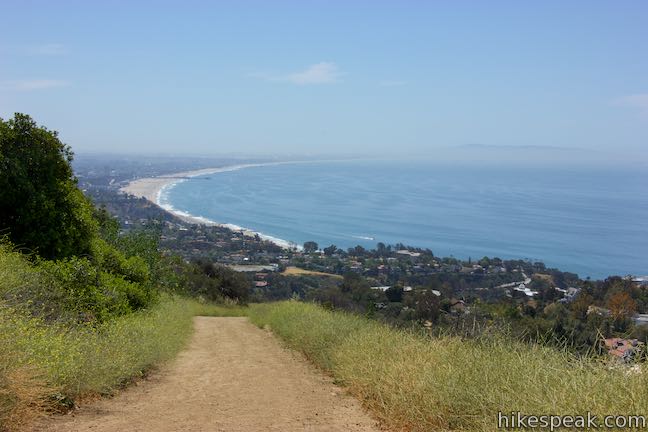
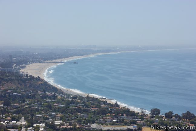
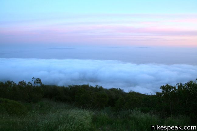
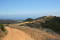
Parker Mesa Overlook offers panoramic views of Santa Monica Bay and the Pacific Ocean. The coastline spans from Palos Verdes to Malibu, with nothing but blue in between.
Parker Mesa Overlook is located on the west side of Topanga State Park, which holds the distinction of being the:
World’s largest wildland within the boundaries of a major city.
This distinguishes it from Griffith Park, which is the:
Largest municipal park and urban wilderness area in the United States.
Both parks offer great hikes. The trek to Parker Mesa Overlook is no exception.
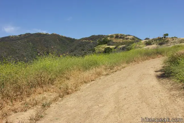
Parker Mesa Overlook sits at the end of a spur trail off East Topanga Fire Road, which runs north to south from Trippet Ranch at the heart of Topanga State Park down to a paved street in the Pacific Palisades north of Sunset Boulevard. One way to reach the mesa is to hike down the fire road from Trippet Ranch to Parker Mesa Overlook for a 6.7-mile round trip hike with 375 feet of elevation gain.
You may also start from the southern end of East Topanga Fire Road at the top of Paseo Miramar. This is a 5.7-mile round trip hike to Parker Mesa Overlook with 900 feet of elevation gain. A longer option is available from a lower trailhead just to the west, at the top of Los Liones Drive. The 1.3-mile long Los Liones Trail climbs a lush slope up to a junction near the bottom of East Topanga Fire Road facilitating a serious 7.8-mile round trip hike with 1,300 feet of elevation gain. These arduous treks are rewarded by sweeping ocean and canyon views.
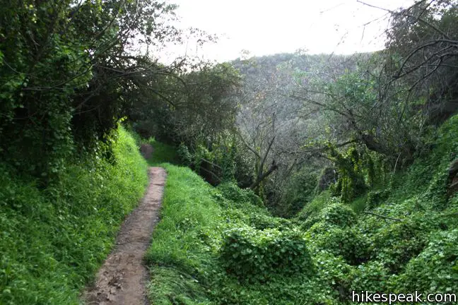
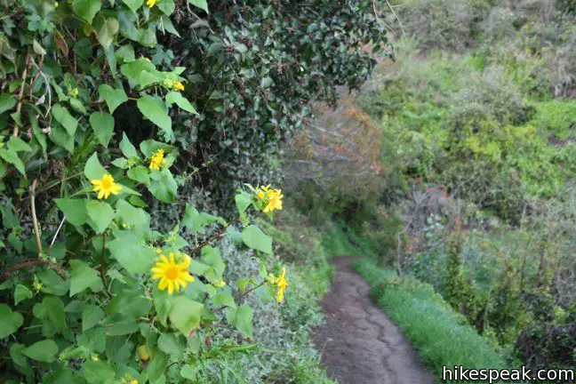
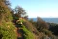
Starting from the trailhead at the end of Los Liones Drive: Find the trail to the right of the cul-de-sac and begin the climb. The single track weaves up an incredibly lush canyon. Slivers of the Pacific offer a taste of the broad ocean views to come.
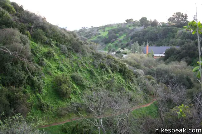
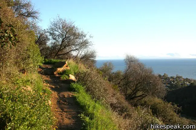
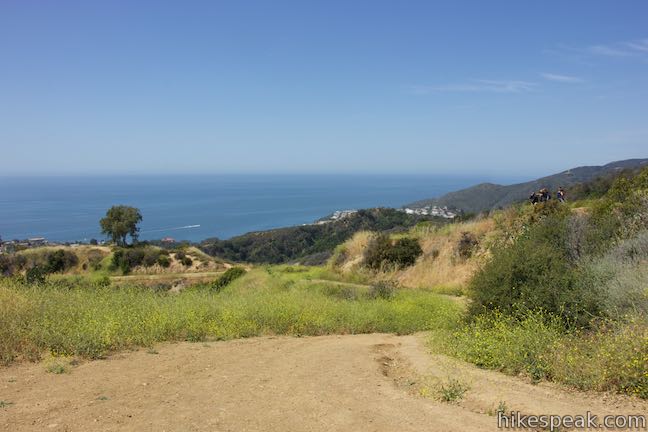
After 1.3 miles, the ivy and chaparral lined trail reaches East Topanga Fire Road and opens up on a great view of the coast. Catch your breath and turn left (almost a full U-turn) up the fire road, joining hikers and mountain bikers from the Paseo Miramar trailhead.
Starting from the trailhead at the top of Paseo Miramar: Where the paved road ends, the hike begins. Take the wide dirt trail leaving the end of the road and begin hiking. East Topanga Fire Road goes up an curves to the right with nice views over Santa Monica Bay.
After a quarter mile, East Topanga Fire Road meets the junction with the Los Liones Trail. From the top of Los Liones Trail, it is another 2.6 miles to Parker Mesa Overlook. East Topanga Fire Road climbs 700 feet over the next 1.15 miles.

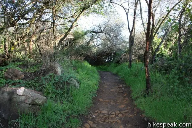
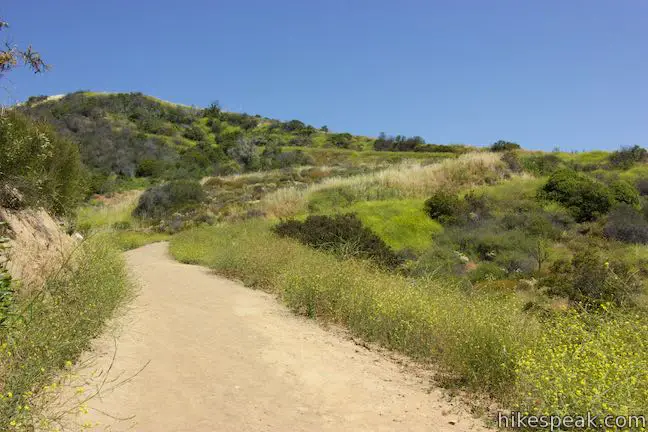
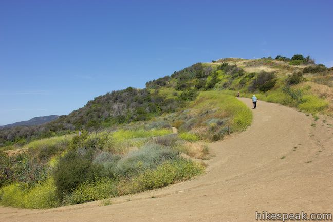
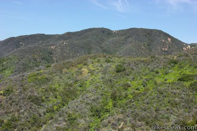
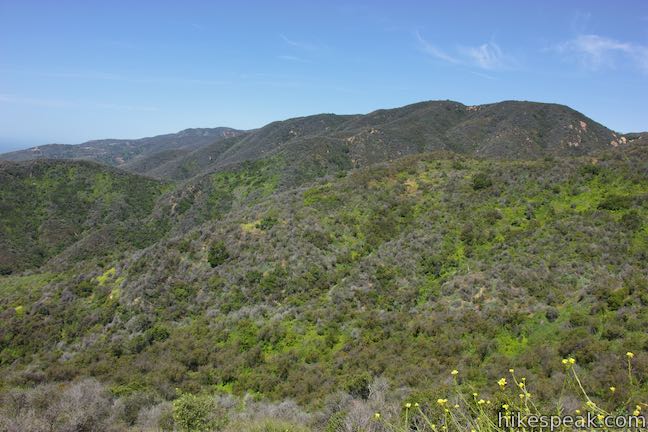
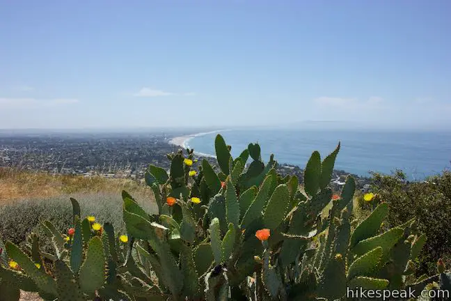
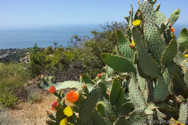
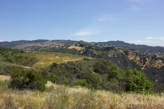
The vegetation along the trails is primarily grasses and sagebrush that provide broad views and lots of sun exposure. Trees offer occasional pockets of shade.
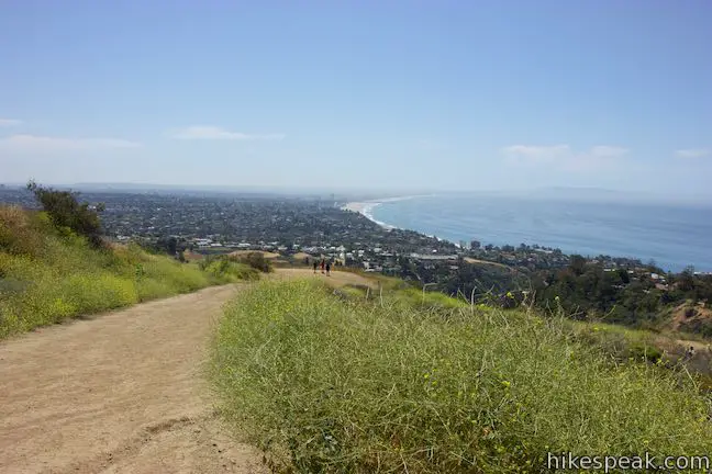
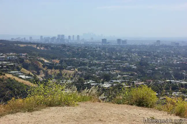
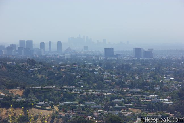
A quarter mile above the Los Liones Trail Junction, there is a path on the right that extends 125 yards out along a flat part of the ridge to a perch with nice views over Santa Monica Bay and inland toward downtown Los Angeles. For a short, but still rewarding hike, you could turn around here for a 1.15-mile round trip hike with 325 feet of elevation change from the Paseo Miramar Trailhead.
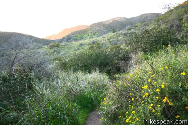
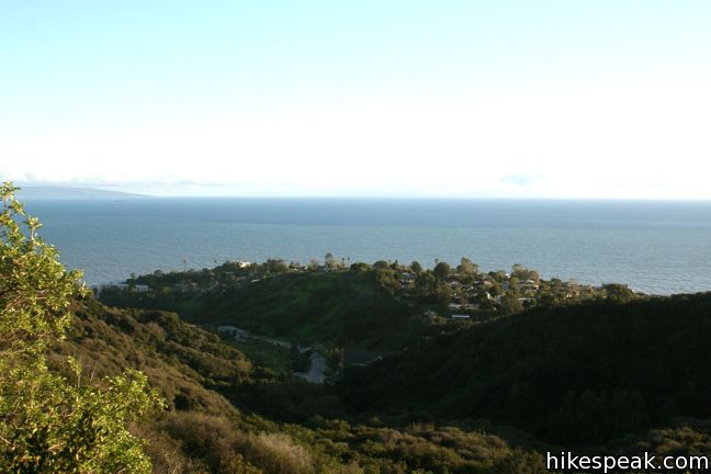
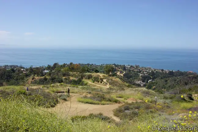
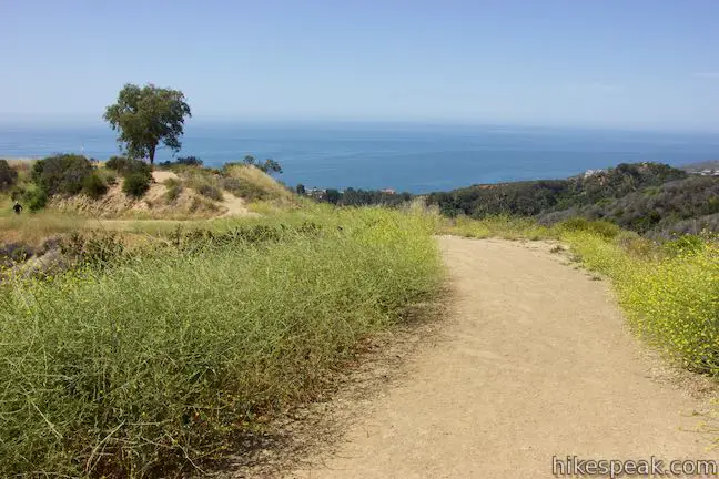
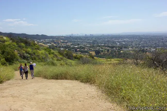
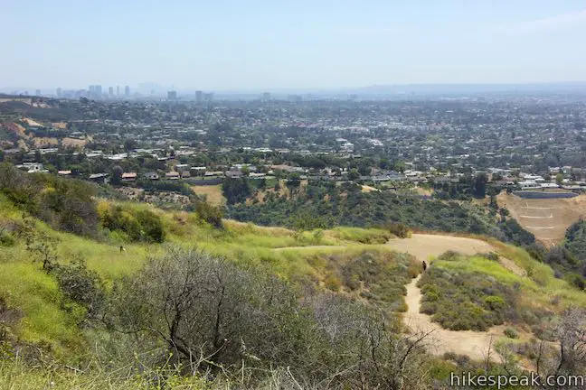
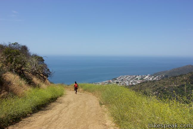
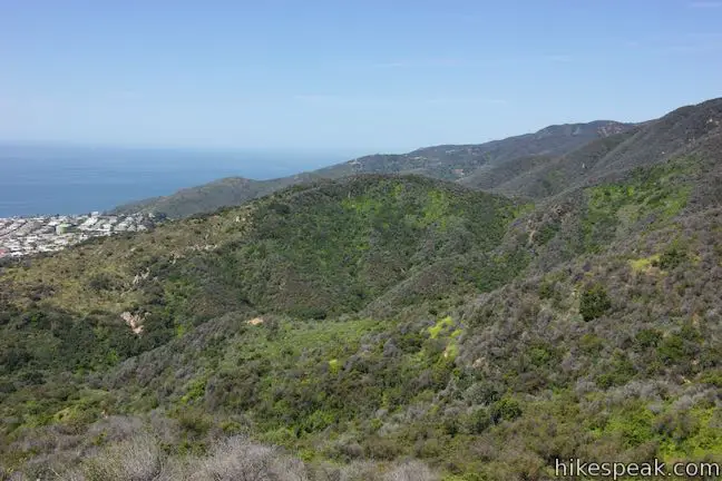
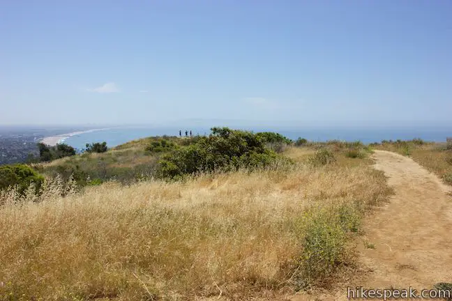
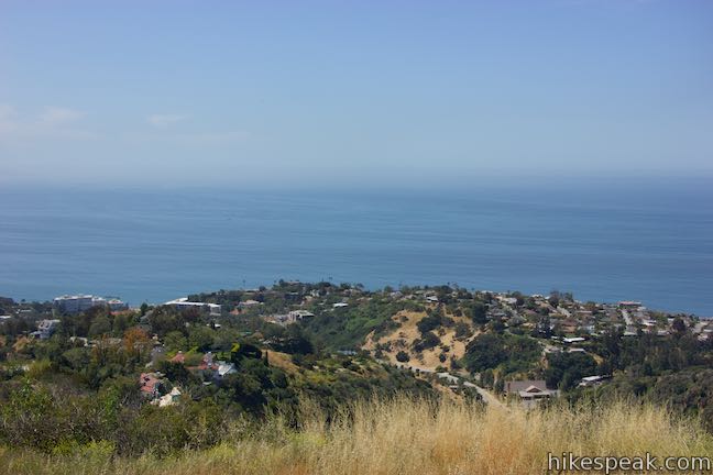
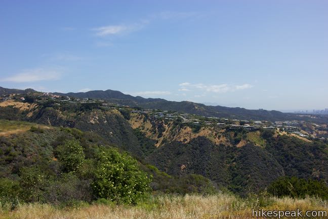
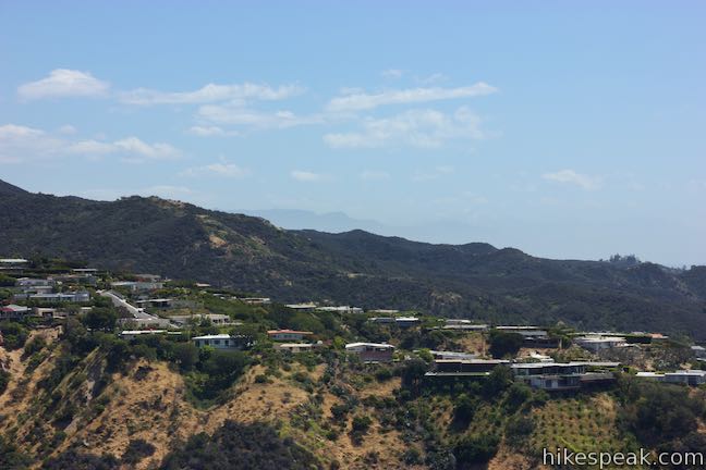
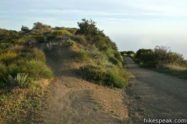
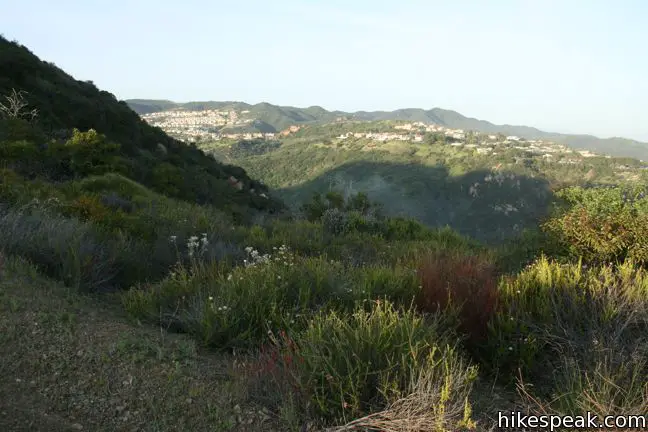
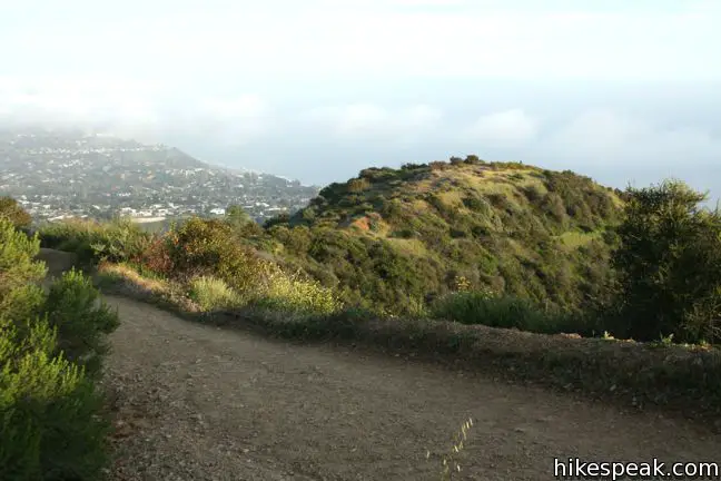
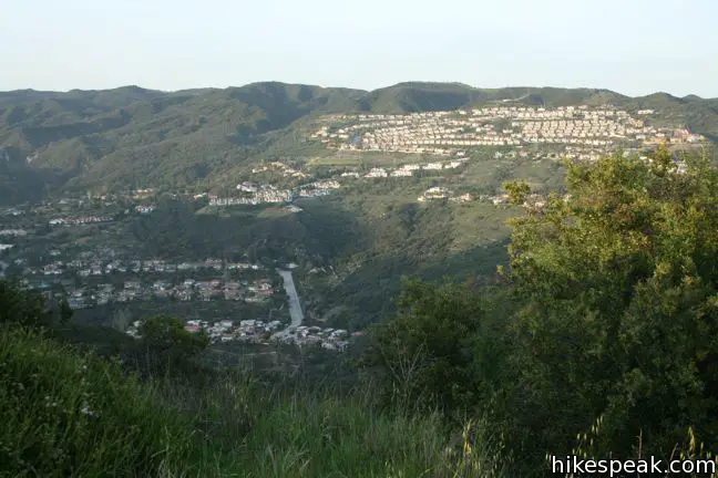
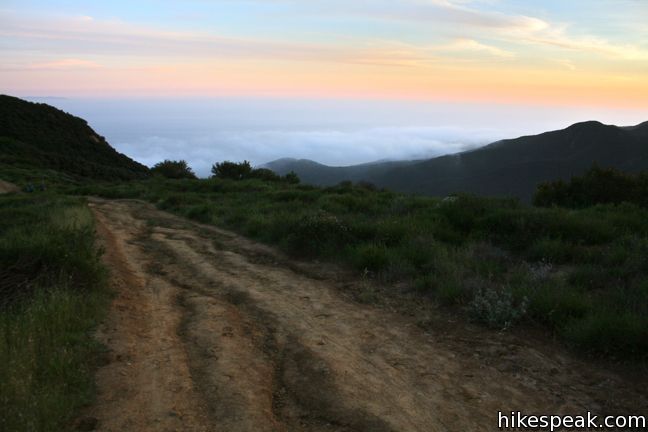
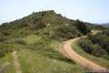
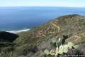
East Topanga Fire Road proceeds past the spur with views up green ridges toward Parker Mesa Overlook. The views expand as you gain more elevation. Find ocean views to the west and views of Temescal Ridge and the houses off Palisades Drive to the east.
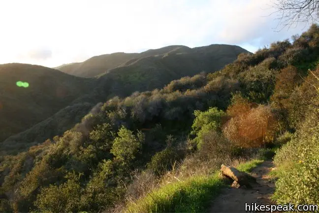
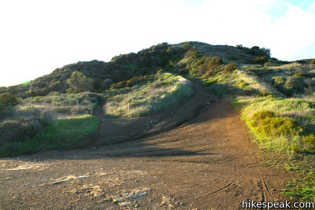
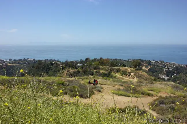
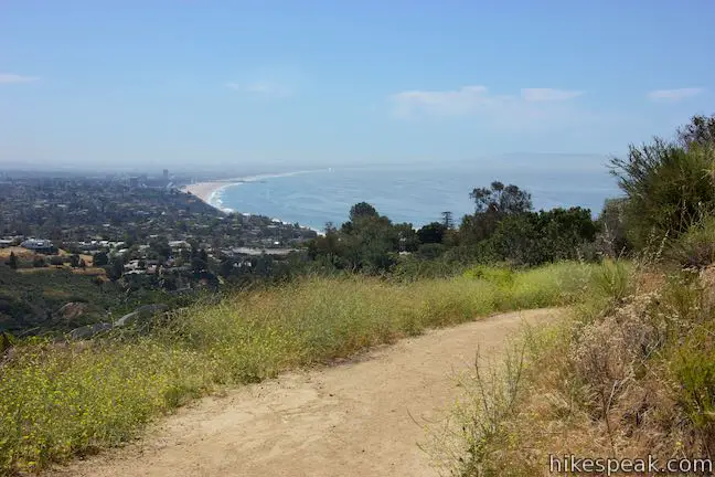
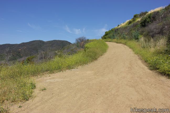
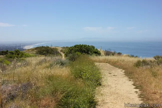
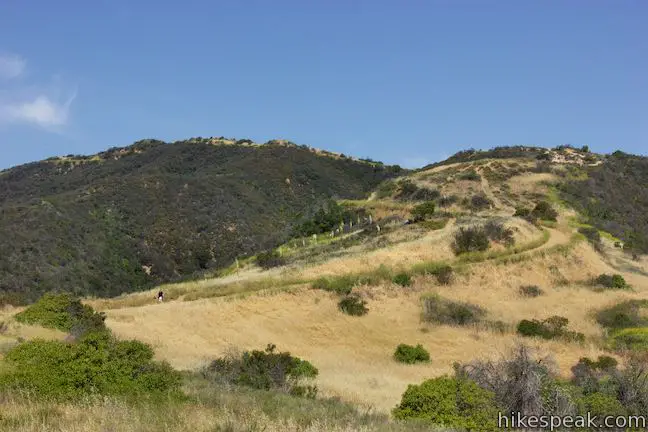
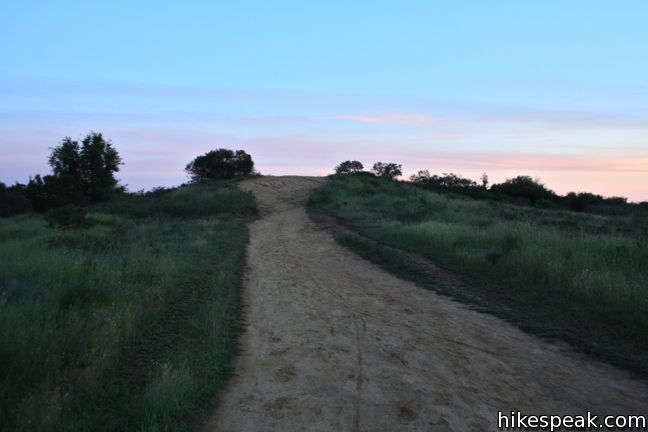
East Topanga Fire Road dips across a saddle, dropping 100 feet, before climbing back up to a junction with the spur trail to Parker Mesa Overlook, 2.05 miles from the Los Liones Trail junction. Ahead, the fire road continues toward Trippet Ranch. Turn left and hike the final 0.55 miles over rolling terrain to the overlook at the end of the mesa.
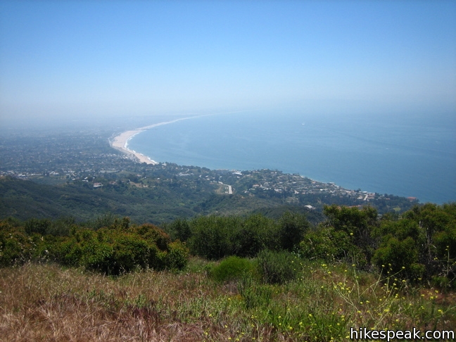
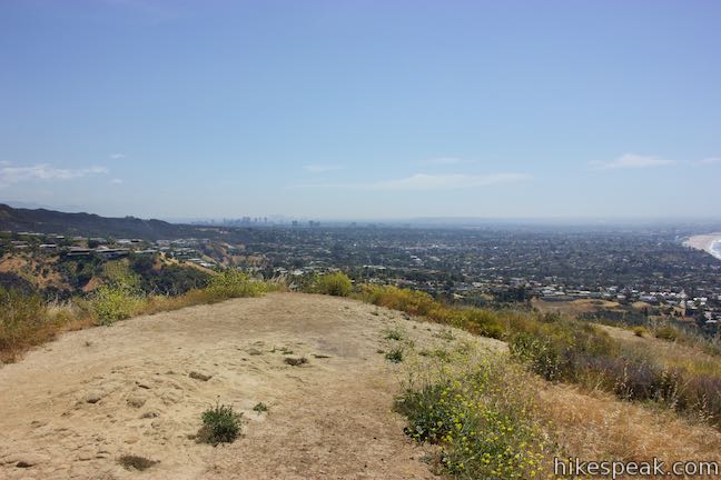
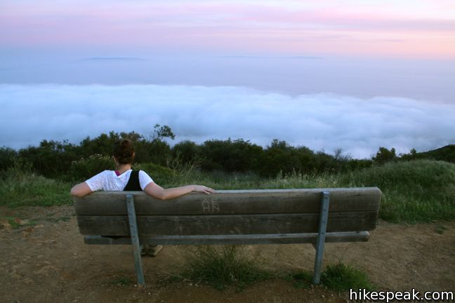
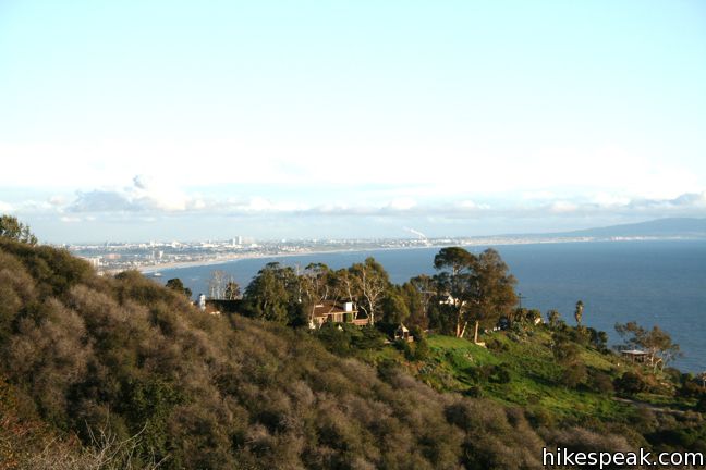
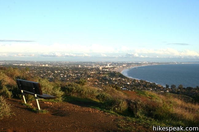
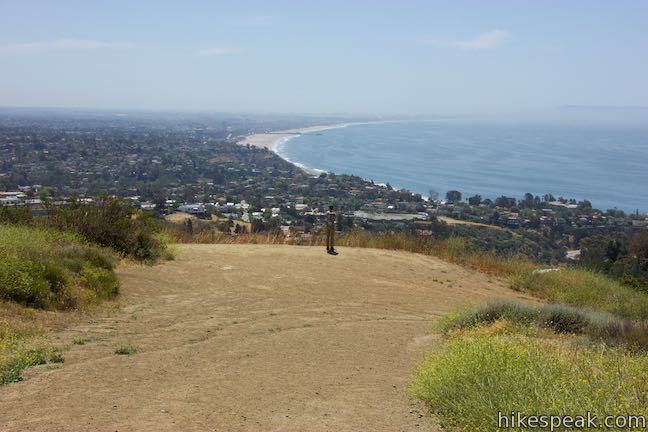
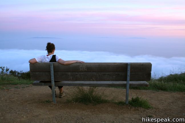
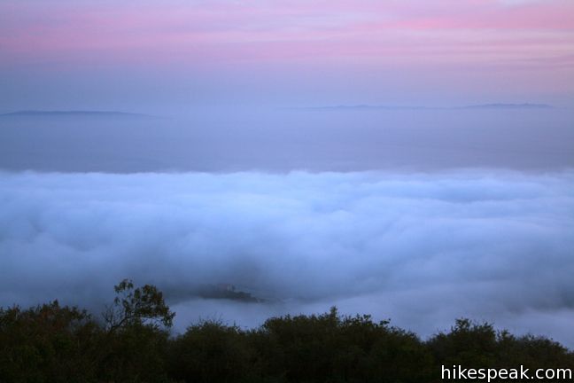
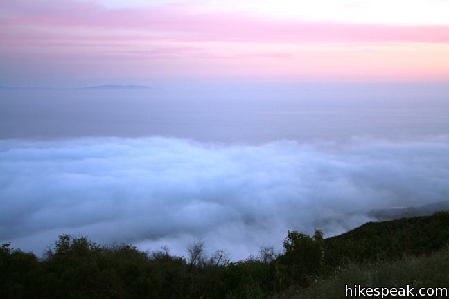
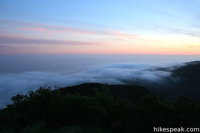
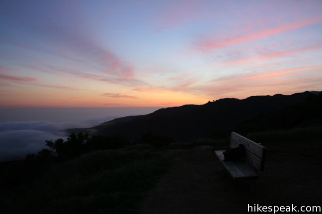
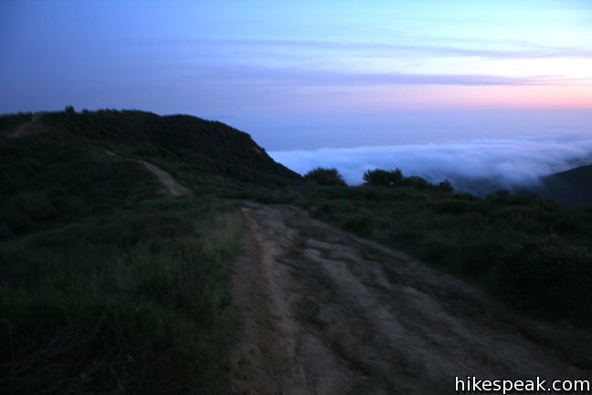
From an elevation of 1,525 feet, Parker Mesa Overlook provides quite a perch over the Santa Monica Mountains and the Pacific Ocean below. A pair of benches have been kindly provided, so have a seat and enjoy the panoramic view. The mesa has the potential to deliver a mesmerizing sunset. Though you should pack a flashlight for the hike back if you plan to stay that late.
After exploring the overlook, hike back to the turnoff. make a right, and return the way you came. To add extra mileage to your hike, continue north along East Topanga Fire Road toward Trippet Ranch. This trail is mostly downhill with more good views of the ocean and the Pacific Palisades neighborhoods nestled into the mountains.
The longer hike beginning on Los Liones Trail provides a great workout and is a good trial-by-trail to condition yourself for a longer summit hike elsewhere. There is no fee to park on Los Liones Drive or Paseo Miramar. However, if you enter from Trippet Ranch, there is a $10 entrance fee for Topanga State Park (or you may park for free along the side of the road that approaches the park and walk in). Dogs are not allowed on trails in Topanga State Park, only on certain service roads. You may see a few rebels on the trail, but the owners may be ticketed.
Directions to the Trailhead
Paseo Miramar Trailhead:
- One street past Los Liones Drive (and just before Palisades Drive) is Paseo Miramar.
- Turn north up the street, which winds up the ridge for 1.2 miles to the trailhead at road's end.
- Street parking is available on the west side of Paseo Miramar.
Los Liones Trailhead:
- Los Liones Drive is the second left off Sunset Blvd from PCH, just 1/3 of a mile from the beach.
- Park on the right side of Los Liones Drive, and enter the trail at the end of the cul-de-sac.
Trailhead Location
Trailhead address: Paseo Miramar Trailhead, 899 Paseo Miramar, Pacific Palisades, CA 90272
Trailhead coordinates: 34.0508, -118.5571 (34° 03′ 02.88″N 118° 33′ 25.56″W)
Trailhead address: Los Liones Trailhead, 580 Los Liones Drive, Pacific Palisades, CA 90272
Trailhead coordinates: 34.04727, -118.56007 (34° 02′ 50.17″N 118° 33′ 36.25″W)
View Santa Monica Mountains in a larger map
Or view a regional map of surrounding Los Angeles trails and campgrounds.
Beginning from Los Liones Drive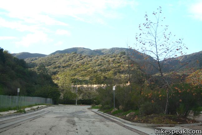


Beginning from Paseo Miramar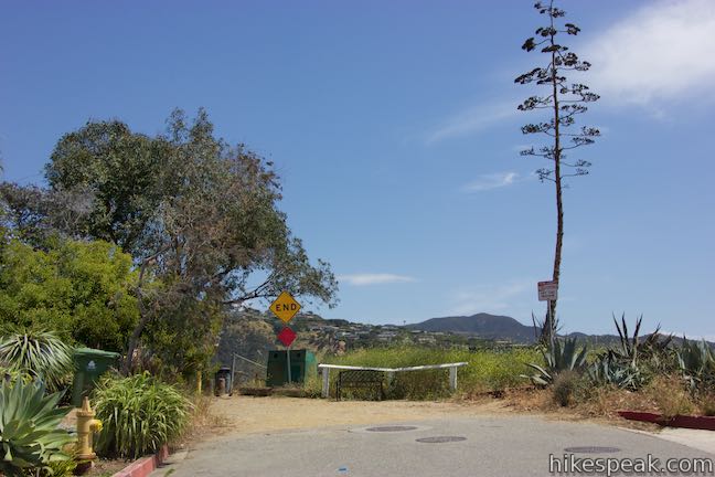


 | Parker Mesa Overlook from Trippet Ranch This 6.7-mile round trip hike heads up to the overlook from the opposite direction, starting at Trippet Ranch, Topanga State Park's main trailhead. |
 | Los Liones Trail This hike visits a lust canyon with ocean views, a potential start of the hike to Parker Mesa Overlook. |
 | Eagle Rock from Santa Ynez Canyon This 7.4-mile hike takes the long route from a canyon in the Pacific Palisades up to the panoramic sandstone summit. |
 | Santa Ynez Falls This 2.5-mile follows a shaded creek to a gorge containing a short waterfall. |
 | Skull Rock This 1.5-mile hike descends Temescal Ridge to a head-shaped formation with great views over Santa Monica Bay. |
 | Temescal Peak This 5.8 to 7.6-mile hike ascends Temescal Ridge to a summit with sweeping views over Topanga State Park and the Santa Monica Mountains. |
 | Temescal Canyon This 2.6-mile loop offers a variety of scenery and decent exercise, despite its relative brevity. |
 | Hondo Canyon This section of the Backbone Trail crosses fields of grains and forests of bays, climbing 1,550 feet over 3.8 miles to a small ocean view. Extend the hike to Topanga Lookout for an incredible perspective over the Santa Monica Mountains. |
 | More trails in the Santa Monica Mountains Explore other destinations in the range. |
 | La Jolla Canyon Loop This 11.75-mile hike explores Point Mugu State Park on the west end of the Santa Monica Mountains, offering extraordinary ocean views. |
 | Calabasas Peak This 3.6-mile hike travels an easy-to-follow fire road, climbing 900 feet to panoramic views of the Santa Monica Mountains and San Fernando Valley. |
 | Zuma Ridge Trail This wide dirt service road which weaves northwest up the back of the ridge west of Zuma Canyon offering access to several trails in the area. |
 | Sandstone Peak This 6.25-mile loop summits the tallest peak in the Santa Monica Mountains. |
Common Questions about Parker Mesa Overlook via East Topanga Fire Road and Los Liones Trail in the Santa Monica Mountains
- Is the trail open?
- Yes. You should expect to find that East Topanga Fire Road to Parker Mesa Overlook is open. There are no recent reports of trail closures. If you discover that the trail is closed, please help your fellow hikers by reporting a closure.
- Is this trail free to access?
- Yes, East Topanga Fire Road to Parker Mesa Overlook is free to access. No entrance fee, pass, or permit is required. If you discover that access rules have changed, please provide feedback on your experience.
- How much time does this hike take?
- It takes approximately 4 hours to hike East Topanga Fire Road to Parker Mesa Overlook. Individual hiking times vary. Add extra time for breaks and taking in the views.
- How long is this hike?
- The hike to East Topanga Fire Road to Parker Mesa Overlook is 5.7 or 7.8 miles (out and back) with 900 to 1300 feet of elevation change.
- Are dogs allowed on this trail?
- No, dogs are likely not allowed on East Topanga Fire Road to Parker Mesa Overlook. The trail is primarily open to hikers, bikes (except on Los Liones Trail).
- Are there ocean views on this hike?
- Yes, East Topanga Fire Road to Parker Mesa Overlook offers views of the ocean.
- What mountain range is this trail in?
- East Topanga Fire Road to Parker Mesa Overlook is located in the Santa Monica Mountains.
- Where is the trailhead located?
- The trailhead for East Topanga Fire Road to Parker Mesa Overlook is located in Pacific Palisades, CA.
Trailhead Address:
899 Paseo Miramar
Pacific Palisades, CA 90272
Trailhead Coordinates:
34.0508, -118.5571 - What are the driving directions to the start of the hike?
To get to the trailhead: Paseo Miramar Trailhead: One street past Los Liones Drive (and just before Palisades Drive) is Paseo Miramar. Turn north up the street, which winds up the ridge for 1.2 miles to the trailhead at road's end. Street parking is available on the west side of Paseo Miramar.
Los Liones Trailhead: Los Liones Drive is the second left off Sunset Blvd from PCH, just 1/3 of a mile from the beach. Park on the right side of Los Liones Drive, and enter the trail at the end of the cul-de-sac.
View custom Google Maps directions from your current location.
- Are there other trails near East Topanga Fire Road to Parker Mesa Overlook?
- Yes, you can find other nearby hikes using the Hikespeak Hike Finder Map.

11 Comments on Parker Mesa Overlook via East Topanga Fire Road and Los Liones Trail in the Santa Monica Mountains
What hikers are saying:
✨ Generated summary of user commentsHikers find this trail rewarding for its lush greenery and expansive views stretching from the Channel Islands to the Los Angeles skyline. To avoid heavy crowds, visit during the week or aim for a sunset trek when the marine layer typically clears. Dan recommends bringing plenty of water and wearing lug soles for traction on the steeper, more challenging sections. Be mindful of mountain bikers and occasional wildlife like snakes while navigating the well marked paths.
“beautiful views all the way to the channel islands and greater LA” Jump to comment ↓
This is a great hike as well as mountain biking.
We ran up and down the trail a few times last week, hard work so bring water. We did meet a snake (Alameda Striped Racer (not deadly)) missed the cougar and the scenery was much drier than the website pictures, but no fog at all so beautiful views all the way to the channel islands and greater LA. Will definitly return.
Greetings: I will be visiting Los Angeles with my daughter and niece (both 18) and we all like a good scenic hike. We will be in the area Dec 10-20. Please suggest hikes like the Mesa with views of the ocean. We will be staying in West Hollywood and prefer not to travel further than Malibu. We are in good shape and love scenery. Thank you so much for your website. If there are hiking groups to go with that would be ok. I want to make sure I do not get lost. Appreciatively, Shawn
Have a great visit to LA. Tuna Canyon Park between Topanga and Malibu has fantastic ocean views from a high bluff. It is very picturesque! For a longer drive, check out Scenic & Overlook Trails Loop in Point Mugu State Park on the Venture side of Malibu. Enjoy!
[…] Photo blog: Sunset at Parker Mesa Overlook in Topanga State Park, California […]
There is an alternative route starting at the Los Liones trailhead that makes the Parker Mesa Overlook a loop. About 20 yards after walking through the trailhead portal, turn left into the gulch immediately past the concrete. Follow the trail about 50-70 yards up the canyon, then it takes a left turn going up a very steep hillside. From here it is about 1.3 miles to the Parker Mesa Overlook benches. This trail can also be reached from the Parker Mesa (aka Sunset Mesa) portal to the park by turning right from PCH onto Coastline (just a few feet past the Getty Villa entrance), then turning right onto Surfview and driving all the way to the top. Caution on the hike: it is very steep, gaining more than 1200 feet, and going down this trail is not recommended. You can take the trail described in the article to return to Los Liones, for a loop of about 5 miles. Bring plenty of water, and lug soles are recommended.
[…] I went hiking at Paseo Miramar. The trail ends at the Parker Mesa Overlook and if you hike on a semi-cloudy/foggy day, you may be able to hike above the clouds. I love this hike because of the ocean and city views […]
[…] Directions: Go to Hikespeak.com for turn-by-turn trail […]
Ran it today, easy hike, well marked and not much foot traffic. A biker or two to watch out for but otherwise pleasant and surprisingly very green. Great views. I’d recommend a morning or sunset hike. Morning could have a slight marine layer but it’s beautiful at that altitude.
Hi,
Would you consider thia hike good for beginners, or too challenging? I’d also be planning to bring some camera gear: couple of cameras and a tripod)
Hiked both Los Leones and Parker Mesa Overlook. Nice trail. Went on a Sunday morning around 9:00am. It was REALLY crowded so perhaps best to hike during the week if you are looking for something more quiet