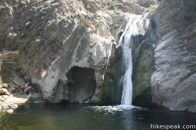
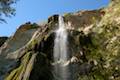
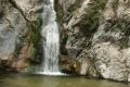
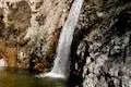
Paradise Falls drops 40 feet into a large pool along the Arroyo Conejo in Thousand Oaks. The waterfall is located within Wildwood Park, and thanks to an almost excessive network of trails, Paradise Falls may be reached via several routes, including a 2.15-mile out and back hike or a 2.55-mile loop that visits a small cave. It is a downhill hike from the trailhead to Paradise Falls with 260 feet of elevation change. Adding a visit to Wildwood Park’s other main attraction, Lizard Rock, is a good way to extend the hike to 4.35 miles or more.
- Paradise Falls is close to many other Los Angeles waterfall hikes.
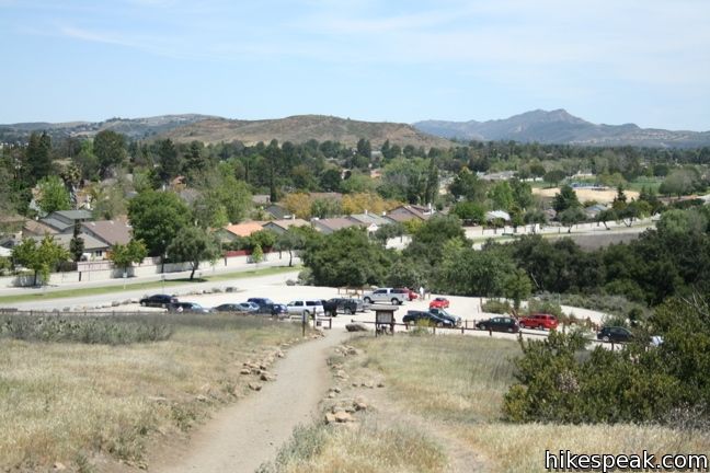
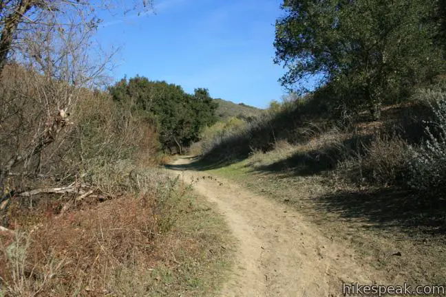
The direction to Paradise Falls is marked at most trail junctions in tWildwood Park, so it will not be difficult to find the waterfall. The easiest route is to head straight west on Mesa Trail, the most obvious trail departing the parking area for Wildwood Park. Pass through a few junctions over the first 0.35 miles and turn left at a split onto North Tepee Trail, following an arrow for Paradise Falls.
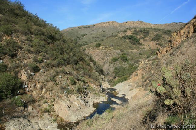
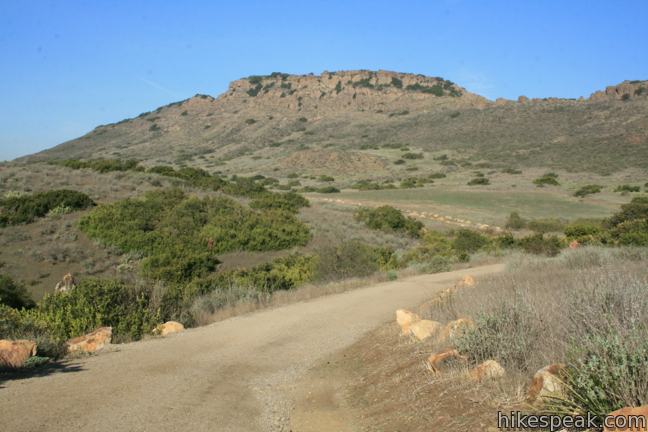
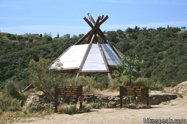
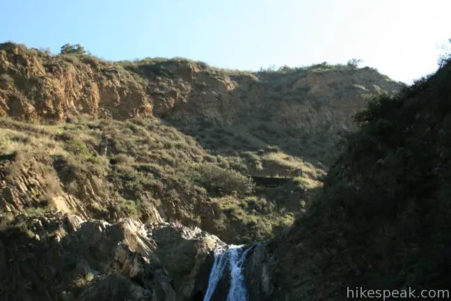
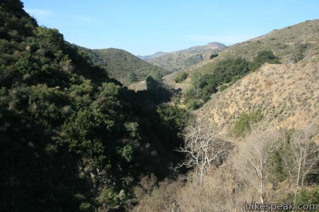
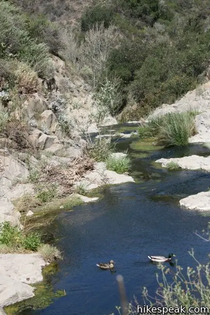
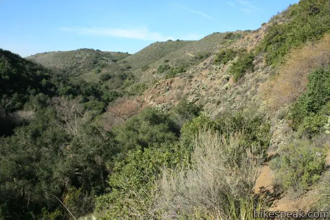
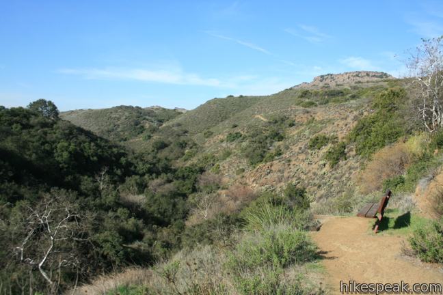
Stay straight through three junctions over the next 0.4 miles to come to a T-junction next to a recreation of a tepee. Here you may look down on the V-shaped canyon carved by the Arroyo Conejo. The landscape above the canyon is dotted with cactus and sage, while the creek is lined with sycamores and oaks, creating a riparian oasis. Since most of Wildwood Park can feel like a desert on a hot day, be sure to wear sunscreen and drink plenty of water.
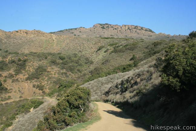
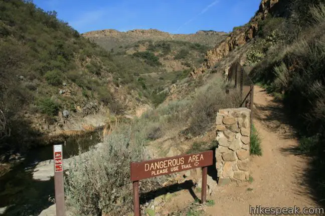
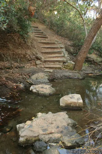
Turn right at the tepee, and drop into the canyon for 1/8 of a mile on Tepee Trail. At the next sign for Paradise Falls, turn left down a single track cutting down the canyon. At the next junction, turn right onto Wildwood Canyon Trail and make an immediate left to continue descending to Paradise Falls. Pass through a picnic area to arrive at a pool below Paradise Falls, 1.07 miles from the start.
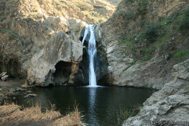
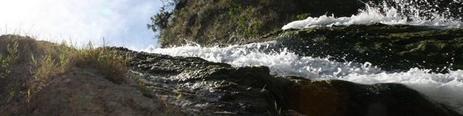
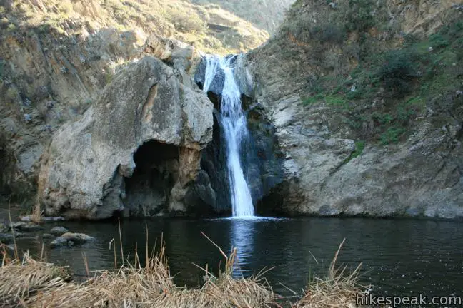
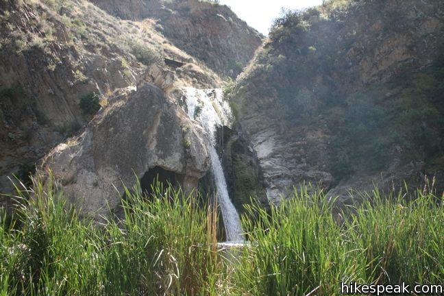
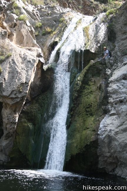
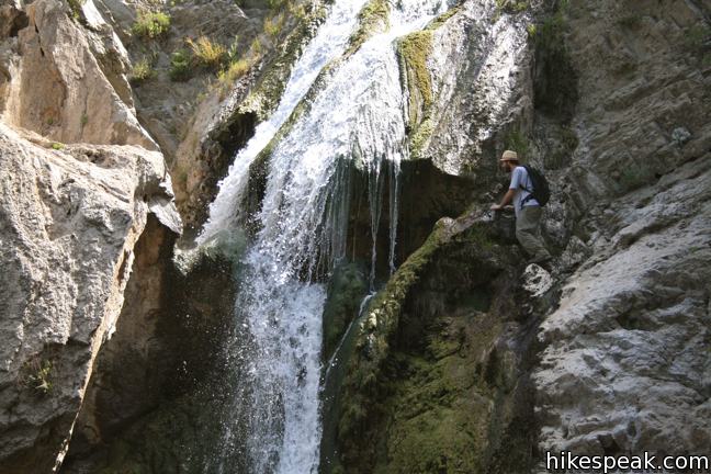
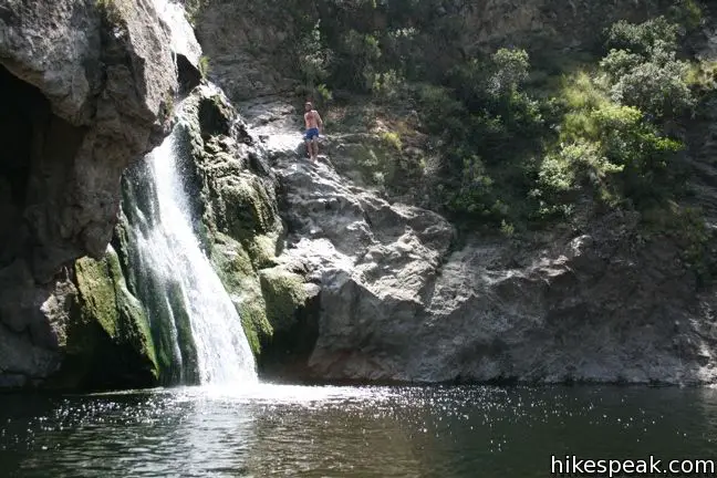
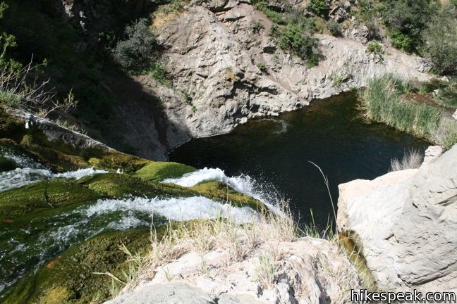
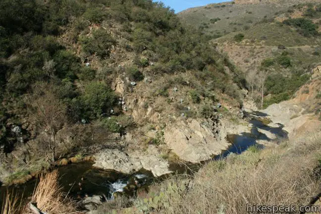
Paradise Falls plunges 40 feet into a large pool. Left of waterfall is a rock grotto that looks alien to the surrounding landscape. Use stepping stones to cross through a line of cattails below the pool to get the best perspective of Paradise Falls from the opposing bank, where rock outcroppings create relaxing seats.
Unfortunately swimming and climbing around the waterfall is prohibited. Though the water is cold and clear, and deep enough for someone to jump in, there is an advisory against swimming in the creek, which is feed by both natural springs and street runoff (yuck).
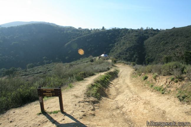
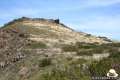
Once you leave Paradise Falls, if you don’t wish to return the way you came, Wildwood Park has several other areas to explore. To extend the hike to just over 4 miles, head downstream on Wildwood Canyon Trail, which remains shaded as it follows the stream past a striking number of picnic tables. Hike up to Lizard Rock before returning to the trailhead across the mesa, completing a grand tour of Wildwood Park.
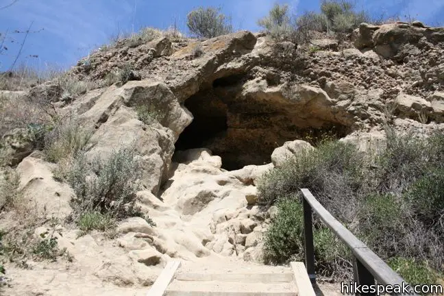
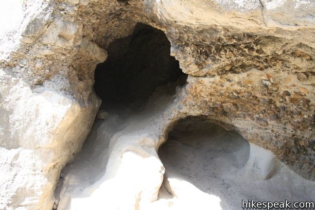
To hike up Wildwood Canyon Trail above the falls, turn right toward another interesting park feature named Indian Cave. This stretch of Wildwood Canyon Trail borders the creek and passes through a shaded picnic area. After 1/4 mile, the trail meets a junction with the other end of Tepee Trail on the left, which can be taken to return to the tepee. Continue another 0.2 miles to a four-way junction near Indian Cave. Straight ahead, a single track ventures up toward the cave. Take this short detour to climb through a small tunnel in the rock face that may have once be occupied by Chumash Indians. The trail to Indian Cave adds 0.2 miles round trip to the hike.
Back at the four-way junction, you could turn either way to return to the trailhead in another 3/4 of a mile. For one 2.55-mile loop, make a left turn (originally on your right) and follow Wildwood Canyon Trail across North Fork Arroyo Creek. On the other side, turn left up Indian Creek Trail, which stays in the shade as it heads out of the canyon.
Head upstream beneath what seems like a thousand oaks bordering Indian Creek. Cross the creek after a quarter mile. Then stick to the left bank and climb out of the canyon (and back into the sun). At the top of the trail, reach Avenido de los Arboles, and turn left to hike less than 0.2 miles back to the trailhead.
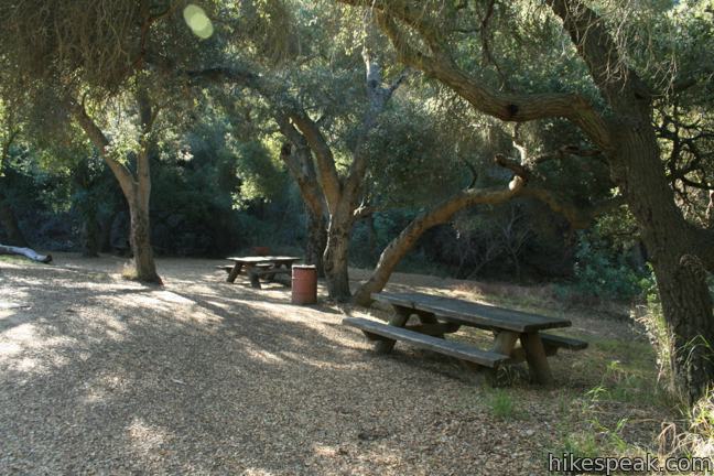
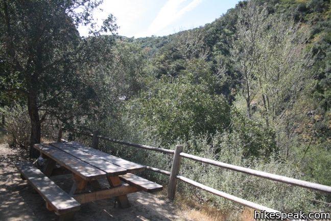
The park’s abundance of picnic tables cannot be overstated. In fact, there are six picnic areas right along the canyon near Paradise Falls. Each table is located in the shade, and on most weekends it is not challenging to find a few that are available. If you head out to Wildwood Park for a picnic, you will find areas with numerous tables and others with just a couple. The park is designed to accommodate any reasonably sized group. Sycamore Flats Picnic Area, downstream from the falls, even has public restrooms. Any of the picnic areas would be a great place to stop off for a bite during a hike of the park.
The basic directions for one loop to Paradise Falls and Indian Cave are:
- Begin hiking west on Mesa Trail (0 miles)
- Turn left onto North Tepee Trail (0.35 miles)
- Reach a T-junction in front of a recreated tepee and turn right onto Tepee Trail (0.75 miles)
- Turn left down a trail to Paradise Falls (0.88 miles)
- Turn right on Wildwood Canyon Trail (0.99 miles)
- Turn left down a trail to Paradise Falls (1.01 miles)
- Enjoy Paradise Falls (1.07 miles)
- Hike back up to Wildwood Canyon Trail and turn right (1.13 miles)
- Stay to the right on Wildwood Trail (1.15 miles)
- Pass a junction with Tepee Trail (1.4 miles)
- Reach a 4-way junction and proceed straight on Indian Cave Trail (1.6 miles)
- Explore Indian Cave (1.7 miles)
- Return to the junction and turn left, which was originally on the right (1.8 miles)
- Cross a bridge over North Fork Arroyo Creek and turn left up Indian Creek Trail (1.82 miles)
- Ascend to Avenida De Los Arboles and turn left (2.4 miles)
- Return to the trailhead (2.55 miles)
No fee or permit is required to visit Paradise Falls in Wildwood Park. Dogs and bikes are welcome, so get out and enjoy! You may also wish to visit other waterfall hikes around Los Angeles.
To get to the trailhead: Take the 101 Freeway to Thousand Oaks to exit 45 for Lynn Road. Drive north for 2.5 miles on Lynn Road, and turn left on Avenido de los Arboles. Drive to the end of the street and park in the lot on the left.
Trailhead address: 928 West Avenida De Los Arboles, Wildwood Regional Park, Thousand Oaks, CA 91360
Trailhead coordinates: 34.2200, -118.9028 (34° 13′ 12″N 118° 54′ 10″W)
View Thousand Oaks in a larger map
Or view a regional map of surrounding Los Angeles trails and campgrounds.


 | Lizard Rock To add extra mileage and views to a visit to Paradise Falls in Thousand Oaks, consider placing Lizard Rock on your itinerary. |
 | Tarantula Hill This 1-mile round trip hike follows a paved trail to the top of a small, round hill in Thousand Oaks with views across the Conejo Valley into the surrounding mountains. |
 | Oak Creek Canyon Trail This 0.8-mile loop starts with an all-access nature trail with signs in English and Braille before transitioning to a less developed dirt single track, looping through chaparral and oak woodlands in Los Robles Open Space. |
 | Angel Vista via Rosewood Trail This 4-mile round trip hike is the most direct route to a panoramic viewpoint overlooking the Conejo Valley. |
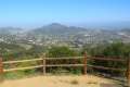 | Angel Vista via West Los Robles Trail This 7.6-mile round trip hike is a more gradual route to the overlook on the north side of the Santa Monica mountains. |
 | More trails in Los Angeles Explore other hiking destinations around Los Angeles. |
 | Escondido Falls This 3.8-mile out and back hike visits a 200-foot waterfall that is split into two tiers. The upper tier is 150 feet tall and stunning after a rainstorm. |
 | Trail Canyon Falls This 4-mile hike ascends a mountain-framed canyon to a 30-foot beauty on the east side of the San Gabriel Mountains. |
 | Eaton Canyon Falls This 3.5-mile hike goes up Eaton Wash to a narrow stretch of Eaton Canyon containing a pleasant 40-foot waterfall. |
 | Switzer Falls This 4.5-mile hike starts out above and finishes below a 50-foot tall waterfall. |
 | More waterfalls around Los Angeles Explore other waterfalls in the Santa Monica and San Gabriel Mountains. |
If I want to hike from the parking lot just to the cave, how far is that and how should I do it? I’m a little confused! Thanks.
The cave is just a bit closer to the trailhead than the waterfall. There are a few routes to the cave. Its location is show on the maps above, east of the waterfall.
do you have to pay for the hike and can you take dogs
This parks is free and you can take your dog. Enjoy your hike!
How steep is this? Wondering if I could do it with my 5 yr old daughter?
I did it with my two year old and there was only one part that was questionably steep – I had to hold his hand
I don’t have the best knees, so how steep is this hike?
There are a lot of changes in incline and the hike back to the parking lot is uphill.
I grew up near here and this was a favorite summer hang out as a teen. However, I have seen it go from secluded hide out to crazy busy summer spot. Which is fine. Just remember hikers, park where there is a pull off, pack out all of your trash, and leave it better than when you found it! I LOVE this place and don’t want to see it ruined for the next generation, fish or other wildlife.
Notes on hiking/swimming: wear good shoes it is STEEP going to the water and coming back, also note that the water levels can get really low so jumping can be risky. It is also VERY cold to jump into from hot rocks. I went into shock one time and….it wasn’t good. Enjoy your time with nature folks and remember to be respectful.
Are people allowed to swim?
There is an advisory against swimming in the creek, which is feed by both natural springs and street runoff.
so regardless there is no swimming whatsoever at all in this park?
I went there July 4 2014. It was quite hot 86 degrees, but the fall was amazing, the Indian cave was well maintained, and the whole trail was fun. I hope parents remind kids that not to toss bottles, containers, and napkins in the park. I hope the city has a project to clean up the park, like once a year.
Thousand Oaks is a cute and clean town.
Is there tent-camping allowed?
Hi, we are planning to take the hike with our 2 year old twins. Can we take a stroller with us to this trail?
The water is super deep it recommended you don’t since it’s actually really easy to drown stay safe if you do go but it is extremely dangerous
I wouldn’t take a stroller. The roads are dirt roads and very uneven. Not sure about tents. You can check it out on the main page.http://www.crpd.org/parkfac/parks/wildwood.asp I love the walk. It’s really quite beautiful.
Is there enough water to jump from the rock ? Nothing crazy but just a simple jump off to where you don’t have to worry about it being too shallow for injury ?
How would the hike be for a 4 year old? Is it too hard for the little ones or would she be able to do it? She is pretty active.
I think she’d do alright. Just avoid doing this hike on really hot days – no shade.
How safe is the parking !
Is the park open on weekends
Yes. You should be able to hike there every day of the week.
has anyone been here this year? (May 2016?) would like to no the current conditions, is there still water running for the waterfall? is it still a good clean friendly hike? is it still a good family destination?
Yes. Was there last weekend.
Is it true that u can go on a horse on the trail ?
I love the hike to Paradise Falls. It’s short enough that you can fit in other activities but long enough that you can really enjoy your time outdoors. It may take just as much time to reach the falls as to return to your car, but that just means you build that into your adventure. Every time I’m in Thousand Oaks I try to take this hike. I don’t agree with this rating at all.
If anyone wants to a full video of the hike down, click here: https://www.youtube.com/watch?v=UhNAvxygc8g
Thanks for sharing. The rating is a user average, so you’re welcome to cast your own vote to help bring up the average.
Is there fishing alowed? If so any fish in that pond?
Are you allowed to get in the water at the waterfall.
Is this park the basis of SCP-778, also know as ‘Paradise Falls’?
Is this a safe hike to walk to walk alone? A female and my dog
How long does this hike take?
is any barbecue place in the park.
I applaud folks that decided to make the city runoffs into a public trail and park. IMO, Paradise falls is the easiest hike to see a waterfall. You can ALWAYS be sure it has water because the water is from street runoffs. SAT was crowded @7am but SUN @6am was empty.(5/27/17). Trail by the water is the most scenic.
I like your attitude!
[…] Tape/Notes: No fee or permit required; for more information on the trail, hikespeak has a nice post on the hike (including options for making the hike […]
Anyone know if this trail was affected by the recent fires?
a friend went there 2 weeks ago, all is fine
Is this an appropriate activity for 20 kids from 6 to 35 years old?
Can you splash in the water ? Yes have a 4yr old
Is it opened ? I know some trails are closed
Does someone knows if the trail to Paradise Falls is opened? Thanks.
No paradise falls is still closed, as of 4th of July weekend
Is it still closed?
Also curious – is it still closed?
I just went there yesterday. Tons of people there.
To anyone who’s still wondering. The trail and surrounding park is once again open. It’s definitely a populated trail (fair warning for those still looking to avoid people entirely), but there’s a lot of space, and a lot of the trails are pretty wide.
[…] If you are located in the Los Angeles area and are looking for a beautiful hike that figuratively transports you to another planet, look no further than Paradise Falls Hike. Located in Thousand Oaks, CA, this hike is 2.7 miles long, so it’s a little more difficult than a morning stroll, but it’s still relatively moderate as far as hiking difficulty goes […]
Hoping to visit this trail on Sunday. How is it if it rains the day before? Is it muddy?
[…] Paradise Falls in Wildwood Park – Hikespeak.com […]