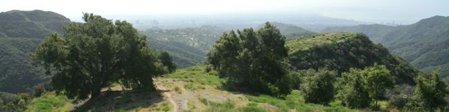
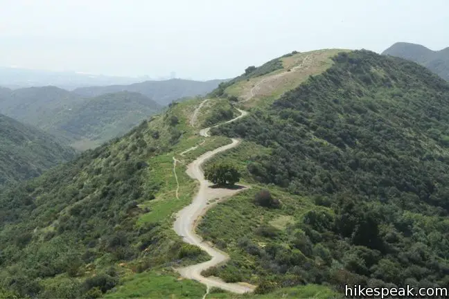
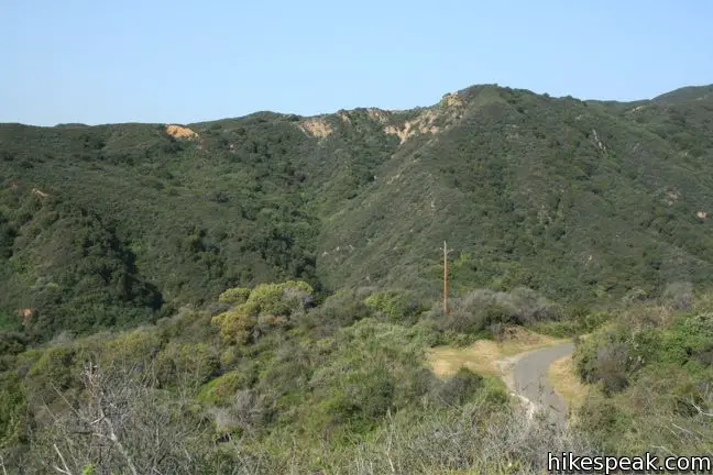
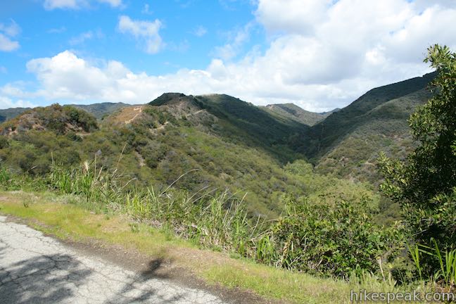
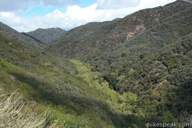
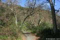
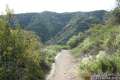
Sullivan Ridge rises between Rustic Canyon and Sullivan Canyon east of Will Rogers State Park in a region of the Santa Monica Mountains aptly named the Big Wild. A 6.3-mile long fire road runs along the ridge, accompanied by a single-track trail that diverges from the road to explore more of Sullivan Ridge. A prominent lone-standing live oak along the road makes a natural turnaround point and a 7.5 to 8.3 mile round trip hike (depending on your course).
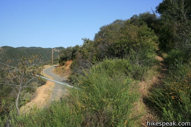
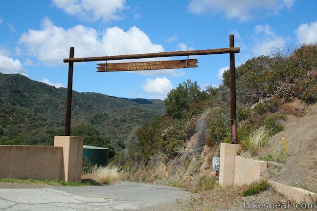
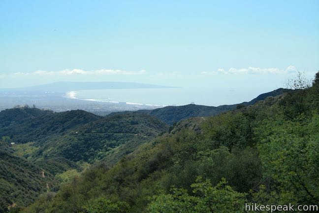
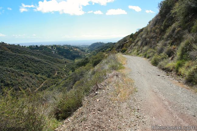
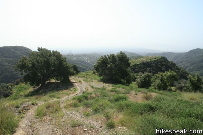
A gate operated by Josepho Boy Scout Camp controls traffic along Sullivan Fire Road. Only permitted vehicles may pass the gate, so traffic is light. For hikers, find parking at the top of Capri Drive in the Pacific Palisades and begin walking up Sullivan Fire Road past a few houses. After 0.4 miles, cross the gate and have a look out over Rustic Canyon toward Santa Monica Bay.
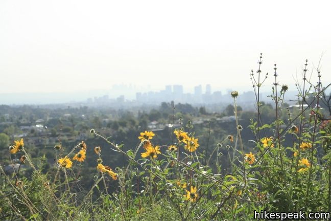
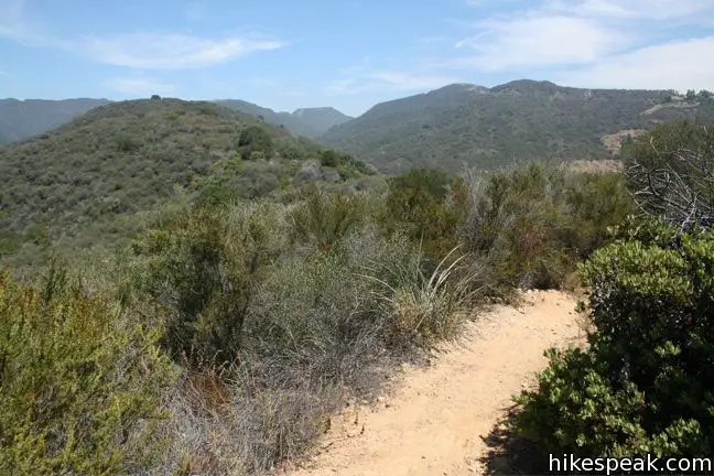
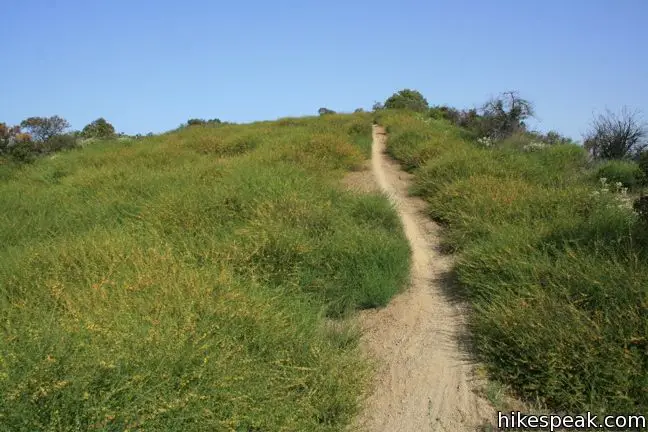
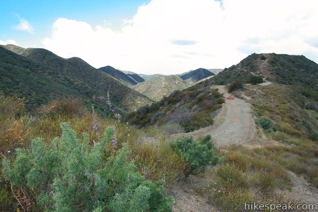
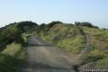
A quarter mile past the gate, a path to right leads up to the trail running across the top of the ridge. This narrow trail offers a great perspective to the east across Sullivan Canyon toward downtown Los Angeles. The trail rejoins the still-paved fire road one mile later, shaving 0.4 miles from the distance on the fire road, and adding a few fun ups and downs.
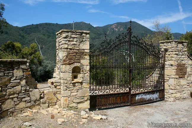
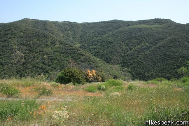
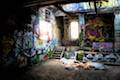
What the singe-track bypasses is a crumbling stone wall and iron gate at the entrance of what was once Murphy Ranch, a compound run by Nazi sympathizers in the 1930s. The ranch was raided and shut down shortly after Pearl Harbor, but ruins of the ranch remain and this bizarre piece of LA history can be visited below the fire road in Rustic Canyon.
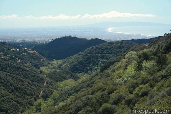
From the spot where the ridge trail rejoins the fire road, it is 0.7 miles to the entrance to Camp Josepho. The boy scout camp takes its name from Anatol Josepho, inventor of the photo booth and friend of Will Rogers.
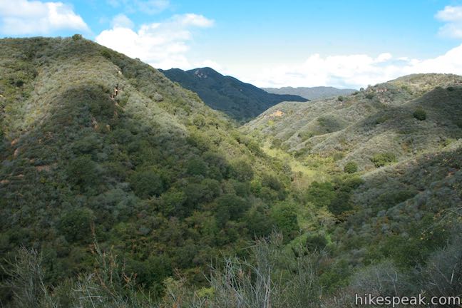
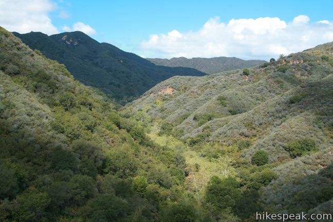
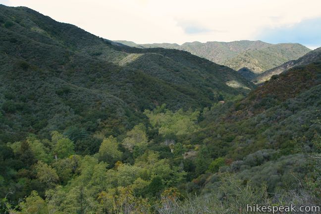
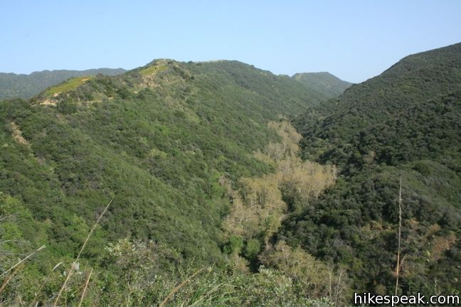
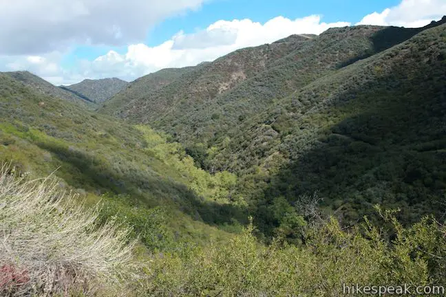
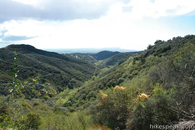
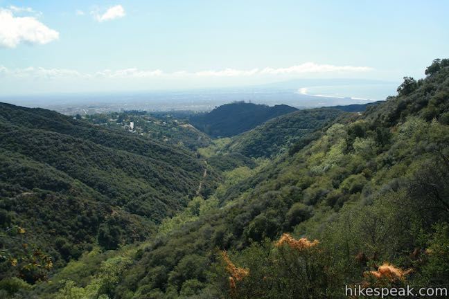
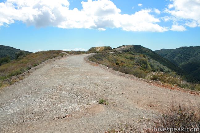
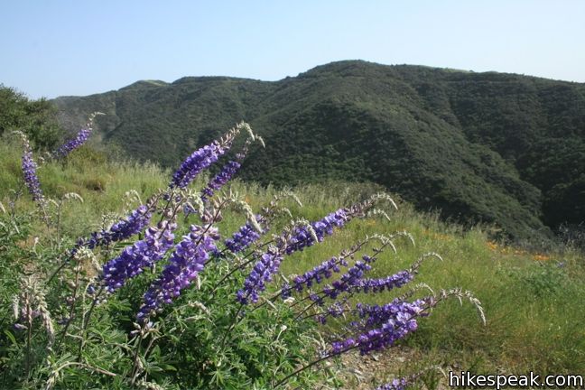
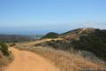
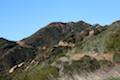
Beyond the camp entrance, the unpaved fire road continues, now closed to vehicle traffic (and dog traffic), and the single-track trail resumes its exploration of the top of the ridge. The trail climbs high above the fire road to offer the finest views of the hike. Indeed, these are spectacular views of the Santa Monica Mountains.
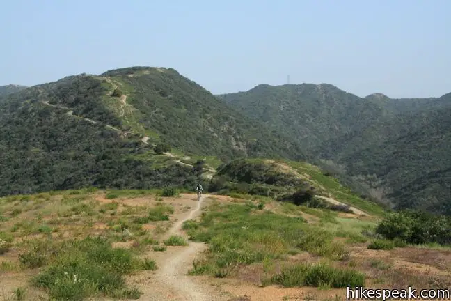
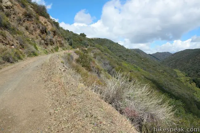
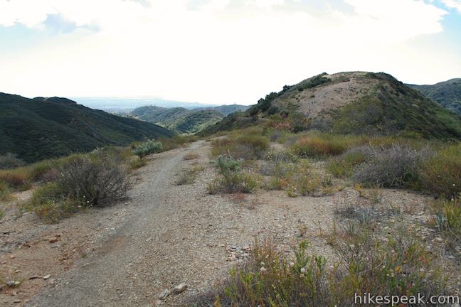
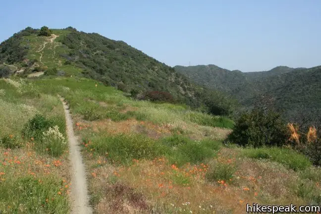
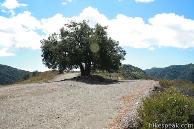
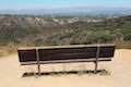
After just over a mile, the trail rejoins the fire road. Continue a third of a mile across a saddle in the ridge to the bold Coastal Live Oak standing along the road. This is one of the only sources of shade, so stop and catch your breath. The landmark tree makes a natural turn-around point for hikers, and the landscape ahead remains fairly similar. To the tree and back is 7.5 to 8.3 miles.
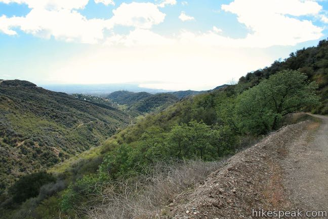
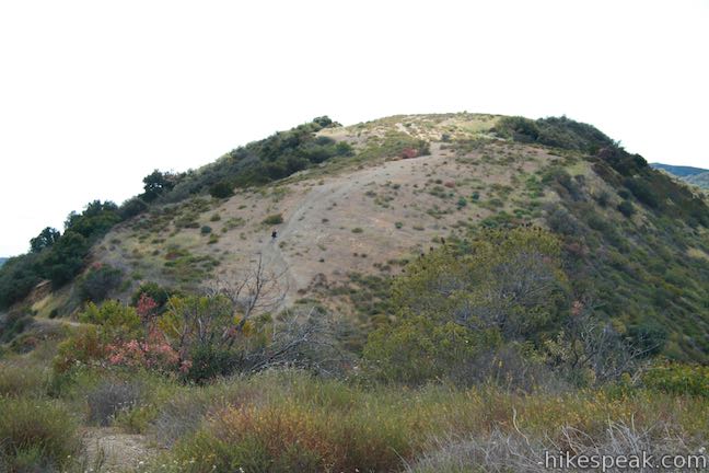
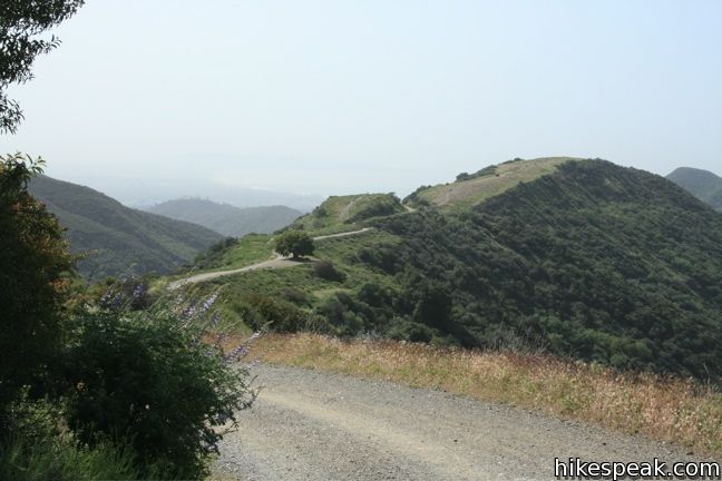
For those continuing on, not far past the tree the ridge trail breaks off again to climb another crest in the ridge. The two paths rejoin ahead of a junction with the fire road ascending from Sullivan Canyon (1.5 miles beyond the tree). Sullivan Ridge Fire Road continues for another 0.6 mile until it comes to a T at unpaved Mulholland Drive. For those who have made it this far, San Vicente Mountain is one mile to the right (a 13.5 to 14.3 round trip hike).
Sullivan Ridge is very popular with mountain bikers, but hikers will enjoy the ridge’s beautiful vistas as well. Like the nearby Westridge hike, there are two paths that you can go down. This being an out and back hike, feel free to explore them both. Dogs are allowed on leash along the paved road as far as the entrance to Camp Josepho, but not on the single track or dirt fire road beyond. No fee or permit is required, so get out and enjoy.
Directions to the Trailhead
- From Sunset Boulevard, 3 miles west of the 405, turn north at the light onto Capri Drive.
- After 1/3 mile continue through the traffic circle, remaining on Capri Drive for another 1/3 mile until it comes to and end at Casale Road.
- Sullivan Ridge Fire road begins to the left.
- Find street parking to the right or on an adjacent road.
Trailhead Location
Trailhead address: Capri Drive & Casale Road, Pacific Palisades, CA 90272
Trailhead coordinates: 34.061, -118.5037 (34° 03′ 39.59″N 118° 30′ 13.31″W)
(Sullivan Ridge Fire Road is in gold)
View Santa Monica Mountains in a larger map
Or view a regional map of surrounding Los Angeles trails and campgrounds.


 | Murphy Ranch This 3.85-mile loop descending from Sullivan Ridge Fire Road into Rustic Canyon to abandoned buildings that had unusual occupants. |
 | Sullivan Canyon This 8.5-mile round trip hike follows a wide trail up the center of a sycamore-filled canyon. |
 | Caballero Canyon Trail This 3.4-mile round trip hike ascends a canyon on the north side of the Santa Monica Mountains with views over the San Fernando Valley. |
 | Westridge Trail to San Vicente Mountain This 7.4-mile hike travels a scenic ridge between a Brentwood neighborhood and a summit that was once used as a Nike Missile site. |
 | Mandeville Canyon to San Vicente Mountain Loop This 5-mile hike incorporating a few trails, taking a DWP road up to Westridge to visit San Vicente Mountain, before crossing Mulholland Drive and Canyonback Ridge to return to Mandeville Canyon via Hollyhock Fire Road. |
 | Temescal Canyon This 2.6-mile loop offers a variety of scenery and decent exercise, despite its relative brevity. |
 | Parker Mesa Overlook This steep out-and-back hike rewards the effort with excellent views of the Pacific Ocean. |
 | More trails in the Santa Monica Mountains Explore other destinations in the range. |
 | Zuma Ridge Trail This wide dirt service road which weaves northwest up the back of the ridge west of Zuma Canyon offering access to several trails in the area. |
 | Calabasas Peak This 3.6-mile hike travels an easy-to-follow fire road, climbing 900 feet to panoramic views of the Santa Monica Mountains and San Fernando Valley. |
 | Hostetter Fire Road to Verdugo Peak This 7.5-mile round trip hike on the north side of the Verdugo Mountains ascends from La Tuna Canyon to the highest summit in the range. |
Common Questions about Sullivan Ridge in the Santa Monica Mountains
- Is the trail open?
- Yes. You should expect to find that Sullivan Ridge Fire Road is open. There are no recent reports of trail closures. If you discover that the trail is closed, please help your fellow hikers by reporting a closure.
- Is this trail free to access?
- Yes, Sullivan Ridge Fire Road is free to access. No entrance fee, pass, or permit is required. If you discover that access rules have changed, please provide feedback on your experience.
- How much time does this hike take?
- It takes approximately 6 hours 15 minutes to hike Sullivan Ridge Fire Road. Individual hiking times vary. Add extra time for breaks and taking in the views.
- How long is this hike?
- The hike to Sullivan Ridge Fire Road is a 12.6 mile out and back with 1350 feet of elevation change.
- Are dogs allowed on this trail?
- Yes, dogs are allowed on Sullivan Ridge Fire Road. The trail is open to hikers, dogs, bikes.
- Is Sullivan Ridge Fire Road a difficult hike?
- This hike should be considered strenuous. Hikers should be prepared for a workout covering 12.6 miles and 1350 feet of climbing.
- Are there ocean views on this hike?
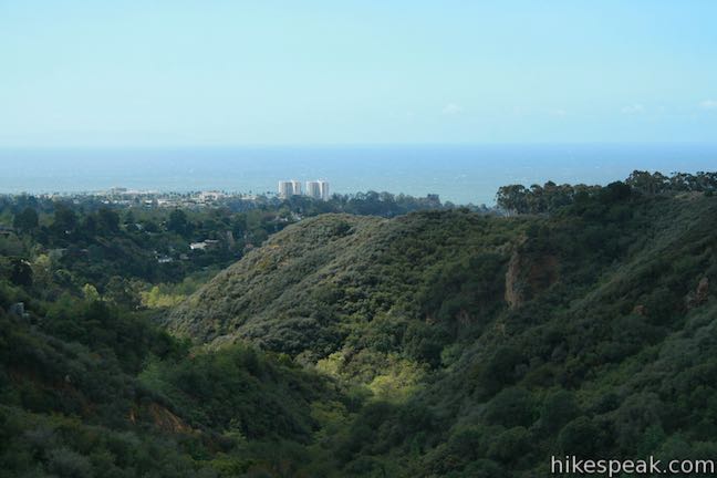
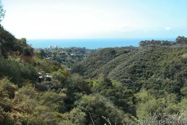
- Yes, Sullivan Ridge Fire Road offers views of the ocean.
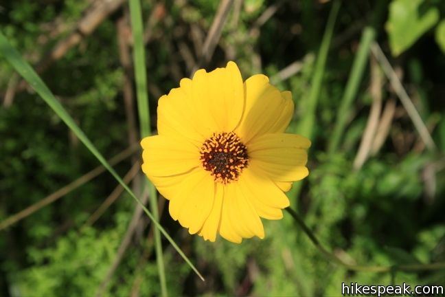
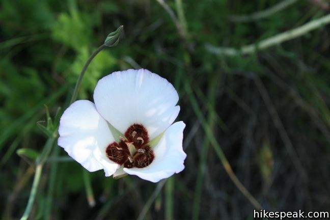
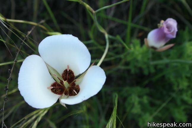
- Is this a good hike for wildflowers?
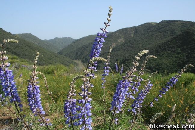
- Yes, Sullivan Ridge Fire Road is known for its seasonal wildflower displays.
- What mountain range is this trail in?
- Sullivan Ridge Fire Road is located in the Santa Monica Mountains.
- Where is the trailhead located?
- The trailhead for Sullivan Ridge Fire Road is located in Pacific Palisades, CA.
Trailhead Address:
Capri Drive
Pacific Palisades, CA 90272
Trailhead Coordinates:
34.061, -118.5037 - What are the driving directions to the start of the hike?
To get to the trailhead: From Sunset Boulevard, 3 miles west of the 405, turn north at the light onto Capri Drive. After 1/3 mile continue through the traffic circle, remaining on Capri Drive for another 1/3 mile until it comes to and end at Casale Road. Sullivan Ridge Fire road begins to the left. Find street parking to the right or on an adjacent road.
View custom Google Maps directions from your current location.
- Are there other trails near Sullivan Ridge Fire Road?
- Yes, you can find other nearby hikes using the Hikespeak Hike Finder Map.

I found an old Boy Scout patch and i was trying to get some history on it. My son is a Eagle scout an a OA Vigil honor recipient and he is 16 as a result we tend to collect patches. The patch is a pocket flap Sullivan trail Scout-a-rama 1955. Do you have any info on its history? Thank you for any help you can give me.
Hi Jennifer, I suspect this may have a patch from the early days of Camp Josepho. Beyond that, I do not know.
Dogs allowed?
Hi Mary,
Dogs are allowed, on leash of course. In Topanga State Park you can take dogs on most major fire roads, just not on smaller trails. Enjoy your hike!
Two comments: dogs are not allowed anywhere in Topanga State Park. That includes dogs on leash. Rangers freely issue $75 tickets to those bringing dogs into the State Park. On a lighter note, Anatol Josepho was the inventor of the photo booth. He also invented the one knob shower handle. What a guy!
Hi Mary,
Great info on Antol Josepho! Dogs are actually allowed on leash on the paved road along Sullivan Ridge (according to the sign anyway). You are correct in that dogs are allowed almost nowhere else in the park and not on any dirt trails. Nearby Westridge Trail is a great hike for dog owners.
Are bicycles allowd on this trail?
Yes. Have a great ride!
can i ride a road bike on the course?
Part of the ridge is paved, but you would be better off with a mountain bike or a hybrid if you want to ride the entire ridge.
How difficult is the trail to mountain bike. Is it appropriate for children? Are there many inclines and are they steep?
The road is paved and relatively easy for the first couple miles, up to the entrance of Camp Josepho. It gets a bit steeper and more challenging after that.
Are there narrow (less than 18 in), steep points to the trail? I’m a beginner and easily lose footing.
The trail/road along the ridge is wide enough for a vehicle. Nearby Westridge Trail would be a good one also for you.
I lived in the Palisades Riviera for 7 years until 4 years ago. We moved to NJ and just moved back in August. I know the Sullivan Ridge Trails well — as a mountain biker, trail runner, hiker, and dog walker. Yesterday, my 13-year-old daughter and I took our 2 labradoodles for a nostalgic hike up to the Murphy Ranch Gate and back. A couple were on the trail with an UNLEASHED pit bull.
Their dog viciously attacked our two, and they both have been hospitalized. Their dog also bit me. If anyone reading this has any more information on this couple, please contact me at 310-601-6998. I’d like to send these losers our vet bills at the very least!
Thanks.
We found the chained gate and walked toward camp Josepho and we can’t find the main building that looks like an a mansion