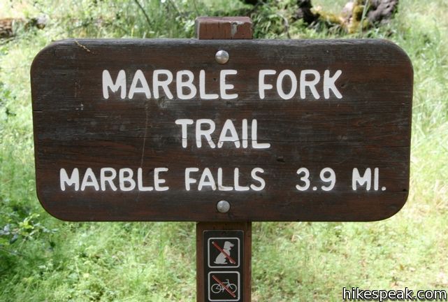
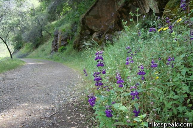
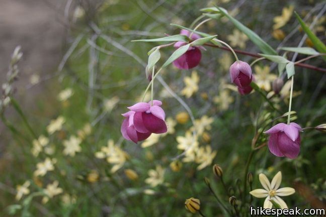
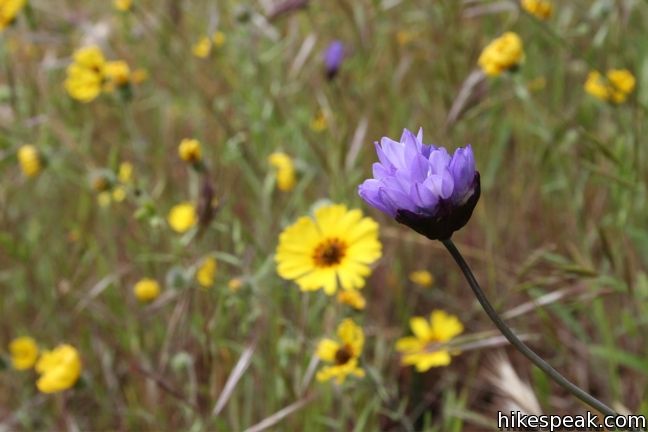
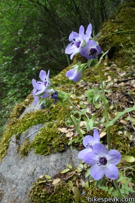
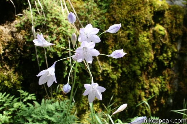
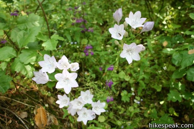
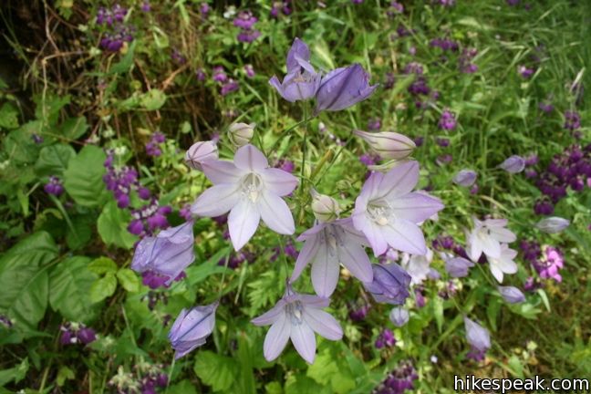
Marble Falls Trail begins from Potwisha Campground in the foothills region of Sequoia National Park. The 8-mile round trip trail is the perfect spot for a spring hike. Follow a flower-lined path up a mountain canyon to a powerful waterfall. In April and May, much of the trail is colored with flowers, giving hikers plenty to look at on the way to Marble Falls.
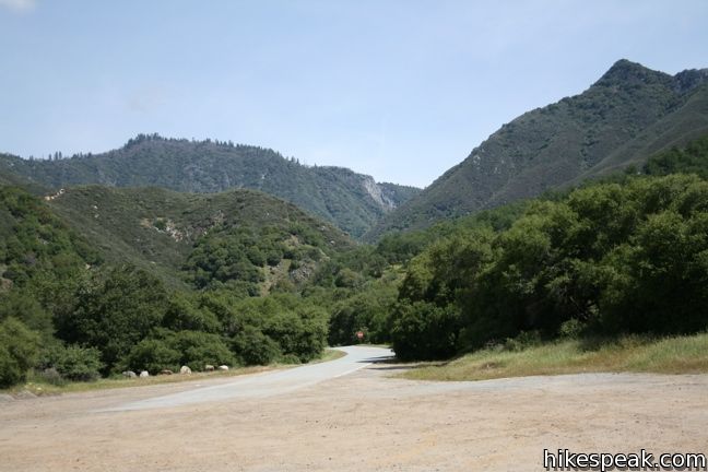
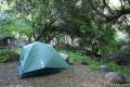
The trail starts near site 14 at Potwisha Campground. A couple parking spots at the trailhead are available for those who are not staying at the campground. If those are full, you may park in a large lot across the road from the campground.
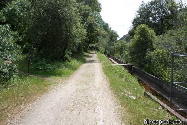
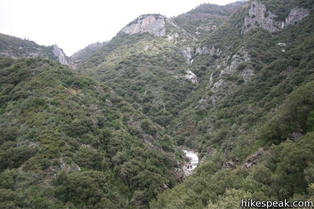
The trail commences up a service road past a sign for Marble Falls. The Marble Fork of the Kaweah River can be seen and heard through the trees to the left. After a short distance, a posted arrow points up a single-track to the left. Turn up this new trail and stay on it for the rest of the hike, as it switches up the canyon wall and heads north toward the falls, gaining 2,150 feet of elevation along the way.
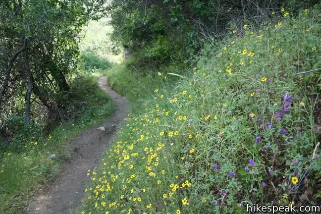
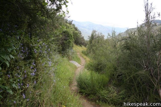
The trail continues steadily uphill, weaving through a painter’s pallet of wildflowers. While it remains several hundred feet above the river, the rushing water will stay within earshot.
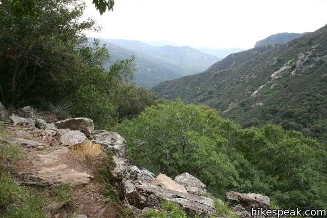
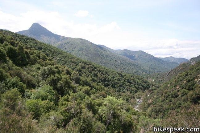
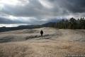
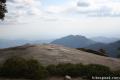
The trail passes through chaparral, along rock faces, and through groves of bays. It is a sincere four miles to the falls. As the elevation increases, the vegetation becomes more alpine. After 2.5 miles, a prominent outcropping boasts a wide view up the canyon and at the raging creek below. From here, the trail continues to climb before finally leveling out near the falls.
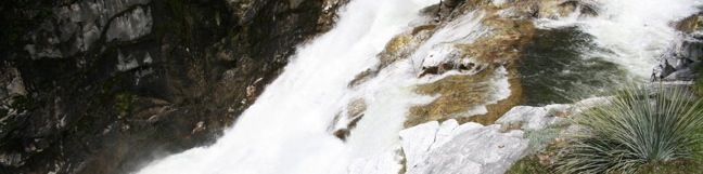
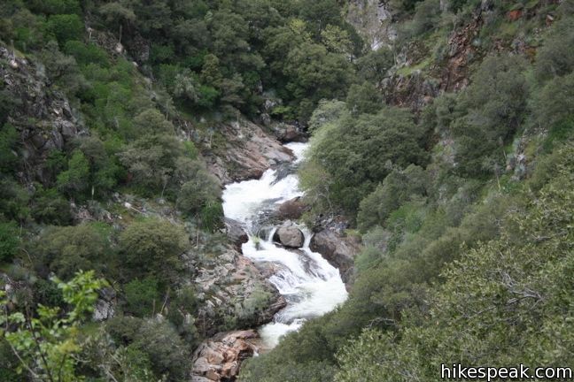
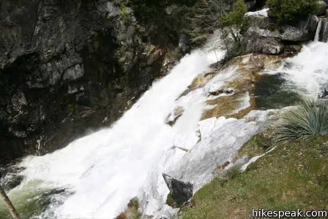
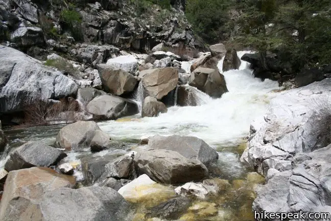
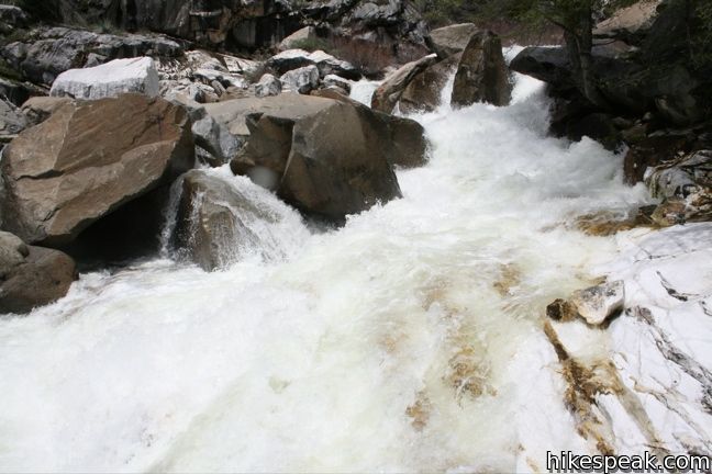
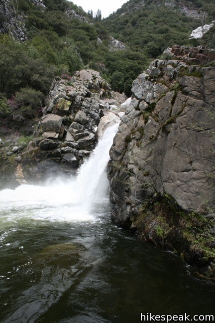
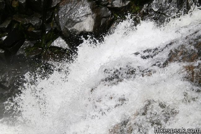
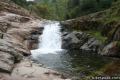
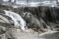
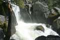
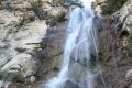
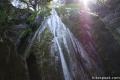
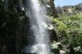
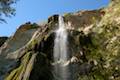
Marble Falls tumbles about seventy feet into a large pool. The river is wide and powerful and the thundering water echoes off the sheer canyon walls. The trail passes the falls and ends on a slab of white marble. Pause on the marble and take in the cacophony of the rushing torrents.
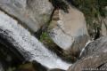
If interested, continue up along the river a bit farther to be treated to another waterfall that tumbles into a lively pool. A faint trail leads to the upper falls that requires a bit of easy scrambling. This waterfall is shorter, but a more direct view is available, and the upper falls is no less picturesque.

The other good news is, the hike back is mostly all downhill. In the spring, when the temperatures in the foothills are accommodating and the river is flowing strong from the snow melt, this hike deserves to be on every itinerary.
Directions to the Trailhead
- From Southern California, take the 5 North to the 99 North.
- After 96 miles, take the 198 East toward Visalia.
- The 198 leads right to the park, where it becomes the Generals Highway.
- An entrance fee is charged to access the park.
- Four miles into the park, cross over the Marble Fork of the Kaweah River and Potwisha Campground is on the left.
- To the right is a parking area across from the campground that those not staying at Potwisha Campground can use for day use (like hiking to Marble Falls).
Trailhead Location
Trailhead address: Generals Highway (California 198), Sequoia National Park, CA 93262
Trailhead coordinates: 36.51785, -118.80115 (36° 31′ 04.3″N 118° 48′ 04.1″W)
View Sequoia National Park in a larger map
Or view a regional map of surrounding Sierra Nevada trails and campgrounds.


 | Paradise Creek This short stroll leaves Buckeye Flat Campground to visit the perfect swimming hole for a hot summer day in the Sierra. |
 | Panther Creek This 6-mile hike follows the Middle Fork Trail to a 100 foot waterfall that drops into the Middle Fork of Kaweah River. |
 | Sunset Rock This 2-mile hike visits a large granite dome with great views to the west, possibly the best place to end your day in the Giant Forest. |
 | Beetle Rock This short walk from the Giant Forest Museum to Beetle Rock visits a granite dome with great views and stunning sunsets. |
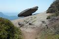 | Hanging Rock Trail This short 0.35-mile hike passes views of Moro Rock en route to a balancing boulder on a canyon rim at the edge of the Giant Forest. |
 | Moro Rock This 0.6 mile hike sports panoramic views and should be considered a mandatory hike for first time visitors to Sequoia National Park. |
 | More trails in the Sierra Nevada Mountains Explore other destinations in Sequoia National Park and the rest of the range. |
 | Tokopah Falls This 4.2-mile hike reaches the base of the tallest waterfall in Sequoia National Park. |
 | Chilnualna Falls in Yosemite National Park This 8-mile round trip hike ascends 2,200 feet past a raucous string of cascades to the top of a waterfall alongside Wawona Dome. |
 | Tangerine Falls in the Los Padres This 2.5-mile hike visits a beautiful waterfall on the edge of Los Padres National Forest near Santa Barbara. |
 | Rose Valley Falls in the Los Padres This 1-mile round trip trail leads to the lower tier of a lovely two-tier 300-foot waterfall. |
 | Sturtevant Falls in the San Gabriel Mountains This 3.3-mile hike visits a 60-foot waterfall and a lush cottage-lined canyon. |
 | Fish Canyon Falls in the San Gabriel Mountains This 4.8-mile round trip hike leaves from an active rock quarry and progresses up a beautiful canyon to a mesmerizing multi-tiered waterfall. |
 | Escondido Falls in the Santa Monica Mountains This 3.8-mile out and back hike visits a 200-foot waterfall that is split into two tiers. The upper tier is 150 feet tall and stunning after a rainstorm. |
 | Sequoia and Kings Canyon National Parks Campgrounds There are 14 campgrounds with over 1,000 total sites spread throughout the park to facilitate your visit. |
Common Questions about Marble Falls in Sequoia National Park
- Is the trail open?
- Yes. You should expect to find that Marble Falls Trail is open. There are no recent reports of trail closures. If you discover that the trail is closed, please help your fellow hikers by reporting a closure.
- Do I need a permit for this hike?
- Yes. National Park Entrance Fee.
- How much time does this hike take?
- It takes approximately 4 hours 30 minutes to hike Marble Falls Trail. Individual hiking times vary. Add extra time for breaks and taking in the views.
- How long is this hike?
- The hike to Marble Falls Trail is a 8 mile out and back with 2150 feet of elevation change.
- Are dogs allowed on this trail?
- No, dogs are likely not allowed on Marble Falls Trail. The trail is primarily open to hikers.
- Is Marble Falls Trail a difficult hike?
- This hike should be considered strenuous. Hikers should be prepared for a workout covering 8 miles and 2150 feet of climbing.
- Will I see a waterfall on this hike?
- Yes, Marble Falls Trail features a waterfall.
- Is this a good hike for wildflowers?
- Yes, Marble Falls Trail is known for its seasonal wildflower displays.
- Where is the trailhead located?
- The trailhead for Marble Falls Trail is located in Sequoia National Park, CA.
Trailhead Address:
California 198
Sequoia National Park, CA 93262
Trailhead Coordinates:
36.51785, -118.80115 - What are the driving directions to the start of the hike?
To get to the trailhead: From Southern California, take the 5 North to the 99 North. After 96 miles, take the 198 East toward Visalia. The 198 leads right to the park, where it becomes the Generals Highway. An entrance fee is charged to access the park. Four miles into the park, cross over the Marble Fork of the Kaweah River and Potwisha Campground is on the left. To the right is a parking area across from the campground that those not staying at Potwisha Campground can use for day use (like hiking to Marble Falls).
View custom Google Maps directions from your current location.
- Are there other trails near Marble Falls Trail?
- Yes, you can find other nearby hikes using the Hikespeak Hike Finder Map.

good hike. just FYI you have to park across the street from the campground near the dump station and the trail starts across from campsite #14.
Thanks for sharing.
This was our first hike of the season. Fairly steep, but it works uphill in a step-wise fashion (hike uphill for about 5 mins or so, it evens out for two mins).Overall it was worth it. Beautiful falls.
Cheers!
Can you camp at Marble Falls?
There is camping at the trailhead at Potwisha Campground, but I don’t believe the park allows camping along the trail or at the falls.
Any suggestion on where to hike during Month of november? Like..first week of november..around sequoia or yosemite.. Thank you
This November 2016, Highway 180 to Roads End in Kings Canyon was open through November 14th. In prior years, Highway 180 was closed from just below Cedar Grove campground. If it is not snowing in the campgrounds that lie between Sequoia and Kings Canyon, there are trailheads in those campgrounds such as Azalea from which you can start your hike.
how will it be to do this trail on July? will the weather might be too hot?
It will be hotter here than at other trails at higher elevation.
Has anyone been to marble falls this year how is the water low or good to swim in?
Will this trail have snow in April?
I just hiked it last week, and no it shouldn’t have snow, it is in lower elevation. It does have lots of poison ivy and be careful of ticks.
Can I bring my dogs?
Dogs are not allowed on trails in Sequoia National Park.
My husband and I are hiking this trail tomorrow and I’m a little freaked out about the idea of encountering a rattle snake. Has anyone who has hiked this trail had an issue with rattle snakes?
I did run into a rattle snake once when I was on this trail. Me and my friends had to jump over it.
can you not park near site #14 at Potwisha Campground?
Only if you’re lucky enough to find an open parking space.
The trailhead by site 14 has just a couple parking spots for hikers not staying at the campground. If those are full, you should park in the large lot across the road from the campground entrance.
Hiked this trail yesterday, no shade and a steep rate. I found it difficult to finally reach the top. But the view was totally worth my feet getting tore up with blisters! The water was amazing. Just be careful to not go in too far
Lovely hike, but unexpectedly dangerous. Wouldn’t recommend to novice hikers as the trail narrows and there is a lot of loose dirt on the side looking down over the drop. The trail is also littered with loose rocks, so watch your step. If swimming, only stay in the smaller pool of water. Do NOT venture further down to the larger one as there is no way to get back up unless you are an experienced rock climber. Even then, I would not recommend attempting the climb as it is pretty risky. Overall, take precaution, stay in a group, avoid going in the summer, and watch out for poison oak! If you’re looking for a breezy nature walk this is not it.
I agree, this is a dangerous hike. My husband broke his leg on the way down due to loose dirt on the edge. He had to be air lifted off the mountain via helicopter. It took them 5.5 hours to get him off the mountain. He had to have surgery and was in the hospital for 4 days. It is hot, narrow and hard. The falls are beautiful but hard to get to.
I doubt this is 8 miles and 2,100 feet of gain. I checked elevation from parking lot and summit with my GPS elevation app and came up with no more than 1,500. My legs tell me that is about right. The sign at the entrance puts the distance at 3.7 miles, so all in all it is a lot easier hike than claimed. Nonetheless, the falls were powerful in May 2019 when the Sierra had far above average snow. I recommend the hike.
[…] National Park. The 8-mile round trip trail is the perfect spot for a … hike”, according to hikespeak.com. It’s approximate completion time is 4 hours and 30 minutes, and the trail has an elevation […]
[…] Hikespeak offers a detailed trail review with pictures, step-by-step instructions, and a detailed geo-location map. […]