La Jolla Canyon Loop
in Point Mugu State Park
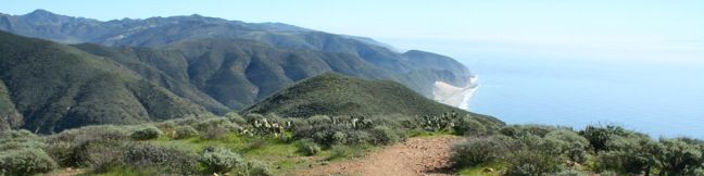
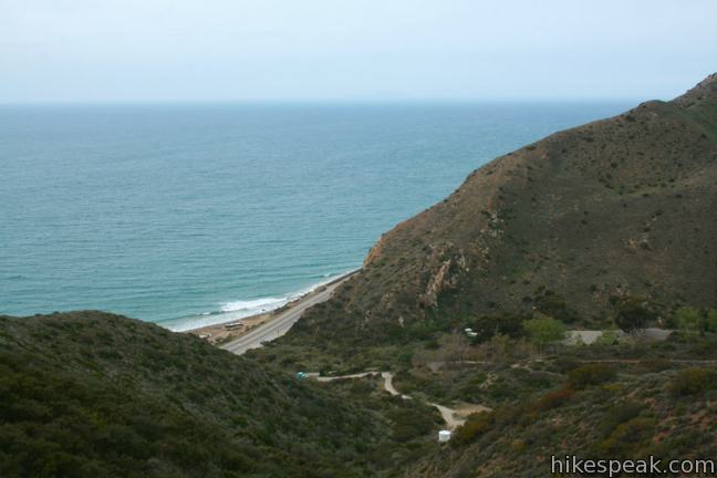
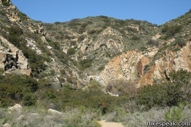
Point Mugu State Park protects 15,000 acres of rustic wilderness on the west end of the Santa Monica Mountains between Oxnard and Malibu. More than 70 miles of trails explore this sprawling park, leaving hikers with options. An excellent way to experience Point Mugu State Park is to set out on a daunting and rewarding 11.75-mile loop. Start at the mouth of La Jolla Canyon just across Highway One from the Pacific Ocean. hike up the east side of the canyon on Ray Miller Trail, take Overlook Fire Road inland to La Jolla Valley Fire Road, cross a mountain valley toward Mugu Peak, then follow an ocean-side mountainside trail back into La Jolla Canyon just in time to pass over a short waterfall on the way back to the trailhead. If that sounds like a lot, it is. This is one heck of a hike!
Update: La Jolla Canyon Trail was damaged in the winters of 2015 and 2017 and is closed until further notice.
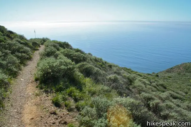
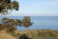
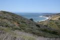
There is 1,225 feet of elevation difference between the trailhead and the high point of the hike, Mugu Peak, a remarkable perch over the Pacific. The ocean views along this loop could easily be the very best in the Santa Monica Mountains. The mountains and grasslands inland from the coast also make for pleasant hiking.
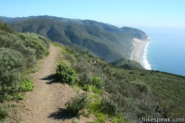
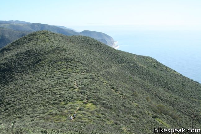
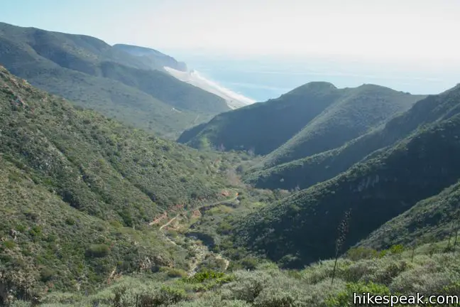
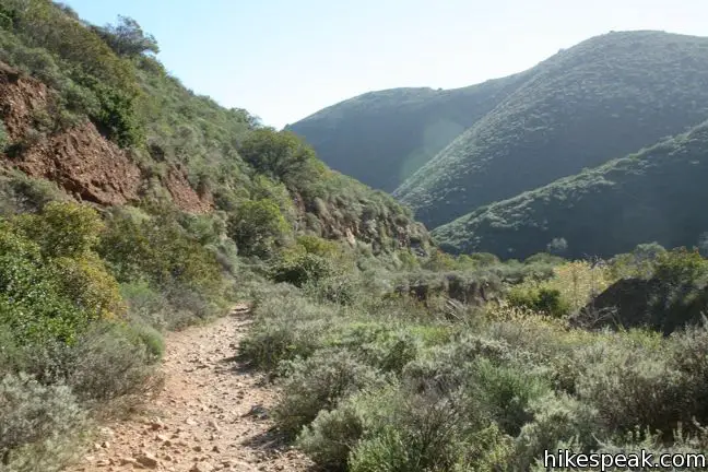
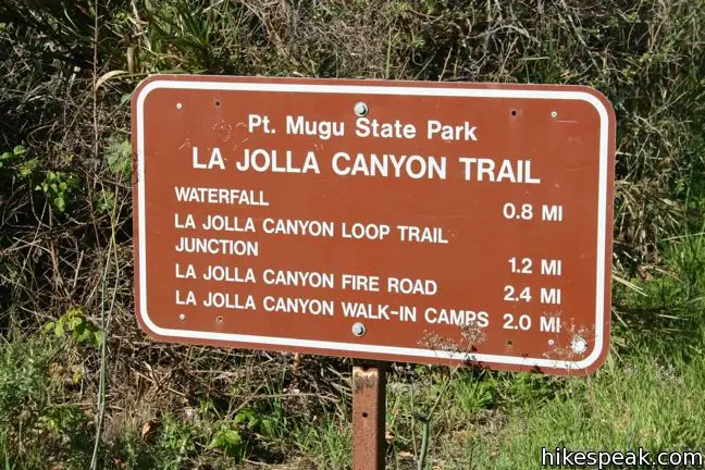
From the La Jolla Canyon Day Use Area in Point Mugu State Park, locate Ray Miller Trail, which will be on the right as you look inland from the parking lot. Straight ahead, La Jolla Canyon Trail goes up canyon toward a seasonal waterfall. This will be the return route for the loop. To start, ascend the east ridge of the canyon on Ray Miller Trail, the western end of the Backbone Trail. The single track winds up the ridge, steadily gaining close to a thousand feet of elevation over 2.75 miles to a junction with Overlook Fire Road.

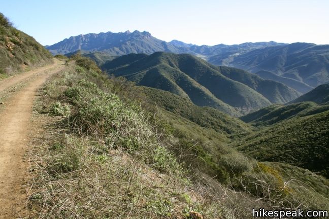
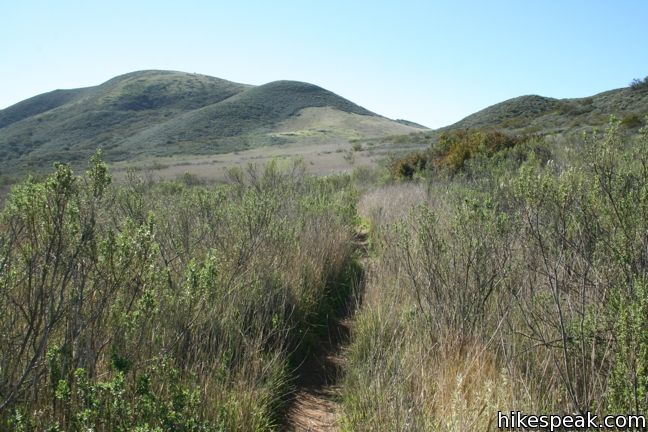
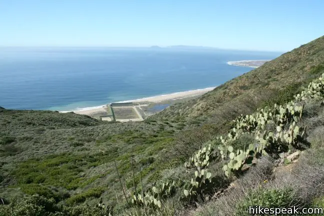
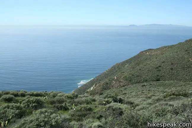
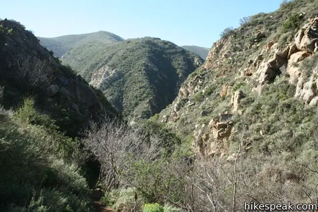
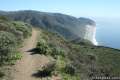
Crashing waves and passing motorcycles serenade the ascent, which is further motivated by expanding views of the canyon and coast. Just over a mile from the start, Ray Miller Trail curves around the south end of the ridge providing its first look down the beach to the east. The trail reaches the ridgeline, 2.25 miles from the start, and turns inland, straddling the ridge between La Jolla Canyon and Big Sycamore Canyon.
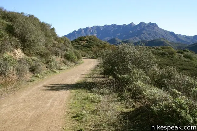
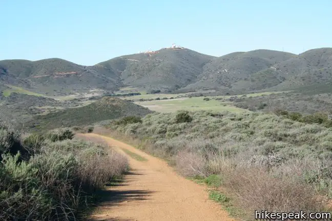
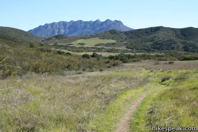
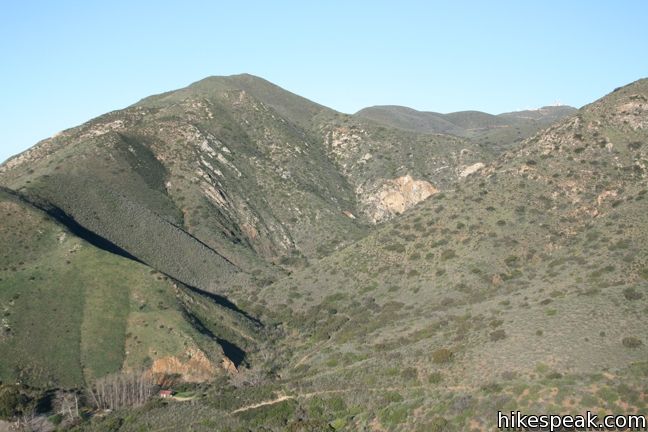
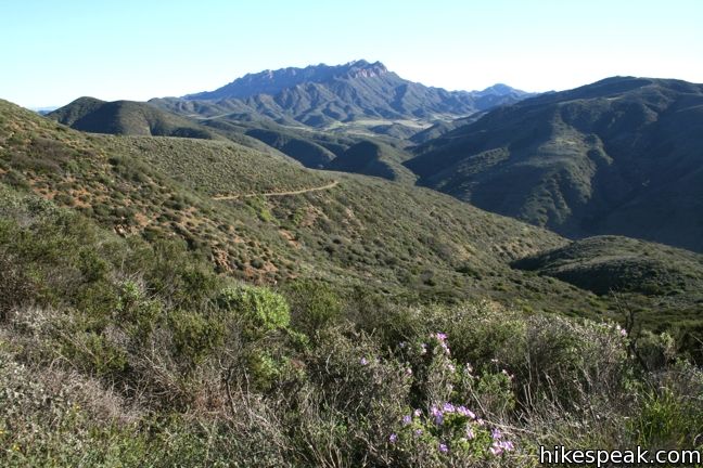
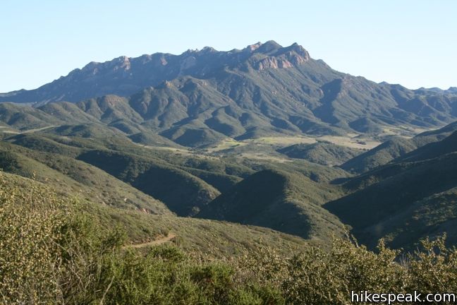
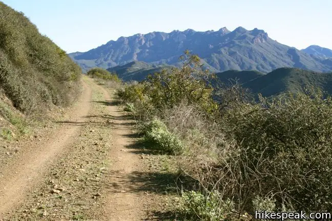
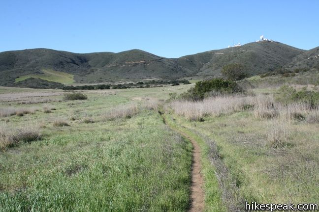
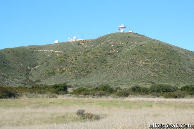
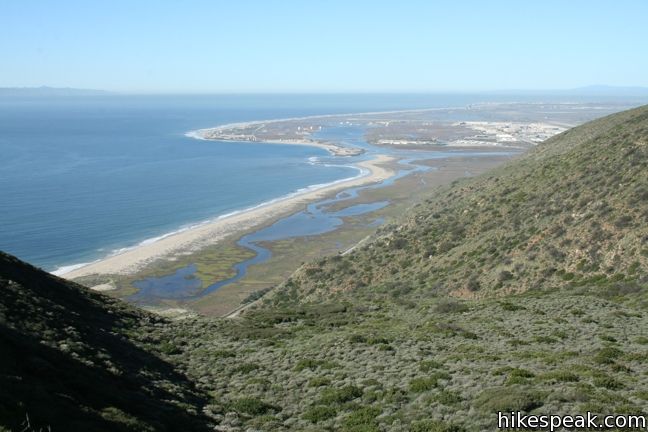
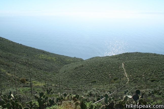
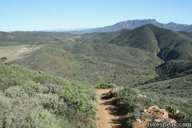
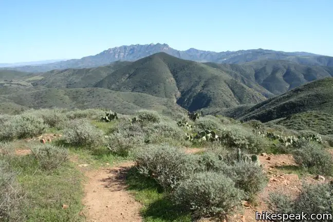
Enjoy luscious ocean and canyon views as you close out Ray Miller Trail and come to a T-junction with Overlook Fire Road. Turn left, taking the wide fire road north through new landscapes. Gaze northeast, across Sycamore Canyon and Serrano Valley toward the Boney Mountains, the highest peaks in the Santa Monica Range, including Sandstone Peak. The fan-shaped valley at the top of La Jolla Canyon comes into view to the west, surrounded by a rim of low peaks that curve around the upper lip of the valley. Atop one of the mountains to the west, you will see Point Mugu Radar Station, a hard-to-miss collection of communication satellites that is one of the few human intrusions in sight.
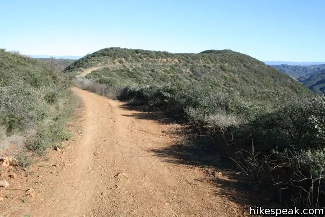
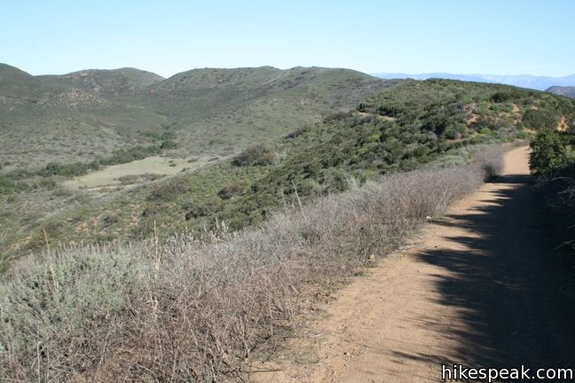
After ascending to 1,140 feet, the fire road turns to the left and winds down to a four-way intersection, 4.75 miles from the start. Just before the junction, Wood Canyon Vista Trail, also a segment of the Backbone Trail, breaks off to the right heading northeast for two miles to the fire road at the bottom of Sycamore Canyon. At the four-way junction, North Guadalasca Fire Road Trail continues straight, northwest up the ridge, while Wood Canyon Fire Road heads to the right, east into Sycamore Canyon.
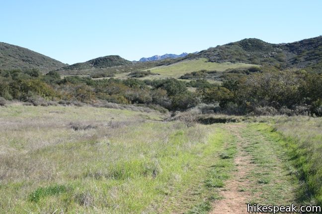
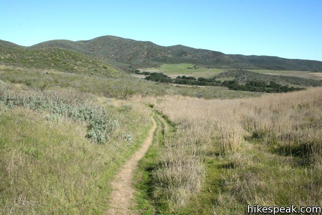
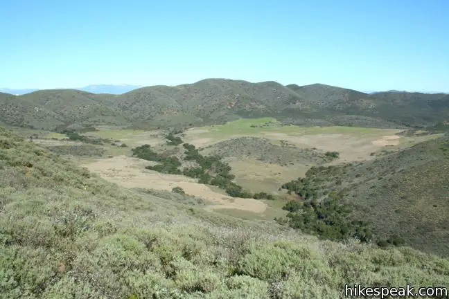
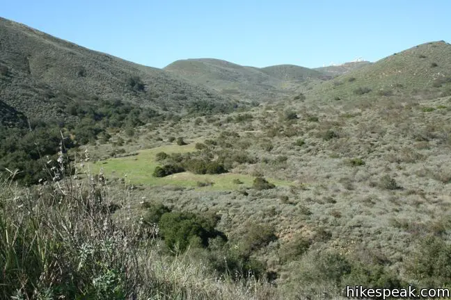
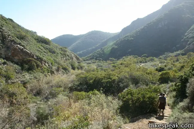
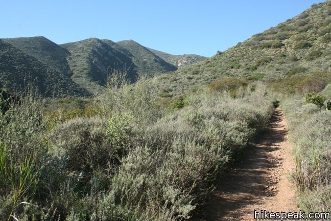
To continue on the loop, turn left toward La Jolla Valley and set out across the grasslands. After 0.2 miles, find a junction on the left with La Jolla Canyon Trail, which descends through the canyon past La Jolla Canyon Falls to the trailhead. This trail can be used to abbreviate the hike to 7.35 miles, but that would omit Mugu Peak, so continue west on La Jolla Valley Fire Road.
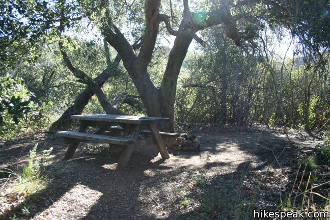
More side trails split off in both directions. To the right are three short spurs for La Jolla Valley Hike-in Campground. The nine sites are spaced to offer privacy and may be reserved for $10 per person per night through the iron ranger in the parking lot at the bottom of La Jolla Canyon. The campground has a vault toilet for those in need, but no drinking water. Campfires are not allowed.
Just past the campground are two junctions on the left with single tracks heading into La Jolla Canyon. These are fingers of the La Jolla Valley Loop Trail, a shorter circuit through the park. Ignore all of the junctions and stick to La Jolla Valley Fire Road. The double-track road crosses a plank bridge and dwindles to a single-track, cutting west through grasslands that may be either green or golden depending on the season of your hike. You will cross a small riparian zone where coast live oaks provide welcome shade. Unfortunately, poison oak is underfoot, making this a bad place to break. The trail turns to the left parallel to the trees and comes to the last junction with La Jolla Valley Loop Trail (1.6 miles past the La Jolla Canyon Trail junction and 6.55 miles from the start of the hike).
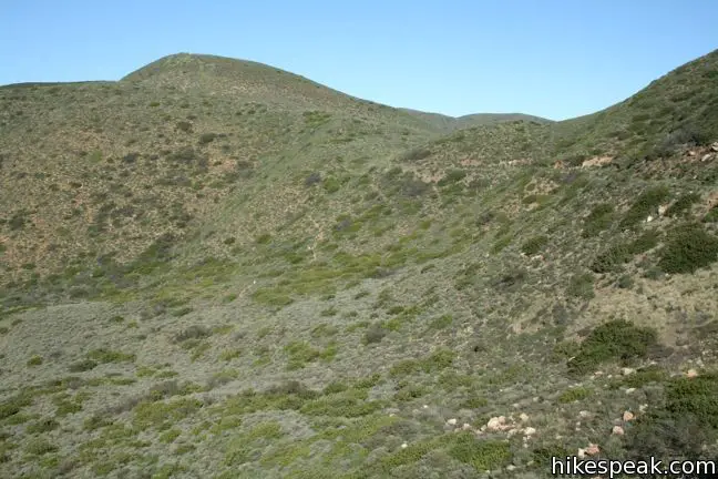
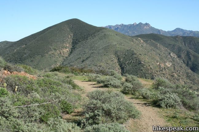
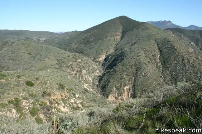
Stay to the right through this junction and ascend the ridge to a saddle west of Mugu Peak, at an elevation of 900 feet. To the left, a single track heads for the summit. One could shorten this hike to 10.75 miles by heading over the peak here, but that would eliminate the immense ocean views just ahead. The trail below the peak, called Mugu Peak Trail, meets up with the track across the summit on the other side at a higher elevation. It is recommended to hike the full loop and approach the summit from the east for a short scenic ascent.
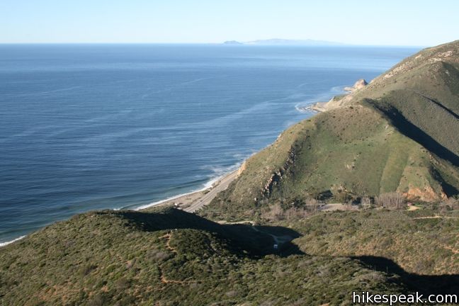
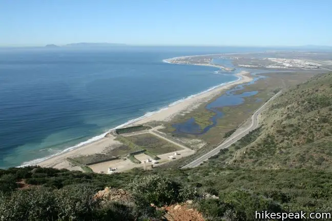
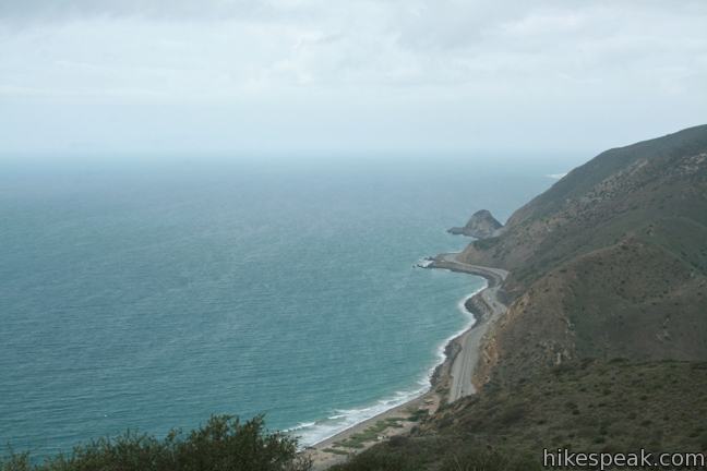
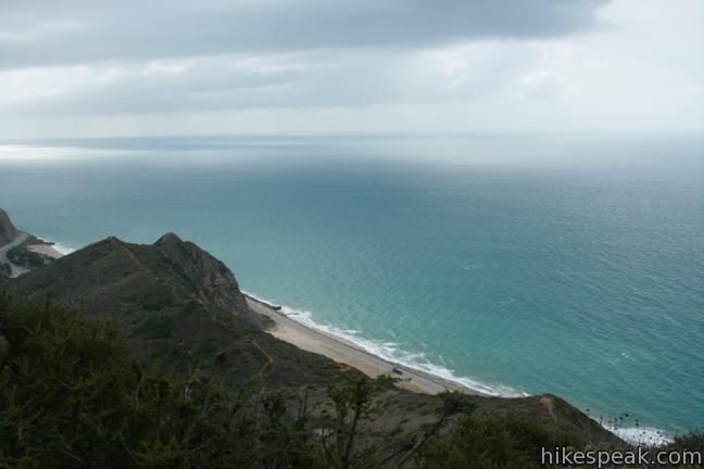
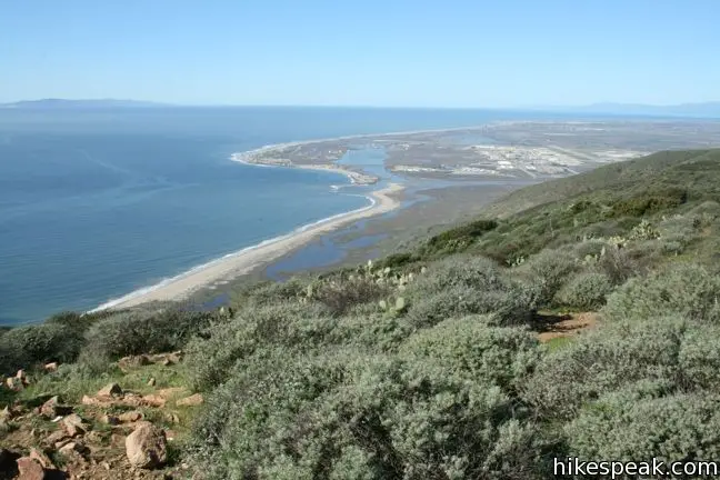
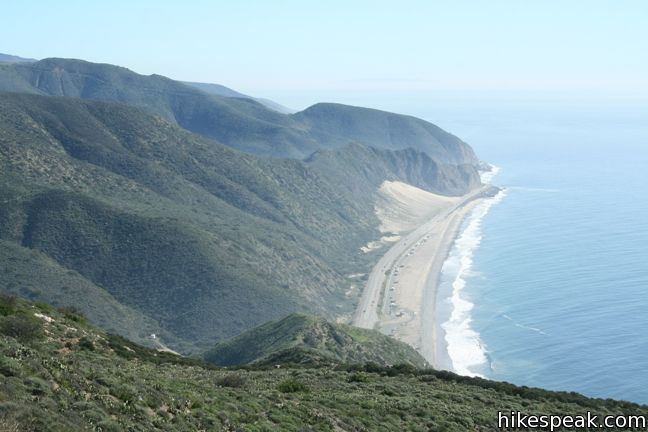
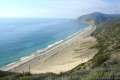
Straight ahead, Chumash Trail descends the steep south side of the saddle for 0.6 miles to another trailhead along PCH. The most defined trail, Mugu Peak Trail heads southeast across the waist of Mugu Peak. The ocean views are back, and they are stunning along this next portion of the hike. The single track takes a level course to a viewpoint along the eastern slope of the peak, 0.35 miles from the saddle. The landing soars above PCH and provides a panoramic perspective up and down the coast. Coastal wetlands to the west make a unique sight. Just past Mugu Lagoon is Point Mugu Naval Base where planes and helicopters can be seen taking off and landing.
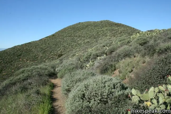
The trail continues around the peak, gradually gaining elevation. One mile from the saddle (and 8.25 miles from the start of the hike), Mugu Peak Trail comes to a junction with a track heading up the summit of Mugu Peak. This point is 160 feet higher than the other end of the trail over the peak (at the saddle), making for an easier ascent with 200 feet of elevation to gain over a quarter mile – just enough to get your heart pumping on the way to the summit.
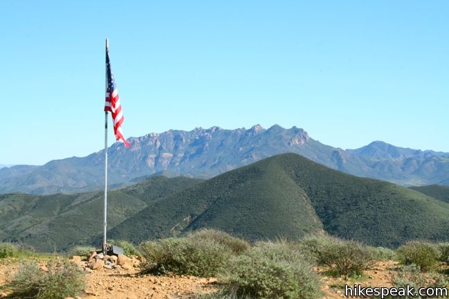
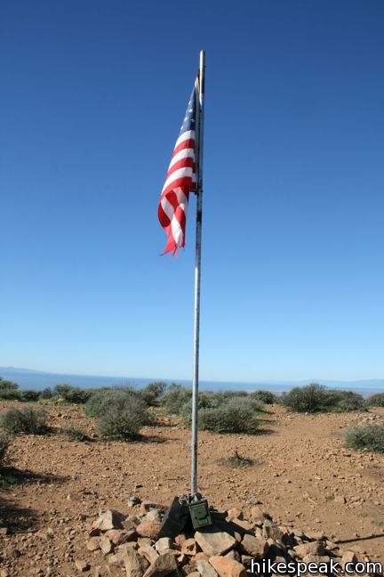
A high-flying American flag stands on the top of Mugu Peak. This round 1,266-foot peak is remarkably close to the ocean, and provides unobstructed 360-degree views along the coast and inland over La Jolla Valley. Old glory is well placed.
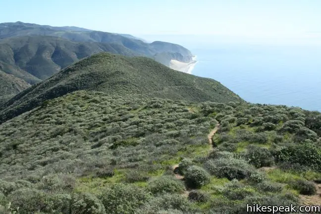
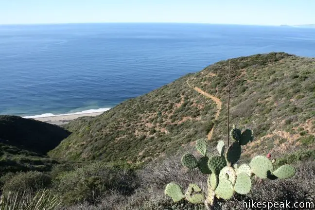
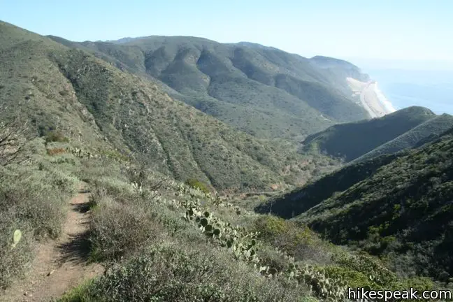
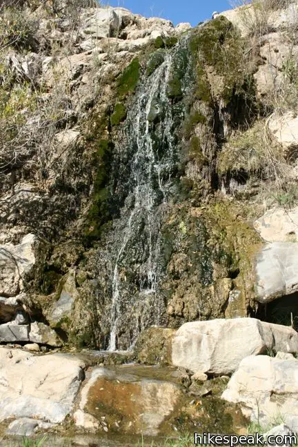
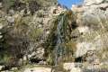
Beyond the summit spur, Mugu Peak Trail descends toward the western ridge of La Jolla Canyon (across from Ray Miller Trail). After curving inland and dropping 460 feet over 0.9 miles, the trail crosses a small creek and comes to a junction with La Jolla Valley Loop Trail. The creek is one of two streams that converge above La Jolla Canyon Falls. Though you are getting close, there is still 1 1/3 miles left to hike to the waterfall.
Pass a rusted out shed just before the junction, and turn right, joining the single-track La Jolla Valley Loop Trail as it wanders northeast over slopes of sage and brush for 0.85 miles to a junction with La Jolla Canyon Trail. Some uphill slopes come before to this final junction. Fortunately, once you get to the junction, the hike is all downhill to the trailhead.
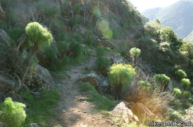
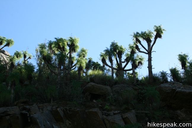
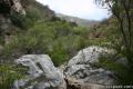
Turn right and descend the rocky wall of La Jolla Canyon, which is lined by bizarre looking vegetation, giant coreopis. The plant looks like fennel crossed with Joshua tree in a lab run by Dr. Seuss.
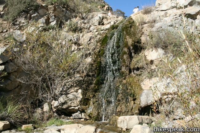
Switchbacks angle through a small grove of walnut trees to a confluence just above the falls. Have a look down the canyon from the top of the waterfall, then take the switchback to the left to the base of the falls. Pause below the mossy twenty-foot cascade before continuing down the canyon the final 0.75 miles to the trailhead.
There are several “wow” moments along the epic hike where the views are so incredible, they stop you in your tracks. This 11.75-mile hike can be shrunken to 11.1 miles by omitting the ascent to the summit of Mugu Peak and the walk out to the landing below. This grand trek will not disappoint, but if the distance is too great, consider these more manageable options:
- Hiking 1.5 miles round trip to La Jolla Canyon Falls
- Hiking 5.5 miles round trip up Ray Miller Trail
- Hiking 7.35 miles up Ray Miller Trail, across Overlook Fire Road, and down La Jolla Canyon Trail
- Hiking 6.5 miles round trip up Mugu Peak Trail to the summit
La Jolla Canyon Loop is largely sun-exposed, so pack plenty of water and sunscreen. No dogs are allowed. An $12 vehicle fee is charged to park at the trailhead (prices as of 2024). For those willing to hike a bit extra, free roadside parking can be found just outside the park along Pacific Coast Highway. No permit is required to day hike the amazing loop, so get out and enjoy!
Update: La Jolla Canyon Trail was damaged in the winters of 2015 and 2017 and is closed until further notice.
Directions to the Trailhead
- From Los Angeles, take the 10 Freeway west through Santa Monica and follow PCH northwest for 34 miles through Malibu to Point Mugu State Park.
- Fifteen miles past the intersection with Kanan Dune Road and 1.5 miles past Sycamore Canyon, turn right into La Jolla Canyon Day Use Area.
- Proceed into the park to the parking lot on the left.
- From Oxnard, head southeast on PCH for ten miles and turn left into La Jolla Canyon Day Use Area.
- Drive in toward the parking lot on the left.
Trailhead Location
Trailhead address: Pacific Coast Highway, Point Mugu State Park, Malibu, CA 90265
Trailhead coordinates: 34.086245, -119.03676 (34° 05′ 10.48″N 119° 02′ 12.33″W)
View Santa Monica Mountains in a larger map
Or view a regional map of surrounding Los Angeles trails and campgrounds.
Ray Miller Trail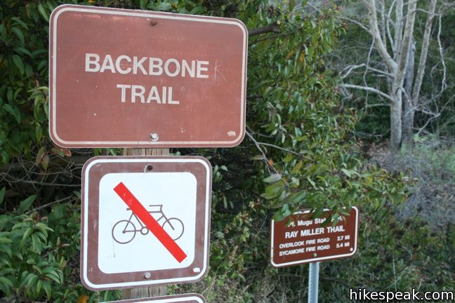


Overlook Fire Road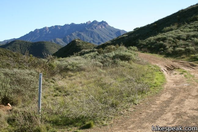

La Jolla Valley Fire Road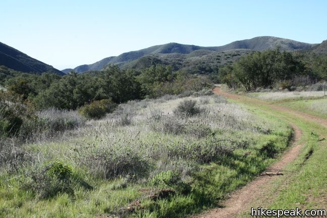

Chumash Trail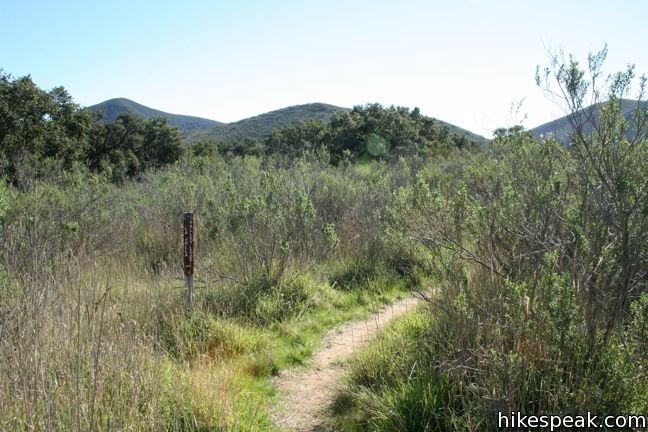


Mugu Peak Trail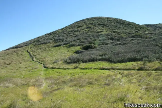


La jolla Valley Loop Trail


La Jolla Valley Canyon Trail
 | Mugu Peak This 6.5-mile hike ascends from the bottom of La Jolla Canyon to the top of a 1,266-foot peak, providing exceptional ocean and canyon views. |
 | La Jolla Canyon Falls This short hike visits the short seasonal waterfall 3/4 of a mile up La Jolla Canyon. |
 | Scenic and Overlook Trails Loop This 2.7 to 3.5-mile hike takes in tremendous ocean views above Big Sycamore Canyon in Point Mugu State Park. |
 | Sandstone Peak This 6.25-mile loop summits the tallest peak in the Santa Monica Mountains. |
 | The Grotto This 3-mile out and back hike visits a remote grotto in the Santa Monica Mountains National Recreation Area. |
 | More trails in the Santa Monica Mountains Explore other destinations in the range. |
 | Hermit Gulch Trail Trans-Catalina Trail Loop This 11.75-mile hike circles the ridges surrounding Avalon and offers offers amazing views of the interiors of Catalina Island and the ocean beyond. |
 | Corral Canyon This 2.5-mile loop offers ocean and canyon views from a unspoiled section of the Santa Monica Mountains in Malibu. |
 | Zuma Canyon Narrows - Zuma Ridge Loop This partially off-trail trek crosses the narrow canyon between Zuma Canyon Trail and Edison Road. Hikers may return along the Zuma Ridge Trail to form a challenging 8-mile loop. |
 | Gaviota Peak This 6.5-mile loop mounts a 2,458-foot summit two miles from the Pacific and then descends Trespass Trail to explore the wilds of the Santa Ynez Mountains west of Santa Barbara. |
 | Sycamore Canyon Campground This 58-site campground in Point Mugu State Park sits at the mouth of a beachfront canyon and has access to trails through the west end of the Santa Monica Mountains. |
Common Questions about La Jolla Canyon Loop in Point Mugu State Park
- Is the trail open?
- Alert: La Jolla Canyon Loop is currently marked as Closed. Please check official websites for current status.
- Do I need a permit for this hike?
- Yes. State Park Day Use Fee.
- How much time does this hike take?
- It takes approximately 5 hours 45 minutes to hike La Jolla Canyon Loop. Individual hiking times vary. Add extra time for breaks and taking in the views.
- How long is this hike?
- The hike to La Jolla Canyon Loop is a 11.75 mile loop with 1225 feet of elevation change.
- Are dogs allowed on this trail?
- No, dogs are likely not allowed on La Jolla Canyon Loop. The trail is primarily open to hikers.
- Is La Jolla Canyon Loop a difficult hike?
- This hike should be considered strenuous. Hikers should be prepared for a workout covering 11.75 miles and 1225 feet of climbing.
- Will I see a waterfall on this hike?
- Yes, La Jolla Canyon Loop features a waterfall.
- Are there ocean views on this hike?
- Yes, La Jolla Canyon Loop offers views of the ocean.
- Does this trail go to a summit?
- Yes, La Jolla Canyon Loop reaches a summit with panoramic views.
- What mountain range is this trail in?
- La Jolla Canyon Loop is located in the Santa Monica Mountains.
- Where is the trailhead located?
- The trailhead for La Jolla Canyon Loop is located in Malibu, CA.
Trailhead Address:
Pacific Coast Highway
Malibu, CA 90265
Trailhead Coordinates:
34.086245, -119.03676 - What are the driving directions to the start of the hike?
To get to the trailhead: From Los Angeles, take the 10 Freeway west through Santa Monica and follow PCH northwest for 34 miles through Malibu to Point Mugu State Park. Fifteen miles past the intersection with Kanan Dune Road and 1.5 miles past Sycamore Canyon, turn right into La Jolla Canyon Day Use Area. Proceed into the park to the parking lot on the left.
From Oxnard, head southeast on PCH for ten miles and turn left into La Jolla Canyon Day Use Area. Drive in toward the parking lot on the left.
View custom Google Maps directions from your current location.
- Are there other trails near La Jolla Canyon Loop?
- Yes, you can find other nearby hikes using the Hikespeak Hike Finder Map.

I’ve done parts of this hike during the rainy season when the falls were flowing good, very beautiful! Great review, helpful in finding what I missed next time I go back, thx!
Great hike, thank you for the great descriptions they helped guide me through the whole trail!
I want to Thank you guys for all the INFO Last Sunday 10-14-12 we Hike up 2 trails we love it the view over the ocean Priceless we are planing 2 hikes with about 15 friends and family and in the future a over night Camp thanks again.
How difficult is this hike? I need to plan a 10 mile minimum hike for our Boy Scout Troop. Is this too hard for 10 year olds? Are the inclines steep and steady or gradual and rolling? How long does it take to hike the whole 11.75 miles? Thank you for any input you have!!!
The length of this hike makes it challenging, but there is also over 1,000 feet of elevation gain. The steepest section of the hike is the descent on Mugu Peak Trail, so don’t do the loop in reverse if you are worried about steepness. The start of the hike, Ray Miller Trail, offers a steady climb. The middle portion of the hike is rolling and gradual. I would allot 5 hours to complete the whole loop. If the hike ends up being too tough, you can cut things short and hike down the valley into La Jolla Canyon (removing Mugu Peak from the loop). Have fun out on the trail!
Do you know if there is overnight parking at the trailhead if I want to camp? Or would I have to park outside of the parking lot and hike a bit further?
Hi! There is overnight parking at the trailhead for those who plan to camp at La Jolla Valley Hike-In Camgpround. There is no overnight parking on PCH outside the park. When you park in the lot, you can register for a campsite with the “Iron Ranger” and get a receipt to leave on your dashboard overnight.
This area is currently a burn area. The pictures shown on-line are not what the current vegetation looks like. Although the ocean views are still as incredible as ever, the hike is now in predominantly burned out vegetation.
Just finished this hike yesterday. Turned out to be about 12 miles but nothing too demanding for terrain. Like Dave said, the hike is predominantly burned out vegetation with some small signs of life scattered about. It gave some interesting views though. If you were going to shorten this hike I would do La Jolla Canyon trail to Mugu Peak trail to the top. That side is more scenic than the Ray miller side.
Does anyone know if dogs are allowed on this trail?
Dogs are not allowed
[…] to Point Mugu State Park, along with Sarah and John, and hiked an 11-mile loop starting at the La Jolla Canyon Loop Trailhead. Like the Old Boney Trail we hiked during our last visit, this section was also burned from the […]
On 5/23/14 – 5/24/14, I had overnight backpacking via the La Jolla Valley Hike-In Campsite, completing the western half of the loop (8.68 miles). Even during the Memorial weekend, the campsite was totally desolated (the site has no water) – so you may like it or not like it. It was ok for me.. no coyotes visiting (or may be they did but I slept through..) Brush fire damage was still very obvious, so the beginning part wasn’t that good, but the flower field in the middle valley was intact, and the Mugu Peak Trail with the fantastic view of the Pacific gave me an immense satisfaction.
We are staying at La Jolla Group site. Is there a firepit, bathroom and a shower? Do we have to walk across the highway to get to the beach? Is the hike too hard for a 6 years old?
How do I make a reservation for a walk -in primitive camp site at the La Jolla canyon site 2 miles in?
and will out California State Beach parking pass work here as it does foe San Onfre and Leo Cabrillo?
Thanks
Hi,
A California State Parks Pass will work for the parking lot. Once you get there, there is an ‘iron ranger’ where you would pay for parking if you did not have the pass. You can register for a campsite with the iron ranger, but I don’t believe there’s a way to reserve a site further in advance. You shouldn’t have an issue showing up and getting a campsite though. Have a great trip!
Is there any way to get to the start to the trail with public transport? and how are the bus connections? Does somebody know the bus number or hours?
Hi,
is there any public transport stoping near the start of this trail or at the campside? if yes can you give me details? If not, which trail (around 10 miles lenght) in the santa monica mountains can you reccommend me, that are to reach without car?
Thank you, Kris
Not sure if you can get all the way out to Malibu, but there is a bus line (2 & 302) along Sunset Boulevard in the Pacific Palisades that can be used to reach trails in Temescal Canyon and Will Rogers State Park.
TRAIL CLOSURE NOTICE: A major connector section of the loop trail in the high-walled canyon north of the parking lot collapsed in rock fall after the Feb. 2015 rains. This hike can no longer be completed as a loop as listed here. The connector section is where the waterfall is in wet season. The rockfall wiped out a steep, narrow section where the trail descended a 80ft. cliff and the area is now extremely unstable and dangerous to pass (also you risk a citation). It will take many dozens, possibly hundreds of hours to repair, so don’t look for this trail to be open in 2015. Here’s the closed trail notice at the north trailhead: http://s22.postimg.org/wf5v1d8f5/150307_La_Jolla_Cyn_trailclosed.jpg
The rest of LaJolla wildland is open and right now it’s especially green and beautiful!
[…] pinnacles of the Boney Mountains State Wilderness Area. For more serious senior hikers, take in the Big Sycamore/Serrano Loop. This epic trip of nearly 10 miles travels the southeastern corner of the […]
Just tried to head into La Jolla Canyon and found that it is currently closed due to storm damage. Folks might want to check with a danger before heading all the way out here. Of course, Ray Miller trail is a great alternative.
Want to reserve camp ground space for my family
We want to go camping at the beach please send message when available thanks
The La Jolla Canyon trail is still closed and it looks like they haven’t started working on getting it repaired yet. We stayed at the La Jolla Valley Hike-in Campground over Memorial Day weekend and we were the only people in the campground. The Boy Scouts did some nice repairs and the vault toilet (doesn’t lock), food lockers, and newer tables are a nice addition. There is a lot of overgrowth amidst the burnt vegetation. BYO water!
p.s. The first part of the hike is BRUTAL if you are hiking in via the Chumash trail with camping gear. You can’t get to the campsite via the La Jolla trail (closed). Pace yourself and be prepared!
[…] coworker of mine recommended I go to Point Mugu State Park and hike the Ray Miller Trail. To get there drive north on the Pacific Coast Highway and take the […]
just did an overnight to the la jolla hike in site from ray miller trailhead. longer detour due to trail closure isn’t so bad. the campsite itself, as jacob said, is a bit depressing. the boy scouts have put in some good equipment but it still pretty much feels like camping in a valley of ashes and dry brush. no visible water source out there either.
Hello Glen,
Do you recall which trails you took as a detour to La Jolla hike-in campsite?
It is an update that the la jolla canyon trail is still closed.
Part of the trail that passes the la jolla canyon falls has been closed and very dangerous.
Followed your post for my trip, 4/1/17. Trail was absolutely beautiful with the spring bloom and cool breeze. The last section with the junction right connecting back to la jolla canyon after Mugu peak is blocked off with a fence and a sign of trail closure due to rain damage. We went over the fence anyways , as the alternative would have been way too many miles for a detour, and the trail turned out to be fine. There is a last section that requires climbing down a rope about 20 ft on the side of water fall. This was more than safe but intimidating for those with a fear of heights. Funny the trail is closed from the top though, as the trail is open if you are approaching from below. Just an FYI.
I did not hike there but drive thru and saw a little black dog that was lost. He was scared and we were unable to catch him. Posting this in case someone looks at this site. He wS in La Jolla parking lot.
I grew up in those beautiful hills, in the 70’s and 80’s literally lived up there. You could say that my parents were off the grid, even though my dad was the mechanic for the city of port hueneme and police dept. I was born in Oxnard and my first address was Hollywood beach! My parents were not hippies but they knew a lot of people and would have huge bonfire parties on the beaches, they were really good friends with Ray Miller may he R.I.P. the ranger for the La Jolla canyon he lived on sight., He was so awesome! I am so happy to see they named a section of the trail after him and a monument! I wish I could have visited him again, he was a big part of my life for many years. I’ve hiked all of the trails even the deer trails., stepped on a rattle snake when I was 9 there… it did not bite me. Stayed in caves, camped in the mountains’, slept on the beach pitched our tent in the sand even through the santa ana winds …. we used to stay up there for 3+weeks at a time in a tent, when not there we were at the other camp sites up and down the coast from Washington to Panama I’ve stayed in both death valley and the Mojave but this place is most dear to my heart. I miss those days with their early dawns and late nights watching the sun rise and fall. Question can you still find cactus apples that are edible up there?
Anyone know if the trail is completely open again? Last post I saw on All Trails app says there was closure 6 months ago but no update since. My sister is visiting in March and I want to take her on this hike.
This hike should be removed. La Jolla Trail has been closed since January 2015. The waterfall no longer exists due to huge rock formations collapsing. It is extremely dangerous to attempt to pass through that section without experience in rock climbing and proper equipment. There are no plans to recreate this passage by the California State Parks. Camarillo Springs fire and heavy rains damaged the trails and loosened boulders on the canyon walls, increasing the hazard of landslides. For your own safety, please stay out of La Jolla Canyon!
Removed? Humbly disagree. Beautiful hike and with all the money the state receives, some should be directed to LaJolla Canyon. Keeping it posted reminds people like me to contact the California State,Parks and state legislators to influence a rehabilitation effort.
Trail from LaJolla group camp on PCH is still closed. I have done the Chumash with the LaJolla loop exiting down the Chumash again a few weeks back. I thought it was a good hike without the falls.
I regularly do the Ray Miller for excercise but have not gone down the Overlook fire road into La Jolla valley, hiking a fire road just does not inspire me.
Regardless of which way you choose to get up there… there will be mosquitoes!!!! Me and my partner were eaten alive, still recovering. You absolutely need a bug net for your face, bug spray, and long sleeves and pants. I’d even recommend gloves for your hands. We went late summer so it is difficult to wear the protective clothing without getting extremely hot. So lightweight is better and light colors instead of dark. There also are coyotes at night that are very curious and will be around. You must be at peace with that otherwise you won’t sleep. There is poison oak and rattlesnakes. There are parts of the trail that are loose rock and very dangerous if you aren’t very attentive. These are basic things I wish we had known before our trip. Some rangers know about the walk-in sites and some don’t so keep trying rangers till you find one that knows whats up. Otherwise it is a beautiful and humbling canyon. I am a local and have wanted to go for some time. Wish I was a bit more prepared but I’m hoping this review will help others have a more enjoyable time.