The Cascade Range is home to many caves including volcanic lava tubes and glacier ice caves. The Guler Ice Cave south of Mount Adams offers a sample of both. Through the early summer this cave contains impressive ice features like frozen stalactites and stalagmites. You will see the most ice if you visit in April and May. As the season warms the cave loses its ice, but remains fun to explore throughout the year. Guler Ice Cave is a cool place to hang out to escape mid-summer heat.
The 650-foot long Guler Ice Cave is a small piece of an extensive network of caves in the Indian Heaven Volcanic Field between Mount Adams and Mount Saint Helens. The most recent eruption in this area, 9,000 years ago, produced a large lava field just west of these lava tubes.
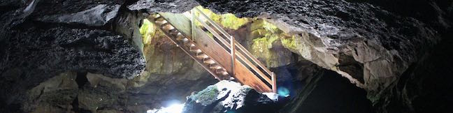
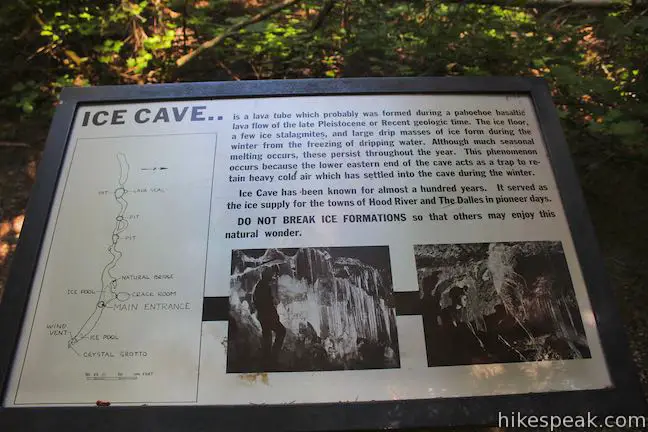
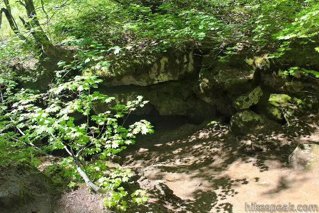
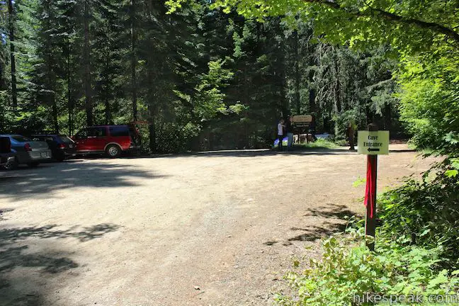
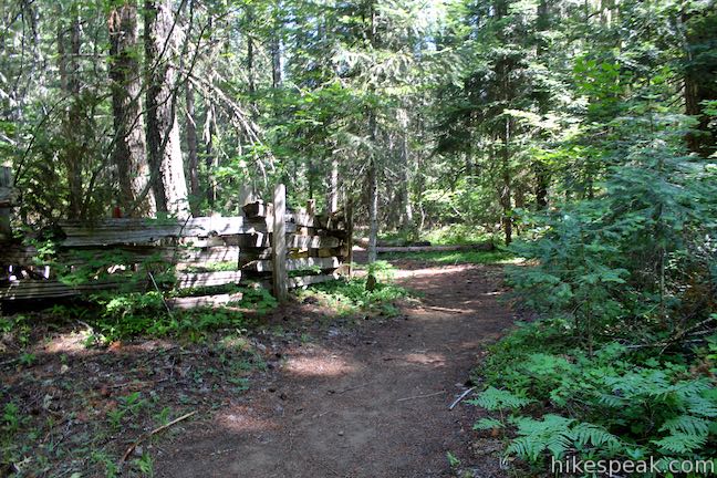
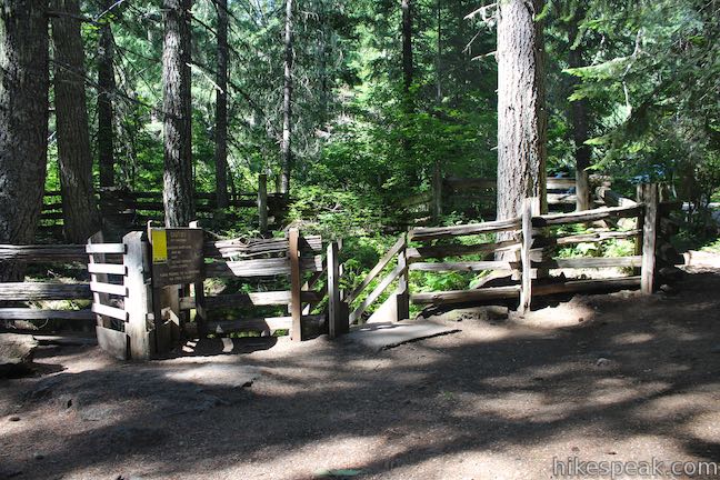
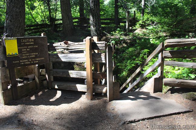
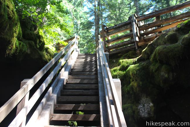
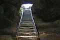
To find the cave, walk just 20 feet east of the parking area (to your left as you drive in). You will quickly reach the cave entrance, which is surrounded by a wooden fence. A staircase leads into the mouth of the cave. Before you enter, be sure to examine and photograph the cave map that is posted next to the cave entrance and on the national forest information board by the parking lot. The dark cave can be disorienting and the map is a helpful resource to make sure you see all of the features.
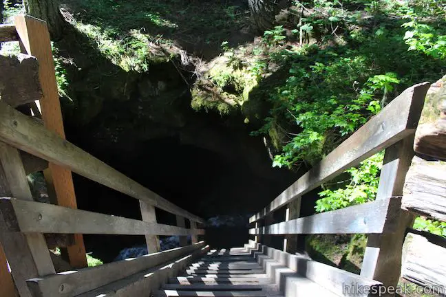
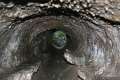
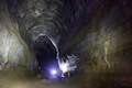
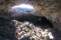
Entering Guler Ice Cave
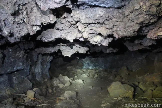
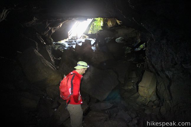
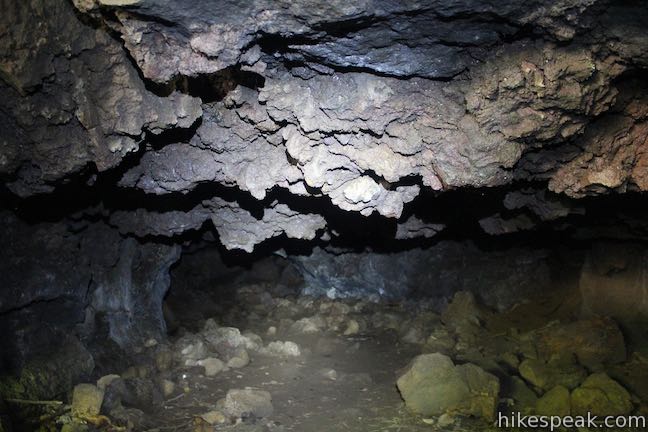
As you descend 20 feet into the cave, notice the temperature change from the top to the bottom. The stairs may be icy, so use caution. Look out for hazards inside the cave as well. The floor of the cave is covered in large, rough rocks that may be unstable. Keep one or two hands free to navigate obstacles. The forest service recommends wearing a helmet in case of rock or ice falls. Depending on the time of year that you visit, the floor of the cave may be covered by ice or have icy patches that are difficult to see. Wear shoes with good traction. As with any underground cave, bring at least two sources of light and warm layers to wear.
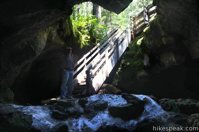
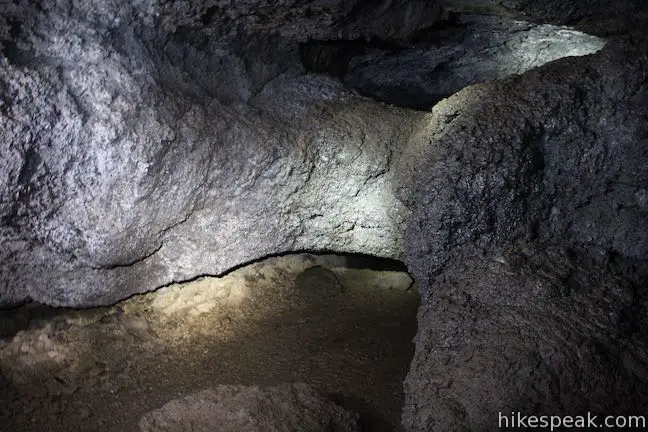
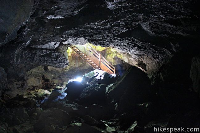
Exploring Guler Ice Cave
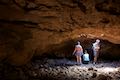
Once down the stairs, turn right to venture into the longest section of the cave, which travels to the west underneath the parking lot. After moving about 250 feet, you will reach a collapsed section of the lava tube described on the map as a ‘pit.’ The pit is a sloped entrance to the cave and those wishing to crawl could actually leave the cave here. The entrance at the pit provides excellent shelter, so don’t be surprised if you see signs of an animal’s den. This collapsed pit blocks any further travel to the west.
To see more of the cave, turn around and make your way back to the entrance, sticking to the left side of the cave. About 90 feet before the staircase, you will find a natural bridge within the cave. When lava flowed through this tunnel, a smaller channel must have formed at the end of an eruption cycle. This natural bridge is a lingering piece of that smaller tube. Continue to hug the left side of the cave to find a small chamber called both the Crack Room and the Spider Room. If you visit in the spring, an Ice Pool will have formed In front of the Crack Room.
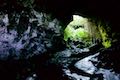
Back to the entrance, pass the staircase and head toward the shorter southeastern section. In just over 100 feet you will come to the end of the cave.
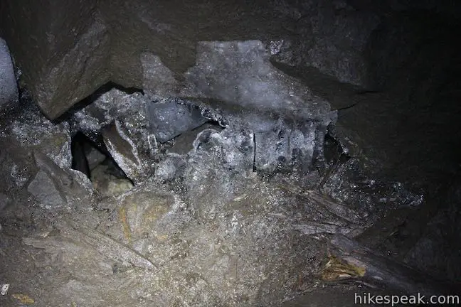
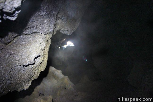
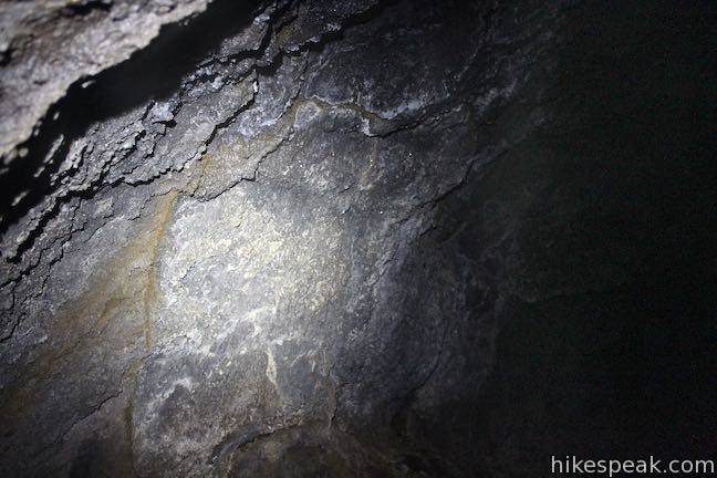
When ice is present, you will discover a spectacular feature called the Crystal Grotto. Even if you visit after all the ice has melted, the cave walls will still produce a dazzling glow. Fungus and bacteria that grow on the cave walls trap water and reflect light, creating a sparkly effect. After admiring the Crystal Grotto, make your way back to the staircase and return to the surface.
McClellan’s Trail
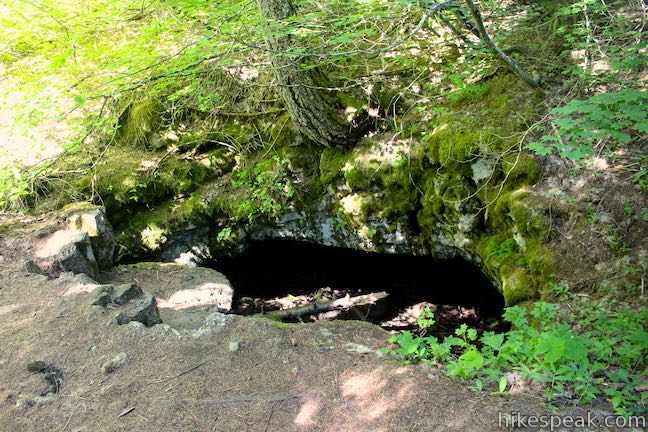
If you would like to explore other areas of Guler Ice Cave, you can hike above ground to the westernmost parts of the cave and enter through two natural openings to the lava tube called ‘pits.’ To access the pits, walk across the parking area and head west on McClellan’s Trail.
After just 120 feet on McClellan’s Trail, you will reach the first pit, corresponding with the end of the ice cave you just explored. Walk down into the pit to peek inside the cave and see what lies beyond the area you explored underground. The cave is blocked beyond the entrance of this pit.
If you continue down the trail, you will arrive at two more pits within another 120 feet. These pits offer access to small sections of cave that few people visit. If you are a cave-lover and willing to crawl, you can climb down into these pits to see what lies within.
After the third pit, the trail splits with one spur traveling north and the other heading southwest. Both trails are overgrown and quickly fade, so only continue exploring if you are comfortable with trickier navigation.
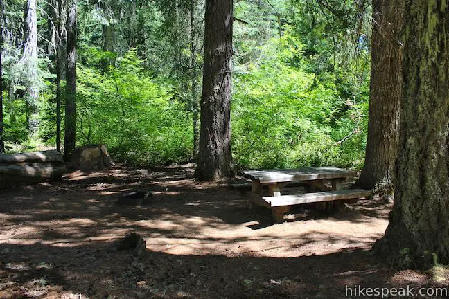
Guler Ice Cave is located within Gifford Pinchot National Forest and a Northwest Forest Pass is required to park at the trailhead. You may self-register for the $5 day pass at the trailhead. An annual America the Beautiful national public lands pass may also be used in lieu of the regional national forest pass. However, the Washington Discover Pass is not valid. Dogs and bikes are not allowed in Guler Ice Cave (naturally). Did you bring lunch? Ice Cave Picnic Site is located next to the parking area.
If you make the trip to Guler Ice Cave, you should take the time to check out the nearby Natural Bridge Interpretive Site through a short hike. Natural Bridge is just 1.1 miles away as the crow flies and a 7-minute drive from the ice cave. To reach it, return to Carson Guler Road (NF-24) and turn left. Drive 0.8 miles and take the first left onto NF-041, following signs for the Natural Bridge. After half a mile on this well maintained gravel road, turn right. The parking lot will be on the left side in 0.3 miles.
Forest Road 24 (NF-24) closes during the winter due to snow. From December through April, check on the road status with Gifford Pinchot National Forest. Those wishing to explore the cave despite the road closure, can do so by hiking a couple miles extra.
Directions to the Trailhead
- From White Salmon, Washington, take Route 141 North for 22 miles to Trout Lake.
- Keep left to stay on Route 141.
- After 5.8 miles, Route 141 becomes Carson Guler Road, also known as National Forest Road 24.
- Drive 0.5 miles and turn left, following signs for the ice cave.
- The parking lot is just 0.2 miles off NF-24.
Trailhead Location
Trailhead address: Guler Ice Cave, Carson Guler Road, Trout Lake, WA 98650
Trailhead coordinates: 45.9613, -121.63265 (45° 57′ 40.68″N 121° 37′ 57.53″W)
You may also view a regional map of surrounding Washington trails and campgrounds.


 | Beacon Rock Trail This 1.6-mile hike follows an impressively engineered trail packed with switchbacks that scale a monolith along the Columbia River. |
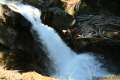
 | Hamilton Mountain The beautiful 7.75-mile lollipop loop visits bombastic waterfalls and panoramic cliffs on the Washington side of the Columbia River Gorge in Beacon Rock State Park. |
 | June Lake This 2.6-mile hike visits a small lake and a waterfall on the southern slopes of Mount Saint Helens. |
 | Lava Canyon Trail This 1.25-mile loop explores a colorful canyon re-carved by the 1980 eruption of Mount Saint Helens. |
 | Ape Cave This adventurous underground hike in Mount Saint Helens National Volcanic Monument travels through one of the longest lava tubes in the world. |
 | Trail of Two Forests This short nature trail in Mount Saint Helens National Volcanic Monument tours a landscaped that was transformed by a molten lava flow. For extra fun, crawl through a 50-foot long lava tube beneath the trail. |
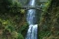 | Multnomah Falls This 0.4 to 2.6-mile hike in Columbia River Gorge visits Oregon's tallest (and probably most visited) waterfall, offering something to hikers of all abilities. |
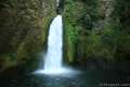 | Wahclella Falls This 2-mile hike visits a sublime waterfall in Oregon's Columbia River Gorge. |
 | More trails in Washington Explore other hikes in the Evergreen State, including Mount Rainier National Park and Mount Saint Helens National Volcanic Monument. |
 | Lava River Cave in Newberry National Volcanic Monument (Oregon) This underground hike explores a lava tube south of Bend that is filled with fascinating volcanic features. |
 | Kalahuipua'a Trail and Fishponds Loop (Hawaii) This action-packed 1.7-mile hike explores a lava field with a lava tube shelter and impressive fishponds along a gorgeous coastline. |
 | Kaumana Caves (Hawaii) This underground hike explores lava tubes on the edge of Hilo, created by an 1881 eruption of Mauna Loa. |
 | Lava Tube in Mojave National Preserve (California) This short 0.6-mile hike drops below the desert surface into an old lava tube with a spectacular skylight. |
 | Caves Trail in Crates of the Moon National Monument (Idaho) This 1.6 mile travels above and below the surface, exploring lava tubes in the Great Rift Lava Flow. |
| Trail of Two Forests in Mount Saint Helens National Volcanic Monument (Washington) This short nature trail tours a landscaped that was transformed by a molten lava flow. For extra fun, crawl through a 50-foot long lava tube beneath the trail. |
| Ape Cave in Mount Saint Helens National Volcanic Monument (Washington) This adventurous underground hike travels through one of the longest lava tubes in the world. |
 | Camping around Mount Saint Helens Beaver Bay Campground and Paradise Creek Campground are two of the places to camp a convenient distance from this trail. |
Common Questions about Guler Ice Cave in Gifford Pinchot National Forest
- Is the trail open?
- Yes. You should expect to find that McClellan’s Trail is open. There are no recent reports of trail closures. If you discover that the trail is closed, please help your fellow hikers by reporting a closure.
- Do I need a permit for this hike?
- Yes. Northwest Forest Pass Required.
- How much time does this hike take?
- It takes approximately 15 minutes to hike McClellan’s Trail. Individual hiking times vary. Add extra time for breaks and taking in the views.
- How long is this hike?
- The hike to McClellan’s Trail is a 0.25 mile out and back with 25 feet of elevation change.
- Are dogs allowed on this trail?
- No, dogs are likely not allowed on McClellan’s Trail. The trail is primarily open to hikers.
- Is McClellan’s Trail good for kids?
- Yes, this hike is likely suitable for children. It is relatively short (0.25 miles) with manageable elevation gain.
- Are there caves on this hike?
- Yes, McClellan’s Trail features caves to explore.
- Does this hike visit a lava tube?
- Yes, pack a headlamp to check out the lava tube on your trek to McClellan’s Trail.
- What mountain range is this trail in?
- McClellan’s Trail is located in the Cascade Range.
- Where is the trailhead located?
- The trailhead for McClellan’s Trail is located in Trout Lake, Washington.
Trailhead Address:
Carson Guler Road
Trout Lake, Washington 98650
Trailhead Coordinates:
45.9613, -121.63265 - What are the driving directions to the start of the hike?
To get to the trailhead: From White Salmon, Washington, take Route 141 North for 22 miles to Trout Lake. Keep left to stay on Route 141. After 5.8 miles, Route 141 becomes Carson Guler Road, also known as National Forest Road 24. Drive 0.5 miles and turn left, following signs for the ice cave. The parking lot is just 0.2 miles off NF-24.
View custom Google Maps directions from your current location.
- Are there other trails near McClellan’s Trail?
- Yes, you can find other nearby hikes using the Hikespeak Hike Finder Map.

Do I need some sort of pass to use this park? I.E. Discover pass
Guler Ice Cave is located within Gifford Pinchot National Forest and a Northwest Forest Pass is required to park at the trailhead. You may self-register for the $5 day pass at the trailhead. An annual America the Beautiful national public lands pass may also be used in lieu of the regional national forest pass. However, the Washington Discover Pass is not valid.
[…] Forest Service – Ice Cave Picnic Area, hikespeak, […]
[…] passages and lava bridges in his journal. Beyond they passed by more lava caves known as Guler Ice Cave. After crossing the White Salmon River at Trout Lake, they reached the camas prairies around Conboy […]