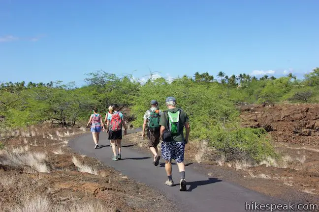
A list of things for hikers to do on the Big Island of Hawai‘i includes: walking across a lava field, exploring a cave, looking for petroglyphs, seeing fishponds created by early Hawaiians, and taking a time-out by tide pools in a beautiful bay. Check off everything on that list with one visit to Kalahuipua‘a Historic Park and Fishpond Preserve. A loop around coastal Kalahuipua‘a Fishponds connects to the end of Kalahuipua‘a Trail to form a lollipop loop hike that is 1.7 miles long with just 30 feet of elevation change. This easy and varied hike has something new to experience around almost every turn.
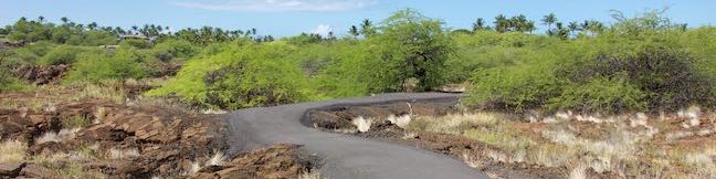
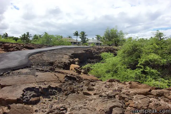
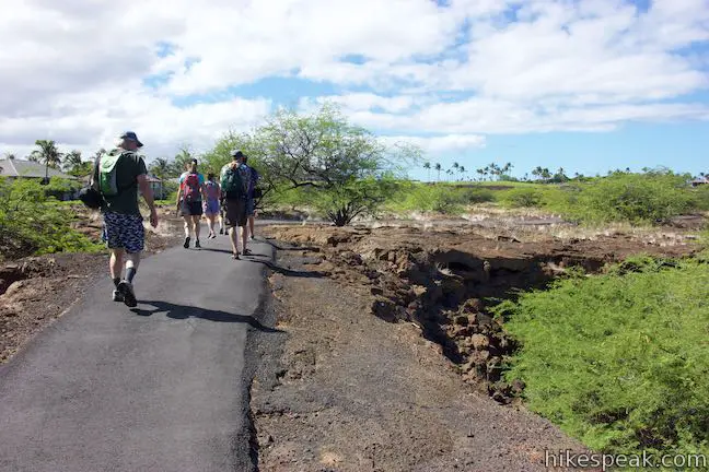
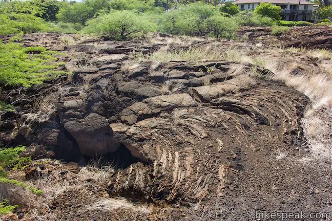
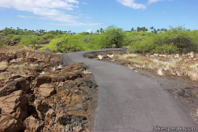
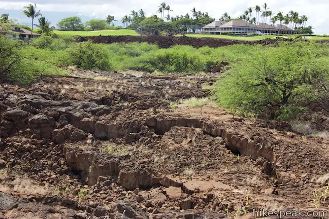
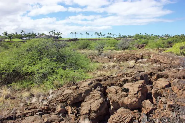
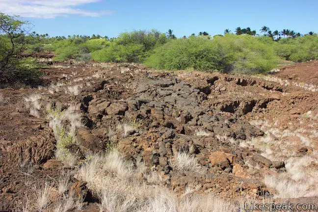
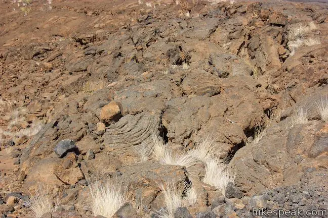
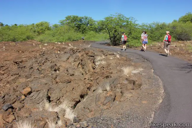
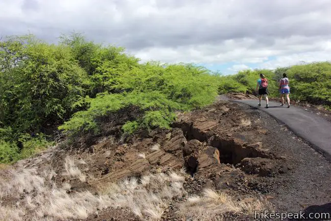
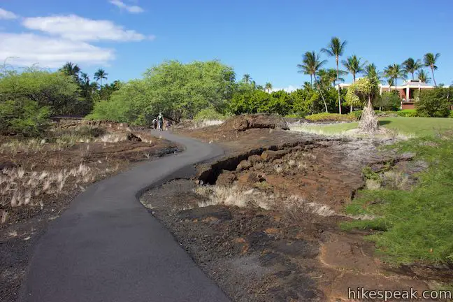
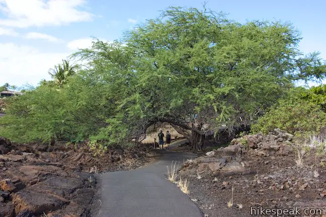
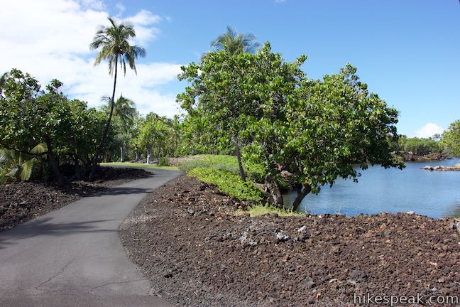
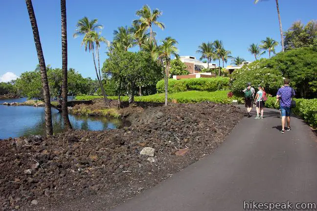
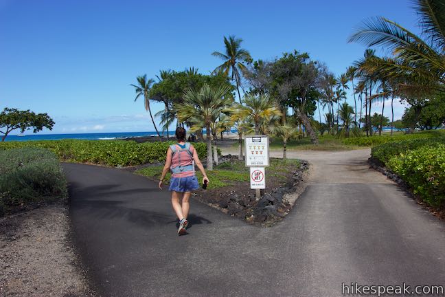
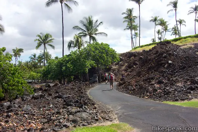
Kalahuipua‘a Historic Park is located beside the Mauna Lani Resort on the west coast of the Big Island of Hawai‘i, 25 miles north of Kona. From a trailhead parking area with bathrooms and picnic sites, set out on a paved trail that rises onto a pahoehoe lava field. (Pahoehoe is the smoother type of lava that looks like hardened batter.) Kalahuipua‘a Trail crosses an ancient lava flow where minimal vegetation has yet to take hold.
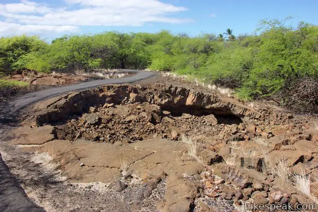
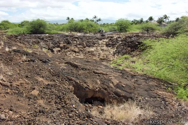
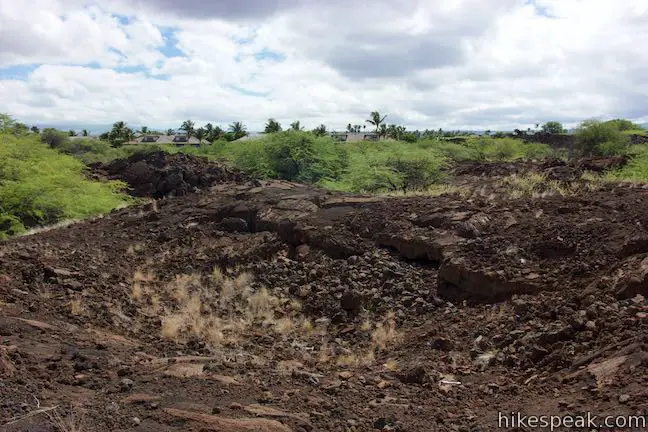
Follow the trail’s weaving path past a few informative panels. The first panel is located in front of a collapsed area in the ground by the trail. The panel describes how lava tubes channel eruptions of pahoehoe lava:
The lava of this ancient flow cooled on the surface first while molten material continued its passage toward the sea under the surface crust. When the source of the lava was cut off, the still-molten lava continued its downhill flow, leaving behind these empty pipelines called lava tubes. You can see these where their roofs collapsed. Ancient Hawaiians found them to be good living quarters – cooler, drier, and less windy than surface shelters.
Continue a little farther to another sign that describes woodworking tools made by early Hawaiians out of the volcanic rock. Hawaiians (including royalty) lived in this area for 800 years before the islands were discovered by westerners.
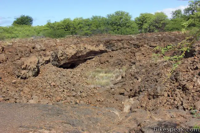
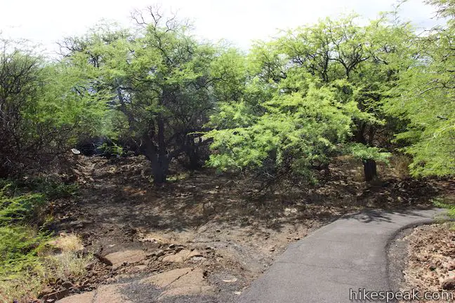
After this sign, the trail makes a big curve to the left and dips toward some short trees. As the trail curves back to the right, look for a path branching of to the left toward a cave below a shelf in the lava. The spot where the footpath leaves the paved trail is not marked with a sign, but you should be able to spot a couple panels in front of the cave to reassure you that this is the right spot to leave the pavement.
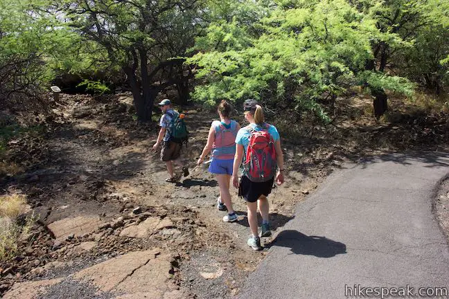
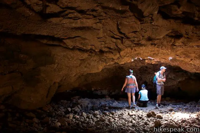
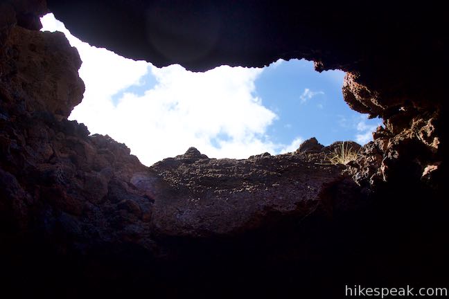
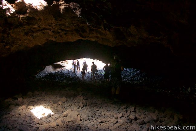
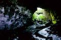
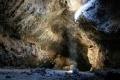
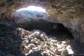
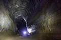
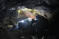
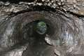
At 0.2 miles from the start, stray off Kalahuipua‘a Trail on the short path to the opening of a lava tube below the volcanic surface. Archeologists have scoured the cave and found evidence of early Hawaiians using the cave as a a shelter from AD 1500 to 1700. One panel explains:
This lava tube shelter was home to small groups of Hawaiians. They slept, worked, cooked, and ate here. The spacious flat floor, shade, protection from the wind and rain, and the cross-ventilation provided by other openings in the rear of the tube made it a very attractive location. A few mats on the floor and a small cooking fire would make this a comfortable shelter, even today.

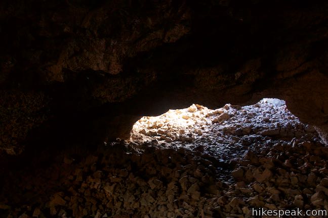
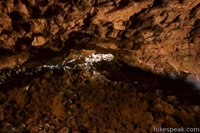
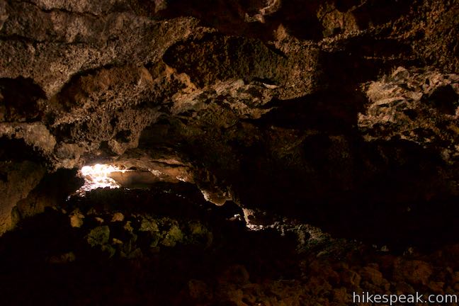
Step into the lava tube and imagine how it might have appeared with these Hawaiians gathered inside. Stagger across the floor of the lava tube shelter, which is covered in a rubble of rocks that have fallen from the ceiling of the cave. Stand below an opening in the middle of the cave and look up toward the sky. Smaller openings leak light into different corners of the cave, making it easy to have a look around without a flashlight (although you might want to bring one).

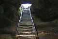
When finished exploring the lava tube shelter, step out into the light. Take the path back to Kalahuipua‘a Trail and turn left to continue along the paved trail.
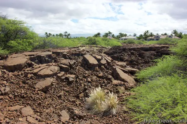
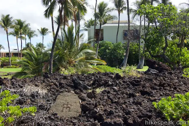
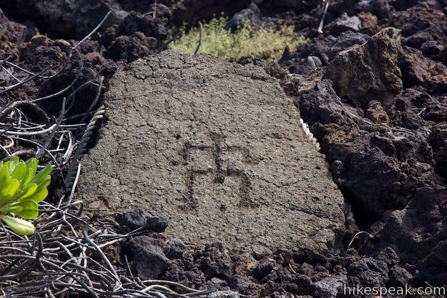
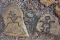
Kalahuipua‘a Trail crosses more of the lava field beside the Mauna Lani Resort. Just before the end of the trail, a rock-lined path ventures to the left. Amble a short distance up this path and see if you can find petroglyphs carved into the volcanic surface.
- Many more petroglyphs can be seen at nearby Malama Trail in Puakō Petroglyph Archeological District
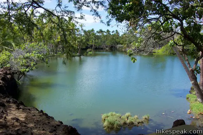
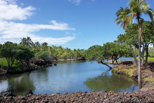
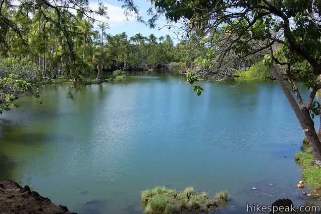
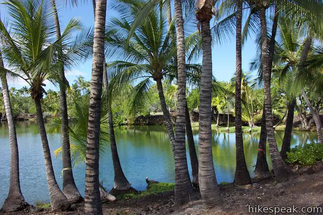
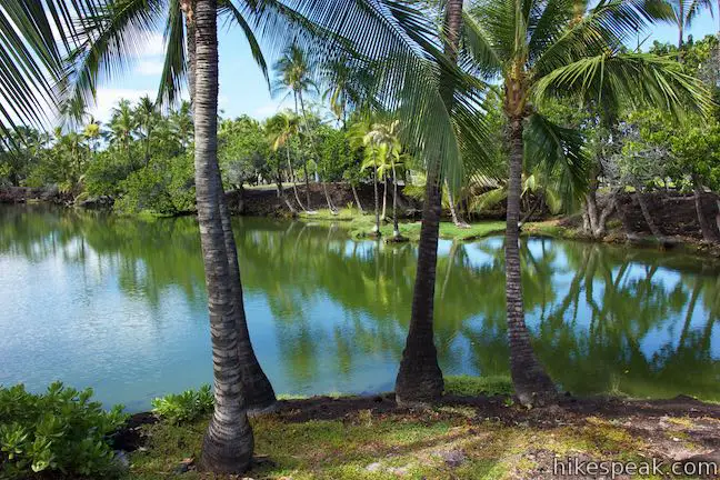
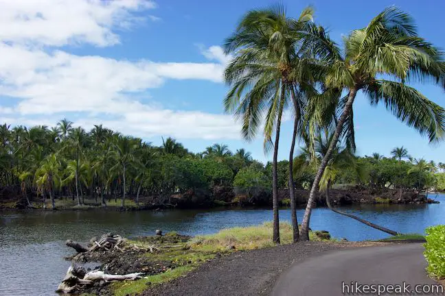
Continue on Kalahuipua‘a Trail, which swiftly comes to an end, 0.35 miles from the start. Cross a road onto a wide paved trail leading to the first fishpond. Look left into Hope’ala Fishpond, a shallow emerald pool that is one of the seven fishponds preserved around the resort.
Walk 125 yards farther up the trail to a junction where the loop begins. Though you can head in either direction, the route described here suggests continuing straight (staying to the right).
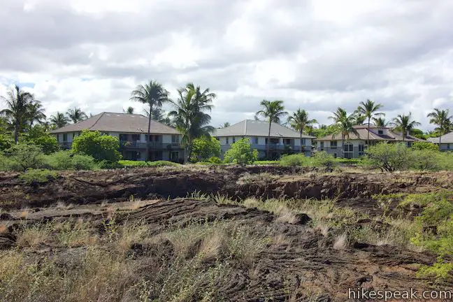
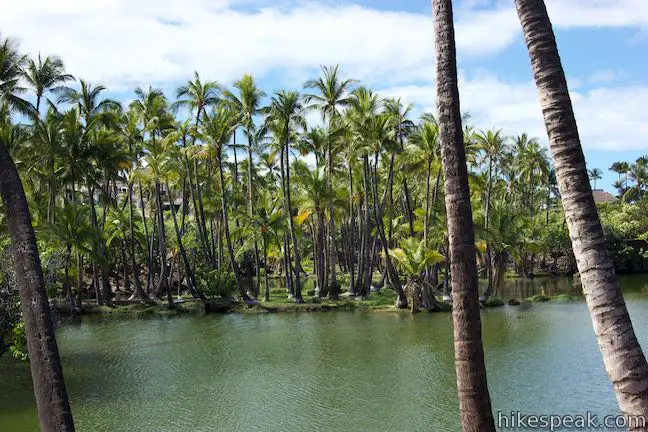
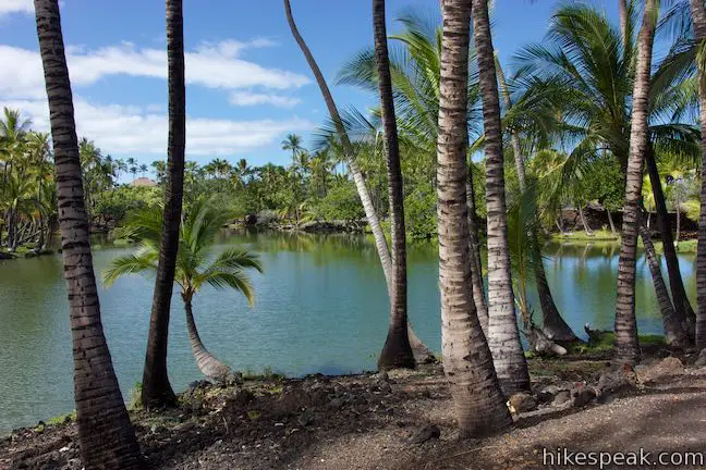
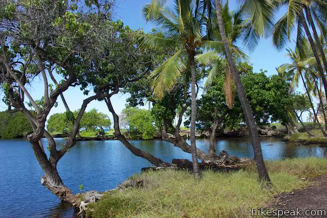
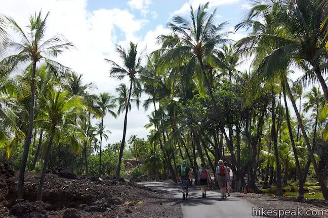
Begin hiking the loop in a counter-clockwise direction. Overlook the encroaching resort buildings to the right and keep your gaze fixed across Lahuipua‘a Fishpond, the largest pond in the preserve. A panel positioned beside the trail explains how early Hawaiians cultivated and fish-farmed these coastal pools.
Since men first found them, the fishponds at Kalahuipua‘a have been a delightful oasis along this arid coast. These brackish ponds are fed and cleansed by fresh water springs seeping into them and the tidal action of the sea. By modifying them and by managing them wisely, the prehistoric Hawaiians were able to raise a variety of fish in these ponds. ‘Ama ‘ama (mullet) and awa (milkfish) were the most common raised fish, but other such as papio (jack), Kaku (barracuda) and puhi (eels) as well as ‘opae (shrimp) lived here also. These ponds are among the few anywhere that are still being managed in much the same way as they were in ancient times. They are still producing fish.
The fishpond of Lahuipua‘a was once a shallow bay that early Hawaiians walled off and enclosed. The fish growing in the ponds eat algae off the bottoms. By keeping predators out, the fish are able to grow to a size where they can be harvested. (Recreational fishing in these fish farms is prohibited).
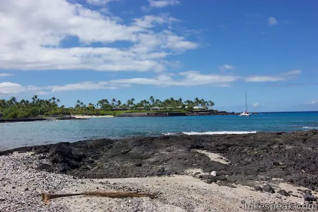
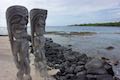
Walk along Lahuipua‘a for a tenth of a mile to come to another junction. Kakaiwa Bay is right in front of you. The loop continues to the left, but why not see even more of the scenic coastline and fishponds? Bearing right, the trail becomes unpaved. Make a second immediate right to follow the dirt road past a reproduction of a petroglyph in front of the resort.
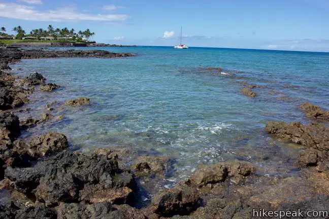
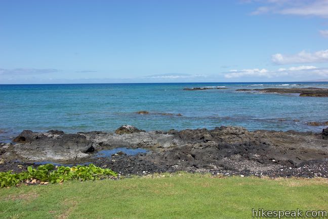
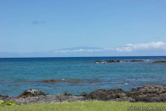
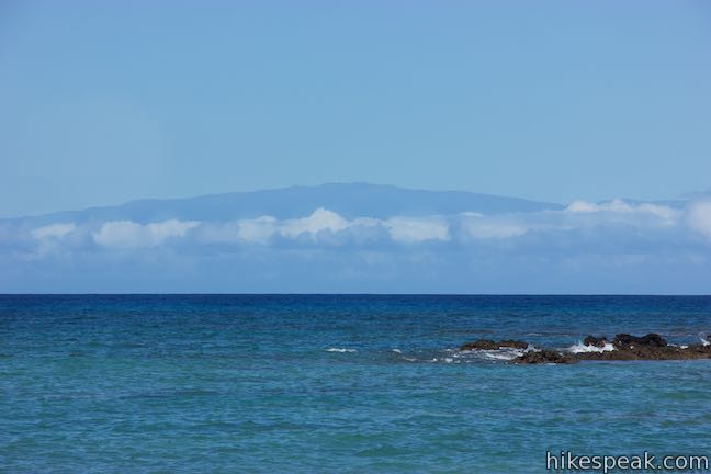
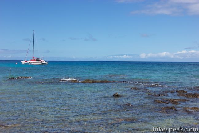
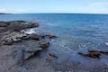
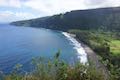
Enjoy sea breezes as you follow the dirt road north. On your right, spot fish swimming around Waipuhi Fishpond. Look at the hālau structure built along the cove to the left. The dirt road leads to a sand beach. Gaze out across Kakaiwa Bay and look north up the coast toward Kohala and the northwest tip of the Big Island of Hawai‘i. Gazing out across Kakaiwa Bay, you may spot land across the sea. That’s the island of Maui, where the white domes of observatories shimmer atop Haleakalā.
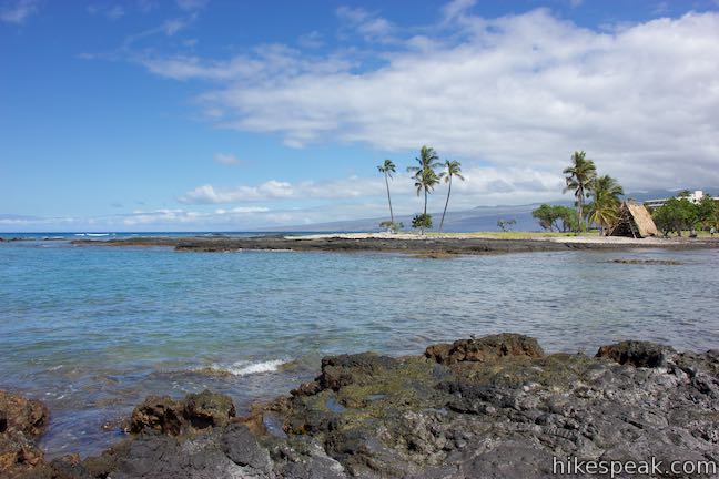
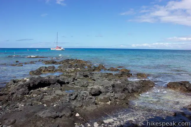
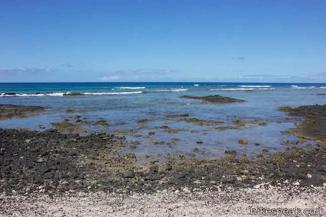
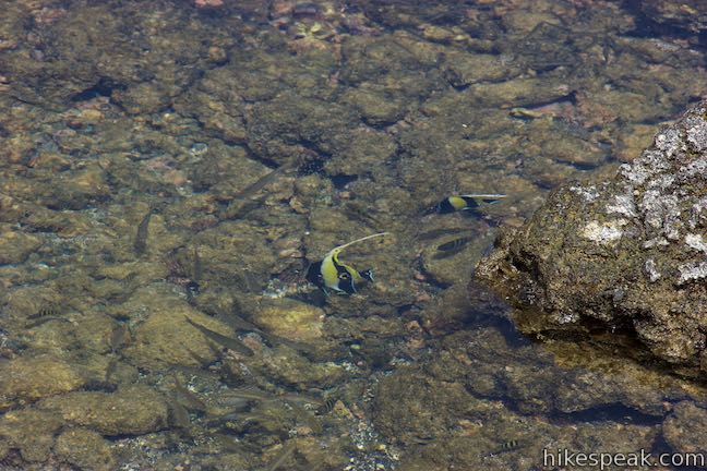
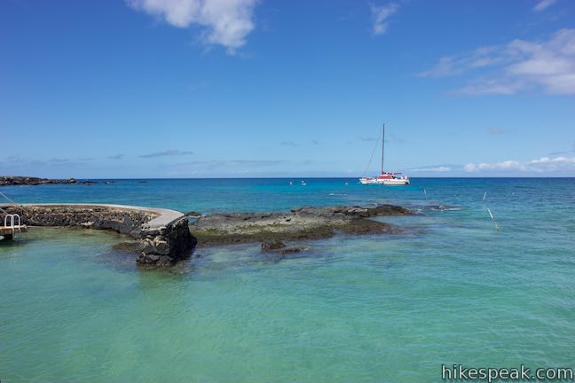
Resist the urge to venture farther up the coast to the north, (or go ahead and explore a little more of the shore in front of the resort). Bear left to curve south around the point. Walk back beside the hālau and admire the wooden frame and roof made of palm fronds. Follow a dirt path around the cove or hop across the rocky tide pools to spot tropical fish like black and yellow striped Moorish idols.
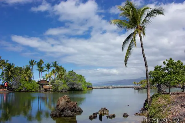
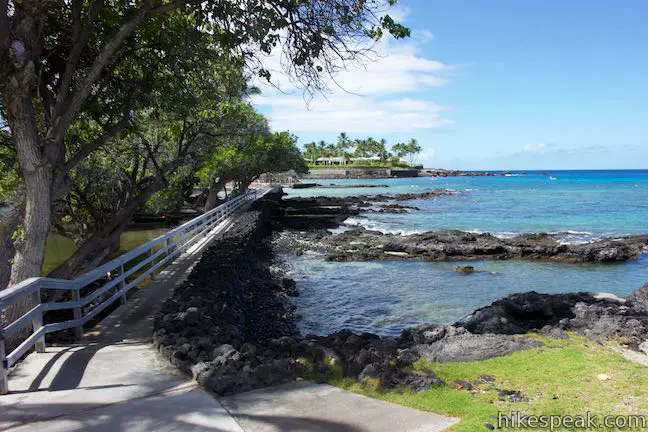
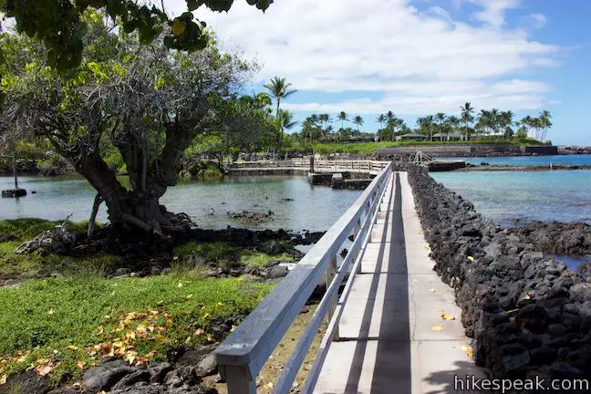
Come around the tide pools to a grassy lawn (at the end of the paved trail that you would have reached by turning left and the junction when you approached the coast). Walk across the lawn to a walkway on top of the wall built to separate Lahuipua‘a Fishpond from the ocean. This stretch of the hike is lovely any way you look at it. A green palm-wrapped fishpond is to your left, while a turquoise, tide pool-wrapped bay is to your right.
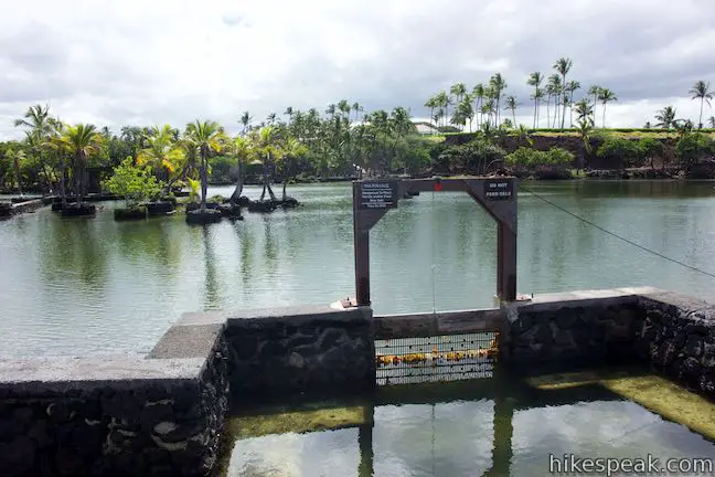
Along the short sea wall, pass a gate between the bay and the fishpond. The volcanic rock making up the sea wall has pores that actually filter some fresh ocean water into the ponds, but makaha gates were important for circulating water and controlling what fish could come in and out of the ponds, as a panel explains:
The prehistoric makaha was made of vertical wood poles lashed together and spaced to allow small fish from the ocean to enter. Larger fish from the pond could not get out. The makaha is the key to a productive fishpond. The makaha you see here was constructed recently but it works in the same way that a prehistoric makaha would have.
Eels swim around the pool in front of the makaha. Pass a boat launch as the trail leaves the sea wall and becomes a wide gravel road. Approach a resort beach and bear left to stay on the road, keeping Lahuipua‘a Fishpond on your left.
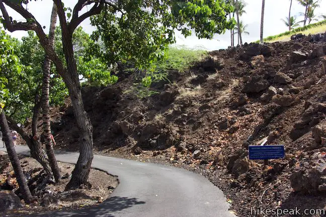
Come to a junction at the southwest corner of the loop, after a mile of hiking. Turn left, continuing to hug Lahuipua‘a Fishpond and passing a blue sign for the “Historic Fishpond Preserve.” Follow the level and palm-lined trail along Lahuipua’a Fishpond, enjoying a nice perspective back toward the sea wall and the coast.
Hike past the smaller Kaaiopio Fishpond, which is stocked with mullet and milkfish. When you come to another junction (0.3 miles past the previous one), make the obvious left turn to continue on a route through the fishponds. The first pond on the hike, Hope’ala, reappears to your right as you make your way along the last piece of the loop.
Meet the junction where the circuit began and bear right. Cross the road to return to Kalahuipua‘a Trail and take the paved path back to the trailhead. This lollipop loop hike in Kalahuipua‘a Historic Park is 1.7 miles long with 30 feet of elevation change. Dogs and bikes are prohibited. No permit is required for this hike and parking at the trailhead is free, so get out and enjoy!
Directions to the Trailhead
- From Kona, drive north on Hawaii 19 for 26 miles.
- A mile and a half after passing Waikoloa Road, turn left at the traffic light onto Mauna Lani Drive (on the makai side of the road).
- Drive one mile to a traffic circle and take the second exit (passing straight through the circle), following signs for the Historic Park (not to be confused with signs for the Petroglpyh Park off the first exit of the traffic circle).
- At the next intersection, turn left onto Pauoa Road.
- Make the first right, at a sign that reads "Historic Park Shoreline Access" and drive up to a trailhead parking area loop.
Trailhead Location
Trailhead address: Pauoa Road, Puako, HI 96743
Trailhead coordinates: 19.9419, -155.8642 (19° 56′ 30.8″N 155° 51′ 51.1″W)
View Puako trails in a larger map
Or view a regional map of surrounding Hawaii trails and campgrounds.


 | Malama Trail This 0.2 to 1.2-mile hike visits rare rock carvings in Puakō Petroglyph Archeological District on the west coast of the Big Island of Hawai'i. |
 | Kiholo Bay & Wainanali‘i Lagoon This 2-mile coastal hike in Kiholo State Park Reserve has non-stop ocean views, crossing tide pools and beaches on the way to a turquoise lagoon. |
 | Royal Grounds – Pu‘uhonua Loop This half-mile loop on the coast south of Kona explores Hawaiian royal grounds and a place of sanctuary in Pu‘uhonua O Hōnaunau National Historical Park. |
 | Waipi‘o Beach & Muliwai Trail Overlook This 4.88-mile hike plunges into fantastically-wild Waipi‘o Valley, crosses a remote black sand beach (framed by cliffs and waterfalls), and climbs to a stellar view overlooking the ocean, beach, and valley. |
 | ‘Akaka Falls This short loop slips through a tropical valley to bold views of a 442-foot single-drop waterfall. |
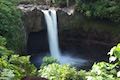 | Rainbow Falls This 0.2-mile hike around Rainbow Falls Lookout explores a viewpoint facing a lovely waterfall and also ventures up to the top of the falls. |
 | Kaumana Caves This underground hike explores lava tubes on the edge of Hilo, created by an 1881 eruption of Mauna Loa. |
 | Lava Tube in Mojave National Preserve (California) This short 0.6-mile hike drops below the desert surface into an old lava tube with a spectacular skylight. |
 | Caves Trail in Crates of the Moon National Monument (Idaho) This 1.6 mile travels above and below the surface, exploring lava tubes in the Great Rift Lava Flow. |
 | Lava River Cave in Newberry National Volcanic Monument (Oregon) This underground hike explores a lava tube south of Bend that is filled with fascinating volcanic features. |
 | Guler Ice Cave in Gifford Pinchot National Forest (Washington) This short hike goes underground to explore an old lava tube with frozen stalactites and stalagmites, plus other interesting cave features. |
 | Trail of Two Forests in Mount Saint Helens National Volcanic Monument (Washington) This short nature trail tours a landscaped that was transformed by a molten lava flow. For extra fun, crawl through a 50-foot long lava tube beneath the trail. |
 | Ape Cave in Mount Saint Helens National Volcanic Monument (Washington) This adventurous underground hike travels through one of the longest lava tubes in the world. |
Common Questions about Kalahuipua‘a Trail and Fishponds Loop in Kalahuipua‘a Historic Park
- Is the trail open?
- Yes. You should expect to find that Kalahuipua'a Trail & Fishponds Loop is open. There are no recent reports of trail closures. If you discover that the trail is closed, please help your fellow hikers by reporting a closure.
- Is this trail free to access?
- Yes, Kalahuipua'a Trail & Fishponds Loop is free to access. No entrance fee, pass, or permit is required. If you discover that access rules have changed, please provide feedback on your experience.
- How much time does this hike take?
- It takes approximately 45 minutes to hike Kalahuipua'a Trail & Fishponds Loop. Individual hiking times vary. Add extra time for breaks and taking in the views.
- How long is this hike?
- The hike to Kalahuipua'a Trail & Fishponds Loop is a 1.7 mile lollipop loop with 30 feet of elevation change.
- Are dogs allowed on this trail?
- No, dogs are likely not allowed on Kalahuipua'a Trail & Fishponds Loop. The trail is primarily open to hikers.
- Is Kalahuipua'a Trail & Fishponds Loop good for kids?
- Yes, this hike is likely suitable for children. It is relatively short (1.7 miles) with manageable elevation gain.
- Does this hike visit a lava tube?
- Yes, pack a headlamp to check out the lava tube on your trek to Kalahuipua'a Trail & Fishponds Loop.
- Where is the trailhead located?
- The trailhead for Kalahuipua'a Trail & Fishponds Loop is located in Puako, Hawaii.
Trailhead Address:
Pauoa Road
Puako, Hawaii 96743
Trailhead Coordinates:
19.9419, -155.8642 - What are the driving directions to the start of the hike?
To get to the trailhead: From Kona, drive north on Hawaii 19 for 26 miles. A mile and a half after passing Waikoloa Road, turn left at the traffic light onto Mauna Lani Drive (on the makai side of the road). Drive one mile to a traffic circle and take the second exit (passing straight through the circle), following signs for the Historic Park (not to be confused with signs for the Petroglpyh Park off the first exit of the traffic circle). At the next intersection, turn left onto Pauoa Road. Make the first right, at a sign that reads "Historic Park Shoreline Access" and drive up to a trailhead parking area loop.
View custom Google Maps directions from your current location.
- Are there other trails near Kalahuipua'a Trail & Fishponds Loop?
- Yes, you can find other nearby hikes using the Hikespeak Hike Finder Map.

[…] easy to do a quick hike to explore more of this beautiful area of the […]