Malama Trail
in Puakō Petroglyph Archeological District
On the Big Island of Hawai‘i, Puakō Petroglyph Archeological District is one of the best places to see rock carvings created by early Hawaiians. Malama Trail offers two hiking itineraries:
- Keep things easy with a 0.2-mile round trip hike on a paved wheelchair-friendly path to an enjoyable collection of reproductions that match the area’s authentic petroglyphs
- A rougher trail continues to the Puakō Petroglyph Field, where a thousand rock carvings can be observed, capping off a 1.2-mile round trip hike
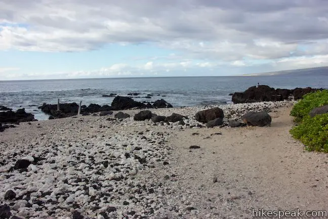
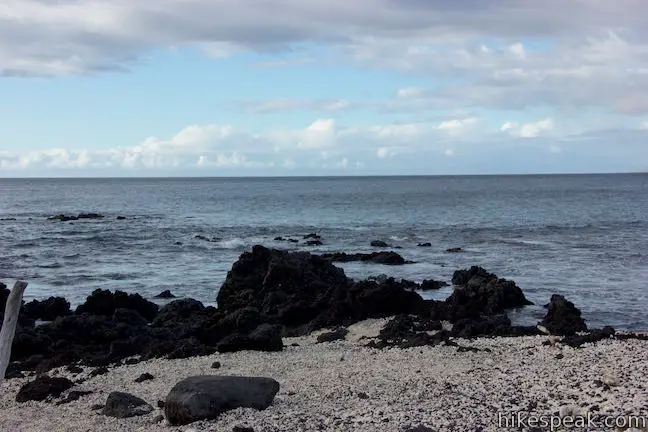
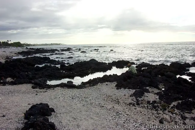
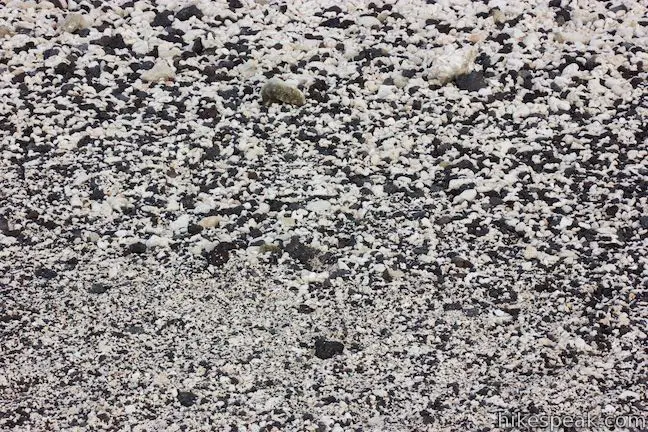
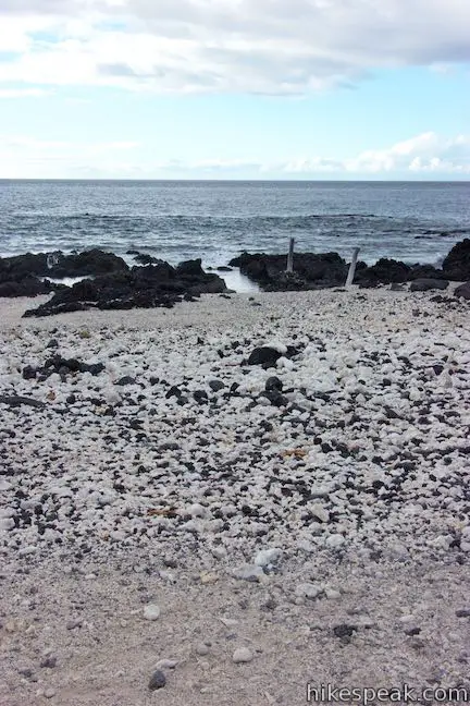
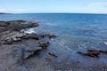
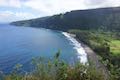
Puakō Petroglyph Archeological District (also know as Puakō Petroglyph Park) is located on the west side of the Big Island, about 25 miles north of Kona. Start from a parking area at the end of Holoholokai Beach Park. Find Malama Trail heading inland, instead of (or in addition to) heading west to the beautiful black-and-white Holoholokai Beach covered with black lava and white coral.
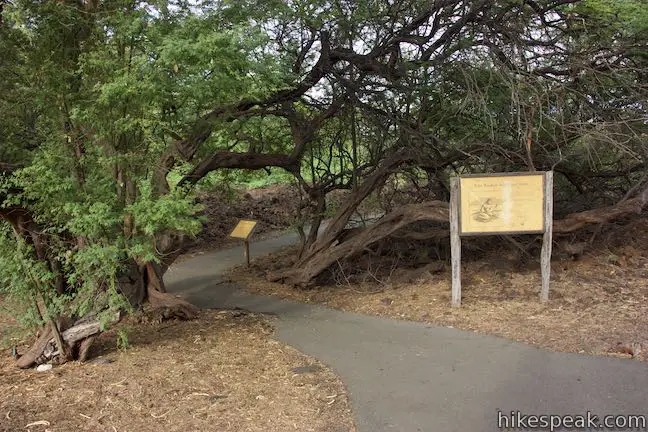
Malama Trail starts from the northeast corner of the parking area. A sign at the trailhead explains that:
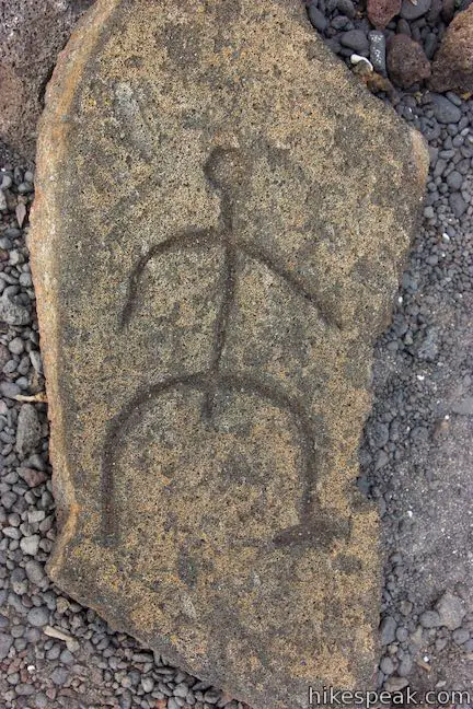
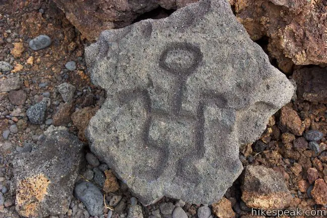
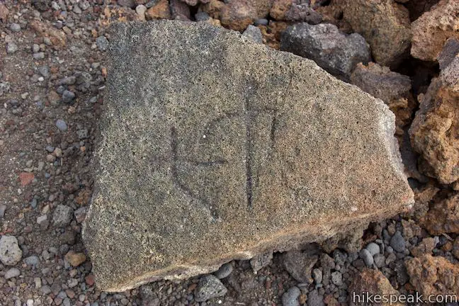
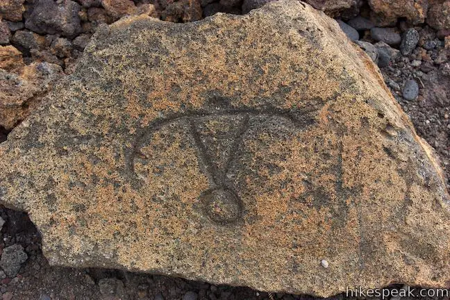
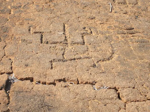
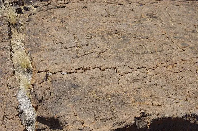
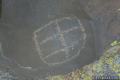
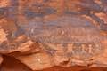
The Puako Petroglyph site is one of the largest and finest concentrations of the mysterious symbols left in Hawai‘i. It is likely that many of these petroglyphs were made sometime between AD 1000 – 1800.
Puakō Petroglyph Archeological District contains 3,000 rock carvings (1,200 of which are visible to visitors), making it the biggest petroglyph area in Hawai‘i and, according to Frommers, “the largest rock art site in the entire Pacific.”
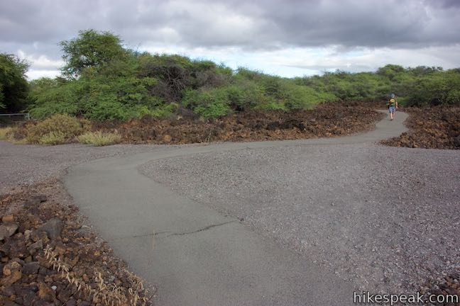
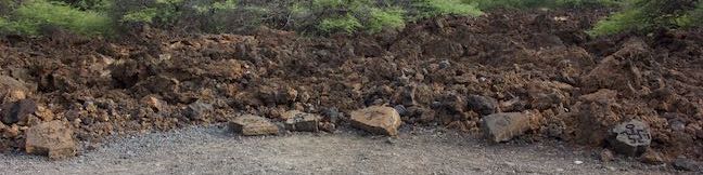
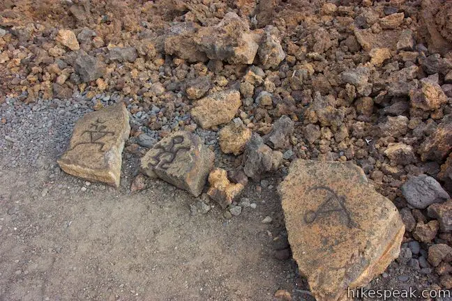
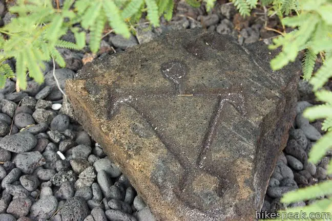
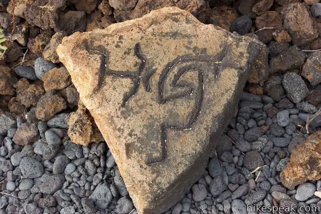
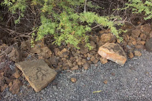
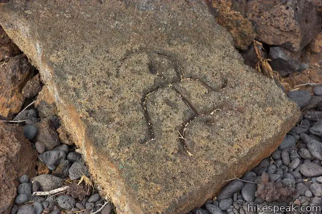
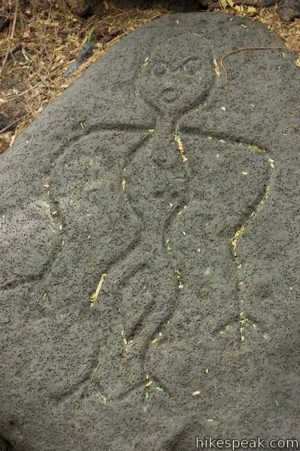
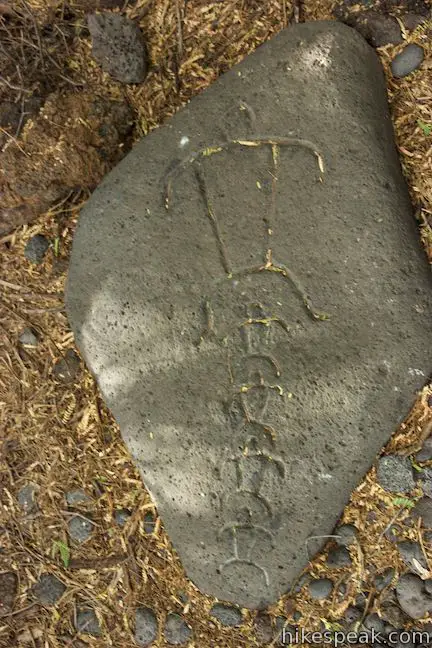
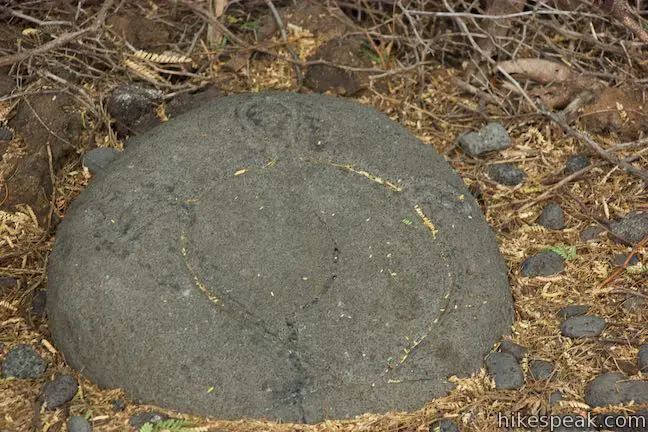
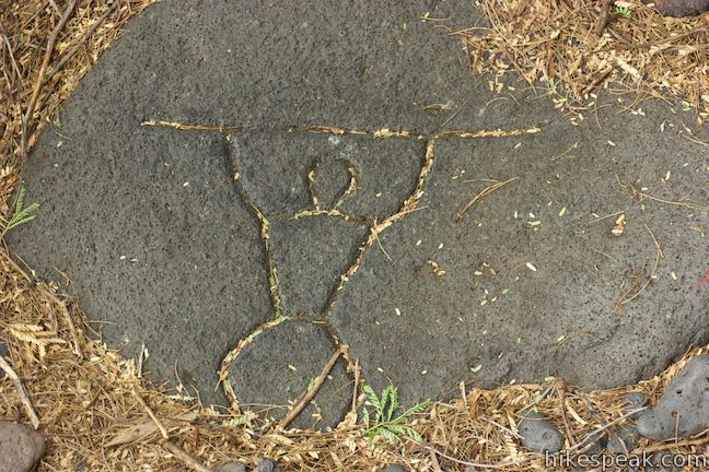
Take the paved trail on a short snaking path to the edge of a forest of kiawe trees. When the pavement ends, it’s time to have a look around. On the right and left sides of the trail, discover gravel areas wrapped by dozens of rock carvings.
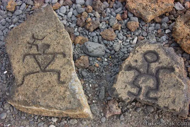
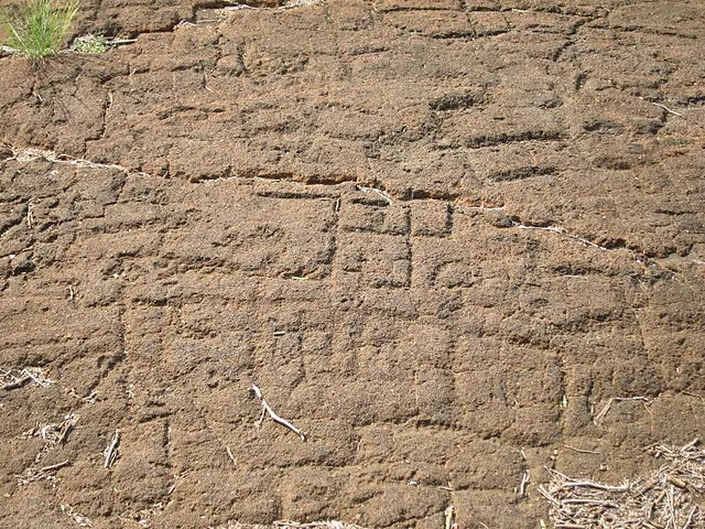
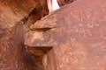
If these petroglyphs appear to be perfectly displayed for hikers, that’s because… they’re on display for hikers! These carvings are actually replicas of some of the area’s true petroglyphs. The reproductions visitors to look closely at different figures carved into lava rocks. Investigate each carving and interpret the stories that they might tell.
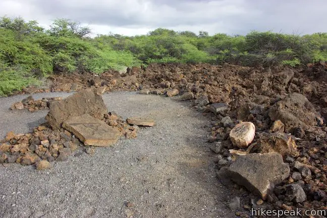
While it is illegal to touch or make rubbings of the historical petroglyphs in the area farther up the trail, these reproductions do not have the same level of protection. The petroglyph reproductions are open for hands-on examination (that young hikers in particular may enjoy).
Even through they are replicas, this area of reproduced petroglyphs is quite interesting. For those who turn around when the pavement ends, the result is a 0.2-mile round trip walk with just a few feet of elevation change.
Puakō Petroglyph Field
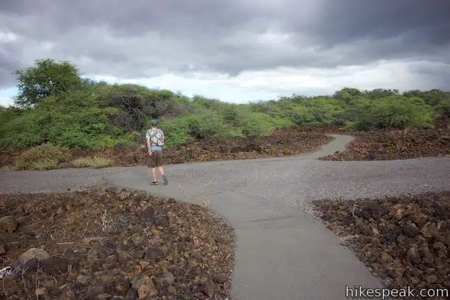
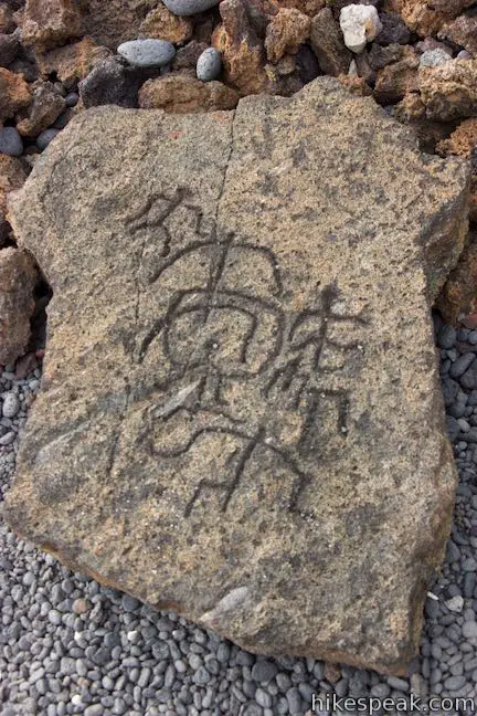
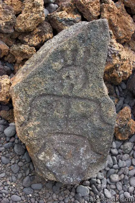
The real petroglyphs are located another half mile up Malama Trail. Don’t attempt the next section of the trail with flip-flops or other inadequate footwear because the kiawe trees are thorny and the lava rock underfoot is uneven.
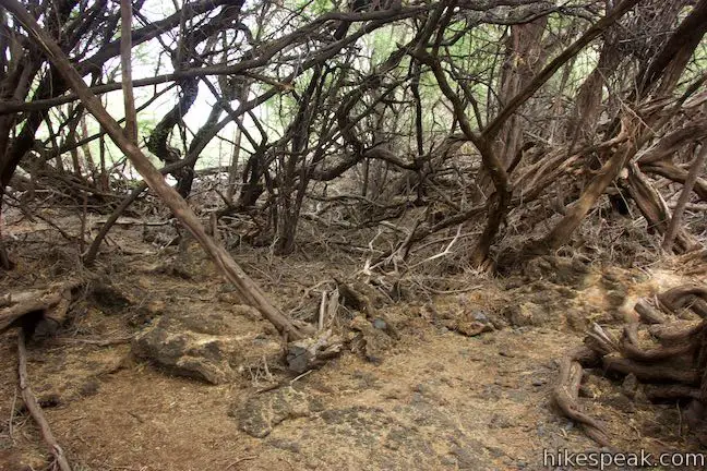
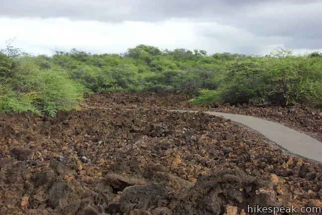
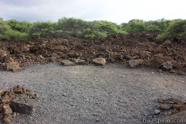
Beyond the pavement, the trail is engulfed by trees. Make your way through the kiawe forest and across a plane of pahoehoe lava. You will pass a lava cave along the way. Malama Trail is marked with cairns or “ahus” rock mounds. After the trail exits the forest, hike straight through an intersection with a dirt road, one hundred yards before the petroglyph field.
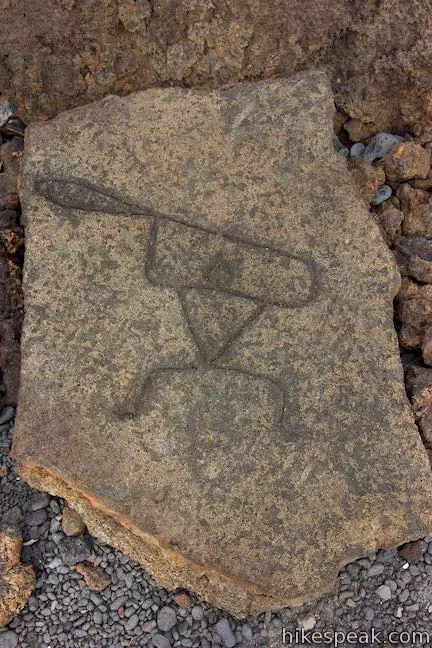
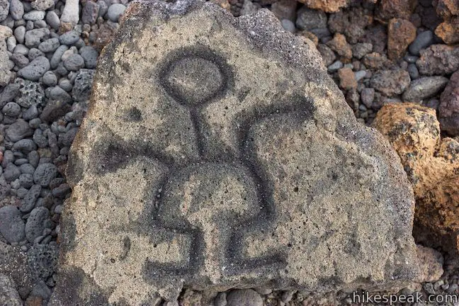
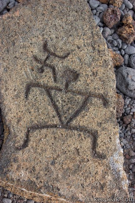
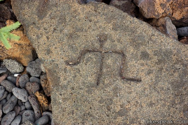
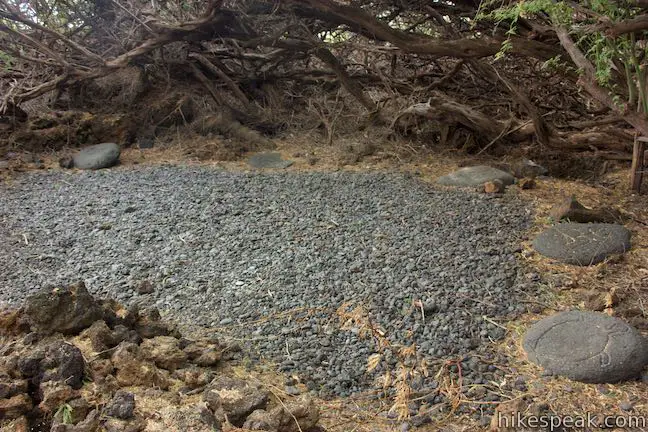
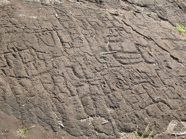
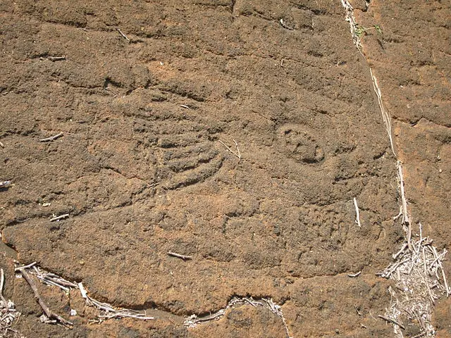
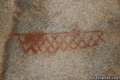
Puakō Petroglyph Field is fenced off for preservation, so circle the railing and examine the authentic rock carvings. Spot petroglyphs resembling paddlers, dancers, hunters, anglers, and animals. In the Hawaiian language, petroglyphs are called “kii pohaku,” meaning images in stone. Whether you admire the petroglyphs as works of art or become intrigued by the human history that they embody, you are bound to wonder about the people who carved the petroglyphs and the messages they convey.
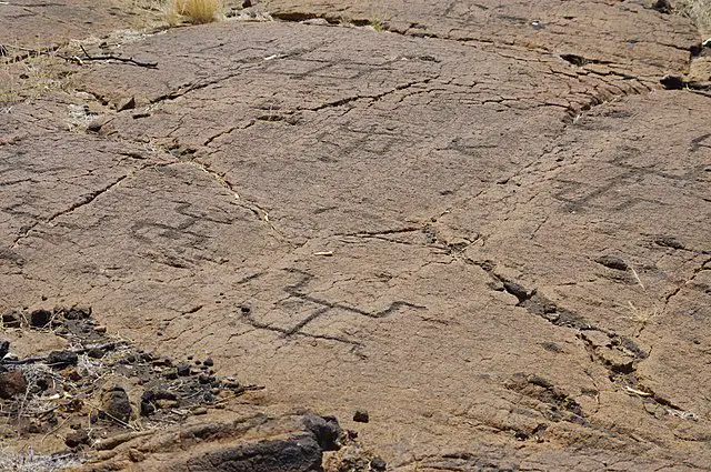
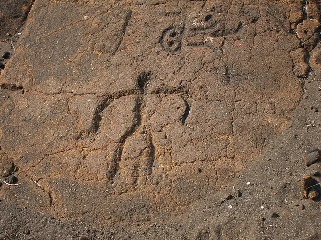
Direct sunlight at midday can make the petroglyphs hard to distinguish. Side lighting in the early morning and late afternoon create better contrast for illuminating the carvings in the rocks. Respect the petroglyphs and obey all fences, boundaries, and preservation rules. After looking over the petroglyph field, hike back the way you came to complete this 1.2 miles round trip with 30 feet of elevation change.
- The previous two photos are available for public use from wikimedia.org – (CC0 1.0)
Holoholokai Beach Park
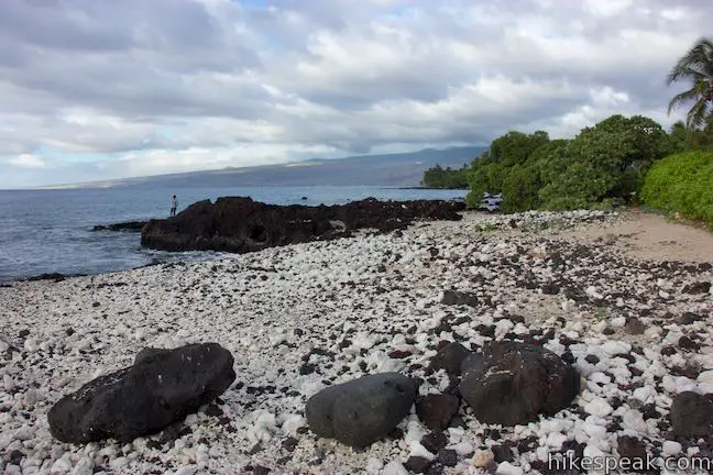
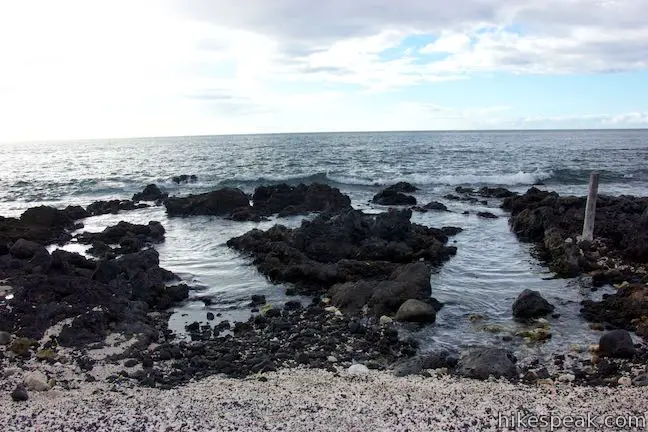
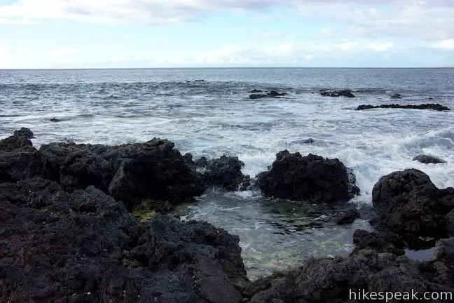
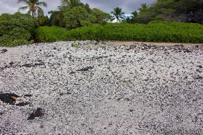
When you get back to the trailhead, walk out the other side of the parking area, passing through a picnic area to Holoholokai Beach (also called Holoholo Kai Beach). Tide pools line the shore, across a beach surface that looks like a chess board with black lava and white coral mixed together in even proportions. Different areas of the beach have larger and finer pieces, but the mixture remains balanced. In addition to its picnic area, Holoholokai Beach Park has bathrooms with showers.
- See more great coastline, fishponds, and a lava tube shelter by visiting nearby Kalahuipua‘a Trail and Fishponds
Directions to the Trailhead
- From Kona, drive north on Hawaii 19 for 26 miles.
- A mile and a half after passing Waikoloa Road, turn left at the traffic light onto Mauna Lani Drive (on the makai side of the road).
- Drive one mile to a traffic circle and take the first exit (like a right turn), following signs for Puako Petroglyph Park.
- Take North Kaniku Drive for another mile and turn right onto Holoholokai Beach Park Road.
- Drive half a mile to the end of the road at the parking area of Malama Trail and Holoholokai Beach Park.
Trailhead Location
Trailhead address: Holoholokai Beach Park Road, Puako, HI 96743
Trailhead coordinates: 19.9552, -155.8594 (19° 57′ 18.7″N 155° 51′ 33.8″W)
View Puako trails in a larger map
Or view a regional map of surrounding Hawaii trails and campgrounds.


Holoholokai Beach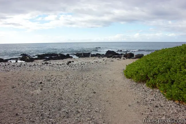


 | Kalahuipua‘a Trail and Fishponds Loop This action-packed 1.7-mile hike explores a lava field with a lava tube shelter and impressive fishponds along a gorgeous coastline. |
 | Kiholo Bay & Wainanali‘i Lagoon This 2-mile coastal hike in Kiholo State Park Reserve has non-stop ocean views, crossing tide pools and beaches on the way to a turquoise lagoon. |
 | Royal Grounds – Pu‘uhonua Loop This half-mile loop on the coast south of Kona explores Hawaiian royal grounds and a place of sanctuary in Pu‘uhonua O Hōnaunau National Historical Park. |
 | Waipi‘o Beach & Muliwai Trail Overlook This 4.88-mile hike plunges into fantastically-wild Waipi‘o Valley, crosses a remote black sand beach (framed by cliffs and waterfalls), and climbs to a stellar view overlooking the ocean, beach, and valley. |
 | ‘Akaka Falls This short loop slips through a tropical valley to bold views of a 442-foot single-drop waterfall. |
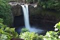 | Rainbow Falls This 0.2-mile hike around Rainbow Falls Lookout explores a viewpoint facing a lovely waterfall and also ventures up to the top of the falls. |
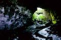 | Kaumana Caves This underground hike explores lava tubes on the edge of Hilo, created by an 1881 eruption of Mauna Loa. |
 | Petroglyphs near Seventeen Mile Point in Mojave National Preserve (California) This quarter-mile path visits ancient engravings in the volcanic rock at the western rim of the cinder fields just off Kelbaker Road. |
 | Petroglyph Canyon Trail to Mouse's Tank in Valley of Fire State Park (Nevada) This 0.75-mile hike travels down a sandy path lined with petroglyphs to a natural basin formed in the sandstone. |
 | Atlatl Rock in Valley of Fire State Park (Nevada) Step right up to see Native American rock art on this 0.1-mile trail with stairs up a rock face to a collection of petroglyphs. |
 | Pictograph Trail in Anza-Borrego Desert State Park (California) This 1.8-mile hike visits rock paintings drawn by Kumeyaay Indians who lived in the Anza-Borrego Desert thousands of years ago. |
 | Barker Dam in Joshua Tree National Park (California) This level 1.5-mile loop visits a foreign-looking reservoir and petroglyphs engravings within the Wonderland of Rocks. |
- Puakō Petroglyph Archeological District on bigislandhikes.com (opens in a new tab)
- Puakō Petroglyph Archeological District on lovebigisland.com (opens in a new tab)
- Puakō Petroglyph Archeological District on modernhiker.com (opens in a new tab)
- Puakō Petroglyph Archeological District on zigzaghawaii.com (opens in a new tab)
- Puakō Petroglyph Archeological District on gohawaii.com (opens in a new tab)
- Puakō Petroglyph Archeological District on frommers.com (opens in a new tab)
Common Questions about Malama Trail in Puakō Petroglyph Archeological District
- Is the trail open?
- Yes. You should expect to find that Malama Trail is open. There are no recent reports of trail closures. If you discover that the trail is closed, please help your fellow hikers by reporting a closure.
- Is this trail free to access?
- Yes, Malama Trail is free to access. No entrance fee, pass, or permit is required. If you discover that access rules have changed, please provide feedback on your experience.
- How much time does this hike take?
- It takes approximately 30 minutes to hike Malama Trail. Individual hiking times vary. Add extra time for breaks and taking in the views.
- How long is this hike?
- The hike to Malama Trail is a 1.2 mile out and back with 30 feet of elevation change.
- Are dogs allowed on this trail?
- No, dogs are likely not allowed on Malama Trail. The trail is primarily open to hikers.
- Is Malama Trail good for kids?
- Yes, this hike is likely suitable for children. It is relatively short (1.2 miles) with manageable elevation gain.
- Where is the trailhead located?
- The trailhead for Malama Trail is located in Puako, Hawaii.
Trailhead Address:
Holoholokai Beach Park Road
Puako, Hawaii 96743
Trailhead Coordinates:
19.9552, -155.8594 - What are the driving directions to the start of the hike?
To get to the trailhead: From Kona, drive north on Hawaii 19 for 26 miles. A mile and a half after passing Waikoloa Road, turn left at the traffic light onto Mauna Lani Drive (on the makai side of the road). Drive one mile to a traffic circle and take the first exit (like a right turn), following signs for Puako Petroglyph Park. Take North Kaniku Drive for another mile and turn right onto Holoholokai Beach Park Road. Drive half a mile to the end of the road at the parking area of Malama Trail and Holoholokai Beach Park.
View custom Google Maps directions from your current location.
- Are there other trails near Malama Trail?
- Yes, you can find other nearby hikes using the Hikespeak Hike Finder Map.

Go the extra miles...
Submit a rating of this hike to go with your comment. Contribute to the average trail rating.