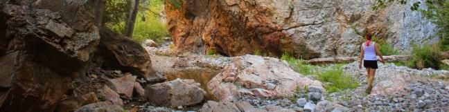
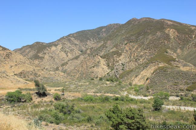
Not to be confused with Fish Canyon Falls on the east end of the Angeles National Forest, the Fish Canyon Narrows reside on the far west end of the Angeles in the Sierra Pelona Mountains north of Santa Clarita. Here a mountain stream passes through hundred-foot cliffs that are at time only twenty feet apart. The red rock walls mimic those you might find hiking in Zion National Park or other Utah canyons. To get to this unusual spot, you’ll hike through four miles of terrain that is more typical to Southern California—a rocky, rugged, and arid canyon with limited vegetation for shade.
In 2009, Los Angeles Magazine published their list of the ten best hikes in Los Angeles and Fish Canyon Narrows came in as number one. This is a lofty title for any trail to live up to, and while Fish Canyon Narrows may fall short, the hike undoubtedly has its perks.
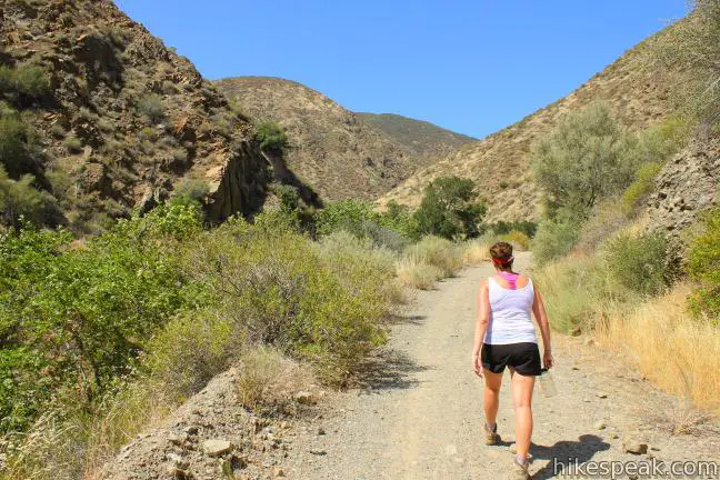
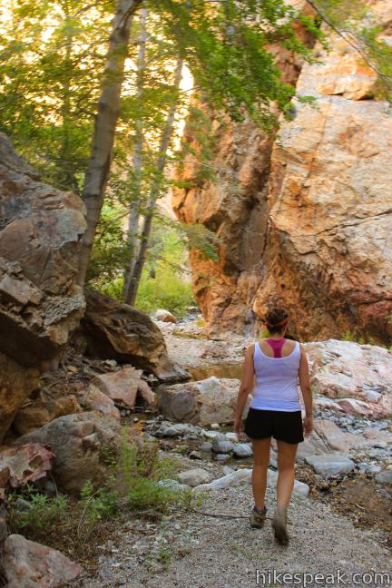
If you are looking for a trek that’s a bit of an adventure, in a remote part of the Angeles National Forest, Fish Canyon Narrows may be for you. This hike of 10 miles or more has 650 feet of elevation change. The hike starts on a paved road, which transitions to a dirt road, followed by a single track. In the end you are left to forge for yourself, rock hopping and bushwhacking up the narrows on the faintest of use trails.
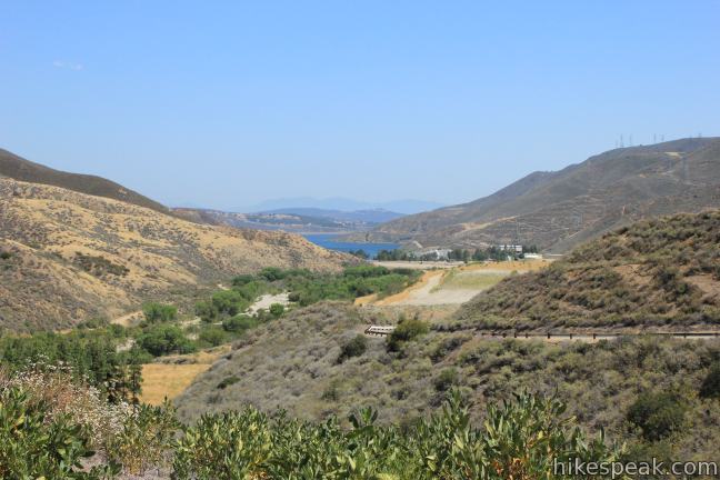
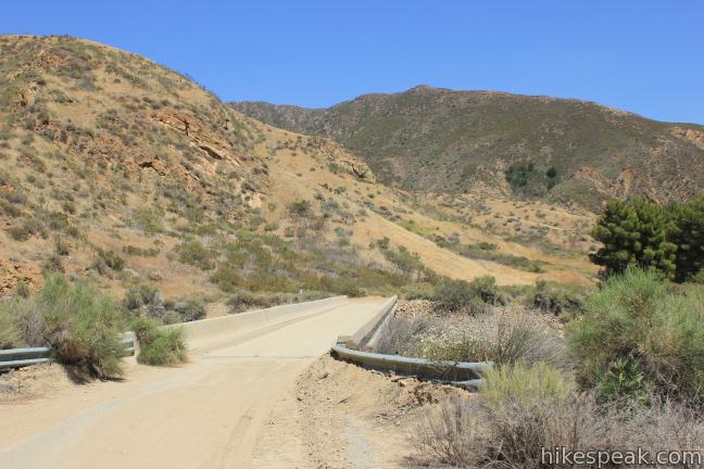
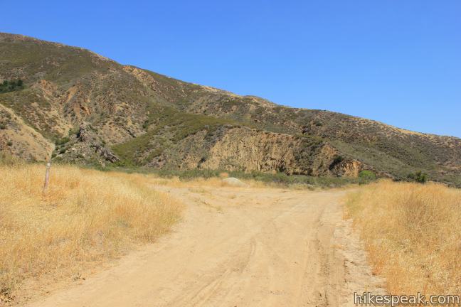
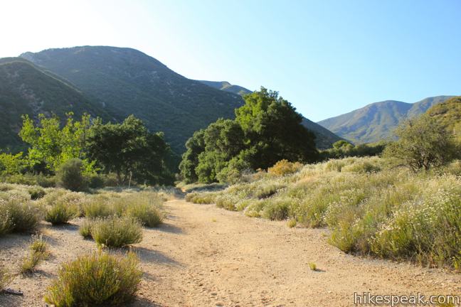
From an under emphasized trailhead on Templin Highway, your first task is to walk 0.6 miles down a closed stretch of the road to the end of the pavement. You will lose 170 feet of elevation along the way, marching past early views south toward Castaic Lake and east toward the mouth of Fish Canyon. Follow the road east, curving over Castaic Creek below an adjacent canyon named Redrock Canyon. After crossing a short bridge, the road turns to dirt. Hike another 0.2 miles to a split and turn left to begin hiking up Fish Canyon.
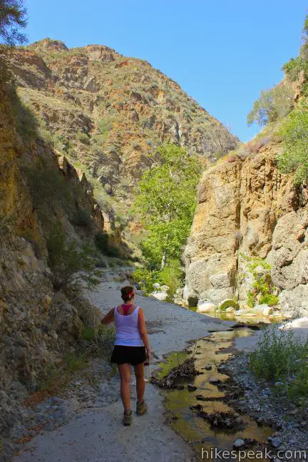
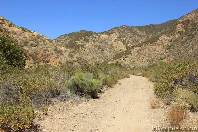
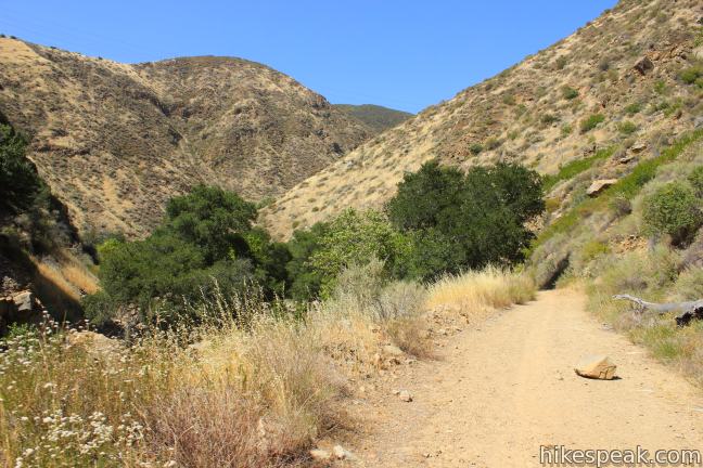
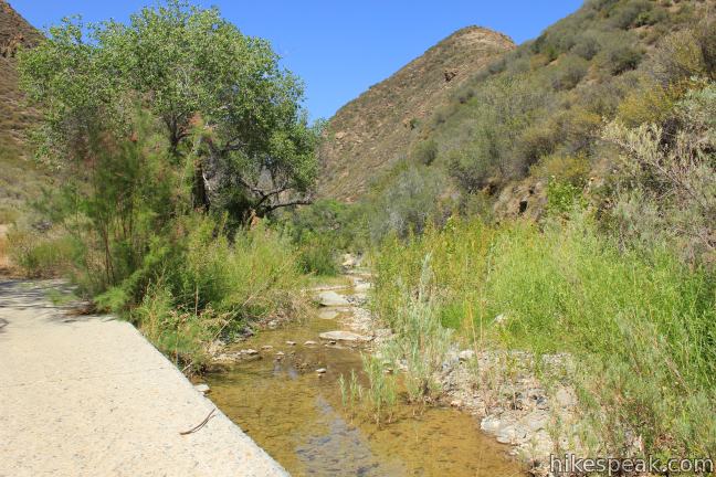
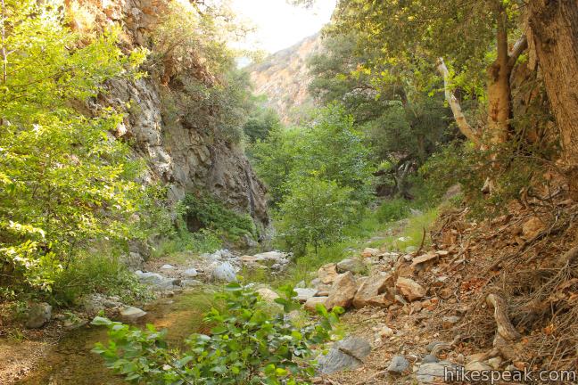
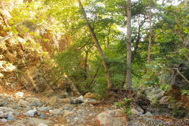
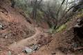
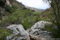
You will cross the creek (or dry creek bed) several times over the next 2.15 leading up to Cienega Campground. This old national forest campground was closed after a 2002 flood washed out the road, converting it to a hiking trail. About 3/4 of a mile before the campground, the canyon walls pinch together, becoming steep and dramatic to offer a taste of the terrain to come. There is a stretch concrete road running through this narrow gorge, making it easier to cross than the narrows ahead.
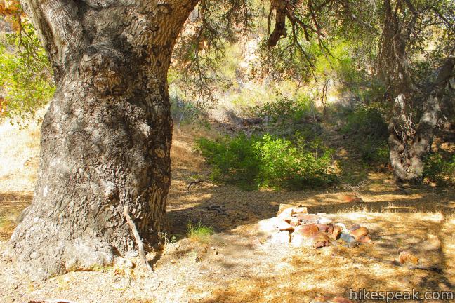
After the canyon walls widen, you will arrive at what was once Cienega Campground. While a few of the old campsites are identifiable, the area has become very overgrown in the last decade. The bathrooms have been destroyed, so Cienega Campground does not even function as a usable trail camp. This had been the starting point for the hike to Fish Canyon Narrows, almost three miles from the current trailhead.
Less than a tenth of a mile past the campground, turn left up a jeep trail that splits off from the road heading north toward the narrows. Ahead, the road follows the East Fork of Fish Canyon toward Rattlesnake Canyon, but you will want to turn left at the unmarked junction and follow another soon-to-be-narrower branch of Fish Canyon.
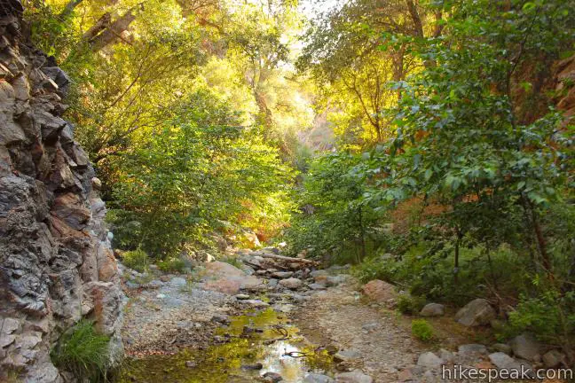
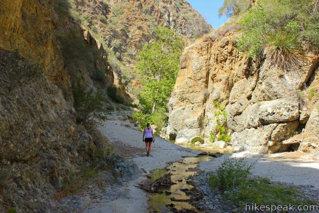
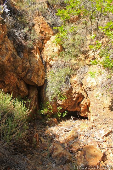
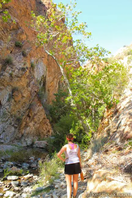
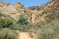
The trail dwindles to a single track over the next mile, passing through pleasant shade to reach the mouth of the narrows. A spot for backpackers to camp is on the right side of the canyon, just before the narrows next to an old mine shaft. This is what remains of the Pianobox Prospect. The name was applied after enthusiastic miners brought a piano all the way to this remote claim. Just ahead, and four miles from the trailhead, the narrows begin (music to your ears).
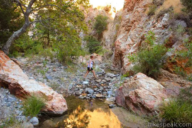
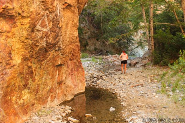
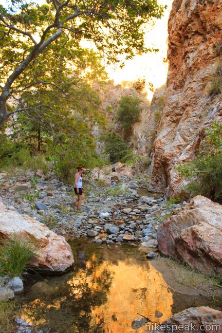
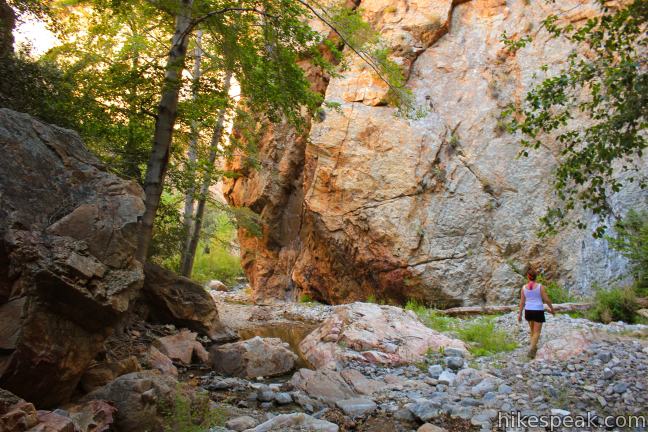
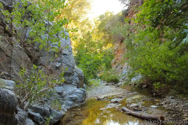
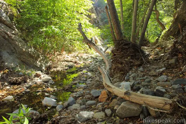
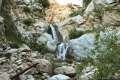
Within the sheer rock walls, the trail immediately becomes less organized. You will have to forge for yourself, rock hopping along the water, scrambling over boulders, and pushing your way through oaks, alders, and other brush. Your progress is sure to be slowed down by the adventure, so take your time and appreciate the scenery. Hundred-foot walls of metamorphosed granite create a thin slot for the creek (and any trail) to pass through.
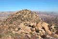
On the northwest side of the narrows, the terrain climbs steeply 1,700 feet to the top of Redrock Mountain. At mid-day, sunlight dances off the babbling creek and the surrounding verdant foliage. Be advised that late in the day, the light can quickly disappear within the canyon.
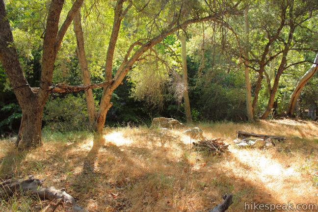
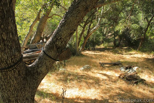
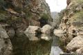
The bottom of the canyon is fairly level, with no major drops in the creek to climb over. After 1.25 miles of trekking up the narrows, you’ll arrive at another small backpacker’s camp located on a bench above the left bank of the creek with a small oak-shaded clearing and a stone fire ring (although campfires are prohibited).
Immediately beyond the camp, the canyon splits. Burro Canyon breaks off to the left, while the Fish Canyon Narrows continue to the right, snaking through a few more serpentine bends before the canyon widens. Persistent backpackers can continue up Fish Canyon Trail to Atmore Meadows or Burnt Peak, deep in the backcountry of the Angeles National Forest. However, the camp is a decent place to turn around for a 10.5-mile day hike.

As you retrace your course down the creek, you will discover that the narrows are just as enjoyable on the way out. The dramatic setting and almost guaranteed solitude make Fish Canyon Narrows feel far from Los Angeles. Enjoy the shaded single track just outside the narrows before returning via the exposed dirt road through Cienega Campground. It is almost all downhill on the hike back, until you reach the pavement for the final ascent to your vehicle along Templin Highway.
Elevation is not the greatest hurdle on this hike, but you are sure to be challenged by the overall length and the effort required to navigate the narrows. The creek flows year round, but can be greatly reduced (or mostly underground) during dry months.
The Sierra Pelona Mountains are a small range northwest of the larger San Gabriel Mountains, bordered by the 5 Freeway to the west, Route 14 to the southeast, and the Antelope Valley to the north.
Dogs and bikes are permitted on the trail, but neither will fair well in the narrows. For backpackers heading up Fish Canyon, campfires are prohibited but camp stoves are allowed. No fee or permit is required to hike to the Fish Canyon Narrows, so get out and enjoy!
Directions to the Trailhead
- From the 5 Freeway north of Santa Clarita and Castaic, take exit 183 onto Templin Highway.
- At the end of the ramp, drive east on Templin Highway for 4.2 miles.
- When you reach the gate at the end of the stretch of Templin Highway that can be driven, pull over and park on the shoulder.
- A private paved road breaks off to the right, but you will hike straight (east) down the closed paved section of Templin Highway.
Trailhead Location
Trailhead address: 37773 Templin Highway, Angeles National Forest, Castaic, CA 91384
Trailhead coordinates: 34.6022, -118.670726 (34° 36′ 07.9″N 118° 40′ 14.6″W)
View Fish Canyon Narrows in a larger map
Or view a regional map of surrounding Los Angeles trails and campgrounds.


 | Vasquez Rocks Natural Area Park This 3.4 to 5.9-mile loop offers a dose of desert hiking close to Los Angeles, exploring striking sandstone formations that are frequently used as movie backdrops. |
 | Los Pinetos Waterfall This 5.33-mile round trip hike in Placerita Canyon Natural Area follows Canyon Trail to the ruins of Walker Ranch and Waterfall Trail to an elusive falls in a sylvan canyon. |
 | Rocky Peak This 4.75-mile hike rises to a 2,715-foot summit in Rocky Peak Park within a rugged mountain range between Chatsworth and Simi Valley. |
 | Towsley View Loop Trail This 5.4-mile loop explores two canyons and scenic ridges in the Santa Susana Mountains, passing the narrows of Towsley Gorge in Towsley Canyon. |
 | More trails in the Los Angeles Explore other destinations in the Santa Monica Mountains, San Gabriel Mountains, and elsewhere. |
 | Zuma Canyon Narrows - Zuma Ridge Loop This off-trail trek in Malibu crosses the narrow canyon between Zuma Canyon Trail and Zuma Ridge Trail to form a challenging 8-mile loop. |
 | Bridge to Nowhere This adventurous 10-mile hike in the San Gabriel Mountains reaches an abandoned and out-of-place bridge with a unique history. |
 | Rubio Canyon Trail This 1.3-mile round trip hike ventures into a rustic canyon to a double waterfall in the San Gabriel Mountains. |
 | Malibu Creek Traverse This adventure hike explores the C-shaped gorge between Rock Pool and Century Lake in Malibu Creek State Park. |
 | Rustic Canyon's Murphy Ranch from Will Rogers State Historic Park This 4 to 5-mile adventure visits the ruins of a strange commune in a canyon east of the park. |
Common Questions about Fish Canyon Narrows in the Sierra Pelona Mountains
- Is the trail open?
- Yes. You should expect to find that Fish Canyon Trail to Fish Canyon Narrows is open. There are no recent reports of trail closures. If you discover that the trail is closed, please help your fellow hikers by reporting a closure.
- Is this trail free to access?
- Yes, Fish Canyon Trail to Fish Canyon Narrows is free to access. No entrance fee, pass, or permit is required. If you discover that access rules have changed, please provide feedback on your experience.
- How much time does this hike take?
- It takes approximately 4 hours 45 minutes to hike Fish Canyon Trail to Fish Canyon Narrows. Individual hiking times vary. Add extra time for breaks and taking in the views.
- How long is this hike?
- The hike to Fish Canyon Trail to Fish Canyon Narrows is a 10.5 mile out and back with 650 feet of elevation change.
- Are dogs allowed on this trail?
- Yes, dogs are allowed on Fish Canyon Trail to Fish Canyon Narrows. The trail is open to hikers, dogs.
- Is Fish Canyon Trail to Fish Canyon Narrows a difficult hike?
- This hike should be considered strenuous. Hikers should be prepared for a workout covering 10.5 miles and 650 feet of climbing.
- Where is the trailhead located?
- The trailhead for Fish Canyon Trail to Fish Canyon Narrows is located in Castaic, CA.
Trailhead Address:
37773 Templin Highway
Castaic, CA 91384
Trailhead Coordinates:
34.6022, -118.670726 - What are the driving directions to the start of the hike?
To get to the trailhead: From the 5 Freeway north of Santa Clarita and Castaic, take exit 183 onto Templin Highway. At the end of the ramp, drive east on Templin Highway for 4.2 miles. When you reach the gate at the end of the stretch of Templin Highway that can be driven, pull over and park on the shoulder. A private paved road breaks off to the right, but you will hike straight (east) down the closed paved section of Templin Highway.
View custom Google Maps directions from your current location.
- Are there other trails near Fish Canyon Trail to Fish Canyon Narrows?
- Yes, you can find other nearby hikes using the Hikespeak Hike Finder Map.

We hiked Fish Canyon the last Saturday of this year that they were open and, unfortunately, was somewhat disappointed. There was absolutely no waterfall, dried up. There was a pool at the bottom, but that was all. The hike was extremely crowded, also, which we had prepared ourselves for. I will be making this hike again in the Spring after rains so I can better judge it.
5/19/2013 – Just got back from an overnight. Lovely! Great, accurate description in this blog, which made it so easy to navigate. Shade cover in the valley, the narrows, and the campsite made it comfy in hot weather. BUT there is almost NO WATER. There were several watery spots along the trail, and just beyond the campsite (after the narrows), but they were almost all free-standing, not flowing, and getting kind of brackish. We filtered, and it worked out fine, but they might dry up soon, so be prepared to carry in your water. Have fun!
Oh, and I forgot to mention, there are lots of foxtails around. And poison – oak? ivy? I never can keep them straight. The one with ‘leaves of three.’ Anyway, lots of it towards the second half of the narrows and beyond. But neither of these things impeded our enjoyment!
Anyone have directions to Knapp Ranch near Atmore Meadow Campground?
One of the prettiest trails in Los Angeles! Most of the water crossings are dry, but the last one before heading off toward Piano Box, surprisingly had running water. Bring a head net for the last little bit, gnats can be annoying otherwise. It’s fun seeing more and more people using this trail.
Is this hike suitable for a 12 and 9 year old?
Awesome hike today. Fantastic scenery, babbling streams. Through the narrows required some scrambling and a lot of debris around but a fantastic time!
is this crowded popular hike? I went to Fish Canyon Falls last week, very much worth it, but so so so many people. I want to hike to get away from people and be with nature.
I’ve done this hike twice since January (today for the second time). And neither time did I see anyone past the abandoned Cienega campround. This trail is remote.
The only downside, and it may be a seasonal thing, but the bugs are really bad right now.
We just went for an overnight to Rogers Camp. There was a lot of water before Vinegar, in the Narrows, and at the camp. Lots of oak along the Narrows, long sleeves and pants a must. It was a great time, We really enjoyed navigating the Narrows and the changing scenery!
My friends and I used to camp at Cienega Campground back in the 60’s. We drove in from Castaic before the dam was there up a road that would now be under the lake. We drove right up to the gorge. I remember there being a lot of little frogs.
Hi Bert, I just hiked up Fish Creek Canyon and saw the Cienega Campground you mention. All the way, I noticed several massive rock cluster that seemed like primitive-type concrete. Initially I wondered if these rock clusters were not part of the debris path from the San Fancisquito dam disaster of 1927. Do you know if there was ever a dam at Fish Creek Canyon that was either breached or destroyed? Those massive rock clusters were man-made and there were plenty of them throughout the water stream. If you know about the history, please let me know. Thank you! Steve
Was there a Hot Springs near that campground back in the 70s
Hiked the Fish Canyon trail to Rodger Camp on 11/27/24. With the fall colors and the water flowing it was a great hike. At 73, hiking poles helped. The story I’ve been told about Piano Box is the miners brought an old piano box and used it like construction works would use a job box to store their equipment. Many years ago I came across some info regarding Rodger Camp. Something about a church group using it as a summer camp. Regardless the hike was great.
[…] 17. Fish Canyon Narrows […]