Ennisbrook Trail in San Ysidro Creek Preserve
in Montecito
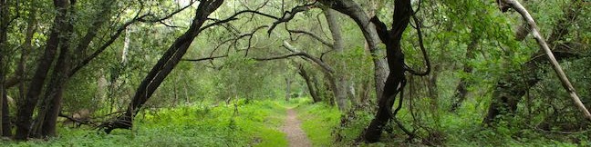
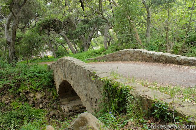
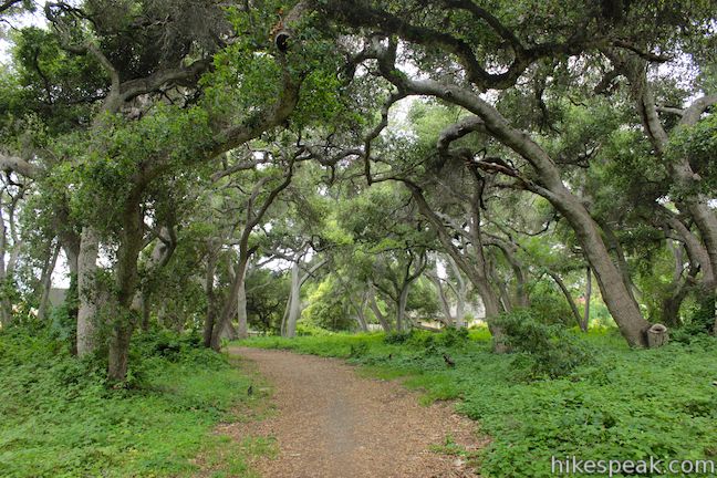
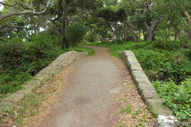
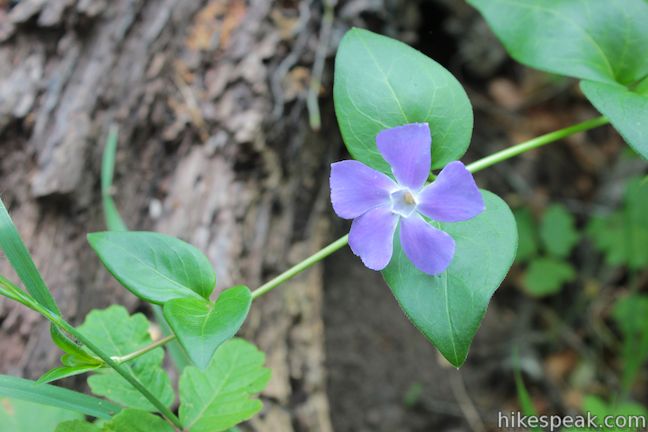
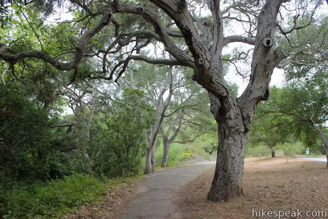
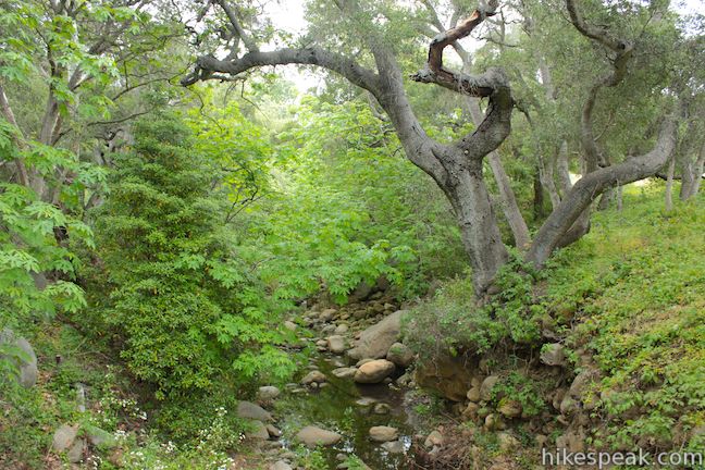
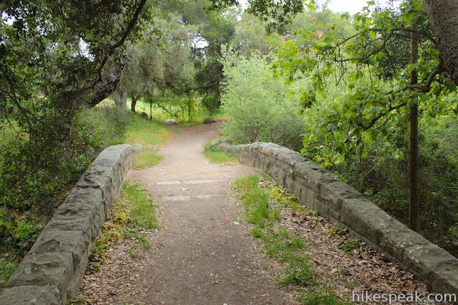
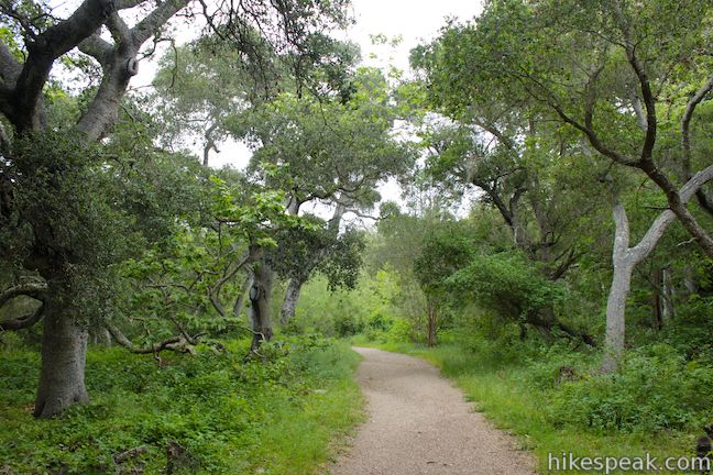
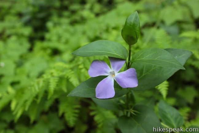
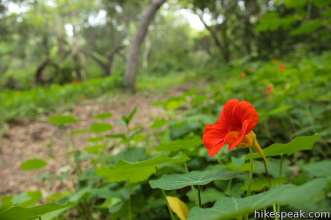
If you are looking for a peaceful stroll in the peaceful Central Coast city of Montecito, examine Ennisbrook Trail. This 1.85-mile lollipop loop with 150 feet of elevation change explores an oak woodland in the 44-acre San Ysidro Creek Preserve. The easy trail is charmed by old stone bridges spanning San Ysidro Creek, which you will follow on this creekside hike. In the spring, there are bursts of orange and yellow nasturtiums along the trail, as well other flowers that make the experience even more pleasant.
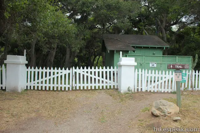
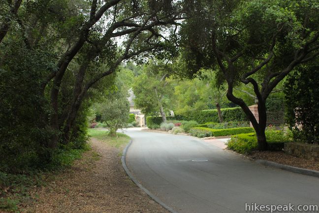
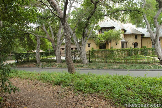
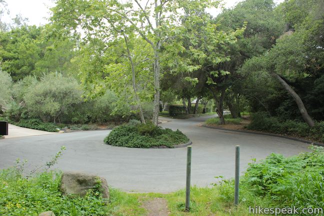
Set out from a trailhead on San Leandro Lane, just a few blocks from the 101 Freeway. In this classy neighborhood, even the trailhead has a white picket fence!
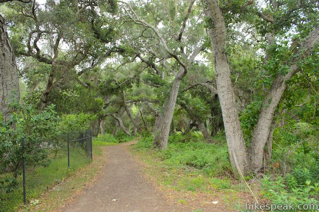
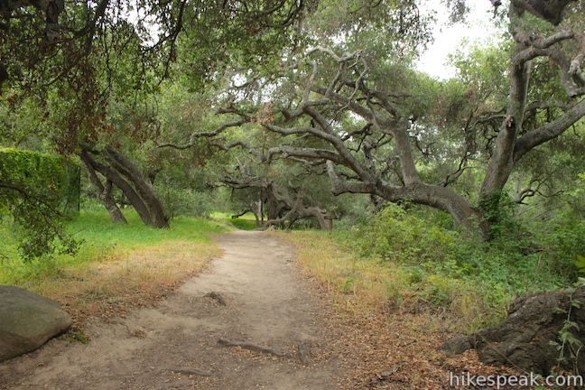
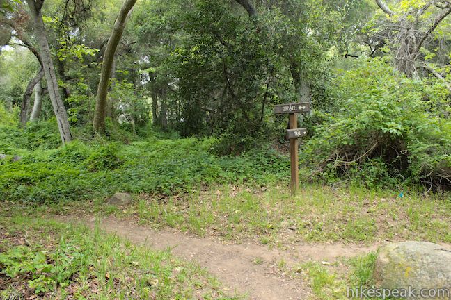
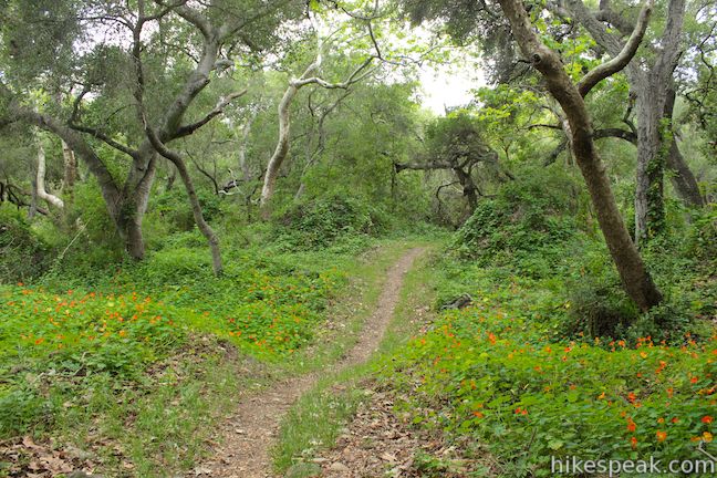
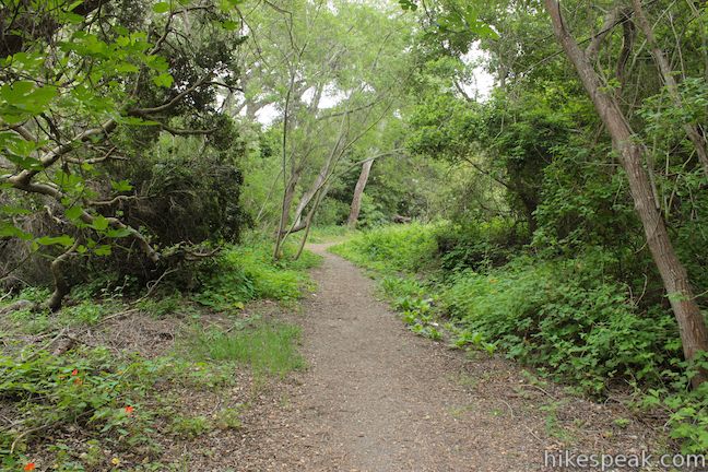
Walk through the gate next to the trail sign, and pass a small green building on the other side to begin up Ennisbrook Trail. The short hike crosses dirt, pebble, and paved trail, both wide and narrow, and there are a few junctions to be mindful of along the way. The first comes 0.05 miles from the start. Just after you cross a stone bridge, you will come to a T-junction. To the right a trail extends east to connect with Coffin Trail and Valley Club Trail. For the Ennisbrook Trail loop, turn left and head upstream above the bank of San Ysidro Creek.
After another tenth of a mile, the trail runs briefly along a chain-link fence as it borders a few backyards. This is a neighborhood hike, so the trail will pass some houses and roads along the way. Fortunately the roads are low traffic and the homes are impressive. The trail proceeds between San Ysidro Creek and Ennisbrook Drive. This roadside path is the least scenic stretch of the hike, but press on, there is more pleasant woodland just ahead.
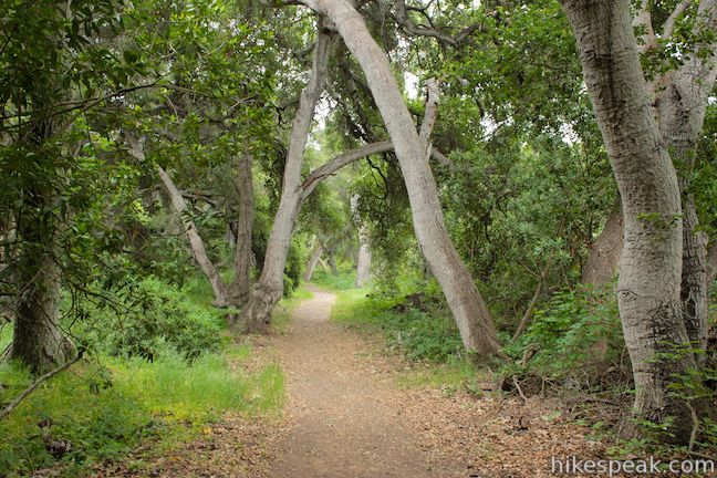
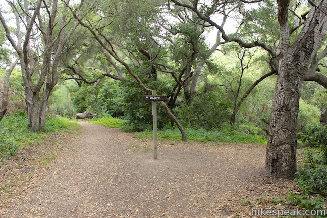
Ennisbrook Trail bends to the left, leaving the road to cross a second stone bridge over San Ysidro Creek, just under half a mile from the start. The old stone bridge is a charming entry into more lush oak woods with a forest floor punctuated by ferns. Walk 0.15 miles from the bridge through the forest to reach the start of the loop at the top of Ennisbrook Trail, which is 0.6 miles long. You can proceed in either direction at this split.
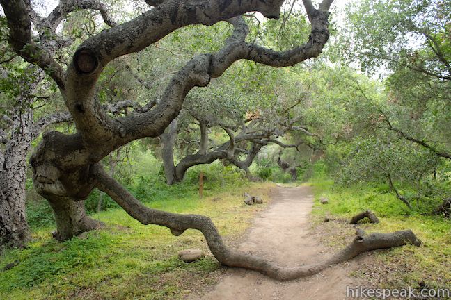
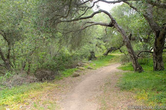
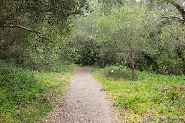
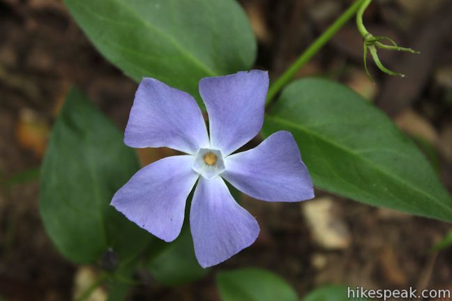
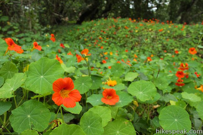
Turning right, you will drop down to San Ysidro Creek. Rock hop across and continue up a dirt single track beneath a canopy of oaks. A quarter mile from the split in the trail, you will come to another junction. Turn left to keep with the circle. You will pass through an area that displays a massive amounts of nasturtiums in the spring. Nasturtiums are a flower native to South and Central America that seem to thrive in this corner of Montecito. The bright flowers come in a variety of colors and patterns in dazzling yellow, orange, and red.


The loop will then reach East Valley Road. Turn left, walking south down a trail along the road for 0.15 miles to a cul-de-sac. Venture back into the forest and proceed another 0.07 miles to close the loop. Continue hiking south, following the trail you came in on to hike 0.63 miles back to the start.
To trek farther up San Ysidro Creek, check out the hike to McMenemy Overlook. No fee or permit is required to hike Ennisbrook Trail in San Ysidro Creek Preserve (sometimes called San Ysidro Creekside Trail). Dogs and mountain bikes are allowed on this 1.85-mile lollipop loop, so get out enjoy!
Directions to the Trailhead
- From the south (Ventura), take the 101 Freeway northwest to exit 92 for Sheffield Drive.
- At the end of the offramp, turn right.
- Make an immediate right, following signs for Sheffield Drive.
- After a horseshoe bend to the left, Sheffield Drive will head north.
- Make the next left on San Leandro Lane.
- Proceed 0.6 miles to the trailhead, which will be on the right.
- From the north (Santa Barbara), take the 101 Freeway southeast to exit 93 for San Ysidro Road.
- Turn left and the end of the offramp.
- Cross over the 101 Freeway and turn right on Jameson Lane.
- Drive 0.3 miles and turn left on Hixon Road.
- After 0.2 miles, continue straight on San Leonardo Lane.
- Go another tenth of a mile and turn right to stay on San Leandro Lane.
- Drive another 0.3 miles to the trailhead, which will be on the left.
- There is roadside parking outside the white picket fence next to the trail sign.
Trailhead Location
Trailhead address: San Leandro Lane, Montecito, CA 93108
Trailhead coordinates: 34.425482, -119.622238 (34° 25′ 31.73″N 119° 37′ 20.05″W)
View Santa Ynez Mountains in a larger map
Or view a regional map of surrounding Central Coast trails and campgrounds.


 | Carpinteria Bluffs Trail to Carpinteria Seal Sanctuary Overlook This 1 to 2-mile hike goes from Carpinteria Bluffs Nature Preserve to a viewing area above a harbor seal rookery, offering beach access and beautiful oceanfront hiking. |
 | Carpinteria Salt Marsh Nature Park This level 1.2-mile round trip hike explores El Estuaro, a vital ecosystem for shorebirds. |
 | Tangerine Falls This 2.5-mile hike visits a beautiful waterfall on the edge of Los Padres National Forest near Santa Barbara. |
 | Montecito Peak This 7.1-mile partial loop climbs to a panoramic summit in Los Padres National Forest overlooking Montecito and Santa Barbara. |
 | McMenemy Overlook This 3.7-mile hike uses four trails to form a loop through the mountains behind Montecito, California. |
 | Inspiration Point from Tunnel Road This 3.75-mile round trip combines Tunnel Trail and Jesusita Trail to ascend Mission Canyon to a sweeping viewpoint that looks down over Santa Barbara and up into the Santa Ynez Mountains. |
 | Inspiration Point from San Roque Road This 7.55 to 7.95-mile round trip hike ascends 1,400 feet up the western side of Jesusita Trail to a panoramic perch in the Santa Ynez Mountains with great views over Santa Barbara. |
 | Chumash Painted Cave This very short trail looks in on Native American rock art in the Santa Ynez Mountains. |
 | Knapp's Castle This easy 0.8-mile hike visits the scenic ruins of an estate home built atop the mountains behind Santa Barbara. |
 | Lizard's Mouth This half-mile hike visits a unique rock formation with amazing views over Santa Barbara and the Pacific. |
 | More Central Coast Hikes Explore other destinations along the California coast between Ventura and Monterey, including trails in Los Padres National Forest. |
Common Questions about Ennisbrook Trail in San Ysidro Creek Preserve in Montecito
- Is the trail open?
- Yes. You should expect to find that Ennisbrook Trail is open. There are no recent reports of trail closures. If you discover that the trail is closed, please help your fellow hikers by reporting a closure.
- Is this trail free to access?
- Yes, Ennisbrook Trail is free to access. No entrance fee, pass, or permit is required. If you discover that access rules have changed, please provide feedback on your experience.
- How much time does this hike take?
- It takes approximately 45 minutes to hike Ennisbrook Trail. Individual hiking times vary. Add extra time for breaks and taking in the views.
- How long is this hike?
- The hike to Ennisbrook Trail is a 1.85 mile lollipop loop with 150 feet of elevation change.
- Are dogs allowed on this trail?
- Yes, dogs are allowed on Ennisbrook Trail. The trail is open to hikers, dogs, bikes.
- Is Ennisbrook Trail good for kids?
- Yes, this hike is likely suitable for children. It is relatively short (1.85 miles) with manageable elevation gain.
- Is this a good hike for wildflowers?
- Yes, Ennisbrook Trail is known for its seasonal wildflower displays.
- Where is the trailhead located?
- The trailhead for Ennisbrook Trail is located in Montecito, CA.
Trailhead Address:
San Leandro Lane
Montecito, CA 93108
Trailhead Coordinates:
34.425482, -119.622238 - What are the driving directions to the start of the hike?
To get to the trailhead: From the south (Ventura), take the 101 Freeway northwest to exit 92 for Sheffield Drive. At the end of the offramp, turn right. Make an immediate right, following signs for Sheffield Drive. After a horseshoe bend to the left, Sheffield Drive will head north. Make the next left on San Leandro Lane. Proceed 0.6 miles to the trailhead, which will be on the right.
From the north (Santa Barbara), take the 101 Freeway southeast to exit 93 for San Ysidro Road. Turn left and the end of the offramp. Cross over the 101 Freeway and turn right on Jameson Lane. Drive 0.3 miles and turn left on Hixon Road. After 0.2 miles, continue straight on San Leonardo Lane. Go another tenth of a mile and turn right to stay on San Leandro Lane. Drive another 0.3 miles to the trailhead, which will be on the left. There is roadside parking outside the white picket fence next to the trail sign.
View custom Google Maps directions from your current location.
- Are there other trails near Ennisbrook Trail?
- Yes, you can find other nearby hikes using the Hikespeak Hike Finder Map.

Dang this trail is really pretty… Would love to take pictures here.
[…] Photo blog: Nastertiums on Ennisbrook Trail in Montecito, California […]
This area looks really nice to photograph, thanks for posting!
Poison Oak is the most common flora. There are innumerable spots at which to stop and take in the beautiful scenery; but while walking, keep you eye on the trail.
At Trailhead coordinates: 34.425482, -119.622238 Google maps show me a long barrier that seems to ban from entering the site. Thank you confirm that this trail is open to the public.
Best regards
Bernard from France
Yes. There is a gate in the fence.
are dogs required to be leashed on this trail? thanks!
My husband and I just went here yesterday – it was extremely run down. Did not look like the photos at all! There were so many (huge) dead branches everywhere and everything was so overgrown and not taken care of it tended to remind us of a trailer park version of a trail! There was horse poop all over it, too.
My hubby and I hike the Ennisbrook trail on February 27, 2021. It is a beautiful forest of oaks and sycamores. The canopies formed by the trees are of different shapes. The trail is very photographic and physically maintained.