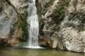
Cooper Canyon offers a relaxing summer waterfall for those staying overnight at Buckhorn Campground or venturing into San Gabriel Mountains National Monument for a get-away day hike. The three-mile round trip trek descends 745 feet into a mountain canyon through an enchanting old-growth forest to reach a small waterfall.
- Cooper Canyon Falls is one of the Los Angeles waterfall hikes.
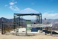
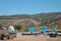
Those tenting at Buckhorn Campground should feel compelled to experience this trail. For other visitors, drive into the campground and follow signs for the day-use parking.
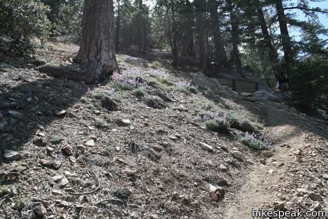
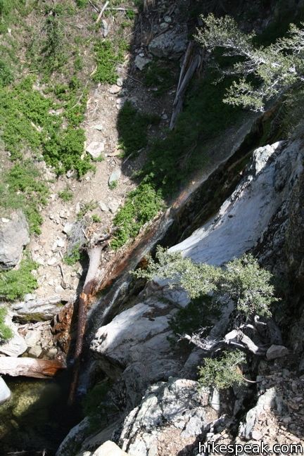
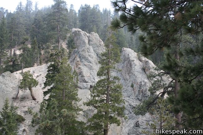
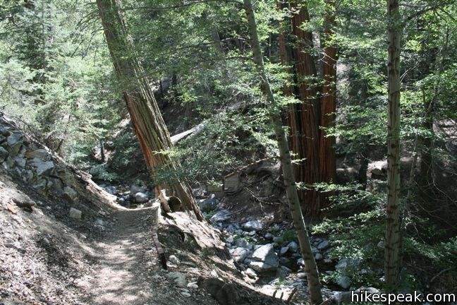
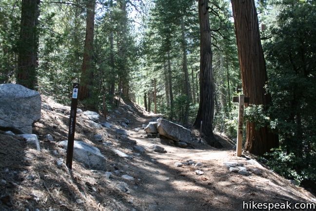
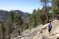
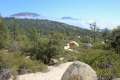
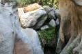
Locate Buckhart Trail and the north end of the lot and begins down the west side of Buckhorn Canyon. The single track passes through a mixed forest of pines, alders, and oaks. To the right, several footpaths lead down to a small creek. The last such sidetrack drops to an overlook that peers down on a tall slender waterfall. Be careful as you travel on and off the trail; your safety is your responsibility.
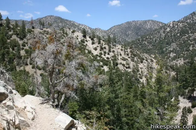
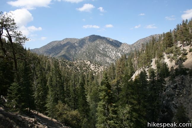
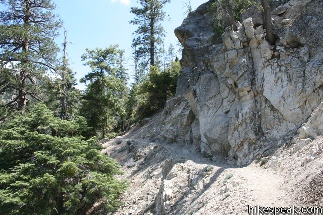
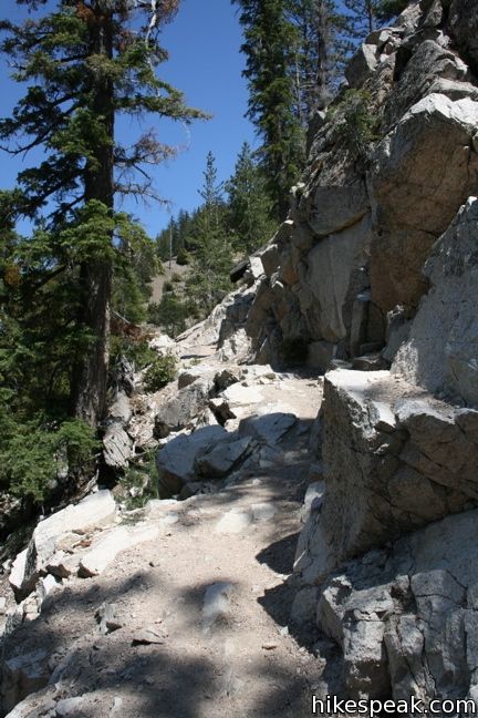
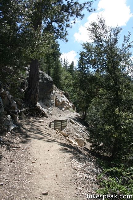
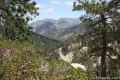
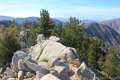
Stay on the main trail to reach Cooper Canyon Falls. The forest gives way to wide views of Cooper Canyon and Pleasant View Ridge as the trail curves left around a rock wall and descends a gravel slope. On the return, this will be the toughest part of the hike.
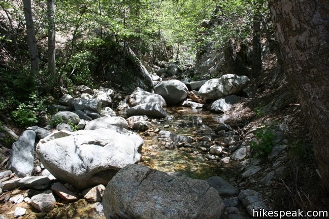
The trail turns east down Upper Little Rock Creek, passing through a pacifying glen of pines and ferns. If the falls weren’t so close ahead, this would be a great place to stop and relax, exploring the trees and creek.
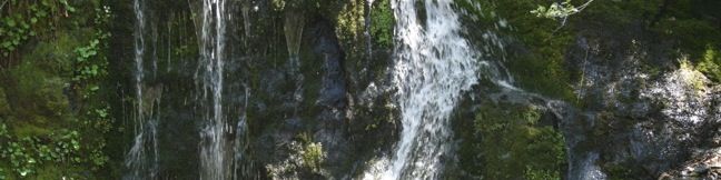
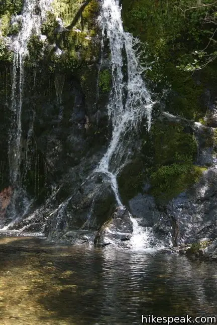
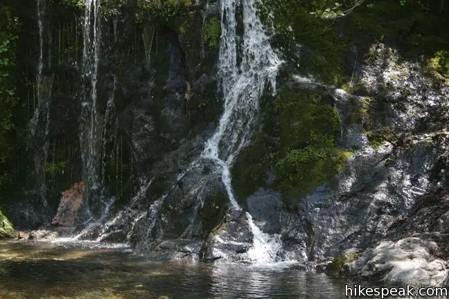
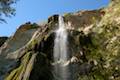
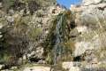
Cross over the creek flowing down Buckhorn Canyon and continue to a junction with the Pacific Crest Trail. Turn right, away from the Cooper Canyon Trail Campground, and travel east a short distance farther. Pay attention to the left side of the trail to spot where Upper Little Rock Creek tumbles over the falls. A pair of paths break off down the steep slope to the creek. This is the way to the waterfall. Descend carefully. A rope tied to a tree near the bottom helps hikers lower themselves the final ten feet.
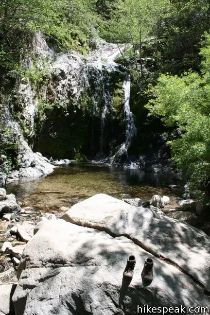
Below the falls are rocks to relax on and a pool to wade in. Small trout swim in the calm knee-high water. Cooper Canyon Falls is little more than thirty feet tall so it will not impress you with its grandeur. Instead, it will seduce you with its serenity.
To return, follow the trail back up the 745 feet of elevation to Buckhorn Campground. The start of this trail is at 6,400 feet and should be free of snow by the end of March. This is a good area to visit in the summer months. When lower elevation waterfalls loose their muster, Cooper Canyon Falls still has a steady flow.
If you are staying at Buckhorn and would like to hike uphill to vast views instead of downhill to the waterfall, consider the trail to Mount Waterman, which starts across the Angeles Crest Highway from the campground.
No permit is needed to hike to Cooper Canyon Falls. Dogs are welcome on the trail, but bikes may find it challenging. A fee is charged to stay overnight at Buckhorn Campground. Alternatively, a National Forest Adventure Pass may be required to park at the trailhead within the campground.
Directions to the Trailhead
- From the 210 Freeway in La Cañada Flintridge, head northeast on Angeles Crest Highway (CA 2) for 35 miles.
- Pass the Mount Waterman Ski Area and turn left into Buckhorn Campground.
- Drive through the campground for 0.4 miles following signs for the day-use area.
- Be sure to display an adventure pass before starting down the Buckhart Trail.
Trailhead Location
Trailhead address: Angeles Crest Highway, San Gabriel Mountains National Monument, Pearblossom, CA 93553
Trailhead coordinates: 34.3475, -117.9110 (34° 20′ 51″N 117° 54′ 39.6″W)
View Mount Waterman Area Trails in a larger map
Or view a regional map of surrounding Los Angeles trails and campgrounds.
 | Mount Waterman The 5.5 to 6 miler can be completed as an out and back hike or a loop, traveling through a pine forest to a round summit. |
 | Twin Peaks & Mount Waterman This 11.65-mile hike extends the loop over Mount Waterman by dropping across a saddle and ascending Twin Peaks, a panoramic summit in the center of the San Gabriel Mountains. |
 | Winston Ridge and Winston Peak This 4.85-mile partial loop bags a summit and a scenic ridge in the high San Gabriel Mountains. |
 | Mount Hillyer This 6,215-foot summit can be reach from two trailheads for a 3 to 6.25-mile hike gaining between 575 and 1,000 feet. |
 | Vetter Mountain This 3.8 or 4.4-mile hike ascends from Charlton Flats Picnic Area to Vetter Mountain, where there are exceptional 360-degree view from the site of an old fire lookout tower. |
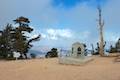 | Mount Baden-Powell This 8.25-mile round trip hike ascends 2,834 feet to one of the tallest summits in the San Gabriel Mountains and a monument to Lord Baden-Powell, a BSA icon and the founder of the Scout Movement. |
 | More trails in the San Gabriel Mountains Explore other destinations in the range. |
 | Fish Canyon Falls This 4.8-mile round trip hike leaves from an active rock quarry and progresses up a beautiful canyon to a mesmerizing multi-tiered waterfall. |
 | Eaton Canyon Falls This 3.5-mile hike goes up Eaton Wash to a narrow stretch of Eaton Canyon containing a pleasant 40-foot waterfall. |
 | Trail Canyon Falls This 4-mile hike ascends a mountain-framed canyon to a 30-foot beauty on the east side of the San Gabriel Mountains. |
 | Santa Ynez Falls This 2.5-mile follows a shaded creek to a gorge containing a short waterfall. |
 | Escondido Falls This 3.8-mile out and back hike visits a 200-foot waterfall that is split into two tiers. The upper tier is 150 feet tall and stunning after a rainstorm. |
 | More waterfalls around Los Angeles Explore other waterfalls in the Santa Monica and San Gabriel Mountains. |
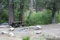 | Buckhorn Campground This 38-site campground is an hour drive up the Angeles Crest Highway from LA and a great weekend spot for summer tent camping. |
 | Horse Flats Campground This 25-site campground in the Angeles National Forest in the San Gabriel Mountains offers first-come first-serve equestrian-friendly sites. |
 | Coulter Group Campground This single-site campground accommodates up to 50 people per night, offering fresh mountain air and sweeping views at 5,300 feet. |
Common Questions about Cooper Canyon Falls in the San Gabriel Mountains
- Is the trail open?
- Yes. You should expect to find that Buckhart Trail to Cooper Canyon Falls is open. There are no recent reports of trail closures. If you discover that the trail is closed, please help your fellow hikers by reporting a closure.
- Do I need a permit for this hike?
- Yes. National Forest Adventure Pass.
- How much time does this hike take?
- It takes approximately 1 hour 45 minutes to hike Buckhart Trail to Cooper Canyon Falls. Individual hiking times vary. Add extra time for breaks and taking in the views.
- How long is this hike?
- The hike to Buckhart Trail to Cooper Canyon Falls is a 3 mile out and back with 745 feet of elevation change.
- Are dogs allowed on this trail?
- Yes, dogs are allowed on Buckhart Trail to Cooper Canyon Falls. The trail is open to hikers, dogs.
- Will I see a waterfall on this hike?
- Yes, Buckhart Trail to Cooper Canyon Falls features a waterfall.
- What mountain range is this trail in?
- Buckhart Trail to Cooper Canyon Falls is located in the San Gabriel Mountains.
- Where is the trailhead located?
- The trailhead for Buckhart Trail to Cooper Canyon Falls is located in Pearblossom, CA.
Trailhead Address:
Angeles Crest Highway
Pearblossom, CA 93553
Trailhead Coordinates:
34.3475, -117.911 - What are the driving directions to the start of the hike?
To get to the trailhead: From the 210 Freeway in La Cañada Flintridge, head northeast on Angeles Crest Highway (CA 2) for 35 miles. Pass the Mount Waterman Ski Area and turn left into Buckhorn Campground. Drive through the campground for 0.4 miles following signs for the day-use area. Be sure to display an adventure pass before starting down the Buckhart Trail.
View custom Google Maps directions from your current location.
- Are there other trails near Buckhart Trail to Cooper Canyon Falls?
- Yes, you can find other nearby hikes using the Hikespeak Hike Finder Map.

Is Buckhorn campground open to public now? I called clear creek station but no one picked up the phone.
Does anybody know?
Its closed still we were there a week ago.half the crestline trail is closed. It was difficult to find the new extended reroute to the falls but it possible if u get there early enough. Its now around a 5 mile round trip hike.
[…] is a bit difficult, but you should be fine finding it if you follow these directions precisely: http://www.hikespeak.com/trails/cooper-canyon-fall/ Be sure you pay $5 for an Adventure Pass on your way into the park otherwise you will get a […]
Hello,
Is horse bare riding allowed?
Has anyone been here recently? I am planning a camping trip for next weekend and I’ve been researching good hiking trails, maybe with waterfalls/rivers/etc if possible. Is this trail still open and is there still a waterfall?
Yes I just completed this trail yesterday. Took us about 2 hours including a short detour left to “Cooper Canyon Trail” towards the Cooper Canyon Trail camp. Instead stay straight on the Burkhart Trail to reach the falls.
Anyone know if any water remains in the falls/pond? Thanks
I want to backpack in to coopers trail camp and see the waterfall. i would like the hike out the next day to be easier. which trailhead should I enter from? cloudburst or buckhorn? Can you park overnight for free at either? what is the mileage to campground and falls from cloudburst? is the elevation increase very much? any answers would be extremely helpful. Thank you.
going there today. this might be helpful for you
http://www.fs.usda.gov/recarea/angeles/recreation/camping-cabins/recarea/?recid=41716&actid=29
hello there, i want to go with my kids this Sunday. where do i purchase the adventure pass?
Please let me know, thank you…..
[…] Cooper Canyon Falls. November 15, 2015. […]
I’m planning a trip out to the falls tomorrow and wanted to know if there is anything to watch out for to get there(splits in the trail, hard climbs, ect.)
Any help is much appreciated!
Andy
Just hiked the trail to the waterfalls from the campground yesterday, and there are no trail issues other than the rope at the falls is covered in bees.
I am going hiking with my kids tomorrow, where do we start the hike to get to the cooper falls?