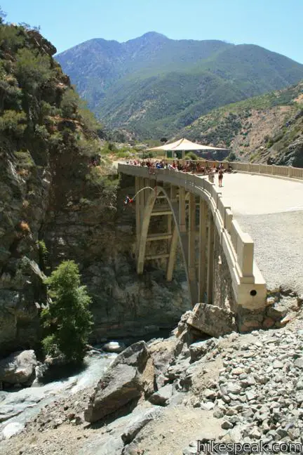
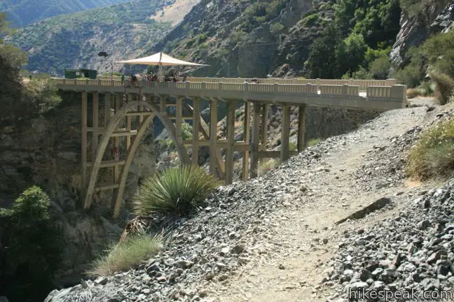
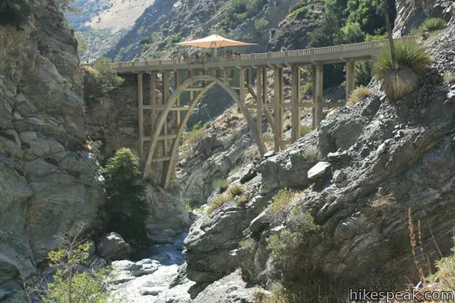
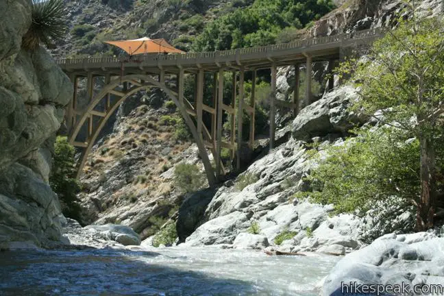
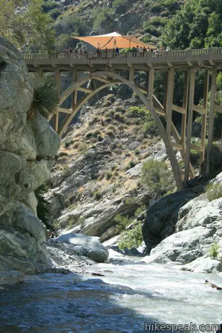
For outdoor-loving Angelinos, Bridge to Nowhere is the affectionate name of a local treasure, an abandoned bridge on a washed-away road in the San Gabriel Mountains that spans across the East Fork of the San Gabriel River.
You’ll find excessive fun on this 10-mile round trip hike with 900 feet of elevation change. The trail uses several river fords to reach the Bridge to Nowhere, adding opportunities to stop and swim. Dedicate at least six hours to completing this outing.
An easy-to-acquire wilderness permit is required to hike to the Bridge to Nowhere, as well as a national forest day use pass (details below).
History of Bridge to Nowhere
LA’s Bridge to Nowhere was constructed in 1936 over a gap carved by the East Fork of the San Gabriel River. The bridge was built to serve as a link in a roadway between the San Gabriel Valley to the south and Wrightwood to the north. However, in the spring of 1938, a massive flood changed the landscape of the canyon and washed out the road leading to the bridge. The road was never restored and construction was abandoned due to a lack of financial investment.
The bridge remains, isolated deep in the San Gabriel Mountains. The Bridge to Nowhere has become an excellent destination for hikers and bungee-jumpers who plunge from the side of the dramatic arch-shaped bridge.
Hike to Bridge to Nowhere
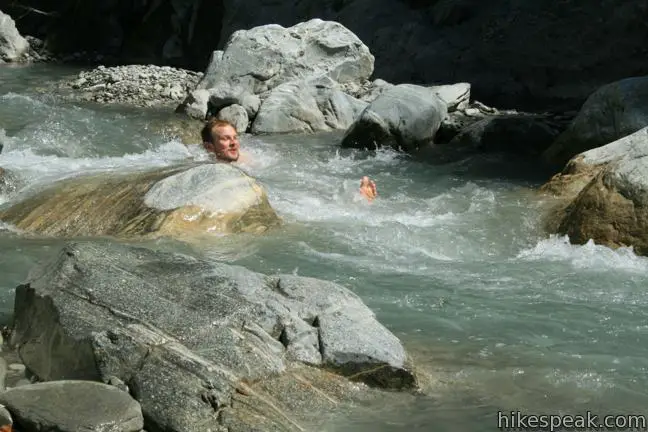
The trail to the Bridge to Nowhere is mostly gradual with some rugged terrain and rock scrambling. Wading through thigh to waist high water is unavoidable (at least in wet months) so pack appropriate footwear. Hiking boots, water shoes, and a towel is the best combination. The hike up the canyon has a minimum of four river crossings. Trekking in wet shoes is not idea, and while it is tedious to change your footwear throughout the hike, your feet may thank you.
Don’t be surprised if the trailhead is crowded. This is a popular hike, and people also park here to picnic and swim in the nearby river. Arrive early, and prepare to leave your vehicle along the road leading to the trailhead if the lot is full.
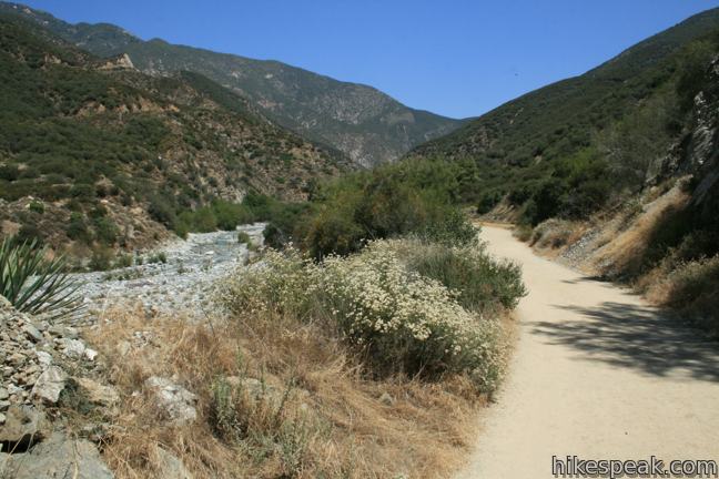
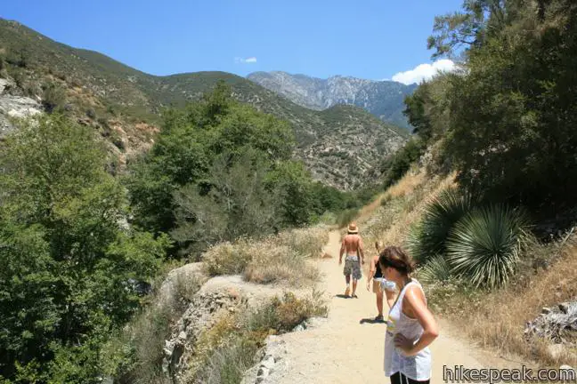
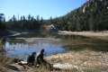
Begin by hiking half a mile down a wide dirt road to Heaton Flats Trail Camp. This first stretch of the trail is slightly downhill, but that changes when you reach the campground and start to hike uphill.
The trail has limited shade and the last two miles are almost entirely in the sun. The campground has a bathroom, in case you forgot to go at the trailhead. Within the campground, the trail passes a junction with the less traveled Heaton Flats Trail, the only trail junction en route to Bridge to Nowhere.
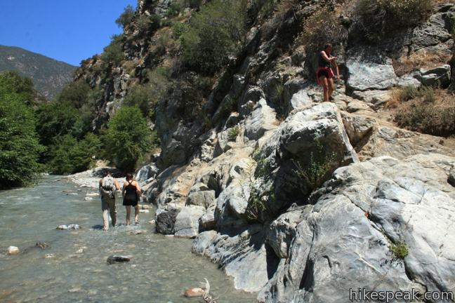
Proceed another quarter mile, passing some concrete remnants of the old roadway to your first taste of the river, a quasi-crossing (when the water level is high). Though the trail maintains its course on the east side of the river, it passes between a rock and a wet place. You must either walk through potentially ankle-deep water, or carefully traverse a short rocky ledge just above the shallow water. This river encounter is optional. The next one is not. A quarter-mile ahead, barrel straight through the thigh to waist-high water. Be careful on the slippery rocks as you cross the cold rushing river. A walking stick is a helpful tool.
It is 0.3 miles up the west side of the river to the next crossing. Find the log bridge and you can stay dry crossing the channel.
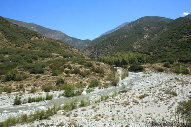
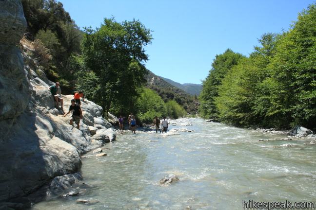
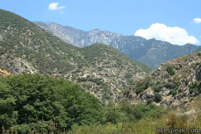
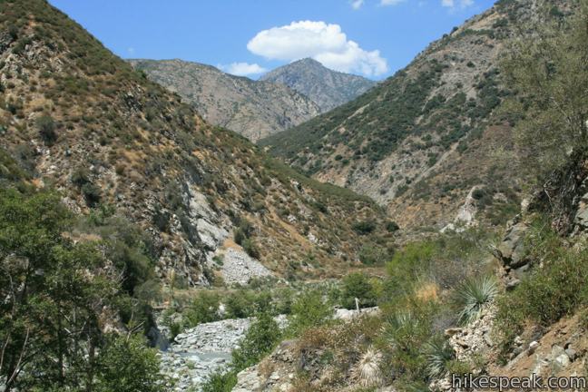
As you continue north, the trail begins to break up. Any path up the canyon will work, but as a general rule, the preferable route can be found on the east back of the river (except for the stretch between the first and second crossings). You can stay on the east side of the canyon for the next 1.65 miles. However, an optional crossing half a mile past the second crossing tempts many hikers.
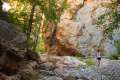
When the trail appears to head straight into the river, stay dry by proceeding up the rock to the right, which leads to a fun scramble through boulders and trees. The trail becomes difficult to follow as it traverses a rocky riparian woodland. As long as you stick to the east side of the canyon, you will find your way.
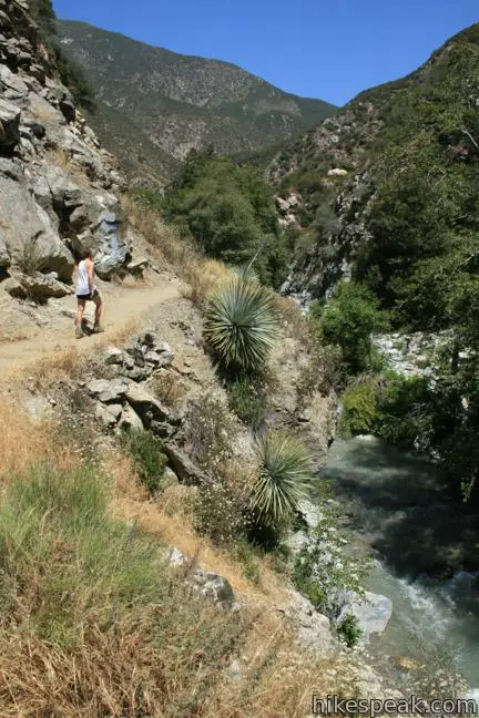
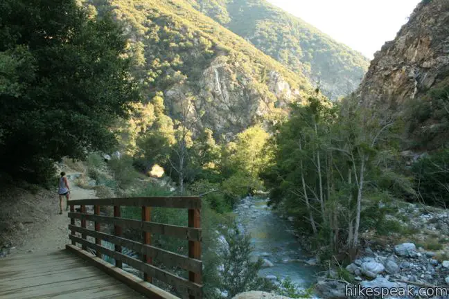
A mile and a quarter from the second creek crossing, and just over 2.5 miles from the start, you will cross a short wooden footbridge and enter Sheep Mountain Wilderness. The trail continues over dirt, sand, and gnarly rocks.
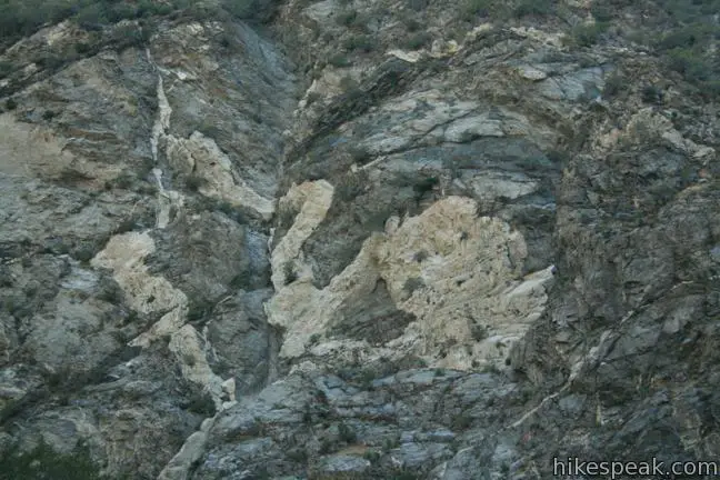
Just before reaching the next mandatory river crossing, 2.95 miles from the start, keep an eye on the rock wall on the west side of the canyon. You will find an animal-like white-on-black pattern nicknamed The Swan.
Ford the river and then immediately wade back to the east shore. A stream flowing into the river here is surrounded by concrete retaining walls, evidence the old road up the canyon.
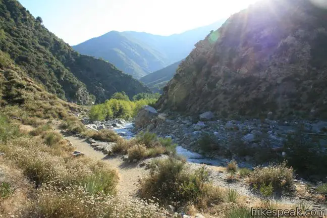
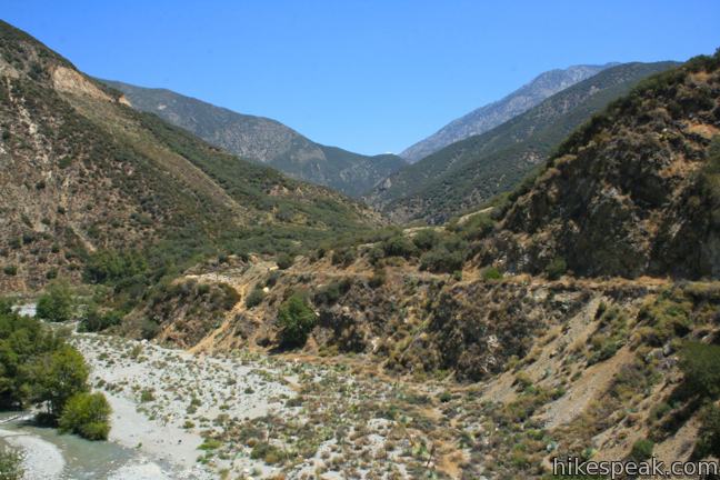
Walk on a bit of pavement resembling an old road up to a large area washed out by the flood at around mile 3.5. The trail drops into a gravel bed on the outside of a bend in the river. Straight ahead, a single wooden frame from an old suspension line can be seen atop a small ridge protruding from the east side of the canyon.
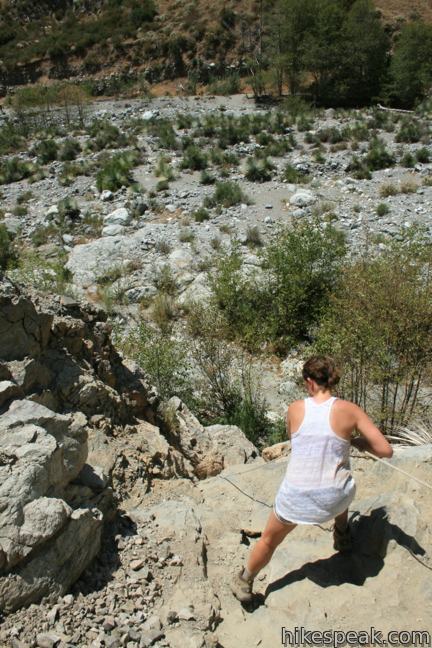
The trail splits, leaving hikers to choose between two obstacles. Stick to the river and set yourself up for two water crossings, or ascend the steep slope to the old road to the right side of the canyon below the wooden pole. This road will suddenly disappear, forcing you to make a rope-assisted descent down a steep rock wall to return to the riverbed. Pick your poison and continue toward the Bridge to Nowhere.
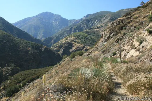
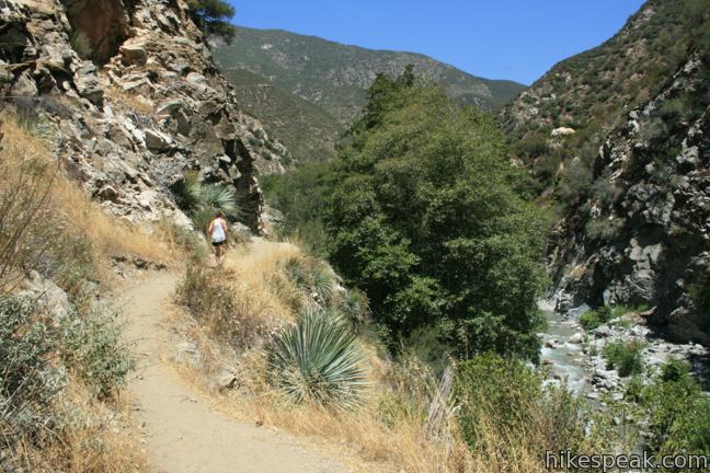
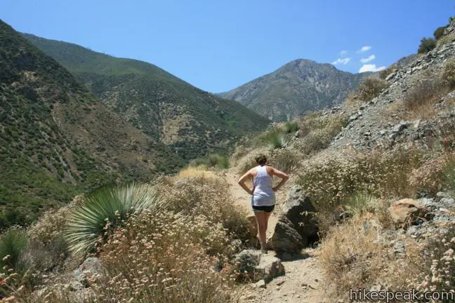
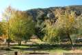
Follow the river to a distinct line of trees, just over 3.75 miles from the start. Turn right and make your way up to the old road bed above the east side of the river. Follow the old road for the final 1.1 miles. The sun-exposed trail rises above the river as it passes through a narrowing canyon and is lined with low brush like chamise and sage that offer broad views.
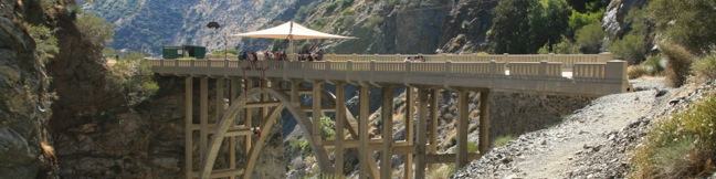
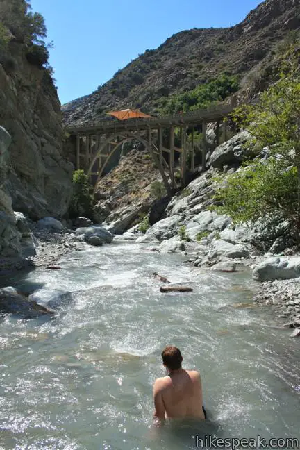
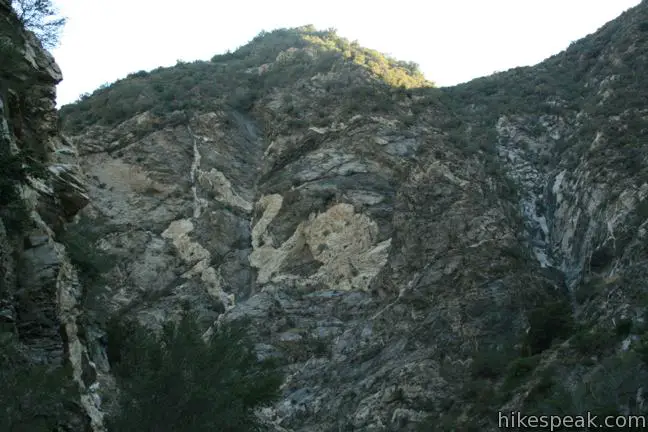
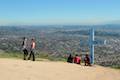
After passing two private property signs (hiker access is permitted), the bridge will appear. It is supported by a grand concrete arch straddling the canyon, shaped like the top of an egg.
The bridge is an elegant structure that provides excellent views. As you cross the bridge, you will notice that it is lower on the right side, adding a touch of vertigo to this out-of-place bridge. The thrill of a good hike is not enough for many, who make the trek in order to bungee-jump from the side of the bridge. Bungee America is the only approved vendor for jumping off the bridge.
Beyond the bridge is a pleasure of another kind, a refreshing swimming hole. A steep single-track drops 1/8 of a mile into the canyon above the bridge. Here you will find relaxing pools, as well as fun rapids – the perfect break before a long hike back.
A wilderness permit is required to access Sheep Mountain Wilderness. You may self-register for a permit at the kiosk at the south end of the trailhead, or obtain one at the East Fork Ranger Station located on the road to the trailhead (or at other ranger stations in Angeles National Forest or San Gabriel Mountains National Monument). A newer permit kiosk should also be available at Heaton Flats Trail Camp. The permit is free. This trail begins within the national forest so an adventure pass (day use pass) be required to park at the trailhead, which can also be purchased at the ranger station.
Dogs are permitted, but this is a long hike with areas of rough terrain that may not be suitable for your canine companion. Bridge to Nowhere is an unforgettable hike, and an understandable Los Angeles favorite.
Directions to the Trailhead
- From the 210 freeway in Azusa, take exit 40 north on Route 39.
- Drive 11.6 miles north, passing the East Fork Ranger Station at the base of the San Gabriel Mountains.
- Pass San Gabriel Reservoir and turn right on East Fork Road.
- After 5.2 miles, when the road makes a sharp bend to the right, continue straight ahead on Camp Bonita Prairie Forks Road.
- The road sticks with the river for an additional 3/4 of a mile to reach the trailhead parking area.
Trailhead Location
Trailhead address: Camp Bonita Road, San Gabriel Mountains National Monument, Azusa, CA 91702
Trailhead coordinates: 34.23696, -117.765119 (34° 14′ 13.05″N 117° 45′ 54.42″W)
View Bridge to Nowhere in a larger map
Or view a regional map of surrounding Los Angeles trails and campgrounds.


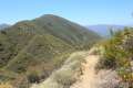 | Heaton Flats Trail This hike of 3.6 to 6 miles (or more) starts from the same trailhead as the hike to the Bridge to Nowhere and climbs toward Iron Mountain and panoramic views. |
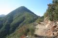 | Smith Mountain This 7-mile hike ascends 1,800 feet to a 5,111 foot summit with panoramic views over the San Gabriel Mountains. |
 | Crystal Lake This 1 1/3-mile round trip hike visits the only naturally occurring lake in the San Gabriel Mountains. |
 | Fish Canyon Falls This 4.8-mile round trip hike leaves from an active rock quarry and progresses up a beautiful canyon to a mesmerizing multi-tiered waterfall. |
 | Azusa Peak (and Glendora Peak) via Garcia Trail This 2 2/3-mile or 4 2/3-mile hike ascends Garcia Trail to "the A" and one or two picturesque summits along Glendora Ridge Motorway. |
 | More trails in the Los Angeles Explore other destinations in the Santa Monica Mountains, San Gabriel Mountains, and elsewhere. |
 | Fish Canyon Narrows This hike of ten miles or more explores an enchanting narrow canyon on the east side of the Angeles National Forest in the Sierra Pelona Mountains north of Santa Clarita. |
 | Coldbrook Campground This 20-site campground in the Angeles National Forest in the San Gabriel Mountains offers first-come first-serve camping year-round. |
Common Questions about Bridge to Nowhere in the San Gabriel Mountains
- Is the trail open?
- Yes. You should expect to find that East Fork Trail to the Bridge to Nowhere is open. There are no recent reports of trail closures. If you discover that the trail is closed, please help your fellow hikers by reporting a closure.
- Do I need a permit for this hike?
- Yes. National Forest Adventure Pass.
- How much time does this hike take?
- It takes approximately 4 hours 45 minutes to hike East Fork Trail to the Bridge to Nowhere. Individual hiking times vary. Add extra time for breaks and taking in the views.
- How long is this hike?
- The hike to East Fork Trail to the Bridge to Nowhere is a 10 mile out and back with 900 feet of elevation change.
- Are dogs allowed on this trail?
- Yes, dogs are allowed on East Fork Trail to the Bridge to Nowhere. The trail is open to hikers, dogs.
- Is East Fork Trail to the Bridge to Nowhere a difficult hike?
- This hike should be considered strenuous. Hikers should be prepared for a workout covering 10 miles and 900 feet of climbing.
- What mountain range is this trail in?
- East Fork Trail to the Bridge to Nowhere is located in the San Gabriel Mountains.
- Where is the trailhead located?
- The trailhead for East Fork Trail to the Bridge to Nowhere is located in Azusa, CA.
Trailhead Address:
Camp Bonita Road
Azusa, CA 91702
Trailhead Coordinates:
34.23696, -117.765119 - What are the driving directions to the start of the hike?
To get to the trailhead: From the 210 freeway in Azusa, take exit 40 north on Route 39. Drive 11.6 miles north, passing the East Fork Ranger Station at the base of the San Gabriel Mountains. Pass San Gabriel Reservoir and turn right on East Fork Road. After 5.2 miles, when the road makes a sharp bend to the right, continue straight ahead on Camp Bonita Prairie Forks Road. The road sticks with the river for an additional 3/4 of a mile to reach the trailhead parking area.
View custom Google Maps directions from your current location.
- Are there other trails near East Fork Trail to the Bridge to Nowhere?
- Yes, you can find other nearby hikes using the Hikespeak Hike Finder Map.

It looks like so much fun!! I may have to plan this “bridge to nowhere” hike in the summer!
Great commentary, mile markers, photos and map. Thank you soooo much! Might you know the name of the camp site just past the bridge, across the river, on the right? We were there Nov. 27th for a day hike and are returning in a few weeks to camp. Your notes are mega helpful!
Hi Lori,
I wasn’t aware of a camping area beyond the bridge. Have a great time on your return hike. Let me know if you find it!
Is it an official campsite? I think I know the spot you are talking about. Haven’t been there in 15 years, but I remember over the bridge, scaling the tiny pathway around the hill (up the river) to the cave opening. And there was passage across the river to a large flat area perfectly suitable for a group camp. But it wasn’t an official campsite that required reservations/pass/etc.
The campsite you are talking about is a Boys Scout Camp.
This hike was great, a fun yet challenging trail and a great payoff when you get to the bridge. I chose to hike just beyond the bridge and down to the river to relax before coming back. This hike is challenging, make sure you pack a lot of water (I drank about 3L on a hot day).
Is this suitable for kids? My 11 year old wants to do it, she’s in a great shape, but I’m worried about the river crossings.
It sounds like she’ll be fine. Unless that water is exceptionally high, the river crossings aren’t that tough. Enjoy the hike!
[…] The Bridge to Nowhere hike in the San Gabriel Mountains. Someday if I ever become a hiker, this is on my list. Another local […]
One of My Favorite Hikes
[…] Today I set out on a new trail. Mark Deaner was our trail leader for this hike. He chose the Bridge to Nowhere in the San Gabriel Mountains. […]
Is there people there to lead us on this hike? My first time will be tomorrow morning I’m just worried about getting lost
This is one of my favorite hikes in LA! It’s nice to get away from all that is LA, and enjoy this scenic, adventurous hike!
Hello, planning to hike in September. How are the water levels, how high to they normally go around that time?
How much does the wilderness permit cost?
The wilderness permit is free. An Adventure Pass is $5/day or #30/year.
where do l get one though?
You can get them at most sporting goods stores like big 5, dicks and REI. Call ahead to make sure they have the daily/year pass depending on which one you want.
You can also display an Interagency Pass, which is a card that you can purchase at most National and/or State Parks that allows you to recreate in any public lands, as National Forests are included in its use. You can just display it on the dash
Hi! Where do I get/receive the wilderness permit? I just picked up an adventure pass and have that
This is a great hike with many chances to soak in the river on a hot day. For those in decent shape, this hike should be fun with some mild challenge. Bring some snacks and a decent water supply with you for fun time.
Backpackers should have a good time with plenty of spaces on the banks of the river to set up your bivouac along the river. There is one spot in particular, just beyond the Bridge to Nowhere, that is worth staging at, just try and get there early!
Have not been up to the bridge in 25 years,went up with some friends yesterday 9/07/2013. It was great.
Very awesome hike. Extremely unfortunate that the visitors have strewn so much litter everywhere. If you can spare the pack room, it would help if everyone just picked up a little trash. I pulled out two shopping bags worth and there was so much more around. Picnickers just left whole meals of wrappers, cartons, cans where they ate and left.
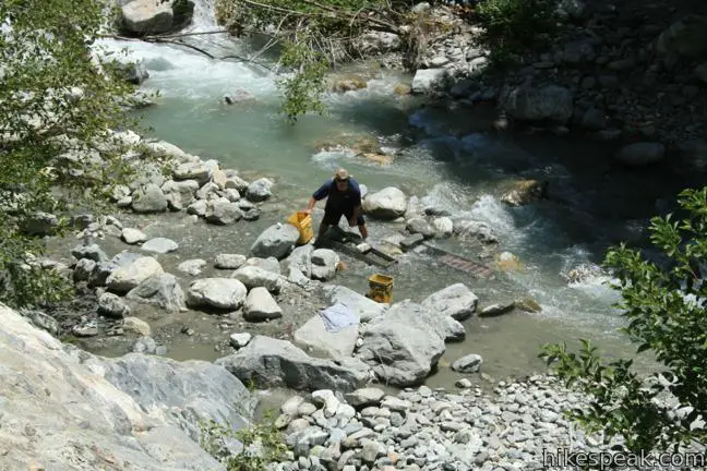
Andy: Yea the trash makes me sick. I backpack in for a night or two as a quick get away and I try to always pick up some of it. I think it comes from the people going to Bungee Jump and the unsavory characters prospecting for gold, that just don’t care. I think something more should be done about this Issue! 1 thing would be the Bungee company should do more to clean up because they are profiting and these people are just leaving there trash everywhere… among other things.
Also the prospectors are destroying the river bed (which they site some constitutional act of 18 something as protecting their right to prospect in wilderness land) and leaving trash and lots of abandoned gear and crap behind.
All I’m saying is maybe people like you (Andy) and me who care about protecting these wilderness areas should do more!
You said you backpack there, was thinking about doing that do you just leave your car in the parking lot there? or what do you do with passes and what not?
Prospectors are the first ones to pick up trash. We love this area and it pays well in enjoyment but not much gold. We look unsavory because we are dirty and sweaty but, we are doing honest work. Any marks or scraping of the earth we make quickly disappears within days. Mighty nature reclaims all. Just look at what she did to our attempt to build a road here. Please have more respect for us as we have the greatest respect for nature.
[…] I didn’t realize at the time, but a wilderness pass is also required for each hiker. Go to Hikespeak.com for more […]
I want to go here !
how much does the camping permit cost for two nights? in the area at the beginning where many campsites are set.
has another price than the annual price for parking
[…] Go to Hikespeak.com for trail directions […]
I had been thinking of this hike for some time, so, late in the day on Memorial Day I started hiking at 4:20pm. I figured it would take me only an hour or so, but it took me more than 2 hours. I made it to the bridge a little past 6:30. Started hiking back around 7 and I just wanted to make it back before it got too dark. Made it back to the parking lot at 8:45. This was definitely more challenging than I expected. I’m a mailman and I walk 12 miles everyday. But it was definitely challenging. Even saw some Big Horn Sheep!
Eric,
Thanks for the post. WAS THERE ANY WATER BY THE BRIDGE?
Planning to leave Friday for a few nights, so a response would be incredibly helpful.
Much Love!
Blaze
Hey I am going tomorrow (7-12-14) and I am curious if you were able to answer your question regarding the water by the bridge. I know it’s going to be hot so it would be nice to take a refreshing swim once we reach the bridge. All the best
Hi there, how was your hike? Was there any water by the bridge? I am planning to go in 2 weeks. Any advice on nearby campsites would be helpful, if you saw anything..
Thank you!
This is probably far too late of a response but nonetheless it might benefit others. There is definitely lots of water, from the river obviously. If you hike past the bridge and go down the trail, you will find a swimming hole that’s nearly 4.5ft deep. I saw several teenagers jumping from the rock into the hole. The water feels incredible after 5 miles. So be sure to take a dip into it even if you just stick your feet in.
I reached the bridge to nowhere for a second time last Friday. The first time was three years ago. During my first trip,
I lost the trail and waded up the river to the bridge before climbing on the almost vertical face of the rock next to the bridge. The second time was easy, as I learned a lesson from the first trip. One should cross the river to the left bank and cross back three times before walking up to the trail on the right, on the mountainside. If you cross the river more than six times (back and forth), you are losing the trail. The theory is: Try to keep to the right wherever you can. If you cannot, move to the other side of the river (left). After the cross and cross back for the third time, look to your right. On the mountainside, try to discern the trail. It is visible if you purposely look for it. Last Friday, three groups – a total of 8 people – missed the trail and they stayed with the river to far. Two groups returned to the trail head without going to the bridge as they were too tired and lost much time walking along the river. The other group, a couple, reversed and found the trail on the mountainside. They would not go back without seeing the bridge. We saw two groups of bighorn. Very impressive.
I’d like to take my 6 year old on this trail in September 2014. Can anyone whose done this trail recently comment on the part above that says “barrel straight through the thigh to waist-high water” which seems to be around mile one? The story above was written in 2011- now, in summer of 2014 in the midst of our (unfortunate) drought, I’m wondering if the river is lower? I ask because “thigh-high” for an adult is like “shoulder-high” for a 6 year old and his mom will kill me if I get him into a dangerous river-crossing situation Thanks for any input.
Did you end up taking him?
My daughter and I just did the hike Labor Day weekend. There is still plenty of water in the river but it is WAY down from where I have seen it in the past. No problem for a 6-year-old. Ankle deep and knee-deep at worst. Most crossings you can dance across the rocks anyway.
Do be a little careful in the pools past the bridge in the river. There were a couple of Bighorn Sheep up there kicking rocks down into the river. Also there is one spot on the trail right before the bridge that has a precipitous drop if you were to somehow slide off the trail. Just be careful is all.
Great Hike. Could use a few more markers though. I did make it all the way and back – highly recommended.
Does anyone know if it would be possible to hike this all the way through to wrightwood? I know the trail is not maintained that far past the bridge, and after years im sure it doesn’t exist. With the proper gear would it be possible? Or legal? Are there any other trails that can be taken through the mountains like that? I really want to trek through the san Gabriel’s. Any recommendations?
Yes. I’ve hiked from Wrightwood Through to Azusa canyon.
Is end of March too early in the season for this hike? I’m hoping to avoid the heat and crowds, but am suddenly worried it might be too chilly or the water too high… Many thanks!
Hi Liska,
I’ve actually done this hike plenty of times all year round. It’s actually very pleasant in the winter, due to the rainy season making everything lush and green. Also, with the recent drought, the water is never more than shin-deep in crossings (in some of the natural pools it can get deep enough to submerge ones self, but one doesnt have to cross through a pool). The only time its gets pretty chilly is at night if your camping, but during the day, the sun and act of hiking keeps you comfortable.
Can Horses make it thru this trail?
No, They for sure cannot make it ALL the way to the bridge. There is a section about 3/4 of a mile before the bridge that would be undeniably too narrow for them.
Plus, im pretty sure this is not a horse friendly/legal trail. But its easy enough for almost any human to do (I wouldn’t recommend it for someone under 10 or so, but I did see an athletic little 9 year old girl do it once.)
Wow….brings back so many memories. I spent a lot of days of my youth in this area….lived at Shady oaks …..a few miles downstream. I found the old China Mine near Fathers day mine….back in the early 70’s. Bungee jumping was discovered on that very bridge….started out as people would let themselves down
on a rope that keep them just barely off the bottom and start swinging as high as they could…eventually someone started using bungee cord rope. I found my first gold nugget nearby….use to be a nice little cove to camp out at just upstream from the bridge about 1/4 mile or so….Back then they also had the East Fork Rapist that would stalk unsuspecting women. He actually came into our camp one night and drank a cup of coffee…he had an automatic weapon strapped on his side so wee didn’t deny him. He just walked in from the dark….and then left the same way…I’m still prospecting out in New Mexico these days but planning a trip back here this August. Regards Tom Klein….aka shadowdog
Hello…me & a group of friends are doing this hike on Sunday, April 19 and i would like to know what all we need regarding passes (how much), is there water in the river?…etc…it is our first time and i am the leader of this hike and want to make sure i pass along all the correct information…thank you.
Do you guys know how to make a reservation for the bungee jumping? Or could we just go straight up there when we pay for it? Planning to do it this summer. Thank you!!
I had a really irritating experience on this hike, and will likely never do it again.
By 9 am, the parking lot was completely full, and so I had to park almost 1 mile away – making a 10 mile hike closer to 12 miles. I parked where a bunch of other cars were parked, with my adventure pass clearly displayed, and I received a completely BS parking ticket from the Sheriff for $63.
On the hike itself, there was nary a moment of privacy for me and my friend – there were giant groups of people every step we took – people seem to like to hike in groups of 10 or more out here.
Yeah, its beautiful country, but with the Disneyland crowds and the goddamn ticket I am now trying to fight – I think I will go elsewhere!!!
FWIW, I usually try to start this hike at sun up, especially in the summer (read: busy) months. You will have absolutely zero crowds for the entire hike in but you will have increasing people on the hike out, especially on weekends (there is a significant difference if you can squeeze in a weekday hike,). Hiking off-season in the winter is a completely different, much more solitary experience.
[…] out these blog posts on Modern Hiker and Hikespeak. They explain the route in […]
Can trail be done on mountain bike?
Na
I love to hike, but I am afraid of really steep terrain, off cliffs and things like that is this trail steep? Looks more like open terrain and rivers?
The canyon walls are steep at the site of the bridge. The trail crosses some ledges along the way, but most of the trail won’t work up any fear of heights. You can choose a route up the canyon that avoids the steeper terrain.
Can you talk more about that part?
Also, in your write-up, you mentioned “The trail splits, leaving hikers to choose between two obstacles. Stick to the river and set yourself up for two water crossings”.
I just want to confirm that choosing this means you won’t have to go through the rope-assisted section? Where does the easier path rejoin the trail?
Correct. If you choose the route that crosses the river twice (#5&6 for the hike), you avoid going over the bluffs section where people have tied ropes. The steeper route then rejoins the trail along the river.
Does anyone know what the water crossing levels are like now?
Warning!! This Trail needs help! I have been hiking this trail for years but in several places it has become Dangerous. On Friday July 21st 2018, I was hit by rock fall out of nowhere at about 2 or 2,5 miles in. I was backpacking the main trail. My goal was a two night trip. One of the rocks hit me in the ankle, there was blood everywhere. The rock also broke my Tibia in my left leg. Thanks to the kindness of strangers and a really well stocked medical kit I did not bleed to death and was able to make it out. Maybe there is nothing that can be done and this was just a freak accident. But I believe it could happen again with no warning. I believe the trail needs some help in several places to make it safer.
We are not in 2018 yet tho.
The date is wrong or you’re a psychic
I’m guessing there is little to none cellular signal strength throughout the hike, making GPS active tracking impossible ???
I love this hike! I did it for about the 8th time yesterday. I either found a great route, or the water is super low-I only had to do one full river cross and two half crosses. Crossed at the first big boulder and stayed on the east side to cross back after the old bridge remnants. There is a place on the higher trail right after the Sheep Mountain Bridge that is really washed out and dangerous. The foot paths is only about a foot wide, and it’s covered with gravel from a slide, and the gravel slide goes several hundred feet below to the river. Folks were crossing it like nothing, but it is bad shape. There’s a similar area on the main trail up the last mile, but it’s not quite as precarious. Overall, a great hike. It takes me less than 4 hours round trip at a steady pace.
I recently discovered the 2 hidden waterfalls near The Bridge to Nowhere. Allison Gulch Falls and Devil Gulch Falls.
https://youtu.be/dLwlTbVCPUo
I’m a US Marine & have traversed the extremely difficult hills of San Diego but let me say this was quite the challenge. Very awesome hike but extremely challenging in certain areas. Hiked Sunday, March 18, 2018 with a group of eight. Two didn’t make it/turned around 2 miles in. Must be honest. Just after 4 days rain its not for the faint of heart or out of shape. There are 2 to 3 areas after the man-made wooden bridge that need expanding. The footholds are only 12 to 18 inches wide & slippery from the loose gravel. Slip here its a 35ft foot fall with no ropes or anything to hold onto. It is amazing that it is still legal to cross on such narrow path. I would not recommend this for children as it is very very dangerous. Be very careful and Bring a Walkingstick or pick one up along the trail. Absolutely majestic scenery though.
Wow im very excited to go hike this location with my dogs but reading your comment worries me now. Honestly, Do you think its manageable if i do take them?
There are area’s that feel dangerous when you cross.you’ll notice a lot of foot steps in the dirt when you start but you’ll see less & less as you go along.There’s a lot of people that start but don’t finish. I almost felt like turning around because it felt like i was going the wrong way.i just kept following the river & climbed up the side of a hill that took me to the infamous bridge to nowhere. ?? there are rattlesnakes up there so pay attention to your surroundings.
This was my first backpacking hike with my son’s Boy Scout troop. Very challenging, and definitely some terrain that you Need caution to overcome. As a big guy, I was fortunate to have some experienced hikers help lead the way. Hiking with a 30lb backpack, and spending the night, was taxiing, great views, and if you go, hike down past the bridge, and enjoy some time, by the river under the bridge.
Did you carry your water in or use a filter or pump from the river?
I hiked this short, interesting trail several times 30 years ago with a group of close friends and have fond memories of it. Every website for the bridge fails to mention the abandoned vehicle tunnel a few hundred feet past the bridge. It’s a little spooky climbing inside as it’s very dark and partially collapsed. For all I know maybe the whole tunnel finally came down after all these years. A fun, easy hike never the less.
How much is camping per night or per week?
I want to do this hike but is it safe ? I’m 60 and probably going alone. Thanks
Yesterday 5/25/2019, I had this hike. It was an amazing 10+ mile hike. Lot of water running in the creeks. Had to cross the creeks several times and enjoyed a lot. A fun filled and strenuous hiking for us.??
Thia not a 10-mile hike out and back. It’s 7.7 miles to the bridge. When you’re done, it’s a total of about 14.6 miles depending on how many times you got re-routed from rock slides that have changed the trail. It’s an all-day hike. Bring plenty of water!
[…] your eyes open you will even spot remains of the old road that once went up to the bridge. (Click here for more information on the history of the bridge as well as more detail on the trail itself.) And […]
Hi my name is Melissa Valdez I found a pair of Apple EarPods on this Hike. If you are the owner of them please email me at mvaldez0927@gmail.com and tell me what kind of print was on your case and what was missing and I will be gladly mail them to you.
My wife’s and my first date way back when in 1985. The trail was empty (except for the odd dredger), and we were the only ones at the bridge. Nice picnic spot. You could also still crawl into the mostly intact road tunnel that was at the far end of the bridge (the Narrows side). Was a wonderful experience.
Is the hiking trail open to the public?
Is the trail open right now?
I want to know this too!!!!
Has anyone been there recently? Want to know if it’s open, thank you.
Ended up going to The Bridge To Nowhere on a Sunday morning because I woke up later than I’d planned, but I am so glad we went!
I brought my GSD with me and the bff, and by the time we arrived at 8:30-9AM, the place was already pretty damn packed. There were tons of people having picnics along the river…starting at the bottom of the mountain alllll the way to the top during our hikes! We had to park a couple miles away along the road from the main parking lot that leads to the trailhead. While it wasn’t too bad getting to the trailhead…you can imagine how tiresome it was walking back to our car D:
Anyway, I love this place! It’s such a beautiful, scenic and easy hike. But man, it got pretty exhausting from all the river crossings, uneven terrain and rugged trails, and the sun right above our heads. My dog enjoyed the hike but it really wore her out! If you’re going to bring your pooch, I recommend you get them hiking boots. The ground isn’t very pleasant for their paws but luckily the cold river water was there. She’s no water dog, and preferably doesn’t want to get wet, but she’ll do it if she has too…just like her mama haha She was so hot and tired she rested right in the river stream while we ate our sandwiches.
It’s a beautiful hike but go prepared! Pack yourself lunch for a nice picnic, bring enough water, put on sunscreen, wear a hat, and if possible, wear trail or hiking shoes. It won’t matter if it’s waterproof because you’re gonna end up crossing hip deep in the river water.
Lastly, PLEASE take your trash with you.
Yes, I hiked with my friend on Tuesday, July 28th. It was very challenging and hot. There were some dangerous crossings especially after the bridge to get into the river below. That was the Reward. The refreshing, cold mountain spring water made me forget about all the pain to get there and I was totally revived! Then when it was time to go back. After walking back in wet shoes, my legs were crapping up and I was thirsty, I just wanted to die! Lol.
My friend and I tried to keep up with these twenty something group who were kind enough to let us tag along. We made it back safely though. I had to take a hot, epsom salt bath to relieve my legs and feet. They went through a lot of trauma.
It was a beautiful hike and I would do it again. It was great to be in nature, breathing in the fresh air. You can wear a mask or not.
[…] Hikespeak.com provides an excellent guide to the entire hike, as well as some invaluable advice specific to this trail. […]
Looks and sounds awesome! We’re gonna do it this coming weekend. Thanks for the tip about the dogs we were gonna take him but maybe not, we’ll do it and then decide on a later date with the pooch. And definitely will bring a trash bag, usually do in all our nature walks. It really is sad to see how much trash people leave.
Can I cross under the bridge to nowhere to fish
Does the $80 national park pass cover forest and parks will it work for the bridge
Is there anyway a person in a wheelchair can access the bridge?
[…] Bridge to Nowhere is a deserted arch constructed in 1936 on a swept road in the San Gabriel Mountains, traversing the […]
Does the river flow now that there has been a ton of rain?
Is it permitted for a handicapped person to drive into the bridge to nowhere?