Bob Jones City to the Sea Bike Trail
in Avila Beach and Avila Valley
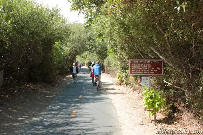
Are you jonesing for an easy trail that leads to a beach town brimming with oceanfront fun? Take a relaxing trip down Bob Jones Bike Trail to Avila Beach, a small bayside hamlet that can bustle with beachgoers on weekends. The level 5-mile round trip trail is suitable for hikers, joggers, walkers, and bikers. You will enjoy refreshing shade from oaks as you follow San Luis Obispo Creek down Avila Valley to its pacifying ending in Avila Beach.
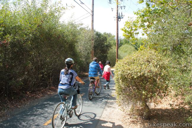
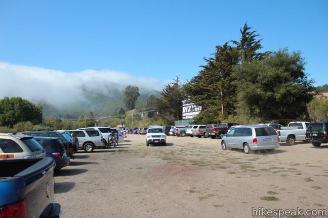
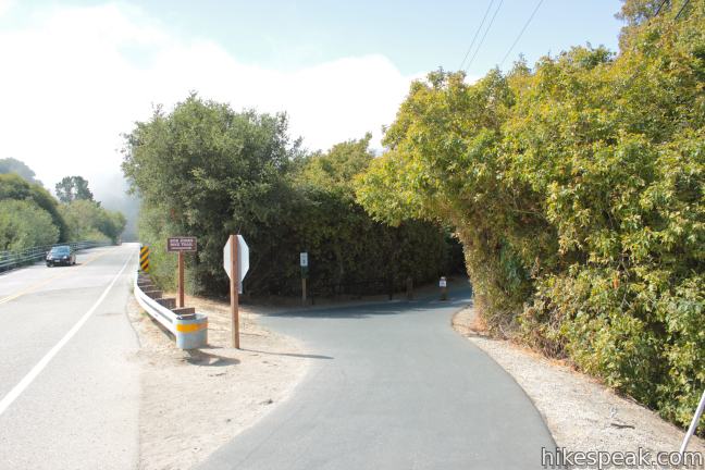
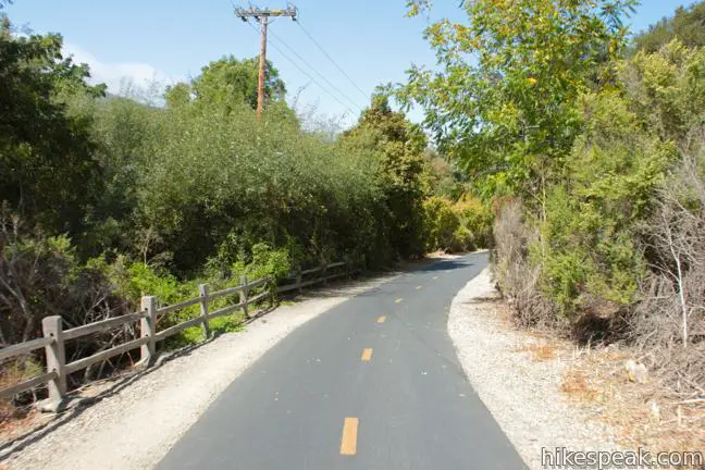
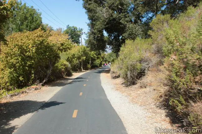
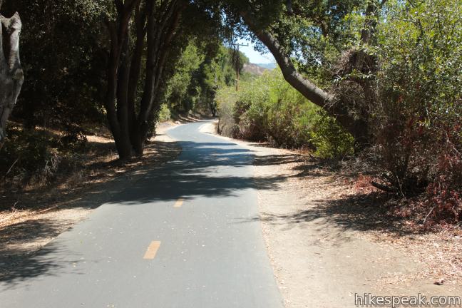
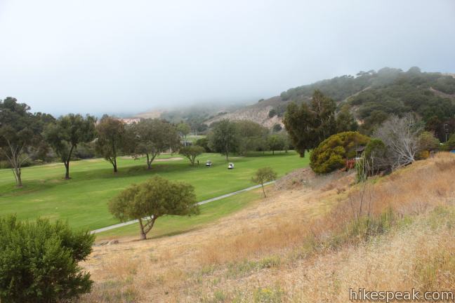
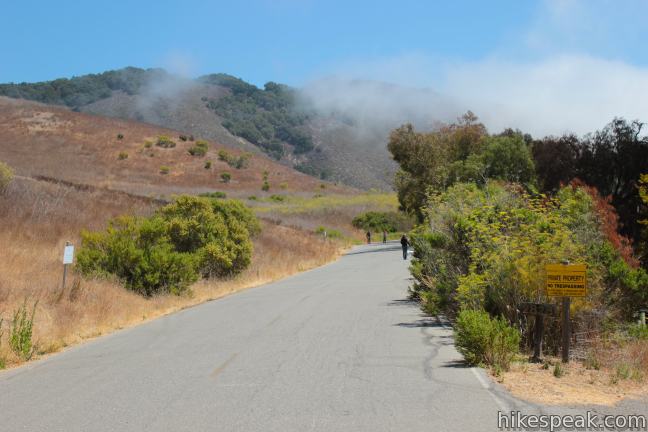
The family-friendly excursion down Bob Jones Bike Trail departs from a park and ride lot on Ontario Road near Highway 101. The Bob Jones City to the Sea Bike Trail begins across the road from the large lot (next to the driveway for the Buddhist temple). Start down the paved path, which has two lanes for bikes bordered by dirt strips that are more comfortable for hikers. As Bob Jones Trail plots a cozy course beneath grand oaks, sneak a peak to the left for between-the-trees views of Ontario Hill. To the right, you will coast past apple orchards at the bottom of Sea Canyon. There are numerous benches along the way for those who would like to linger in this natural setting.
Bob Jones Trail is named after a local environmental activist, as a sign at the start of the trail explains:
Bob Jones was an environmental pioneer. He had a lifelong interest in protecting natural habitat and the environment. He worked for the Department of Fish and Game for 23 years. Jones co-founded the environmental firm Jones and Stokes in 1970. In 1983 he retired to Avila Valley. Bob served as President of the Land Conservancy of San Luis Obispo County from 1987 – 1989. Bob was instrumental in the restoration and protection of the San Luis Obispo Creek until his death in 1994. The trail honors a man with a vision who listened to, encouraged, and inspired others.
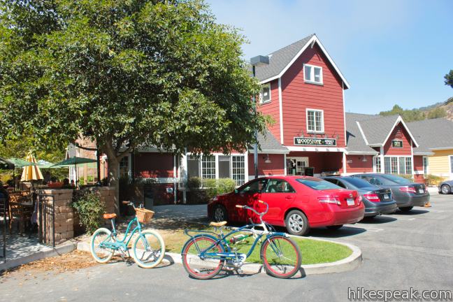
After crossing See Creek (about 3/4 of a mile from the start), Bob Jones Bike Trail passes beneath San Luis Bay Road and finds the bank of San Luis Obispo Creek. Just beyond the bridge, the trail passes Woodstone Market & Deli, where you can grab a bite, about a mile from the start.
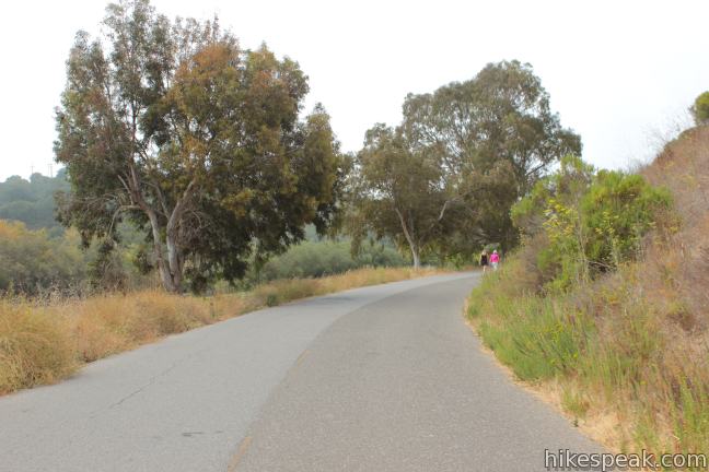
Pass a playground on the left across from Avila Village Inn, and continue down the level, shaded riverside path. Bob Jones Trail parallels Avila Bay Club on the right as it approaches a left hand turn onto Blue Heron Drive, a wide gated road that sees far more traffic from cyclists and hikers than it does from cars.
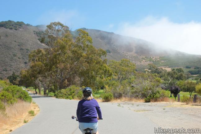
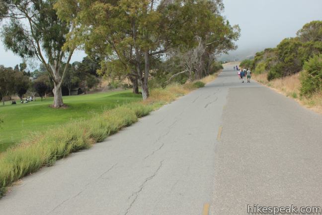
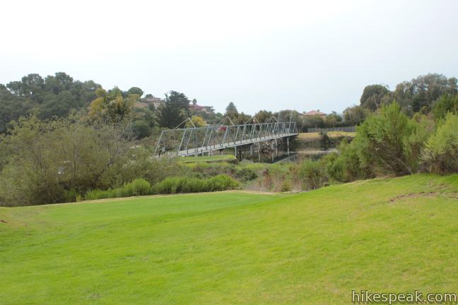
The paved Blue Heron Drive continues along the creek and angles up a short hill next to the Avila Beach Golf Course. Even if you are riding a beach cruiser without gears, you should be able to conquer the hill without difficulty. After wrapping around the golf course, it is time to leave the road. Follow a sign directing bike traffic to the left across the greens and over Golf Course Bridge. The short metal span is open to bikers, hikers, and golfers in carts.
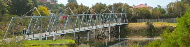
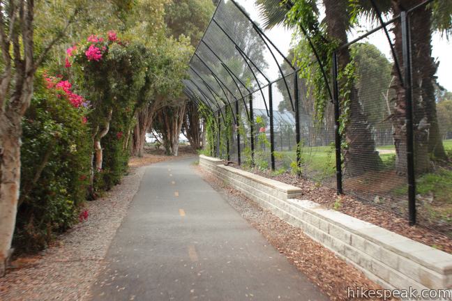
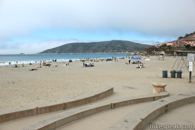
Leaving the golf course, Bob Jones Trail eases into Avila and comes to an end at the intersection of Avila Beach Drive and San Juan Street. Cross the road and begin exploring Avila Beach. You can hit the sand, walk out on the pier, grab a bite on the boardwalk, or quench your thirst at one of the only-in-Avila oceanfront wine tasting rooms.
Bob Jones City to the Sea Bike Trail is open to hikers and bikers alike. Dogs are welcome on leash. There are vault toilets at the trailhead and public restrooms near the Avila Pier. The vision of Bob Jones Trail is to connect downtown San Luis Obispo with Avila Beach, but currently the only complete section is the 2.5-miles of the aforementioned trail between Ontario Road and Avila Beach. No fee or permit is required to explore Bob Jones Trail, so get out and enjoy!
Directions to the Trailhead
- From San Luis Obispo, take Highway 101 south to exit 196, San Luis Bay Drive.
- Turn right (west) at the top of the ramp.
- Then make an immediate left onto Ontario Road.
- Drive 0.8 miles and turn left into the park & ride lot for Bob Jones Trail.
Trailhead Location
Trailhead address: 7001 Ontario Road, San Luis Obispo, CA 93405
Trailhead coordinates: 35.18565, -120.703016 (35° 11′ 08.34″N 120° 42′ 10.85″W)
View Avila Beach in a larger map
Or view a regional map of surrounding Central Coast trails and campgrounds.


 | Point San Luis Lighthouse via Pecho Coast Trail This docent-led 3.5-mile out and back hike crosses scenic coastal bluffs to reach the historic lighthouse on Point San Luis. |
 | Sycamore Crest Trail This 1.75-mile hike departs from Sycamore Mineral Springs Resort and ascends the north slope of Ontario Hill, arriving at a scenic ocean perch. Extend the hike down the ridge and create a 3.25-mile one-way hike. |
 | Shell Beach Bluff Trail - Ontario Ridge Trail Loop This 2.8-mile loop explores the coast between Shell Beach and Avila Beach, on and below a 700-foot ridge. |
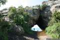 | Cave Landing This half-mile round trip hike descends 100 feet to a natural rock bridge at the end of a headland east of Avila Beach. |
 | Oso Flaco Lake Trail This hike of 2 miles or more takes a boardwalk over a coastal lake and across sand dunes to an out-of-the-way beach. |
 | Johnson Ranch Loop This 2.5 to 3.7-mile loop explores a grassy open space just south of San Luis Obispo. |
 | Johnson Ranch - Irish Hills Connector Trail This scenic 5-mile point-to-point hike connects Johnson Ranch Open Space with Irish Hills Natural Reserve. |
 | More hikes in San Luis Obispo Explore other trails around San Luis Obispo including Morro Bay State Park, Montaña de Oro State Park, and the Morros. |
Common Questions about Bob Jones City to the Sea Bike Trail in Avila Beach and Avila Valley
- Is the trail open?
- Yes. You should expect to find that Bob Jones Bike Trail is open. There are no recent reports of trail closures. If you discover that the trail is closed, please help your fellow hikers by reporting a closure.
- Is this trail free to access?
- Yes, Bob Jones Bike Trail is free to access. No entrance fee, pass, or permit is required. If you discover that access rules have changed, please provide feedback on your experience.
- How much time does this hike take?
- It takes approximately 2 hours 15 minutes to hike Bob Jones Bike Trail. Individual hiking times vary. Add extra time for breaks and taking in the views.
- How long is this hike?
- The hike to Bob Jones Bike Trail is a 5 mile out and back with 50 feet of elevation change.
- Are dogs allowed on this trail?
- Yes, dogs are allowed on Bob Jones Bike Trail. The trail is open to hikers, bikes, dogs.
- Are there ocean views on this hike?
- Yes, Bob Jones Bike Trail offers views of the ocean.
- Where is the trailhead located?
- The trailhead for Bob Jones Bike Trail is located in San Luis Obispo, CA.
Trailhead Address:
7001 Ontario Road
San Luis Obispo, CA 93405
Trailhead Coordinates:
35.18565, -120.703016 - What are the driving directions to the start of the hike?
To get to the trailhead: From San Luis Obispo, take Highway 101 south to exit 196, San Luis Bay Drive. Turn right (west) at the top of the ramp. Then make an immediate left onto Ontario Road. Drive 0.8 miles and turn left into the park & ride lot for Bob Jones Trail.
View custom Google Maps directions from your current location.
- Are there other trails near Bob Jones Bike Trail?
- Yes, you can find other nearby hikes using the Hikespeak Hike Finder Map.

we really enjoy taking the BJT to Avila for Friday Farmer’s Market; the parking lot near the trail head is easy to get to . . . some day the BJT will go all the way to SLO.
[…] made our way over to the serene, 5 mile (round trip) “Bob Jones City to Sea” bike path (map here), parking just past the KOA Campground on Ontario Road. This mostly paved path took us under tree […]
[…] Bob Jones Trail […]
An easy 5-mile walk or run. Mostly 0 incline. Beautiful vegetation and views, but can get a little crowded if there are a lot of bikers and strollers trying to pass. It would be great to see this trail get extended, as it is, it’s not much of a bike ride unless you’re bringing kids along.
Check out my detailed blog review of this amazing trail at https://adulthoodinslo.wordpress.com/2016/07/18/bob-jones-city-to-the-sea-bike-trail/ !
I would like to know what the large steel posts with flat iron tops are popping up all over the place on the South side of the Bob Jones trail. I’m just curious. I can’t find any information on line.
As of Sep 2016, there is a sign on the trail that explains the mystery. “The Stilted Garden. In 2006, SLO County issued building permits to build 22 vacation units here. Foundations were installed to support the units above the flood plain. The permits expired in 2011 because waste water disposal had not been determined.”
I want to know who is responsible for the Bob Jones Pathway between San Luis Bay Drive and its end. I want to do an earthcache for geocaching.com. There would be no physical alteration but merely a website to direct geocachers to the sign at the Uplifted Monterey Shale at N 35 11.247 W 120 43.575. Permission by geocaching.com is necessary to promote this earthcache and I need to contact the party responsible for this part of the bike trail.
This is a great trail for a leisurely walk or ride, and easy for seniors/kids. One will routinely see families/strollers/joggers/bikes/walkers. If you’re looking for a more strenuous hiking or biking workout, this isn’t it. It’s a great option for those who want a low-key outing.