McMenemy Trail Montecito hike Los Padres National Forest Overlook Santa Ynez Mountains San Ysidro Canyon Trail, Santa Barbara, California
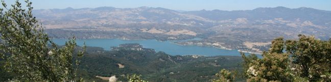
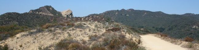
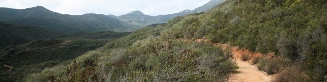
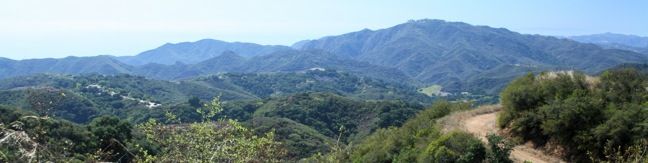
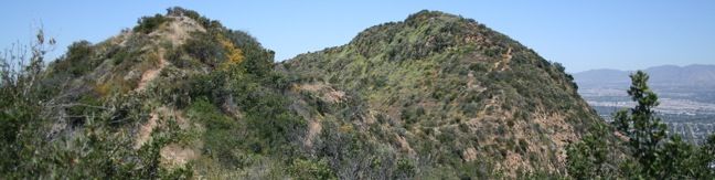
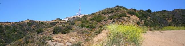
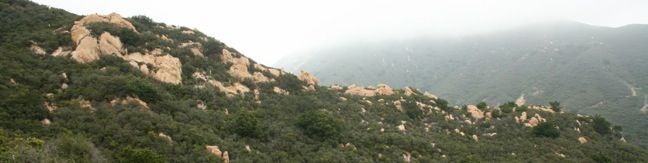
This 3.7-mile hike combines four trails (San Ysidro Canyon Trail, McMenemy Trail, Girard Trail, and Edison Catway Fire Road) to form a loop through the mountains behind Montecito, California. The trails ascend 1,000 feet, providing good exercise and views. From San Ysidro Trailhead, begin hiking inland on the wide trail that passes through a neighborhood before reaching Los Padres National Forest. ...Read more.
My Hikes: Completed hikeA green icon of shows a picture of a landscape with a check mark in the upper right corner, signifying that this is a hike you would like to put on your completed list.OK! Add to trails I've hiked
My Hikes: Want to hikeA green icon of shows a picture of a landscape with a heart in the upper right corner, signifying that this is a hike you would like to put on your to-do list.OK! Add to trails I want to hike
TagsA green icon depicting a tags represents a list of words and phrases that this content is tagged with Tagged with · Free Trails · Los Padres National Forest · Ocean Views · Santa Ynez Mountains
Hike DistanceA green icon of a hiker used to label information about the length of the hike Distance: 3.7 miles · Elevation change: 1000 feet
By: Published: Last updated: December 5, 2025
Santa Barbara Outdoors Tequepis Trail Santa Ynez Mountains hike Lake Cachuma Circle V Camp
Tequepis Trail begins near the shores of Lake Cachuma and ascends the north side of the Santa Ynez Mountains behind Santa Barbara. The trail up offers views of the lake and valley, and there are broader ocean views from the top. This is an invigorating 8.4-mile round trip hike with 2,300 feet of elevation gain. To reach Tequepis Trail, start at the free parking lot at the entrance of Circle V Camp. ...Read more.
My Hikes: Completed hikeA green icon of shows a picture of a landscape with a check mark in the upper right corner, signifying that this is a hike you would like to put on your completed list.OK! Add to trails I've hiked
My Hikes: Want to hikeA green icon of shows a picture of a landscape with a heart in the upper right corner, signifying that this is a hike you would like to put on your to-do list.OK! Add to trails I want to hike
TagsA green icon depicting a tags represents a list of words and phrases that this content is tagged with Tagged with · Free Trails · Los Padres National Forest · Ocean Views · Topatopa Mountains
Hike DistanceA green icon of a hiker used to label information about the length of the hike Distance: 8.4 miles · Elevation change: 2300 feet
By: Published: Last updated: December 5, 2025
Santa Ynez Canyon Trail to Eagle Rock in Topanga State Park in the Santa Monica Mountains, Los Angeles, Vereda de La Montura, Pacific Palisades, Sunset Boulevart, Hike, trail, sandstone summit
The craggy sandstone summit of Eagle Rock rises over Topanga State Park, delivering panoramic views of the Santa Monica Mountains. The shortest trail to awesome prominence is a four-mile hike from Trippet Ranch to Eagle Rock. For a more challenging trek, explore this 7.4-mile round trip hike ascending 1,400 feet from Santa Ynez Canyon to the 1,957-foot summit of Eagle Rock. ...Read more.
My Hikes: Completed hikeA green icon of shows a picture of a landscape with a check mark in the upper right corner, signifying that this is a hike you would like to put on your completed list.OK! Add to trails I've hiked
My Hikes: Want to hikeA green icon of shows a picture of a landscape with a heart in the upper right corner, signifying that this is a hike you would like to put on your to-do list.OK! Add to trails I want to hike
TagsA green icon depicting a tags represents a list of words and phrases that this content is tagged with Tagged with · California State Parks · Creeks · Free Trails · Pacific Palisades · Summits · Topanga · Santa Monica Mountains · Topanga State Park
Hike DistanceA green icon of a hiker used to label information about the length of the hike Distance: 7.4 miles · Elevation change: 1400 feet
By: Published: Last updated: December 5, 2025
Upper Solstice Canyon Trail Malibu Castro Crest from Corral Canyon Road through Upper Solstice Canyon in the Santa Monica Mountains
Between Corral Canyon Road and Castro Crest, the Backbone Trail passes though a remote segment of the Santa Monica Mountains know as Upper Solstice Canyon. While it is possible to feel quite removed at the bottom of this trail, the high ridges on both ends provide such sweeping views as to immediately restore your sense of place. From Corral Canyon Road to Castro Crest is 5. ...Read more.
My Hikes: Completed hikeA green icon of shows a picture of a landscape with a check mark in the upper right corner, signifying that this is a hike you would like to put on your completed list.OK! Add to trails I've hiked
My Hikes: Want to hikeA green icon of shows a picture of a landscape with a heart in the upper right corner, signifying that this is a hike you would like to put on your to-do list.OK! Add to trails I want to hike
TagsA green icon depicting a tags represents a list of words and phrases that this content is tagged with Tagged with · Agoura Hills · Backbone Trail · Free Trails · Malibu · Santa Monica Mountains National Recreation Area · Dog-Friendly Trails · Mountain Biking Trails · Santa Monica Mountains
Hike DistanceA green icon of a hiker used to label information about the length of the hike Distance: 5.5 miles · Elevation change: 540 feet
By: Published: Last updated: December 7, 2025
Castro Crest from Latigo Canyon Road Malibu hike Castro Crest Backbone Trail Santa Monica Mountains
Castro Crest is located 1.4 miles from Latigo Canyon Road up a pleasant section of the Backbone Trail. The crest offers excellent views over Malibu's Santa Monica Mountains, with the option to continue another half-mile up Castro Peak. The summit may not be reached however, as it is privately owned and extremely closed to the public. Another popular extension is to continue on the Backbone Trail for another 2. ...Read more.
My Hikes: Completed hikeA green icon of shows a picture of a landscape with a check mark in the upper right corner, signifying that this is a hike you would like to put on your completed list.OK! Add to trails I've hiked
My Hikes: Want to hikeA green icon of shows a picture of a landscape with a heart in the upper right corner, signifying that this is a hike you would like to put on your to-do list.OK! Add to trails I want to hike
TagsA green icon depicting a tags represents a list of words and phrases that this content is tagged with Tagged with · Backbone Trail · Free Trails · Malibu · Santa Monica Mountains National Recreation Area · Dog-Friendly Trails · Mountain Biking Trails · Santa Monica Mountains
Hike DistanceA green icon of a hiker used to label information about the length of the hike Distance: 3.8 miles · Elevation change: 650 feet
By: Published: Last updated: December 9, 2025
Runyon Canyon Park Hollywood Hike dog park dog-friendly Runyon Canyon Park is one of the most popular hiking destinations in Los Angeles best hike LA
Runyon Canyon Park is one of the most popular hiking destinations in Los Angeles and often shows up on publishers' lists of best hikes in LA. This 130-acre dog park is located in Hollywood on the east end of the Santa Monica Mountains, providing hikers with a few overlapping loops and great views over Hollywood. For a quick Runyon Canyon hike, try a 1. ...Read more.
My Hikes: Completed hikeA green icon of shows a picture of a landscape with a check mark in the upper right corner, signifying that this is a hike you would like to put on your completed list.OK! Add to trails I've hiked
My Hikes: Want to hikeA green icon of shows a picture of a landscape with a heart in the upper right corner, signifying that this is a hike you would like to put on your to-do list.OK! Add to trails I want to hike
TagsA green icon depicting a tags represents a list of words and phrases that this content is tagged with Tagged with · Free Trails · Hollywood · Dog-Friendly Trails · Santa Monica Mountains
Hike DistanceA green icon of a hiker used to label information about the length of the hike Distance: 2.65 miles · Elevation change: 700 feet
By: Published: Last updated: December 7, 2025
Cahuenga Peak Hike Griffith Peak Hollywood Sign trail Wonder View Griffith Park Hollywood Sign Wonder View Trail Wisdom Tree Hike Burbank Peak
Cahuenga Peak is the highest summit in Griffith Park with excellent views of Los Angeles, Burbank, and that iconic landmark - the Hollywood Sign. Visit the Cahuenga Peak, Burbank Peak, and Mount Lee on a rugged two-trail outing. Burbank Peak Trail (formerly Wonder View Trail) climbs from the west, passing a mini-summit viewpoint on the ridge of Cahuenga Peak known as Burbank Peak (home of the Wisdom Tree) Aileen Getty Ridge Trail goes from Burbank Peak up over the top of Cahuenga Peak and along a ridge to the Hollywood Sign at the top of Mount Lee Combine Burbank Peak Trail and Aileen Getty Ridge Trail for a hike to three summits that is 3 miles round trip with 875 feet of elevation change. ...Read more.
My Hikes: Completed hikeA green icon of shows a picture of a landscape with a check mark in the upper right corner, signifying that this is a hike you would like to put on your completed list.OK! Add to trails I've hiked
My Hikes: Want to hikeA green icon of shows a picture of a landscape with a heart in the upper right corner, signifying that this is a hike you would like to put on your to-do list.OK! Add to trails I want to hike
TagsA green icon depicting a tags represents a list of words and phrases that this content is tagged with Tagged with · Free Trails · Hollywood · Summits · Dog-Friendly Trails · Griffith Park · Santa Monica Mountains
Hike DistanceA green icon of a hiker used to label information about the length of the hike Distance: 3 miles · Elevation change: 875 feet
By: Published: Last updated: December 5, 2025
Hollywood Sign Hike Griffith Park Los Angeles Canyon Drive Franklin trail Lake Hollywood
Want to hike to the Hollywood Sign? One way to get there is a 6.4-mile hike through Griffith Park that summits Mount Lee directly behind the iconic lettering. Beyond just gazing up at the sign, the hike offers the opposite perspective, a chance to look down at the city below. The moderate day hike gains 1,050 feet of elevation over wide fire roads, and the last mile is actually paved. ...Read more.
My Hikes: Completed hikeA green icon of shows a picture of a landscape with a check mark in the upper right corner, signifying that this is a hike you would like to put on your completed list.OK! Add to trails I've hiked
My Hikes: Want to hikeA green icon of shows a picture of a landscape with a heart in the upper right corner, signifying that this is a hike you would like to put on your to-do list.OK! Add to trails I want to hike
TagsA green icon depicting a tags represents a list of words and phrases that this content is tagged with Tagged with · Free Trails · Hollywood · Summits · Dog-Friendly Trails · Griffith Park · Santa Monica Mountains
Hike DistanceA green icon of a hiker used to label information about the length of the hike Distance: 6.4 miles · Elevation change: 1050 feet
By: Published: Last updated: December 7, 2025
Primrose Lake Trail Sequoia National Park backcountry hike
If you are hiking to Sky Blue Lake in the high mountain backcountry of Sequoia National Park, There are nearby lakes worth visiting. Primrose Lake, is located just off the side of Miter Basin and is a scenic destination. To get to Primrose Lake, follow Upper Rock Creek to Miter Basin. Pass the Major General on the right and turn left up the last cirque before the ridge that separates Primrose Lake from Sky Blue Lake at the top of the basin (see the map below for a visual explanation). ...Read more.
My Hikes: Completed hikeA green icon of shows a picture of a landscape with a check mark in the upper right corner, signifying that this is a hike you would like to put on your completed list.OK! Add to trails I've hiked
My Hikes: Want to hikeA green icon of shows a picture of a landscape with a heart in the upper right corner, signifying that this is a hike you would like to put on your to-do list.OK! Add to trails I want to hike
TagsA green icon depicting a tags represents a list of words and phrases that this content is tagged with Tagged with · Backpacking · Free Trails · Lakes · Lone Pine · National Parks · Off Trail
Hike DistanceA green icon of a hiker used to label information about the length of the hike Distance: 28 miles · Elevation change: 2350 feet
By: Published: Last updated: December 5, 2025
New Army Pass sierra nevada mountains sequoia national park hiking trail john muir wilderness
New Army Pass lies at the end of Cottonwood Lakes Trail, 7.5 miles from Horseshoe Meadow. The pass provides off-trail ascents to two nearby summits, Mount Langley and Cirque Peak. A trail down the northwest side of the pass ventures into Sequoia National Park with access to countless backcountry destinations including Lower Soldier Lake, Sky Blue Lake, and Mount Pickering. ...Read more.
My Hikes: Completed hikeA green icon of shows a picture of a landscape with a check mark in the upper right corner, signifying that this is a hike you would like to put on your completed list.OK! Add to trails I've hiked
My Hikes: Want to hikeA green icon of shows a picture of a landscape with a heart in the upper right corner, signifying that this is a hike you would like to put on your to-do list.OK! Add to trails I want to hike
TagsA green icon depicting a tags represents a list of words and phrases that this content is tagged with Tagged with · Backpacking · Free Trails · John Muir Wilderness · Lakes · Lone Pine · National Parks · Pacific Crest Trail
Hike DistanceA green icon of a hiker used to label information about the length of the hike Distance: 19.2 miles · Elevation change: 2300 feet
By: Published: Last updated: December 5, 2025

Tag!

You've come to a tag page, one of the blogiest ways to browse hikespeak.com.

Here are some more tags. The most common tags are the big ones at the top of the list. Have a look around. You may also find what you seek with the search feature on the Hike Finder Map.

Free TrailsNational ParksOcean ViewsCalifornia State ParksSummitsWaterfallsTent CampingCreeksLakesNature TrailsAngeles National ForestMalibuAdventure PassCascade RangeNew Zealand Department of ConservationDesert CanyonsOff TrailWildflowersLos Padres National ForestBeachesNew Zealand National ParksMountains Recreation and Conservation AuthorityGriffith ParkSan Gabriel Mountains National MonumentWheelchair-FriendlyBig SurCampervan CampingRuinsSequoia GrovesOregon State ParksLos OsosHollywoodCavesBackpackingHydrothermalPacific Crest TrailMontaña de Oro State ParkTopanga State ParkRedwood GrovesAustralian National ParksYosemite ValleySanta Monica Mountains National Recreation AreaSanta Ynez MountainsAltadenaIrish HillsTopangaBureau of Land ManagementAgoura HillsMalibu Creek State ParkArchesLookout TowersBorrego SpringsTrail CampPacific PalisadesBoulderingLone PineMorrosBackbone TrailLavaWest Hills of PortlandColumbia River Gorge National Scenic AreaTualatin MountainsDeschutes National ForestBendMinesMammoth LakesGiant ForestArthur's Pass National ParkGrand JunctionWalk-in CampingTongariro National ParkFruitaNevada State ParksArthur's Pass VillageRotoruaTide PoolsLa Cañada FlintridgeAzusaCleveland National ForestMorro BayLava TubesArcadiaAccommodationsOvertonIsland in the SkyJohn Muir TrailGoletaPasadenaZion CanyonTasmania's 60 Great Short WalksHot SpringsCalabasasMount CookForest ParkAoraki Mount Cook National ParkGolden Trout WildernessVerdugo MountainsBoardwalksGaviota State ParkClaremontSanta Lucia MountainsNorthwest PortlandBadlandsPhillip IslandGrand Canyon of the YellowstoneRainforestsTillamookSan Bernardino National ForestVolcanoesClosedLas VegasShasta-Trinity National ForestGeyser BasinsBrentwoodButtesVolcanoSan Ysidro MountainsMorro Bay State ParkThousand OaksOakhurstNewbury ParkPetroglyphsMorterosGrant GroveStairsAdirondack MountainsFreycinet PeninsulaColes BayPalos Verdes PeninsulaSand DunesOnondaga CountyGiant Sequoia National MonumentAdirondack ParkGifford Pinchot National ForestTopatopa MountainsAnsel Adams WildernessWestridge-Canyonback Wilderness ParkSanta Ana MountainsSilver Moccasin TrailWestern Divide Ranger DistrictMemorialsLighthousesOhakuneTrabuco Ranger DistrictOrange County ParksSan Bernardino MountainsTasman PeninsulaJohn Muir WildernessPaicinesWestern DivideSunriverPoint Mugu State ParkFreycinet National ParkOjaiPfeiffer Big Sur State ParkHobartSistersNatural BridgesSouth Lake TahoeNewberry National Volcanic MonumentCastle Crags State ParkSouthwest PortlandWill Rogers State ParkHumboldt Redwoods State ParkReservoir Canyon Natural ReserveMount Hood National ForestMount ShastaWhakapapa VillageContinental DivideTopanga CanyonMount HoodDomesThree Capes Scenic RouteLeo Carrillo State ParkLava Butte Lava FlowCratersOasesTarzanaWater SlidesNelder GroveWashington State ParksStevensonCliff JumpingPicnic AreaJulia Pfeiffer Burns State ParkGovernment CampRancho Palos VerdesCambriaPearblossomWildlife ViewingSouth Coast WildernessLaguna BeachJulianWind CavesGoing-to-the-Sun RoadSilver Peak WildernessMoabSpringvilleYellowstone RiverNewhallAvila BeachTemescal Gateway ParkSan Vicente Mountain ParkWawonaHawaii State ParksMontecitoMount William National ParkSan Jacinto Ranger DistrictLos Robles Open SpaceBinghamton University Nature PreserveSwimming HolesVestalPalomar Ranger DistrictCalifornia Coastal TrailBlack HillsLabrador Hollow Unique AreaCortland CountyTullyNew York State ForestsTasman National ParkKlamath MountainsGlacier LakesIdyllwildBurbankSublimityTanksWaiotapuSilver Falls State ParkSan Jacinto MountainsCedar GroveCamp ShermanHutsBeacon Rock State ParkDeschutes RiverObservatoriesColumbia River GorgePortlandTaurangaLyleDeschutes River State Recreation AreaCarpinteriaFish HatcheryWenatche National ForestSherman OaksCinder ConesCrestlineLake ElsinoreMurrietaRichardson Grove Redwoods State ParkElephant SealsBritzRocky MountainsSan Mateo Canyon WildernessCusterPlacerita Canyon State ParkRedwood Mountain GroveHume Lake Ranger DistrictCal PolyCrystal Cove State ParkTwentynine PalmsSanta Susana MountainsGlaciersBeverly HillsNicholas Flat Natural PreserveSouthern AlpsCatalina IslandSanta PaulaPlacerita Canyon Natural AreaConejo ValleyWoodland HillsSanta MargaritaSimi HillsOkukuPepperwoodBishop Peak Natural ReserveTryon Creek State Natural AreaSnowshoeingNew York State ParksMount Thomas Forest Conservation AreaWaimangu Volcanic ValleyLake Tahoe Basin National Forest LandsWascoSierra Pelona MountainsBlowholesCrescent CityEmma Wood State BeachHiloTe AwamutuMount WellingtonWellington ParkPictographsLauncestonAndrew Molera State ParkSaltwater RiverEaglehawk NeckCastle Crags WildernessSummit Valley Edmund D. Edelman ParkWaipio ValleySan PedroTaupoLodgeSummit ValleyTujungaSun ValleyGlendalePuakoLimekiln State ParkMarvin Braude Mulholland Gateway ParkOkere Falls Scenic ReserveHood RiverMacleay ParkWilsons Promontory National ParkCampervan ReviewCampervan RentalArroyo GrandeWillamette National ForestAvila ValleyMount Field National ParkTree MoldsBlue Mountain LakeRangitikeiOkere FallsWhananaki NorthBike TrailSheep Mountain WildernessSanta Rosa and San Jacinto Mountains National MonumentAgua DulceFallbrookMonserate Mountain PreserveSan SimeonTauwhara BayOtamure Recreation ReserveOtamure BayHokianga HarbourFallbrook Land ConservancyKoalasCape Woolamai State Faunal ReserveLiffeyLiffey Falls State ReserveGreat Western TiersSaint Columba Falls State ReservePyenganaVasquez Rocks Natural Area ParkJamesvilleNewport BeachNewport BayUpper Newport Bay Nature PreserveWest HillsFreeride TrailsEl Capitán State BeachWeir Canyon Wilderness ParkSantiago Oaks Regional ParkAnaheimPlaya VistaDocent-led HikesWhitewater PreserveOnondaga County ParkBaldwinsvilleBeaver Lake Nature CenterClark Reservation State ParkDouglas-Apsley National ParkBechinoMatamataMuruparaFiscalini Ranch PreserveWhitewater RaftingTop 10 Holiday ParkPapamoaAerial GreenwayManhattanHigh LineMount MaunganuiBoat CruiseCrazy Horse MemorialSatellite CommunicatorsSOS BeaconsGPS NavigatorsSanta Lucia WildernessLord of the RingsHobbitonCataract Gorge ReserveBerriedaleYucca ValleySan Rafael HillsB&BBackpackers LodgeBel AirGuy W. Talbot State ParkEugeneMission Trails Regional ParkTurangiSanteeConcretionsMangawekaHuntervilleMotor LodgeMalibu Lagoon State BeachSespe WildernessBisonStudio CityHollywood HillsCastaicSanta ClaritaArcoPalos Verdes EstatesDuarteJennerFort BraggOrickWeottMyers FlatGarbervillePortervilleMaricopaCooke CityDevils TowerCarpinteria Seal SanctuaryApp ReviewLake Tikitapu Scenic ReserveSalt Point State ParkMacKerricher State ParkPrairie Creek Redwoods State ParkJedediah Smith Redwoods State ParkCulver CityVentura RiverCucamonga WildernessBaldwin Hills Scenic Overlook State ParkEl Chorro Regional ParkKenneth Hahn State Recreation AreaLake MichiganTuna Canyon ParkStroller-FriendlyPismo BeachAmboyPeters Canyon Regional ParkOrangeWarner SpringsPalomar MountainsPrimitive CampingRefugio State BeachMonroviaMonrovia Canyon ParkSanta Clarita Woodlands ParkCayucosHarmony Headlands State ParkKings CanyonBanningSan Jacinto WildernessMount San Jacinto State ParkFayettevilleGetty View ParkHearst San Simeon State ParkCalaveras Big Trees State ParkCanoe & KayakSimi ValleyCarbon Canyon Regional ParkBreaSan BernardinoLas CrucesCarpinteria Bluffs Nature PreserveSonoraCarpinteria Salt Marsh Nature ParkCross Country SkiingBig Bear LakeAmboy Crater National Natural LandmarkLaguna Coast Wilderness ParkHuntington BeachCentral ParkGreen Lakes State ParkKura Tawhiti / Castle Hill Conservation AreaPu‘uhonua O Hōnaunau National Historical ParkCamassia Natural AreaHappy ValleyAtascaderoCape Kiwanda Natural AreaPacific CityCape Meares State Scenic ViewpointEcola State ParkCannon BeachMosierWillamette RiverOregon CityMojave Trails National MonumentWest LinnThe Nature ConservancyHonomuArchie Briggs Natural AreaKohala Forest ReserveShevlin ParkTumalo CreekKonaFishpondsMarquam Nature ParkSiletz Bay National Wildlife RefugeDepoe BayLincoln CityCape Lookout State ParkShasta LakePalouse Falls State ParkArroyo Sequit ParkArboretumsKlamathMontagueTualatin Hills Nature ParkBeavertonWeedCorbettGeorge Himes Nature ParkMcKenzie BridgeClatskanieWhite SalmonCamasKlamath National ForestLake ArrowheadOceano Dunes State Vehicular Recreation AreaNipomoLas Virgines View ParkEldorado State ParkColorado State ParksBoulderAdirondack High PeaksLaCrosseLake PlacidCascade LocksSeasideSkyforestLacamas Lake Regional ParkAwbrey ButteCape Meares State ParkUpper Ojai ValleyDunsmuirWelchesPowell Butte Nature ParkGlenbrookOceansideCastle HillRhododendronMount Lowe RailwayBass LakeLongridge ParkOak ParkSoutheast PortlandPilot Butte State ParkHonaunauNative American HeritageYurtsPetrified LogsCarson City