Johnson Ranch Open Space loop hike San Luis Obispo trail Johnson Ranch Trail
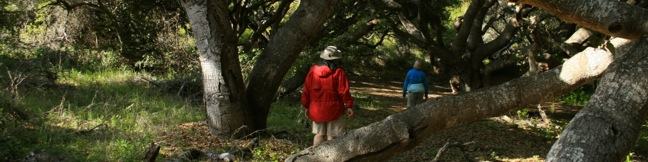
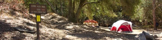
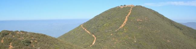
Johnson Ranch Open Space preserves 242 acres of old ranch land just south of San Luis Obispo. The 3.7-mile Johnson Ranch Loop explores the municipal open space, which is dominated by rolling grassy hills accented by serpentine rocks. A shortcut can be used to trim the hike to 2.5 miles. There is 200 feet of total elevation between the high and low points of the hike, a distance that is... Read more.
My Hikes: Completed hikeA green icon of shows a picture of a landscape with a check mark in the upper right corner, signifying that this is a hike you would like to put on your completed list.OK! Add to trails I've hiked
My Hikes: Want to hikeA green icon of shows a picture of a landscape with a heart in the upper right corner, signifying that this is a hike you would like to put on your to-do list.OK! Add to trails I want to hike
TagsA green icon depicting a tags represents a list of words and phrases that this content is tagged with Tagged with · Free Trails
Hike DistanceA green icon of a hiker used to label information about the length of the hike Distance: 3.7 miles · Elevation change: 200 feet
By: Published: Last updated: April 2, 2019
Dune Trail Montaña de Oro State Park Hazard Canyon Reef hike tide pools trail Los Osos California San Luis Obispo
For a quick one-mile jaunt in Montaña de Oro State Park, hike down Dune Trail to Hazard Canyon Reef. At the bottom of this oceanfront ravine is a rocky shoreline graced with engaging tide pools. Explore up or down the coast to extend your stay, or settle in for a picnic on the sandy beach. The postcard views of Morro Rock are a good reason to stick around. The trail begins from Hazard... Read more.
My Hikes: Completed hikeA green icon of shows a picture of a landscape with a check mark in the upper right corner, signifying that this is a hike you would like to put on your completed list.OK! Add to trails I've hiked
My Hikes: Want to hikeA green icon of shows a picture of a landscape with a heart in the upper right corner, signifying that this is a hike you would like to put on your to-do list.OK! Add to trails I want to hike
TagsA green icon depicting a tags represents a list of words and phrases that this content is tagged with Tagged with · California State Parks · Free Trails · Los Osos · Ocean Views · Tide Pools · Montaña de Oro State Park
Hike DistanceA green icon of a hiker used to label information about the length of the hike Distance: 1 mile · Elevation change: 100 feet
By: Published: Last updated: May 11, 2017
Los Osos Oaks California State Natural Reserve hike San Luis Obispo
The 90-acre Los Osos Oaks State Natural Reserve protects a pocket of 800-year-old oaks near San Luis Obispo, California. Los Osos Creek Trail, Chumash Trail, and Oak View Trail loop through the park presenting easy hikes between 0.75 and 1.5 miles. The trails pass beneath (and sometimes between) the gangly branches of pygmy oaks, offering quiet hikes through a shady grove. A bridge into... Read more.
My Hikes: Completed hikeA green icon of shows a picture of a landscape with a check mark in the upper right corner, signifying that this is a hike you would like to put on your completed list.OK! Add to trails I've hiked
My Hikes: Want to hikeA green icon of shows a picture of a landscape with a heart in the upper right corner, signifying that this is a hike you would like to put on your to-do list.OK! Add to trails I want to hike
TagsA green icon depicting a tags represents a list of words and phrases that this content is tagged with Tagged with · California State Parks · Free Trails · Los Osos
Hike DistanceA green icon of a hiker used to label information about the length of the hike Distance: 1.5 miles · Elevation change: 25 feet
By: Published: Last updated: October 8, 2024
Morro Dunes Ecological Reserve Bayview Loop Trail Los Osos Hike San Luis Obispo Montana de Oro California
The community of Los Osos on the San Luis Obispo County coast is buffered on the south side by an ecological reserve. A 2.6-mile hike through Morro Dunes Ecological Reserve (also called Bayview Ecological Reserve) ascends 800 feet, briefly entering Montaña de Oro State Park at the trail's highest point. The loop travels over ancient sand dunes that became grown over by grasses and brush. ... Read more.
My Hikes: Completed hikeA green icon of shows a picture of a landscape with a check mark in the upper right corner, signifying that this is a hike you would like to put on your completed list.OK! Add to trails I've hiked
My Hikes: Want to hikeA green icon of shows a picture of a landscape with a heart in the upper right corner, signifying that this is a hike you would like to put on your to-do list.OK! Add to trails I want to hike
TagsA green icon depicting a tags represents a list of words and phrases that this content is tagged with Tagged with · California State Parks · Free Trails · Los Osos · Morro Bay · Ocean Views · Sand Dunes · Montaña de Oro State Park
Hike DistanceA green icon of a hiker used to label information about the length of the hike Distance: 2.6 miles · Elevation change: 800 feet
By: Published: Last updated: May 11, 2017
El Moro Elfin Forest Natural Preserve hike boardwalk overlooking Morro Bay Estuary Los Osos Elfin Forest
Elfin Forest Natural Preserve (also know as Los Osos Elfin Forest and El Moro Elfin Forest Natural Area) lies between the communities of Morro Bay and Los Osos on the coast of San Luis Obispo County. A mile of boardwalk circles the 90-acre preserve, providing opportunities to gaze across Morro Bay and admire nearby peaks in Morro Bay State Park. There is a thin 80 feet of elevation gain... Read more.
My Hikes: Completed hikeA green icon of shows a picture of a landscape with a check mark in the upper right corner, signifying that this is a hike you would like to put on your completed list.OK! Add to trails I've hiked
My Hikes: Want to hikeA green icon of shows a picture of a landscape with a heart in the upper right corner, signifying that this is a hike you would like to put on your to-do list.OK! Add to trails I want to hike
TagsA green icon depicting a tags represents a list of words and phrases that this content is tagged with Tagged with · California State Parks · Free Trails · Los Osos · Morro Bay · Morro Bay State Park · Nature Trails · Ocean Views · Stroller-Friendly · Wheelchair-Friendly
Hike DistanceA green icon of a hiker used to label information about the length of the hike Distance: 1 mile · Elevation change: 80 feet
By: Published: Last updated: May 20, 2017
Gaviota State Park Tunnel View Trail Trespass Trail Loop Santa Barbara hike California Highway 101
On Tunnel View Trail, you can expect to see exactly what the name advertises, a view of the Gaviota Tunnel crossed by northbound traffic on Highway 101 between Santa Barbara and Buellton. You can also expect this 2.6 mile loop with 600 feet of elevation gain to deliver a rustic hiking experience up a narrow overgrown trail. If you could tune out the din of the freeway below, the trail would... Read more.
My Hikes: Completed hikeA green icon of shows a picture of a landscape with a check mark in the upper right corner, signifying that this is a hike you would like to put on your completed list.OK! Add to trails I've hiked
My Hikes: Want to hikeA green icon of shows a picture of a landscape with a heart in the upper right corner, signifying that this is a hike you would like to put on your to-do list.OK! Add to trails I want to hike
TagsA green icon depicting a tags represents a list of words and phrases that this content is tagged with Tagged with · California State Parks · Gaviota State Park · Goleta · Santa Ynez Mountains
Hike DistanceA green icon of a hiker used to label information about the length of the hike Distance: 2.6 miles · Elevation change: 600 feet
By: Published: Last updated: May 20, 2017
Big Sycamore Canyon Campground Point Mugu State Park Santa Monica Mountains Malibu Hike Los Angeles
Sycamore Canyon Campground sits just off the beach in Point Mugu State Park on the west end of the Santa Monica Mountains in Malibu. The 13,300-acre park boasts beautiful beaches, rocky peaks, and miles and miles of hiking trails. Tents and RVs are welcome attack this drive-up campground. In addition to beach access, Sycamore Canyon Campground provides fire rings, picnic tables, potable... Read more.
TagsA green icon depicting a tags represents a list of words and phrases that this content is tagged with Tagged with · Newbury Park · Ocean Views · Point Mugu State Park · Tent Camping · Santa Monica Mountains
By: Published: Last updated: February 5, 2025
Scenic and Overlook Trails Loop Point Mugu State Park Malibu Los Angeles California hiking trail Big Sycamore Canyon
Point Mugu State Park preserves a stunningly picturesque portion of the Santa Monica Mountains at the west end of Malibu. When you see park trails with names like Scenic Trail and Overlook Trail, you anticipate first class ocean views. Scenic and Overlook Trails Loop delivers the goods! This 2.7-mile hike climbs 425 feet to tremendous vistas atop a ridge west of Big Sycamore Canyon. The... Read more.
My Hikes: Completed hikeA green icon of shows a picture of a landscape with a check mark in the upper right corner, signifying that this is a hike you would like to put on your completed list.OK! Add to trails I've hiked
My Hikes: Want to hikeA green icon of shows a picture of a landscape with a heart in the upper right corner, signifying that this is a hike you would like to put on your to-do list.OK! Add to trails I want to hike
TagsA green icon depicting a tags represents a list of words and phrases that this content is tagged with Tagged with · California State Parks · Malibu · Newbury Park · Ocean Views · Point Mugu State Park · Mountain Biking Trails
Hike DistanceA green icon of a hiker used to label information about the length of the hike Distance: 2.7 miles · Elevation change: 425 feet
By: Published: Last updated: May 19, 2024
Cerro Alto Campground Los Padres National Forest San Luis Obispo Morro Bay camping camp
Ah, what could be finer than a night beneath the pines and oaks at a cozy campground in Los Padres National Forest? A peaceful camping experience awaits at Cerro Alto Campground, located just off Route 41 between Morro Bay and Atascadero in San Luis Obispo County. The year-round campground has 22 sites spread out along a mile-long road in an oak-shaded canyon below Cerro Alto. Sites at... Read more.
TagsA green icon depicting a tags represents a list of words and phrases that this content is tagged with Tagged with · Atascadero · Los Padres National Forest · Morro Bay · Tent Camping
By: Published: Last updated: January 8, 2019
Cerro Alto Los Padres National Forest San Luis Obispo Morro Bay Hike trail high point Cerro Alto Peak
The 2,624-foot summit of Cerro Alto is one of the highest points in San Luis Obispo County and delivers a panoramic view. It seems like you can see the entire county from the top of the commanding peak, including each of the volcanic peaks stretching between Morro Bay and Edna Valley, the Nine Sisters. There are a couple ways to the summit, each tackling 1,600 feet of elevation between the... Read more.
My Hikes: Completed hikeA green icon of shows a picture of a landscape with a check mark in the upper right corner, signifying that this is a hike you would like to put on your completed list.OK! Add to trails I've hiked
My Hikes: Want to hikeA green icon of shows a picture of a landscape with a heart in the upper right corner, signifying that this is a hike you would like to put on your to-do list.OK! Add to trails I want to hike
TagsA green icon depicting a tags represents a list of words and phrases that this content is tagged with Tagged with · Los Padres National Forest · Ocean Views · Summits
Hike DistanceA green icon of a hiker used to label information about the length of the hike Distance: 5.35 miles · Elevation change: 1600 feet
By: Published: Last updated: April 19, 2018