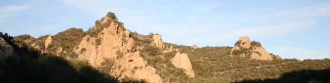
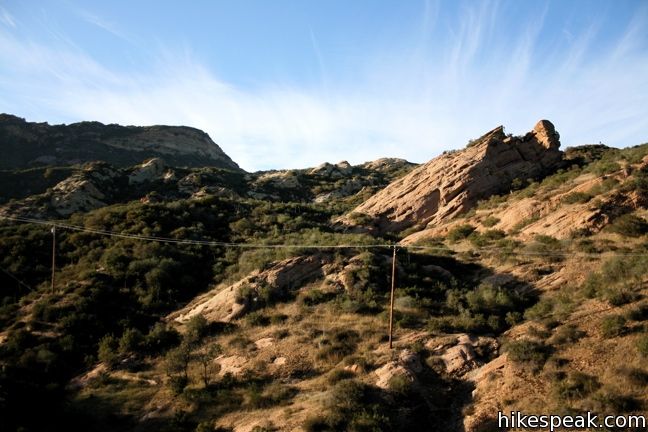
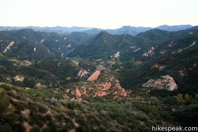
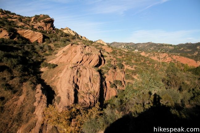
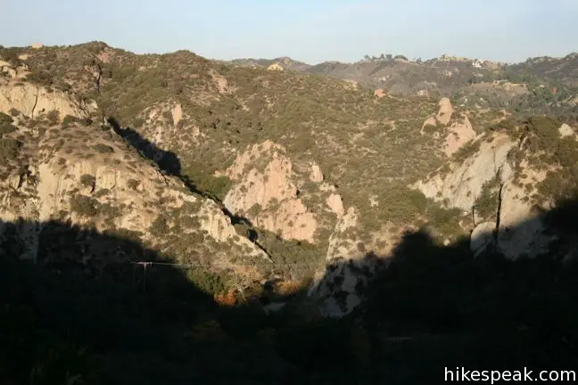
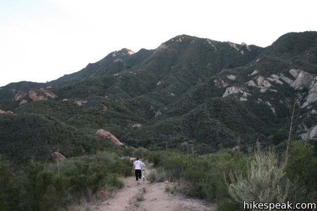
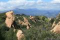
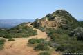
As the name implies, Red Rock Canyon is filled with impressive colorful sandstone. The red rocks stand out from their lush green surroundings to create a dramatic landscape. The canyon lies adjacent to Calabasas Peak, which can be visited in conjunction with the park to form an excellent excursion.
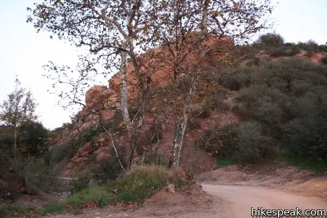
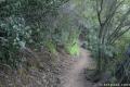
The park’s main entrance is located at the end of Red Rock Road. Main is in quotes because the park entrance is so hidden that one must drive down a narrow dirt road to reach it. First time visitors will be questioning their directions, but this only adds to the enchanting character of the park.
The other way to enter the park is by hiking in from Stunt Road along the Calabasas Peak Motorway. This adds some extra mileage but eludes a $5 parking fee.
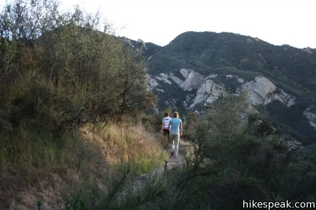
The park has two main trails, Red Rocks Overlook and Red Rock Motorway. Red Rock Motorway is a 1.2-mile long wide fire road that starts at the parking lot and progresses up to a T-junction with the Calabasas Peak Motorway. The junction is 1.1 miles from the summit of Calabasas Peak and 0.7 miles from Stunt Road. The total distance from the Red Rocks Trailhead to Calabasas Peak is 2.3 miles, and it is 1.9 miles from the Red Rocks Trailhead to Stunt Road.
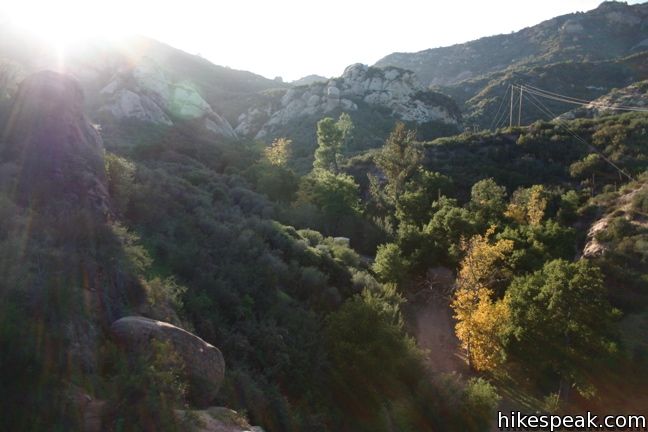
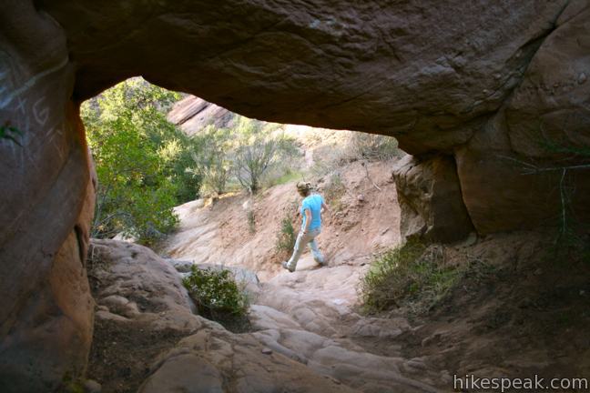
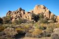
A third of a mile from the trailhead along Red Rock Motorway is a tall sandstone formation on the left that begs to be explored (and should be). Climb above the small caves to gain a sweeping view of Red Rock Canyon.
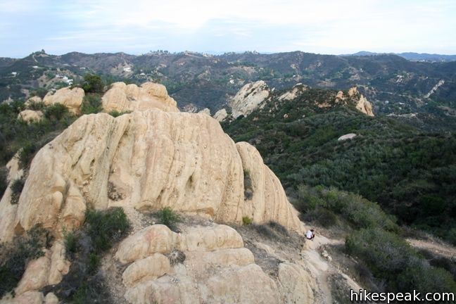
Not far beyond the caves comes a junction with the Overlook Trail. This unmarked single track breaks off to the right and climbs 325 feet over 3/4 of a mile to more outstanding Red Rock views. Those looking to break off trail and do some bouldering, will find good opportunities along the way.
How far am I hiking again? A lot of numbers have been thrown around, so here are the basic distances for hiking in the park:
- From Stunt Road to the overlook is 4.4 miles round trip
- From Red Rock Trailhead to the overlook is 2.4 miles round trip
- From Red Rock Trailhead to Calabasas Peak is 4.6 miles round trip
- From Red Rock Trailhead to the junction with the Calabasas Peak Motorway is 2.4 miles round trip
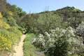
Red Rocks Canyon is an enchanting spot. The drive into the park makes you feel as though you are entering a remote and rustic location, even if you are only miles from the 101. Leashed dogs and bicycles are permitted. Bathrooms and a picnic area are at the trailhead.
To get to the trailhead: Take the Valley Circle Drive/Topanga Canyon Blvd. exit off the 101, and head south on Mulholland Drive. Turn right on Valmar Road which becomes Old Topanga Canyon Road. Turn right when the road comes to an end on Mulholland Highway Road. After a short distance, turn left to get back on Old Topanga Canyon Road. Stay on this road as it weaves through canyon neighborhoods, and turn right on to Red Rock Road. Stay on Red Rock Road as it becomes narrow and unpaved. Continue past all of the “no parking” and “no trespassing” signs until the road ends at the park.
Trailhead address: 23601 West Red Rock Road, Topanga Canyon, CA 90290
Trailhead coordinates: 34.1061, -118.6372 (34° 06′ 22″N 118° 38′ 13.9″W)
For directions to the Stunt Road trailhead, review Calabasas Peak.
View Santa Monica Mountains in a larger map
Or view a regional map of surrounding Los Angeles trails and campgrounds.


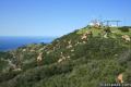
 | Calabasas Peak from Stunt Road This 3.6-mile hike on Calabasas Peak Motorway approaches Calabasas Peak from the south, ascending through sandstone formations to panoramic views of the Santa Monica Mountains and San Fernando Valley. |
 | Calabasas Peak from Old Topanga Canyon Road This 4.2-mile hike on Calabasas Peak Motorway approaches Calabasas Peak from the northeast, providing big views over Topanga and other parts of the Santa Monica Mountains. |
 | Calabasas Peak via Calabasas - Cold Creek Trail This 4.5-mile round trip hike starts up a scenic single track formerly know as the Secret Trail and ascends 750 feet to the summit of Calabasas Peak. |
 | Stunt High Trail to Saddle Peak This 7.5-mile hike combines Stunt High Trail and a section of the Backbone Trail to visit the 6th tallest summit in the Santa Monica Mountains. |
 | Backbone Trail to Saddle Peak This 2-mile hike approaches Saddle Peak from the east. |
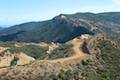
 | Hondo Canyon This section of the Backbone Trail crosses fields of grains and forests of bays, climbing 1,550 feet over 3.8 miles to a small ocean view. Extend the hike to Topanga Lookout for an incredible perspective over the Santa Monica Mountains. |
 | Topanga Lookout This 2-mile visits the site of an old fire tower that still offers great views of the surrounding mountains. |
 | Viewridge Trail This 3-mile hike in Summit Valley Edmund D. Edelman Park travels down a canyon on Viewridge Trail (also known Santa Maria Canyon Trail) to Summer Hill Ranch Road where there are sweeping views over Topanga and the Santa Monica Mountains from Canyon Overlook. |
 | More trails in the Santa Monica Mountains Explore other destinations in the range. |
 | Hidden Valley This one mile loop circles the interior of a small valley surrounded by tall rocks that serves as an excellent bouldering arena. |
 | Temescal Canyon in the Santa Monica Mountains This 2.6-mile loop offers a variety of scenery and decent exercise, despite its relative brevity. |
Great Hike. If you’re looking for a great L.A. experience without the buzz this is the place for you. We were there the first week of Jan 2012, mid 70’s and just saw one other hiking party (2). The views are spectacular with a variety of vistas, sand stone formations (climbing), foliage, and caves. A short stunning ride out of the area brings you to Malibu and the Pacific. Already planning to go back there next time in L.A. If you leave your camera you’ll be sorry.
Rick J. ( Gainesville, Fla. )
Hi. Thanks for sharing this hike. We just hiked during the rainy weekend so there was no on there, but and the skies cleared up before our hike! We did the overlook trail and trail towards Calabasas Peak, but couldn’t make it all the way with our newborn. We will return to do the whole hike. Thanks again for sharing these dog friendly hikes! This was one of our favorites.
I’m so glad I found this post about this trail. I have lived in Santa Monica over 10 years and never been here. Went on 10/11/2013 and it was great. Only saw 2 other people the whole time and trhey were on foot. I went on my mountain bike and going up the trail marked by the small Sign was great. Very easy to miss the trail. There is a small sign that says something about the trail being fixed by the eagle scouts or something. The sign is right next to a trash can and you will see some wooden steps off the main trail that lead you up to a small trail. The climb was pretty hard in certain areas on the bike due to how loose the gravel/sand is, but once I got to the top and turned around, the downhill was very Fun.! Stay on those breaks… haha, it is easy to get going very fast and even on the breaks full force sometimes didn’t stop me cause you just slide, but very good for the adrenal glands I uploaded a full video of the ride so you can see the trail if interested. Here is the vimeo link: https://vimeo.com/77086604
It is the entire ride so it is sped up a lot in sections and has timeplapse mixed in of 2 second frame grabs off the video. You can skip to just the down hill section if ya like at time 4:50
Red Rock Canyon is absolutely beautiful! I saw a couple other people while I was out there, but the views and rocks are stunning and there’s some great shaded areas and meditation spots (if you’re into that kind of thing.) Really lovely hiking trail.
?so darn cool all the rocks…
Choose it!
[…] Lookout, the former site of a fire tower, stands above Red Rock Canyon Park and continues to offer fine views of the Santa Monica Mountains, Calabasas, and the Santa Susana […]
It is such a treat seeing Red Rock Cyn being preserved. When I was a kid (I grew up in Topanga) this was a Boy Scout Camp, Camp Slauson. My troop had a cabin there where we had our weekly meetings. We also spent many weekends there although it played host to many kids from the city on weekends and we rather liked having the place to ourselves. I think I’ve walked almost every square inch of the place. The photos here bring back many memories. Many thanks for preserving this treasure.
FOUND YOUR CHILD’S RAY BAN PRESCRIPTION GLASSES on this great Hike – Mother’s Day – 2018