Los Osos Oaks State Natural Reserve
in San Luis Obispo
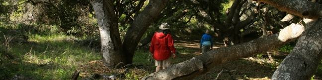
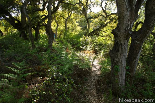
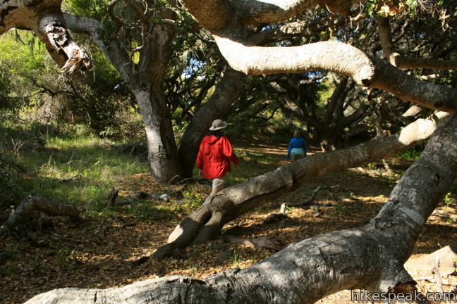
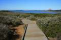
The 90-acre Los Osos Oaks State Natural Reserve protects a pocket of 800-year-old oaks near San Luis Obispo, California. Los Osos Creek Trail, Chumash Trail, and Oak View Trail loop through the park presenting easy hikes between 0.75 and 1.5 miles. The trails pass beneath (and sometimes between) the gangly branches of pygmy oaks, offering quiet hikes through a shady grove.
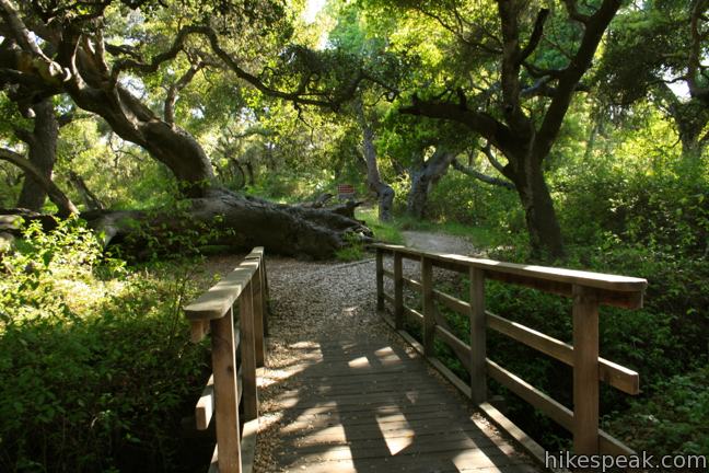
The quick stroll begins from a free parking area along Los Osos Valley Road. Enter the grove of coast live oaks, crossing a wooden footbridge to reach a three way split. The heart of the oak forest lies straight ahead on the east side of Chumash Loop Trail. Farther to the east is Los Osos Creek Trail, which passes the near stagnant waters of a seasonal stream.
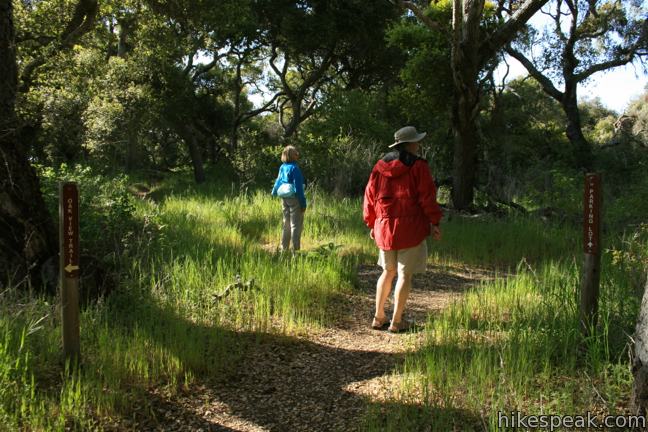
The west side of Chumash Loop Trail breaks off to the right and all three paths reunite farther to the south. At that point, the trails also join Oak View Trail, which offers another loop trail heading farther south through more oaks and chaparral woodlands. If these trail options sound overwhelming, don’t be concerned. Each trail offers a similar experience hiking beneath the oaks. See the map in the park brochure for a better understanding of the trails.
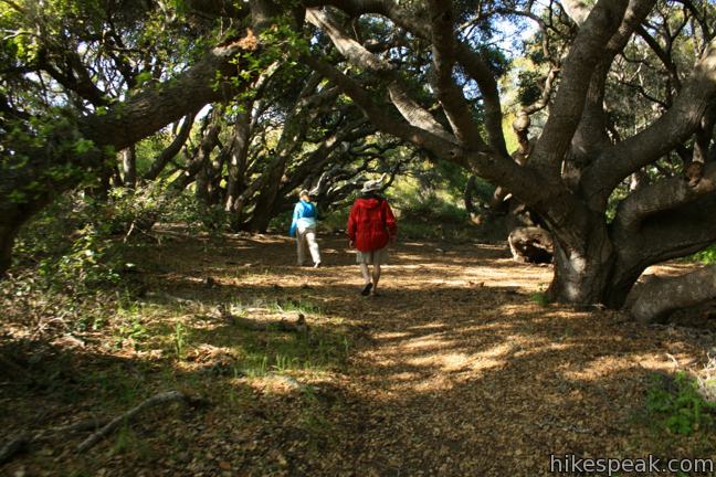
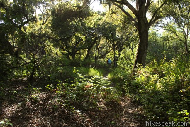
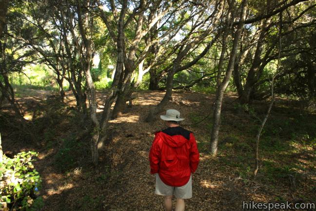
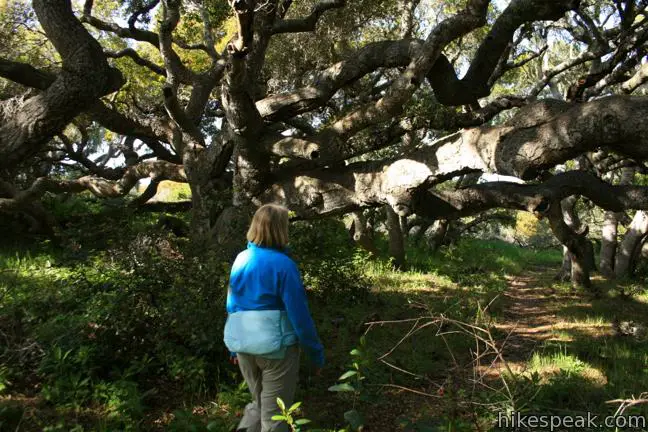
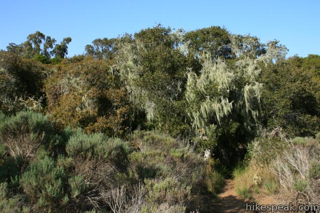
Start down any trail you like and make your way into the grove. Century old coast live oaks offer a dense canopy overhead. Grown upon ancient dunes, these oaks are stunted to about 30-feet tall. The oaks have broad sprawling limbs decorated by lace lichens. The mossy growths hang like a Santa Clause convention of white beards, adding further charm to the forest.
If you turn left on Los Osos Creek Trail, be sure to follow the trail when it curls to the right. If you remain parallel to the road, you will come to a sudden dead end on the bank of the creek’s murky pools. The preserve has a few unnamed side paths, but the major junctions are well marked, like intersections at the south end of Los Osos Creek Trail with both Oak View Trail and Chumash Loop Trail.
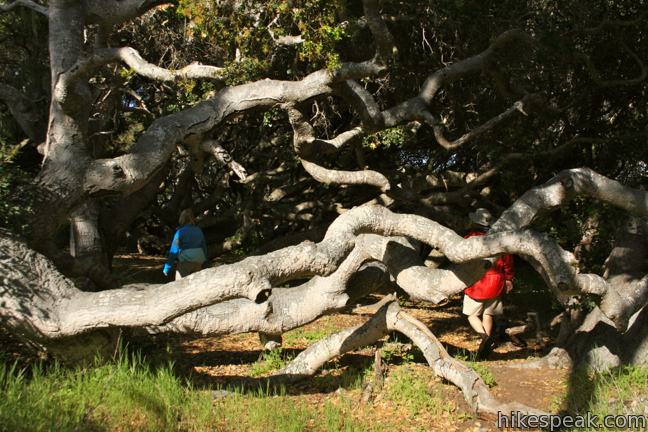
Return via either side of Chumash Trail for a 0.75-mile hike with 25 feet of elevation change. Oak View Trail circles farther to the south exploring more chaparral and oaks. No matter how far you hike in Los Osos Oaks State Natural Reserve, make a point to include a stroll on the section of Chumash Loop Trail that passes through the center of the park. Here long gangly oak branches spread across the trail to creating interesting obstacles that enrapture you in an enchanting world. Dogs are not allowed, but no fee or permit is required for this short hike in Los Osos Oaks State Natural Reserve, so get out and enjoy!
Directions to the Trailhead
- From Highway 101 south of San Luis Obispo, take exit 200A onto Los Osos Valley Road and drive 9 miles west.
- Turn left into a marked turnout for Los Osos Oaks (If you pass Palomino Drive on the right, you just missed it).
Trailhead Location
Trailhead address: 1813 Los Osos Valley Road, Los Osos, CA 93402
Trailhead coordinates: 35.306274, -120.81351 (35° 18′ 22.58″N 120° 48′ 48.64″W)
You may also view a regional map of surrounding Central Coast trails and campgrounds.


 | Morro Dunes Ecological Reserve This 2.6-mile loop serves up panoramic views over Morro Bay as it ascends 800 feet from Los Osos to Montaña de Oro State Park. |
 | Elfin Forest Natural Reserve This easy 1-mile loop on a boardwalk explores a pygmy forest on the edge of Morro Bay. |
 | Chumash & Crespi Trails Loop This 2.9-mile circuit in Morro Bay State Park visits an oak grove and bay views by combining Chumash Trail, Crespi Trail, and Hutash Trail. |
 | Dune Trail to Hazard Canyon Reef This one-mile hike in Montaña de Oro State Park descends an oceanfront ravine to a rocky shoreline graced with engaging tide pools. |
 | Valencia Peak This 4.5-mile hike summits a 1,347-foot peak with stunning views over Montaña de Oro. |
 | Bluff Trail This hike of around three miles tours tide pools, beaches, and impressive cliffs along the picturesque coast of Montaña de Oro State Park. |
 | More hikes in San Luis Obispo Explore other trails around San Luis Obispo including Montaña de Oro State Park and the Morros. |
- The park brochure for Los Osos Oaks (opens in a new tab)
- Los Osos Oaks on ohranger.com (opens in a new tab)
- Los Osos Oaks on ourhikingmystery.blogspot.com (opens in a new tab)
- Los Osos Oaks on wikipedia.org (opens in a new tab)
- The official website for Los Osos Oaks State Natural Reserve (opens in a new tab)
Common Questions about Los Osos Oaks State Natural Reserve in San Luis Obispo
- Is the trail open?
- Yes. You should expect to find that Los Osos Oaks State Reserve is open. There are no recent reports of trail closures. If you discover that the trail is closed, please help your fellow hikers by reporting a closure.
- Is this trail free to access?
- Yes, Los Osos Oaks State Reserve is free to access. No entrance fee, pass, or permit is required. If you discover that access rules have changed, please provide feedback on your experience.
- How much time does this hike take?
- It takes approximately 30 minutes to hike Los Osos Oaks State Reserve. Individual hiking times vary. Add extra time for breaks and taking in the views.
- How long is this hike?
- The hike to Los Osos Oaks State Reserve is a 1.5 mile loop with 25 feet of elevation change.
- Are dogs allowed on this trail?
- No, dogs are likely not allowed on Los Osos Oaks State Reserve. The trail is primarily open to hikers.
- Is Los Osos Oaks State Reserve good for kids?
- Yes, this hike is likely suitable for children. It is relatively short (1.5 miles) with manageable elevation gain.
- Where is the trailhead located?
- The trailhead for Los Osos Oaks State Reserve is located in Los Osos, CA.
Trailhead Address:
1813 Los Osos Valley Road
Los Osos, CA 93402
Trailhead Coordinates:
35.306274, -120.81351 - What are the driving directions to the start of the hike?
To get to the trailhead: From Highway 101 south of San Luis Obispo, take exit 200A onto Los Osos Valley Road and drive 9 miles west. Turn left into a marked turnout for Los Osos Oaks (If you pass Palomino Drive on the right, you just missed it).
View custom Google Maps directions from your current location.
- Are there other trails near Los Osos Oaks State Reserve?
- Yes, you can find other nearby hikes using the Hikespeak Hike Finder Map.

Are these trails accessible? I use an electric scooter for mobility.
This would not be the best option with an electric scooter. Consider checking out the nearby Elfin Forest instead.