Los Liones Trail
in the Santa Monica Mountains
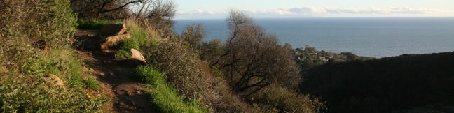
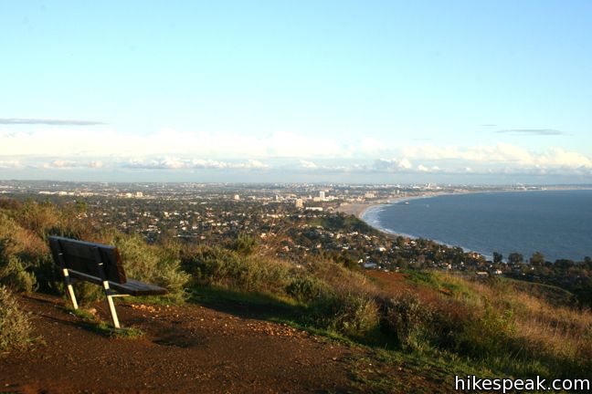
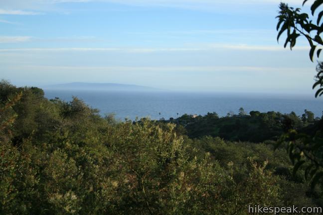
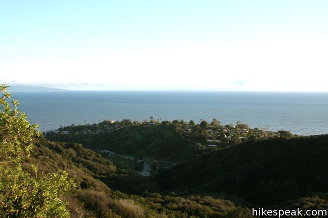
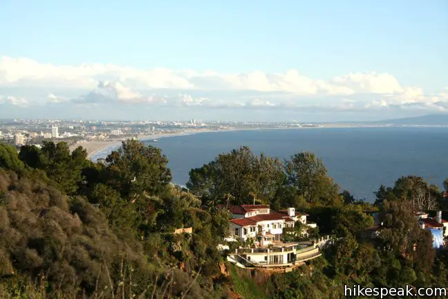
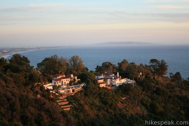
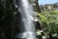
Los Liones Trail weaves up a lush canyon at the south end of Topanga State Park, just a mile from the Pacific Ocean. The ivy and chaparral-lined hike offers glimpses of Santa Monica Bay. After 1.3 miles and 550 feet of elevation gain, Los Liones Trail arrives at a clearing on a ridge at a bench that looks down on the Pacific Palisades, Santa Monica, and the ocean beyond.
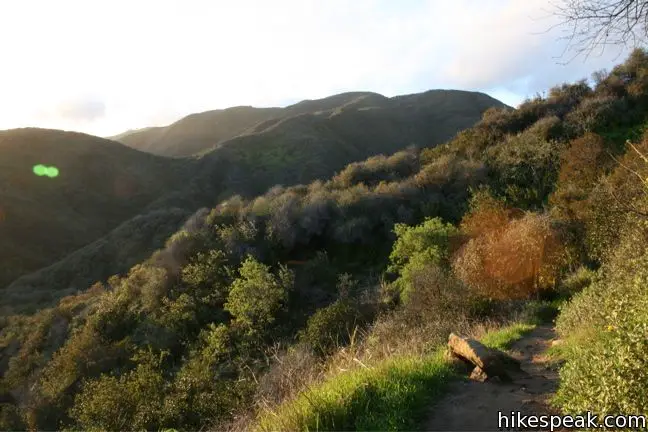
The top of Los Liones Trail joins East Topanga Fire Road. Those eager to hike farther can continue up to Parker Mesa Overlook, a sweeping viewpoint in Topanga State Park.
Find the Los Liones Entrance to Topanga State Park on the right side of the cul-de-sac at the end of Los Liones Drive in the Pacific Palisades. A big sign should make Los Liones Trail easy to spot.
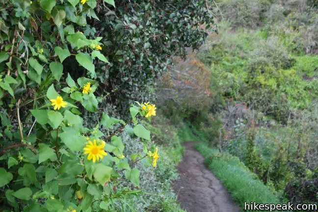
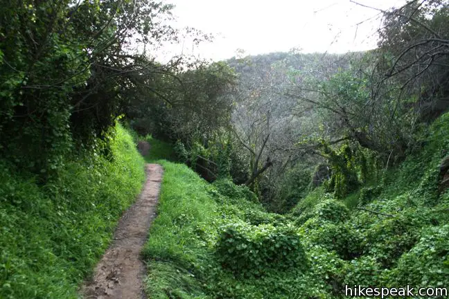
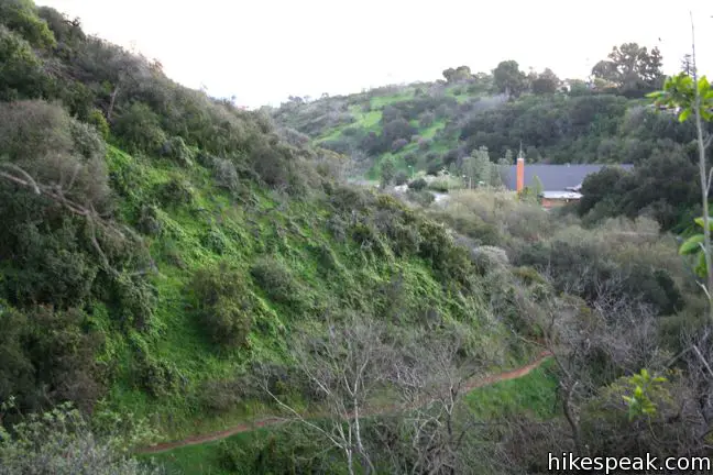
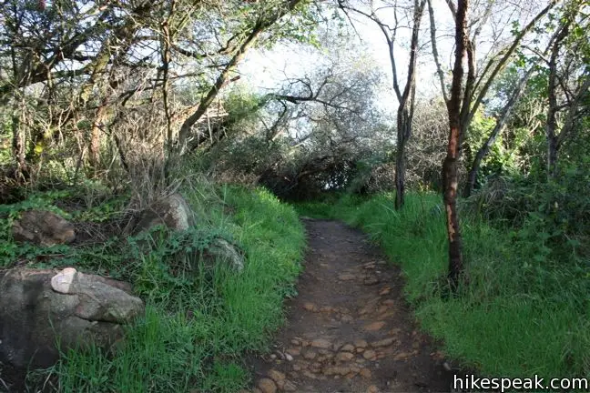
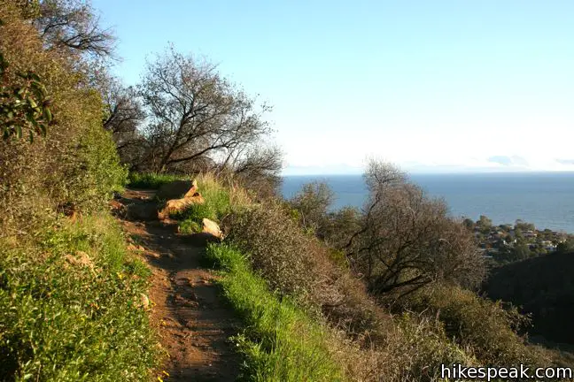
Hike north up the east side of the canyon on a dirt single track. Ivy hangs off the trees, creating a lush environment for a steady climb along the undulating canyon wall.
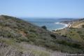
After 1/3 of a mile, look down the canyon for the first ocean view beyond the mouth of the canyon.
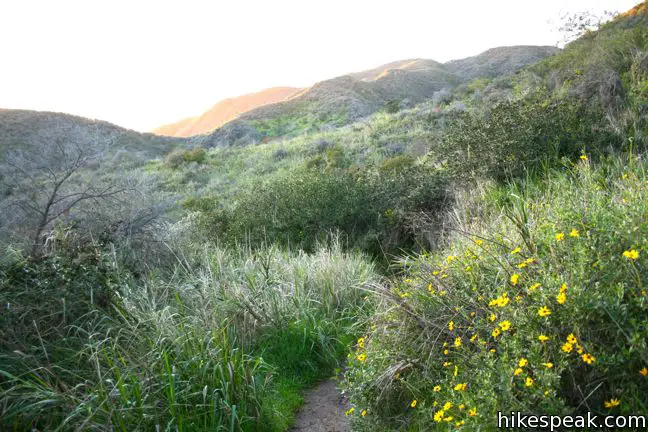
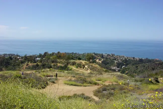
Half a mile from the start, gain a clear view up the canyon toward the higher lands of Topanga State Park. The trail makes a sharp turn to the right as chaparral becomes the dominant vegetation. As the trail continues to climb, it angles southeast toward the top of the ridge neighboring the canyon, delivering expanding ocean views.
The first junction you will reach is with East Topanga Fire Road at the top of Los Liones Trail. Turn left up this wide trail to hike to Parker Mesa Overlook, a great viewpoint from a higher ridge in the Santa Monica Mountains that is 2.6 miles away. Otherwise, you can return down the Los Liones Trail to complete a 2.6-mile out and back trek.
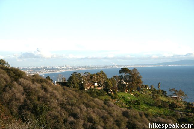
At the top of Los Liones Trail, take a load off. Sit on the bench just before the junction and admire the south-facing view of Santa Monica Bay. watch slow moving waves roll in toward the shore. The views extend down to Palos Verdes Peninsula. On a clear day, even Catalina Island is visible. What a peaceful spot of a quick city escape!
Los Liones Trail is a 2.6-mile round trip hike. The trek up Los Liones Trail is most enjoyable in cool temperatures. When it gets too hot, the enclosed trail can feel more oppressive than enchanting. Dogs and bikes are not welcome, but no fee or permit is required, so get out and enjoy!
Directions to the Trailhead
- Los Liones Drive is the second left off Sunset Blvd from PCH and is just 1/3 of a mile from the beach.
- Park on the right side of Los Liones, and enter the trail from the end of the cul-de-sac.
Trailhead Location
Trailhead address: 580 Los Liones Drive, Pacific Palisades, CA 90272
Trailhead coordinates: 34.04727, -118.56007 (34° 02′ 50.17″N 118° 33′ 36.25″W)
View Santa Monica Mountains in a larger map
Or view a regional map of surrounding Los Angeles trails and campgrounds.


 | Parker Mesa Overlook This steep out-and-back hike rewards the effort with excellent views of the Pacific Ocean. |
 | Santa Ynez Falls This 2.5-mile follows a shaded creek to a gorge containing a short waterfall. |
 | Skull Rock This 1.5-mile hike descends Temescal Ridge to a head-shaped formation with great views over Santa Monica Bay. |
 | Temescal Canyon This 2.6-mile loop offers a variety of scenery and decent exercise, despite its relative brevity. |
 | More trails in the Santa Monica Mountains Explore other destinations in the range. |
 | Corral Canyon This 2.5-mile loop offers ocean and canyon views from a unspoiled section of the Santa Monica Mountains in Malibu. |
 | The Grotto This 3-mile out and back hike visits a remote grotto in the Santa Monica Mountains National Recreation Area. |
 | Sturtevant Falls This 3.3-mile hike visits a 60-foot waterfall and a lush cottage-lined canyon. |
 | Hoegees Camp This 4.25-mile hike follows Lower Winter Creek Trail through a beautiful wooded canyon to a backcountry campground with fourteen first-come first-serve sites. |
Common Questions about Los Liones Trail in the Santa Monica Mountains
- Is the trail open?
- Yes. You should expect to find that Los Liones Trail is open. There are no recent reports of trail closures. If you discover that the trail is closed, please help your fellow hikers by reporting a closure.
- Is this trail free to access?
- Yes, Los Liones Trail is free to access. No entrance fee, pass, or permit is required. If you discover that access rules have changed, please provide feedback on your experience.
- How much time does this hike take?
- It takes approximately 1 hour 30 minutes to hike Los Liones Trail. Individual hiking times vary. Add extra time for breaks and taking in the views.
- How long is this hike?
- The hike to Los Liones Trail is a 2.6 mile out and back with 550 feet of elevation change.
- Are dogs allowed on this trail?
- No, dogs are likely not allowed on Los Liones Trail. The trail is primarily open to hikers.
- Are there ocean views on this hike?
- Yes, Los Liones Trail offers views of the ocean.
- Where is the trailhead located?
- The trailhead for Los Liones Trail is located in Pacific Palisades, CA.
Trailhead Address:
580 Los Liones Drive
Pacific Palisades, CA 90272
Trailhead Coordinates:
34.04727, -118.56007 - What are the driving directions to the start of the hike?
To get to the trailhead: Los Liones Drive is the second left off Sunset Blvd from PCH and is just 1/3 of a mile from the beach. Park on the right side of Los Liones, and enter the trail from the end of the cul-de-sac.
View custom Google Maps directions from your current location.
- Are there other trails near Los Liones Trail?
- Yes, you can find other nearby hikes using the Hikespeak Hike Finder Map.

30 Comments on Los Liones Trail in the Santa Monica Mountains
What hikers are saying:
✨ Generated summary of user commentsHikers enjoy the lush vegetation and the breathtaking panoramic views of the bay and city. The trail offers a mix of shaded paths and sun-exposed fire roads that provide a rewarding workout. Arielle warns that car break-ins are a concern at the trailhead, so avoid leaving any valuables in your vehicle. Dogs and mountain bikes are prohibited on this route.
“The beauty of the trail and great views are worth the effort!” Jump to comment ↓
“The sweeping panoramic views of the bay and city were breathtaking.” Jump to comment ↓
Super pretty trail. I use this to get to the Parker Mesa Overlook. The trail is lush and mostly shaded and great fun to run, cause it’s narrow and the ground is kind of spongy for good shock absorption. Anyone know how far it is to Parker Mesa Overlook if you start at Los Liones instead of the other way?
Starting from Los Liones Trail, it is 7.8 miles round trip to Parker Mesa Overlook with 1,250 feet of elevation gain. Great hike!
Yes. Amazing. Thanks for telling me how long it is.
Just hiked this yesterday and loved it! The los leones part of the hike was a little more suited to my tastes, as the trail wasn’t a fire road, and full of lush vegetation, whereas the trail from the junction to Parker Mesa was all dusty, well worn fire road. However, the effort was worth it as the sweeping panoramic views of the bay and city were breathtaking. Will do this hike again at night for a new view of the city lights.
Loved this trail! I didn’t think it was that crowded (went around 3:30), and the terrain was challenging but not too difficult. I only did a few miles of the trail but what I saw was breathtaking. The views are incredible and entirely worth it. Thanks so much for all the info! Will definitely be hiking this trail again.
Are dogs allowed on this trail?
Sorry. Dogs are not allowed. For something nearby that’s dog-friendly, you could check out Lower Canyonback Trail, Upper Canyonback Trail (with off-leash areas), or Tuna Canyon Park.
Seems like a nice one-way hike (Los Liones East Topanga Road 1.5 mile hike) if you can bring two cars. I like loops so you don’t see the same view twice, but they seem to be harder to find.
This trail is right next to my new work. Are mountain bikes allowed on this trail???
-alan
No bikes on Los Liones Trail, but you can bike up East Topanga Fire Road to Parker Mesa Overlook from the top of Paseo Miramar.
where is the best parking if you want to start at Los Liones Trail?
You can park along Los Liones Drive. To get directions, use 580 Los Liones Drive, Pacific Palisades, CA 90272.
What kind of hazards are present? i.e. poison oak, ticks, rattlesnakes, etc.
Did it stop you?
I want to have a picnic birthday party for my brother… featuring a tethered hot air balloon rides. Is this a good place for this? Is it allowed?
This was a great hike and workout for me…took us 35 minutes up (stopped to rest a few times) and total about 1 hour 10 minutes. The view was so incredible and worth it – we could see downtown LA, all the way down to PV, Catalina, and Malibu. Will do it again for sure! A fellow hiker saw a rattlesnake but we mostly saw geckos/lizards and butterflies…
I Want to go there tomorrow but I’m not sure if it’s ok to go since we have a few brush fires around the area? Is it safe?
It will be my first time to go there. what is fire road all about? is there snake ? is there any waterfall?
[…] to los angeles for a meet up with our friend alyx schwarz and took a wednesday night hike on the los liones trail. quite honestly, there wasn’t too much hesitation in this. she asked if we wanted to partner […]
[…] Trail Guide: Los Liones Trail via Hikespeak […]
First time hiking ever, and I was curious, is there a set time to be there?
The park is open from sunrise to sunset. Enjoy your hike.
Kids they can go this trail ?
Unlike dogs and bikes, children are permitted.
Is this trail suitable for folks with little to no hiking experience? What is the terrain like?
The trail is very easy to follow, and clear. In some places, the ground is hard and rocky. There are many long uphills and downhills (on the way back). Some areas are shaded, and there are some good rocks to take a rest on, if need be. I think it’s suitable for people with minimal hiking experience IF the people are used to walking or other exercise at a good pace. I went on a Friday and encountered many other hikers (though they were well-spaced), so it didn’t feel crowded. The beauty of the trail and great views are worth the effort!
Does anyone know if this trail and the connecting trail to hike up to the Parker Mesa Overlook were affected by the recent Pacific Palisades fire? It’s such a beautiful and popular hike, it would be such a shame if the route were out of commission for a bit.
This comment is not about the trail. The trail was beautiful and wonderful. However, I have reasons to believe someone went into my car and stole my credit and debit cards. My car has the capability to auto lock itself when I step away, but I found my car to be unlocked after hiking the trail and my cards were missing from my car. Please do not make the same mistake I did and do not leave valuables in the car. I do not know how they were able to unlock my car and I am in shock that it happened in broad daylight. Also, they tried using my card at Bloomingdales in Santa Monica which is about 5 miles from the trailhead parking lot. Please be careful out there!
Someone 100% stole from you. Someone broke the lock on my car last week after trying to break in. I had nothing in sight for them to steal but still wanted to break in!! My friend also had her car broken into there and they stole her designer purse, etc. I actually need to file a police report but not sure which one. Anyone know?
Is there anywhere to use a bathroom (have kidney issues so even if bushes, that works)? Also, is there a place to picnic at trail head?