Cradled below a jagged ridge of volcanic peaks called the Minarets, Iceberg Lake is a beautiful, potentially snow-bordered or ice-filled lake of vivid blue water. The backcountry lake is located deep in the Ansel Adams Wilderness of Inyo National Forest, 8.3 miles from the trailhead at Agnew Meadows. Iceberg Lake is just a mile from Ediza Lake and a nice extension for the hike to that outstanding lake. Backpackers camping at Ediza Lake can put on a light pack for a quick hike up to Iceberg Lake as a way to explore more of this breathtaking area of the Sierra. While short, Iceberg Lake Trail is steep in spots, ascending just over 500 feet above Ediza Lake.
To get to Iceberg Lake Trail, start by following directions to Shadow Lake and Ediza Lake.
The basic directions approaching Ediza Lake are:
- Begin up River Trail (Pacific Crest Trail) from Agnew Meadows (0 miles)
- Stay to the right through a junction where PCT breaks off toward Reds Meadow (0.9 miles)
- Descend into a canyon and stay to the right past another trail to Reds Meadow (1.55 miles)
- Pass Olaine Lake (2.15 miles)
- Turn left up Shadow Creek Trail (2.5 miles)
- Pass the outlet of Shadow Lake (3.85 miles)
- Turn right on John Muir Trail (4.55 miles)
- Turn left up the next stretch of Shadow Creek Trail to Ediza Lake (5.25 miles)
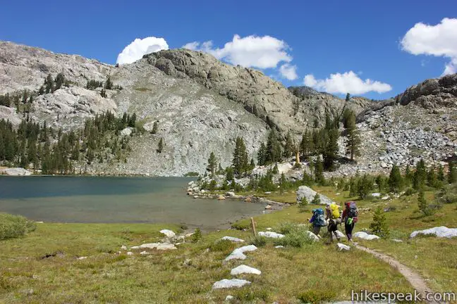
- Reach the outlet of Ediza Lake and continue up the trail (7 miles)
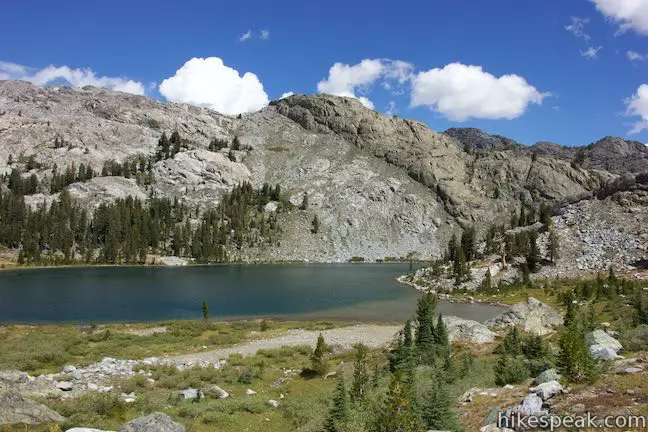
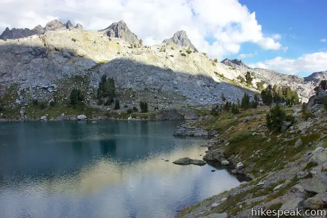
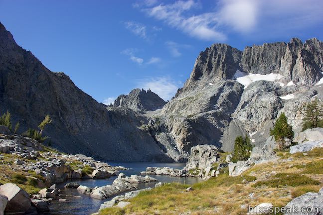
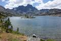
After meeting Ediza Lake, the trail continues down the east shore, coming to a junction after another 0.3 miles. Along the way, enjoy fantastic views across the lake toward Mount Ritter and Banner Peak. At the junction, which is marked with a sign for Iceberg Lake, take the trail beginning on the left, which ascends toward the lovely lake above. A path to the right proceeds along the edge of Ediza Lake, leading to potential camping spots.
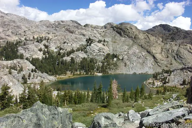
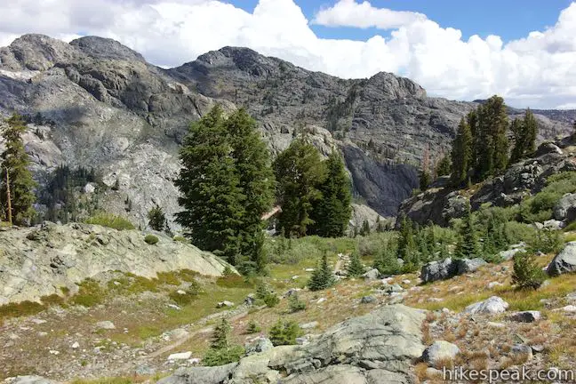
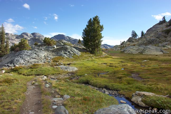
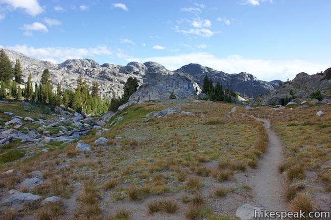
If you start Iceberg Lake Trail right after hiking 7.3 miles from Agnew Meadows (gaining 1,250 feet of elevation from the canyon containing Olaine Lake), the switchbacks that lie ahead may prove tiresome. If you camp overnight at Ediza Lake, you may be feeling spry and you bound up stone steps built into the slope south of Ediza Lake. Over your shoulder, the view of Ediza Lake continues to expand, revealing more of the surrounding pines and rocky ridges. Each time you finish a switchback, another appears on the mountainside above. The ascent is longer than it might seem at the start, but press on. Eventually, you will cross a stream as the trail tapers out.
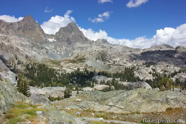
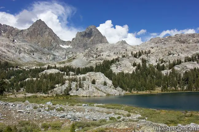
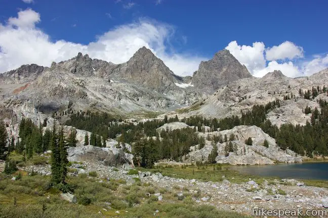
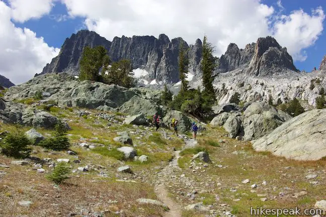
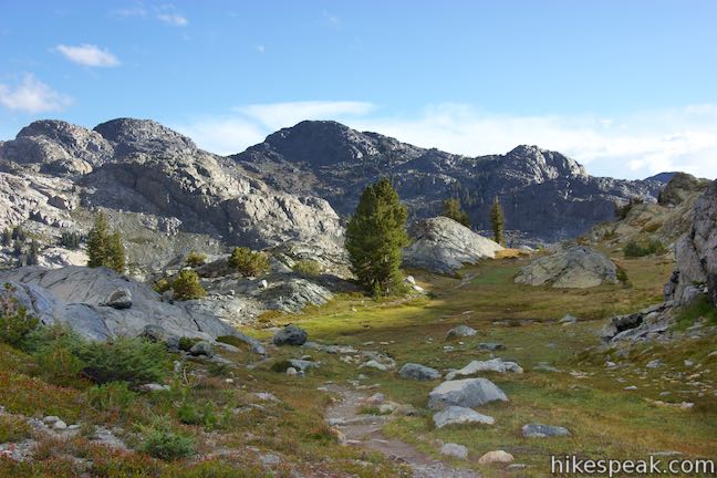
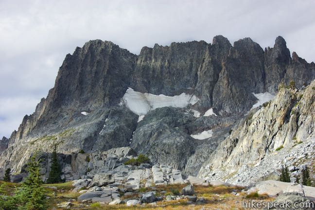
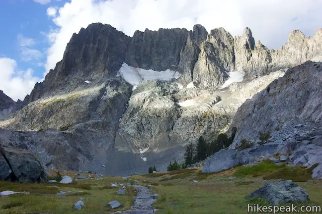
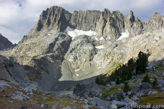
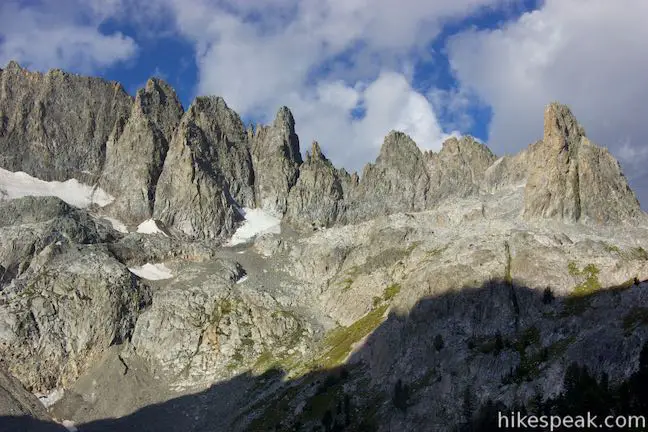
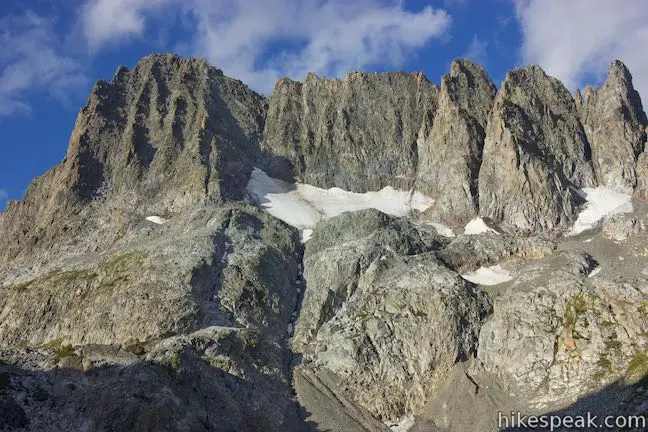
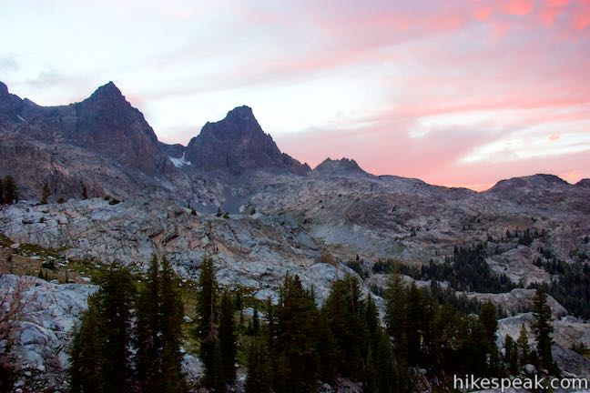
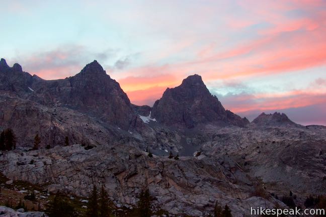
Up to this point, the views have been fantastic, with good looks down over Ediza Lake, or up at two pyramid-shaped peaks to the northwest, Mount Ritter and Banner Peak, at 13,143 feet and 12,936 feet respectively. The views don’t get any worse as you keep going, but they do change. The trail aims straight toward a section of the jagged peaks called the Minarets, located on Volcanic Ridge. The steep ridge has sharp points and creases that hold pockets of snow even during summer months.
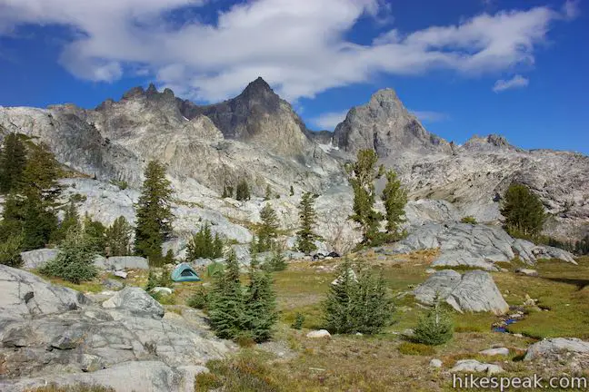
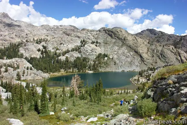
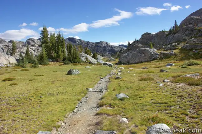
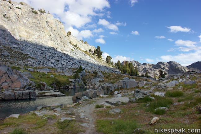
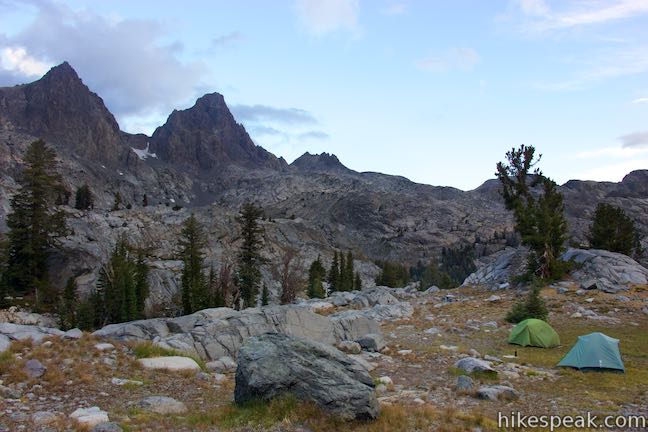
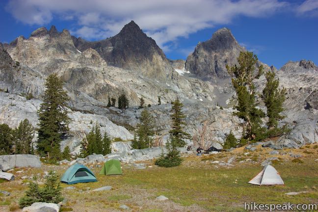
Hike up the trail straight toward the Minarets and come over a short line of boulders to cross a grassy meadow. The meadow extends to the right where the terrain eventually drops into a ravine carved by the stream flowing out of Iceberg Lake. This meadow is a pleasant place for backpackers to camp as an alternative to Ediza Lake. An additional spot to camp can be found by a cluster of trees near Iceberg Lake, another 0.3 miles up the trail.
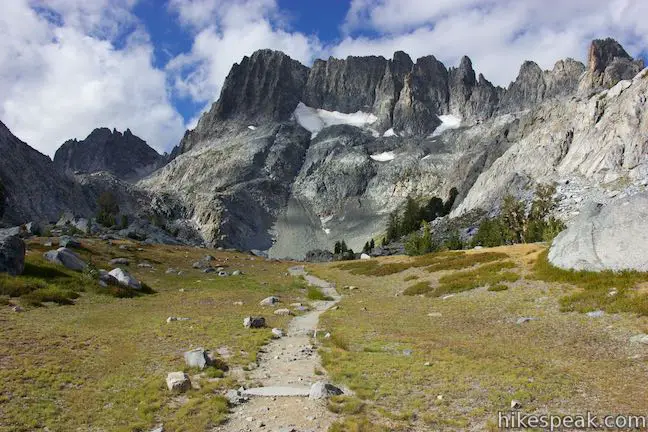
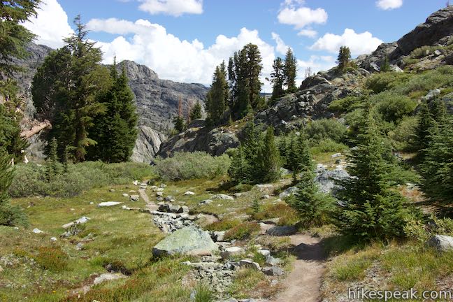
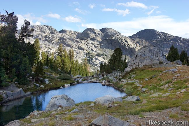
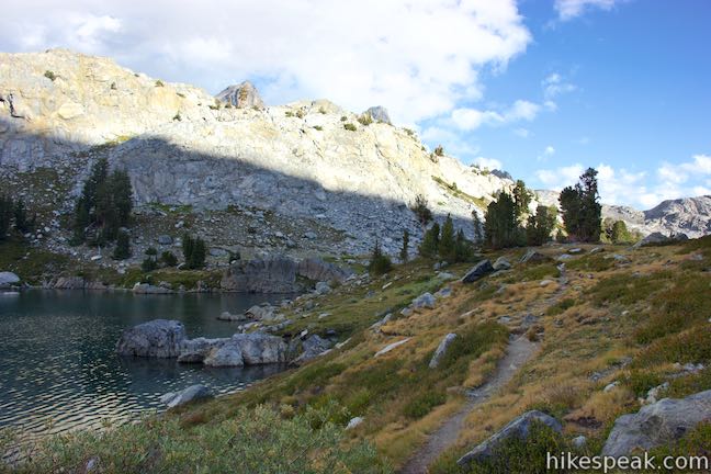
The single-track trail is gradual from the meadow to the lake, passing between some boulder piles. The trail gets closer to the creek flowing out of the lake, which has several nice pools that serve as appetizers from the lake above. Soon, Iceberg Lake is revealed and the trail takes you right up to water’s edge next to the outlet.
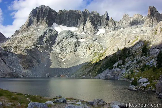
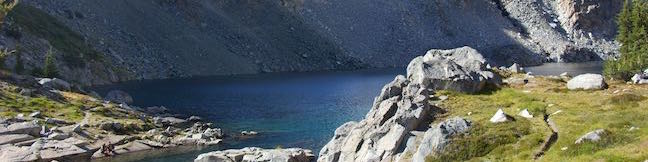
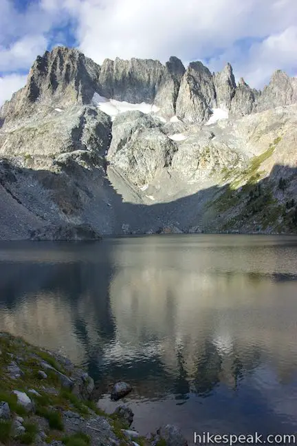
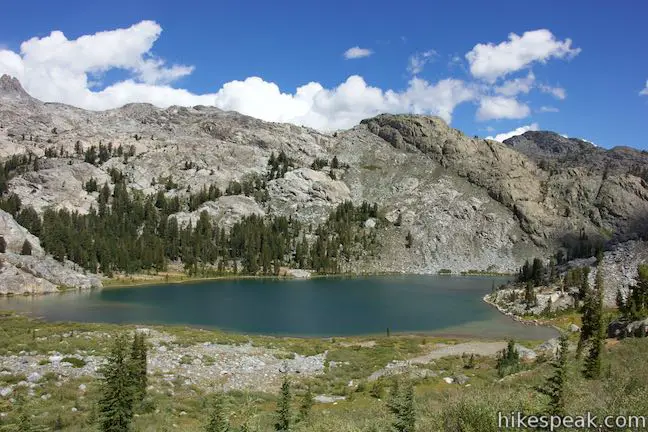
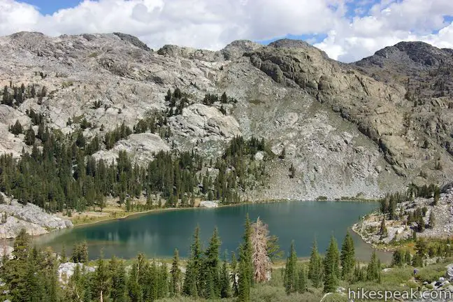
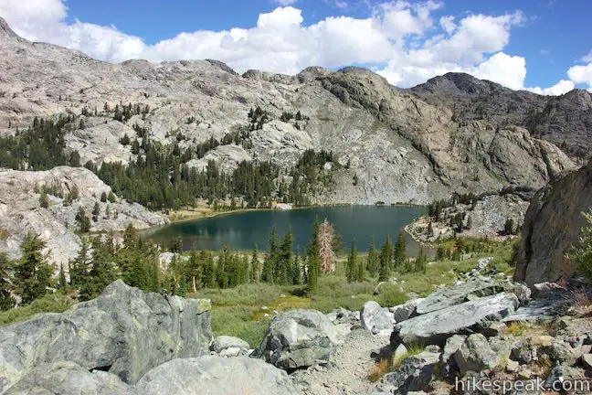
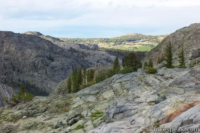
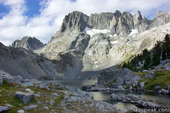
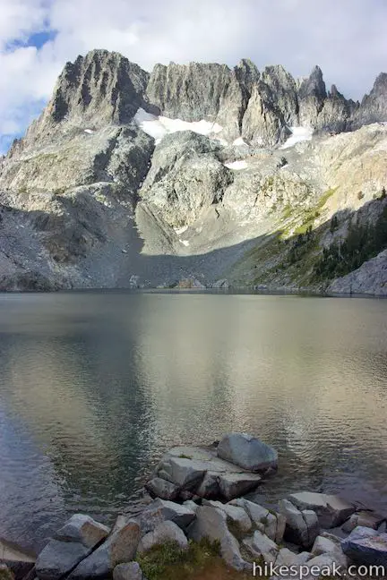
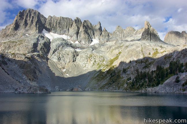
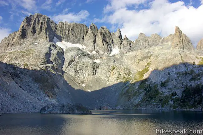
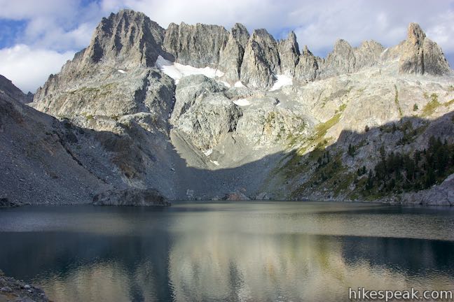
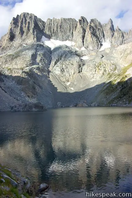
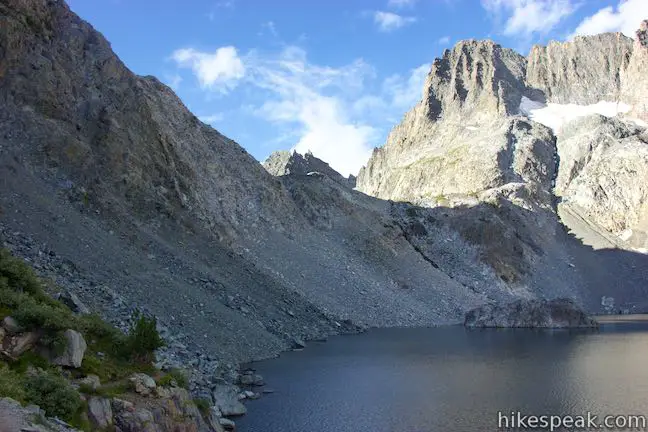
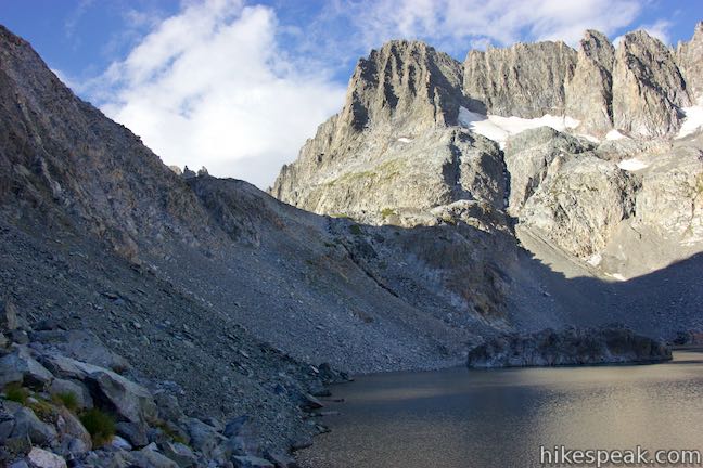
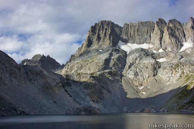
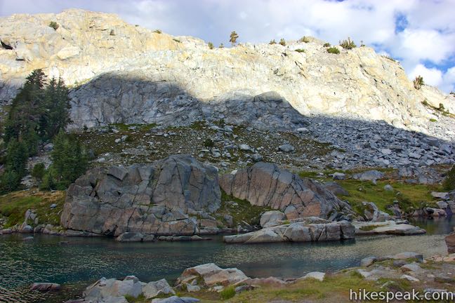
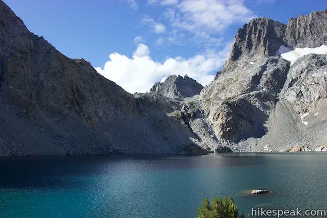
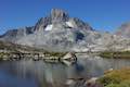
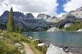
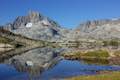
Iceberg Lake is as dramatic as they come. The lake is at 9,780 feet, framed by a horseshoe of steep slopes below the sheer cliffs of the Minarets. Across the lake, you’ll see a large shelf of snow and ice at the base of the cliffs. A stream of melted water from the snow flows right down into Iceberg Lake, leaving no doubt that this is a cold-water lake. As the name would suggest, there may actually be icebergs on the water when you visit. The trail continues along the east shore of Iceberg Lake, offering new views across the water, which turns a vivid blue in the sunlight. The trail reaches the edge of the grassy slope on the side of the lake, 0.2 miles from the outlet. From here, the path becomes narrow and harder to follow. It crosses the talus slope on the south side of the lake and ascends to a pass leading to Cecile Lake, another lake cradled by the Minarets.
Unless you’re trekking to that upper lake (crampons may be required if there is snow and ice on the pass), head back to the outlet of Iceberg Lake and follow the trail back to Ediza Lake. The hike back on Iceberg Lake Trail to Ediza Lake is downhill and easy. For additional views of Iceberg Lake, you can rock hop across the steam below the lake and venture up onto a ledge across from the start of the stream. There are no bad views of Iceberg Lake.
The northernmost of the Minarets in view is Waller Minaret, separated by a gap from Leonard Minaret and a string of spires that run south above the snow shelf. Each peak has a name like Leonard, Turner, Jensen, Dyer, Dawson, Bedayan, Rice and Eichorn. Clyde Minaret is to the south of those, above the pass to Cecile Lake.
Iceberg Lake is certainly stunning. If you make the hike to Ediza Lake, it is well worth the extra effort to reach Iceberg Lake. For the junction by Ediza Lake up to the outlet of Iceberg Lake is two miles round trip with 510 feet of elevation change. Dogs are permitted on this trail. A permit is required for overnight hikes in Ansel Adams Wilderness and a quota is in place at the trailhead. A shuttle bus takes hikers from Mammoth Lakes to the trailhead at Agnew Meadows. Review the write-ups of the hike to Shadow Lake and Ediza Lake for more information.
Directions to the Trailhead
- Take Route 395 to Route 203 and drive 3.6 miles to Mammoth Lakes.
- Turn right onto Minaret Road toward Mammoth Mountain.
- Reach the ski resort after 4 miles.
- Unless you are staying at a campground during your visit, park here and take the shuttle to Agnew Meadows.
- If you are driving in, go 1.4 miles past the ski resort to Minaret Vista Entrance Station where a 10-dollar fee is charged for each vehicle to continue down into the valley.
- Drive 2.6 miles down a narrow paved road to a horseshoe bend at the intersection with Agnew Meadows Road.
- Turn right and drive 0.4 miles to the trailhead at the end of the road.
Trailhead Location
Trailhead address: Agnew Meadows Road, Mammoth Lakes, CA 93546
Trailhead coordinates: 37.682, -119.086 (37° 40′ 55.20″N 119° 05′ 09.59″W)
You may also view a regional map of surrounding Sierra Nevada trails and campgrounds.


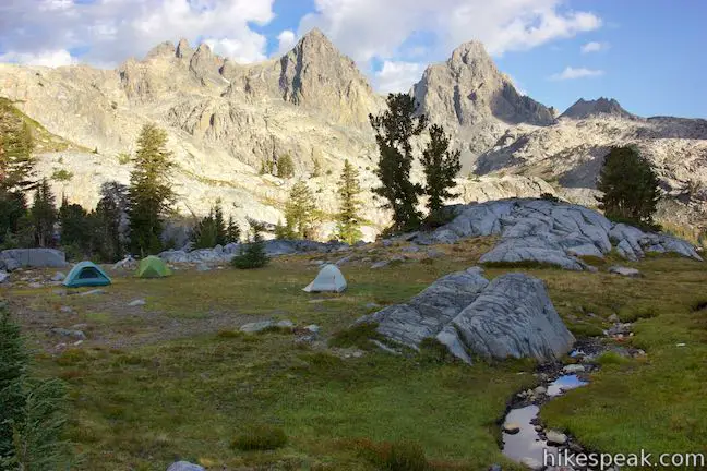


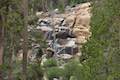
Camping near Iceberg Lake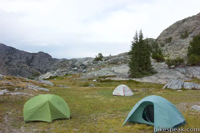
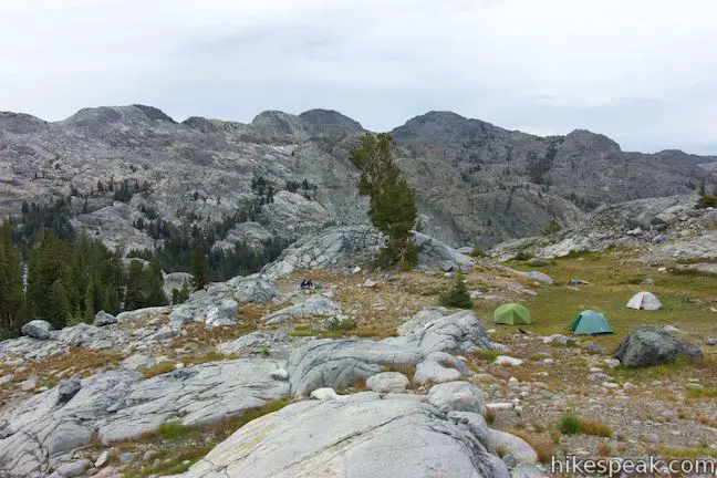


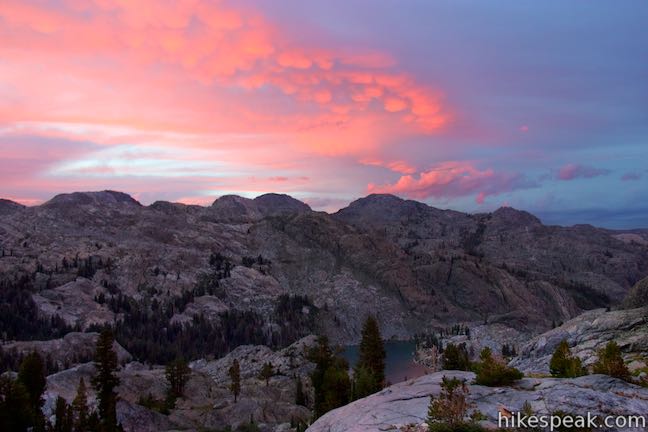
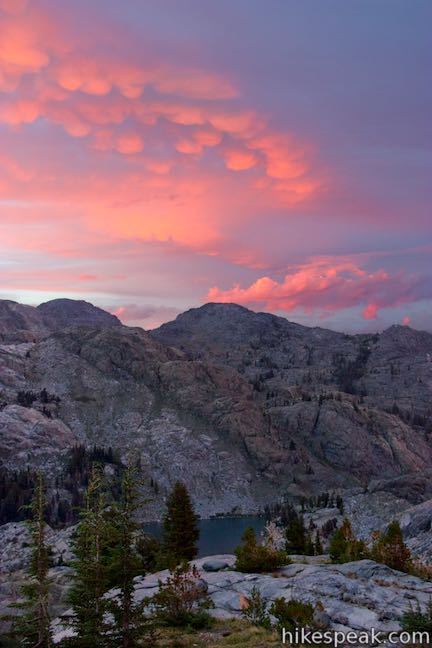
Sunset views off Iceberg Lake Trail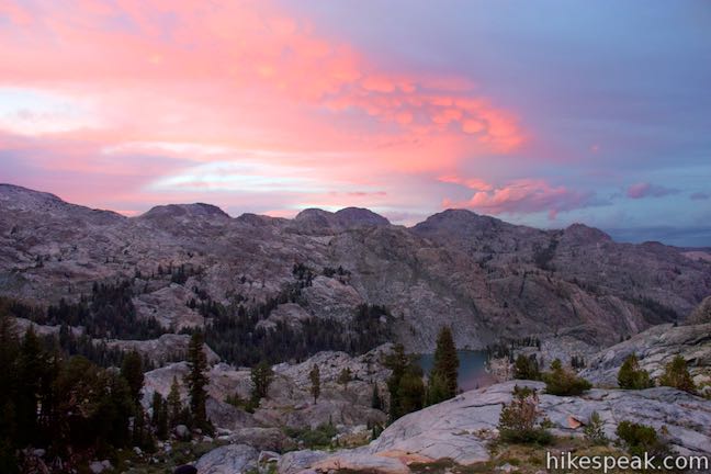

Photos of the hike to Shadow Lake and Ediza Lake are found with those write-ups.
 | Ediza Lake - Thousand Island Lake Loop This multi-day backpacking loop of around 25 miles incorporates sections of John Muir Trail and Pacific Crest Trail to visit a series of stunning Sierra lakes in the Ansel Adams Wilderness of Inyo National Forest. |
 | Shadow Lake This 8.5-mile hike crosses a picturesque canyon and passes a plunging cascade to visit a mountain lake in the Ansel Adams Wilderness of Inyo National Forest near Mammoth Lakes. |
 | Ediza Lake This hike of around 15 miles round trip ventures above Shadow Lake along a creek to a beautiful lake below Mount Ritter and Banner Peak in the Ansel Adams Wilderness of Inyo National Forest near Mammoth Lakes. Ediza Lake is an excellent destination for backpackers. |
 | Garnet Lake This beautiful lake along John Muir Trail is 8.55 miles from the trailhead at Agnew Meadows, making it an ideal lake to visit on a backpacking loop. |
 | Thousand Island Lake This exceptional lake is a true gem of the Sierra and is 8.75 miles from the trailhead at Agnew Meadows via High Trail, a section of Pacific Crest Trail, making it a great destination for an overnight trek. |
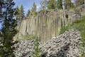 | Devils Postpile This 1 to 1.35-mile hike visits the columnar basalt cliff that Devils Postpile National Monument is named after, with top-down and bottom-up views of the impressive formation. The hike can be extended to include Rainbow Falls at the south end of the monument. |
 | Rainbow Falls This hike of 5.1 miles or more passes the Devils Postpile Formation to reach an attractive 101-foot waterfall with rainbows in its mist. |
 | Minaret Falls This 3-mile hike from Devils Postpile National Monument connects with Pacific Crest Trail to reach the base of a waterfall that tumbles and slides down a rocky slope. |
 | More trails in the Sierra Nevada Mountains Explore other destinations in Inyo National Forest and the rest of the range. |
 | Devils Postpile National Monument Campground This 21-site first-come first-serve campground provides camping in a pine forest next the Middle Fork San Joaquin River near the trailhead for Devils Postpile National Monument. |
- Thousand Island Lake, Ediza Lake, and Iceberg Lake Loop on backcountrycow.com (opens in a new tab)
- Ediza Lake, Iceberg Lake, and Rosalie Lake on beaut-tree.net (opens in a new tab)
- Iceberg Lake on Ediza & Minaret Lakes Loop on sites.google.com/site/zbjohnsonadventures (opens in a new tab)
- A national forest map of Agnew Meadow Trails (opens in a new tab)
- A national forest brochure for the Reds Meadow - Devils Postpile Shuttle (opens in a new tab)
- Agnew Meadows on summitpost.org (opens in a new tab)
- The official national forest webpage for Shadow Lake Trail (opens in a new tab)
Common Questions about Iceberg Lake in Ansel Adams Wilderness
- Is the trail open?
- Yes. You should expect to find that Iceberg Lake Trail is open. There are no recent reports of trail closures. If you discover that the trail is closed, please help your fellow hikers by reporting a closure.
- Do I need a permit for this hike?
- Yes. Access fee, overnight permit.
- How much time does this hike take?
- It takes approximately 1 hour 15 minutes to hike Iceberg Lake Trail. Individual hiking times vary. Add extra time for breaks and taking in the views.
- How long is this hike?
- The hike to Iceberg Lake Trail is a 2 mile out and back extension with 510 feet of elevation change.
- Are dogs allowed on this trail?
- Yes, dogs are allowed on Iceberg Lake Trail. The trail is open to hikers, dogs.
- Is there a lake on this hike?
- Yes, Iceberg Lake Trail visits a lake.
- Where is the trailhead located?
- The trailhead for Iceberg Lake Trail is located in Mammoth Lakes, CA.
Trailhead Address:
Agnew Meadows Road
Mammoth Lakes, CA 93546
Trailhead Coordinates:
37.682, -119.086 - What are the driving directions to the start of the hike?
To get to the trailhead: Take Route 395 to Route 203 and drive 3.6 miles to Mammoth Lakes. Turn right onto Minaret Road toward Mammoth Mountain. Reach the ski resort after 4 miles. Unless you are staying at a campground during your visit, park here and take the shuttle to Agnew Meadows. If you are driving in, go 1.4 miles past the ski resort to Minaret Vista Entrance Station where a 10-dollar fee is charged for each vehicle to continue down into the valley. Drive 2.6 miles down a narrow paved road to a horseshoe bend at the intersection with Agnew Meadows Road. Turn right and drive 0.4 miles to the trailhead at the end of the road.
View custom Google Maps directions from your current location.
- Are there other trails near Iceberg Lake Trail?
- Yes, you can find other nearby hikes using the Hikespeak Hike Finder Map.

Go the extra miles...
Submit a rating of this hike to go with your comment. Contribute to the average trail rating.