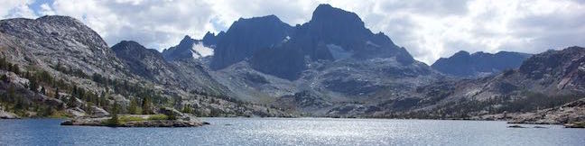
Garnet Lake is located on John Muir Trail between Shadow Lake and Thousand Island Lake in the Ansel Adams Wilderness of Inyo National Forest. The lake is stunning, set below the 12,936-foot mass of Banner Peak and framed by ridges of bedrock and pines. Hiking directly there, Garnet Lake is 8.55 miles from the trailhead at Agnew Meadows, so most of the lake’s visitors are backpackers (a minimum of 17.1 miles is pretty long for a day hike). Is it worth visiting Garnet Lake on a backpacking trip? Absolutely – and especially if you make it a loop. A 10,150-foot pass and two smaller lakes, Ruby Lake and Emerald Lake, separate Garnet Lake and Thousand Island Lake. There is another high pass south of Garnet Lake, so expect big views all along John Muir Trail. To see Garnet Lake on a loop that passes Shadow Lake and Thousand Island Lake, you’ll put in a minimum of about 19 2/3 miles of hiking.
Garnet Lake is 3.3 miles north of the John Muir Trail – Shadow Lake Trail junction below Ediza Lake and 2.35 miles south of the John Muir Trail – Pacific Crest Trail junction at Thousand Island Lake. No junctions fall in between, so the route to Garnet Lake is obvious in either direction. John Muir Trail is steep between the south side of the lake and the pass above. If you are hiking to Garnet Lake on a loop (Ediza Lake – Thousand Island Lake Loop), you may wish to start from the south and hike north past Garnet Lake, converting that steep part of the trail to a descent with scenic views over Garnet Lake.
This write-up describes visiting Garnet Lake on a northbound hike on John Muir Trail from Shadow Lake Trail to Thousand Island Lake. To get there, you’ll need to set out on River Trail from a trailhead at Agnew Meadows in the Eastern Sierra near the city of Mammoth Lakes. Get underway by following directions to Shadow Lake and Ediza Lake.
The simplified directions approaching Ediza Lake are:
- Begin on River Trail (Pacific Crest Trail) from Agnew Meadows (0 miles)
- Stay to the right through a junction where PCT breaks off toward Reds Meadow (0.9 miles)
- Descend into a canyon and stay to the right past another trail to Reds Meadow (1.55 miles)
- Pass Olaine Lake (2.15 miles)
- Turn left up Shadow Creek Trail (2.5 miles)
- Reach the outlet of Shadow Lake (3.85 miles)
- Turn right on John Muir Trail (4.55 miles)
- Come to a junction on the left with the next stretch of Shadow Creek Trail to Ediza Lake (5.25 miles)
Optionally, you can turn left and hike another 1.75 miles to Ediza Lake (7 miles from Agnew Meadows) and continue beyond that up to Iceberg Lake (8.3 miles from Agnew Meadows). After visiting those lakes, hike back down to John Muir Trail to continue north toward Garnet Lake.
Shadow Lake Trail to Garnet Lake
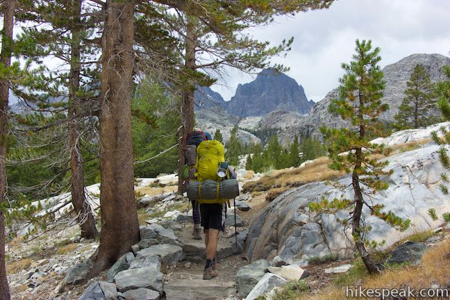
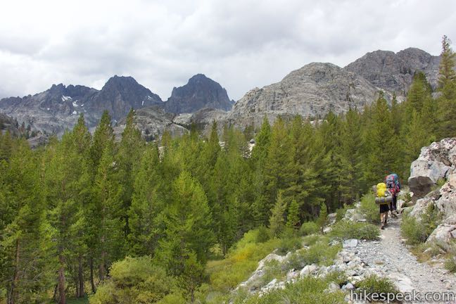
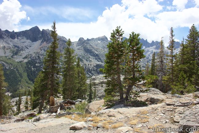
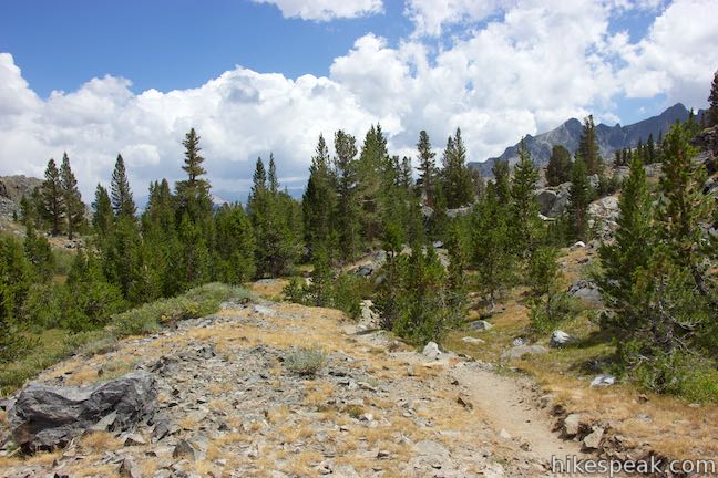
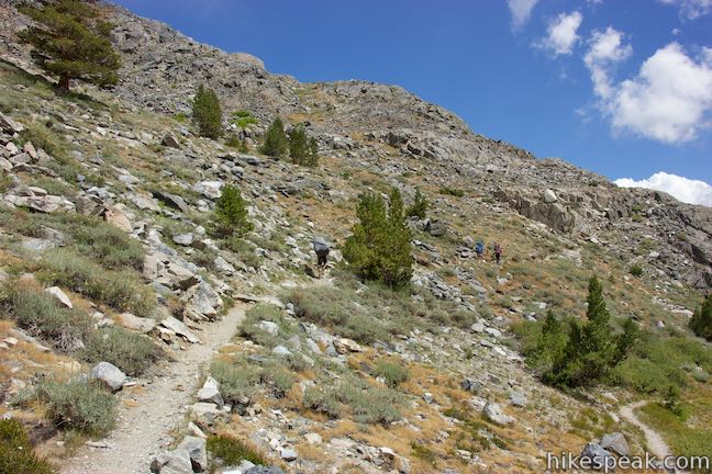
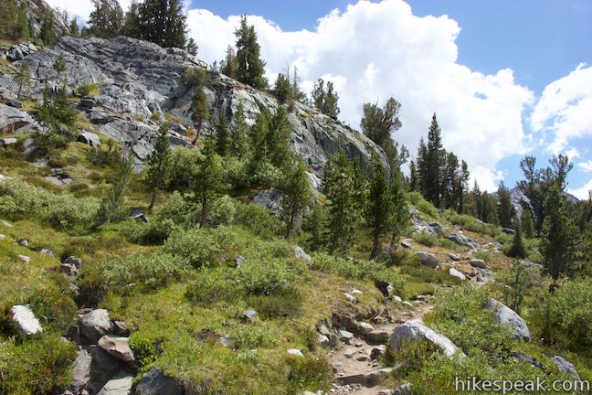
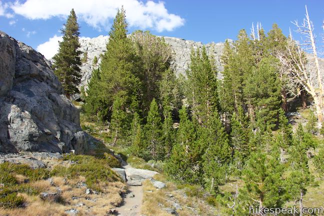
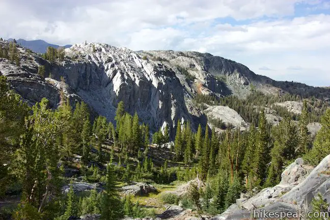
Proceeding north from the junction with the trail to Ediza Lake, John Muir Trail ascends out of the canyon to a pass above Garnet Lake, gaining 1,090 feet over 2.3 miles. It is a long steady climb, with stone steps built into the winding trail. As you get higher up the ridge, views of the surrounding mountains expand. At 0.7 miles from the previous junction, pass a ledge with views across the canyon and west toward Mount Ritter and the Minarets. The trail angles northeast as it climbs, passing more perches over the next 2/3 of a mile that offer views over the canyon.
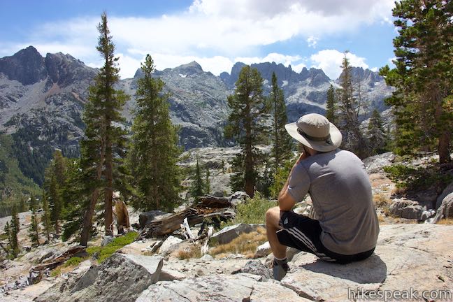
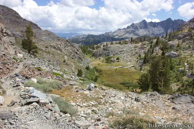
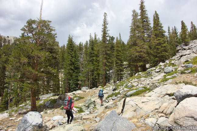
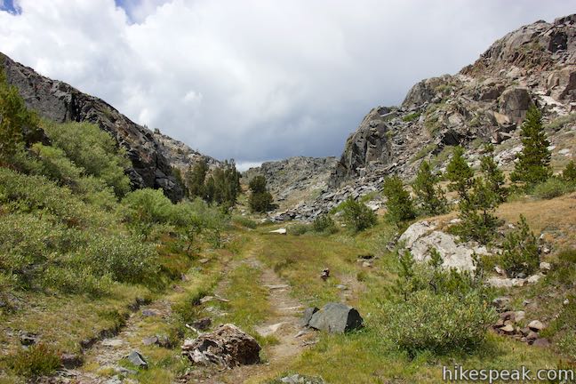
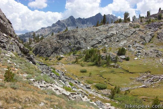
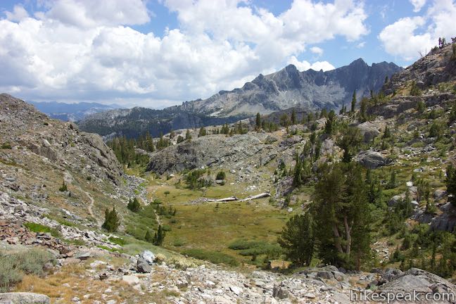
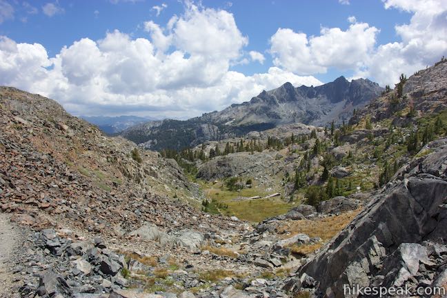
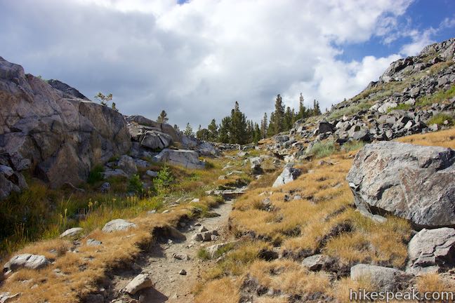
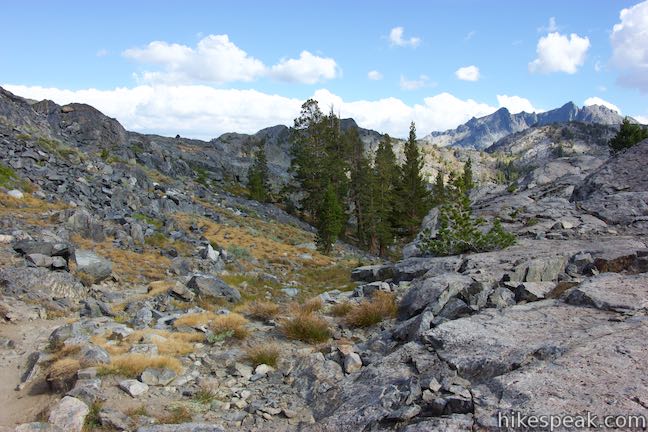
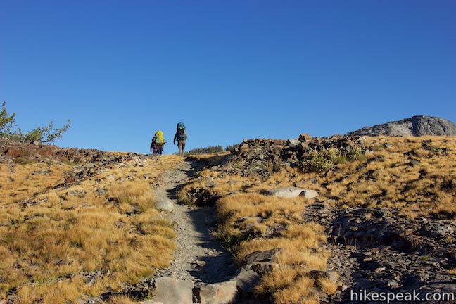
Around a mile and a half above the junction with the trail to Ediza Lake, John Muir Trail leaves the canyon rim and tapers out as it passes through boulder formations. It may feel like you are about to hit the pass at this point. However, you still have farther to go. The trail keeps ascending gradually until it reaches a grassy meadow wrapped by rocky ridges in the shape of a “U.” Now you are near the pass! Follow switchbacks up the steep slope of large loose rocks to climb to the pass. As you near the top, look over your shoulder for a southwest-facing panorama over the landscape you’ve trekked through. The views change completely on the other side.
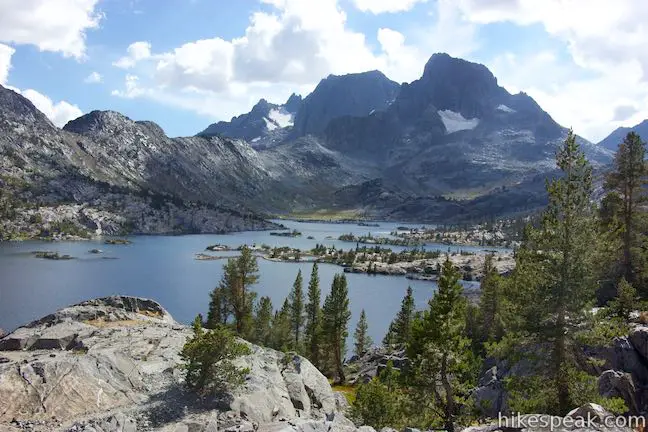
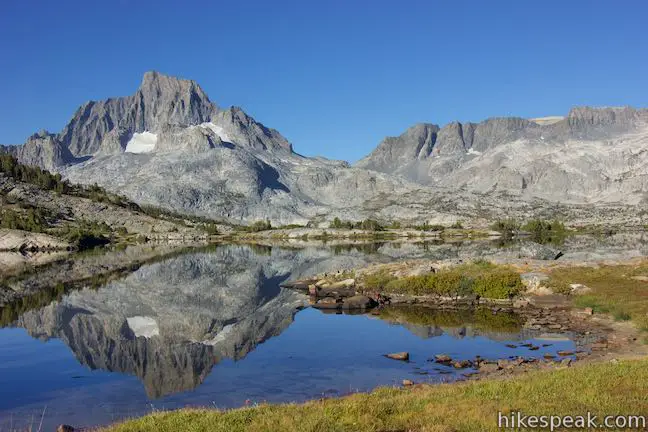
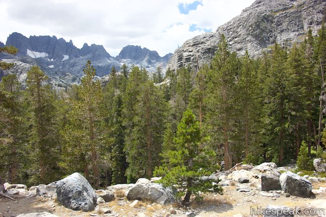
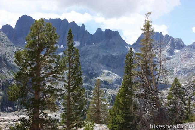
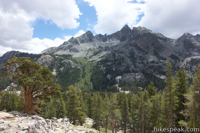
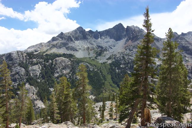
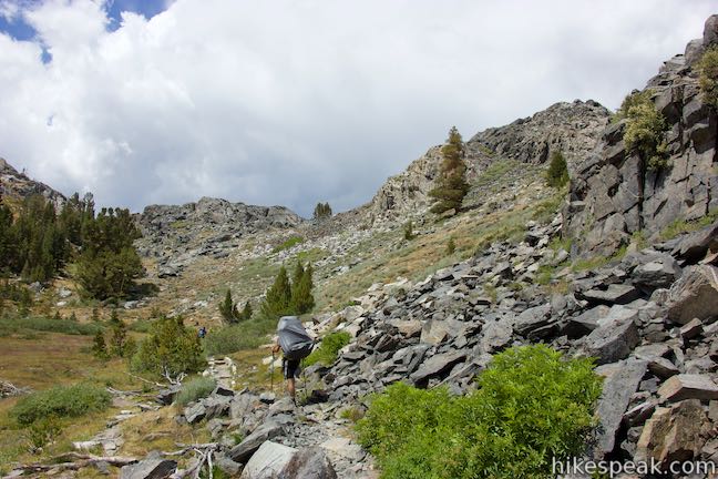
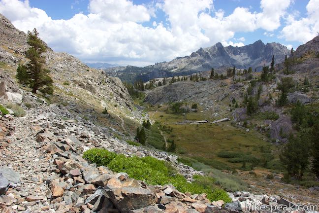
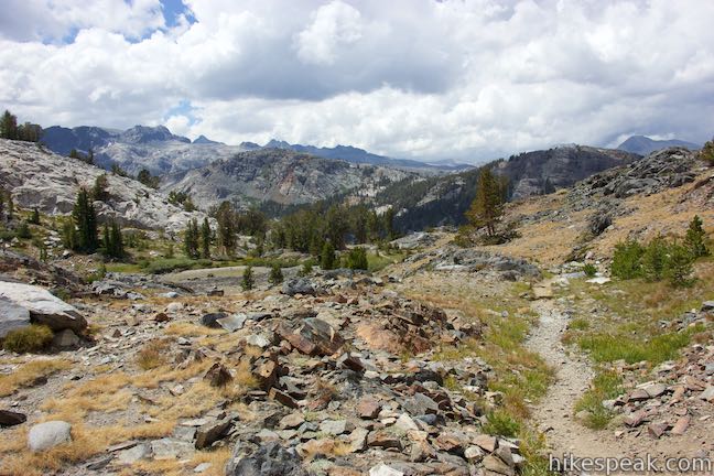
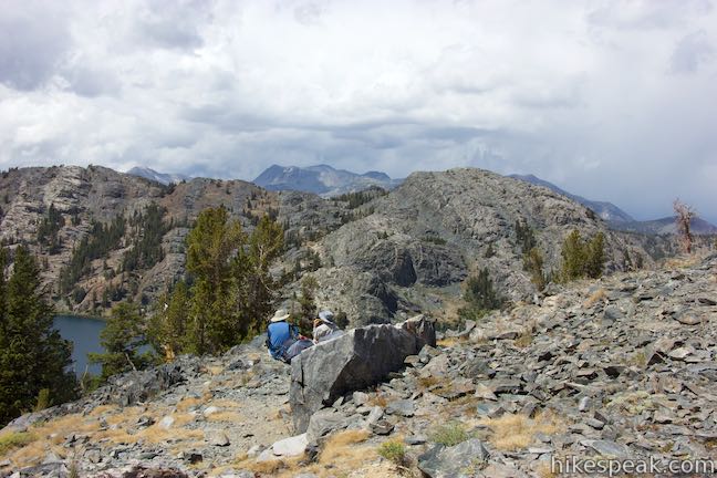
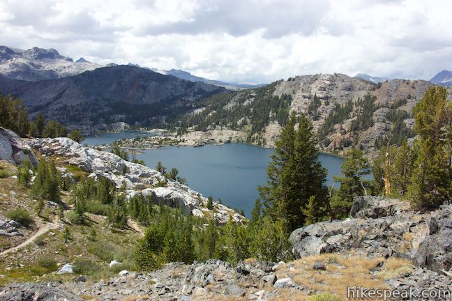
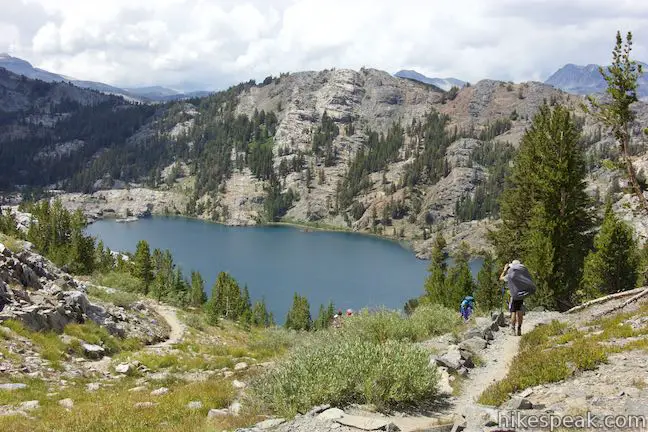
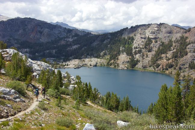
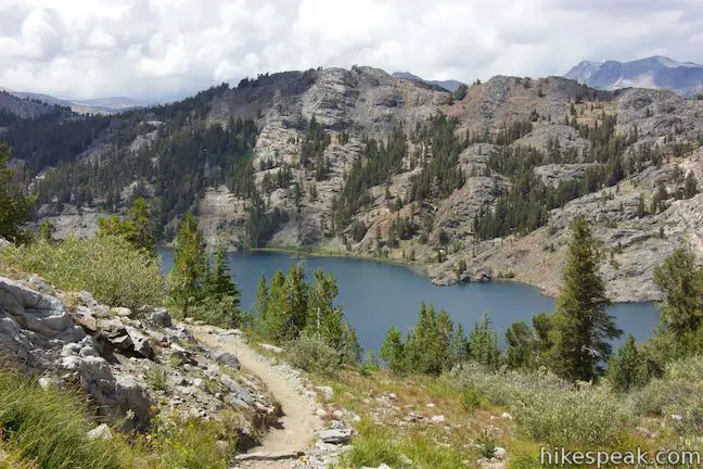
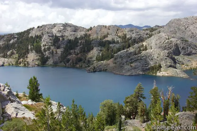
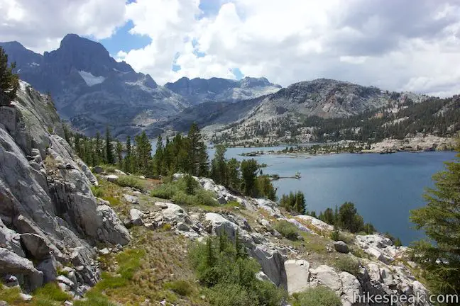
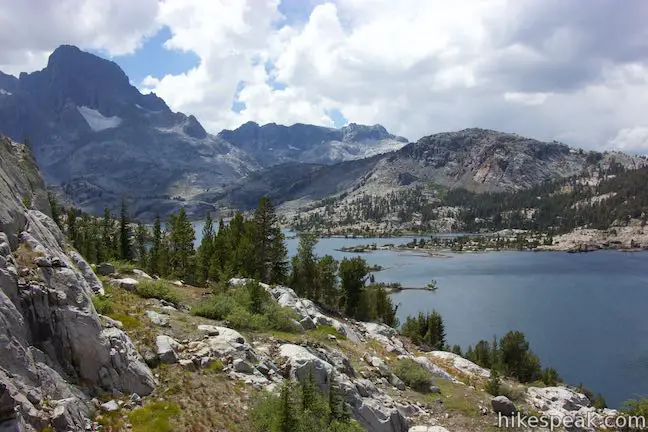
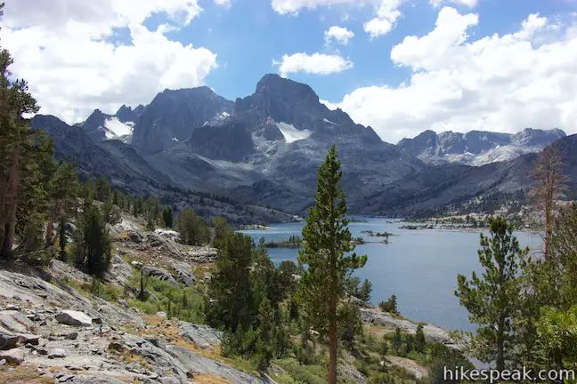
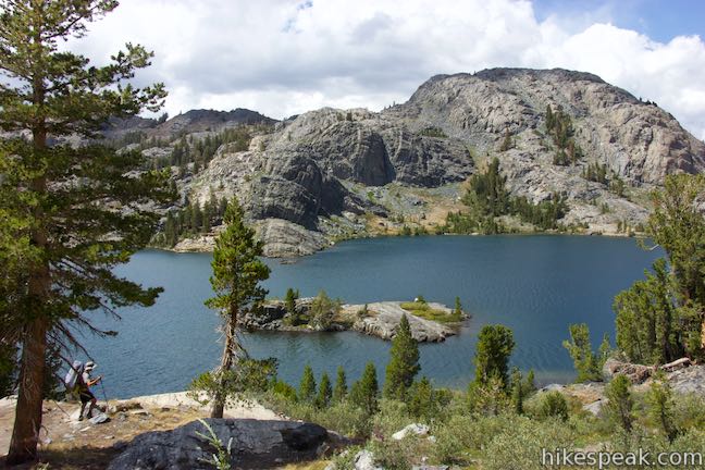
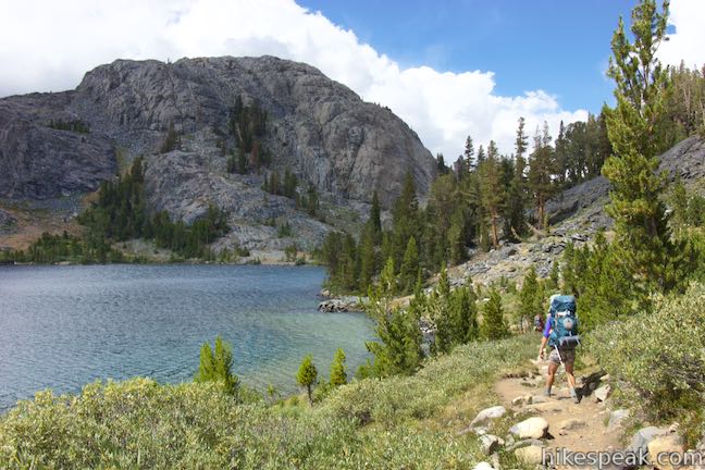
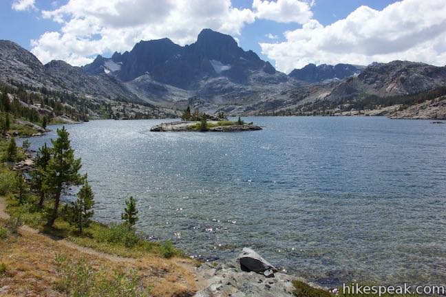
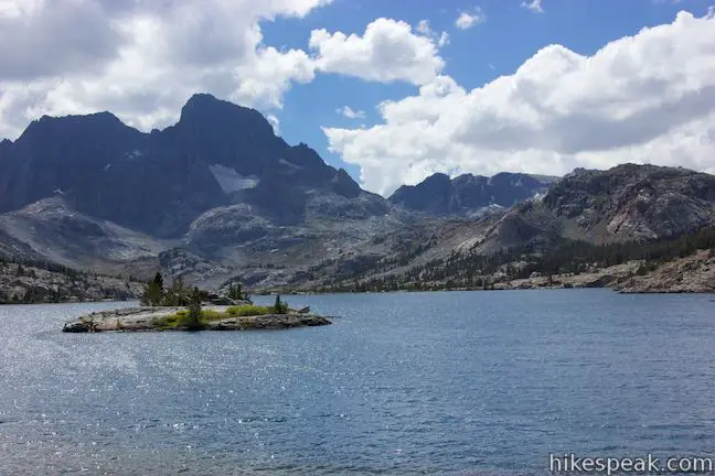
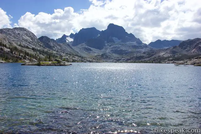
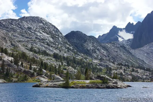
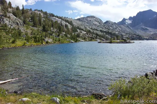
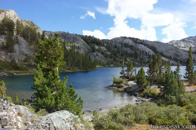
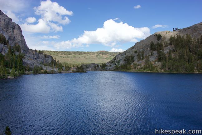
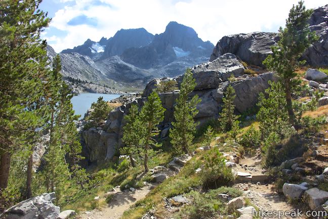
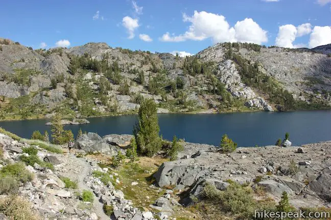
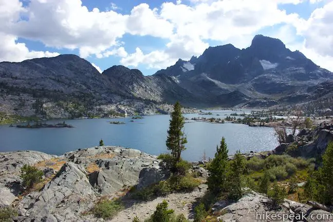
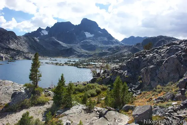
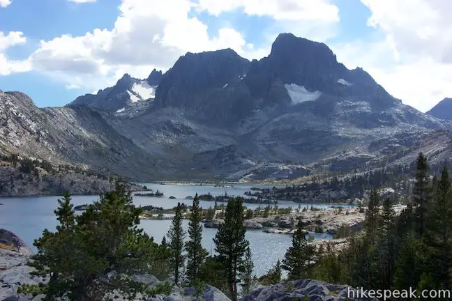
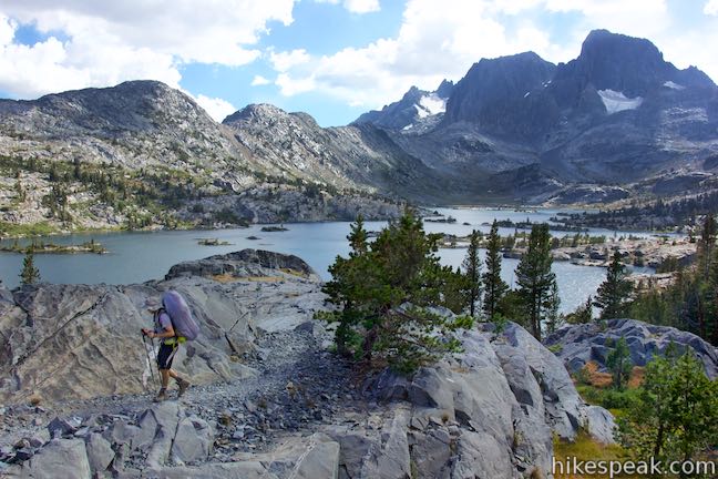
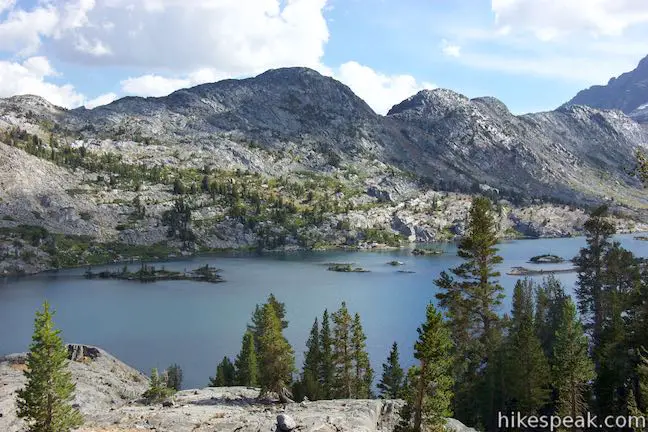
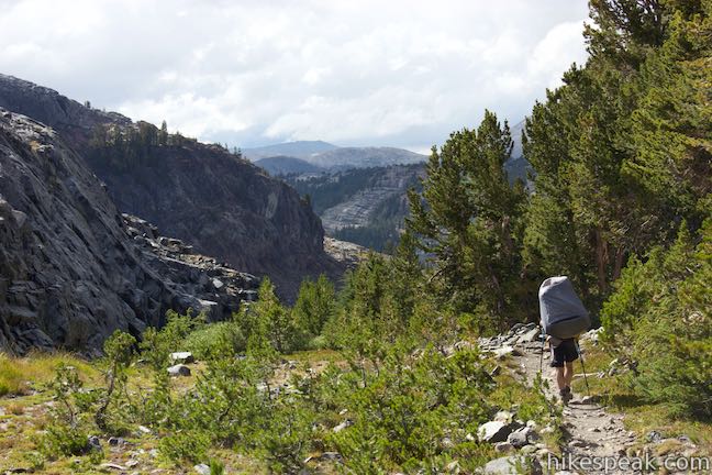
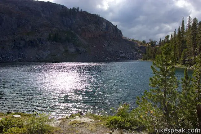
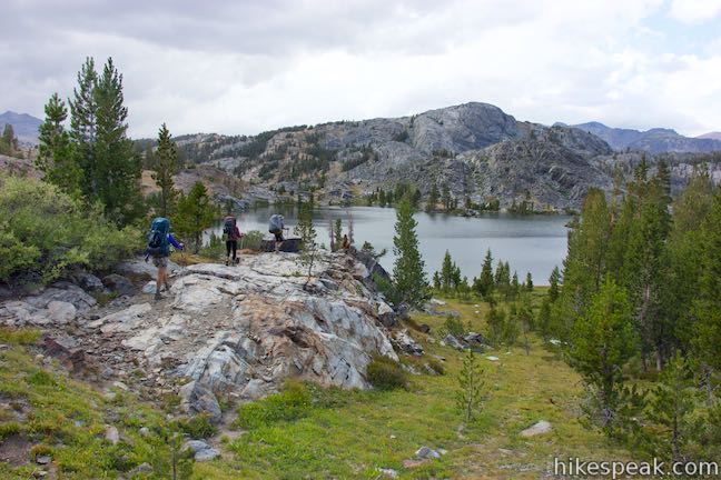
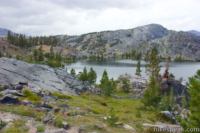
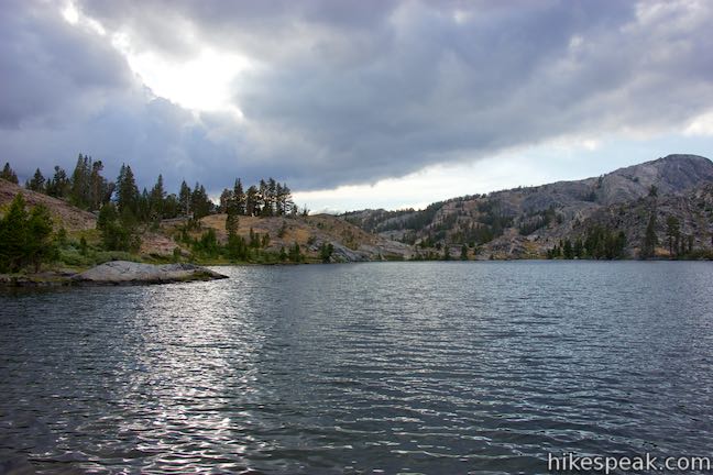
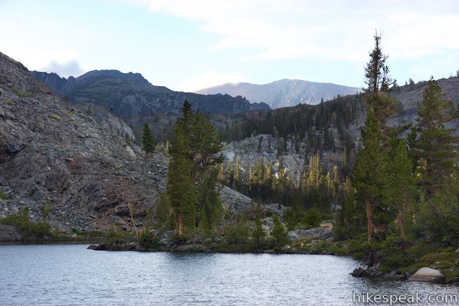
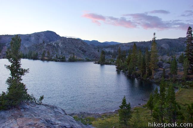
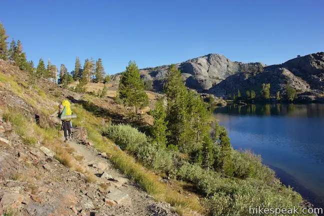
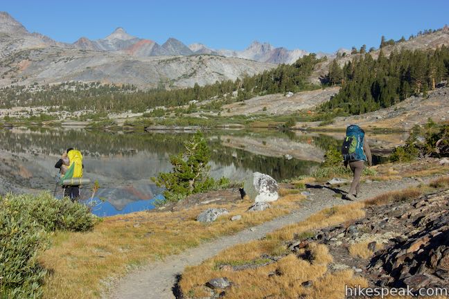
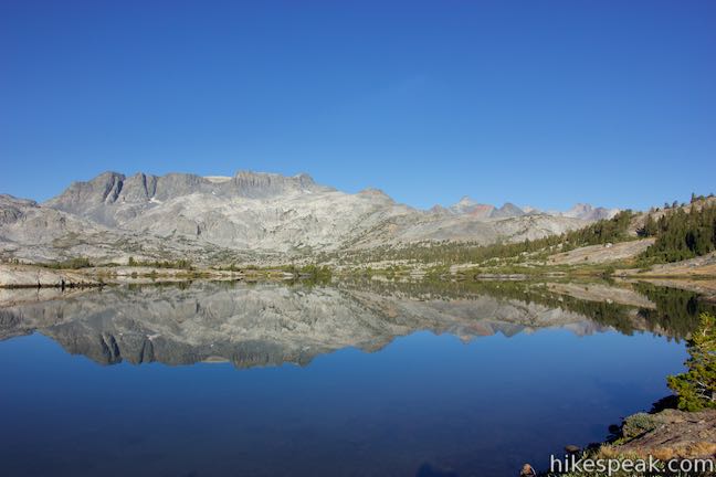
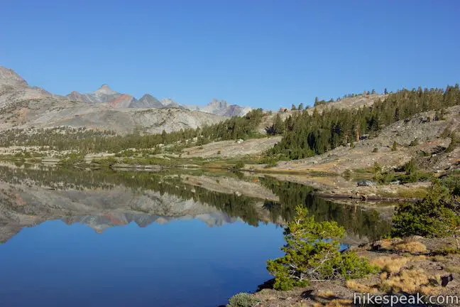
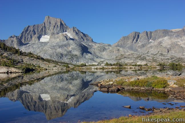
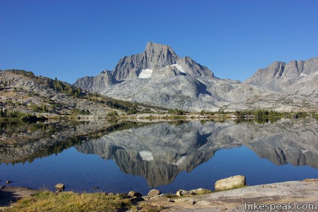
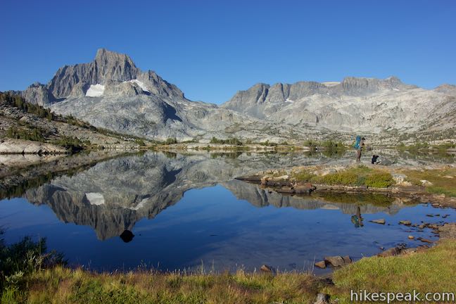
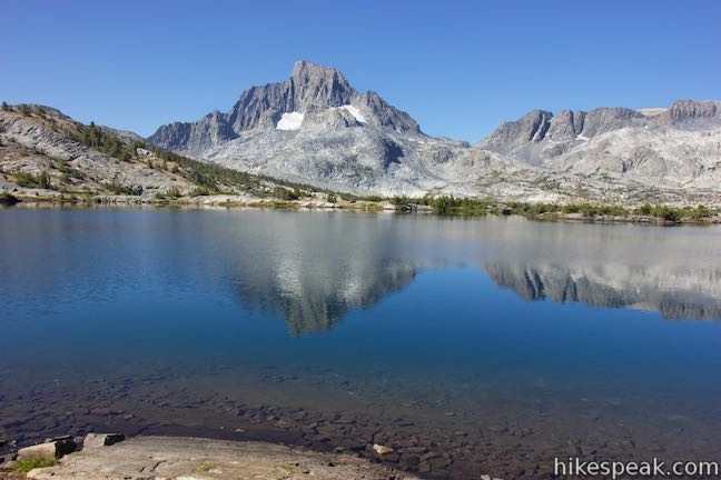
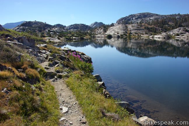
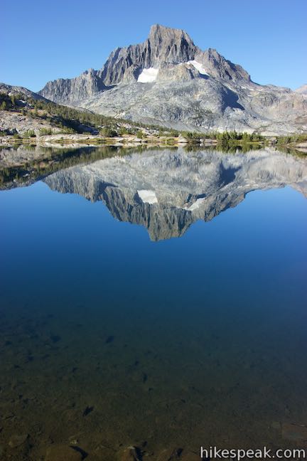
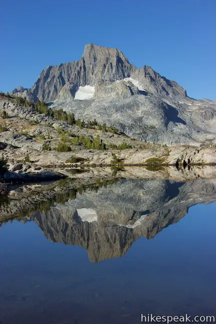
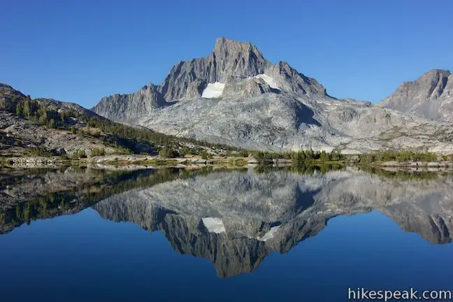
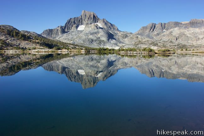
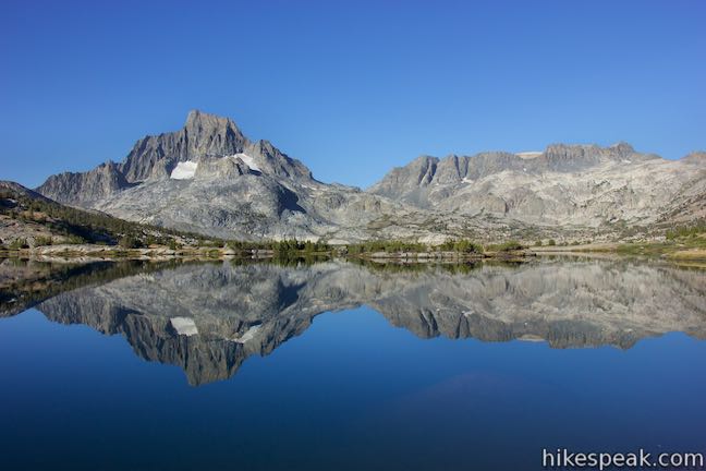
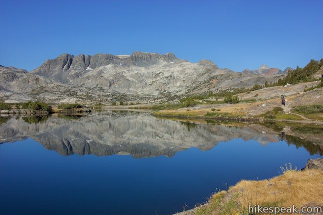
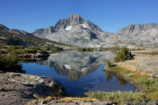
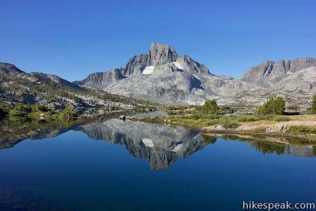
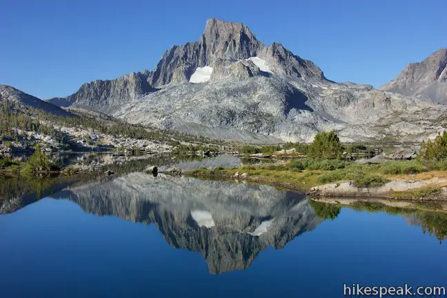
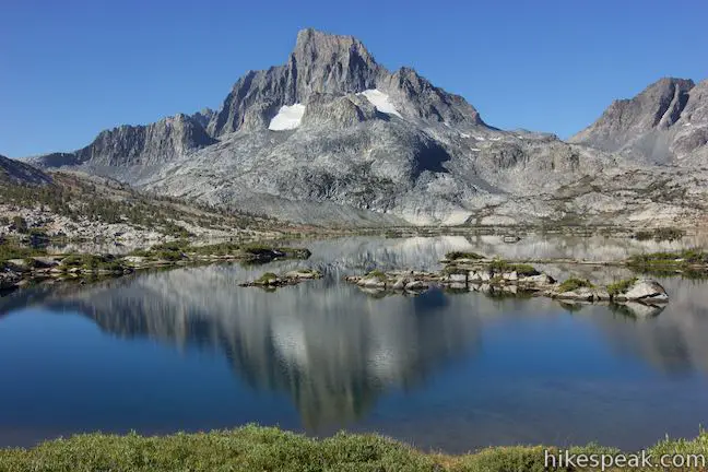
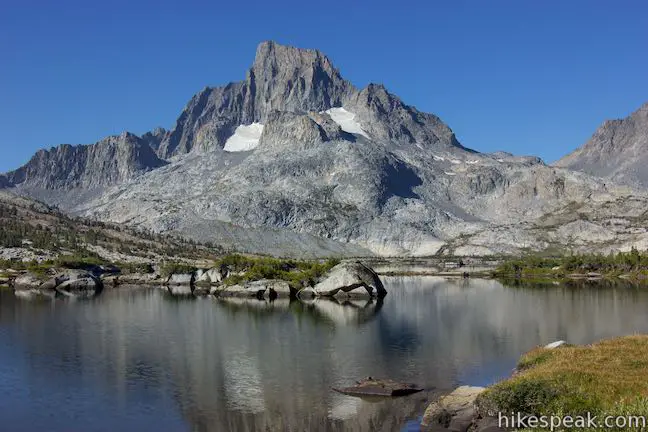
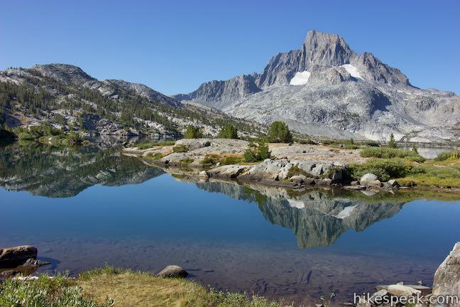
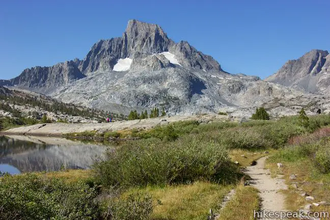
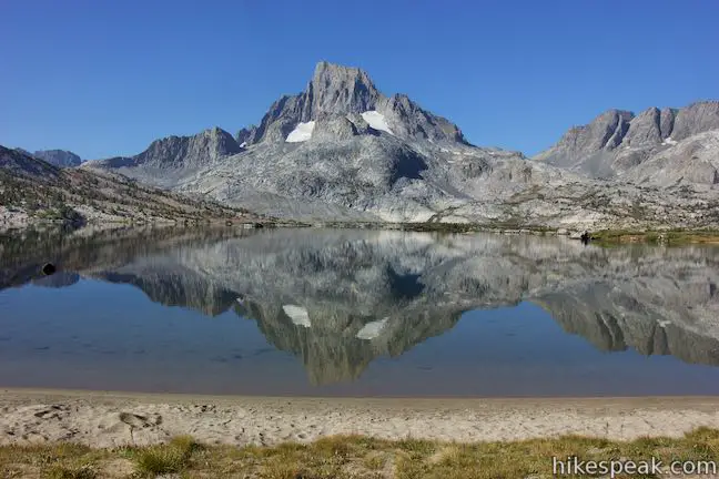
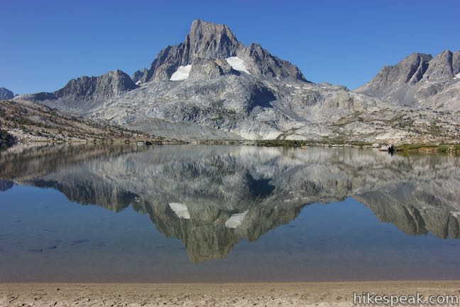
Tip over the 10,110-foot pass and begin down toward Garnet Lake, a sliver of which can be glimpsed from the pass. The trail descends 425 feet over the next mile to the outlet of Garnet Lake and most of that comes over sincere switchbacks. Drop from the pass and walk along a tarn that may be a dry mud pool depending on the season. A tenth of a mile below the pass, reach a vista point overlooking Garnet Lake. Garnet Lake is a beauty, running from the northeast to the southwest, bracketed by stone ridges. Islands are clustered around the west side of the lake below Banner Peak, an imposing Sierra summit. If you need a break, boulders just off the trail provide nice places to sit and take in the views.
Over the next half mile, the trail swings down switchbacks. Each bend delivers a new perspective of Garnet Lake, which grows bigger as you ascend. Eventually, the trail reaches the base of the slope and heads northeast toward the outlet of Garnet Lake.
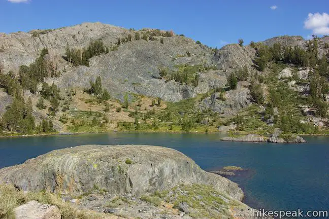
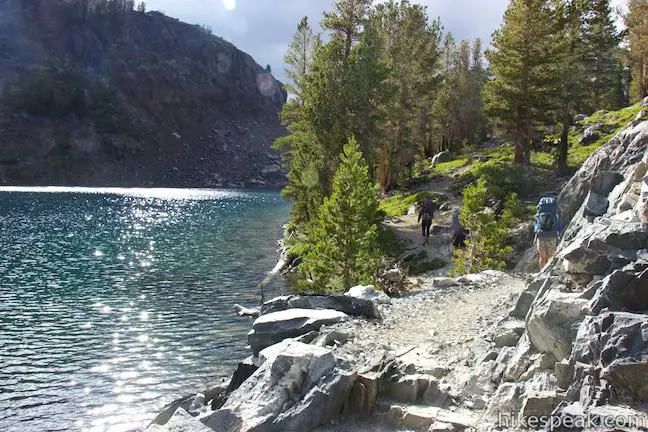
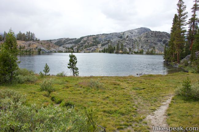
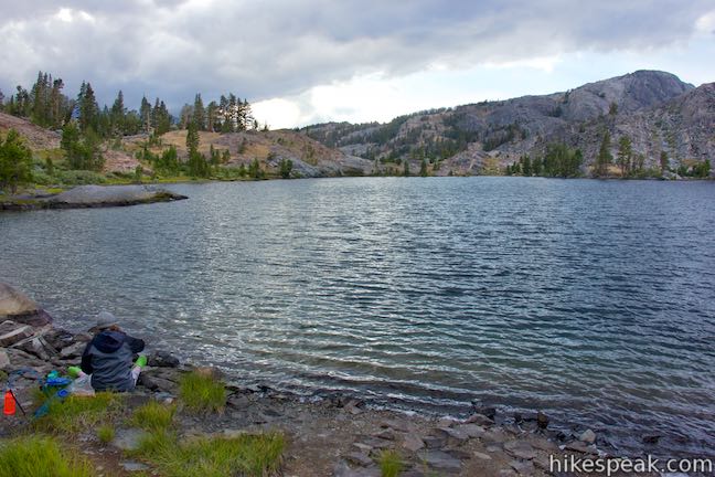
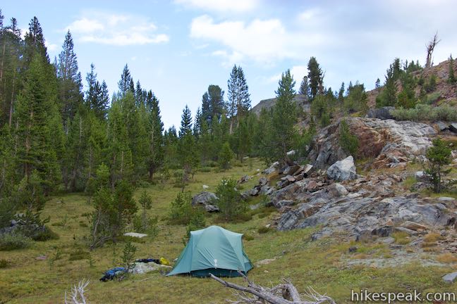
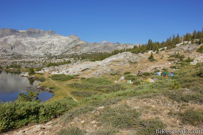
The trail meets the lakeshore, about 0.3 miles to the outlet of the lake. If you plan to camp by Garnet Lake, notice an island that the trail passes as it approaches the shore. Camping around Garnet Lake is only allowed west of that island. Camping closer to the outlet of the lake is banned.
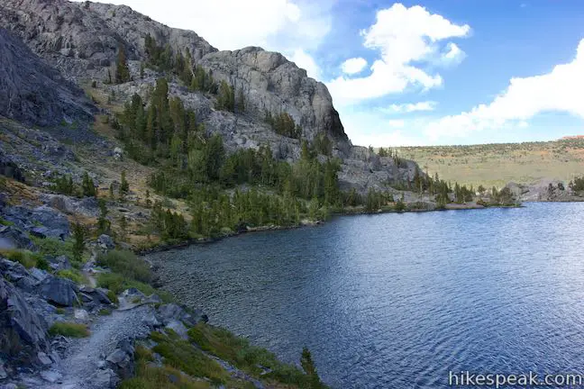
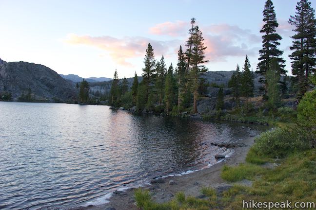
As you come around a cove, 0.15 miles before the outlet of Garnet Lake, pass a short, rocky point jutting into the water. This is a nice place to break by the lake. A special note for swimmers: the small cove to the left of the point has a sandy bottom and is a pleasant place to wade in and swim (if you don’t mind the chill of a mountain lake). On sunny days, the water in the sandy area doesn’t feel as cold as the water farther out.
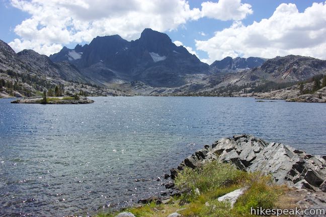
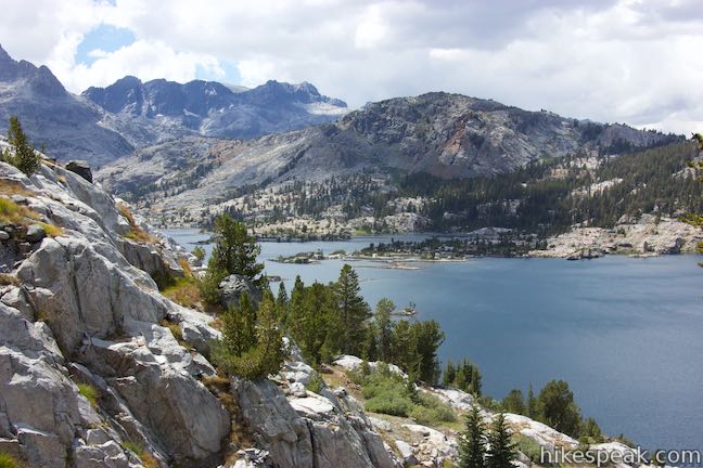
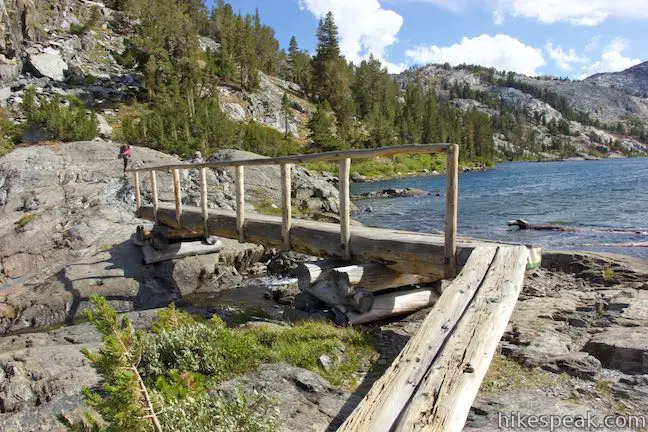
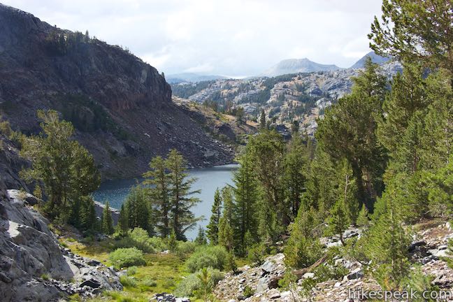
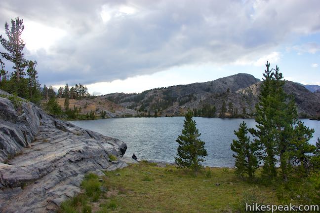
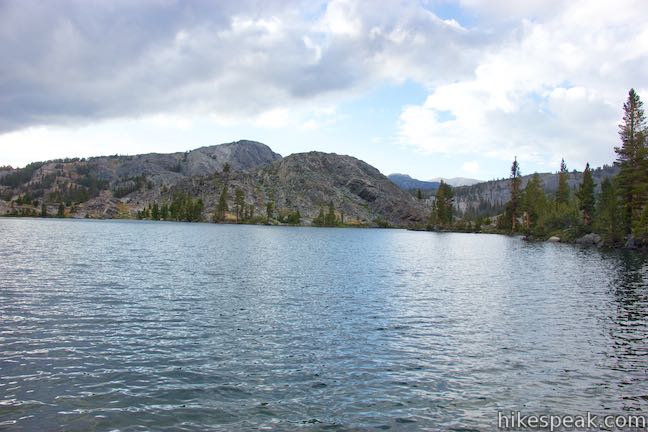
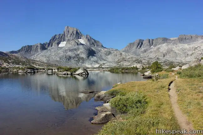
Round a bend in the coast to come to the outlet of the lake where a wooden bridge crosses a stream flowing out of the lake. As you cross the bridge, look back up the length of Garnet Lake toward Banner Peak. In the other direction, you can look northeast down the stream, which makes its way into the valley below and joins the Middle Fork of San Joaquin River.
Garnet Lake to Thousand Island Lake
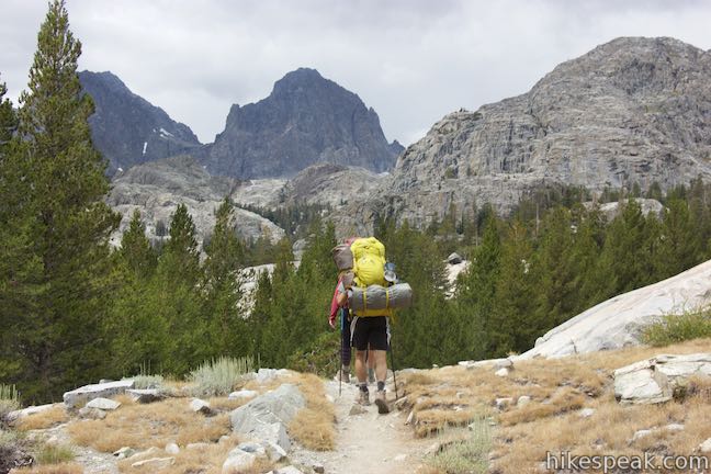
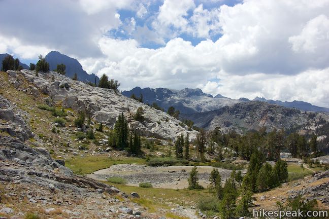
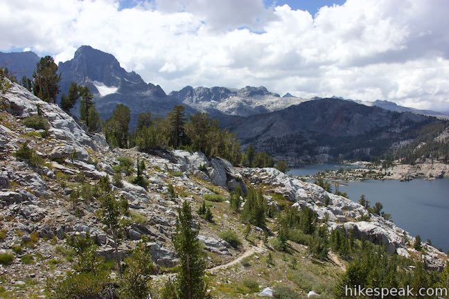
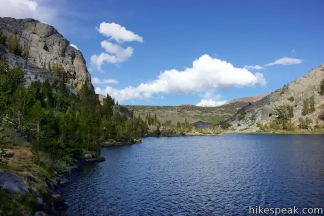
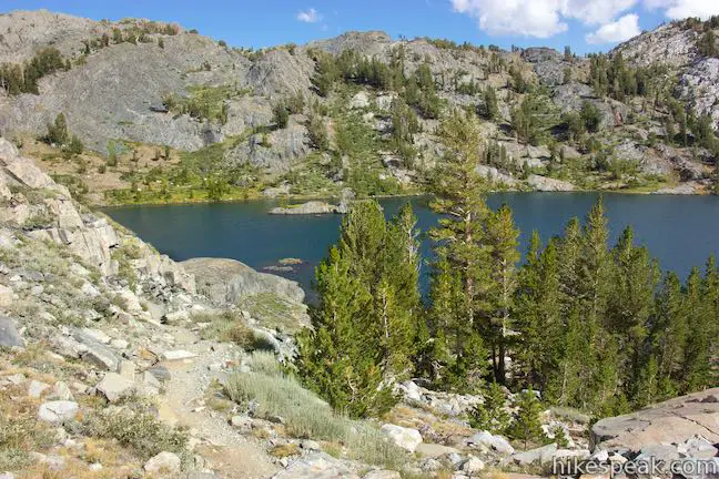
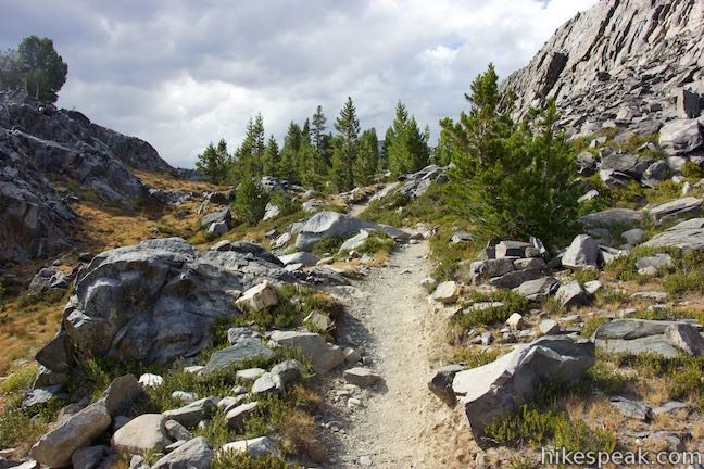
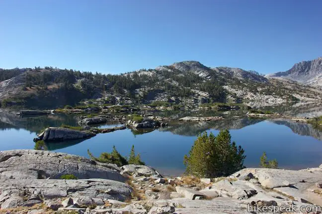
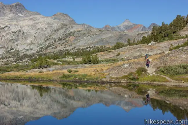
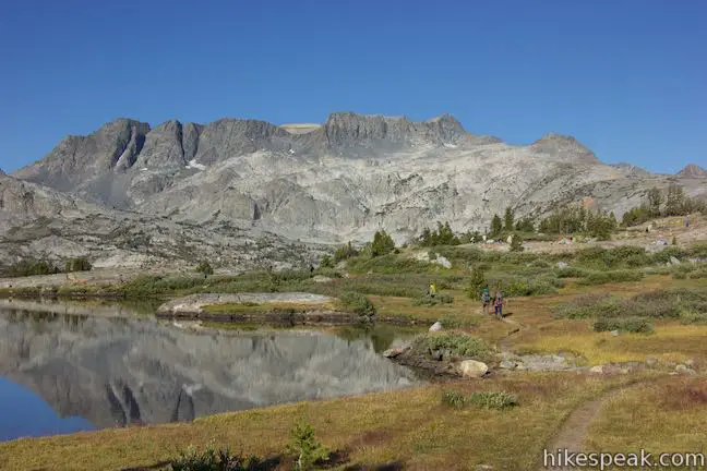
Past the outlet of Garnet Lake, John Muir Trail curves to the left and goes along the shore of the lake for a stretch. From Garnet Lake, it is 2.35 miles to Thousand Island Lake with a pass and two smaller lakes in between. Hike along the north shore of the lake for less than a quarter mile before John Muir Trail turns to the right and heads up switchbacks through pines onto a ledge of bedrock. As the trail heads north, you’ll get lovely views back over Garnet Lake, especially toward the islands to the west beneath Banner Peak.
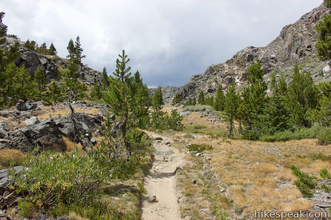
Eventually, you’ll lose sight of the lake as the trail pushes through a gap between boulder formations and ascends to a 10,150-foot pass. While slightly higher than the pass south of Garnet Lake, this high point is easier to reach, with 465 feet gained over one mile from the outlet of Garnet Lake.
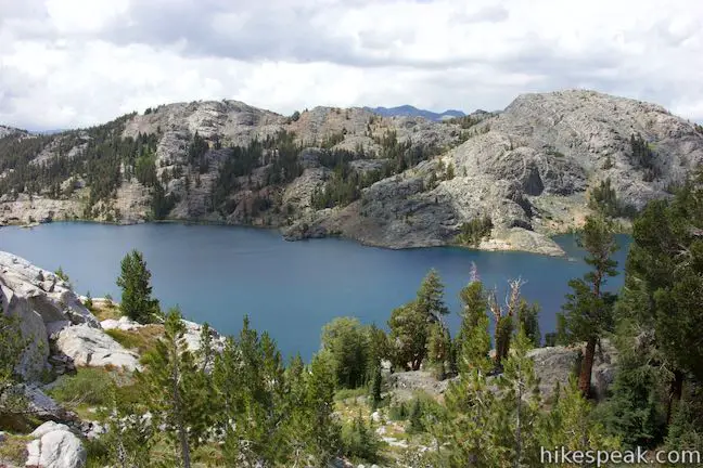
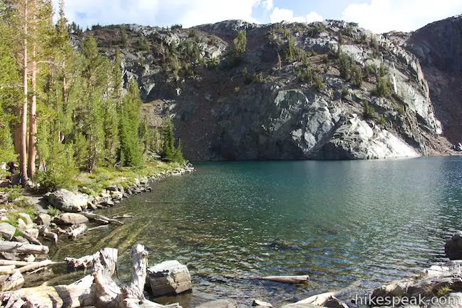
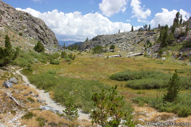
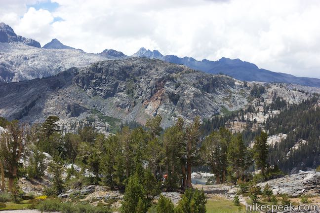
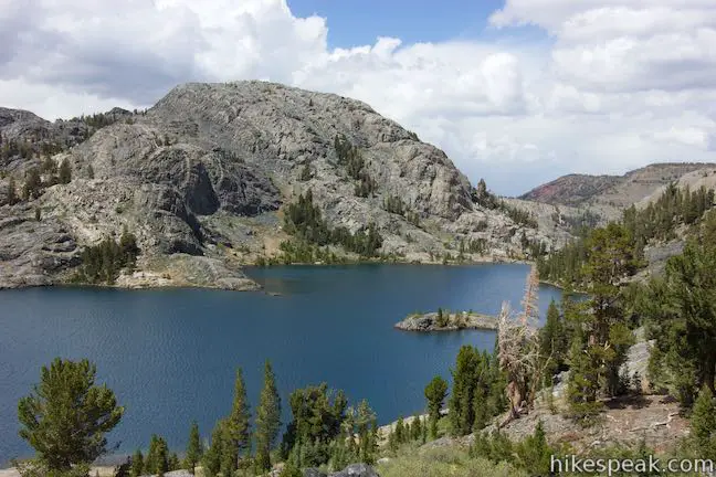
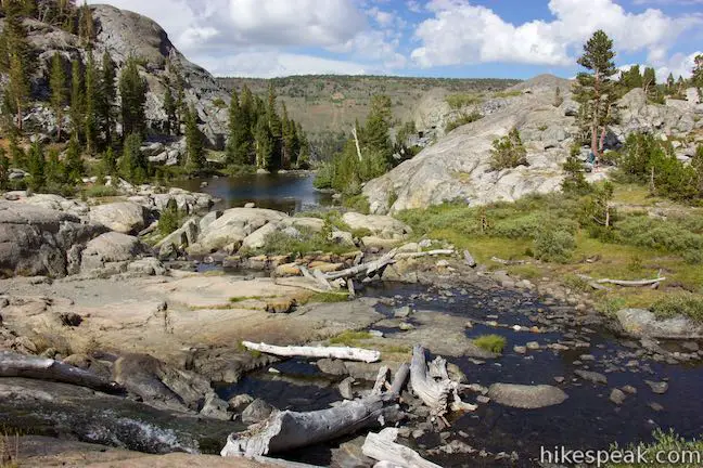
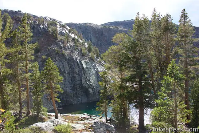
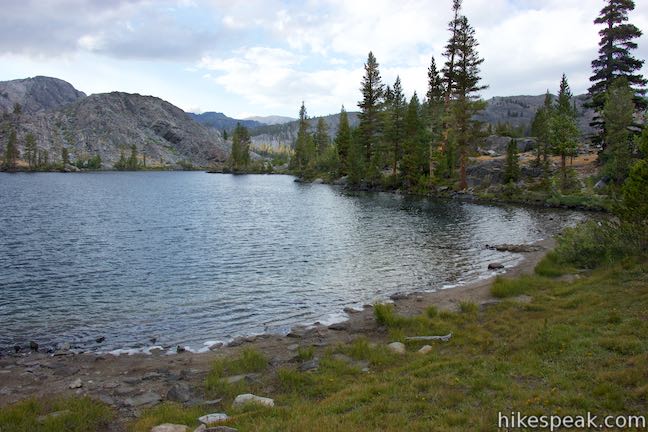
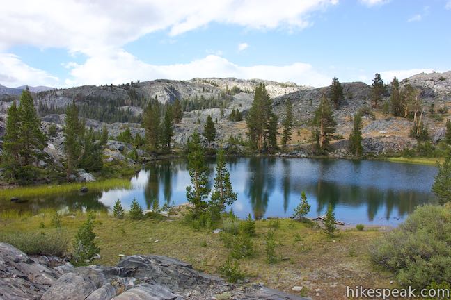
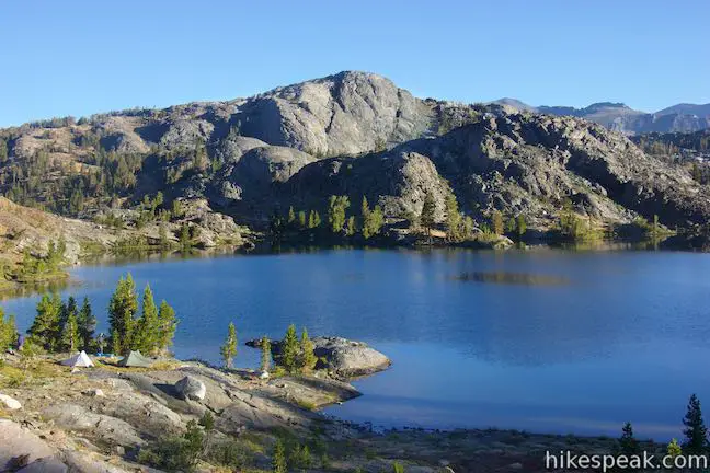
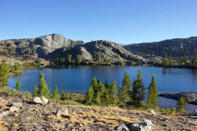
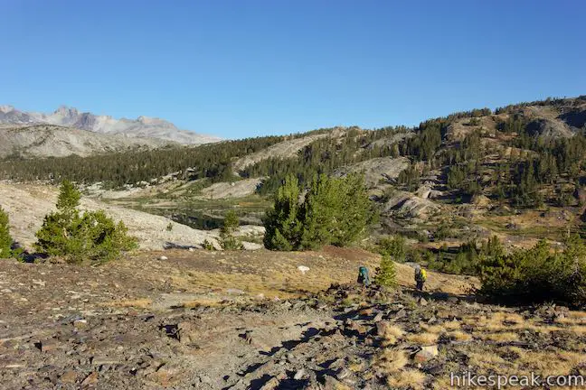
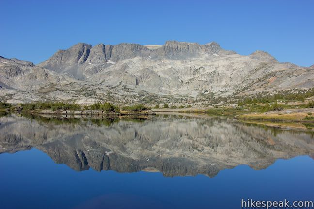
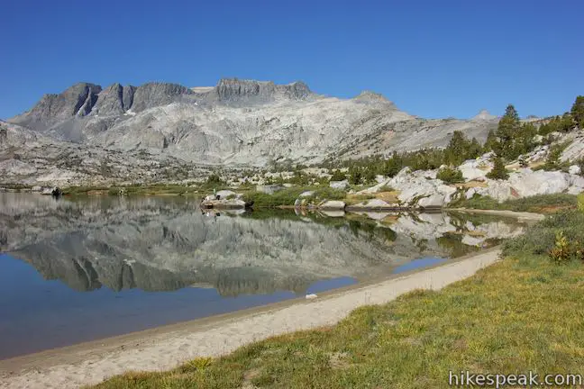
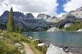
Drop down the other side of the ridge into a forest of dense pines. Through the trees, notice Ruby Lake, a smaller lake backed by steep cliffs. Descend a series of switchbacks toward the shore of Ruby Lake. At the north end of each turn, discover views over a valley to the northeast. After hiking 1.4 miles from the outlet of Garnet Lake, pass the pleasant shore of Ruby Lake, where you can hop across the stream flowing out the lake. Ruby Lake looks relatively round in person, but is shaped like an arrowhead in aerial views.
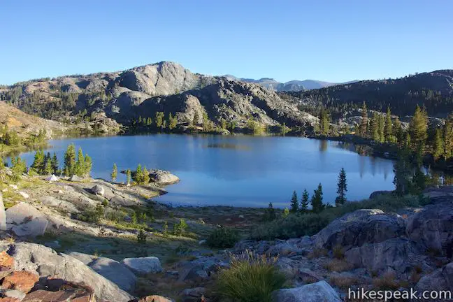
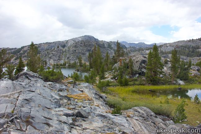
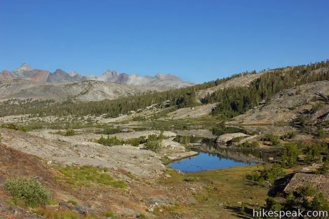
John Muir Trail continues through trees along the north shore of Ruby Lake, before turning away from the water to head over a short rise to another lake. Emerald Lake is larger than Ruby Lake and bordered by a smaller pond. The trail runs along the south shore of Emerald Lake, staying elevated above the water. Backpackers wishing to camp at Emerald Lake will find an obvious site at the southeast end of the lake. Camping on the west side of the lake between Emerald Lake and Thousand Island Lake is prohibited. Short ridges surround Emerald Lake. While it is not a massive lake and doesn’t have views of the area’s tallest mountains, Emerald Lake is a pleasant spot to take a break or camp.
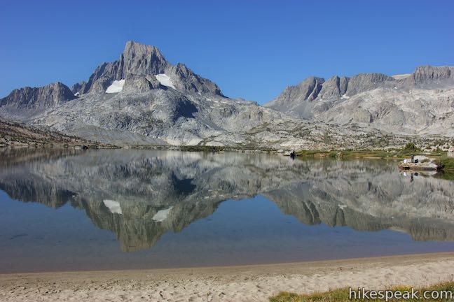
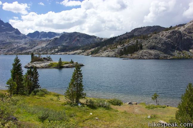
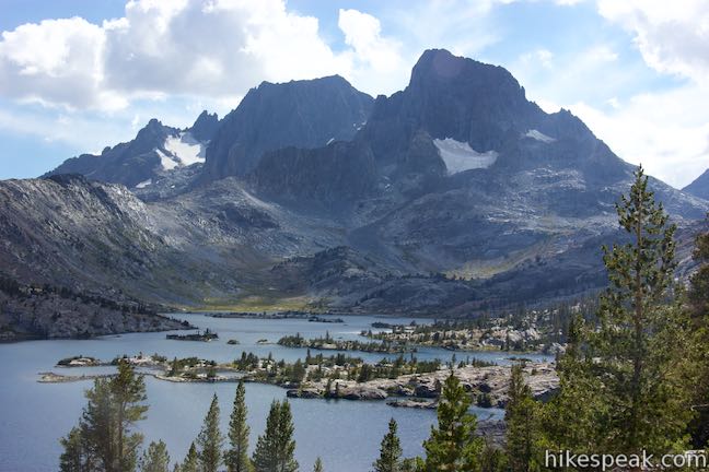
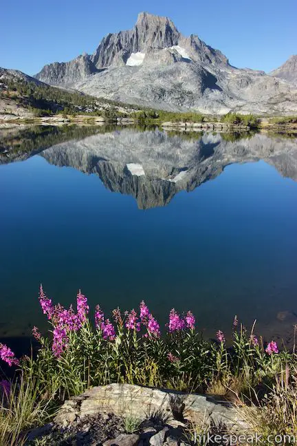
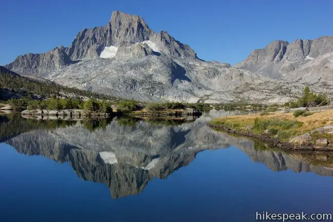
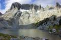
It is only about half a mile from Emerald Lake to Thousand Island Lake. Continue along the shore and rise over a low pass. As you cross over this ridge south of Thousand Island Lake, you’ll begin to see the small northeast end of that lake. There isn’t as much to see from here as you might hope, so head downhill toward the lake. Like Garnet Lake, Thousand Island Lake runs from the northeast to the southwest, where it is close to Banner Peak. The northeast end of Thousand Island Lake, which the trail goes along, is narrower than the other end. Points and islands along the shore shrink the down-the-lake views from John Muir Trail. Nevertheless, it will be obvious that Thousand Island Lake is a beauty worth exploring.
Cross a bridge over the outlet of Thousand Island Lake and walk another tenth of a mile to a 4-way junction. Pacific Crest Trail (High Trail) goes to the right, venturing 8.75 miles back to Agnew Meadows. A united John Muir and Pacific Crest Trails continues to the north toward Island Pass. To the left, a path explores the north shore of Thousand Island Lake.
Places to camp can be found by exploring at least a quarter mile down the trail along the side of the lake. Superb views of Thousand Island Lake and Banner Peak will also be found. A sandy cove half a mile down the trail is a nice place to swim with a great view across the body of the lake toward that peak (over several small islands).
Beyond Thousand Island Lake
Excluding the side trail to Ediza Lake, you could reach the junction by Thousand Island Lake after 10.9 miles of hiking (River Trail to Shadow Lake Trail past Shadow Lake to John Muir Trail and then JMT past Garnet Lake, Ruby Lake, and Emerald Lake). After you explore Thousand Island Lake, you could shorten your hike back to Agnew Meadows by taking High Trail (a section of Pacific Crest Trail). Returning by High Trail makes for a distance of at least twenty miles – a good distance for an overnight trek. With two nights, you can hike a few more miles and add Ediza Lake to the itinerary for the rewarding and lake-filled Ediza Lake – Thousand Island Lake Loop.
What you should know before you go
Dogs are allowed on leashes on trails in Ansel Adams Wilderness. Overnight camping is not allowed around Shadow Lake, along Shadow Creek, and around the outlets of Ediza Lake, Garnet Lake, and Thousand Island Lake (consult with the national forest for maps of restricted areas). The trailhead has a small parking area, toilets, and a bear-proof storage locker. When traveling in the backcountry, you may with to carry an SOS beacon and communicator.
No permit is required to day hike in Ansel Adams Wilderness. A permit is required for any overnight trips and a trail quota is in place. The 18 daily permits for Shadow Creek Trail that can be reserved in advance book up quickly. The other 12 walk-in permits can be obtained at Inyo National Forest Ranger Stations starting at 11 a.m. the previous day. Arrive earlier than eleven, take a number, and wait in line if you are determined to get a walk-in permit. Mammoth Lakes Welcome Center is the nearest Inyo National Forest Ranger Station. The center is open daily from 8 a.m. to 5 p.m. and distributes permits and rents bear-proof canisters. The ranger station is located at 2510 Main Street (Route 203) on the road into Mammoth Lakes.
While the permit has no cost (except an online processing fee), there is a fee to take the shuttle or a vehicle on the road to Agnew Meadows. If you stay at a campground in the Reds Meadow Area during you visit (like Devils Postpile National Monument Campground), you are permitted to drive in and park at the trailhead. Those not staying overnight at a developed campground will need to park at Mammoth Mountain Ski Resort and shuttle in from there (get off at the first shuttle stop for Agnew Meadows). A $10 vehicle fee is charged to drive in. The shuttle charges by the individual (current pricing). From the Agnew Meadows Shuttle Stop, it is an additional 0.4-mile walk down a gravel road to the trailhead for River Trail.
Directions to the Trailhead
- Take Route 395 to Route 203 and drive 3.6 miles to Mammoth Lakes.
- Turn right onto Minaret Road toward Mammoth Mountain.
- Reach the ski resort after 4 miles.
- Unless you are staying at a campground during your visit, park here and take the shuttle to Agnew Meadows.
- If you are driving in, go 1.4 miles past the ski resort to Minaret Vista Entrance Station where a 10-dollar fee is charged for each vehicle to continue down into the valley.
- Drive 2.6 miles down a narrow paved road to a horseshoe bend at the intersection with Agnew Meadows Road.
- Turn right and drive 0.4 miles to the trailhead at the end of the road.
Trailhead Location
Trailhead address: Agnew Meadows Road, Mammoth Lakes, CA 93546
Trailhead coordinates: 37.682, -119.086 (37° 40′ 55.20″N 119° 05′ 09.59″W)
View Ansel Adams Wilderness in a larger map
Or view a regional map of surrounding Sierra Nevada trails and campgrounds.


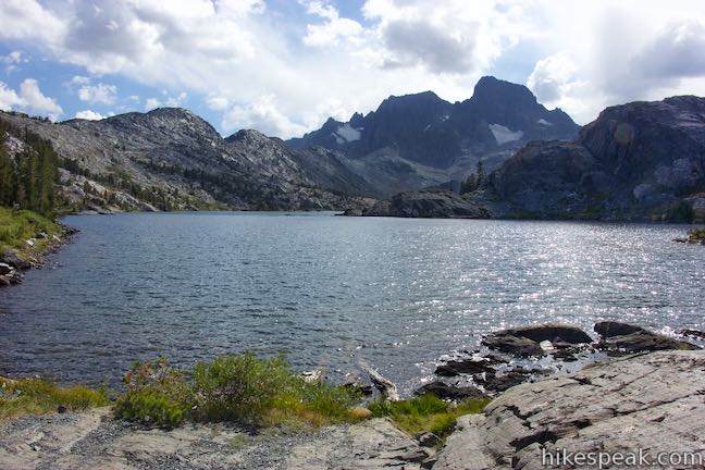


Thousand Island Lake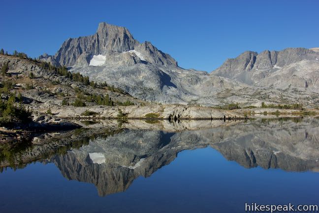


 | Ediza Lake - Thousand Island Lake Loop This multi-day backpacking loop of around 25 miles incorporates sections of John Muir Trail and Pacific Crest Trail to visit a series of stunning Sierra lakes in the Ansel Adams Wilderness of Inyo National Forest. |
 | Thousand Island Lake This exceptional lake is a true gem of the Sierra and is 8.75 miles from the trailhead at Agnew Meadows via High Trail, a section of Pacific Crest Trail, making it a great destination for an overnight trek. |
 | Shadow Lake This 8.5-mile hike crosses a picturesque canyon and passes a plunging cascade to visit a mountain lake in the Ansel Adams Wilderness of Inyo National Forest near Mammoth Lakes. |
 | Ediza Lake This hike of around 15 miles round trip ventures above Shadow Lake along a creek to a beautiful lake below Mount Ritter and Banner Peak in the Ansel Adams Wilderness of Inyo National Forest near Mammoth Lakes. Ediza Lake is an excellent destination for backpackers. |
 | Iceberg Lake This short extension off the trail to Ediza Lake heads to a higher lake in a sublime setting below a ridge of steep spires called the Minarets. |
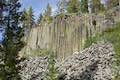 | Devils Postpile This 1 to 1.35-mile hike visits the columnar basalt cliff that Devils Postpile National Monument is named after, with top-down and bottom-up views of the impressive formation. The hike can be extended to include Rainbow Falls at the south end of the monument. |
 | Rainbow Falls This hike of 5.1 miles or more passes the Devils Postpile Formation to reach an attractive 101-foot waterfall with rainbows in its mist. |
 | Minaret Falls This 3-mile hike from Devils Postpile National Monument connects with Pacific Crest Trail to reach the base of a waterfall that tumbles and slides down a rocky slope. |
 | More trails in the Sierra Nevada Mountains Explore other destinations in Inyo National Forest and the rest of the range. |
 | Devils Postpile National Monument Campground This 21-site first-come first-serve campground provides camping in a pine forest next the Middle Fork San Joaquin River near the trailhead for Devils Postpile National Monument. |
- Garnet Lake and Iceberg Lake Trail on kevinstravelblog.com (opens in a new tab)
- Garnet Lake on thecaliforniahikingpage.com (opens in a new tab)
- Garnet Lake on summitascents.com (opens in a new tab)
- Shadow Creek Trail to Garnet Lake on beaut-tree.net (opens in a new tab)
- Thousand Island Lake, Ediza Lake, and Iceberg Lake Loop on backcountrycow.com (opens in a new tab)
- A national forest map of Agnew Meadow Trails (opens in a new tab)
- A national forest brochure for the Reds Meadow - Devils Postpile Shuttle (opens in a new tab)
- Agnew Meadows on summitpost.org (opens in a new tab)
- The official national forest webpage for Shadow Lake Trail (opens in a new tab)
Common Questions about Garnet Lake in Ansel Adams Wilderness
- Is the trail open?
- Yes. You should expect to find that John Muir Trail: Shadow Creek Trail to Thousand Island Lake is open. There are no recent reports of trail closures. If you discover that the trail is closed, please help your fellow hikers by reporting a closure.
- Do I need a permit for this hike?
- Yes. Access fee, overnight permit.
- How much time does this hike take?
- It takes approximately 3 hours to hike John Muir Trail: Shadow Creek Trail to Thousand Island Lake. Individual hiking times vary. Add extra time for breaks and taking in the views.
- How long is this hike?
- The hike to John Muir Trail: Shadow Creek Trail to Thousand Island Lake is a 5.65 mile one-way segment with 1130 feet of elevation change.
- Are dogs allowed on this trail?
- Yes, dogs are allowed on John Muir Trail: Shadow Creek Trail to Thousand Island Lake. The trail is open to hikers, dogs.
- Is there a lake on this hike?
- Yes, John Muir Trail: Shadow Creek Trail to Thousand Island Lake visits a lake.
- Where is the trailhead located?
- The trailhead for John Muir Trail: Shadow Creek Trail to Thousand Island Lake is located in Mammoth Lakes, CA.
Trailhead Address:
Agnew Meadows Road
Mammoth Lakes, CA 93546
Trailhead Coordinates:
37.682, -119.086 - What are the driving directions to the start of the hike?
To get to the trailhead: Take Route 395 to Route 203 and drive 3.6 miles to Mammoth Lakes. Turn right onto Minaret Road toward Mammoth Mountain. Reach the ski resort after 4 miles. Unless you are staying at a campground during your visit, park here and take the shuttle to Agnew Meadows. If you are driving in, go 1.4 miles past the ski resort to Minaret Vista Entrance Station where a 10-dollar fee is charged for each vehicle to continue down into the valley. Drive 2.6 miles down a narrow paved road to a horseshoe bend at the intersection with Agnew Meadows Road. Turn right and drive 0.4 miles to the trailhead at the end of the road.
View custom Google Maps directions from your current location.
- Are there other trails near John Muir Trail: Shadow Creek Trail to Thousand Island Lake?
- Yes, you can find other nearby hikes using the Hikespeak Hike Finder Map.

There is an “unmaintained” trail between the San Joaquin River and Garnet, as well as rough passes at the back side of the lakes right below Banner. The JMT is the most accessible/popular route.
[…] a photo by National Geographic photographer Peter Essick. A monumental shot of thunder clouds at Garnet Lake located on John Muir Trail between Shadow Lake and Thousand Island Lake in the Ansel Adams […]