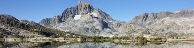
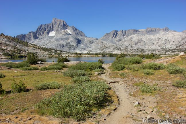
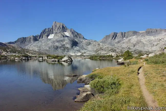
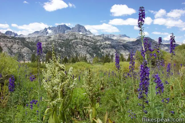
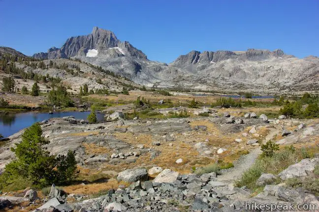
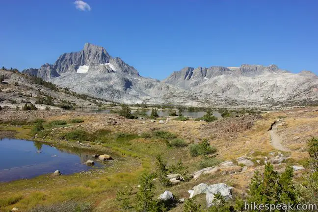
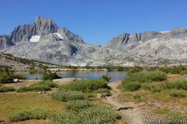
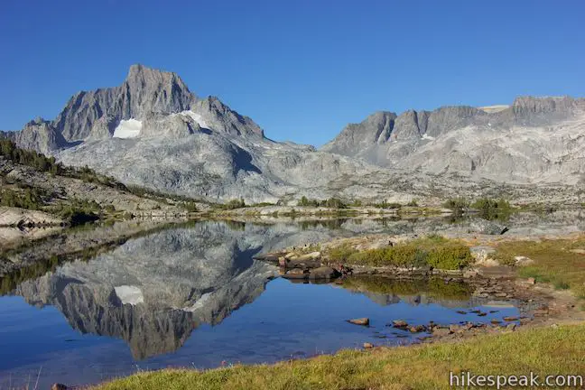
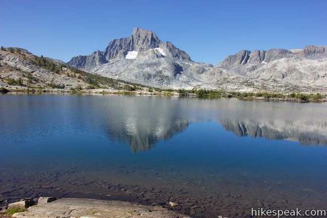
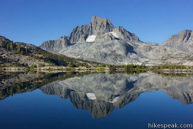
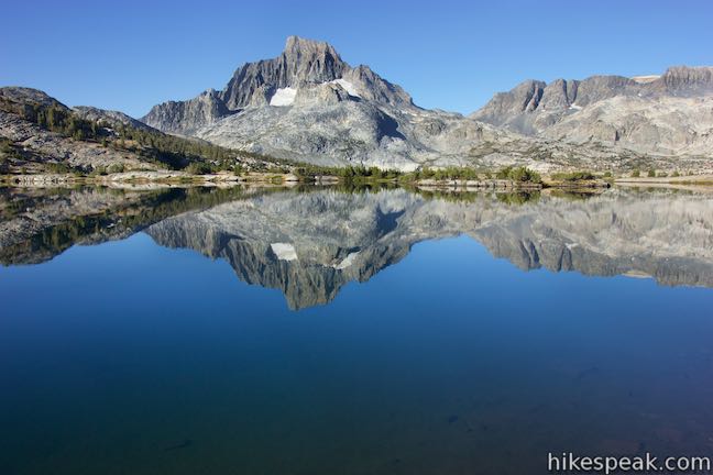
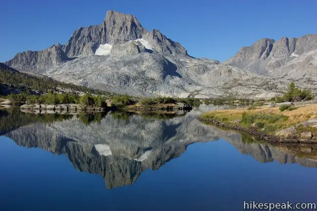
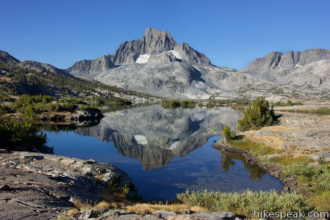
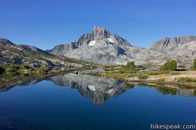
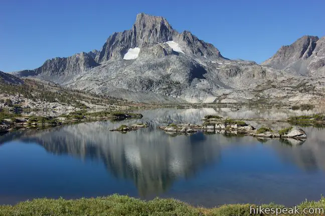
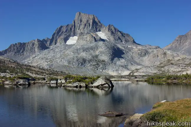
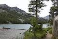
Thousand Island Lake is regarded as one of the most spectacular lakes in the Eastern Sierra. Banner Peak, a towering 12,936-foot mountain above the lake’s west shore, is reflected in its clear blue water. The lake has numerous (if not a thousand) small islands. Both John Muir Trail and Pacific Crest Trail pass Thousand Island Lake, giving hikers significant and scenic routes to consider.
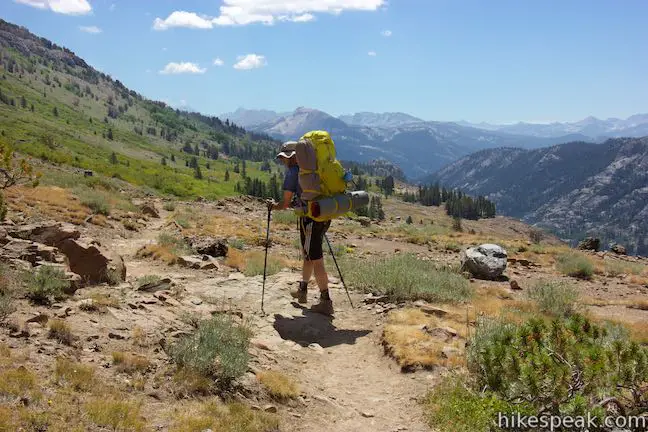
High Trail is one of a few different routes that lead to Thousand Island Lake from trailheads at Agnew Meadows (near Mammoth Lakes). High Trail is an 8.75-mile long section of Pacific Crest Trail that is full of sweeping panoramas. Beyond the junction where High Trail meets John Muir Trail, hikers will definitely want to venture up a less formal trail along the shore of Thousand Island Lake to get the best views of the lake, bringing the out-and-back distance for a day hike to Thousand Island Lake to at least 18 miles.
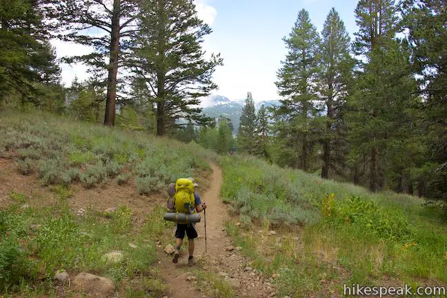
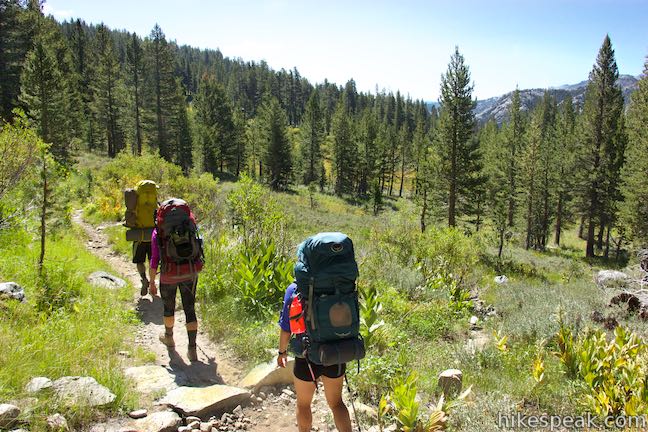
Because of the mileage commitment, Thousand Island Lake is a desirable destination for backpackers and a popular overnight camping spot in Ansel Adams Wilderness. Hikers can use the junction of John Muir Trail and Pacific Crest Trail to create a grand loop, like the Ediza Lake – Thousand Island Lake Loop, which is a minimum of 23.75 miles round trip and takes hikers to a few other beautiful lakes.
High Trail (PCT) to Thousand Island Lake
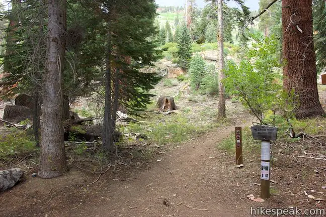
High Trail begins from Agnew Meadows, which has a pair of trailhead for two sections of Pacific Crest Trail going through the Ansel Adams Wilderness of Inyo National Forest. Agnew Meadows is located near Mammoth Lakes on the east side of the Sierra Nevada Mountains.
Starting from the Agnew Meadows Shuttle Stop, walk a quarter mile down Agnew Meadows Road, past a pack station, to the start of High Trail. High Trail begins on the right and is the northbound section of Pacific Crest Trail. Another 0.15 miles down Agnew Meadows Road, at the end of the road, the southbound section of Pacific Crest Trail called River Trail leaves Agnew Meadows.
High Trail starts at an elevation of 8,340 feet and ascends to 9,725 feet as it crosses the northeast side of a canyon containing the Middle Fork of San Joaquin River. The trail bounces down to 9,415 feet before ascending to Thousand Island Lake at 9,840 feet.
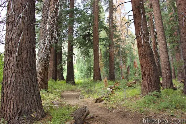
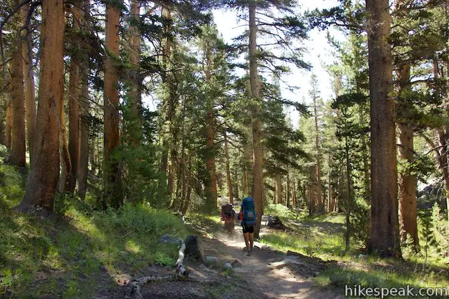
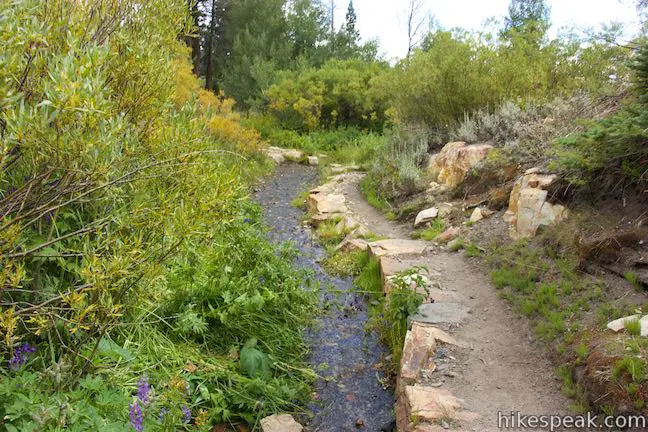
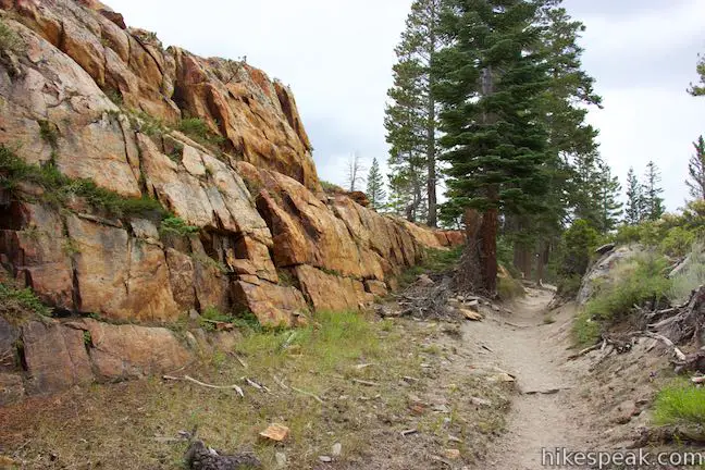
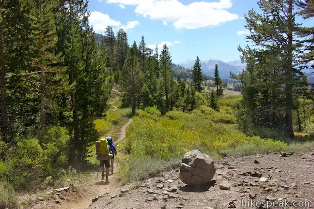
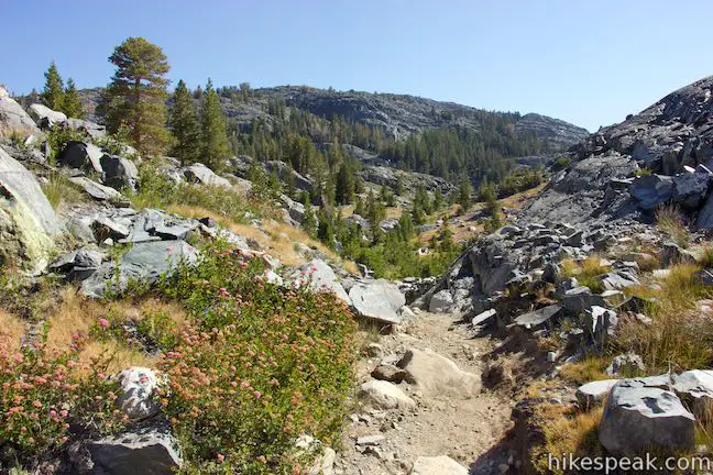
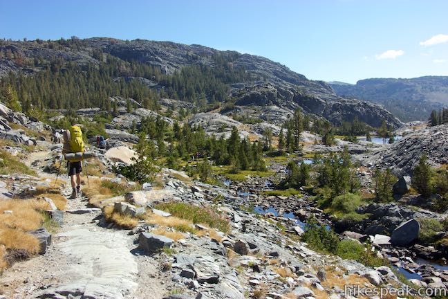
Begin up High Trail, crossing over a log bridge to pass the back of the pack station. Weave uphill through tall pines and approach a string of switchbacks on a brush-covered slope.
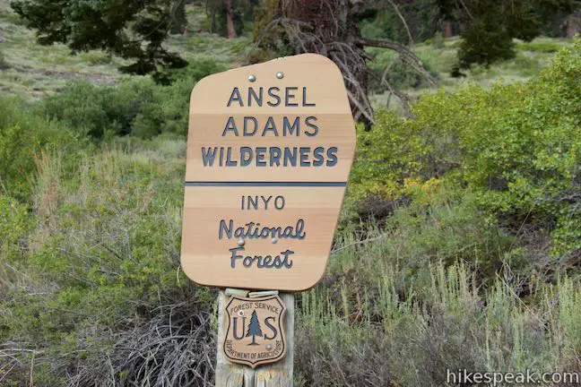
Near the bottom of the switchbacks, the trail passes a sign marking the boundary of Ansel Adams Wilderness, 0.4 miles from the trailhead. Take the trail up through half a dozen turns, rising above the pines. Atop the switchbacks, you’ll get your first views over the canyon to the west. This perspective gets better as you go.
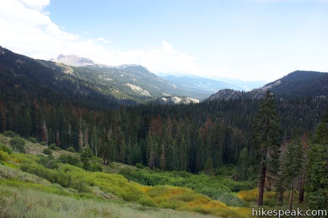
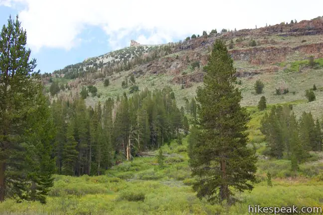
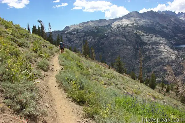
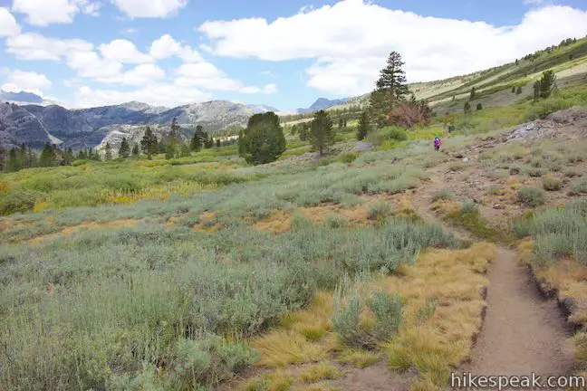
After the switchbacks, High Trail continues to ascend gradually aiming due northwest along the side of the canyon. Looking back to the south, you’ll see Agnew Meadows below, breaking up the pines. Farther to the south rises Mammoth Mountain, home of a popular ski resort.
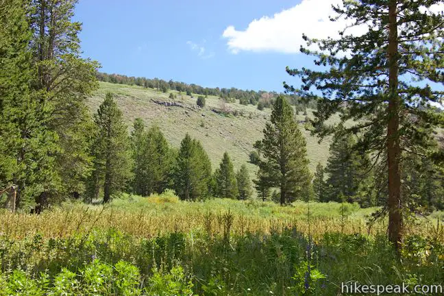
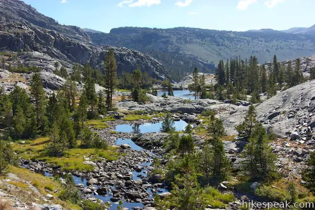
The trail goes through lush meadows past a few small streams. There are over a dozen streams along High Trail, where water crosses the trail as it heads down the side of the canyon. If you need a source of water to filter, you should have plenty of chances along High Trail.
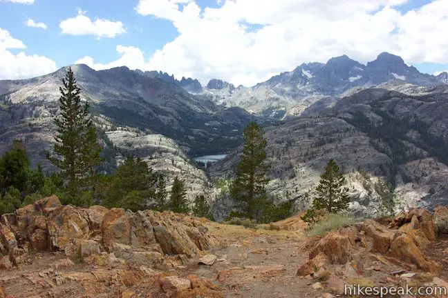
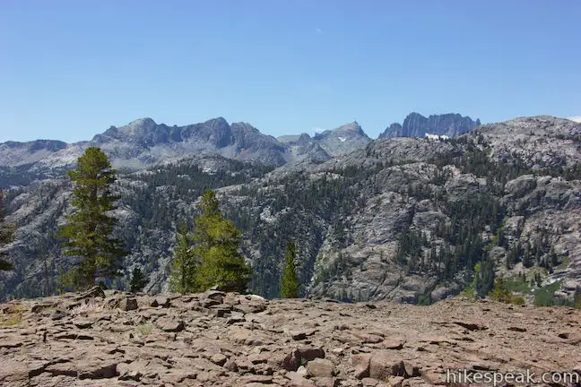
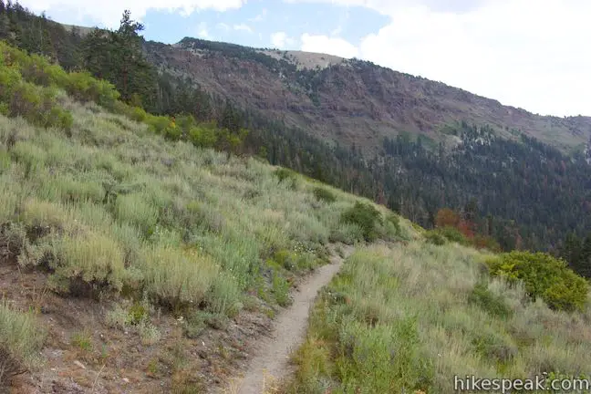
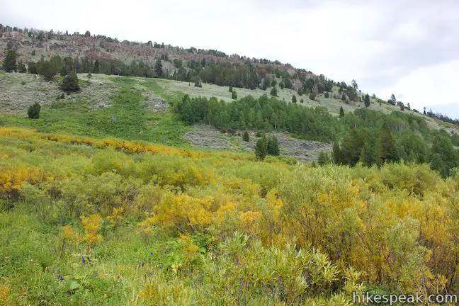
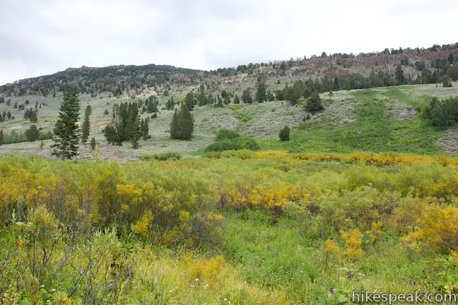
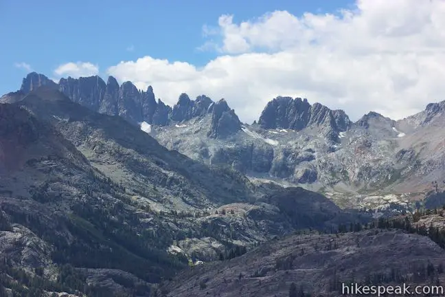
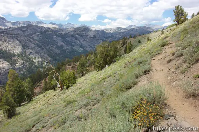
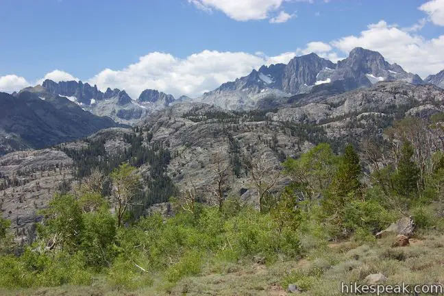
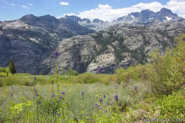
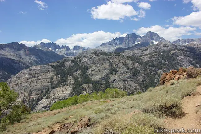
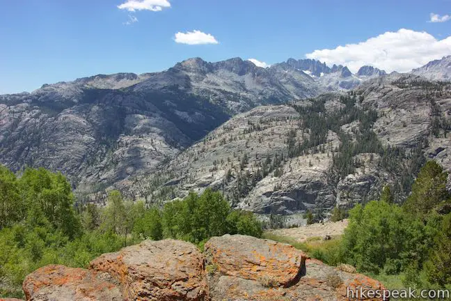
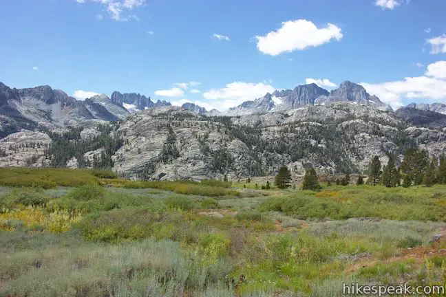
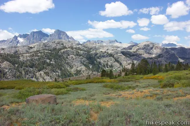
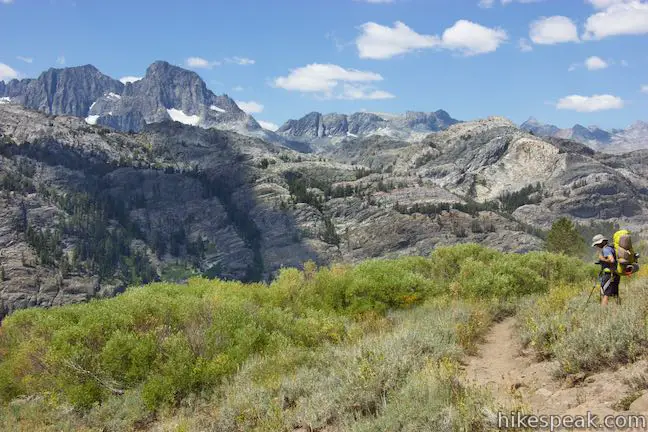
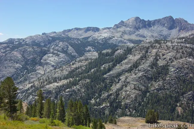
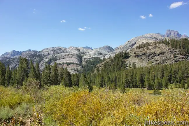
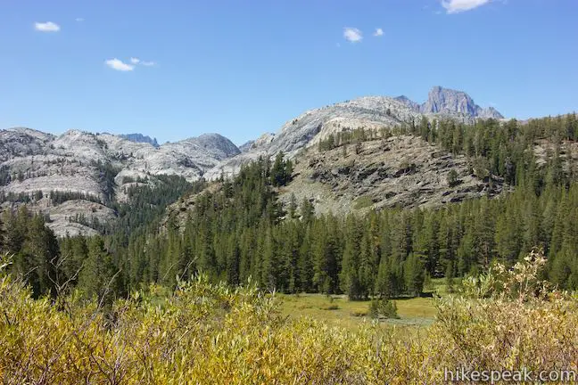
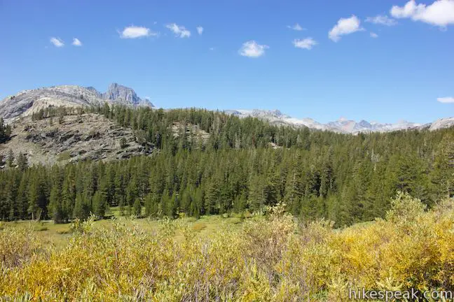
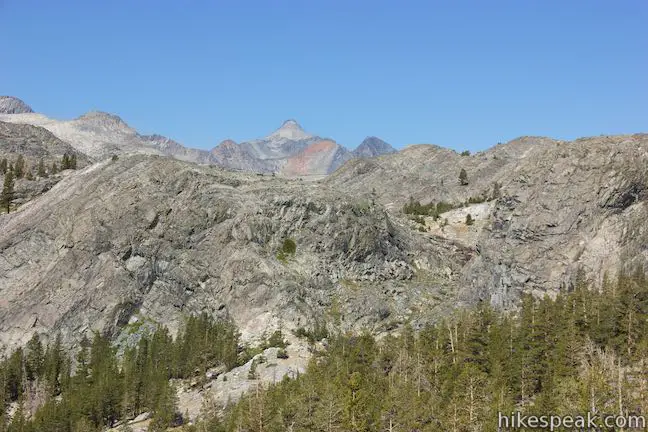
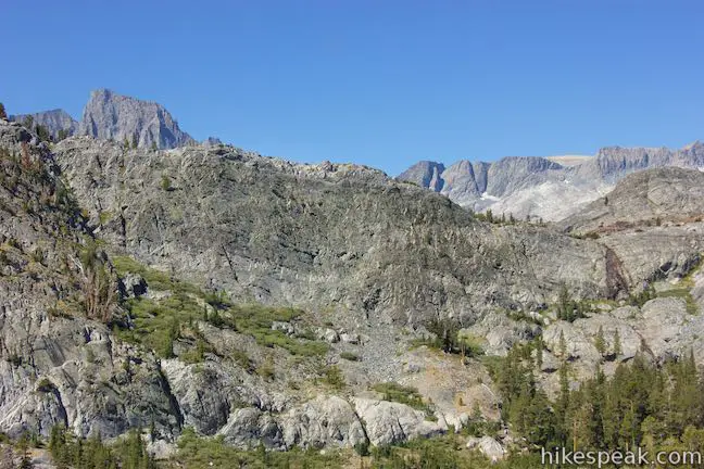
As the trail continues uphill, the pines give way to slopes of sage and brush that offer broader views. Look across the canyon to the west, which contains River Trail and the Middle Fork of San Joaquin River. On the other side of the canyon rises a steep stone ridge backed by impressive high peaks like the Minarets and the double-pyramid of Mount Ritter and Banner Peak just a bit farther to the north.
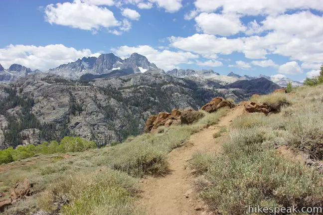
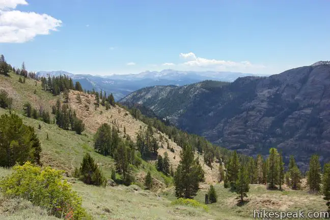
If you like what you see, there’s good news. The views remain immense over the next several miles as you head northwest across the side of the canyon.
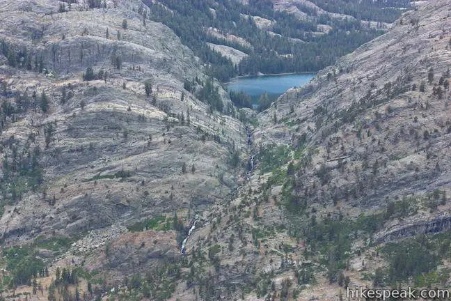
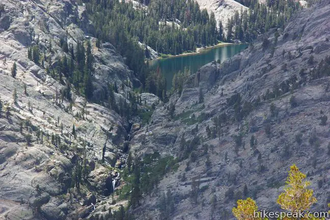
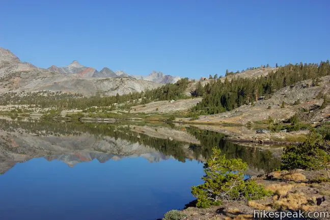
You will pass through clusters of quaking aspens marking riparian areas on the side of the canyon. As you progress farther to the north, you’ll line up for a view of Shadow Lake, which is on the opposite side of the canyon, cradled in a hanging valley and surrounded by pines. A cascade below the lake is visible too, bordered by Shadow Creek Trail. The gap created by Shadow Lake makes for a good perspective of the Minarets, a volcanic ridge of jagged peaks.
The best views of Shadow Lake come at bends in the trail, 3.15 and 3.75 miles from Agnew Meadows. At the first bend, which has an outcropping of orange rock, you can step out on the rock and get a fine look at Shadow Lake and the cascade that flows below.
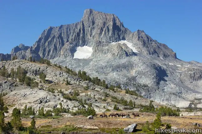
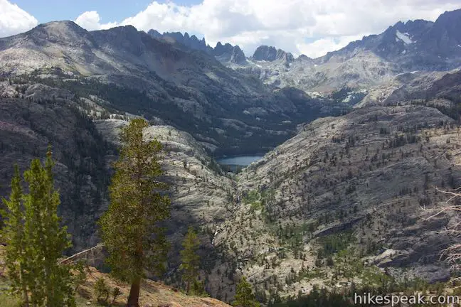
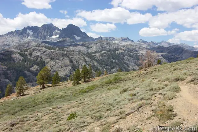
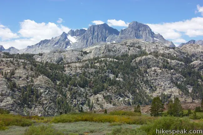
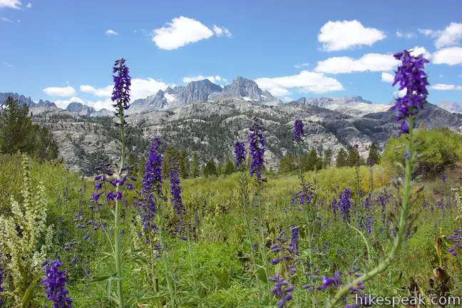
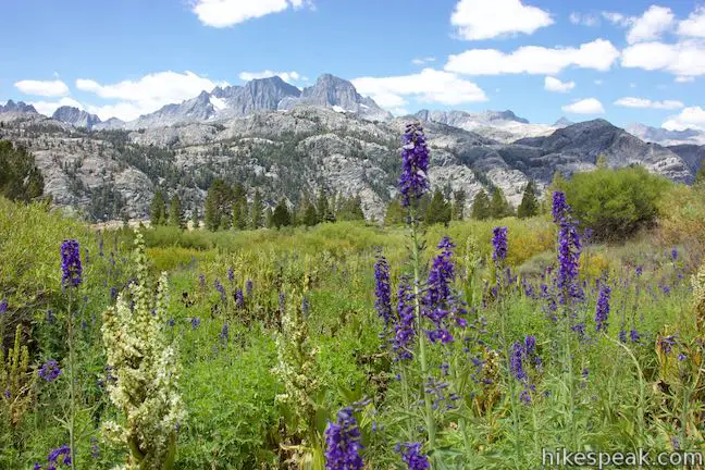
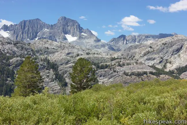
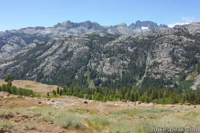
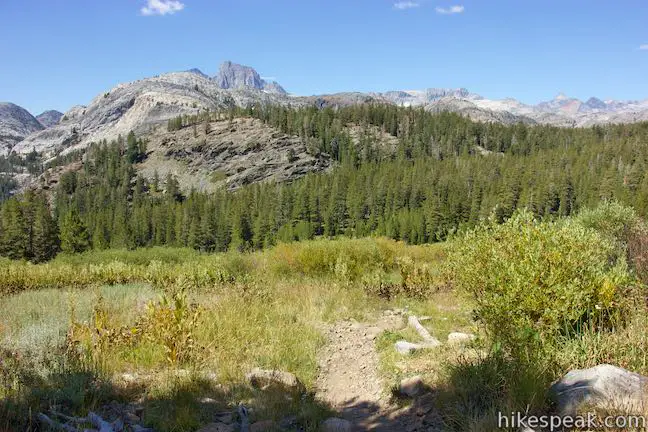
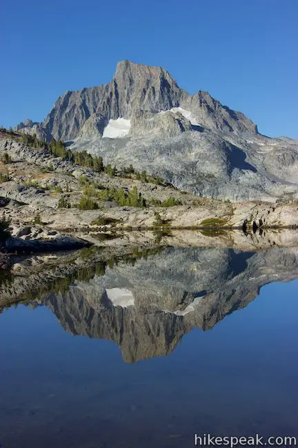
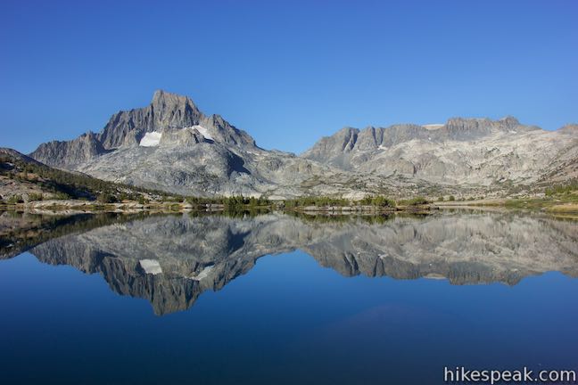
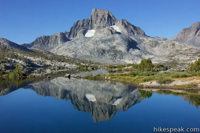
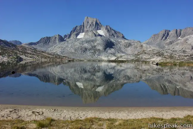
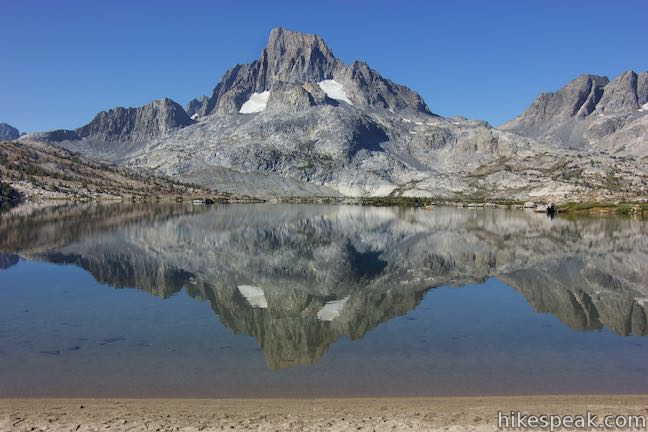
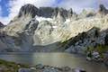
Follow the trail around a draw in the side of the canyon to come to another perch that seems to look straight across the canyon at Shadow Lake. It is another 5 miles from here to Thousand Island Lake, and while Shadow Lake gradually disappears from view, replaced by improving views of the area’s two tallest mountains. Mount Ritter and Banner Peak are steep, lofty mountains that rise to 13,143 feet and 12,936 feet, respectively. Snow clings to the slopes of these high peaks that are connected by a jagged ridge.
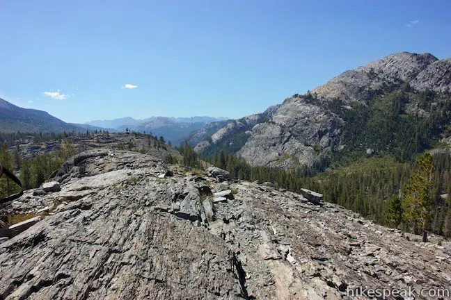
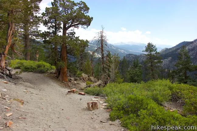
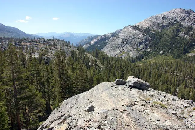
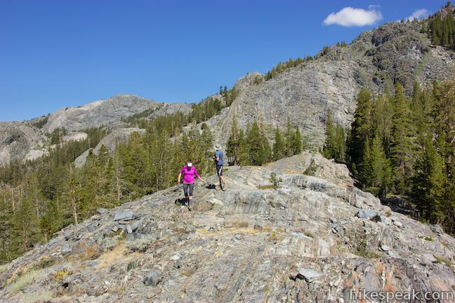
The single track maintains its course along the slope at the top of the canyon, crossing several trickling streams. Hike along stone cliff at the rim of the canyon, enjoying the plentiful panoramas that this elevated perch provides.
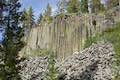
Eventually, the trail passes an outcropping of volcanic rock that loosely resembles the columnar basalt at Devils Postpile. Ahead, you will drop into threes and the views shrink, so appreciate one last overview of the surroundings.
High Trail goes between shaded areas of pines and exposed areas of sage brush for the next third of a mile to reach the first of three trails that branch off High Trail to ascend to the Clark Lakes. These junctions come at 5.95, 6.75, and 7.45 miles from Agnew Meadows. Stay to the left through each junction, following signs for Thousand Island Lake.
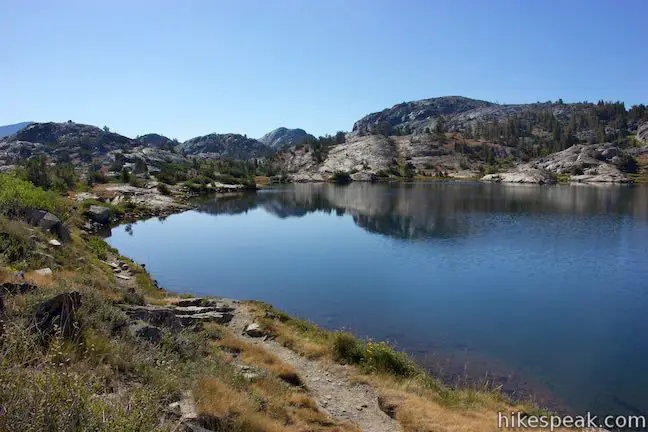
- The trails up to the Clark Lakes, which ascend out of the valley to a collection of lakes, can be used as a potential extension off High Trail.
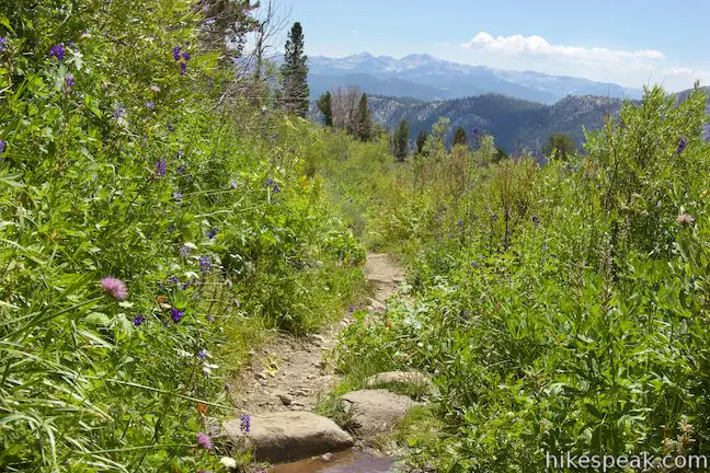
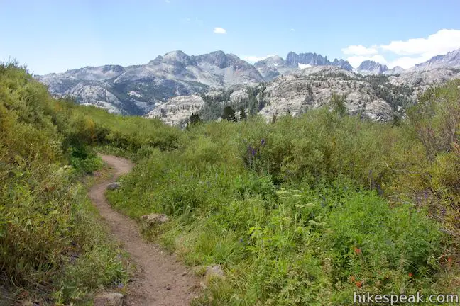
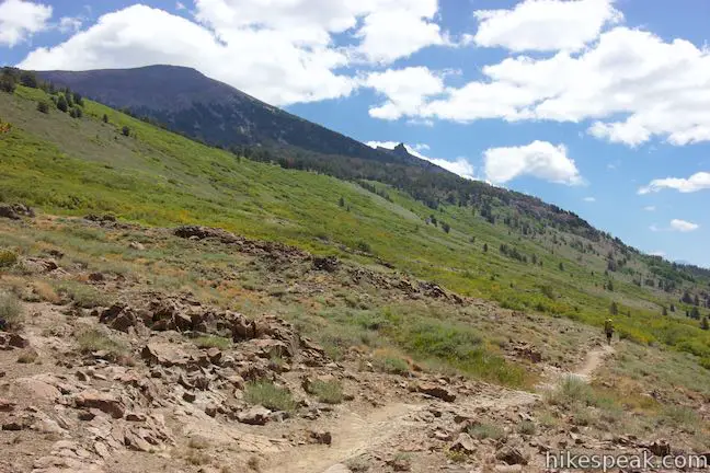
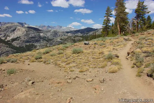
At the junction with the first trail up to Clark Lakes, High Trail turns due west toward Thousand Island Lake. The trail leaves a loosely-packed forest and descends gradually across a sloping meadow, passing colorful flowers among the green grasses and brush. The meadow has views down the valley toward the peaks to the southwest.
Once you pass the second trail up to Clark Lakes, it is another two miles to Thousand Island Lake. The surroundings become more wooded, with small meadows breaking up the forest. A pond appears in one meadow on your left (no it’s not Thousand Island Lake). Pass through a pine forest dappled by sunlight and cross the westernmost trail up to Clark Lakes.
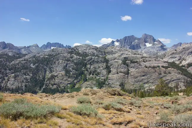
The trail drops across a depression and comes up to a ridge of exposed bedrock running perpendicular to the trail. The rock juts out into the pine-covered valley to the left. If you stray off the trail here, you can walk out to the end of this short rocky ridge for a commanding panorama. Banner Peak and Davis Peak are visible to the west, poking up above a steep ridge. These mountains are on the west side of Thousand Island Lake, so it is a good sign that you are getting close.
Continue on High Trail, which descends through more pines to a junction with River Trail. This junction is 7.75 miles from Agnew Meadows, which means it is just another mile to Thousand Island Lake.
- If you turned left here, you could hike down the canyon bottom along the Middle Fork of San Joaquin River (formed by the waters of Thousand Island Lake, Garnet Lake, and others). River Trail joins Shadow Creek Trail before ascending to Agnew Meadows. Stay to the right to continue on High Trail to Thousand Island Lake.
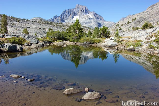
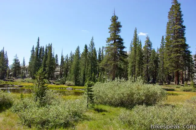
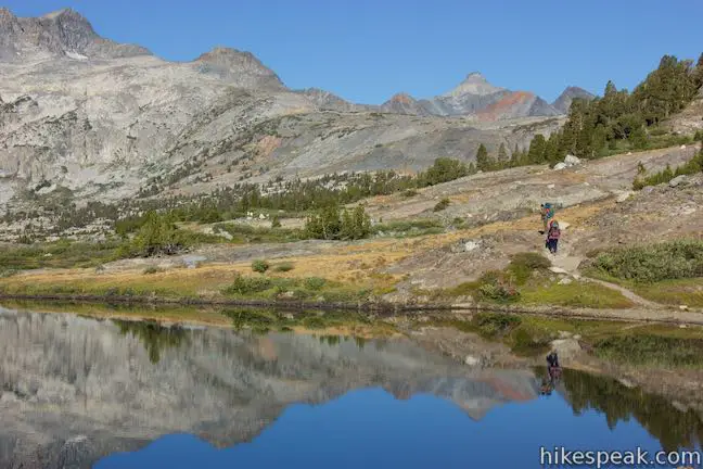
High Trail makes its way up out of the forest to rocky terrain with grasses and fewer pines. Come up to pools that have formed alongside the stream flowing out of Thousand Island Lake. Banner Peak is visible to the west, reflected in these pools.
Continue up the trail above the stream to a junction at the merger of John Muir Trail and Pacific Crest Trail. This junction marks the end of High Trail and is 8.75 miles from Agnew Meadows.
- To the right, the combined trails head north.
- To the left, John Muir Trail goes south in the direction of Devils Postpile National Monument, passing Garnet Lake more immediately (this route can be used to form a nice loop with trails leaving from Agnew Meadows).
- Straight ahead, another trail goes along the north shore of Thousand Island Lake, leading to potential campsites and superb lake views.
You’ll feel compelled to hike a bit farther straight on the lakeside trail.
Exploring Thousand Island Lake
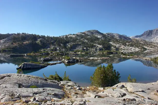
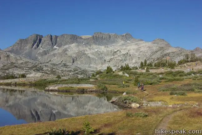
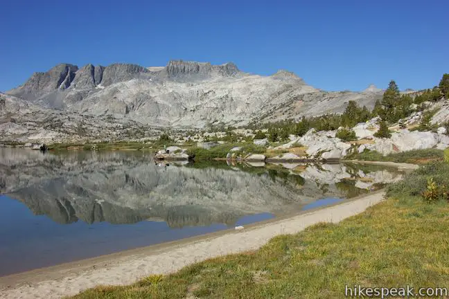
Thousand Island Lake is a postcard waiting to happen – a beautiful blue lake with a wild collection of islands below a massive mountain. You won’t be able to fully appreciate Thousand Island Lake from the junction of High Trail (PCT) and John Muir Trail, so explore farther.
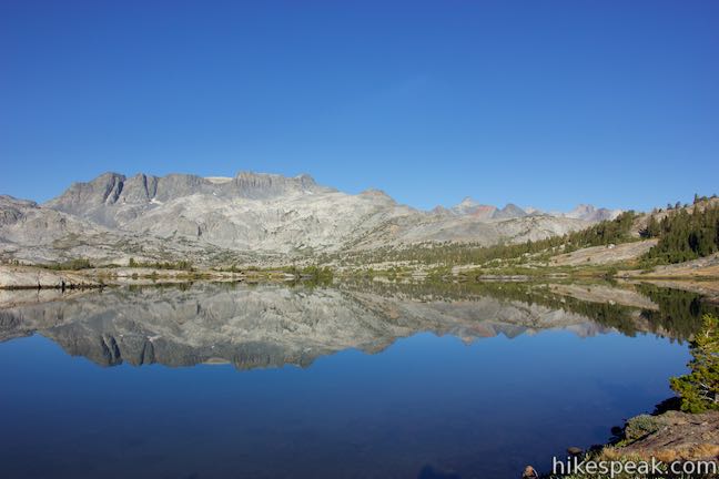
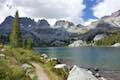
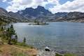
The northeast end of Thousand Island Lake (near the junction) is narrower than the other end below Banner Peak, which has more islands. Points along the shore and a few islands make it hard to get a good view down the lake from end to end.
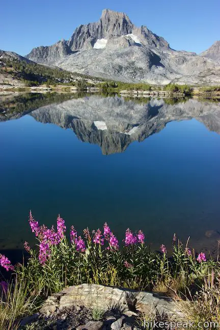
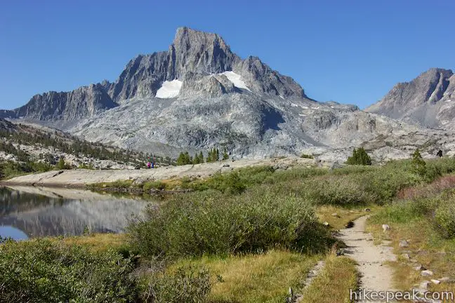
Hike down the trail along the north shore and you’ll quickly discover outstanding views over the lake, where Banner Peak is reflected like a mirror by still water.
Go as little as a quarter mile to reach a point with a relatively full view of the lake.
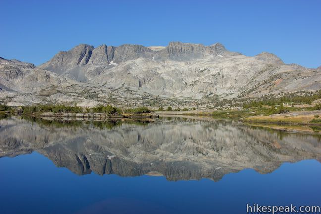
Continue to a sandy cove, half a mile up the trail. The cove has a lovely crescent shape that cradles a nice little beach. It also has a bold view of Banner Peak across the main body of the lake and a perspective of the islands at the west end of the lake below Mount Davis. This beach makes a lovely place to swim in the cold mountain lake.
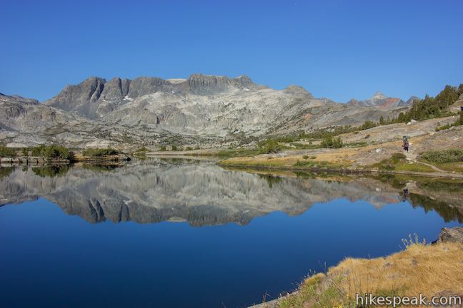
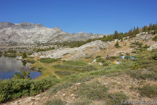
The path pushes past the cove along the shore of Thousand Island Lake, providing more lake views and places for backpackers to camp. Thousand Island Lake is a popular backpacking destination, so it can get more crowded with campers than you might usually expect to find in the backcountry.
Camping at Thousand Island Lake: Backpackers are not allowed to camp within a quarter mile of the outlet of Thousand Island Lake. The north shore is the only area along Thousand Island Lake where camping is allowed. The trail passes several spots to camp that are set back from the trail and the lake with grand views.
The basic directions to Thousand Island Lake are:
- Leave Agnew Meadow on High Trail (0 miles)
- Pass a wilderness sign and ascend switchbacks (0.4 miles)
- Pass perches with views of Shadow Lake (3.15 & 3.75 miles)
- Stay left last the easternmost trail to Clark Lakes (5.95 miles)
- Stay left past a second trail to Clark Lakes (6.75 miles)
- Stay left past the westernmost trail to Clark Lakes (7.45 miles)
- Stay to the right past the top of River Trail (7.75 miles)
- Meet John Muir Trail near the outlet of Thousand Island Lake (8.75 miles)
Thousand Island Lake to Agnew Meadows
Those experiencing High Trail in the opposite direction will have an enjoyable experience too. Despite its overall downhill trajectory, the trail goes uphill more than you might expect. Thousand Island Lake is at 9,840 feet and Agnew Meadows is at 8,340 feet. However, it’s not all downhill. High Trail stumbles down to 9,425 feet and then makes its way back up to 9,725 feet (earning its name) before sacrificing elevation to return to Agnew Meadows.
Head east from Thousand Island Lake following the sign for Agnew Meadows. High Trail follows the stream flowing out of Thousand Island Lake past several reflective pools. Go through rocky terrain alongside the pools, being sure to look back for some of the last full views of Banner Peak.
The trail drops into a pleasant pine forest dappled by sunlight. This is the only short stretch of High Trail that doesn’t have any sweeping views, so appreciate the forest’s finer details.
Come to a junction with River Trail, one mile from Thousand Island Lake. You could turn right to hike down the canyon bottom along the Middle Fork of San Joaquin River (formed by the waters of Thousand Island Lake, Garnet Lake, and others). River Trail meets Shadow Creek Trail before ascending to Agnew Meadows. Stay to the left to continue on High Trail.
Popping out of the forest, the trail passes a line of rock jutting out into the pine-covered valley. If you step off the trail here, you can walk out on this short ridge for a commanding panorama over the valley to the south. Banner Peak and Davis Peak are visible to the west as well, appearing above a steep ridge.
High Trail continues down into more pines and then turns uphill to meet the first of three junctions with trails to the Clark Lakes. These junctions come 1.3, 2, and 2.8 miles from Thousand Island Lake. At each junction, stay to the right on Pacific Crest Trail, following signs for Agnew Meadows.
- The trails up to the Clark Lakes ascend out of the valley to a collection of lakes and can be used as a potential extension on the hike back to Agnew Meadows.
Beyond the first trail to the Clark Lakes, High Trail goes through more pine forest. A few small meadows break up the trees. One meadow on the right has a small pond.
After the second trail to Clark Lakes (two miles from Thousand Island Lake), High Trail exits the trees and crosses a sloping meadow, gradually ascending past colorful flowers amongst green grasses and brush. This opening offers views down the valley toward peaks to the southwest. Slip back into a loosely-packed forest and pass the third trail up to Clark Lakes. It is just under six miles from here to Agnew Meadows.
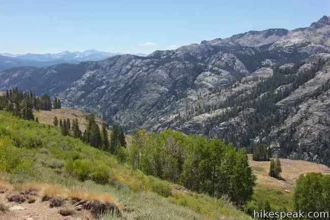
After hiking relatively due east up to this point, High Trail now points southeast for the duration, paralleling the canyon below. Hike in and out of pines and sagebrush for a third of a mile to reach an outcropping of volcanic rock that loosely resembles the columnar basalt at Devils Postpile. At this point, you’ll discover sweeping views across the canyon to the west, which contains River Trail and the Middle Fork of the San Joaquin River. On the other side of the canyon, a steep stone ridge is backed by impressive high peaks like the Minarets, Mount Ritter, and Banner Peak.
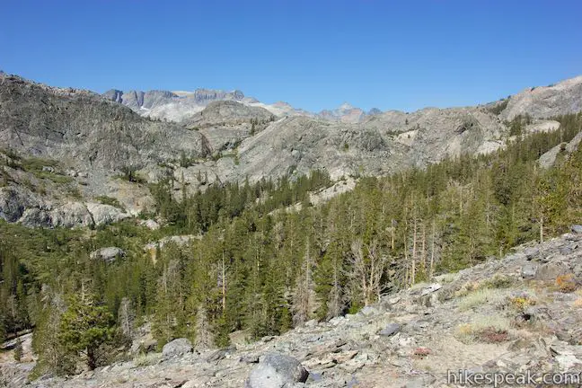
If you are enamored with the scenery, you’re in luck! The views remain immense over the next five miles as you head southeast across the side of the canyon. If you hiked to Ediza Lake or Garnet Lake before hiking High Trail, you will have passed through the tremendous landscapes on the west side of the canyon, making the panoramic views on High Trail that much more satisfying.
The single track continues along the slope at the top of the canyon, making its way over the top of a stone cliff at the rim of the canyon. This elevated perch provides plentiful views. High Trail crosses well over a dozen small streams flowing down the side of the canyon. If you need water to filter, you should find several sources.
Pines are dominant early on, but High Trail passes through pockets of quaking aspen that are nestled into riparian areas along the side of the canyon. While this middle section of High Trail is generally gradual and headed in a single direction, there is one period where you must go uphill on switchbacks through some quaking aspens, before you can keep progressing along the side of the canyon.
The trees don’t block the view for long, giving way to looks across the canyon toward Shadow Lake, which is cradled in a hanging valley and surrounded by pines. A cascade below the lake is visible too, bordered by Shadow Creek Trail. The gap created by Shadow Lake allows a clear view of the Minarets.
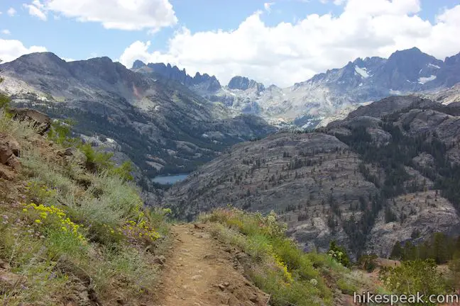
An excellent perspective of Shadow Lake comes from a bend in the trail, 5 miles from Thousand Island Lake and 3.75 miles from Agnew Meadows.
As you continue down the trail, you will go around a draw in the terrain and come to an outcropping of orange rock with another fine view of Shadow Lake. Shadow Lake shrinks from view as you continue down the trail. To replace it, you will gain a perspective down the valley toward Mammoth Mountain.
As High Trail becomes less high, it crosses more streams and quaking aspens before returning to pines. A clearing on the right side of the trail near the edge of a ledge makes a tempting place to stop, but press on over the final 1.1 miles of the trail.
Continue down High Trail, catching glimpses of Agnew Meadows in the pine forest below. How could you be so high above your destination with so little distance to go? The answer comes when you spot over half a dozen switchbacks leading down the side of the canyon. Descend the tapered switchbacks, enjoying your final panoramic views.
Toward the bottom of the slope, you’ll pass a new sign at the boundary of Ansel Adams Wilderness. It is another 0.4 miles from here to the trailhead.
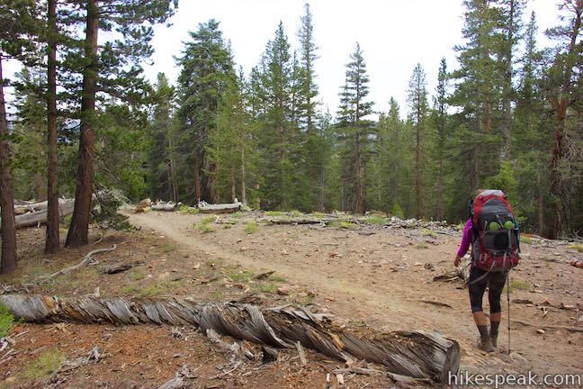
Weave downhill through a forest of large pines. Pass along the backside of the pack station at Agnew Meadows with a tenth of a mile to go. Cross over a log bridge and go through the last bit of forest to reach the trailhead for High Trail at Agnew Meadows.
If you left a vehicle at the River Trail Trailhead at Agnew Meadows, turn right and walk 0.15 miles to that trailhead at the end of Agnew Meadows Road. If you are taking the shuttle bus back to Mammoth Lakes, turn left and walk another quarter mile up Agnew Meadows Road to the shuttle stop.
What you should know before you go
Overnight camping is not permitted within a hundred feet of lakes, streams, and trails. Camping is also banned within a quarter mile of the outlet of Thousand Island Lake. Check current restrictions when your obtain your permit.
A permit is required for any overnight trips in Ansel Adams Wilderness and a trail quota is in place. High Trail has a daily limit of 12 permits that can be reserved in advance along with 8 walk-in permits. Permits for High Trail and other Inyo National Forest trailheads can be reserved at recreation.gov. Walk-in permits can be obtained at Inyo National Forest Ranger Stations starting at 11 a.m. the day before the first day of your hike. Arrive earlier than eleven, take a number, and wait in line if you are determined to get a walk-in permit.
Mammoth Lakes Welcome Center is the nearest Inyo National Forest Ranger Station. The center is open daily from 8 a.m. to 5 p.m. and distributes permits and rents bear-proof canisters. The ranger station is located at 2510 Main Street (Route 203) on the road into Mammoth Lakes.
While the permit has no cost (except an online processing fee), there is a fee to take the shuttle or a vehicle on the road to Agnew Meadows. If you stay at a campground in the Reds Meadow Area during you visit (like Devils Postpile National Monument Campground), you are permitted to drive in and park at the trailhead.
Those not staying overnight at a developed campground will need to park at Mammoth Mountain Ski Resort and shuttle in from there (get off at the first shuttle stop for Agnew Meadows). A $15 vehicle fee is charged to drive in (as of 2025). The shuttle charges by the individual (current pricing info). From the Agnew Meadows Shuttle Stop, it is a quarter-mile walk down a gravel road to the trailhead for High Trail.
The trailheads at Agnew Meadows have small parking areas, toilets, and bear-proof storage lockers. Dogs are allowed on leashes on High Trail and other trails in Ansel Adams Wilderness.
Campfires are not allowed above 10,000 feet and in several other restricted areas due to wildfire danger. While in the backcountry, food must be stored in approved bear-proof canisters. Follow “leave no trace” practices when disposing of waste. While traveling in the backcountry, you may with to carry an SOS beacon and communicator.
Directions to the Trailhead
- Take Route 395 to Route 203 and drive 3.6 miles to Mammoth Lakes.
- Turn right onto Minaret Road toward Mammoth Mountain.
- Reach the ski resort after 4 miles.
- Unless you are staying at a campground during your visit, park here and take the shuttle to Agnew Meadows.
- If you are driving in, go 1.4 miles past the ski resort to Minaret Vista Entrance Station where a 10-dollar fee is charged for each vehicle to continue down into the valley.
- Drive 2.6 miles down a narrow paved road to a horseshoe bend at the intersection with Agnew Meadows Road.
- Turn right and drive 0.25 miles to the High Trail Trailhead (0.15 miles from the end of the road).
Trailhead Location
Trailhead address: Agnew Meadows Road, Mammoth Lakes, CA 93546
Trailhead coordinates: 37.682865, -119.0847 (37° 40′ 58.31″N 119° 05′ 04.91″W)
View Ansel Adams Wilderness in a larger map
Or view a regional map of surrounding Sierra Nevada trails and campgrounds.


 | Ediza Lake - Thousand Island Lake Loop This multi-day backpacking loop of around 25 miles incorporates sections of John Muir Trail and Pacific Crest Trail to visit a series of stunning Sierra lakes in the Ansel Adams Wilderness of Inyo National Forest. |
 | Shadow Lake This 8.5-mile hike crosses a picturesque canyon and passes a plunging cascade to visit a mountain lake in the Ansel Adams Wilderness of Inyo National Forest near Mammoth Lakes. |
 | Ediza Lake This hike of around 15 miles round trip ventures above Shadow Lake along a creek to a beautiful lake below Mount Ritter and Banner Peak in the Ansel Adams Wilderness of Inyo National Forest near Mammoth Lakes. Ediza Lake is an excellent destination for backpackers. |
 | Iceberg Lake This short extension off the trail to Ediza Lake heads to a higher lake in a sublime setting below a ridge of steep spires called the Minarets. |
 | Garnet Lake This beautiful lake along John Muir Trail is 8.55 miles from the trailhead at Agnew Meadows, making it an ideal lake to visit on a backpacking loop. |
 | Devils Postpile This 1 to 1.35-mile hike visits the columnar basalt cliff that Devils Postpile National Monument is named after, with top-down and bottom-up views of the impressive formation. The hike can be extended to include Rainbow Falls at the south end of the monument. |
 | Rainbow Falls This hike of 5.1 miles or more passes the Devils Postpile Formation to reach an attractive 101-foot waterfall with rainbows in its mist. |
 | Minaret Falls This 3-mile hike from Devils Postpile National Monument connects with Pacific Crest Trail to reach the base of a waterfall that tumbles and slides down a rocky slope. |
 | More trails in the Sierra Nevada Mountains Explore other destinations in Inyo National Forest and the rest of the range. |
 | Devils Postpile National Monument Campground This 21-site first-come first-serve campground provides camping in a pine forest next the Middle Fork San Joaquin River near the trailhead for Devils Postpile National Monument. |
- Thousand Island Lake on umich.edu (opens in a new tab)
- Thousand Island Lake on wikipedia.org (opens in a new tab)
- Thousand Island Lake Loop on backpacker.com (opens in a new tab)
- Thousand Island Lake, Ediza Lake, and Iceberg Lake Loop on backcountrycow.com (opens in a new tab)
- A national forest map of Agnew Meadow Trails (opens in a new tab)
- A national forest brochure for the Reds Meadow - Devils Postpile Shuttle (opens in a new tab)
- Agnew Meadows on summitpost.org (opens in a new tab)
- The official national forest webpage for Shadow Lake Trail (opens in a new tab)
Common Questions about Thousand Island Lake in Ansel Adams Wilderness
- Is the trail open?
- Yes. You should expect to find that Hike to Thousand Island Lake is open. There are no recent reports of trail closures. If you discover that the trail is closed, please help your fellow hikers by reporting a closure.
- Do I need a permit for this hike?
- Yes. Access fee.
- How much time does this hike take?
- It takes approximately 4 hours 30 minutes to hike Hike to Thousand Island Lake. Individual hiking times vary. Add extra time for breaks and taking in the views.
- How long is this hike?
- The hike to Hike to Thousand Island Lake is a 8.75 mile one way, overnight permit with 1515 feet of elevation change.
- Are dogs allowed on this trail?
- Yes, dogs are allowed on Hike to Thousand Island Lake. The trail is open to hikers, dogs.
- Is Hike to Thousand Island Lake a difficult hike?
- This hike should be considered strenuous. Hikers should be prepared for a workout covering 8.75 miles and 1515 feet of climbing.
- Is there a lake on this hike?
- Yes, Hike to Thousand Island Lake visits a lake.
- Where is the trailhead located?
- The trailhead for Hike to Thousand Island Lake is located in Mammoth Lakes, CA.
Trailhead Address:
Agnew Meadows Road
Mammoth Lakes, CA 93546
Trailhead Coordinates:
37.682865, -119.0847 - What are the driving directions to the start of the hike?
To get to the trailhead: Take Route 395 to Route 203 and drive 3.6 miles to Mammoth Lakes. Turn right onto Minaret Road toward Mammoth Mountain. Reach the ski resort after 4 miles. Unless you are staying at a campground during your visit, park here and take the shuttle to Agnew Meadows. If you are driving in, go 1.4 miles past the ski resort to Minaret Vista Entrance Station where a 10-dollar fee is charged for each vehicle to continue down into the valley. Drive 2.6 miles down a narrow paved road to a horseshoe bend at the intersection with Agnew Meadows Road. Turn right and drive 0.25 miles to the High Trail Trailhead (0.15 miles from the end of the road).
View custom Google Maps directions from your current location.
- Are there other trails near Hike to Thousand Island Lake?
- Yes, you can find other nearby hikes using the Hikespeak Hike Finder Map.

21 Comments on Thousand Island Lake in Ansel Adams Wilderness
What hikers are saying:
✨ Generated summary of user commentsHikers describe Thousand Island Lake as a breathtaking destination, calling it the most beautiful area they have ever seen. Tom recommends returning via the High Trail or River Trail rather than the JMT to avoid unnecessary exertion that adds little to the scenery. Setting a relaxed pace allows for a better experience of the surrounding landscape without feeling rushed.
“1000 island was the most beautiful area I've ever seen.” Jump to comment ↓
“Take your time & enjoy the views!” Jump to comment ↓
Wonderful detailed information, thank you.
what are normal weather conditions in mid may?
[…] links: Detailed hike description; Forest Service website; Trail […]
Of the 3 trails to 1000 island lk., which is less demanding? thanks
High Trail is probably the route you want.
Is there A trail to thousands island lake from the west
[…] At Thousand Island Lake, the PCT continues north to Yosemite, but the 3,000-metre alpine lake is the final destination for most day hikers. Muir called it Islet, for its abundance of tiny granite islands […]
what is the snow level like on the thousand island lake hike now? Is it clear? Are the streams passable?
[…] More Information: Hikespeak […]
Why the 2.5 stars???
Great question! The star rating is an average of the ratings given by hikers who use this site. I give it 5 stars, for sure. My rating counts as much as everyone else’s.
Used this as my guide last week. What an amazing hike! 1000 island was the most beautiful area I’ve ever seen. I should have returned via either the High Trail or River Trail, but instead took the JMT which added a bunch of elevation and miles and didn’t really add much to the hike. Seeing Garnet was nice, but didn’t compare to 1000 island and I’ve done the Ediza Lake section, so going down to the River Trail from there after 17+ miles was a bit of pain in the ass. My loop ended up being 20 miles- just about the upper limit of a day hike for me, I think….
Just curious on wilderness permits. I can’t find this hike on Recreation.gov. Any input would be appreciated.
Thanks!
Great information. We are doing this hike in September. Do you have any data on Clark Lakes from the High trail?
I’m curious on how long the trek is back from Thousand Island to Agnew Meadows. We’ve got to arrange some transportation back to Mammoth so looking for an approx. hike time out. I’m guessing 3.5 to 4 hrs?
Hi Steve,
That timing seems about right, if you are hiking 25-minute miles. It all depends on your pace and how often you stop to take in the scenery. Perhaps give yourself some extra time so that you don’t feel rushed. Take your time & enjoy the views!
Hello! Does anyone have information on getting wilderness permits? Are you able to get reserve permits? I can find anything on recreation.gov. Appreciate any information you can provide. Thanks!
Hello.
I’m looking for information for wilderness permits for this hike. I’ve check Recreation.gov but can’t find it. Any input would be appreciated!
Thanks!
How can I get directions hiking from River trail to thousand island lake
Has anyone hiked this in November?
I’m curious to know if we wanted an easier hike if its best to hike in on High Trail, camp 3 nights near Thousand Island Lake, day hike to surrounding lakes, and hike back out high trail? -Thanks