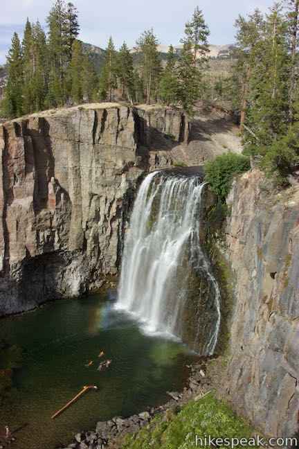
Rainbow Falls
in Devils Postpile National Monument
While Devils Postpile Formation is the reason you come to Devils Postpile National Monument, you shouldn’t leave without seeing Rainbow Falls, an attractive 101-foot single drop waterfall that leaps over volcanic cliffs and flashes frequent rainbows. Luckily for hikers, both attractions can be seen on the very same trek. Devils Postpile Formation is less than half a mile from the park’s main trailhead, along the route to Rainbow Falls. Hiking to Rainbow Falls and back is 5.1 miles round trip or more with 325 feet of elevation change. If you add a trail over the top of Devils Postpile to the itinerary, the hike jumps to 5.25 mile round trip with 435 feet of elevation change, and there are other possible extensions as well.
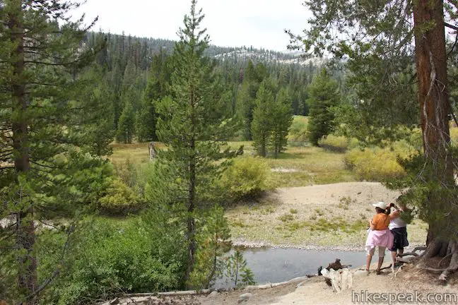
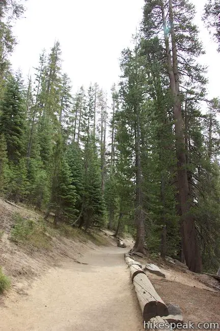
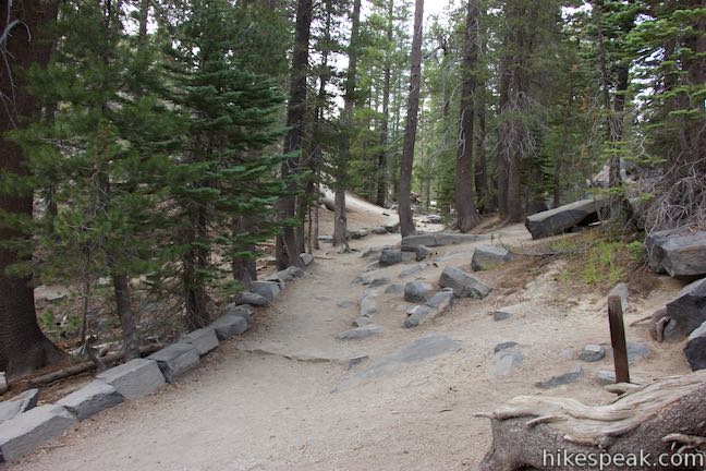
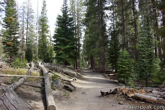
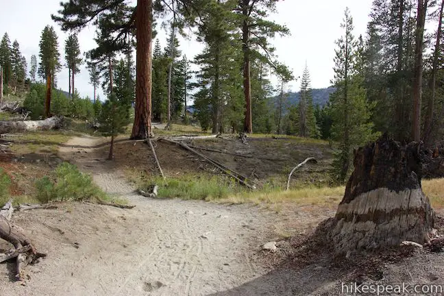
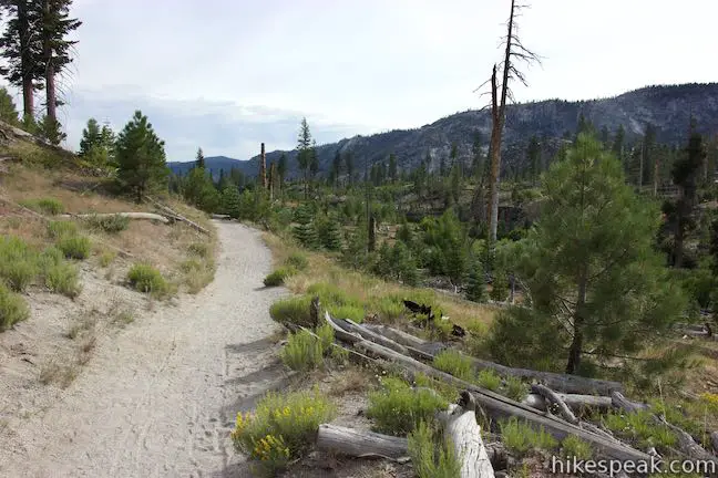
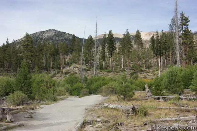
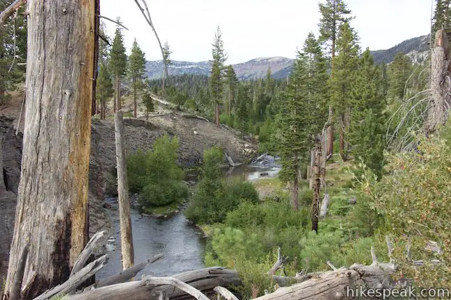
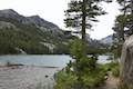
Devils Postpile National Monument is located near Mammoth Lakes in the Eastern Sierra Nevada Mountains and preserves 800 acres that are surrounded by national forest. Begin from the end of the road into the monument where you’ll find a ranger station, a campground, and a trailhead. Set out along the trail, which hugs the edge of a forest bordering Soda Springs Meadow, a grassy area along the winding waters of the Middle Fork of San Joaquin River. The lovely meadow is backed by pine forests on all sides.
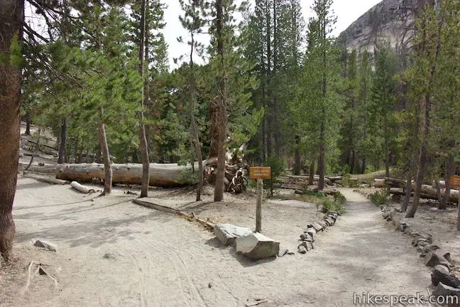
Come to a split after a quarter mile on the dirt trail. A trail to Minaret Falls parts to the right, crosses the river, and immediately passes a path to Soda Springs, where cold water bubbles to the surface along the river. Stay to the left at the junction with the trail to Minaret Falls and proceed toward Devils Postpile and Rainbow Falls. Walk along a bluff above the river. In another tenth of a mile, you’ll reach a junction with the Loop Trail to the Top of Devils Postpile, which ascends to the left. Straight ahead, enjoy the first view of Devils Postpile, a profile of the cliffs.
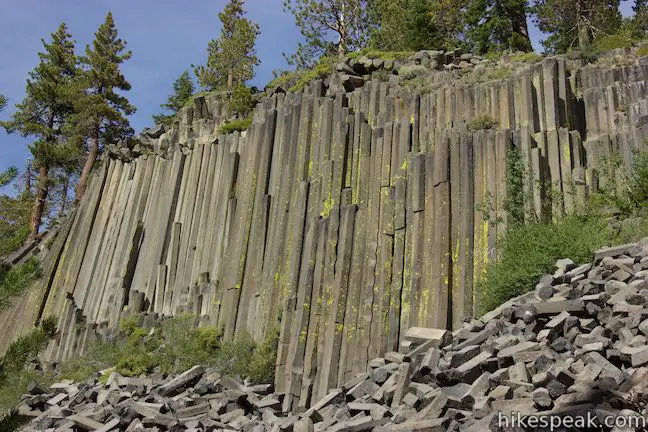
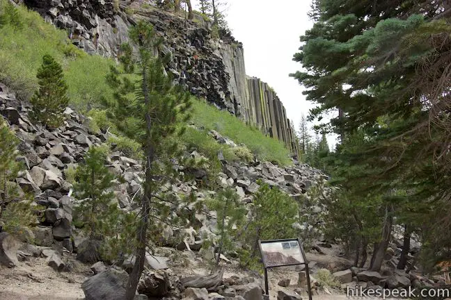
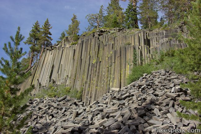
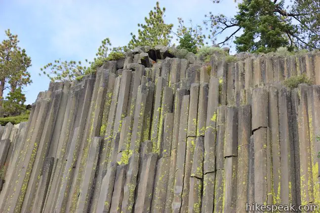
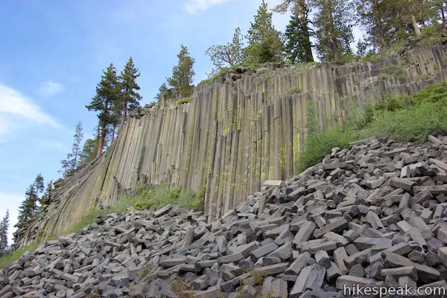
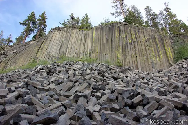
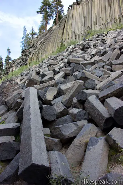
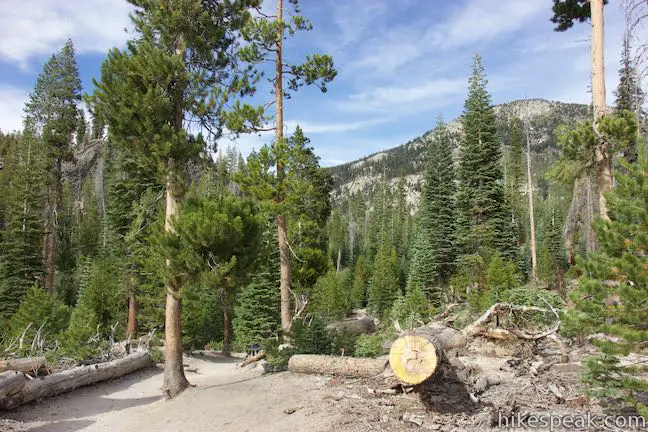
If you want to hike the loop over the top of Devils Postpile, you can turn left at this junction, saving the head-on views of Devils Postpile for the hike back. Otherwise, proceed to the right down stone steps or a ramp and approach viewing areas below Devils Postpile. The formation has 60-foot cliffs made up of vertical basalt columns that were formed within a pool of cooling lava and exposed by subsequent glacial flows. An amphitheater-like collection of stumps below Devils Postpile makes good seating for admiring the cliffs.
Past the stumps, the trail turns sharply uphill and approaches the other end of the trail across the top of Devils Postpile. At 0.6 miles from the start (or 0.75 miles from the start via the upper route), pass the southern junction between the two trails and continue south following signs for Rainbow Falls.
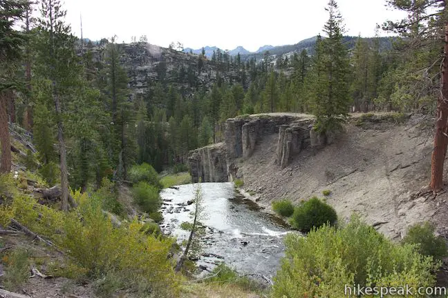
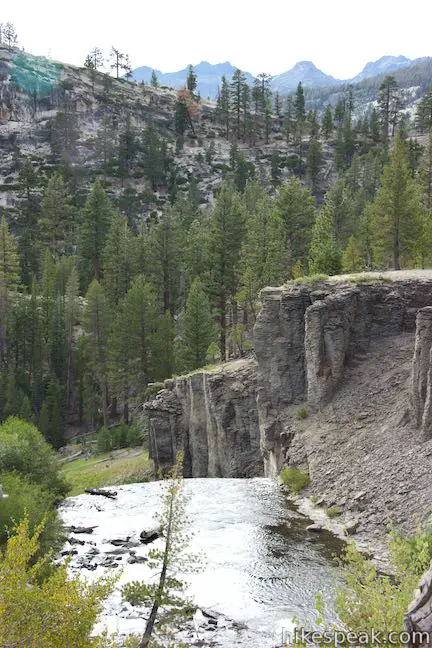
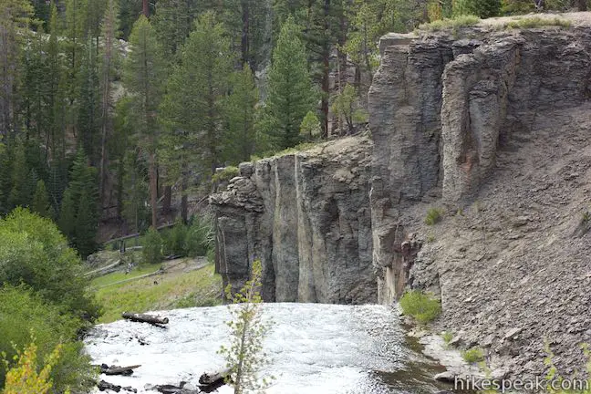
In another 0.15 miles, you will pass a sign as you leave Devils Postpile National Monument. When you get to Rainbow Falls, you will pop back in the rectangle-shaped monument, but much of the trail passes through neighboring Inyo National Forest. Look to your left as you exit the monument to see basalt cliffs that aren’t quite as photogenic as the Devils Postpile Formation. Shortly after exiting the monument, stay to the right past a trail on the left that connects to Reds Meadow. There are a few junctions along this route with trails connecting to Reds Meadow, which is an alternate starting point for hikers.
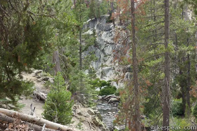
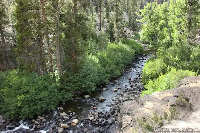
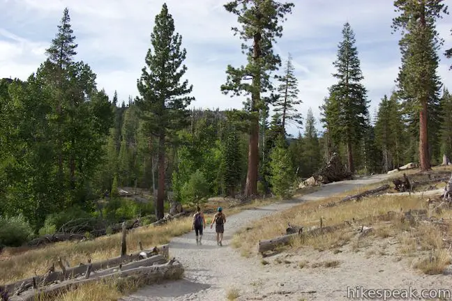
The trail ahead is sandy and mostly downhill, passing through a pine forest. As the trail progresses toward Rainbow Falls, it never strays too far from the river. At 1.3 miles from the start (via the lower trail past Devils Postpile), the trail passes cliffs above the river. If you step off trail here, you can look up and down the river from the ledge. A tenth of a mile farther, reach a junction and stay straight toward Rainbow Falls, crossing Pacific Crest Trail, which is also John Muir Trail in this area.
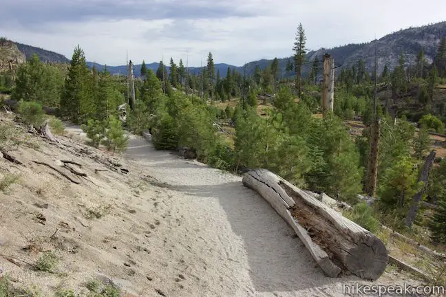
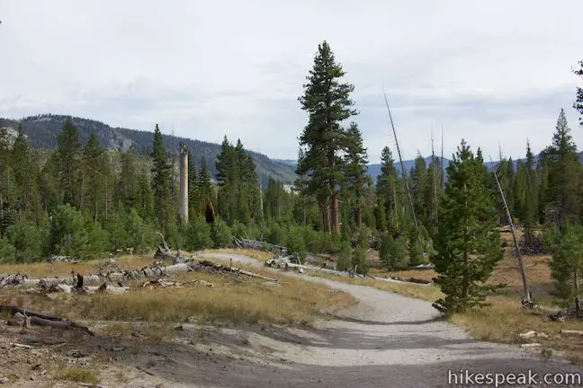
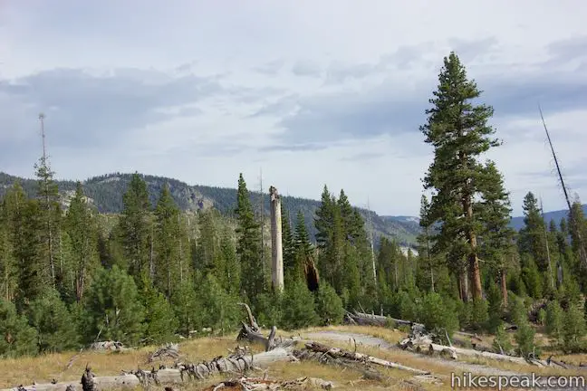
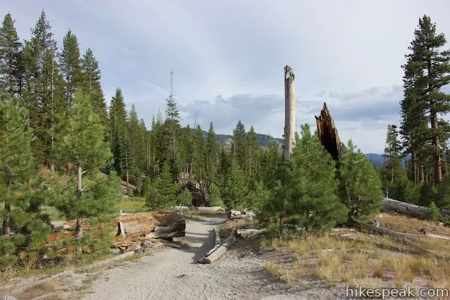
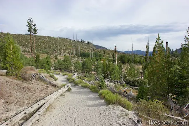
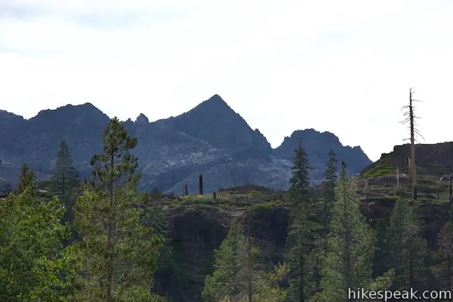
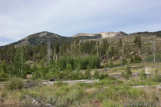
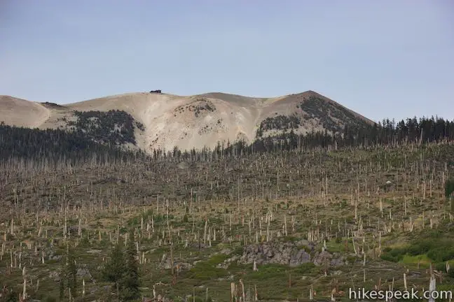
Views of the surrounding valley and ridges expand as you go. Walk past snags that were left behind by the Rainbow Fire, which scorched this area in 1992. New growth along the trail is sparser than the forest to the north, allowing you to look a long way down the valley. A panel along the trail explains that the fire, which was started by lightning, expanded and changed the area:
Strong winds, drought, and heavy surface fuels propelled the fire through 8,000 acres of dense forest. In response, a new community of plants and animals has moved in. Sun-loving ferns, herbs and berries are food for a variety of animals, big and small. In turn, some of these animals become food for others. As the forest slowly regrows, a diverse mix of plants and animals are taking advantage of a productive, yet temporary gap in the forest.
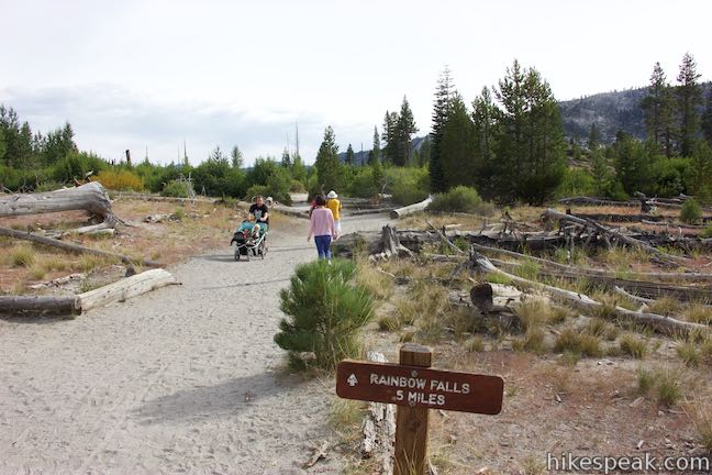
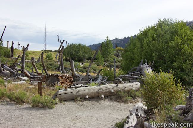
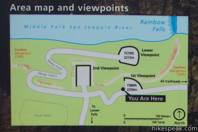
As you get closer to the waterfall, you’ll come to a string of junction. At 2.1 miles from the Devils Postpile Trailhead and 0.45 miles before the waterfall, come to a merger with a trail that approaches the waterfall from Rainbow Falls Trailhead at the end of Minaret Summit Road (shuttle stop 9). This is an alternate route to or from the waterfall for a shorter hike that skips the Devils Postpile Formation. Bear right to continue toward the waterfall. In another 0.05 miles, the trail crosses Boundary Creek near a sign for Ansel Adams Wilderness. Enter the wilderness and proceed toward the waterfall.
Turn right again at the 2.4-mile mark. Fish Creek Trail continues to the left. The route to Rainbow Falls is well marked, so bear right and head back into Devils Postpile National Monument. In another 0.05 miles, bear right past a horse trail. From here, steps lead down to the river, where you’ll find an overlook alongside Rainbow Falls.
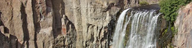
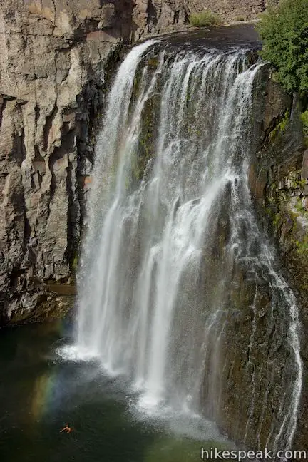
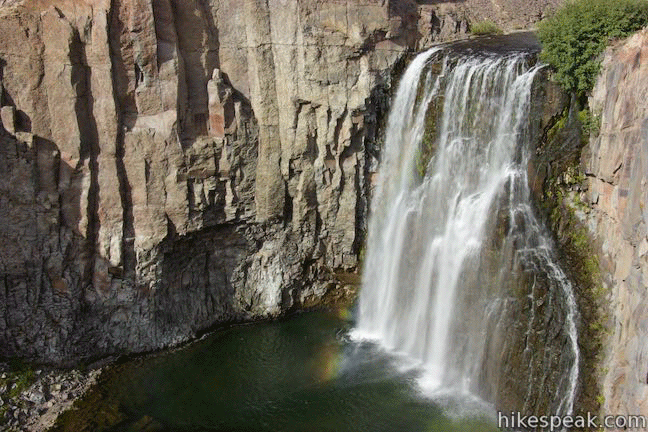
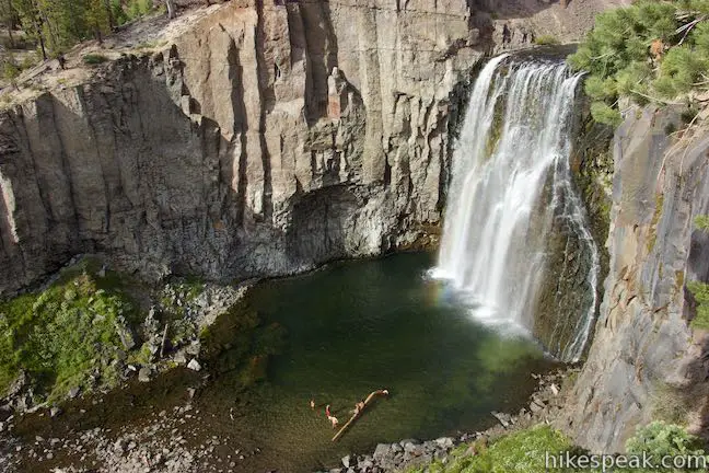
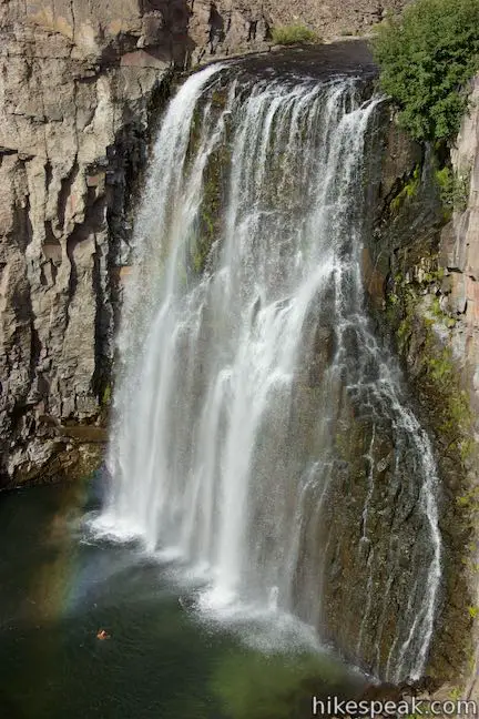
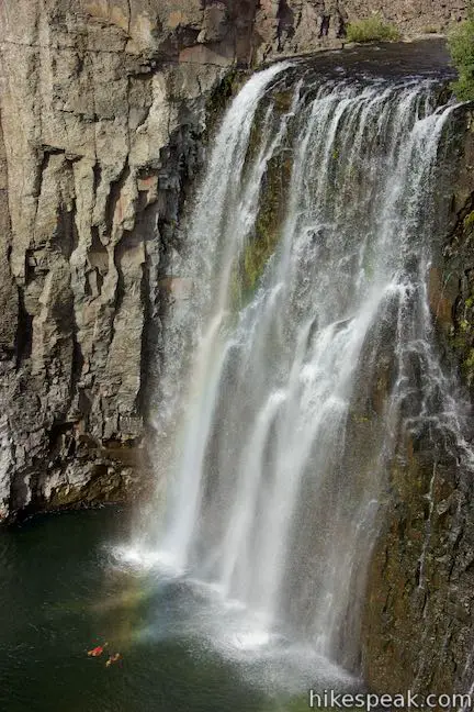
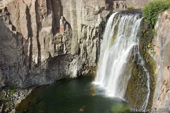
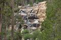
At just over 2.5 miles from the start, you’ll reach the first of two overlooks for Rainbow Falls. Stand on a stone patio and watch the beautiful rainbow-flashing waterfall drop just over a hundred feet down volcanic cliffs. The waterfall makes a single-drop plunge into a pool of turquoise water below. Despite its devilish address, Rainbow Falls looks like a little piece of paradise. The waterfall delivers on its name, with colorful rainbows appearing in its mist, particularly on sunny days at midday. A sign warns of the dangers of swimming below the waterfall, but you may still see people in the river, squealing with fun.
Rainbow Falls gets its single-drop shape from the rock it flows over, as the park guide explains:
Glaciers widened the canyons but did not create Rainbow Falls. The two layers of volcanic rock you see in the cliffs are similar but with an important difference. They are composed of the same lava but they cooled at different ranges. On top is the harder, more erosion-resistant rock. Below is the softer, less erosion-resistant rock. Water cascading over the falls wears away the lower, softer rock faster, undercutting the stronger rock and creating an alcove beneath it. As the stronger rock loses support, it caves in and breaks apart into boulders and rock debris at the bottom of the falls.
Erosion will cause the waterfall to move slowly upstream over time. The layer of rock just below the river is volcanic andesite – tough stuff that erodes slowly. The lower rock is volcanic rhyodacite, which erodes a little faster. As this rock falls away, it undercuts the upper layer, causing it to collapse.
Past this first overlook, the trail continues to a second overlook on the rim of the river gorge. Beyond that, steps lead down to the base of the waterfall. Another trail continues half a mile downstream to Lower Falls. Hiking back from the overlooks makes for a hike that’s 5.1 miles round trip. If you take the Loop Trail to Top of Devils Postpile, that will extend the hike slightly to 5.25 miles round trip.
Directions to the Trailhead
- Take Route 395 to Route 203 and drive 3.6 miles to Mammoth Lakes.
- Turn right onto Minaret Road toward Mammoth Mountain.
- Reach the ski resort after another 4 miles.
- Those who are visiting the park for the day (not staying overnight at the campground) should park here and take the shuttle to Devils Postpile National Monument (fees apply).
- If you choose to drive to the monument, go another 1.4 miles past the ski resort to Minaret Vista Entrance Station where a 10 dollar fee is charged for each vehicle entering in the valley below.
- Drive 6.7 miles toward Reds Meadow.
- Turn right, following signs for Devils Postpile National Monument and drive the final 0.3 miles to Devils Postpile.
- You will come to a loop with parking at the end of the road.
- The ranger station is straight ahead, the campground is on the right, and the trail into Devils Postpile is to the left.
- The shuttle will drop hikers off outside the ranger station next to the trailhead.
Trailhead Location
Trailhead address: Minaret Summit Road, Mammoth Lakes, CA 93546
Trailhead coordinates: 37.6299, -119.0847 (37° 37′ 47.63″N 119° 05′ 04.91″W)
You may also view a regional map of surrounding Sierra Nevada trails and campgrounds.
Trail to Devils Postpile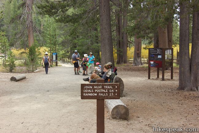


Trail to Rainbow Falls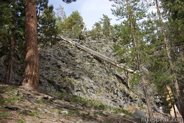


 | Minaret Falls This 3-mile hike from Devils Postpile National Monument connects with Pacific Crest Trail to reach the base of a waterfall that tumbles and slides down a rocky slope. |
 | Shadow Lake This 8.5-mile hike crosses a picturesque canyon and passes a plunging cascade to visit a mountain lake in the Ansel Adams Wilderness of Inyo National Forest near Mammoth Lakes. |
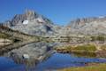
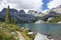 | Ediza Lake This hike of around 15 miles round trip ventures above Shadow Lake along a creek to a beautiful lake below Mount Ritter and Banner Peak in the Ansel Adams Wilderness of Inyo National Forest near Mammoth Lakes. Ediza Lake is an excellent destination for backpackers. |
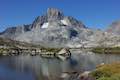
 | Garnet Lake This beautiful lake along John Muir Trail is 8.55 miles from the trailhead at Agnew Meadows, making it an ideal lake to visit on a backpacking loop. |
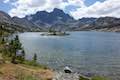
 | Thousand Island Lake This exceptional lake is a true gem of the Sierra and is 8.75 miles from the trailhead at Agnew Meadows via High Trail, a section of Pacific Crest Trail, making it a great destination for an overnight trek. |
 | Ediza Lake - Thousand Island Lake Loop This multi-day backpacking loop of around 25 miles incorporates sections of John Muir Trail and Pacific Crest Trail to visit a series of stunning Sierra lakes in the Ansel Adams Wilderness of Inyo National Forest. |
 | More trails in the Sierra Nevada Mountains Explore other destinations in Ansel Adams Wilderness and the rest of the range. |
 | Devils Postpile National Monument Campground This 21-site first-come first-serve campground provides camping in a pine forest next the Middle Fork San Joaquin River near the trailhead for Devils Postpile National Monument. |
- Rainbow Falls on world-of-waterfalls.com (opens in a new tab)
- Rainbow Falls on californiathroughmylens.com (opens in a new tab)
- Rainbow Falls on waterfallswest.comt (opens in a new tab)
- Rainbow Falls on americansouthwest.net (opens in a new tab)
- Devils Postpile and Rainbow Falls on socalhiker.net (opens in a new tab)
- Devils Postpile and Rainbow Falls on greeneadventures.com (opens in a new tab)
- Devils Postpile and Rainbow Falls on modernhiker.com (opens in a new tab)
- Devils Postpile National Monument on wikipedia.org (opens in a new tab)
- The official website for Devils Postpile National Monument (opens in a new tab)
Common Questions about Rainbow Falls in Devils Postpile National Monument
- Is the trail open?
- Yes. You should expect to find that Hike to Rainbow Falls is open. There are no recent reports of trail closures. If you discover that the trail is closed, please help your fellow hikers by reporting a closure.
- Do I need a permit for this hike?
- Yes. Access fee.
- How much time does this hike take?
- It takes approximately 2 hours 15 minutes to hike Hike to Rainbow Falls. Individual hiking times vary. Add extra time for breaks and taking in the views.
- How long is this hike?
- The hike to Hike to Rainbow Falls is a 5.1 mile out and back with 325 feet of elevation change.
- Are dogs allowed on this trail?
- Yes, dogs are allowed on Hike to Rainbow Falls. The trail is open to hikers, dogs.
- Will I see a waterfall on this hike?
- Yes, Hike to Rainbow Falls features a waterfall.
- Where is the trailhead located?
- The trailhead for Hike to Rainbow Falls is located in Mammoth Lakes, CA.
Trailhead Address:
Minaret Summit Road
Mammoth Lakes, CA 93546
Trailhead Coordinates:
37.6299, -119.0847 - What are the driving directions to the start of the hike?
To get to the trailhead: Take Route 395 to Route 203 and drive 3.6 miles to Mammoth Lakes. Turn right onto Minaret Road toward Mammoth Mountain. Reach the ski resort after another 4 miles. Those who are visiting the park for the day (not staying overnight at the campground) should park here and take the shuttle to Devils Postpile National Monument (fees apply). If you choose to drive to the monument, go another 1.4 miles past the ski resort to Minaret Vista Entrance Station where a 10 dollar fee is charged for each vehicle entering in the valley below. Drive 6.7 miles toward Reds Meadow. Turn right, following signs for Devils Postpile National Monument and drive the final 0.3 miles to Devils Postpile. You will come to a loop with parking at the end of the road. The ranger station is straight ahead, the campground is on the right, and the trail into Devils Postpile is to the left. The shuttle will drop hikers off outside the ranger station next to the trailhead.
View custom Google Maps directions from your current location.
- Are there other trails near Hike to Rainbow Falls?
- Yes, you can find other nearby hikes using the Hikespeak Hike Finder Map.

I visited Rainbow Falls for the first time this year in June on my way home from Yosemite. It was definitively worth the stop. I definitely recommend hitting the natural the hot springs outside Mammoth as well if you’re in the area. https://twitter.com/AdventureSoCal/status/568709830568845312/photo/1