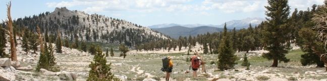
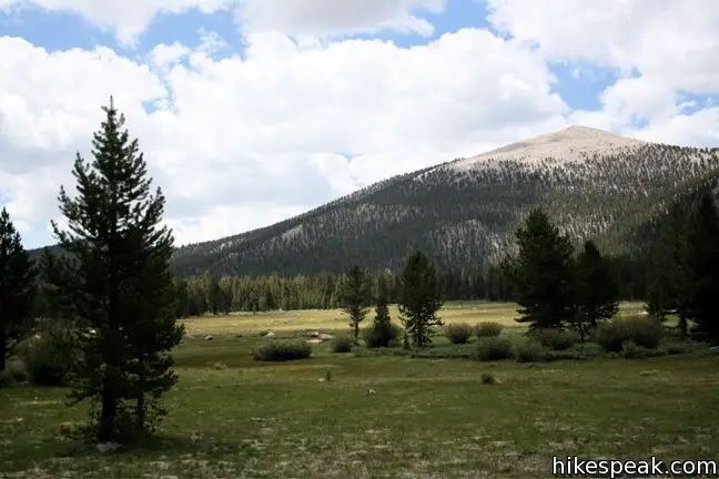
At an elevation of 11,200 feet, Cottonwood Pass serves as a gateway to the Golden Trout Wilderness and Sequoia National Park. The pass is reached via a 3.5-mile one way trail from Horseshoe Meadow, which has an elevation of 10,000 feet, making this is one of the easiest passes for hikers to reach in the Eastern Sierra.
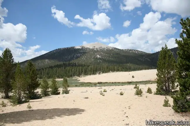
Pick up the trail at Horsehoe Meadow Campground and begin hiking east over packed sand along the northern edge of Horseshoe Meadow. After a third of a mile, the level trail crosses an early junction. To the left is a single track heading to Trail Pass, To the right is a path to the pack station, which means there could be horse presence (and presents) on the trail from here on.
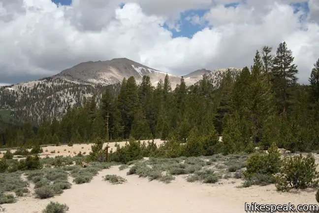
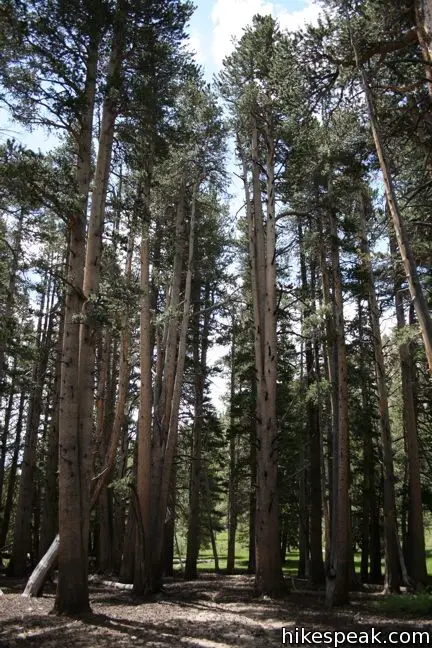
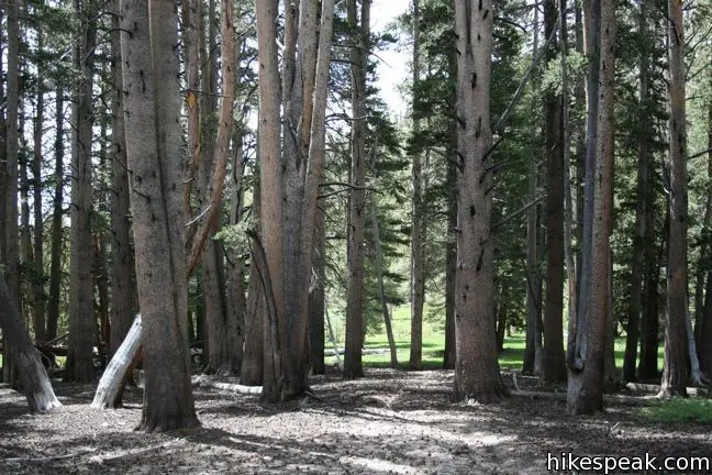
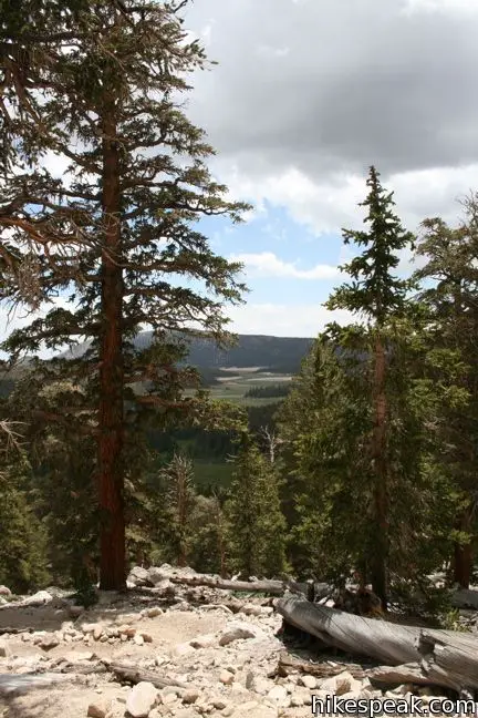
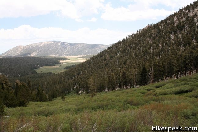
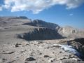
The trail passes through a light forest and remains fairly level for the first two miles. Just past the end of the meadow is small creek that the trail crosses twice before beginning a series of long gradual switchbacks. The views expand as you ascend of bulk of the 1,200 feet between the trailhead and the pass.
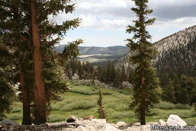
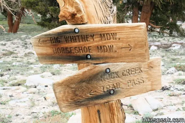
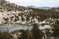
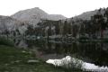
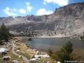
Just over Cottonwood Pass comes a junction with the Pacific Crest Trail. Straight ahead, the trail continues west across Golden Trout Wilderness and down to Big Whitney Meadow. To the right, the PCT heads northwest toward Rock Creek, Lower Soldier Lake, and the whole of Sequoia National Park. After just 0.6 miles, this track comes to Chicken Spring Lake, a worthy turn around point for an 8.2-mile hike.
Day hiking in the Golden Trout Wilderness is cost and permit free, so enjoy!
What you should know before you go: A wilderness permit is required for all overnight stays and a trailhead quota of forty backpackers per day is in force from the end of June to Mid-September. A permit may be booked in advance for a five-dollar fee or obtained the day of the hike for free at the nearby ranger station in Lone Pine (or one of the other Inyo National Forest permit offices). Sixteen of the forty permits are saved for hikers without reservation. If you get to Lone Pine early on the day of your expedition, snatching up a permit should not be a problem.
To be safe, backpackers must carry a bear canister, which can be rented in Lone Pine for five dollars. Bear lockers are also provided at the trailhead. Make sure your vehicle is bear-safe before leaving the parking lot. Dogs are permitted on a leash on trails in Inyo National Forest but not across the boundary in Sequoia National Park.
Given the 10,000-foot elevation of the Cottonwood Pass trailhead, altitude sickness is common. It is advisable to spend a night of acclimation at one of the trailhead campgrounds to avoid facing the symptoms (headaches, nausea, and lack of appetite) out on the trail. When traveling in the backcountry, you may also with to carry an SOS beacon and communicator.
Directions to the Trailhead
- It takes half an hour to ascend from the city of Lone Pine to the trailhead campgrounds.
- From Route 395 in Lone Pine, turn west at the traffic light on to Whitney Portal Road.
- After three miles, turn left on Horseshoe Meadow Road.
- Drive twenty miles up mountain switchbacks to road's end at Horseshoe Meadow.
- The Cottonwood Pass trailhead is at the east end of the campground.
Trailhead Location
Trailhead address: Horseshoe Meadows Road, Inyo National Forest, Lone Pine, CA 93545
Trailhead coordinates: 36.44834, -118.17065 (36° 26′ 54″N 118° 10′ 14.3″W)
View Eastern Sierra in a larger map
Or view a regional map of surrounding Sierra Nevada trails and campgrounds.


 | Chicken Spring Lake This 8.2-mile round trip hike continues past Cottonwood Pass to an alpine lake that makes a nice day hike destination or a good first camp for backpackers. |
 | Lower Soldier Lake This 19.2-mile loop crosses Cottonwood Pass and New Army Pass to visit a beautiful lake that is an ideal camping spot for backpackers heading higher and deeper into the Sierra. |
 | Cottonwood Lakes This scenic trail through a lake-filled basin provides a 10-mile round trip day hike to Long Lake and a 7.5-miles one-way trek to New Army Pass on the border of Sequoia National Park near Mount Langley. |
 | Mount Langley This 22-mile trek travels past Cottonwood Lakes Trail over New Army Pass to a 14,042-foot summit with towering views of the Sierra. |
 | Old Cottonwood Creek Trail This 8 to 9-mile day hike follows a secluded trail through mountain meadows to the South Fork Lakes and Cirque Lake. |
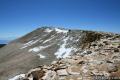 | Cirque Peak This 12,900-foot summit can be reached via off-trail ascents from New Army Pass, Cirque Lake, and Chicken Spring Lake. |
 | More trails in the Sierra Nevada Mountains Explore other destinations in Sequoia National Park and the rest of the range. |
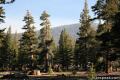 | Horseshoe Meadow Campgrounds This pair of campgrounds offer 40 sites and serve as a great base for the Cottonwood Pass and Cottonwood Lakes trails. |
- Cottonwood Pass & Chicken Spring Lake in Sequoia and Kings Canyon National Park: Must-Do Hikes for Everyone by Mike White (opens in a new tab)
- Cottonwood Pass Trail in The High Sierra: Peaks, Passes, Trails by R. J. Secor (opens in a new tab)
- Trail and campground status page for the Mount Whitney Ranger District of Inyo National Forest (opens in a new tab)
- Inyo National Forest bear canister page (opens in a new tab)
- The official website for Inyo National Forest (opens in a new tab)
Common Questions about Cottonwood Pass in the Golden Trout Wilderness
- Is the trail open?
- Yes. You should expect to find that Cottonwood Pass Trail is open. There are no recent reports of trail closures. If you discover that the trail is closed, please help your fellow hikers by reporting a closure.
- Do I need a permit for this hike?
- Yes. National Forest Wilderness Permit and bear canister required for overnight trips.
- How much time does this hike take?
- It takes approximately 3 hours 45 minutes to hike Cottonwood Pass Trail. Individual hiking times vary. Add extra time for breaks and taking in the views.
- How long is this hike?
- The hike to Cottonwood Pass Trail is a 7 mile out and back with 1200 feet of elevation change.
- Are dogs allowed on this trail?
- Yes, dogs are allowed on Cottonwood Pass Trail. The trail is open to hikers, dogs.
- Where is the trailhead located?
- The trailhead for Cottonwood Pass Trail is located in Lone Pine, CA.
Trailhead Address:
Horseshoe Meadows Road
Lone Pine, CA 93545
Trailhead Coordinates:
36.44834, -118.17065 - What are the driving directions to the start of the hike?
To get to the trailhead: It takes half an hour to ascend from the city of Lone Pine to the trailhead campgrounds. From Route 395 in Lone Pine, turn west at the traffic light on to Whitney Portal Road. After three miles, turn left on Horseshoe Meadow Road. Drive twenty miles up mountain switchbacks to road's end at Horseshoe Meadow. The Cottonwood Pass trailhead is at the east end of the campground.
View custom Google Maps directions from your current location.
- Are there other trails near Cottonwood Pass Trail?
- Yes, you can find other nearby hikes using the Hikespeak Hike Finder Map.

14 Comments on Cottonwood Pass in the Golden Trout Wilderness
What hikers are saying:
✨ Generated summary of user commentsThis trail offers a pristine wilderness experience where the landscape feels preserved and well-maintained. Carla appreciates the sense of security provided by the permit system, which ensures rangers can locate anyone who might lose their way. Visitors should bring camp stoves for meal preparation and treat all stream water to ensure it is safe for drinking.
“It is a great pristine area to hike through.” Jump to comment ↓
Why does all the open land and wilderness in California have to be controlled by the government? Why is there no free wide open land anymore? It is sad we have to pay money to government masters and nannies every time we want to go enjoy nature. This is too sad.
The area is free to visit if you get a permit the day of your hike. It’s really not much of a hassle. Our tax dollars allow the gov’t to do a great job maintaining trails and preserving this beautiful area for everyone to enjoy.
@jmsroman and those of like mind:
hikespeak has it dead on. These areas would get really beat up if they were not protected. And every modern country has a government that tries, to varying degrees, to protect regional areas of natural beauty. It is hardly a matter of taxation without representation. Moreover, there hasn’t really been a sort of “free wide open land” (as envisioned above) in at least 50 years; one can be anachronistically wistful or naive, or just enjoy that these lovely patches of earth are protected for us to enjoy.
right on hikespeak; I am so thankful for all the trail
maintenance. Our taxes going towards our being able to
enjoy this rich beauty is a miniscule sacrifice compared
to those made by John Muir. God love him but I could
never have done what he did. I’m thankful for the permits
too in case I get lost, which I tend to do, the rangers will
know where I went.
Blame it on the problem of population explosion. I hiked in the Sierra Nevada 60 years ago. No permits were required then. You were also considered something of an oddball as a wilderness hiker/camper. There are many more people engaging in this activity now.
Yes and you could actually drink out of the streams w/ cupped hands and not worry about getting sick. Until I observed a young mother rinsing out her baby’s cloth diaper in the Kings River but I’m sure she never went into the back country.
Right on HikeSpeak, you speak for the majority, not the minority that won’t be happy until California looks like West Virginia (with the tops ripped off mountains and the water poisoned and destroyed). Preventing the slow erosion of the commons requires eternal vigilance.
My son and I are planning on hiking in the Sequoia/Kings Canyon and Yosemite area during the week of May 11-18th. We would like to do a couple nites backpacking trip in each of those areas. Does this seem feasible regarding snow in the park? What trails would you recommend?
Thanks for any information you can give me.
Patti (from Michigan – used to snow, but I don’t like it)
The banner photo on this page is me and my husband (then, boyfriend) at the start of our NB JMT trip! I’ll post the photo he took of me right there on bdjmt.blogspot.com as soon as I find it.
We had an incredible hike and are looking forward to spending this week in the Cottonwood area again.
Thanks for posting!
Well that’s a first! Hope you don’t mind. It is an incredibly great area to hike!
[…] set up camp at Horseshoe Meadows, 10,000 feet in elevation, and went on a 7-mile hike to Cottonwood Pass, which reaches 11,200 feet. This helped us, and our lungs, acclimate to the high altitudes that we […]
How does one cook their food in these areas or what is actually allowed? A wood fire or a backpacking stove? I don’t see much wood scattered around in the beautiful pictures posted that’s why I’m asking. But maybe that’s because the place is kept clean and the hikers and campers follow the rules of leaving no trace. I enjoy wood fires to cook my meals but whatever is allowed, I’ll follow.
Camp stoves are the way to prepare meals out there. It is a great pristine area to hike through. Enjoy!
[…] suddenly you have at trip! You’ll be hiking from Horseshoe Meadow campgrounds in the Sierras over Cottonwood Pass, and on to Lower Soldier Lake. It will be 5 chicks, 1 dude, and a whole lot of […]