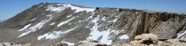
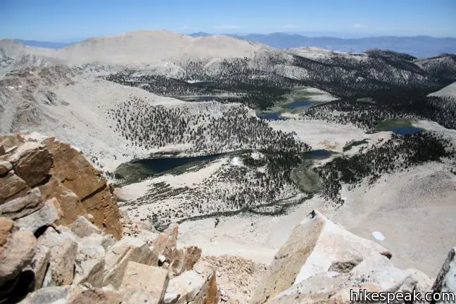
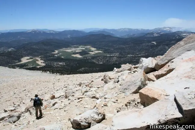
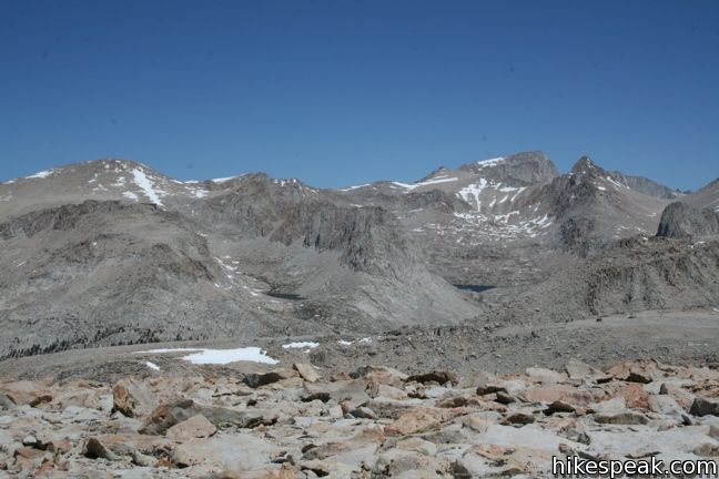
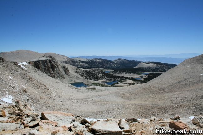
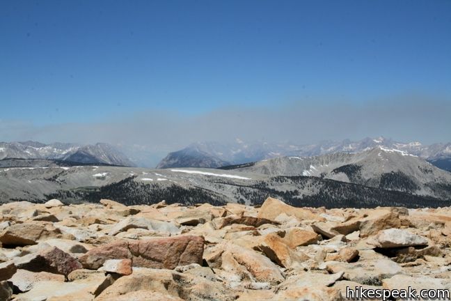
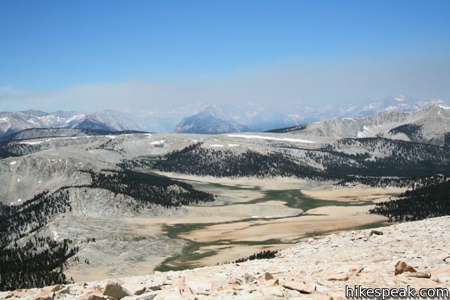
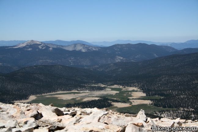
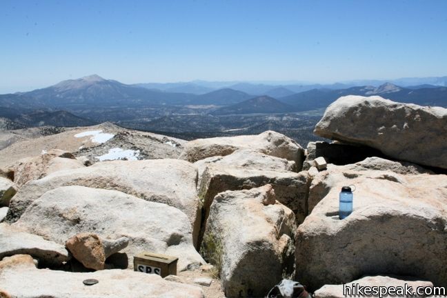
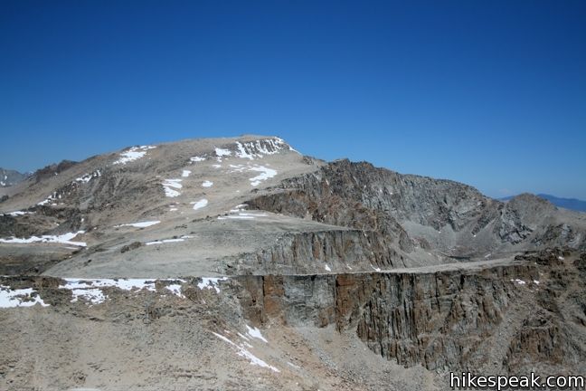
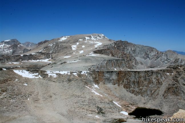
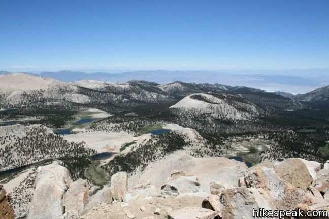
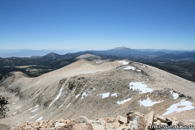
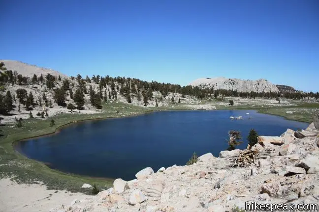
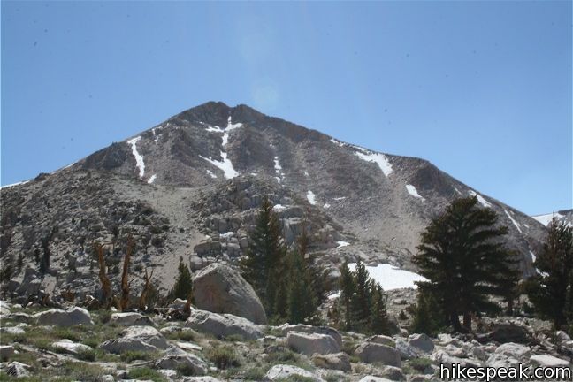
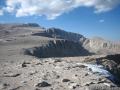
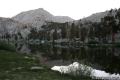
Cirque Peak can be reached from either Cottonwood Pass Trail or Cottonwood Lakes Trail. The mountain rises between the two, straddling the divide of the Golden Trout and John Muir Wildernesses. The summit boasts an excellent panorama with a good look at Mount Langley to the north, the Cottonwood Lakes to the east, and the sprawling Sierra to the west.
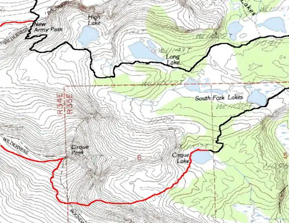
By far the easiest approach to Cirque Peak is from New Army Pass. The pass is 7.5-miles from Cottonwood Lakes Trailhead and at 12,300 feet, the pass is just 600 feet beneath the summit. The toughest part of this route is the series of switchbacks beneath New Army Pass. From the pass, it is little more than a walk to the top.
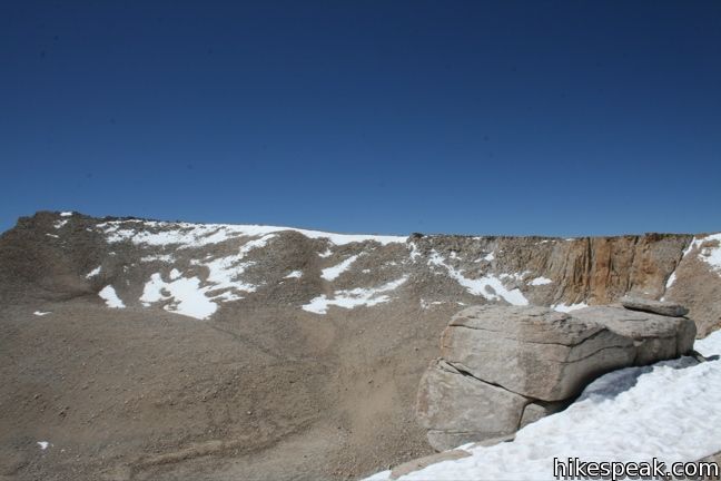
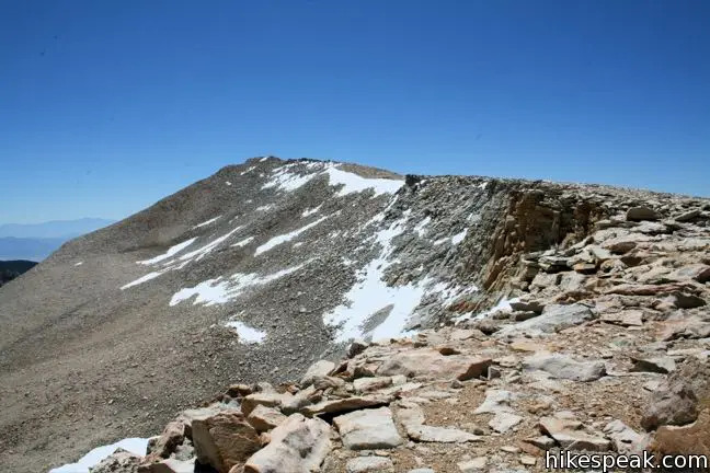
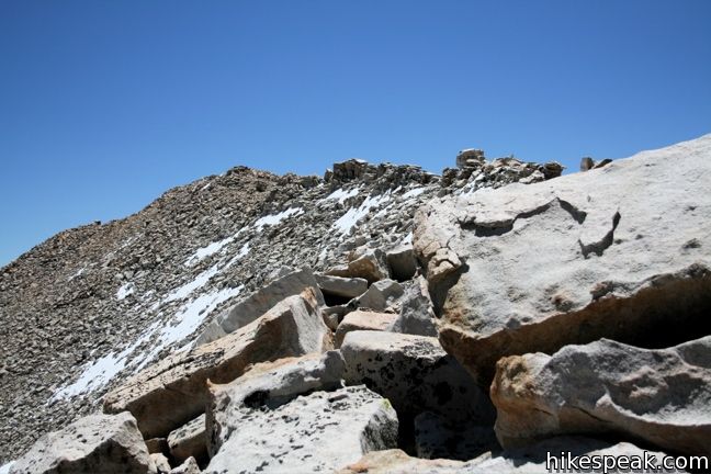
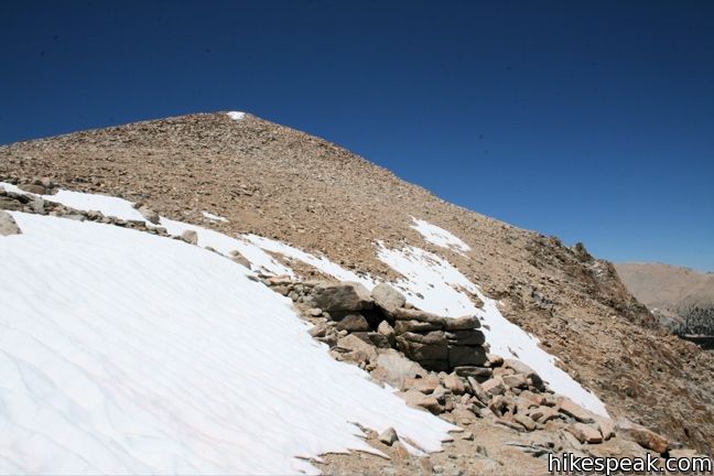
Head west from the pass across a trail-less landscape of rock and sand. Follow the ridgeline as it turns south toward the peak. staying west of the crest to avoid the larger rocks. Continue beneath a series of false peaks and save your ascent for true summit. Cirque Peak is about two miles from the pass and will not put up much of a challenge to anyone who has made it this far into the Sierra.

Two other approaches are worth noting:
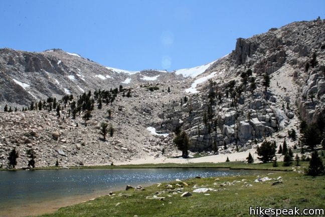
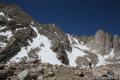
Hikers can make the ascent from Cirque Lake or Chicken Spring Lake. Both options require about two miles of off-trail trekking and some Class 2 scrambling. These routes meet up at the saddle south of Cirque Peak and take the summit from there.
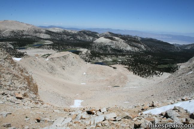
From Cirque Lake at the end of Old Cottonwood Creek Trail, cross a short but tiresome boulder field to get to the base of the mountain. Look up and choose a path. Loose gravel and rocks can add a little extra effort to the climb to the saddle. Descending this slope is much easier.
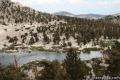
Those who ascend Cirque Peak by hiking Cottonwood Lakes Trail to New Army Pass may wish to return to Horseshoe Meadow by dropping down to Cirque Lake and Old Cottonwood Creek Trail. This is the shortest route between the trailhead and the peak.
Old Cottonwood Creek Trail fizzles out on the hillside north of Cirque Lake, so picking it up is a little tricky. If you descend from Cirque Peak, circle to the north side of the lake. About eighty yards from the east end, turn left and head up the hillside. Once you find the trail, it is easy to follow down to South Fork Lake and out to Horseshoe Meadow.
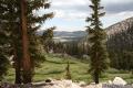
To reach Cirque Peak: Make your way to Horseshoe Meadow and set out on either Cottonwood Pass Trail, Old Cottonwood Creek Trail, or Cottonwood Lakes Trail.
Directions to the Trailhead
- It takes half an hour to ascend from the city of Lone Pine to the trailhead campgrounds.
- From Route 395 in Lone Pine, turn west at the traffic light on to Whitney Portal Road.
- After three miles, turn left on Horseshoe Meadow Road.
- Drive twenty miles up mountain switchbacks to the end of the road at Horseshoe Meadow.
- Turn right, following signs for Cottonwood Lakes and park at the trailhead.
Trailhead Location
Trailhead address: Horseshoe Meadows Road, Inyo National Forest, Lone Pine, CA 93545
Trailhead coordinates: 36.4532, -118.1699 (36° 27′ 11.5″N 118° 10′ 11.6″W)
View Eastern Sierra in a larger map
Or view a regional map of surrounding Sierra Nevada trails and campgrounds.

 | Old Cottonwood Creek Trail This 8 to 9-mile day hike follows a secluded trail through mountain meadows to the South Fork Lakes and Cirque Lake. |
 | Cottonwood Lakes This trail through lake-filled Cottonwood Basin provides a 10-mile round trip day hike to Long Lake and a 7.5-miles one-way trek to New Army Pass a 12,300-foot gateway to the Eastern Sierra including nearby Mount Langley. |
 | Mount Langley This 22-mile trek travels past Cottonwood Lakes Trail over New Army Pass to a 14,042-foot summit with towering views of the Sierra. |
 | Mount Pickering This 13,485-foot summit west of Mount Langley offers more excellent sierra views. |
 | Chicken Spring Lake This 8.2-mile round trip hike continues past Cottonwood Pass to an alpine lake that makes a nice day hike destination or a good first camp for backpackers. |
 | Cottonwood Pass This 7-mile round trip trail ascends 1,200 feet to an 11,200-foot pass and a junction with the Pacific Crest Trail, with access to Golden Trout Wilderness and Sequoia National Park. |
 | Lower Soldier Lake This 19.2-mile loop crosses Cottonwood Pass and New Army Pass to visit a beautiful lake that is an ideal camping spot for backpackers heading higher and deeper into the Sierra. |
 | More trails in the Sierra Nevada Mountains Explore other destinations in Sequoia National Park and the rest of the range. |
 | Horseshoe Meadow Campgrounds This pair of campgrounds offer 40 sites and serve as a great base for the Cottonwood Pass and Cottonwood Lakes trails. |
- Cirque Peak on summitpost.org (opens in a new tab)
- Cirque Peak on peakpagger.com (opens in a new tab)
- Cirque Peak and Mount Langley on Bob Burd's Trip Reports (opens in a new tab)
- Trail and campground status page for the Mount Whitney Ranger District of Inyo National Forest (opens in a new tab)
- Inyo National Forest bear canister page (opens in a new tab)
- The official website for Inyo National Forest (opens in a new tab)
Common Questions about Cirque Peak in the John Muir and Golden Trout Wildernesses
- Is the trail open?
- Yes. You should expect to find that Cottonwood Lakes Trail & Cirque Peak Ascent is open. There are no recent reports of trail closures. If you discover that the trail is closed, please help your fellow hikers by reporting a closure.
- Do I need a permit for this hike?
- Yes. National Forest Wilderness Permit and bear canister required for overnight trips.
- How much time does this hike take?
- It takes approximately 9 hours 45 minutes to hike Cottonwood Lakes Trail & Cirque Peak Ascent. Individual hiking times vary. Add extra time for breaks and taking in the views.
- How long is this hike?
- The hike to Cottonwood Lakes Trail & Cirque Peak Ascent is a 19 mile out and back with 2900 feet of elevation change.
- Are dogs allowed on this trail?
- No, dogs are likely not allowed on Cottonwood Lakes Trail & Cirque Peak Ascent. The trail is primarily open to hikers.
- Is Cottonwood Lakes Trail & Cirque Peak Ascent a difficult hike?
- This hike should be considered strenuous. Hikers should be prepared for a workout covering 19 miles and 2900 feet of climbing.
- Does this trail go to a summit?
- Yes, Cottonwood Lakes Trail & Cirque Peak Ascent reaches a summit with panoramic views.
- Where is the trailhead located?
- The trailhead for Cottonwood Lakes Trail & Cirque Peak Ascent is located in Lone Pine, CA.
Trailhead Address:
Horseshoe Meadows Road
Lone Pine, CA 93545
Trailhead Coordinates:
36.4532, -118.1699 - What are the driving directions to the start of the hike?
To get to the trailhead: It takes half an hour to ascend from the city of Lone Pine to the trailhead campgrounds. From Route 395 in Lone Pine, turn west at the traffic light on to Whitney Portal Road. After three miles, turn left on Horseshoe Meadow Road. Drive twenty miles up mountain switchbacks to the end of the road at Horseshoe Meadow. Turn right, following signs for Cottonwood Lakes and park at the trailhead.
View custom Google Maps directions from your current location.
- Are there other trails near Cottonwood Lakes Trail & Cirque Peak Ascent?
- Yes, you can find other nearby hikes using the Hikespeak Hike Finder Map.

Go the extra miles...
Submit a rating of this hike to go with your comment. Contribute to the average trail rating.