Hikes in Southern California
While hikespeak.com proudly offers information on over 150 hikes in Los Angeles, the surrounding counties should not be ovelooked. Enjoy numerous trails in the Southern California counties of Orange, Riverside, San Diego, and San Bernardino. SoCal is SoReady to be hiked!
The highest point in Southern California in found in the San Bernardino Mountains in San Bernardino County. San Gorgonio Mountain is 11,500 feet tall and one of the most topographically prominent peaks in America. San Bernardino National Forest is the principal parkland preserving the San Bernardino Mountains, protecting 676,666 acres in San Bernardino and Riverside counties.
Highlights of Southern California


Southern California Hiking
This collection of trails in Southern California (Orange County, Riverside County, San Bernardino County, and San Diego County) lists hikes roughly from north to south. The table may also be sorted alphabetically or by distance to help you pick your next hike. Each trail links to its own report complete with photos, GPS maps, elevation profiles, directions, and all the other information needed to locate and enjoy these hikes. Below the table is an interactive map that shows the location of each hike.
Trail | Description | Distance | Location |
|---|---|---|---|
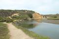
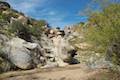
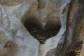 100 100 | Heart Rock This hike follows a mountain stream to an overlook of an amazing heart-shaped formation in the rock wall along Seeley Creek Falls. | 1 - 1.4 miles 200 feet | 34.257001, -117.305862 |
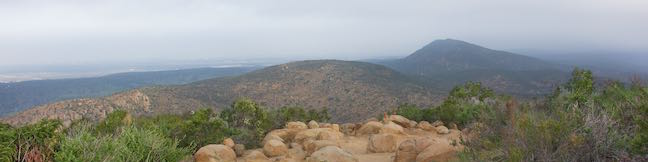
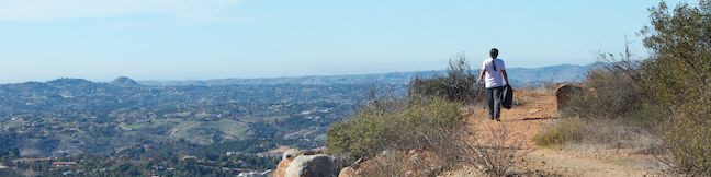
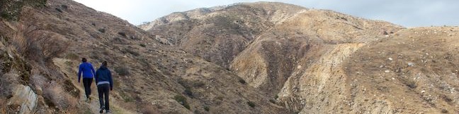
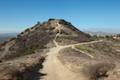
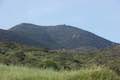
 150 150 | Marshall Peak This hike reaches a panoramic summit above the foothills of the San Bernardino Mountains. | 3.25 miles 375 feet | 34.22432, -117.299559 |
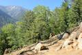
 170 170 | Heaps Peak Arboretum Take a short hike on Sequoia Trail and Footprint Trail to learn about the plants, animals, and natural history of the San Bernardino Mountains. | 0.75 miles 90 feet | 34.2338, -117.1606 |
 200 200 | Towne Trail This easy out and back hike takes a gradual course across the mountains on the south side of Big Bear Lake. | 2.66 miles 200 feet | 34.236792, -116.889687 |
 230 230 | Canyon View Loop Trail This loop in Whitewater Preserve crosses Whitewater River and incorporates a section of the Pacific Crest Trail to deliver big views up and down Whitewater Canyon. | 3.75 miles 650 feet | 33.989183, -116.656132 |
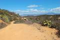
 250 250 | Indian Mountain This out and back hike crosses a saddle to a 5,790-foot summit with views of the mountains around San Jacinto Peak near Idyllwild. | 6 miles 815 feet | 33.797213, -116.7777 |
 260 260 | San Jacinto Peak via Marion Mountain Trail This non-nonsense out and back hike ascends to one of Southern California's most panoramic summits. | 13.2 miles 4500 feet | 33.79117, -116.735386 |
 270 270 | Ernie Maxwell Scenic Trail This gradual out and back hike near Idyllwild crosses quiet forests with rugged mountain views. | 5.2 miles 675 feet | 33.764735, -116.687213 |
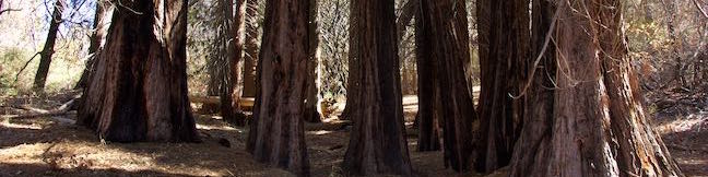
 300 300 | Carbon Canyon Regional Park Redwood Grove This level hike visits a small grove of small coastal redwoods that is the largest grove of these large trees in Southern California. | 2.5 miles 75 feet | 33.920923, -117.82935 |
 306 306 | Weir Canyon Trail This loop explores the side of a canyon in a wilderness connected to Santiago Oaks Regional Park near Anaheim. | 3.8 miles 350 feet | 33.830446, -117.744129 |
 310 310 | Lake View Loop & East Ridge Overlook This figure eight loop adds a short extension to Lake View Loop to reach the high point of Peters Canyon Regional Park. | 3.65 miles 200 feet | 33.784024, -117.762424 |
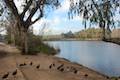 320 320 | Lake Huntington This level and easy loop circles a small lake in Huntington Beach Central Park. | 0.75 miles 25 feet | 33.69929, -118.010354 |
 330 330 | West Bluff Trail Loop This loop combines trails above and below the West Bluff in Upper Newport Bay Nature Preserve to provide a variety of views across Upper Newport Bay. | 2.5 miles 75 feet | 33.654468, -117.886134 |
 340 340 | Little Sycamore Canyon - Serrano Ridge - Camarillo Canyon - Stagecoach South Trails Loop in Laguna Coast Wilderness Park This loop uses four trails to explore two canyons and a ridge in Laguna Coast Wilderness Park. | 5 miles 500 feet | 33.607746, -117.763248 |
 360 360 | Geology Discovery Trail This loop in Crystal Cove State Park follows guide markers exploring geology in the beautiful backcountry of this Orange County wilderness. | 9 miles 900 feet | 33.56638, -117.821616 |
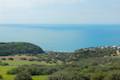
 363 363 | Moro Beach This out and back hike ventures down Moro Canyon to a picturesque beach in Crystal Cove State Park. | 2 miles 150 feet | 33.56638, -117.821616 |
 390 390 | El Cariso Nature Trail This loop examines common plants in the Santa Ana Mountains, along with uncommon views views across the mountain range, passing an old mine for more fun. | 1.35 - 1.55 miles 125 feet | 33.650867, -117.413113 |
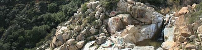
 400 400 | Ortega Falls This hike visits a refreshing waterfall, cascade, and swimming hole off Ortega Highway in the Santa Ana Mountains. | 0.33 miles 50 feet | 33.625765, -117.426339 |
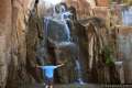
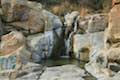 590 590 | Tenaja Falls This hike ventures up a wilderness canyon to a tall, five-tier waterfall along San Mateo Creek in the Santa Ana Mountains. | 1.5 miles 275 feet | 33.5491, -117.3946 |
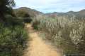 600 600 | Fisherman's Camp This hike follows an old road to an old campground with views over San Mateo Canyon in the Santa Ana Mountains. | 3.33 miles 400 feet | 33.532281, -117.393036 |
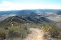 700 700 | Moserate Mountain This loop begins with a 1 2/3-mile ascent to a panoramic summit before descending along a ridge for even more views. | 4.4 miles 1,200 feet | 33.365934, -117.159113 |
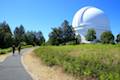 800 800 | Observatory Trail The out and back hike travels between Observatory Campground and Palomar Observatory, crossing a pleasant mountain woodland with valley views along the way. | 5.1 miles 700 feet | 33.342414, -116.878697 |
 820 820 | Indian Flats Trail This easy hike from Indian Flats Campground explores seasonal pools in the East Fork of the San Luis Rey River. | 0.5 miles 75 feet | 33.349488, -116.661797 |
 980 980 | Kwaay Paay Peak This out and back hike rewards a good workout with panoramic views as it climbs to a 1,194-foot summit in Mission Trails Regional Park, just 10 miles from downtown San Diego. | 2.5 miles 890 feet | 32.84022, -117.03701 |