
Within the Cleveland National Forest on Palomar Mountain is a trail through a pleasant woodland that has broad valley vistas en route to a world-renowned destination. What more could you want? Strap on your hiking boots and set out up Observatory Trail, which is 2.2 miles long from point to point with 700 feet of elevation gain. The trail starts at Observatory Campground and ends just outside the Palomar Observatory. From the top of Observatory Trail, it is a third of a mile walk to observatory’s main dome where you can visit the viewing deck of the impressive 200-inch Hale Telescope.
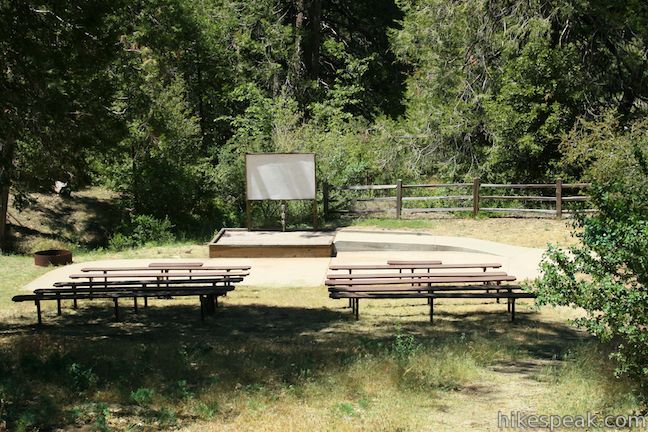
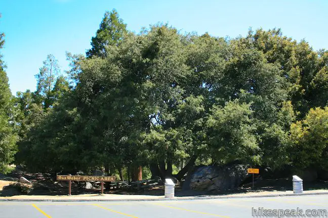
Start from Observatory Campground, which has 42 astronomically-friendly campsites operated by the Cleveland National Forest. On the east side of the campground loop road you will find a sizeable day use parking area at the beginning of Observatory Trail. Start up the trail, which immediately passes to the left of a campground amphitheater.
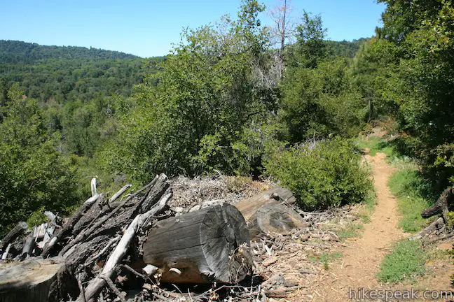
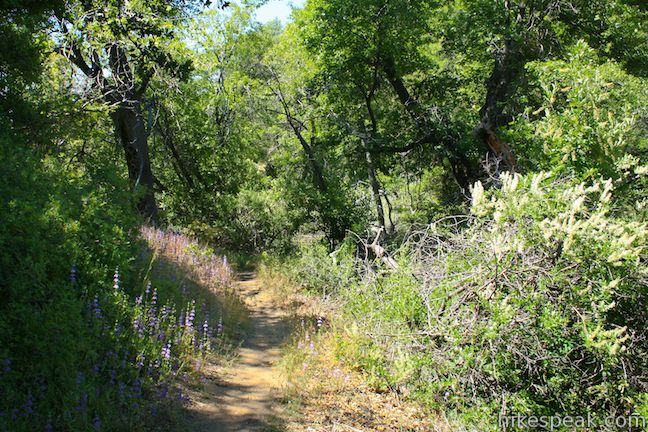
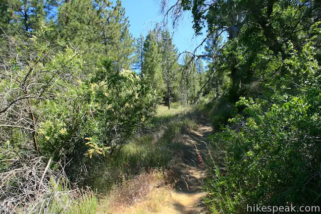
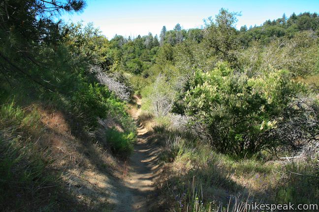
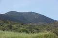
There are no junctions to concern yourself with along Observatory Trail, so unwind and enjoy a hike up a wooded mountainside shaded by a mixed forest of Jeffrey pines, ponderosa pines, black oaks, live oaks, and various chaparral. Three benches along the trail allow you to take a break amidst the 700 feet of elevation gain. The first bench comes just over a third of a mile from the start.
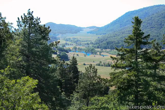
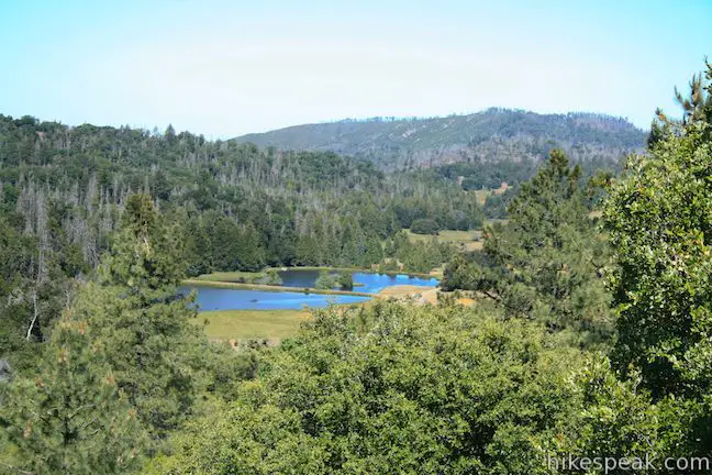
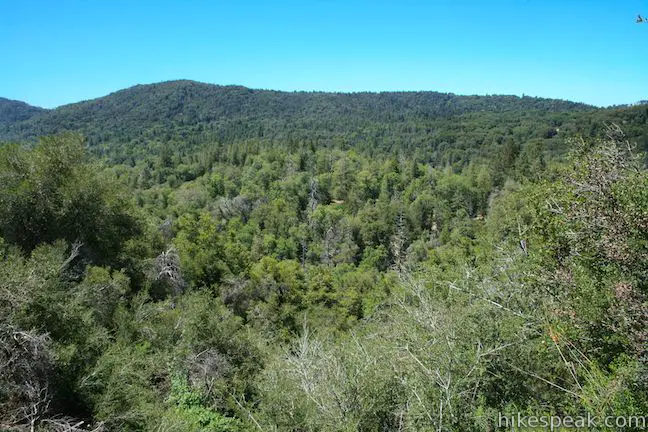
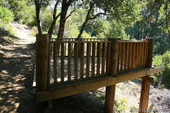
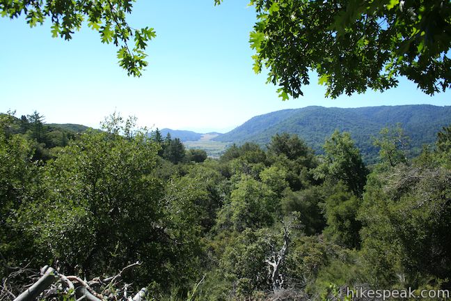
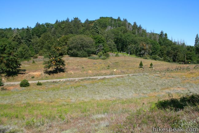
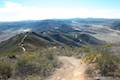
If you hike Observatory Trail in the spring you will spot monkeyflower, lupines, and other wildflowers blooming alongside the dirt single track. The trail heads east for 0.6 miles to Mendenhall Valley Overlook. Step out onto the wooden platform on the right side of the trail, which provides a window through the trees over Mendenhall Valley, a large grassy meadow cradled by the Palomar Mountains. Gaze over the long meadow, which is broken up by clusters of trees and a grouping of small ponds.
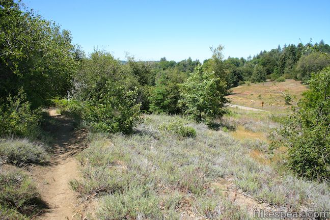
Beyond Mendenhall Valley Overlook, Observatory Trail bends to the left, heading north toward Palomar Observatory. The trail parallels South Grade Road (the road between the campground and the observatory) and you will hear occasional vehicle noise along this hike. Cross a wooden footbridge, a tenth of a mile past Mendenhall Valley Overlook and continue up the dirt trail. Shortly thereafter you will pass another bench.
At 1.2 miles from the start you will pass through a national forest boundary, leaving Cleveland National Forest. Outside the national forest, the trail continues over the same terrain and is similarly well maintained. Pass a third bench, 1.75 miles from the start.
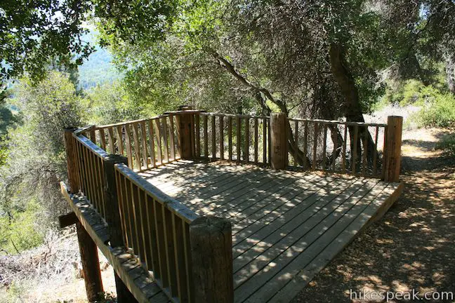
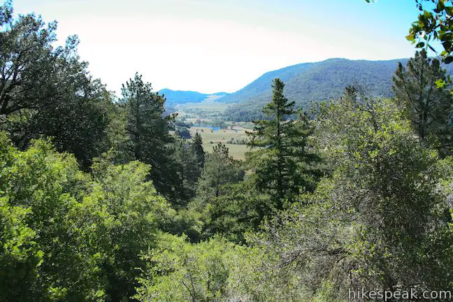
At two miles into the hike, come to what looks like a trail junction. To the left is a short spur out to an outcropping of rocks. Climb up the small boulder pile and enjoy a lovely view. The unofficial overlook peers west over ponds in Upper French Valley, another mountain meadow in the Palomar Mountains.
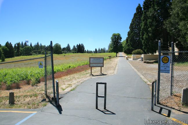
Continue up Observatory Trail for the final 0.2 miles to the top of the trail, 2.2 miles from the start. When you reach the top of the trail, turn right on Canfield Road and walk up the paved road, immediately entering the Palomar Observatory grounds.
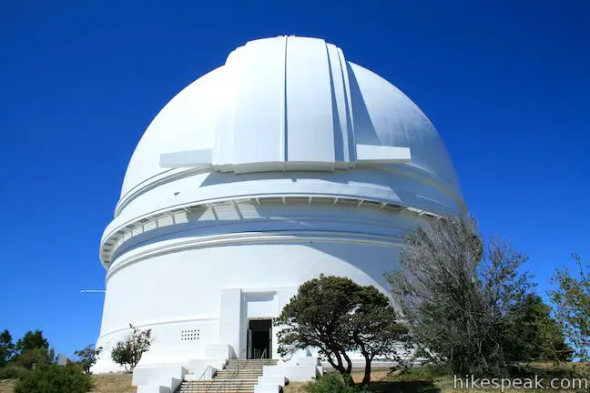
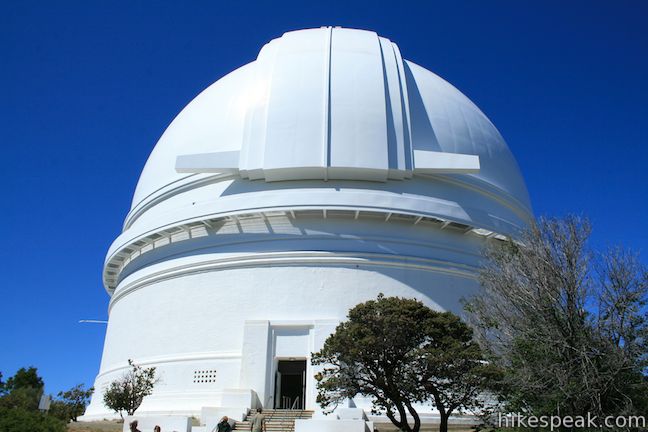
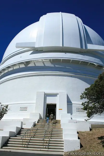
Palomar Observatory features a world-class telescope, the enormous 200-inch Hale Telescope named in honor of the legendary American astronomer George Hale, whose vision it was to create an observatory of this magnitude, but past away before it was complete. Edwin Hubble, another legendary astronomer, was the first to operate the telescope. Palomar Observatory has allowed mankind to see farther into the universe than ever before. The observatory is owned and operated by the California Institute of Technology (Caltech) and is open to the public.
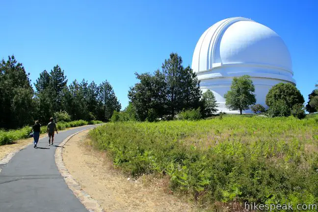
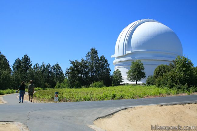
To reach the Hale Telescope, walk straight through a parking lot at the end of the road and continue along a level paved path. You will pass a museum and gift shop on the right along the way to the massive white dome for the 200-inch Hale Telescope, which is 1/3 of a mile from the top of Observatory Trail. You can walk a circle around the grand dome and go inside to the visitors gallery. Hike up a flight of stairs to an observation area where you can look in on the famous working telescope in action.

After scoping out Palomar Observatory, hike back to Observatory Trail and down to Observatory Campground. Observatory Trail is 4.4 miles round trip. If you hike from the top of the trail to the Hale Telescope and back, the total distance of the hike will be around 5.1 miles with 700 feet of elevation gain.
If you wish to camp at Observatory Campground, 42 sites offer amenities like fire rings, picnic tables, charcoal grills, vault toilets, flush toilets, and showers, and special astronomy events. The campground is open from April through October.
If you are not staying overnight at Observatory Campground, it has a sizeable day use parking area inside the campground at the start of the trail. If you park at the trailhead (instead of camping), a National Forest Adventure Pass is required for each vehicle and can be purchased for $5 per day. If you don’t have or don’t want to buy an adventure pass, it is free to park at the Palomar Observatory at the top of the trail.
The Palomar Observatory is open every day except Christmas and Christmas Eve from 9:00 a.m. to 3:00 p.m. during Standard Time and from 9:00 a.m. to 4:00 p.m. during Daylight Savings Time. Hazardous road conditions can also restrict access to the observatory.
Dogs are welcome on leashes. Mountain bikes are permitted on Observatory Trail but you are asked to walk your bike on the Palomar Observatory property. No permit is required to hike Observatory Trail to Palomar Observatory, so get out and enjoy!
Directions to the Trailhead
- Take the 15 Freeway to exit 46 for Route 76 east toward Pala.
- Drive east on Route 76 for 20.4 miles and turn left onto South Grande Road (S6).
- Take South Grade road for 6.8 miles to an intersection with East Grade Road and angle left to continue up South Grade Road, driving north for another 2.4 miles to Observatory Campground.
- Turn right into the campground.
- The trail starts from the day use parking area at the far side of the campground loop road.
Trailhead Location
Trailhead address: South Grade Road, Cleveland National Forest, Palomar Mountain, CA 92060
Trailhead coordinates: 33.342414, -116.878697 (33° 20′ 32.69″N 116° 52′ 43.30″W)
You may also view a regional map of surrounding Southern California trails and campgrounds.


 | Indian Flats Trail This easy half-mile hike from Atáxam Mámta’ash Campground (Indian Flats) explores seasonal pools in the East Fork of the San Luis Rey River. |
 | Moserate Mountain This 4.4-mile loop begins with a 1 2/3-mile ascent that gains 1,200 feet to reach a panoramic summit and then descends along a ridge for even more views. |
 | Kwaay Paay Peak This 2.5-mile hike rewards a good workout with panoramic views as it climbs to a 1,194-foot summit in Mission Trails Regional Park, just 10 miles from downtown San Diego. |
 | More hikes in Southern California Explore more trails in Orange, Riverside, San Bernardino, and San Diego counties. |
 | Observatory Campground This 42-site campground in Cleveland National Forest offers camping near the world-renowned Palomar Observatory for $15 per night. |
- Observatory Trail on sandiegoreader.com (opens in a new tab)
- Observatory Trail in 100 Classic Hikes in Southern California by Allen Riedel (opens in a new tab)
- Observatory Trail on wildernet.com (opens in a new tab)
- Observatory Trail on abhiking.blogspot.com (opens in a new tab)
- Observatory Campground on wildernet.com (opens in a new tab)
- Observatory Campground on campsitephotos.com (opens in a new tab)
- Palomar Observatory on wikipedia.org (opens in a new tab)
- The official webpage for Palomar Observatory (opens in a new tab)
- The official Cleveland National Forest webpage for Observatory Campground (opens in a new tab)
Common Questions about Observatory Trail in Cleveland National Forest
- Is the trail open?
- Yes. You should expect to find that Observatory Trail is open. There are no recent reports of trail closures. If you discover that the trail is closed, please help your fellow hikers by reporting a closure.
- Do I need a permit for this hike?
- Yes. National Forest Adventure Pass.
- How much time does this hike take?
- It takes approximately 2 hours 30 minutes to hike Observatory Trail. Individual hiking times vary. Add extra time for breaks and taking in the views.
- How long is this hike?
- The hike to Observatory Trail is a 5.1 mile out and back with 700 feet of elevation change.
- Are dogs allowed on this trail?
- Yes, dogs are allowed on Observatory Trail. The trail is open to hikers, dogs, bikes.
- Does this trail go to a summit?
- Yes, Observatory Trail reaches a summit with panoramic views.
- Where is the trailhead located?
- The trailhead for Observatory Trail is located in Palomar Mountain, CA.
Trailhead Address:
South Grade Road
Palomar Mountain, CA 92060
Trailhead Coordinates:
33.342414, -116.878697 - What are the driving directions to the start of the hike?
To get to the trailhead: Take the 15 Freeway to exit 46 for Route 76 east toward Pala. Drive east on Route 76 for 20.4 miles and turn left onto South Grande Road (S6). Take South Grade road for 6.8 miles to an intersection with East Grade Road and angle left to continue up South Grade Road, driving north for another 2.4 miles to Observatory Campground. Turn right into the campground. The trail starts from the day use parking area at the far side of the campground loop road.
View custom Google Maps directions from your current location.
- Are there other trails near Observatory Trail?
- Yes, you can find other nearby hikes using the Hikespeak Hike Finder Map.

Go the extra miles...
Submit a rating of this hike to go with your comment. Contribute to the average trail rating.