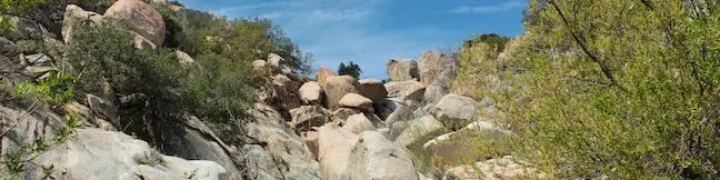
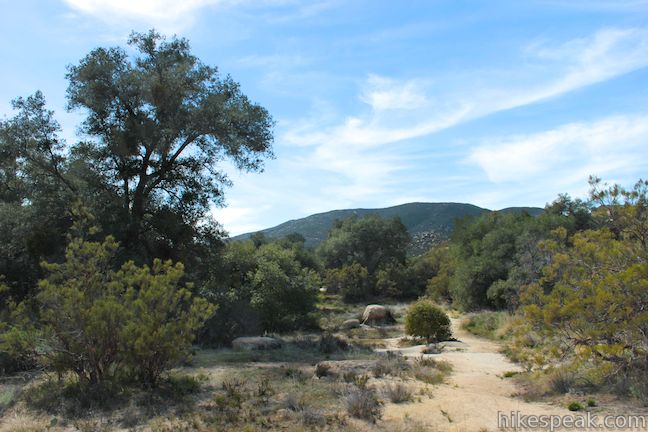
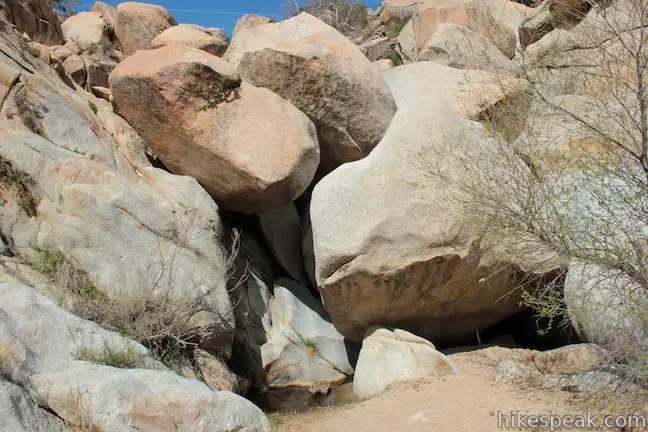
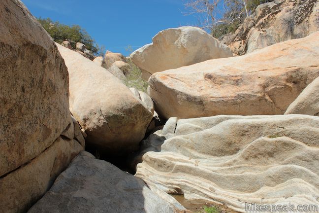
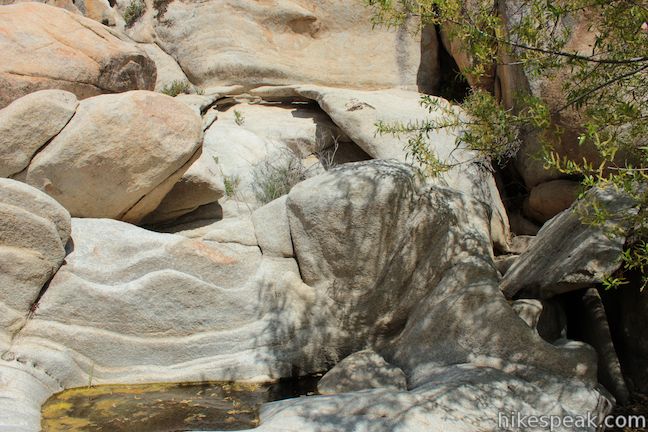
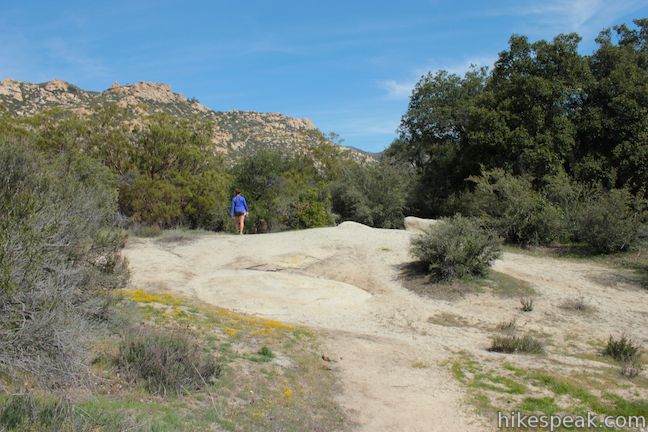
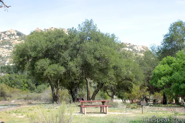
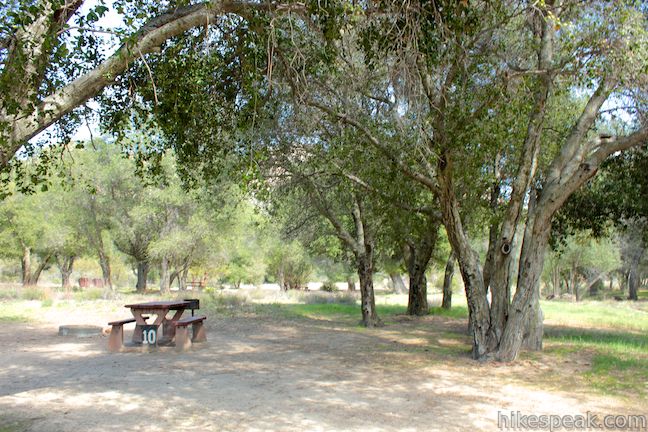
Located in the Cleveland National Forest near Warner Springs, The live oak-shaded Atáxam Mámta’ash Campground (formerly know as Indian Flats) is the start of a short trail to a trickling river fork. It is a 0.5-mile round trip hike from the campground goes down to the East Fork of the San Luis Rey River, which flows down a mountain slope covered in granite boulders. The river is filled with interesting pools and passageways to explore.
It is not an exaggeration to say that Jerry Schad, the author of Afoot and Afield San Diego County and several other hiking guides, probably knew the trails of San Diego County better than anyone, and he though Indian Flats Trail was perfect for children, writing:
What better way is there to pique a child’s interest in nature than to introduce him or her to a shallow, lazily flowing river full of tadpoles and frogs?
This short trail has just 75 feet of elevation change, making is easy for kids of any age to reach the pools, which could fascinate them for hours. Plan an overnight trip to Atáxam Mámta’ash Campground and young and old can enjoy a great weekend in the outdoors.
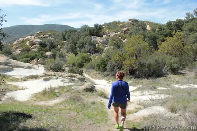
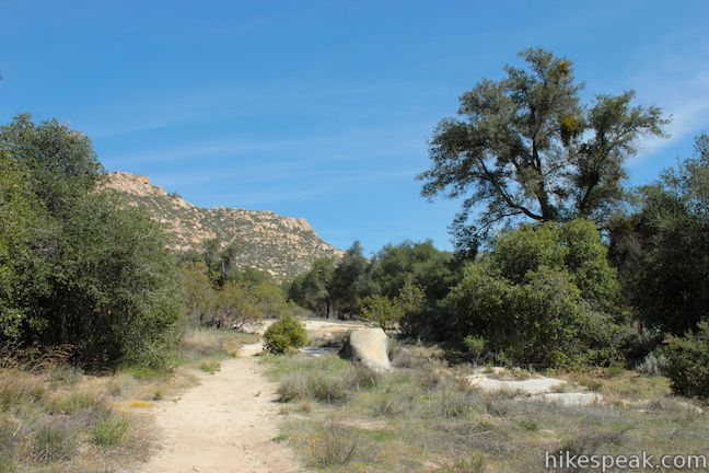
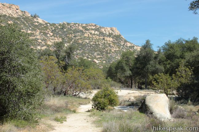
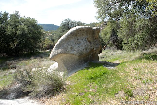
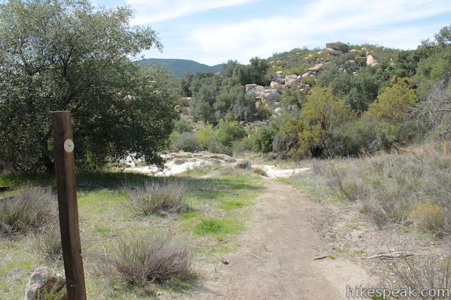
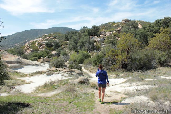
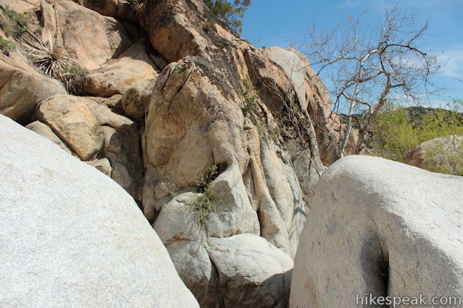
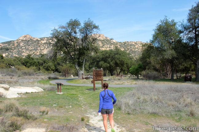
To hike to the East Fork of the San Luis Rey River, make your way to the far end of the single loop in Atáxam Mámta’ash Campground where a wooden panel is labeled Indian Flats (this sign has likely been updated since the 2022 name change for the campground). Next to it, you will find a worn path heading northwest on a gradual downhill grade. Most of the trail crosses exposed bedrock and there are numerous granite outcroppings along the trail. Pass through the oak woodland for just 0.2 miles to reach the river fork. There are a few spur paths along the way, so stick to the most worn trail. When you pass a boulder shaped like a mushroom on the left side of the trail, follow the main route as it curves to the right. You will quickly pass a wooden post and begin descending to the creek.
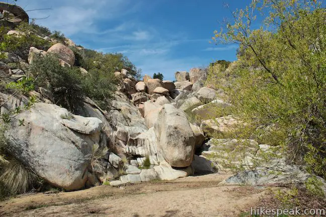
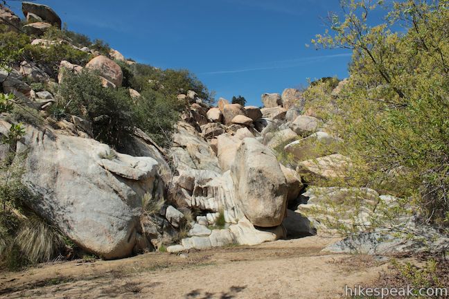
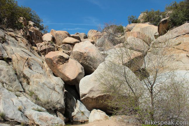
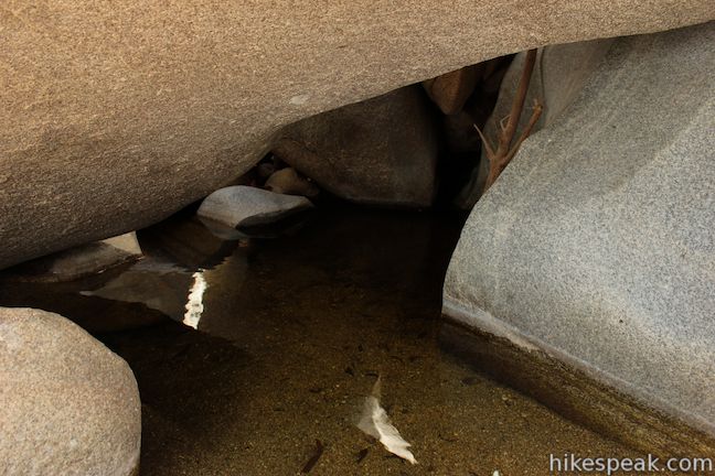
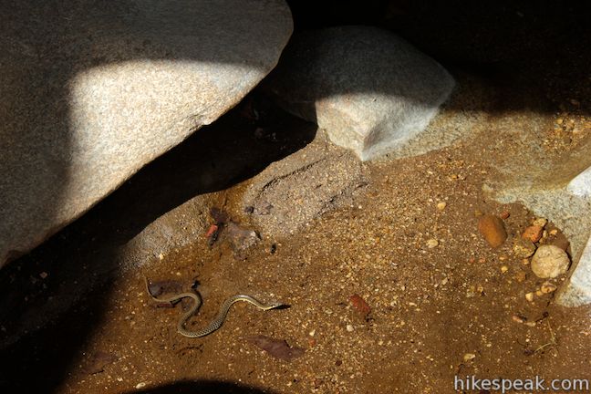
When you reach the East Fork of the San Luis Rey River, turn upstream (to the right) where you will find water coming down a granite slope. Large boulders surround the stream, covering it in many places. There is only a small drainage for the East Fork of the San Luis Rey River, so you may find it quite dry outside of the wet winter season. If you are in the mood to explore, you can follow the water up the mountain slope, climbing around boulders or wading through shallows to reach miniature waterfalls and caves. Wildlife like frogs and snakes can be found in the pools. Explore as much as you like before returning the way you came.

No permit is required to hike Indian Flats Trail to the East Fork of the San Luis Rey River. Dogs are permitted on a leash. There is a $12 fee to stay overnight at Atáxam Mámta’ash Campground. Otherwise, you will need a National Forest Adventure Pass ($5 per day) to park at the trailhead. Indian Flats Campground has 17 sites with picnic tables, fire rings, charcoal grills, and vault toilets.
Trail and campground closure: Indian Flats Campground and Indian Flats Trail are closed to the public each year in April and May during the active season for the endangered arroyo toad, whose habitat includes the area around Indian Flats Campground. The specific closure dates may vary from year to year, so check the national forest webpage for Atáxam Mámta’ash Campground or call the Palomar Ranger District of the Cleveland National Forest at (760) 788-0250 before visiting in the spring. If you see an arroyo toad in the East Fork of San Luis Rey River, please do not approach it.
Directions to the Trailhead
- Take Route 79 to Lost Valley Road in Warner Springs.
- Lost Valley Road is located 1.5 miles northwest of the center of the small town.
- In the other direction, the intersection is 18 miles southeast of Aguanga on Route 79.
- There will be a sign for Atáxam Mámta'ash Campground (Indian Flats) at the bottom of Lost Valley Road.
- Drive north up the narrow paved road for 7 miles to the campground at the end of the road.
- The trail begins from the far end of the loop.
- If you are not staying overnight at Atáxam Mámta'ash Campground, additional parking can be found near the group camping area at the start of the loop.
Trailhead Location
Trailhead address: Lost Valley Road, Cleveland National Forest, Warner Springs, CA 92086
Trailhead coordinates: 33.349488, -116.661797 (33° 20′ 58.15″N 116° 39′ 42.46″W)
You may also view a regional map of surrounding Southern California trails and campgrounds.
Indian Flats Trail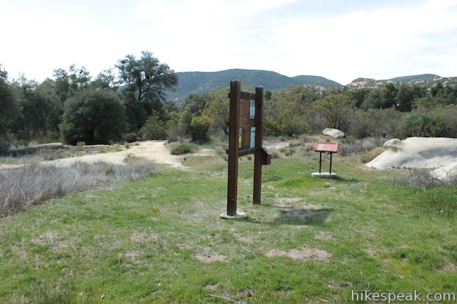


Indian Flats Campground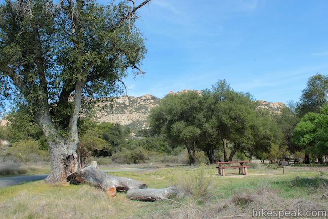


 | Observatory Trail The 5.1-mile hike travels between Observatory Campground and Palomar Observatory, crossing a pleasant mountain woodland with valley views along the way. |
 | Moserate Mountain This 4.4-mile loop begins with a 1 2/3-mile ascent that gains 1,200 feet to reach a panoramic summit and then descends along a ridge for even more views. |
 | Kwaay Paay Peak This 2.5-mile hike rewards a good workout with panoramic views as it climbs to a 1,194-foot summit in Mission Trails Regional Park, just 10 miles from downtown San Diego. |
 | More hikes in Southern California Explore more trails in Orange, Riverside, San Bernardino, and San Diego counties. |
 | Indian Flats Campground This 17-site campground in Cleveland National Forest offers first-come first-serve camping for $12 per night. |
Common Questions about Indian Flats Trail to East Fork San Luis Rey River in Cleveland National Forest
- Is the trail open?
- This trail is subject to seasonal closures. While generally open, it closes annually for specific seasons (such as winter weather or wildlife protection). Please verify the current status with the managing agency before visiting. If you find the trail is unexpectedly closed, please report a closure.
- Do I need a permit for this hike?
- Yes. National Forest Adventure Pass.
- How much time does this hike take?
- It takes approximately 15 minutes to hike Indian Flats Campground Trail. Individual hiking times vary. Add extra time for breaks and taking in the views.
- How long is this hike?
- The hike to Indian Flats Campground Trail is a 0.5 mile out and back with 75 feet of elevation change.
- Are dogs allowed on this trail?
- Yes, dogs are allowed on Indian Flats Campground Trail. The trail is open to hikers, dogs.
- Is Indian Flats Campground Trail good for kids?
- Yes, this hike is likely suitable for children. It is relatively short (0.5 miles) with manageable elevation gain.
- Where is the trailhead located?
- The trailhead for Indian Flats Campground Trail is located in Warner Springs, CA.
Trailhead Address:
Lost Valley Road
Warner Springs, CA 92086
Trailhead Coordinates:
33.349488, -116.661797 - What are the driving directions to the start of the hike?
To get to the trailhead: Take Route 79 to Lost Valley Road in Warner Springs. Lost Valley Road is located 1.5 miles northwest of the center of the small town. In the other direction, the intersection is 18 miles southeast of Aguanga on Route 79. There will be a sign for Atáxam Mámta'ash Campground (Indian Flats) at the bottom of Lost Valley Road. Drive north up the narrow paved road for 7 miles to the campground at the end of the road. The trail begins from the far end of the loop. If you are not staying overnight at Atáxam Mámta'ash Campground, additional parking can be found near the group camping area at the start of the loop.
View custom Google Maps directions from your current location.
- Are there other trails near Indian Flats Campground Trail?
- Yes, you can find other nearby hikes using the Hikespeak Hike Finder Map.

I am slowly getting all my back packing gear and was wondering if it was allowed if I stayed in a camp site at Indian Flats but back packed into the falls for the night so I can start trying out the gear that I have bought. One night is all I am looking for. Is this possible to do there?
According to this Cleveland National Forest webpage, “undeveloped camping” is only allowed in the Trabuco Ranger District, so you would not be allowed to do so near Indian Flats Campground.
Does anyone have photos of the rock scupltures on the granite cliffs? if you are standing at the campground loop facing the “Tooth” boulder and look up at the mountain top you will see a boulder that makes a “mohawk” and the face of an indian head with a body. The arms meet together and under the arms is the head of a wolf. To the right is the head of a cougar/mountain lion, there are other animal heads such as bear and alligator, also I believe there were 2 or 3 fish. I am trying to find someone that would have photos of this. I camped out in the granite rock area above the main dirt road that meets the “Tooth” Boulder road to the campsite and I didn’t have a camera. It was my first time there and my camping friend spotted it and showed me it and we were both astonished. I now live in Washington and I only went to this campground once. But if I ever go back, I will definitely get photos.