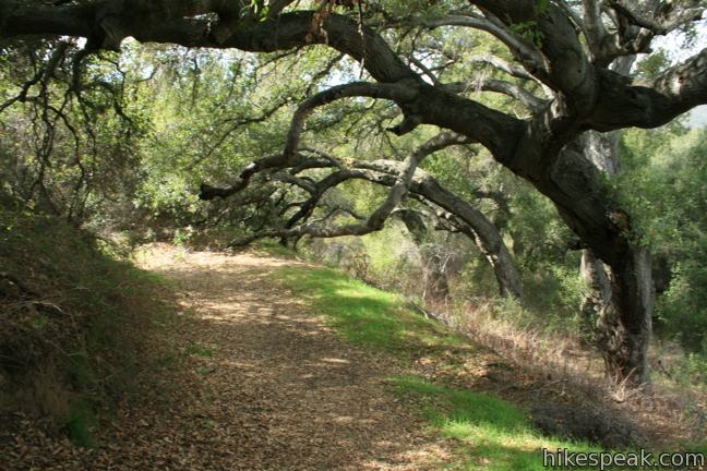
Once you break out of the trees at the trailhead, broad canyon views stay with you the way to Fisherman’s Camp in the San Mateo Canyon Wilderness. Fisherman’s Camp Trail descends 1.66 miles down what was once a road to what was once a campground nestled at the mouth of Tenaja Canyon. Grassy plots remain where backpackers can put up a tent in the shady creek-side retreat. Campfires are prohibited, but Fisherman’s Camp is still a serviceable trail camp. Enjoy a quick escape on this 3 1/3-mile round trip hike with 400 feet of elevation change, or head deeper into the wilderness on one of the trails extending beyond the camp.
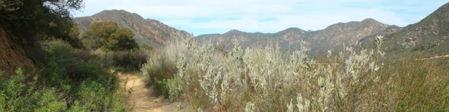
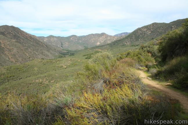
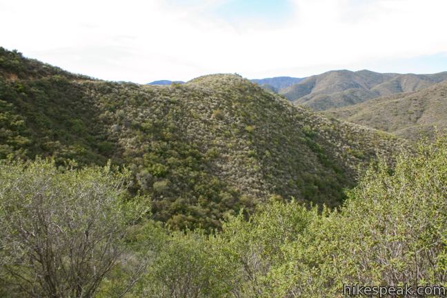
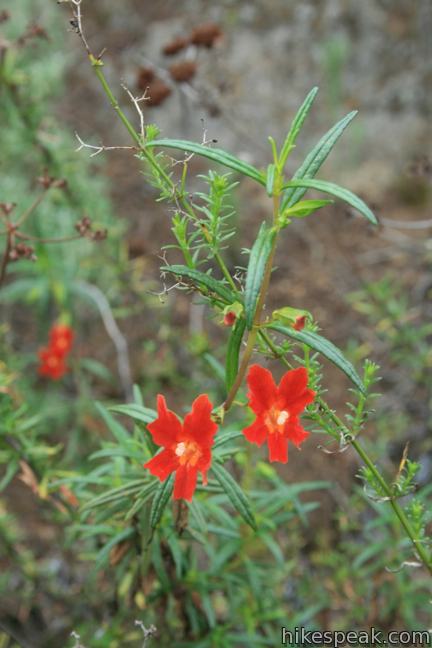
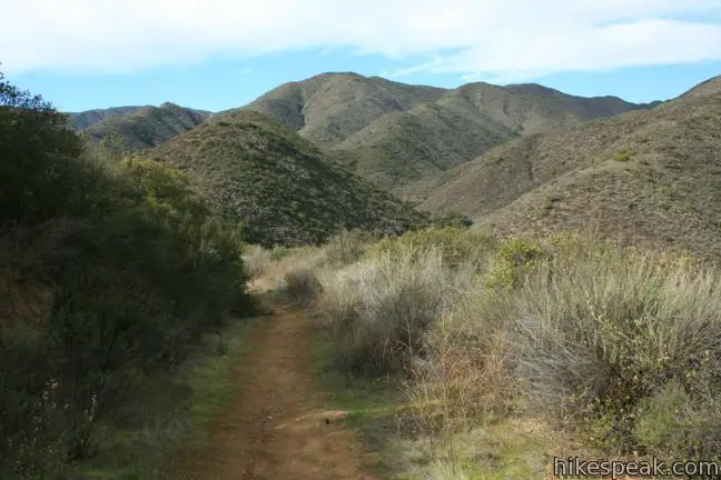
A few hundred feet down Fisherman’s Camp Trail, the roadside oaks are replaced by sage-covered slopes. As you travel west along the south side of Upper San Mateo Canyon, you will be struck with expansive views of the surrounding mountains.
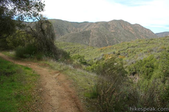
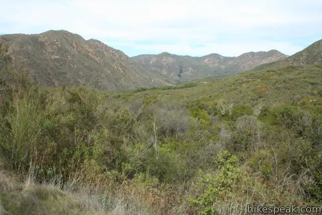
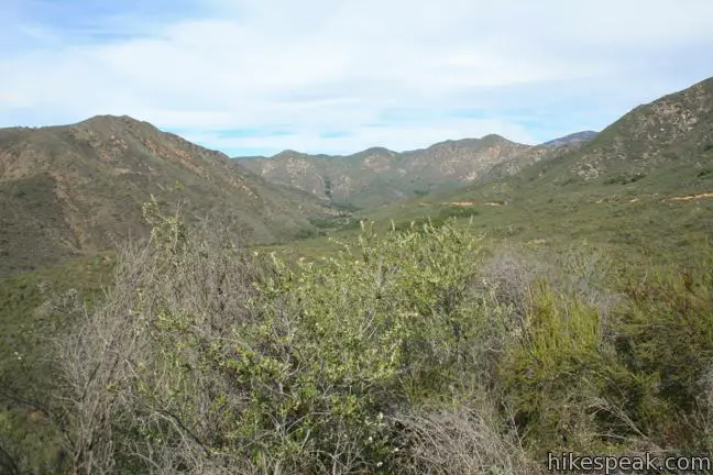
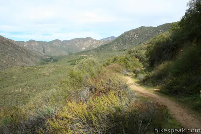
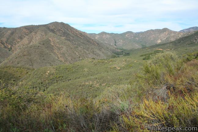
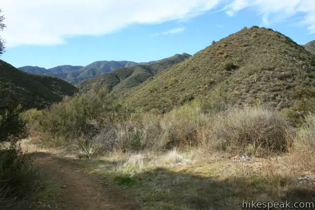
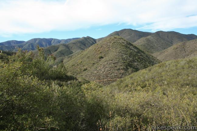
The first 2/3 of a mile is easy going, losing and then regaining 50 feet of elevation to reach a saddle on the side of the canyon. Ahead is an even bigger view down San Mateo Canyon, a wide depression made up of finger-like ravines spread out in the shape of a maple leaf. Continue down the trail, for a more intimate look at the canyon. This is what backcountry hiking in the peninsular ranges is supposed to be like — impressively remote, rugged, and natural.
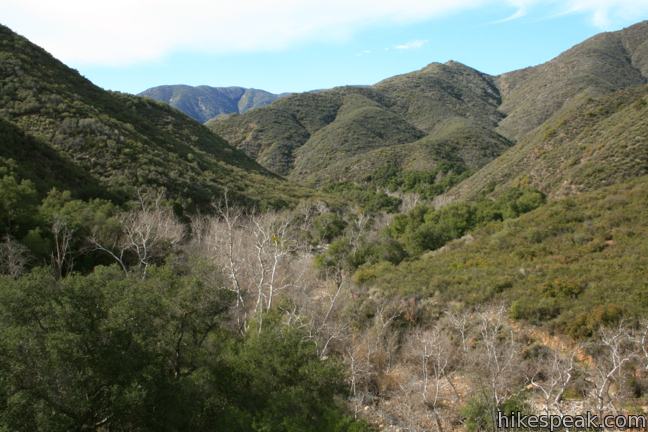
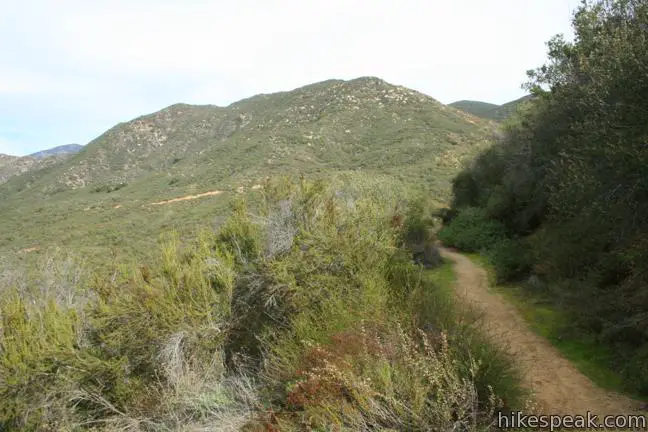
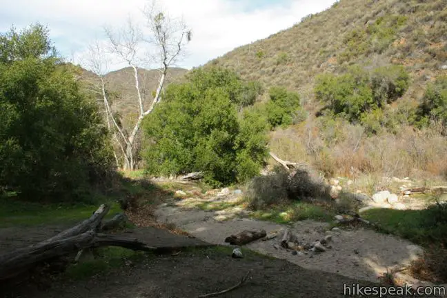
Beyond the saddle, the trail turns downhill and finally begins an earnest descent into the canyon. Follows the winding curvature of the canyon for another mile down to the canyon floor near the confluence of San Mateo Canyon and Tenaja Canyon. The trail ends at a junction with San Mateo Canyon Trail. To the right, this trail heads northeast up the canyon for two miles to meet Cleveland Forest Road near the start of Tenaja Falls Trail, 1.5 miles up the road from Fisherman’s Camp Trailhead.
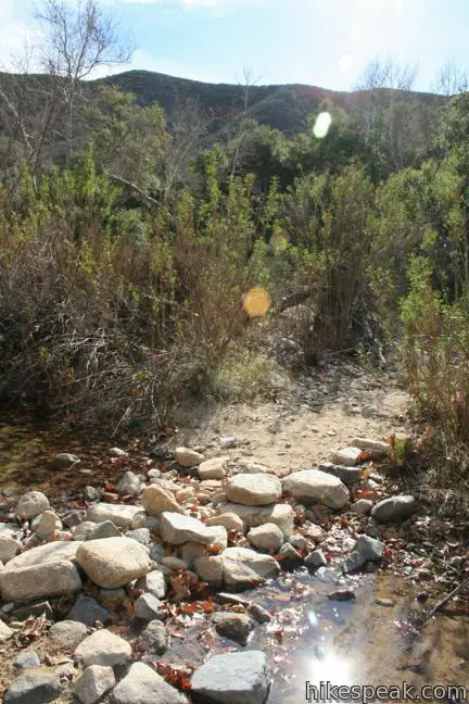
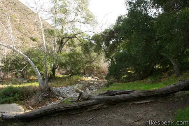
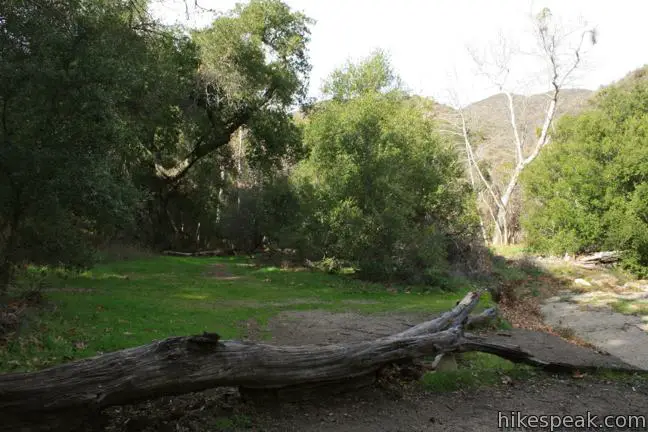
Turn left and walk a few hundred feet, crossing Tenaja Creek, to arrive at the decommissioned campground in a shady riparian zone of sycamores and oaks.
Two more trails extend out of Fisherman’s Camp. The first is the other end of San Mateo Canyon Trail, which heads southwest deeper into San Mateo Canyon. Tenaja Trail heads southeast up Tenaja Canyon to the Tenaja Trailhead on Cleveland Forest Road (aka Wildomar Road) 1.7 miles before the Fisherman’s Camp Trailhead. Both trails leaving the camp are well marked.
If you are simply returning the way you came, take a moment to linger at Fisherman’s Camp. The campground doesn’t have any picnic tables or benches, just a couple downed logs that are perfect for resting on.
If you are camping overnight, obtain a permit in advance from a Cleveland National Forest Ranger Station. The camp sits at an elevation of 1,120 feet and can be quite warm in the summer.
No permit is required to day hike to Fisherman’s Camp, and it is free to park at the trailhead (a National Forest Adventure Pass is no longer required). Dogs and mountain bikes are prohibited, but the trail is a great breakaway for hikers, so get out and enjoy. To see a nearby waterfall that’s the star of the region, take a short hike up Tenaja Falls Trail.
Directions to the Trailhead
- Take Interstate 15 to exit 68 for Clinton Keith Road, which is located in Murrieta north of Temecula and south of Lake Elsinore.
- Head west on Clinton Keith Road for 5.2 miles.
- Then stay to the right as the road becomes Tenaja Road.
- Proceed for 1.7 miles and turn right to remain on Tenaja Road.
- After another 3/4 of a mile, make another right to stick with Tenaja Road.
- Drive 3.5 miles farther up Tenaja Road and turn right onto Cleveland Forest Road (7S01).
- After 0.9 miles, pass Tenaja Trailhead on the left (not to be confused with the starting point for Tenaja Falls Trail).
- Stay to the right on the forest road, which becomes Tenaja Truck Trail.
- Follow this narrow paved road for 2.8 miles to a small turnout on the left for Tenaja Falls Trailhead.
Trailhead Location
Trailhead address: Tenaja Truck Trail, Cleveland National Forest, Murrieta, CA 92562
Trailhead coordinates: 33.5323, -117.3930 (33° 31′ 56.3″N 117° 23′ 34.8″W)
View Santa Ana Mountains in a larger map
Or view a regional map of surrounding Southern California trails and campgrounds.


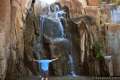
 | Tenaja Falls This 1.5-mile round trip hike ventures up a wilderness canyon to a tall, five-tier waterfall along San Mateo Creek in the Santa Ana Mountains. |
 | Ortega Falls This 1/3-mile round trip hike visits a refreshing waterfall, cascade, and swimming hole off Ortega Highway in the Santa Ana Mountains. |
 | El Cariso Nature Trail This 1.35 to 1.55-mile loop examines common plants in the Santa Ana Mountains, along with uncommon views views across the mountain range, passing an old mine for more fun. |
 | More hikes in Southern California Explore more trails in Orange, Riverside, San Bernardino, and San Diego counties. |
Common Questions about Fisherman’s Camp Trail in the Santa Ana Mountains
- Is the trail open?
- Yes. You should expect to find that Fisherman's Camp Trail is open. There are no recent reports of trail closures. If you discover that the trail is closed, please help your fellow hikers by reporting a closure.
- Is this trail free to access?
- Yes, Fisherman's Camp Trail is free to access. No entrance fee, pass, or permit is required. If you discover that access rules have changed, please provide feedback on your experience.
- How much time does this hike take?
- It takes approximately 1 hour 30 minutes to hike Fisherman's Camp Trail. Individual hiking times vary. Add extra time for breaks and taking in the views.
- How long is this hike?
- The hike to Fisherman's Camp Trail is a 3.33 mile out and back with 400 feet of elevation change.
- Are dogs allowed on this trail?
- No, dogs are likely not allowed on Fisherman's Camp Trail. The trail is primarily open to hikers.
- What mountain range is this trail in?
- Fisherman's Camp Trail is located in the Santa Ana Mountains.
- Where is the trailhead located?
- The trailhead for Fisherman's Camp Trail is located in Murrieta, CA.
Trailhead Address:
Tenaja Truck Trail
Murrieta, CA 92562
Trailhead Coordinates:
33.5323, -117.3930 - What are the driving directions to the start of the hike?
To get to the trailhead: Take Interstate 15 to exit 68 for Clinton Keith Road, which is located in Murrieta north of Temecula and south of Lake Elsinore. Head west on Clinton Keith Road for 5.2 miles. Then stay to the right as the road becomes Tenaja Road. Proceed for 1.7 miles and turn right to remain on Tenaja Road. After another 3/4 of a mile, make another right to stick with Tenaja Road. Drive 3.5 miles farther up Tenaja Road and turn right onto Cleveland Forest Road (7S01). After 0.9 miles, pass Tenaja Trailhead on the left (not to be confused with the starting point for Tenaja Falls Trail). Stay to the right on the forest road, which becomes Tenaja Truck Trail. Follow this narrow paved road for 2.8 miles to a small turnout on the left for Tenaja Falls Trailhead.
View custom Google Maps directions from your current location.
- Are there other trails near Fisherman's Camp Trail?
- Yes, you can find other nearby hikes using the Hikespeak Hike Finder Map.

I would like to spend two nights with some boyscouts. What other campsites are available besides Fisherman’s Camp. Is it possible to start at the trailhead for Fisherman’s and
end at the Candy Store on Hwy 74?
Mark,
It is possible with established trails, but there is a private community you must travel through about 8 miles before you reach the Candy Store on 74. I have not asked the question if the community is open to through hikers (I just spoke with Trabuco Ranger Station Gina :(951) 736-1811. The other challenge will be water. After you ascend out of San Mateo canyon you will be on high ground for over 12 miles.