Hikes in Ojai

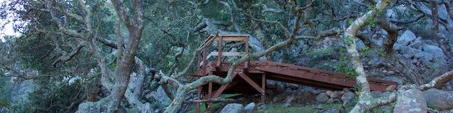
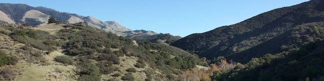
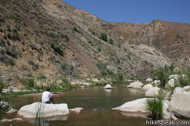
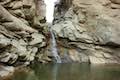
The city of Ojai lies on the southern edge of Los Padres National Forest, and there is great hiking in the green mountains around the city. Route 33, Mariposa Highway, heads north of Ojai into the breathtaking mountains, offering a scenic drive with numerous hairpin switchbacks. Along the way, there are several places to hike and camp. The largest campground in the area is Wheeler Gorge with seventy sites and a pleasant one-mile loop trail. The tallest waterfall in the Los Padres, the two-tier 300-foot Rose Valley Falls, is located three miles off Route 33 and is easy to get to from the campground. East of the waterfall is Sespe Wilderness, where backpackers can trek to more remote locations, including Willett Hot Springs.

Hiking in Ojai
A hiker relaxes along Sespe Creek

An adventure pass is required to enter Los Padres National Forest. Day passes cost $5 and an annual pass is $30. The passes may be purchased within the park, at various local retailers, and online. The passes are valid at other national forests in California as well, like Angeles National Forest.


View Central Coast Hikes in a larger map

Hikes in Los Padres National Forest near Ojai

Rose Valley Falls Trail
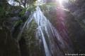
Rose Valley Falls
This 1-mile round trip trail leads to the lower tier of this two-tier 300 foot waterfall. From there one can scramble off trail to the much taller upper tier.
Sespe Creek TrailSespe Creek to Willett Hot Springs
This 19-miles round trip follows Sespe Creek to a relaxing hot springs.
Gorge TrailWheeler Gorge
This 1-mile loop explores the forest around this 70-site Campground.

Comments are closed.

Los Padres Trail
Gaviota State Park Tunnel View Trail Trespass Trail Loop Santa Barbara hike California 101 Freeway
On Tunnel View Trail, you can expect to see exactly what the name advertises, a view of the Gaviota Tunnel crossed by northbound traffic on the 101 Freeway between Santa Barbara and Buellton. You can also expect this 2.6 mile loop with 600 feet of elevation gain to deliver a rustic hiking experience up a narrow overgrown trail. If you could tune out the din of the freeway… Read more.
Los Padres Trail
Cerro Alto Campground Los Padres National Forest San Luis Obispo Morro Bay camping camp
Ah, what could be finer than a night beneath the pines and oaks at a cozy campground in Los Padres National Forest? A peaceful camping experience awaits at Cerro Alto Campground, located just off Route 41 between Morro Bay and Atascadero in San Luis Obispo County. The year-round campground has 22 sites spread out along a mile-long road. The sites are private and perfect… Read more.
Tagged with: |
Los Padres Trail
Cerro Alto Los Padres National Forest San Luis Obispo Morro Bay Hike trail high point Cerro Alto Peak
The 2,624-foot summit of Cerro Alto is one of the highest points in San Luis Obispo County and delivers a panoramic view. It seems like you can see the entire county from the top of the commanding peak, including each of the volcanic peaks stretching between Morro Bay and Edna Valley, the Nine Sisters. There are a couple ways to the summit, each tackling 1,600 feet of… Read more.
Los Padres Trail
Cerro Cabrillo Peak Morro Bay State Park San Luis Obispo California Nine Sister hike trail Tiki Rock
There are nine principle volcanic plugs spread between the central coast cities of Morro Bay and San Luis Obispo. The 911-foot Cerro Cabrillo (or Cabrillo Peak) is the third of the Nine Sisters from the west after Morro Rock and Black Hill. The summit of Cerro Cabrillo is the highest point in Morro Bay State Park, offering panoramic oceanfront views.  The unmaintained… Read more.
Los Padres Trail
Turtle Rock Chorro Trail Morro Bay State Park San Luis Obispo hike California Morro Estuary Los Osos
If you are looking for an easy 45-minute hike to the top of a pimple of a hill between two of San Luis Obispo’s Nine Sisters, take Chorro Trail to Turtle Rock in Morro Bay State Park. This 2.1-mile round trip hike begins with views of the estuary feeding Morro Bay and ends atop a small rise between Black Hill and Cerro Cabrillo. There is only 200 feet of elevation gain… Read more.