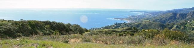
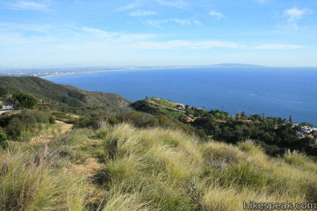
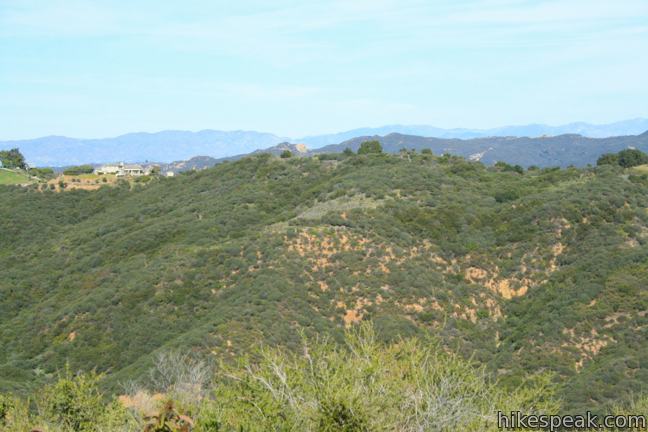
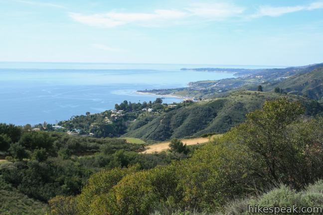
Tuna Canyon Park preserves 1,255 beautiful acres in the mountains between Topanga and Malibu. Despite being relatively unknown and under-visited, the park delivers some of the grandest ocean views to be found anywhere in the Santa Monica Mountains. From ridges 1,500 feet above a silken Pacific Ocean, Tuna Canyon Park looks east toward Santa Monica Bay and west up the coast of Malibu.
Tuna Canyon Park has two main viewpoints, found at the ends of Hearst Tank Motorway and Big Rock Lateral. From the main trailhead, it is 1.6 miles round trip to the east-facing viewpoint on Hearst Tank Motorway, and 3.8 miles round trip to the west-facing viewpoint on Big Rock Lateral. Take in both vistas on a combined 5.1 mile hike with 900 feet of elevation change, or really go big and check out a viewpoint on Budwood Motorway for a 6.2-mile expedition.
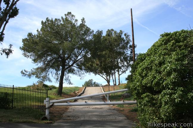
The trailhead for Tuna Canyon Park is barely marked (perhaps why it receives so few visitors), but can be found in the mountains between Malibu and Topanga on the outside of a bend in Tuna Canyon Road.
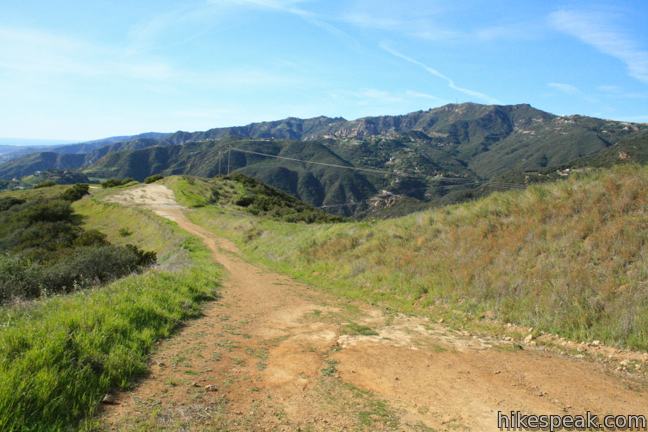
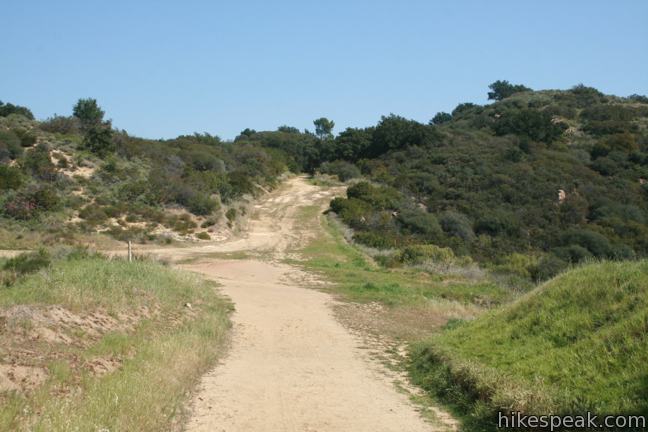
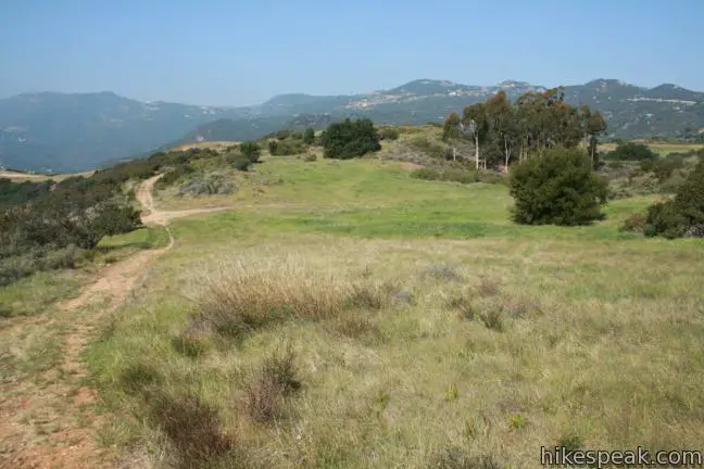
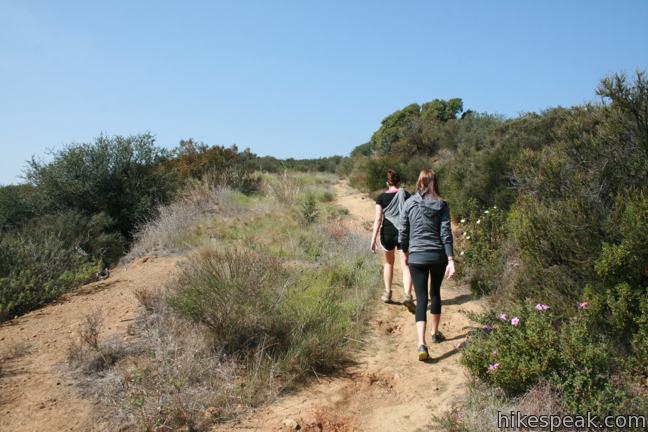
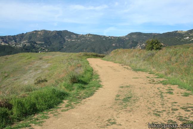
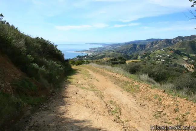
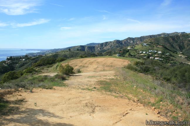
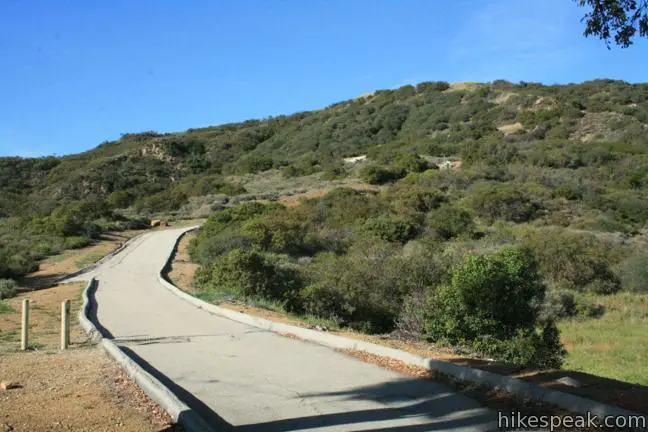
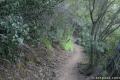
Hike south down a dirt service road named Big Rock Motorway for 0.15 miles to an unmarked junction. Turn left to hike up Hearst Tank Motorway to the highest point in park at approximately 1,800 feet. Oaks along the bottom of this dirt service road are some of the only shade-providers in the park. Elsewhere, the sagebrush and chaparral allow for incredible open views.
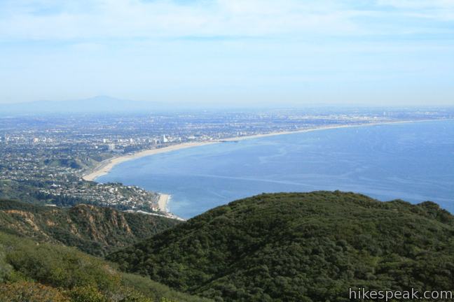
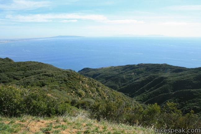
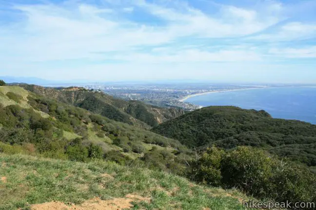
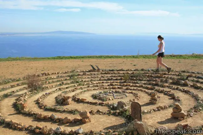
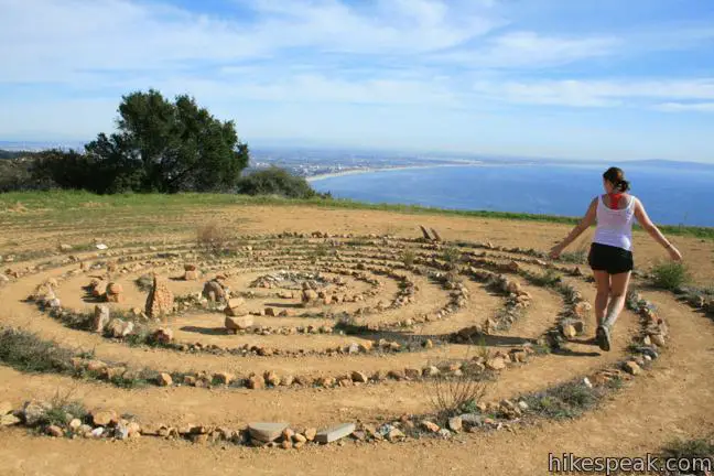
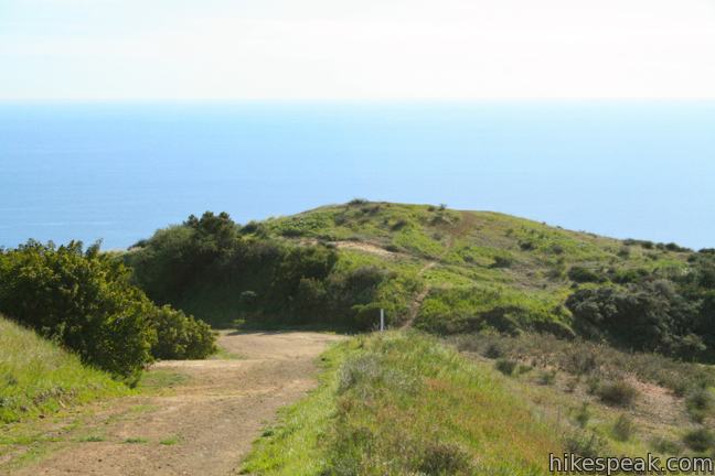
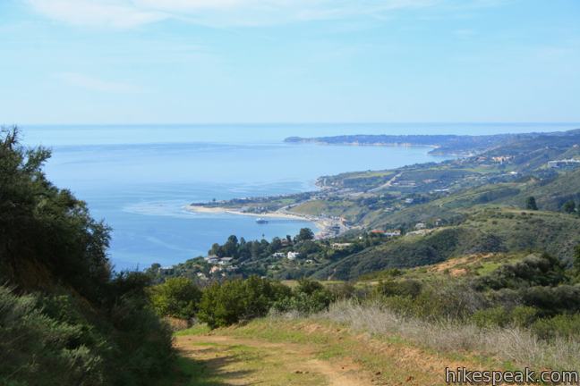
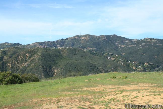
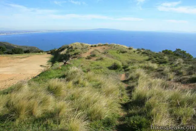
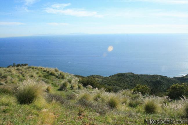
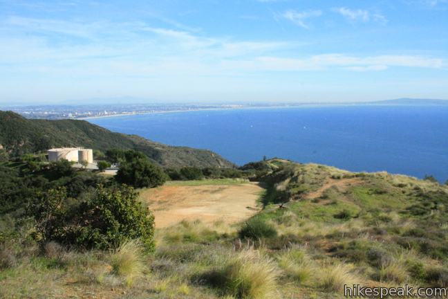
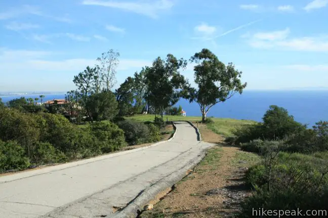
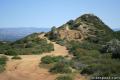
Halfway up the 250-foot ascent, the 2/3 of a mile long service road passes a saddle that looks down on the Pacific. From the saddle it is another 0.2 miles to a level spot on the top of the ridge. Walk to the right, to a point that looks south and west over Malibu. Get an eyeful and continue east to the end of the trail for a compelling panorama down the mountains toward Santa Monica Bay and inland toward downtown Los Angeles. To the northeast, there is even a view of Eagle Rock in Topanga State Park. The higher peaks of the San Gabriel Mountains can be seen in the distance. On a clear day this is one of the best viewpoints anywhere in the range. To get you to linger even longer, some visitors have built a stone labyrinth at the end of the point.
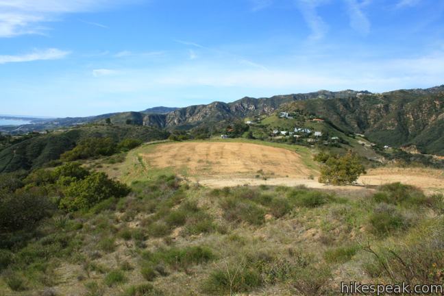
Return down Hearst Tank Motorway to the junction with Big Rock Motorway and continue south to reach Big Rock Lateral. You will gain about 50 feet of elevation, passing a junction with Budwood Motorway, which break off to the left heading down to the Pacific.
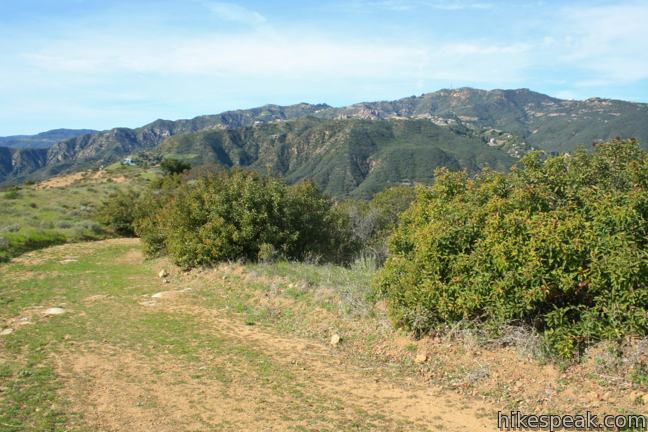
For a short extension, you may head 0.55 miles down Budwood Motorway to a rise that offers views down a green canyon toward Santa Monica Bay. Hike a tenth of a mile to a 4-way split and head straight over a knoll, or turn right and wrap around the hill. The trails reunite and continue down the ridge for another 0.2 miles to a split. Straight ahead, a narrow trail continues down the canyon. Turn left to take in the view from a rise protruding into the canyon. The viewpoint lies straight south of Hearst Tank Motorway, providing a similar (though less grand) perspective. On the hike up Budwood Motorway, if you are heading back to the trailhead, you may head north through the 4-way junction, exploring a single track that passes a grove of eucalyptus. Turn left when you pass a broad oak tree to return to the main trail.
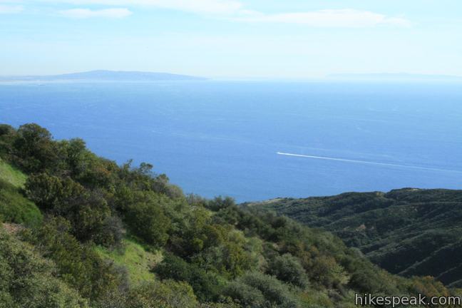
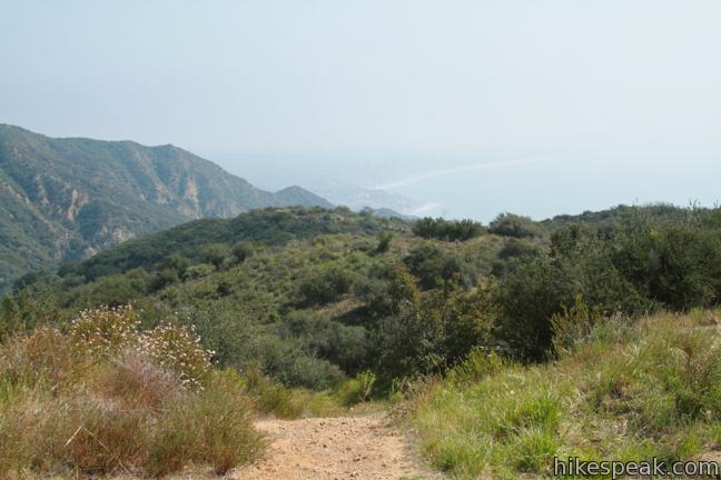
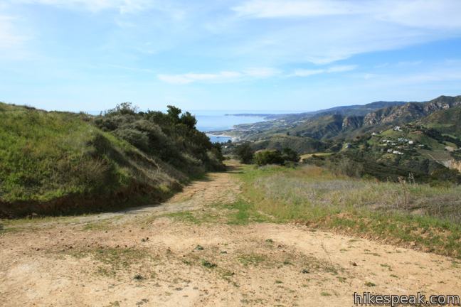
As you continue down Big Rock Motorwaypast the junction with Budwood Motorway toward Big Rock Lateral, a 180-degree view of the ocean spreads out below. The trail heads downhill and also looks west over Las Flores Canyon toward Saddle Peak, which looms above at 2,805 feet making it the 6th tallest summit in the Santa Monica Mountains.
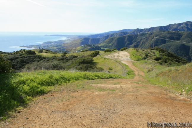
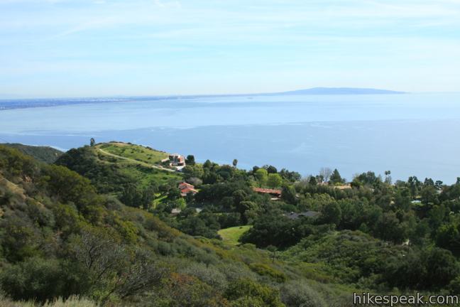
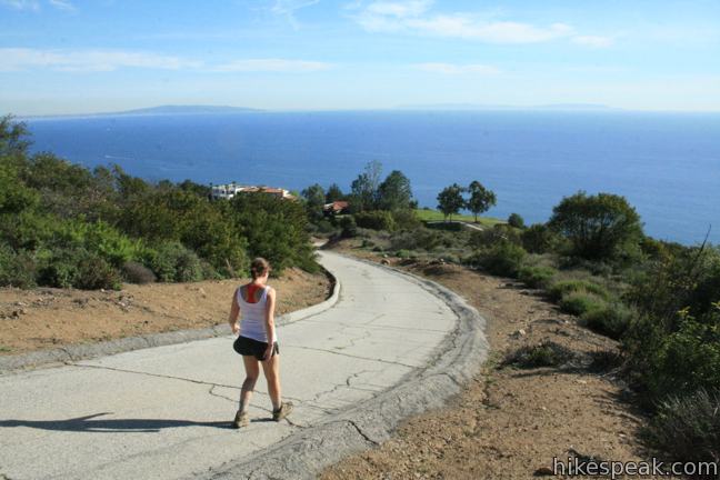
The views are nonstop as you drop 250 feet over 0.9 miles from Hearst Tank Motorway to a Y-junction with Big Rock Lateral. Turn right to progress down the mountainside, descending 400 feet over 3/4 of a mile to a landing that peers west over Las Flores Canyon. Cleared landings along Big Rock Lateral deliver knockout views up the winding Malibu coast. From this peaceful vantage high above the surf, the oceanfront below looks quiet and calm. Yes you have to hike back uphill after the trail dead-ends, but the view is worth it. It is 1.9 miles back to the trailhead on Tuna Canyon Road with 650 feet of elevation gain.
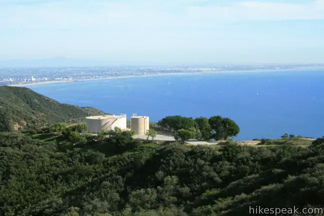
From the junction at the top of Big Rock Lateral, Big Rock Motorway angles east a short distance to a holding tank on the ridge. The dirt trail meets a paved service road coming up from Big Rock Road. This is another access point to Tuna Canyon Park. Though the paved road is steep, it packs even more views of the Pacific. It is 0.6 miles from Big Rock Drive to the junction with Big Rock Lateral with 400 feet of elevation change. Those who don’t mind the climb, and aren’t worried about overdosing on ocean views, could start their hike from Big Rock Drive (although public parking at this trailhead is under dispute as described in the comments below).
No matter how many trails you explore in Tuna canyon Park, you should uncover lovely views. No permit is required to visit Tuna Canyon Park and there is no fee to park. Dogs and mountain bikes are welcome. The ocean views are extraordinary, so give Tuna a try!
Directions to the Trailhead
Tuna Canyon Park Main Trailhead:
- Drive 3.3 miles west of Topanga Canyon Road on PCH to Las Flores Canyon Road.
- Turn north and drive 3.4 miles up Las Flores Road to Rambla Pacifica Street.
- Turn right, drive 0.6 miles and make another right on Schueren Road.
- Drive 1.8 miles and turn right on Saddle Peak Road.
- After 3.2 miles, turn right on Tuna Canyon Road.
- Proceed one mile to the trailhead on the right at the outside of a bend in the road.
- The fireroad is obvious but unmarked.
- Beyond the trailhead Tuna Canyon Road becomes one-way down to PCH and can be used when leaving the park.
Big Rock Drive Trailhead:
- Drive 1.7 miles west of Topanga Canyon Road, and turn north off PCH onto Big Rock Drive, which curves up the mountain for another 1.7 miles.
- Although space for a few cars to park at the end of the road can be found, this many not be open to the public and reports of ticketing and towing have been described below.
- Definitely do not park in the fire lane in front of the service road that continues to the left.
Trailhead Location
Trailhead address: Tuna Canyon Park, Tuna Canyon Road & Hearst Tank Motorway, Topanga Canyon, CA 90290
Trailhead coordinates: 34.059538, -118.616345 (34° 03′ 34.33″N 118° 36′ 58.84″W)
Trailhead address: Big Rock Drive Trailhead, 20885 Big Rock Drive, Malibu, CA 90265
Trailhead coordinates: 34.04553, -118.624279 (34° 02′ 43.90″N 118° 37′ 27.40″W)
View Santa Monica Mountains in a larger map
Or view a regional map of surrounding Los Angeles trails and campgrounds.


 | Saddle Peak from the Backbone Trail This 2-mile hike summits Saddle Peak, the 6th tallest summit in the Santa Monica Mountains. |
 | Topanga Lookout This 2-mile visits the site of an old fire tower that still offers great views of the surrounding mountains. |
 | Hondo Canyon This section of the Backbone Trail crosses fields of grains and forests of bays, climbing 1,550 feet over 3.8 miles to a small ocean view. Extend the hike to Topanga Lookout for an incredible perspective over the Santa Monica Mountains. |
 | Eagle Rock from Trippet Ranch This 4.5-mile loop takes Musch Trail and Eagle Springs Fire Road to visit an exceptional sandstone summit in Topanga State Park. |
 | More trails in the Santa Monica Mountains Explore other destinations in the range. |
Common Questions about Tuna Canyon Park in the Santa Monica Mountains
- Is the trail open?
- Yes. You should expect to find that Tuna Canyon Park Hike is open. There are no recent reports of trail closures. If you discover that the trail is closed, please help your fellow hikers by reporting a closure.
- Is this trail free to access?
- Yes, Tuna Canyon Park Hike is free to access. No entrance fee, pass, or permit is required. If you discover that access rules have changed, please provide feedback on your experience.
- How much time does this hike take?
- It takes approximately 2 hours 45 minutes to hike Tuna Canyon Park Hike. Individual hiking times vary. Add extra time for breaks and taking in the views.
- How long is this hike?
- The hike to Tuna Canyon Park Hike is 1.6 - 5.1 miles (out and back) with 900 feet of elevation change.
- Are dogs allowed on this trail?
- Yes, dogs are allowed on Tuna Canyon Park Hike. The trail is open to hikers, dogs, bikes.
- Are there ocean views on this hike?
- Yes, Tuna Canyon Park Hike offers views of the ocean.
- What mountain range is this trail in?
- Tuna Canyon Park Hike is located in the Santa Monica Mountains.
- Where is the trailhead located?
- The trailhead for Tuna Canyon Park Hike is located in Topanga Canyon, CA.
Trailhead Address:
Tuna Canyon Road & Hearst Tank Motorway
Topanga Canyon, CA 90290
Trailhead Coordinates:
34.059538, -118.616345 - What are the driving directions to the start of the hike?
To get to the trailhead: Tuna Canyon Park Main Trailhead: Drive 3.3 miles west of Topanga Canyon Road on PCH to Las Flores Canyon Road. Turn north and drive 3.4 miles up Las Flores Road to Rambla Pacifica Street. Turn right, drive 0.6 miles and make another right on Schueren Road. Drive 1.8 miles and turn right on Saddle Peak Road. After 3.2 miles, turn right on Tuna Canyon Road. Proceed one mile to the trailhead on the right at the outside of a bend in the road. The fireroad is obvious but unmarked. Beyond the trailhead Tuna Canyon Road becomes one-way down to PCH and can be used when leaving the park.
Big Rock Drive Trailhead: Drive 1.7 miles west of Topanga Canyon Road, and turn north off PCH onto Big Rock Drive, which curves up the mountain for another 1.7 miles. Although space for a few cars to park at the end of the road can be found, this many not be open to the public and reports of ticketing and towing have been described below. Definitely do not park in the fire lane in front of the service road that continues to the left.
View custom Google Maps directions from your current location.
- Are there other trails near Tuna Canyon Park Hike?
- Yes, you can find other nearby hikes using the Hikespeak Hike Finder Map.

This place look great! I can’t wait to go here…………
WARNING: Parking is now unavailable at the Big Rock Drive trailhead. Reportedly, a hiker parked overnight and had a campfire. The neighbors shut down all parking on this private road.
Please let your hikespeak readers know that all parking at the top of Big Rock Drive is no longer available and all cars will be towed due to a hiker sleeping out overnight and having a campfire in the scrub brush at the trailhead. So sorry to shut parking down but we are concerned for everyone’s safety.
Do you have RV parking available?
Only roadside parking is available and the roads to the trailheads are not particularly RV friendly.
I just went up here today via Big Rock Canyon. The road is marked as private towards the top. Is there any danger of being ticketed for parking on a private road? Thanks. I parked anyways and it was a lovely hike, but I was a bit worried that a security guard was going to call and have my car towed.
Hi Dave,
Parking has been legal at the top of Big Rock Drive, but as you saw, there is only room for a few cars and lots of private-only areas along the road.
As a hiker, I also enjoy Hikespeak, and do appreciate this website and all the heartfelt love Seth must be putting into this project to help the public enjoy nature. That being said, the info that he gives out here is incorrect. I am posting to help you so you can find a lovely hike for yourself, friends, and/or family where you can actually access the trail. Here’s the situation: the top of Big Rock Drive is a PRIVATE road and homeowners have the legal right to authorize who parks on their land or not and to have cars towed who do not have permission to park on their property. At this time, no parking is allowed anymore anywhere in the vicinity of what hikespeak.com may have mistakenly identified a public trailhead. Homeowners are having any unauthorized vehicles parked in the area towed away at vehicle owners expense. If your car has been towed please contact Malibu Towing at 310-456-8006. Towing fee is approximately $200. Wishing you a beautiful and uplifting time hiking from the actual trailhead for this hike, which is on Tuna Canyon Road. Blessings on your path.
Hi Wendy,
Thanks for the info. I’ve updated the write-up and directions. Sad to hear that vehicles are being towed…
I confused the top of BIg Rock road with tuna canyon road… where you can park…
It it ok to mountain bike here as well?
Yes. Mountain bikes are allowed on the dirt roads in the park
This hiking trail looks confusing. Where do u start? I want to make it to the top and enjoy the beautiful oceanview with my girl.
This park does have a few options. Follow the directions to the main trailhead. Hike down the trail and turn left to get up to the highest ocean view. Enjoy the park!
It’s worth noting that Tuna Canyon Road is one way (down) only and this park cannot be accessed from the PCH. You must take Topanga Canyon Road to the top. The dog enjoyed the walk once we found it today.
[…] no people but a horse. That’s my favorite on a hike, no peeps around, just horses. Check out Tuna Canyon hike here. On a clear day the ocean views are stunning and there are lots of small trails allover the place, […]
Hi,
We are coming from Woodland Hills, CA from SF valley. Do we have to go to Big Rock Drive or is there any short cut on the way driving down 27.
Thank you,
Manisha
The idea that there is a “trailhead” off of Big Rock Drive is incorrect. The trsilhead is on Tuna Canyon Road. There is no public parking on Big Rick Drive as it is a private road and cars are being towed at car owners expense by Malibu Towing.
Is this trail actually hike-able with a stroller?
What’s your opinion of car camping overnight and to go hiking the next day?
Be aware. Big Rock Drive is s private road. Due to fire danger and a hiker who slept overnight and had a campfire near the trailhead neighbors no longer allow parking at the Big Rock Drive trailhead. No parking signs are posted and cars are being towed.
If its legal to park there, how can the hiker’s cars be towed? The neighbors can’t do that.
It’s all private property and yes, it is legal and towing is handled by Malibu Towing at owner’s expense at 310-456-8006 if your car has been towed.
I think your right
I went up yesterday to hike and the neighbor did come out and said make sure you don’t come back. No parking up here. She said she is trying to stop people from coming up there. so- caution with parking up there.
I hiked from the end of Big Rock to the Labyrinth, which seemed busy today. I meandered down Budwood Motorway due to the incredible views and solitude, then kept hiking down the motorway “trail.” Google maps showed the motorway continued down to the neighborhood on Pena road by PCH. It was quite an adventure bushwhacking, almost entirely without a trail. I’m quite scratched up from the point the maintained trail ended until I got to Pena road. Then had to hike up PCH and up Big Rock to my car. So worth it, if you’re in the mood. I’m going to sleep like a baby tonight.
For such an effort to discover this spot and get there, it was surprising to see the evidence of so many lowlife humans: numerous deposits of dog shit.
From Tuna, to the left is more traffic, and STEEP. To the right is fairly (for mountains) level, and less populated.
Wifey got scared/almost sick on the winding roads to get there.
Dog liked it.
I liked it.
Wife liked it.
On a sunny day, I bet it can get HOT. It’s desert landscape.
Any concern about Mountain Lions at Tuna Canyon Park? I went there today alone with my dog and although beautiful, it came across my mind a couple of times.
Seeing a mountain lion (let along interacting with one) is quite rare.
I think the neighbours who want to keep the area private are writing these towing threats… it’s à public road and I don’t know why you couldn’t park off to the side… many people do… I don’t think anyone has gotten towed
Hi Michael. I’m sure you don’t mean to mislead people and want to clarify that when a person buys a house they receive an official map that shows the outline of the land they own. All of the land, road, and property in the upper Big Rock Drive area is owned by the homeowners. This is includes the road, which the homeowners pay to have paved. The road is not owned by a governmental agency and is not a public road. If you were to park on the road—or even alongside the road—your car is subject to being towed at the property owner’s discretion. Best wishes to you for much joy in your hiking adventures.
Thinking of hiking this trail tomorrow, but I’m wondering if I’ll regret it in the heat of the day. Is this an okay trail for a Summer hike?
Do not drive to the Big Rock trailhead at 20885 Big Rock Drive, Malibu, CA 90265. It’s all private roads off of PCH. I drove 30 minutes from Brentwood (thanks goodness I didn’t drive from further). There is no parking around that area and I wouldn’t risk pissing off the residence who probably do not like people coming in to hike. It’s a shame because the view from there seems gorgeous. It was breathe taking from the drive down. Will try next weekend to hike Tuna Canyon from the main trailhead.
Typical rich folk shutting this down. Love how they are all peaceful and loving sounding but then Get the F off our land. But blessed travels to you on your way back to your rented slum.
We didn’t realize how long the drive was to main trailhead so didn’t have much time to do hike. But in just the 10 min we were out there my son got poison oak!! I guess it’s everywhere there and I hadn’t seen any note on this. I love this site cuz these trails are empty but you mite want to put warnings like poison oak at the top of description!!
Not sure who these aggressive locals are writing threatening posts? Just because you bought 7000 sqft of land doesn’t mean you own the area! Stop with your towing threats, this in itself is illegal and can land you in hot water. We all pay taxes to the State of California and are entitled to enjoy these PUBLIC lands as much as you are.
I have gone to the main trailhead a couple times and I love it! I am an avid hiker but I’ve been taking friends who aren’t that keen on it because the views are unbeatable (on a clear day or a foggy one since you are above most of the clouds) and they always want to come back.