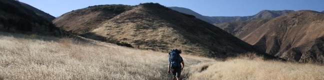
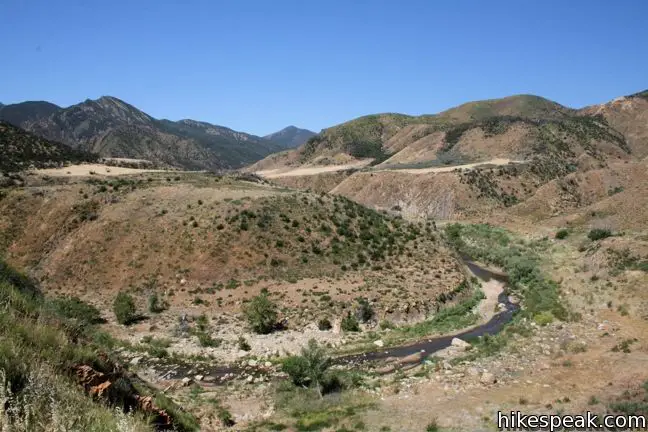
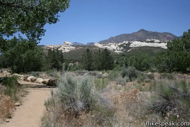
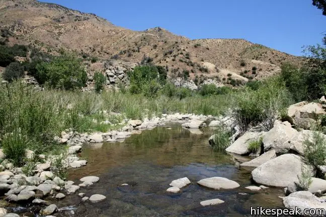
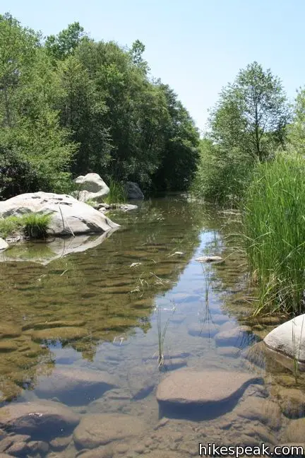
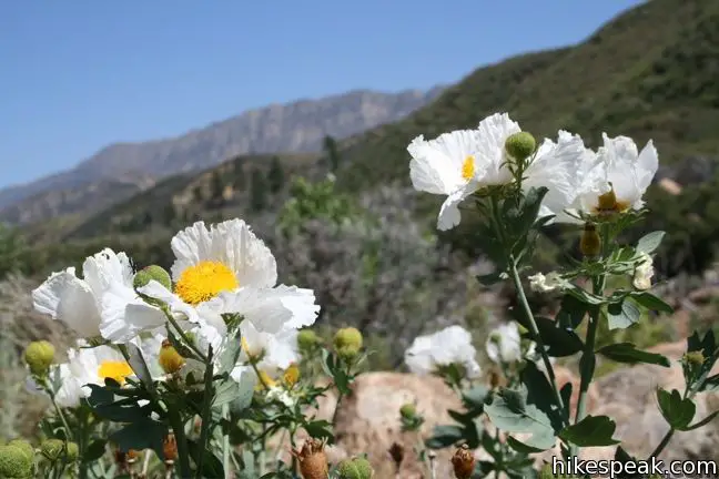
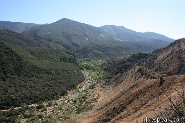
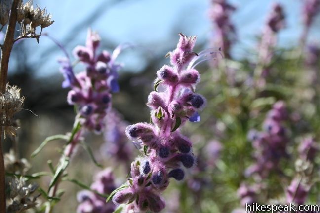
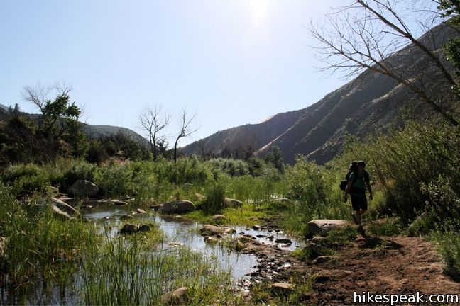
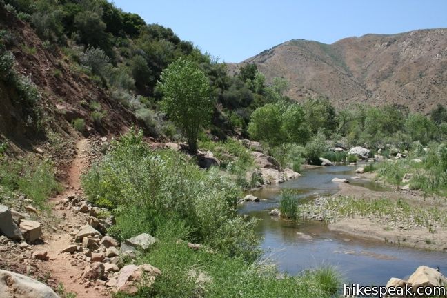
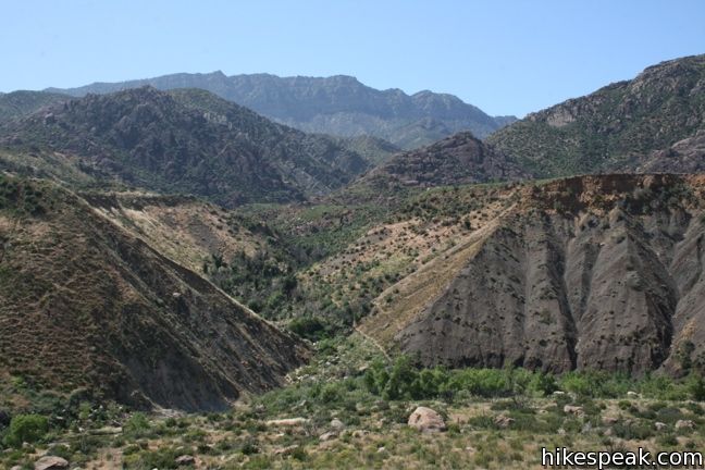
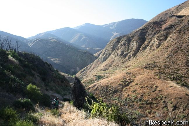
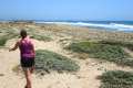
Located just north of Ojai, Sespe Wilderness is the largest wilderness area within Los Padres National Forest, occupying 342 square miles. Sespe Creek cuts through this land and the adjacent trail offers great views of a wide valley and scenic creek. The trail starts from Piedra Blanca trailhead near Rose Valley Falls and leaves the dense green of the bays, oaks, and chaparral for grassland plains that feel surprisingly southwestern. Scattered groves along the creek provide shade for camping and picnicking. The creek has several warm-water swimming holes to enjoy. As if that were not enough to justify the trek, there are also hot springs feeding into the creek. Willett Hot Springs is 9.5 miles from the trailhead and Sespe Hot Springs is 15.5 miles away. Willett Hot Springs can be visited as a long 19-mile day hike, or as a more reasonable overnight backpacking adventure.
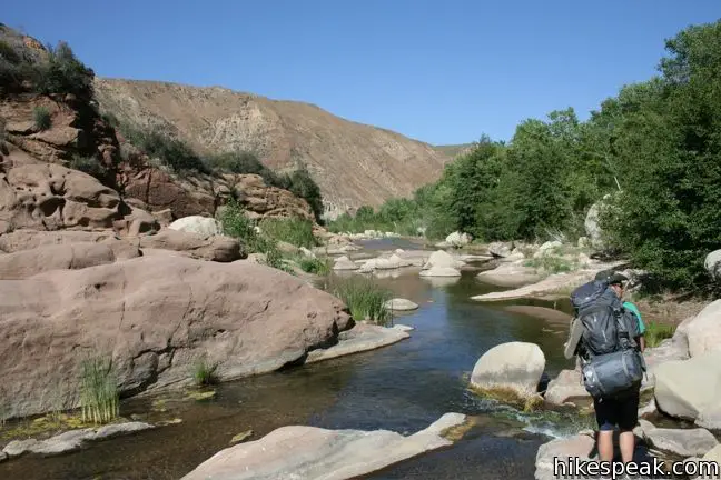
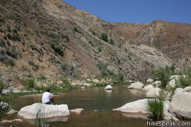
If those distances intimidate you, do not rule out a visit to Sespe Creek. While shallow, the water in the creek is so pleasant for swimming that you could have an enjoyable time without going all the way to the hot springs. That is, you could hike one mile, two miles, four miles, and so on, and find a nice place to enjoy a picnic, a swim, and maybe a night of camping before returning to your vehicle. The 19-mile commitment necessary to visit the hot springs is not required to enjoy Sespe Creek.
The water in Sespe Creek can warm by twenty degrees over the course of the day, making the temperature perfect for an afternoon swim. For this reason, April through June is the best time to visit Sespe Creek. While springs feed the creek year-round, water levels in the fall may be too low for good swimming.
Hiking on Sespe River Trail
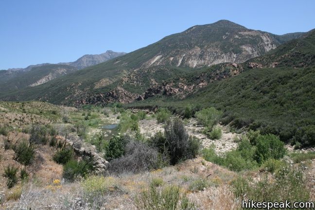
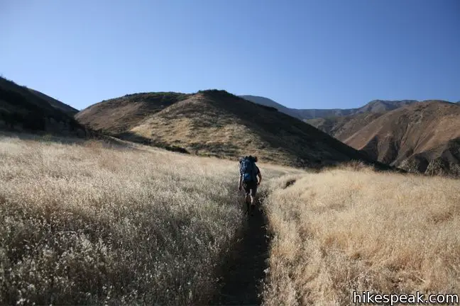
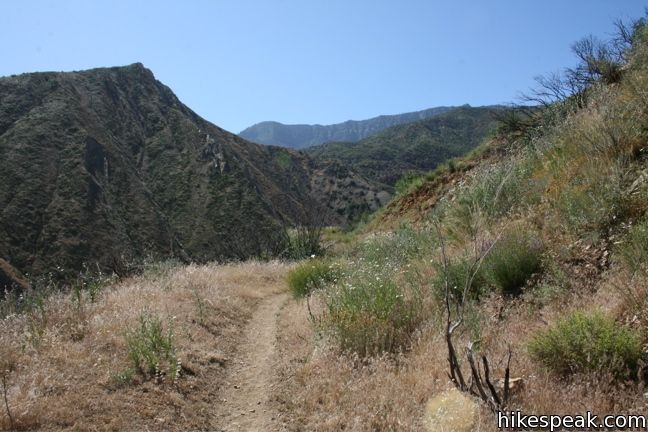
The trail is fairly straightforward, with a few exceptions that warrant explanation. From the Piedra Blanca parking lot, take the trailhead that starts to the left of the bathrooms. Start hiking east and you will soon come to two creek crossings. In the spring when the water is high, rock hopping is required. Continue along the north bank of the creek, heading downstream toward the hot springs. The trail is straight and level as it charges into the grasslands of Sespe Wilderness. You will pass over a few rises before arriving at Bear Creek Campground. This is the halfway point to Willett Campground and common turn around point for day hikers.
From Bear Creek Campground, the trail crosses over to the south side of the creek. The crossing is easy to miss. If you realize you are walking on a path that is too faint to be the trail, double back and look for the point where the trail crosses the creek near the east-most fire ring. A mile downstream, the trail crosses back over to the north side.
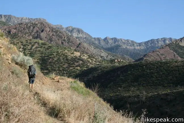
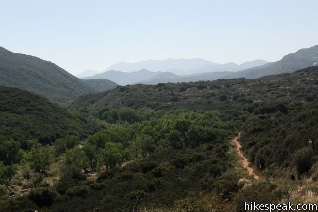
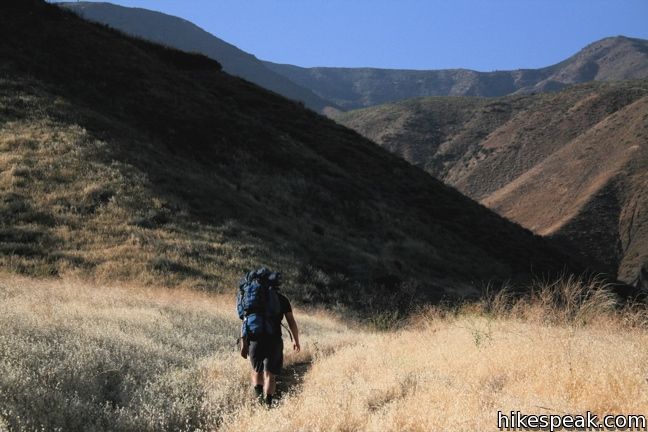
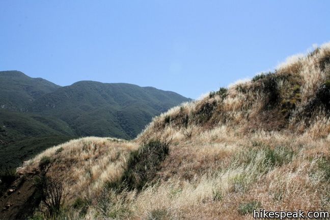
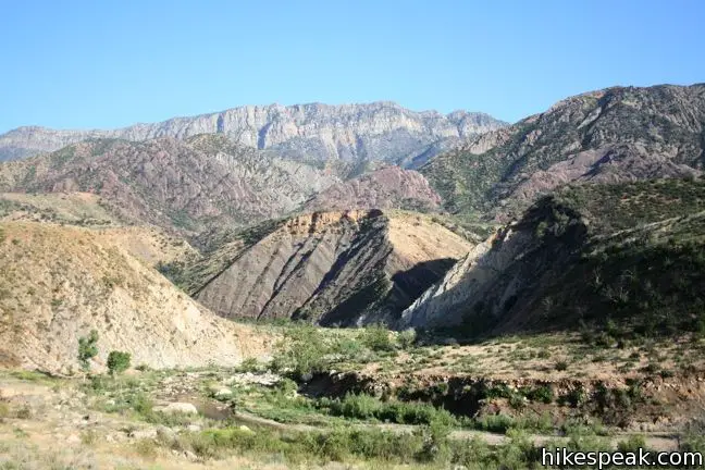
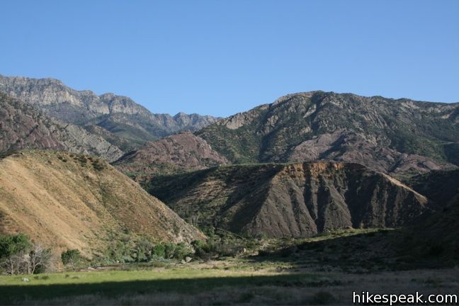
From here, the trail is less level. While the difference in elevation between the trailhead and the destination is minimal, the trail winds up and down numerous hillsides crossing several dry seasonal streams that flow into Sespe Creek. A 2006 wildfire burned areas along Sespe Creek and the remnants of burned chaparral are hidden amongst the regrowth. Press on past Oak Flat Camp and Ten Sycamore Flat Camp to Willett Campground. These campgrounds are not signed, so use your judgment and the map below.
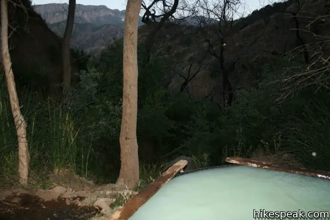
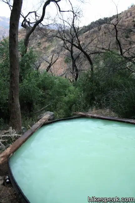
After descending into the grove of trees along the creek near Willett Campground, a trail marker will direct you to cross over to the south side. This will seem counter-intuitive, as the hot springs are up the mountain to the north. Cross over the creek and follow the trail. It will soon cross back over to the north side of the creek. From here, follow the spur doubling back upstream. You will pass an abandoned building and a stone chimney that stands alone in the grass field. Follow the narrow trail as it climbs up the mountain to the springs. It is 0.6 miles from Willett Campground to Willett Hot Springs, and much of this trail is fairly steep. The trail ends at the hot springs, where a large rubber tub filled with teal water awaits, eager to soak your weary muscles.
Camping on Sespe River Trail
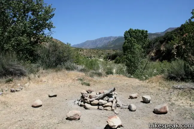
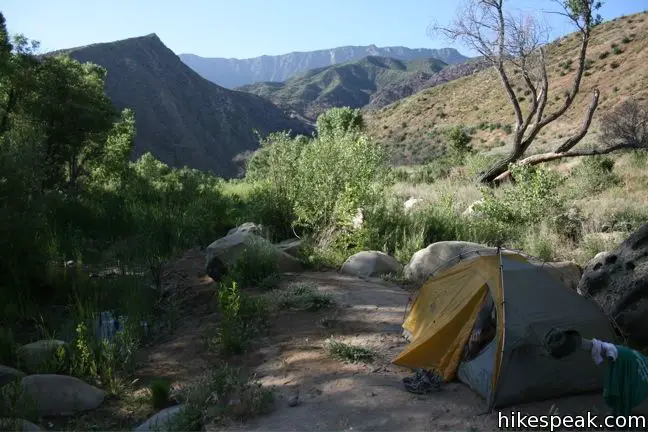
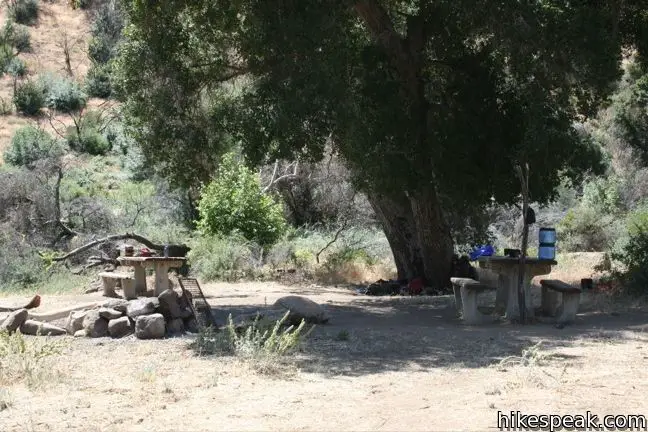
Backcountry camping in Sespe Wilderness is free and easy, and there is plenty of it along Sespe Creek between the Piedra Blanca trailhead and Willett Hot Springs (and beyond). Traditional carry-in carry-out rules apply, but backpackers may pitch a tent wherever they like. Four wilderness campgrounds are located along the creek, each with a few clear places to put up a tent and build a fire. Beyond the mapped sites, are many more places where people have clearly camped in the past. This makes it easy for you to camp in several private locations along the creek.
A permit is needed for campfires and stoves. The fire permit is free and requires only that you agree to a few safety terms:
- Clear flammable material away from the fire a minimum of five feet in all directions
- Have a shovel available for preparing and extinguishing campfires
- Have a responsible person observing the fire at all times
- Extinguish campfire with water, using the drown, stir, and feel method
Print this permit, fill it out, and bring it with you on your hike.
Wood is fairly abundant and gathering it is permitted. Numerous fire rings have already built along the creek, allowing backpackers to minimize their impact and avoid wasting time destroying the grasslands to create a safe area for a fire. When picking a spot to start a fire, look for a place where someone has already had one. Fire ring seems to be built in just about every desirable place.
About fifty feet from Willett Hot Springs is a single campsite and a fire ring. The 0.6-mile long trail up to the springs from Sespe Creek is steep, and can feel even steeper after nine miles of backpacking, so you may wish to camp below. Fortunately, several pleasant sites are located beneath the 0.6 miles spur. This is the area know as Willett Campground. You may set up a tent here and enjoy the comforts of shade and proximity to a viable water supply (which needs to be filtered). From the creek it is easy to walk up to the hot springs and back in a bathing suit, so spare yourself the hike up to the springs will all your gear, and claim one of the nicer spots down along the creek.
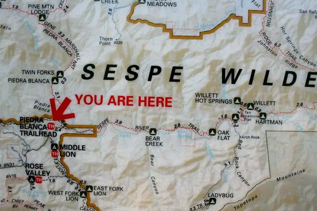
This map, posted at the trailhead, provides a good references for distances along the trail:
An adventure pass is required to park your vehicle at the trailhead. No backcountry permit is needed to camp in the Sespe Wilderness but a free fire permit should be obtained if you wish to have a campfire or stove. Bikes are not allowed, but dogs are welcomes on leashes, so get out and enjoy!
Directions to the Trailhead
- Take the 101 North to Ventura and take exit 70 B for Route 33.
- Drive north on Route 33 for 11.5 miles to the city of Ojai.
- Because Route 33 bends through downtown, it is actually shorter (and faster) to turn off the 33 and then back on it.
- Turn left on Baldwin Road (Route 150) and after a short two blocks make the right onto La Luna Avenue.
- Drive north for two miles and make a left to return to the 33.
- (If you miss the turn for Baldwin Road, you can make a later turn to stay on the 33.)
- Continue northeast on Route 33 for 13 miles as the road enters Los Padres National Forest and climbs up the mountain.
- Turn right at the turnoff for Rose Valley on Forest Route 5N24.
- Drive past Rose Valley Falls and Middle Lion Campground, taking the road 5.6 miles to the end at Piedra Blanca Trailhead.
Trailhead Location
Trailhead address: Rose Valley Road (Forest Route 5N24), Los Padres National Forest, Maricopa, CA 93252
Trailhead coordinates: 34.5605, -119.1648 (34° 33′ 37.79″N 119° 09′ 53.27″W)
View Sespe Creek Trail in a larger map
Or view a regional map of surrounding Central Coast trails and campgrounds.


 | Rose Valley Falls This 1-mile round trip trail leads to the lower tier of a lovely two-tier 300-foot waterfall. |
 | Wheeler Gorge This 1-mile loop explores the forest around this 70-site Campground. |
 | Horn Canyon Trail This 2.9-mile hike in Ojai goes up a canyon in the frontcountry of the Topatopa Mountains and ventures off trail along the soothing waters of Thacher Creek. |
 | Sisar Canyon Trail This 5.5 to 6.5-mile hike travels up a canyon to a viewpoint in the Topatopa Mountains between Ojai and Santa Paula. |
 | Santa Paula Canyon Trail to the Punchbowl This 8-mile hike ventures up rugged Santa Paula Canyon to a waterfall and a Punchbowl of pools and cascades in Santa Paula Creek by Big Cone Camp. |
 | Ocean's Edge and River's Edge Trails Loop This level and easy 1.5-mile loop in Emma Wood State Beach borders the Pacific Ocean, the Ventura River, and an estuary flocked by seabirds. |
 | More Central Coast Hikes Explore other destinations along the California coast between Ventura and Monterey, including trails in Los Padres National Forest. |
Common Questions about Sespe Creek to Willett Hot Springs in Los Padres National Forest
- Is the trail open?
- Yes. You should expect to find that Sespe Creek Trail is open. There are no recent reports of trail closures. If you discover that the trail is closed, please help your fellow hikers by reporting a closure.
- Do I need a permit for this hike?
- Yes. National Forest Adventure Pass.
- How much time does this hike take?
- It takes approximately 8 hours 15 minutes to hike Sespe Creek Trail. Individual hiking times vary. Add extra time for breaks and taking in the views.
- How long is this hike?
- The hike to Sespe Creek Trail is a 19 mile out and back with 500 feet of elevation change.
- Are dogs allowed on this trail?
- Yes, dogs are allowed on Sespe Creek Trail. The trail is open to hikers, dogs.
- Is Sespe Creek Trail a difficult hike?
- This hike should be considered strenuous. Hikers should be prepared for a workout covering 19 miles and 500 feet of climbing.
- Are there hot springs on this hike?
- Yes, there are hot springs located along Sespe Creek Trail.
- Where is the trailhead located?
- The trailhead for Sespe Creek Trail is located in Maricopa, CA.
Trailhead Address:
Rose Valley Road
Maricopa, CA 93252
Trailhead Coordinates:
34.5605, -119.1648 - What are the driving directions to the start of the hike?
To get to the trailhead: Take the 101 North to Ventura and take exit 70 B for Route 33. Drive north on Route 33 for 11.5 miles to the city of Ojai. Because Route 33 bends through downtown, it is actually shorter (and faster) to turn off the 33 and then back on it. Turn left on Baldwin Road (Route 150) and after a short two blocks make the right onto La Luna Avenue. Drive north for two miles and make a left to return to the 33. (If you miss the turn for Baldwin Road, you can make a later turn to stay on the 33.) Continue northeast on Route 33 for 13 miles as the road enters Los Padres National Forest and climbs up the mountain. Turn right at the turnoff for Rose Valley on Forest Route 5N24. Drive past Rose Valley Falls and Middle Lion Campground, taking the road 5.6 miles to the end at Piedra Blanca Trailhead.
View custom Google Maps directions from your current location.
- Are there other trails near Sespe Creek Trail?
- Yes, you can find other nearby hikes using the Hikespeak Hike Finder Map.

Anyone out there in my world hike into the Willett Hot Springs in Los Padres? Looking for any valuable info on this hike…
Like Paul i have great memories of going up to the hot springs from Ojai in the mid 70’s up 33. Best time to go is right about now when the nights are chilly and the steam rises from the pools. The ground is heated by the water flowing below the turf on the cyn floor. You’ll prob have the place to yourself. Got the worst tonsil infection of my life there- penicillin didn’t faze it, the bacteria count in the pools has got to be staggering. don’t drink the water lower down from the fissures.
during the years 1969-70-71 i went to the hot springs that was 11 miles past the ranger station that was right there at Rose Cyn which was right past Wheeler Hot Springs up wheeler Gorge.My walk was all upstream on the Sespe River until I got to the hot water( luke warm actually) coming down the slight canyon from the left then i would go upstream to the source-which was dangerously hot- and get into the sauna that some very expert and enterprising person had constructed and left for the enjoyment of all. I had cleared my own ‘personal’ soaking pool by clearing a few stones at a depth that left just my eyes and nose above water when I laid down in ‘my’ pool that was at my temperature-the farther from the source,the cooler the water. I coul usually count on 3-5 uninterupted days alone in those summers and weeks alone in those autumns,winters and early springs.
Is it ok to hike this trail nude ?
Probably not a very good idea…
Probably a great idea.
ill see you soon scott, in the flesh
Has anyone seen fish in this area lately?
I have been threatening to do this hike for years. This is the year, probably going in late April/May. I would love to do some light flyfishing on the 2 day hike.
Just there from the 21st-25th, no fish anywhere on the creek to Willett, flow was moderate and getting higher on Sunday morning with the storm. Last year in April saw Black Catfish at Bear Creek and 9 inch steelhead at Oak Flat, but that was very high water. April/May does tend to be the best time, I would stick with the riffles, and check out Timber Creek as a day hike from Oak Flat overnight. Be patient and go light with lazy tugs on the surface.
I heard that there was a mudslide that filled the pool, can anyone confirm or deny this?
Thanks JR-
I’ll report back after the trip.
scott:
it is o.k. to hike the trail nude as long as you are with at least 3 single females companions, ages 21+
Beautiful article! Thank you for all of your time spent putting this together, looking forward to the hike tomorrow!
How was it? I want to go up there later this month for a few days but worried that there won’t be water to filter… also to the dude who got sick who posted a while ago, always bring a water filter – you should never drink the water unfiltered. Pretend you’re in India lol.
I was wondering if the creeks were flowing right now too so there would be water to filter and also some to lay around in to beat the heat.
As well, is it legal to bring a firearm on this trail? Fresh dove and quail are super tasty after a long hike!
There was not water when I was there back in July…just a few nasty warm puddles. It was rediculously hot and we had to turn back.
can you bring your dog?
Hi – Dogs are allowed on this trail, but it can be a tough hike for them.
Hikespeak – Why do you say it’s a tough hike for dogs? Thinking about bringing mine, but you’ve made me apprehensive.
Hi – That depends on how far you plan to go and what kind of dog you got. Going all the way to the hot springs would be an awful lot for most dogs. Things aren’t so steep at the beginning, so if you’re only plan to hike in a few miles to camp, your dog will probably be OK. Bring extra water for your dog for when you’re away from the creek as the trail can be long, hot, and dry. Be safe and have fun!
Has anyone been up to the springs recently? It was so hot and dry up here this summer and fall I’m wondering how the water level in the creek and springs is looking…
thanks
I am thinking about going towards the end of February is this too early to see the wild flowers in bloom? Eric, did you ever find out how the water levels are?
Recently visited nearby Rose Valley Falls and there was plenty of water. There was snow on the surrounding mountains, so Sespe Creek should be flowing nicely.
The directions given are a bit confusing… why does it have you get off the freeway just to get back on. Can anyone provide me with some clarification? Thanks!
You are welcome to take Route 33 all the way through Ojai, but it is shorter and quicker to follow the directions provided, which trim off a section of Route 33 as it passes through downtown Ojai, hitting traffic lights.
The simplest way is just to stay on 33, which makes a sharp left BEFORE ever entering downtown Ojai (the left is a “T” intersection: straight goes to downtown Ojai, left to continue up to the hills). The left is clearly marked and there’s a Vons shopping center to the left as well.
Thank you!
awesome thanks for the tip! I am going up this weekend I will report back on how the conditions were when I get back!
Definitely report back please. I’m planning on a two-day trip up there on the 16th with some friends. Would love an update.
Will do! it looks like this weekend is gonna be a cold one!
It is gonna be a cold one on Friday according to weather report thursday-friday morning its supposed to rain with snow elevation dropping to around 2,500 ft. It is gonna make for a cold but great trip!
about how does it take to get to the campsite areas at the base of the hot spring?
It’s about 10 miles so it should take you 4.5-5 hours to make the hike. Easy hike all the way.
Hey Erik,
How was the trip and is the water flowing? Also, did you have to do a lot of crossing on the way (walk in or were you able to hop rocks over),
Just wondering as planning a trip there in a couple of weeks and yours is the latest entry. Hope to go before it gets too hot..
Thanks ahead of time for the update!
my uncle’s truck was broken into while we were backpacking. Beware!!!
Thanks for the report Luke. I’m thinking of driving my old beater to the trailhead rather than my regular ride.
Anybody see any fish this year? I’ll be going in May. I like the heat myself….
Looking to take my scout troop in May because the guys need a 20 mile hike for the hiking merit badge. Back and forth is just about the 20 miles they need, but I’m wondering if there’s quite a lot of elevation change.
Hi-
This seems like a good option. There is rolling terrain along the trail. There is only about 500 feet between the high a low points of the trail so there aren’t any climbs that are too long or steep. Enjoy!
I JUST WENT UP THRU DOUGH FLAT AND MAKE SURE YOU READ THE MAP WELL AND THE BURNED SIGNS ALONG THE WAY. THE TRAIL IS NOT WELL MAINTAINED AND YOU LOSE WATER ON THE WAY BACK SO MAKE SURE YOU FILL UP WELL ON THE WAY OUT BECAUSE IT IS ALL UP HILL. IF YOU GO THIS WAY I WOULD SAY NO LATER THEN MID APRIL. TOO DRY THIS WAY.
Camped at Oak Flat May 16-18. Very low water but the weather was perfect. Mid to high 70’s and always a breeze. Day trip to Willett and the cabins. Met a younger foursome of campers who went on to camp at Willett. Nice guys. Other than them, we were the only ones beyond Bear Creek that I know of until the weekend. We literally passed 100 people on our way out Saturday. Almost had an “incident” with a big, aggressive and unleashed dog owned by an irresponsible kid near the Piedra Blanca trailhead. I heard the dog yelp a few minutes later. He either got kicked or a snake got him.
Highlight of my trip: after breakfast in camp I was standing by one of the tables next to a big oak and suddenly heard what sounded like an incoming mortar. The whooshing sound of something dropping right on top of us. I looked to the trail to see if there was a report of smoke or sign of where it came from and my buddy, who was standing in a better position than me could see 2 large hawks locked together, free falling right over our heads. They broke away right at tree top level and flew off in separate directions (I did see that last part). Either fighting or mating I would think.
Either way, it was an awesome experience. I have seen it once before at a great distance, but the sound was frightening and unexpected. Also had a deer pass by our camp both afternoons heading for water.
We got lucky in May as far as weather was concerned. Beat the crowd also. And we got dropped off/picked up at the trailhead so no worries about getting broken in to or our fuel siphoned.
I walked up the trail from the parking lot to the first sign and asked 2 groups hiking out Sunday afternoon about the water levels. There’s enough water in the swimming holes, but the creek is low. The second group (about 15 kids) came back from Sespe Hot Springs (31 miles round trip). The leader said the springs was really hot since there was no creek running through it. It was is the mid-80s (air temperature) at 3:00 on Sunday, 5/19. We’re going in about 2 weeks for a quick backpacking trip.
Hi Cynthia, could you give a report on willet hot springs when you get back, planning to go in july with my girlfriend while I’m home. Thank you!
We would also like to know about water levels; shooting for 4th of July weekend and want to make sure it’s worth the 5 hour drive! Cynthia, how was it end of May? Thanks!
was there in april 1973. I remember a bunch of pools at different intervals descending the down hot stream. the lower the pools the cooler the water. the cold creek ran next to it nearby. someone had built a small wooden sauna on the hot stream where it was very hot. it was incredible. you could jump back and forth between the hot and cold streams. the rumor was army corps of engineers was up there practicing and made all the small pools on the hot spring. nothing but very cool hippies (of which I was one). every one walking around nude. lots of great recreational drugs.no ripoffs and no stealing. equal amounts of men and women. great memory from my youth.those were the good old days. maybe floods took out bathing pools? I haven’t heard any mention of them by anybody.
We just returned from a backpacking trip from the Piedra Blanca Trailhead to Willett Hot Springs. It was a long, hot trip with very little shade. When I say very little, I mean close to none. There’s also very little water. Bear Camp has a large pool, with super loud Arroyo toads croaking at night. The next water source is a very murky, algae filled pool at Oak Flats. The water level is extremely low. After that, the only other water source is the Willett Creek Spring, which is the best tasting water on this route. Be sure to fill from the very bottom of the spring, where it meets the Sespe.
Other than those three locations, the water is completely dried up and the hike is a little depressing. Most of the greenery is dead or gray and the hike is very hot and dry. It is best to hike at night on a full or close to full moon, as the trail is very clearly marked and it’s much cooler. The super moon this weekend was amazing!
The wife and a few friends went up to scout Middle Lions Camp / Lower Lion’s and it’s famous cliff-dive and swimming hole just this last weekend July 6th. Weather was actually a good 80 degrees, which is quite doable, but sadly the creeks & sespe river were next to dry. Stagnant water barely running in Middle Lions, and a dry creek bed in lower lion’s Camp. The swimming hold had gone down at least 8-9 ft. but there was still enough water for a little dip (roughly around 8ft. at it’s deepest point). Usually the water level in the swimming hole is 15-20ft at it’s highest. Hopefully we will have some great rains this Nov-March 2014 to fill everything back up!
Hello all – Thinking of bpacking this trail in early October. Is there anough water for: a) drinking (filtered of couse); and b) soaking in the tub/springs?
Thanks for any insight –
SSP — Just hiked to Willett this past weekend and the creek bed was dry, the entire hike. There was a spring at Bear Creek (about halfway point) that you can fill up and the water is cold. Highly recommend you plan to stop there to get water. After that, you won’;t find a lot of running water until you get to Willett. There is running water there and some pools deep enough to get in and cool off. By the abandoned cabins, you will find faucets, fed by a spring high up on the mountain but they DO NOT run consistently (almost like the available water is from condensation). We washed our clothes in the creek by our camp site and did make the hike up to the hot spring. Good hike but definitely plan for the water!
WARNING: BRING ALL THE WATER YOU WILL NEED.
Our group was there this weekend, and there is no water available for drinking. Drinking water flows from a small spring a few hundred yards above the old cabins, into a 55 gallon drum, then down a gravity-fed pipe to two spigots near the old cabins. We used every last drop of the (nasty) water in the cistern, and I walked up the hill to find that the spring had run dry some time ago. When it does start running, make sure you treat this water, as I’m sure the tank has a little fetid puddle at the bottom, stewing in the heat.
The hot springs are the only source of water right now. They are running strong. We used an extra piece of flex hose setup a siphon and drained the pool for a good cleaning. The springs refilled the pool in ~30 minutes. Temp was probably a few ticks over 100.
There are small pools of standing water where the hot springs creek reaches the valley floor, but I’m not sure I would drink it. Maybe in an emergency, and only if nuked with chlorine or iodine. These stagnant pools are the only water for miles around, so it’s teaming with critters who care not where they poop. Also, not sure what the sulfur and mineral profile is of the hot spring water–not sure what if any consequences await after drinking here.
As AS noted above, Kerr Spring was running. It’s about .5 miles downstream from Bear Creek Camp. Make sure you know where it is, and mark it on your map or GPS. The trail passes through unusual, dense clump of forest on the south side of the river. The canopy here is only possible because of the spring. Look for a small side trail leading up above the main trail. As of this weekend, it had some fallen logs across it. A hundred yards up, you’ll find the spring flowing from an exposed pipe.
I’m going to call the Los Padres Ojai district office this morning to warn them about the water situation at Willett. Hopefully, they can post a warning notice at Piedra Blanca.
Great Info on this hike! Im looking at doing a one night here in next couple weeks. Anyone have any more recent info about the drinking water situation?
Heading out this way for the first time in several years Thanksgiving weekend. Hopefully there’s no one else out there. We go camping on Black fridays to make sure and stay away from city traffic and tickle-me-elmo-killers.
We should have a pretty sizable group, and I hope that anyone else considering this hike that weekend is excited to rub knees hahaha.
We’ll have females, but won’t be hiking nude, OR beer-bonging teal-colored nature-tub water. I shall bring a filter.
Any interested parties (guys must bring a girl) please call us to see if you want to go. (805)754-6930 Should be arriving early the morning of the 29th.
Patrick,
The gf and I are planning on camping there over Thanksgiving weekend. I’ll give you a call once we finalize our trip details. It’s been a while since I’ve planned a backpacking trip on my own and it’d be nice to have some friends on the trail. The low water situation does have me a little concerned. How will you be handling the water situation?
Just did this hike this weekend. Beautiful fall colors on the trees – really stunning! There were just a few spots with running water (didn’t check spring at Bear Creek). Just before Oak Flat we crossed a very low running creek that we could have scooped enough out of to filter if we were desperate. We stocked up at Willet – filtered about 6 liters from the low running creek for our morning coffee and return journey.
Thanks for all the info here!
Hi all, am wondering about more recent water conditions – anyone been there in 2014? I plan on doing the trail from Piedra Blanca to at least Bear Creek and possibly on to Oak Flat and Willet alone (well, with my dog) on Feb 8-9. Any thoughts about best places to get water along the way right now? Bear Creek, Kerr Spring, Oak Flat, Willet, Timber Creek? Any info at all would help. Thanks!
Willet spring had water today (2/4). It wasn’t hot and not close to deep enough to soak in, though. I tried to link a photo from FB, but geniuses that they are they can’t imagine that I might want to make one, but not every, picture public.
I got lost where the trail crosses the creek N to S and ended up wading in water more than knee deep trying to find the trail again. So there was plenty of water today (2/4). It may have rained/snowed in the area last night, though.
FO FB.
I am planning to take this hike to Willett in about a week. Does anyone have an update on the water situation?
Any water updates? reek water sufficient to filter, soak in?
Thanks
Here is a link to the Forest Service Water Report. It was written on 2/14/14.
http://www.fs.usda.gov/detail/lpnf/alerts-notices/?cid=stelprd3791067
Any water updates? Any water at the Hot Springs? Water in the creek sufficient to filter?
Thanks
Water in the creek is ankle to shin high and moving all the way from the trailhead to Willett. Plenty to filter. Absolutely gorgeous out there right now. Surprisingly green, and all the wildflowers are in bloom.
What is the current water conditions? I am thinking about going this weekend
hey did you end up going? im plannin on a spur of the moment trip with a couple friends for tomorrow and the next day- how are the hot springs? would you say its a good time to go? we have never been
Hi Blake! Did you end up going as well? How was the water there this week? I am planning to be on the trail 6/14 – 6/15.
I drank unfiltered water from the falls today. Will I get ill? What should i do?
Mary, how’d that work out for ya?
Has anyone encountered a mountain lion or a bear on his/her hike? How about the frequency of seeing rattlesnakes along the trail/creekbed? Is this the area where Mike Herdman got lost?
[…] morning. I hadn’t been out walking much during the winter, and I’d been wanting to take this backpack to Willet and Sespe Hot Springs for two years. I was raring to go, but I got bogged down in odds and ends. Before I knew it, […]
Is the hike worth going if the water levels are low because of drought? Can you have a campfire if the fire season is high? Planning in August.
I spoke with a Ranger last week. I’m headed out to do this hike this weekend July 18-20. She said no campfires and we had trouble figuring out the water levels. It’s low but I think its doable. Since it’s a short hike we’ll load up on extra water.
Spoke to a ranger this week.
Some pools but no flowing water.
We will be on the trail this weekend.
Just hiked it July 19-20. Got as far as Oak Flats Campground (6.8m) and there was no water but a sludgy puddle. Had to turn back to camp at Beartrap Campground where it was 5-6′ deep in spots.
This was my experience as well at this time (07/27-29 2018)
Sludgy puddle at oak flat, didn’t fill up enough a bear creek and turned around for fear of dehydrating at Willett, unsure if there would be any water in the creek. Be prepared and fill all the way up at Bear Creek if attempting this hike in the summer!! It’s beyond hot, don’t carry too much
Any updates on the water situation? Looking toward going out in the next couple weeks and wondering if we need to hike in with all our water or if we can filter it during the hike. Is there any place we can get consistent updates from rangers?
I am looking to take this hike in a couple of weeks. Anyone have a water update?
Just got back today from an overnight to Willet hot springs. Only place I found water was at bear creek and Willet. Nothing except hot sludgy pools every couple miles. Carry a lot, it’s hot. And don’t leave home without a filter. I ended up filtering water near Willet, in a 3″ deep 1′ wide “stream” that was close to 80 degrees. It was run off from the hotspring, and tasted like tap water. The hotspring is beat. Don’t waste your energy climbing the steep, slippery trail to get to it. It had stagnant water in it about 3/4 full, and was not flowing. The piping was all jacked up and in need of some repairs. If you have an engineering spirit, all the supplies are there. I will even hike with you and help. But you are in charge. Haha. Good luck, follow the directions above, and have fun! Oh yea, and stop at bear creek with some light tackle to catch yourself some bluegill and catfish!
Thanks for this update, this is valuable. I had hoped to do this backpack over a weekend in mid-October, but feared the water situation would make it a big disappointment. Sounds like that’s the case.
I am going today solo if anyone is keen
I am interested in the possibility of a bikepacking adventure to one of these tubs. Is there any rule against bringing a bike on this trail? Anyone done it before?
Aaron, I’m pretty certain there are no bikes allowed on the trail.
I just went yesterday. We biked about 3 miles in, stashed the bikes before we walked up the stone steps and hiked the remaining 6 miles. It is a tough ride, sometimes we had to walk the bikes, but it was a fun ride, no posting about bikes not being allowed. Once you get to the camp near the hot spring, there is still running water, you’ll need to filter. But enough for drinking and cooking. have fun!
Jennie,
There is definitely NO biking in any of the Sespe Wilderness, or any designated Wilderness area for that matter. There are signs posted at the Piedra Blanca trailhead as well at the Sespe River trail junction that point this out. If you’d like to know more about the Los Padres Wilderness areas and what you can or cannot do there, here’s a link:
http://www.fs.usda.gov/detailfull/lpnf/specialplaces/?cid=stelprdb5097577
Please don’t ride bikes in Wilderness areas! It’s not an arbitrary rule – bikes have much more of an impact on trails and on the wildlife than hiking or horse backing do.
Austin, you are totally incorrect on the impact of horses being less than that of bicycles. horses chew up trails, as do cattle, esp. after a rain. the ground then rehardens and the hoofprints solidify into a hardened patchwork mess. bikes cant be ridden after a rain in most places due to amount of clay in the soils.
What is it like to camp out along the trail? I was thinking of just bringing a yoga mat and blanket, are there any mountain lions?
I just moved here and was thinking about hiking to Willett campground and the hot springs next weekend. about how long is the hike to the campground? I understand the mileage is about 9.5, was just curious about how long timewise it takes/
Has anyone been out recently and know the water situation? I’m thinking about a weekend backpacking trip this coming weekend.
I too am interested to know this. And status of hot tub, is it functional again?
Ive been all over this website the last few year’s. Not much water to see pictures of as to the drought here in California. Im 60 and contemplating revisiting this year. Not so much interested in going as far as ” the hot springs ” : but to go from where I used to go and park my Van and take the “Y” from the creek to the left go up a ways to where there were large flat rocks of which was where we stayed the afternoon . The miniature little falls cascading upstream were a site to see themselves. Those little pools when filled ” were good enough to enjoy and cool off ( 1970 ). Want to take another day trip 2015 ? The road had a rock since I’d been there. Do I have to park before the rock slide and walk around and up ? If so I may need to camp overnight then go back the next morning I’ll probably be alone as that’s okay for me as Id have my cell phone charged for and emergency. What are the chances of this plan working out ?
Rain this year , im going wouldn’t miss it for the world as to the abundance of rain for us here in Dec. 17th 2014. My destination is much below where the Hot Springs are. Ill have to sign up with the ranger station somewhere, at lest talk to them. Is there a pamphlet ? . We never went by any “rules” in the early 70’s. Have to work around the rock slide which covered the road. Maybe they constructed another way around it. That would be nice …
Ill go this year reguardless
Going 2015, prime time !!
In the nude !
Please have the decency to cover yourself when you see me and my boys coming. I figure you can get enough of yourself in the privacy of your own home.
Anyone been up to the hotsprings lately? I wanted to see how the trail and tub are since the rains.
Does anyone know if there is any bouldering or rock climbing along the trail?
I just hiked this trail a little over a week ago. Good amount of water. We happened to get rained on but can’t wait to come back in the summer.
Ali Z
Thanks for the update. Great to hear of all the water after such a long dry spell. Cant wait to get up there.
Just a reminder that whether you saw the signs or not, it’s COMPLETELY and unambiguously illegal per Federal law to bring a bike into a Federal Wilderness Area. This is completely and unambiguously a designated Federal Wilderness Area. Leave your bikes at home.
Hello , i am planning to hike the sespe river trail . and camp out for a couple of nights. is it safe to park ones vehicle on the piedra blanca trail head ? greetings from Amsterdam
Park ay your own risk. There have been problems. I get dropped off and picked up.
Anyone dropped off Nordhoff Ridge down though Lady Bug and up to the Piedra Blance trailhead in the past? I’d like to do a 2 nighter with a couple of friends this month while there’s water. I’ve driven up the ridge in the past with USFS blessing. Planned to get dropped off and picked up.
Wanted to do Reyes/Haddock and down the Piedra Blanca but the USFS is pretty adamant about the summit gate staying closed until May.
I guess Nordhoff Ridge Road is also closed until May.
Just went on 3/14. Plenty of water to filter. It’s hot so you’ll need it
Where did you go and from where?
Just wondering whether the Sespe River from the Piedra Blanca trail head has enough water to filter (so I don’t have to pack lots of water to reach Willett or Sespe) and whether Willett/ Sespe Hot Springs has water to sufficiently enjoy.
I am thinking about hiking into Willett HS April 13 for one night, is anyone interested in joining me? I will be enjoying the CO opportunity as much as possible.
That’s just strange. Not the trip. But inviting a complete stranger to participate in, uh, that…..
Thinking about doing this hike in late May. Can anyone that has been there recently tell me if there will be enough water to filter along the way? Whats the swimming situation like? Thanks in advance!
I would like to go hiking in mid June. Can someone please update on the water situation? Thanks
Going to be up there for Memorial Day weekend, 2015 – Anyone hiking nude? or want to join? I could Saturday, Sunday and Monday morning. Let me know. Thanks!
Just got back yesterday, tons of water.
Agreed. Plenty of water.
Great article.
Does anyone know how far it is from the Sespe Hot Spring Pools to Lady Bug Campground?
Thanks!
Any recent ventures? Thinking about going in late July but I wonder if it’ll be too hot/ not enough water
Backpacked to Bear Creek Camp this past weekend (Jul-25&26). There was plenty of water there but most of the creek on the way up was dry.
Spent Friday + Saturday (11/13/15) up at the hot springs. On the hike in there’s no real water until you get to Kerr Spring. At Willett everything is good. Looks like someone updated the “plumbing” so the “hot tub” is a bit less stagnant/slimy. Some kind souls have left some scrub brushes — pay it forward and do a little cleaning before you leave. Can’t tell you how awesome it is to walk up there and see a clean “tub.”
Is overnight parking at Piedra Blanca trailhead still a problem for break ins? Thanks
I’ve never had an issue after 3 day hikes and one overnight. I would still advise to not keeping anything of value in the vehicle.
Thank you. Just did an overnight (2 nights) and no issues.
How was the water flow in the creek? Did you go past Willett Hot Springs? We are thinking of doing a 2 night trip in a couple weeks and camping at Sespe Springs further up the trail…any input welcome. Thanks.
hows the water flow at bear creek camp?
Im going to be hiking this trail in about a week…anyone know anything about water flow in the area?
How was it?
Wondering if anyone has been up recently, and if there is water?
We were just out to Willett hot springs this past weekend…
The tub temp is around 102, as low as I can remember in our dozen or so trips in since the turn of the century, and the area around the tub is quite lush-almost jungle-like!
Now in regards to water availability, it’s dire. Kerr springs and the faucet @ the ranch are bone dry, along with the Sespe and assorted feeder spring fed creeks.
The 2 water sources are a pond on the Sespe @ Bear Creek camp and a small creek @ the Willett crossing, that’s it.
We’ve had a lot of winter Rain in SoCal and I’m hoping there’s some water around. Has anyone been there recently? Like since Wukchumni’s trip in Oct?
Water is no doubt very plentiful
Another Scott here interested to see if there’s water along the trail, anyone been recently? I’m going next weekend and would prefer not to bring water if I don’t have to….
We’re headed up this trail in a couple weeks. Any trail reports? Water reports? Etc.?
Is it worth taking fishing gear? We’re heading up in a couple of weeks.
Nope, but take bug spray!
i enjoyed fly fishing there last summer. caught some super tiny fish, but fun
To all you eager beavers:
I was up here this past weekend and conditions were pretty great. High 50’s low 60’s and mostly sunny. There’s about 6 or so crossings that you will probably get wet at – water going up to your knee in the deepest spots. The cabin sites were pretty full so I nabbed a sandbar site a little south which I ended up enjoying even more, less bugs, mice, and plentiful firewood / sand for putting out fires. There’s a pretty severe slide at Kerr Spring that has already been well traversed enough to make the slide easily navigable.
Was on the trail last week- plenty of water but fairly easy crossings and nice swimming holes. Slides at Kerr Springs and a mile or so East of Bear Creek made route finding a bit challenging, but follow the footprints and look for cairns near the riverbank. Black flies are out in force on calm days and nothing kept them at bay! Wear long sleeves and pants or prepare to get chewed.
Hey, hows the water flow up there right now? is it Good for June the rest of June? Enough to filter and trail through and camp for a while?
Is there Good swimming spots out there enough to lay and chill in the hot spring right now? Is the water to hot? Good enough to filter?
No bear or mountain lion attacks?
Still plenty of water to pump for drinking at each campsite August 7, 2017. The Willett hot springs tub is full and relaxing. Worth the effort to get there.
Does anyone know how the water levels are at each campsite now?
Hi, I was thinking of going up in a couple weeks. the cold does not bother me but does anyone know if there is water there?
Although I don’t know about the water level, I do know the recent fire in Ventura. The area may or may not be burnt, so if you do go, would you mind letting me know how bad the fire damage is? Thanks.
Back to your question. I live in a nearby city (Santa Clarita) and we have been getting a lot of rainfall in these past couple of weeks. I would suspect that there is water there, but I can’t guarantee anything. As of writing this, it has been raining in an out for the last couple of weeks, so I would say the chances of water are pretty high.
Did you end up going? If so, how was the fire? Was it all burnt up?
I’m a new, young hiker. Would it be a good idea to do this hike with my brother?
And how long is this hike? Some say 19 miles, some say 15. But is that round trip to the Sespe Hot springs (not Willet)?
Was there a lot of fire damage?
Don’t bother heading out there anymore. The Willett tub is gone and the trail to the Sespe Hot Springs has slid away in many places.
Is the camping at Bear Creek Trail Camp still okay to stay at? I’ve never been out there and looking for a 4-5 mile trip.
We were then planning to do a day hike from there to Willet Hot Springs. Besides the tub (which is in all the photos), is there a natural pool to relax in?
What happened to the tub that was out here?! I used to love going out there for a soak but it’s gone and now and no real natural pool there to soak in… I went last weekend and there’s just a big flat spot where the tub used to be. Did the forest service remove it?
Any updates on the condition of the trail?
Anyone know if this trail is open during COVID and if there is water on the creek?
I was there today, just hiked a couple of miles in and out for the day. The water is the lowest I’ve ever seen, but it’s just the time of year I think.
Gonna go hiking there on the first of January with my buds. I’ll post back on here how the water is and if the hot springs are doing good. It’s been raining so I’m hoping that the river and springs will be good. Wish me luck. First-time backpacking.
Hi John! Any luck? My husband and I also are thinking of doing our first backpacking trip here soon. I’m wondering how things are with the closures?
Does anyone have updates on the condition of the trail? Has anyone hiked it recently?