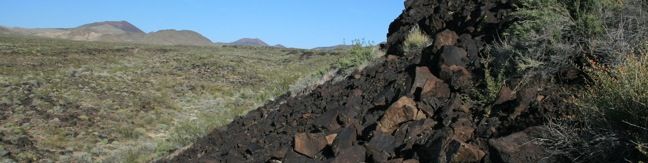
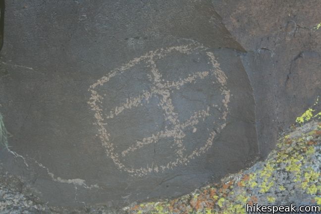
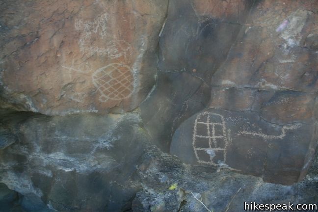
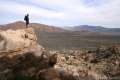
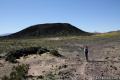
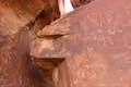
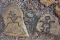
Visitors driving though Mojave National Preserve between Baker and Kelso Depot may wish to stop near Seventeen Mile Point for a quick walk to simple petroglyphs drawn into the volcanic rock outcroppings along the road. While certainly not the only petroglyphs in the preserve, these might be the easiest to get to.
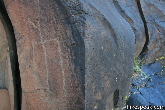
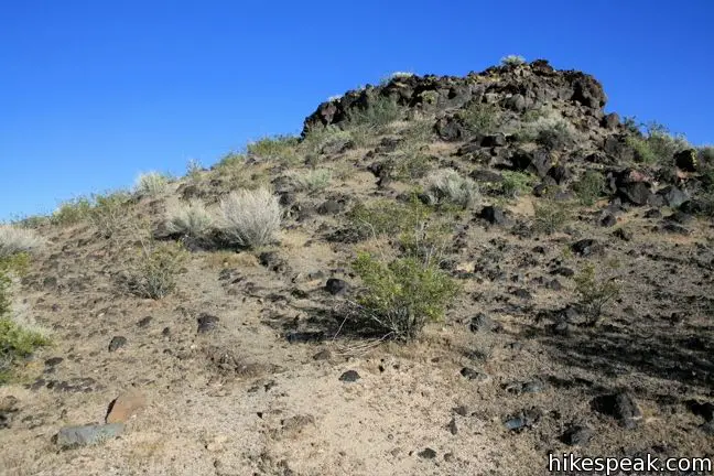
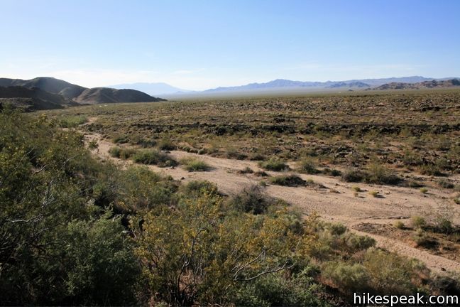
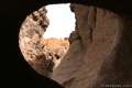
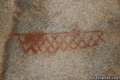
On Kelbaker Road, 13.4 miles from the 15 freeway in Baker and 21.1 miles from the Kelso Depot, there is a small turnoff on the east side of the road. Park here and take the footpath up a short slope to the northern side of an elevated strip of dark volcanic rock. The path continues beneath the 15-foot tall rock shelf past thousand-year-old Indian drawings. Look carefully for the simple designs drawn into the dark rock. The engravings disappear after a short distance. Either return back along the rocks or drop down to the wash below to return to the trailhead for a 0.25-mile round trip hike.
Directions to the Trailhead
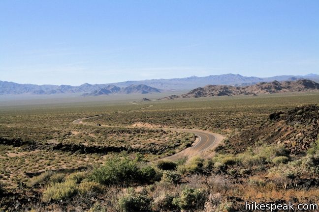
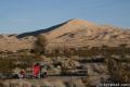
- The unmarked turnout is located on the western edge of the cinder fields, 1/3 of a mile north of a larger wash (that is used for roadside camping) in a bend in Kelbaker Road refereed to as Seventeen Mile Point.
- The path is visible to traffic heading toward Kelso Depot from Baker, but is hard to spot in the opposite direction.
Trailhead Location
Trailhead address: Kelbaker Road, Mojave National Preserve, CA 92309
Trailhead coordinates: 35.205572, -115.872077 (35° 12′ 20.05″N 115° 52′ 19.47″W)

 | Lava Tube This short 0.6-mile hike drops below the surface into an old lava tube. |
 | Kelso Dunes This 3-mile round trip hike climbs 470 feet to the highest point in this 45 square mile dune field. |
 | Teutonia Peak This 3.4 to 4-mile round trip hike crosses the world's densest Joshua tree forest, passing an abandoned silver mine to reach a rocky summit with views of Cima Dome. |
 | New York Peak This 7 to 9-mile round trip hike summits the highest point of the New York Range in the northeast corner of the preserve. |
 | Rock Spring Loop Trail This 1 1/3-mile loop visits a rare desert spring, a Rock House built in the 1920s, a miners' mill site, and an old U.S. Army post on a short and scenic circuit. |
 | Hole-in-the-Wall Rings Trail This 1.5-mile loop takes visitors through a landscape of pocketed rocks. Ringbolts allow fun passage through narrow canyons. |
 | Silver Peak This 8.5-mile hike summits a 6,365-foot peak in the Granite Mountains. |
 | Fountain Peak This 5-mile off trail trek summits a peak with commanding views over the Providence Mountains. |
 | Amboy Crater This 3-mile round trip hike travels up and into this crater adjacent to Mojave National Preserve. |
 | Hikes in the California Desert Explore more trails in Death Valley National Park, Joshua Tree National Park, Anza-Borrego Desert State Park, and Mojave National Preserve. |
 | Pictograph Trail in Anza-Borrego Desert State Park (California) This 1.8-mile hike visits rock paintings drawn by Kumeyaay Indians who lived in the Anza-Borrego Desert thousands of years ago. |
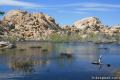 | Barker Dam in Joshua Tree National Park (California) This level 1.5-mile loop visits a foreign-looking reservoir and petroglyphs engravings within the Wonderland of Rocks. |
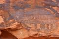 | Petroglyph Canyon Trail to Mouse's Tank in Valley of Fire State Park (Nevada) This 0.75-mile hike travels down a sandy path lined with petroglyphs to a natural basin formed in the sandstone. |
 | Atlatl Rock in Valley of Fire State Park (Nevada) Step right up to see Native American rock art on this 0.1-mile trail with stairs up a rock face to a collection of petroglyphs. |
 | Malama Trail (Hawaii) This 0.2 to 1.2-mile hike visits rare rock carvings in Puakō Petroglyph Archeological District on the west coast of the Big Island of Hawai'i. |
 | Mojave National Preserve There are a few campgrounds and endless roadside camping within the preserve. |
Common Questions about Petroglyphs on North Lava Bed Wash near Seventeen Mile Point in Mojave National Preserve
- Is the trail open?
- Yes. You should expect to find that Petroglyphs on North Lava Bed Wash near Seventeen Mile Point in Mojave National Preserve is open. There are no recent reports of trail closures. If you discover that the trail is closed, please help your fellow hikers by reporting a closure.
- Is this trail free to access?
- Yes, Petroglyphs on North Lava Bed Wash near Seventeen Mile Point in Mojave National Preserve is free to access. No entrance fee, pass, or permit is required. If you discover that access rules have changed, please provide feedback on your experience.
- How much time does this hike take?
- It takes approximately 15 minutes to hike Petroglyphs on North Lava Bed Wash near Seventeen Mile Point in Mojave National Preserve. Individual hiking times vary. Add extra time for breaks and taking in the views.
- How long is this hike?
- The hike to Petroglyphs on North Lava Bed Wash near Seventeen Mile Point in Mojave National Preserve is a 0.25 mile out and back / loop with 25 feet of elevation change.
- Are dogs allowed on this trail?
- Yes, dogs are allowed on Petroglyphs on North Lava Bed Wash near Seventeen Mile Point in Mojave National Preserve. The trail is open to hikers, dogs.
- Is Petroglyphs on North Lava Bed Wash near Seventeen Mile Point in Mojave National Preserve good for kids?
- Yes, this hike is likely suitable for children. It is relatively short (0.25 miles) with manageable elevation gain.
- Where is the trailhead located?
- The trailhead for Petroglyphs on North Lava Bed Wash near Seventeen Mile Point in Mojave National Preserve is located in Mojave National Preserve, CA.
Trailhead Address:
Kelbaker Road
Mojave National Preserve, CA 92309
Trailhead Coordinates:
35.205572, -115.872077 - What are the driving directions to the start of the hike?
To get to the trailhead: The unmarked turnout is located on the western edge of the cinder fields, 1/3 of a mile north of a larger wash (that is used for roadside camping) in a bend in Kelbaker Road refereed to as Seventeen Mile Point. The path is visible to traffic heading toward Kelso Depot from Baker, but is hard to spot in the opposite direction.
View custom Google Maps directions from your current location.
- Are there other trails near Petroglyphs on North Lava Bed Wash near Seventeen Mile Point in Mojave National Preserve?
- Yes, you can find other nearby hikes using the Hikespeak Hike Finder Map.

Go the extra miles...
Submit a rating of this hike to go with your comment. Contribute to the average trail rating.