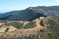
Mesa Peak via Mesa Peak Motorway from Corral Canyon Road in the Santa Monica Mountains

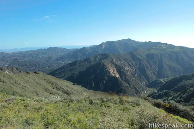
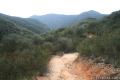
It is pretty unusual to hike to a peak from a trailhead at a higher elevation. In the case of Mesa Peak, the lofty trailhead along Corral Canyon Road treats hikers to summit-worthy views right from the get-go. While the elevation profile is atypical, the hike along Mesa Peak Motorway to Mesa Peak in Malibu is quite enjoyable. Ocean overlooks appear all along the wide dirt road, which also passes some very impressive sandstone formations.
The hike from Corral Canyon Road to Mesa Peak is a 6.5-mile round trip with 465 feet of elevation change between the high and low points of the hike. Expect lots of ups and downs along this undulating route. The trail makes a rolling 250-foot ascent to the hike’s high point and then drops across a saddle and rises to another major crest before descending to the small summit of Mesa Peak.
The sweeping views over Malibu and the Pacific Ocean make Mesa Peak a worthwhile destination. Because there are similar views along Mesa Peak Motorway to those found at the summit, hikers could turn around early and still have an enjoyable outing. For a shorter 5.35-mile round trip hike with 375 feet of elevation change, stop at a crest on Mesa Peak Motorway before the last descent to Mesa Peak and follow a path up McAuley Peak, which has a prominent boulder that looks like a frog or a lizard’s head.
- For a tougher ascent to Mesa Peak, hike up the east end of Mesa Peak motorway from Piuma Trailhead to Mesa Peak.
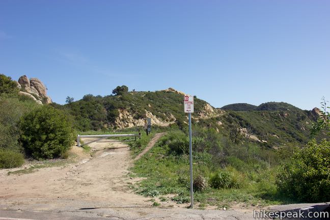
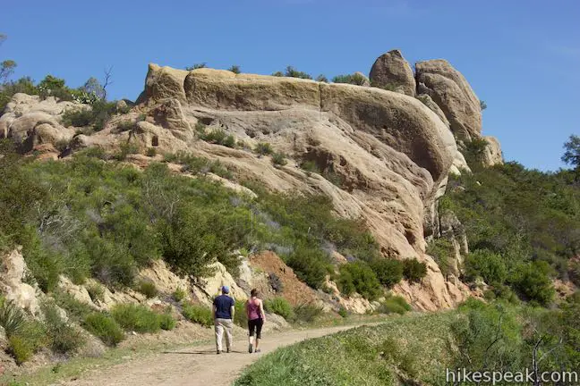
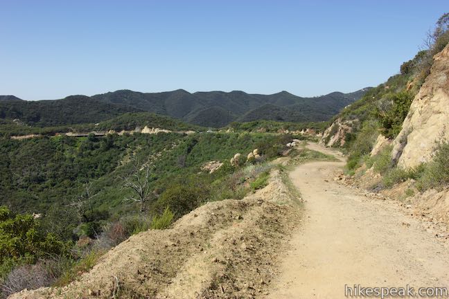
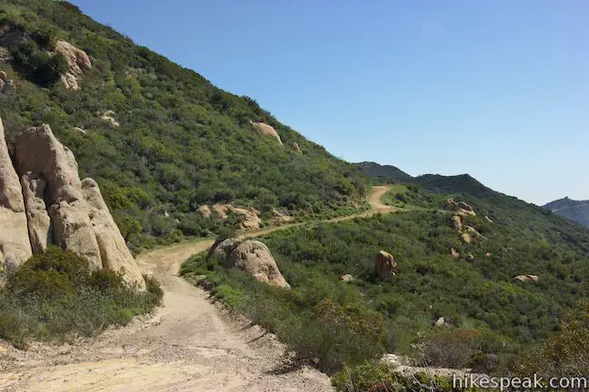
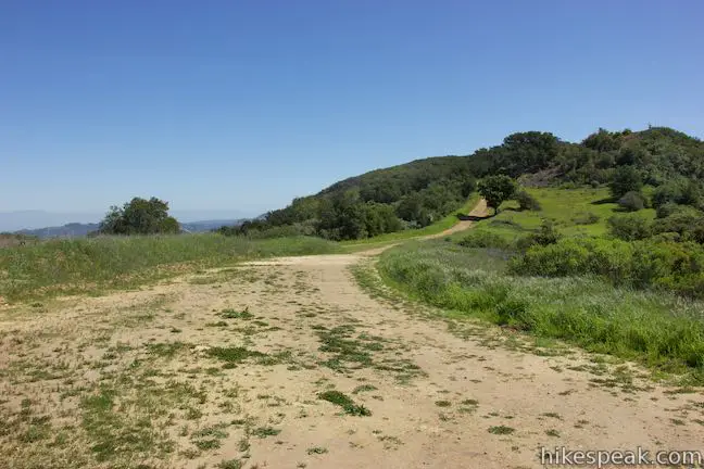
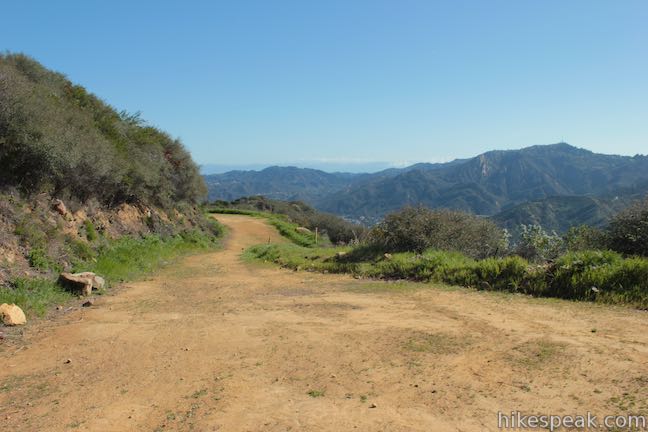
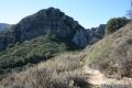
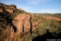
Starting from Corral Canyon Road at an elevation of 1,985 feet, Mesa Peak Motorway ventures east across the top of a high ridge in the Santa Monica Mountains. Take a look down the upper reaches of Corral Canyon toward the coast of Malibu. At times, the road offers views north over Agoura and other parts of the Santa Monica Mountains. Begin by hiking 0.35 miles up Mesa Peak Motorway to a junction with the Backbone Trail. Turn right to stay on Mesa Peak Motorway, which is now also the Backbone Trail. You will be hiking through a garden of strangely-shaped sandstone rock formations.
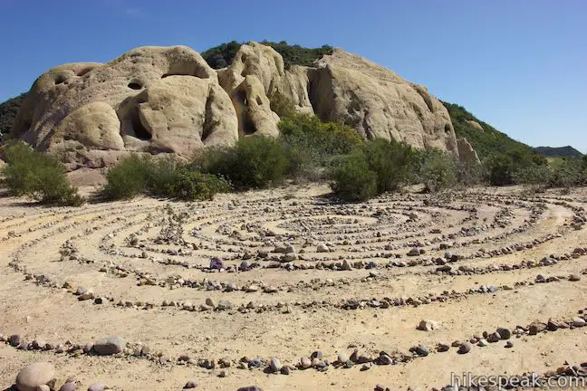
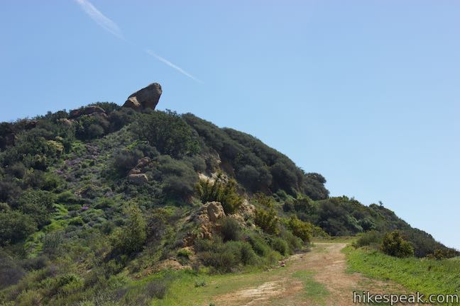
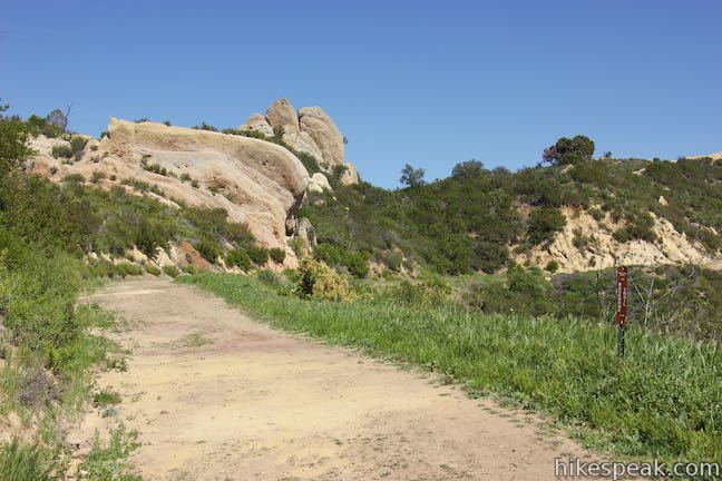
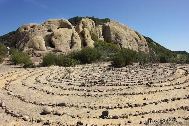
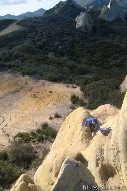
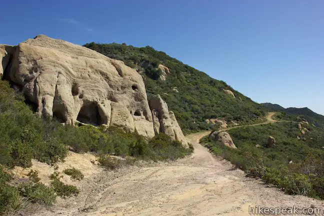
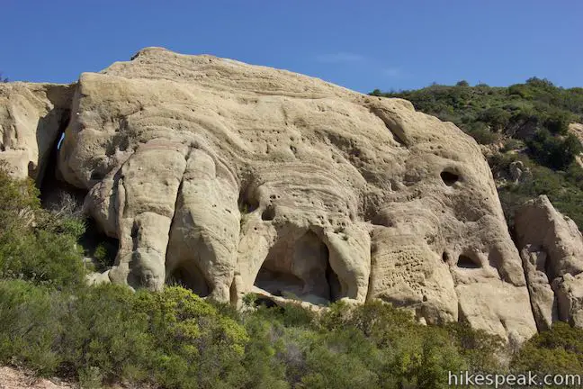
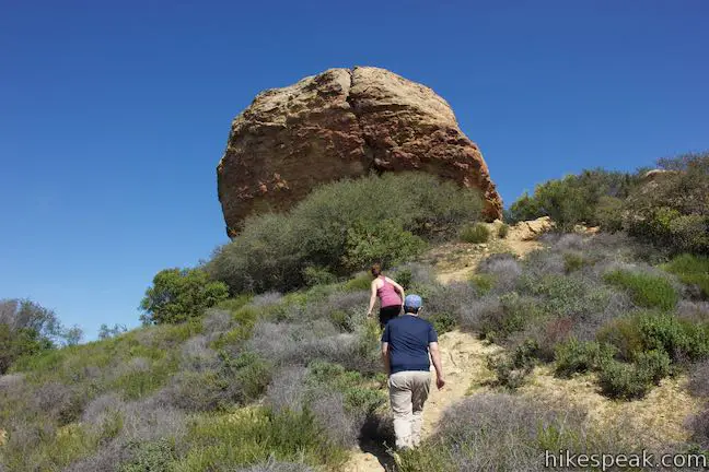
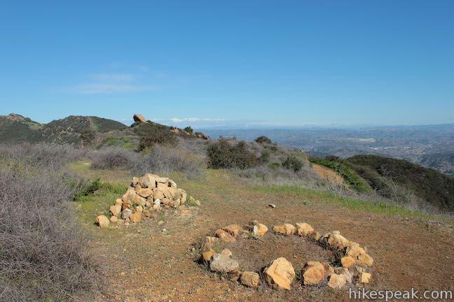
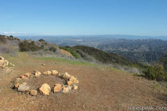
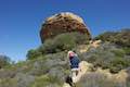
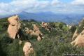
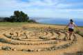
Walk a short distance down Mesa Peak Motorway to a clearing on the left, under half a mile from Corral Canyon Road. Within the clearing, a spiral-shaped stone labyrinth has been assembled below pocked sandstone cliffs. You can walk in circles through the labyrinth or climb around on the boulders above the trail. Less disciplined hikers will be compelled to hop off trail to explore all the interesting rock formations along Mesa Peak Motorway. A path off the left side of the trail before this clearing goes toward a boulder with access to a graffiti-covered cave called Corral Canyon Cave or Jim Morrison Cave (for his reported visiting of the cave). Due to excessive vandalism, California State Parks closed access to the cave in May 2016.
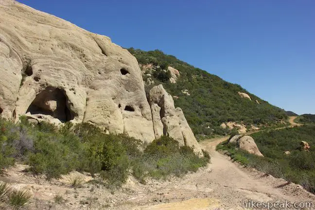
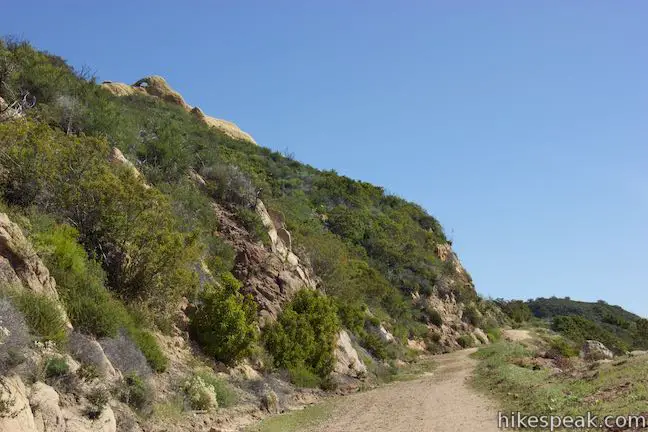
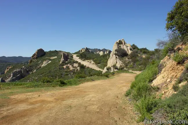
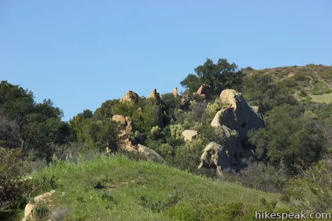
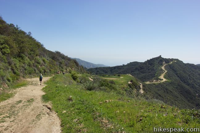
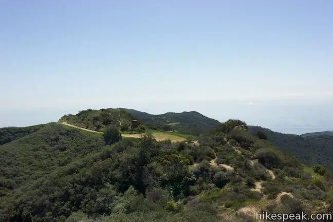
Passing the clearing, Mesa Peak Motorway heads downhill alongside an unusual wall of sandstone before turning uphill again. To your right, broad views down Corral Canyon go all the way to the Pacific Ocean. After a mile of hiking, the road crosses a dip in the ridgeline and flips to the north side of the ridge. Mesa Peak Motorway passes a few oaks that provide rare shade along the hike. Look west off the saddle and spot a ring of spiky boulders that resemble a crown.
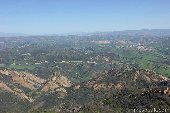
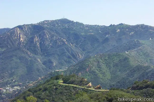
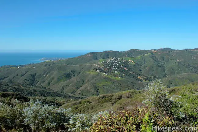
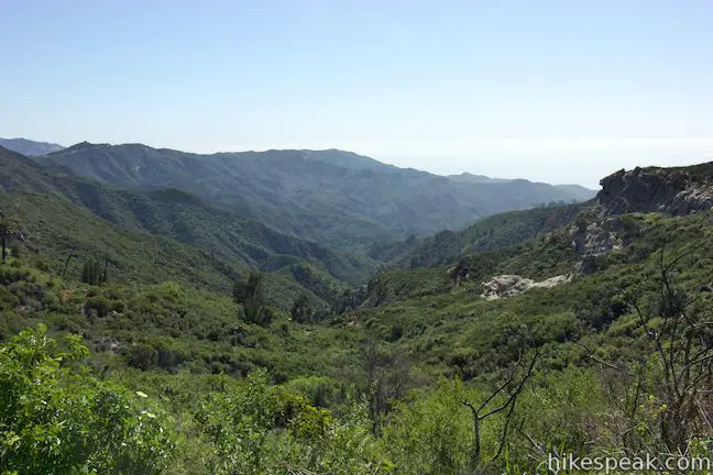
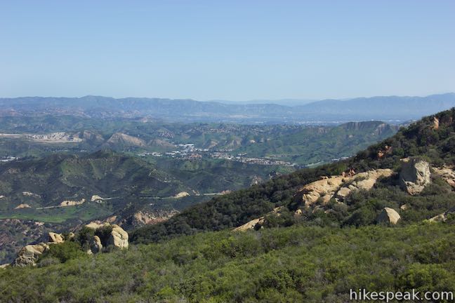
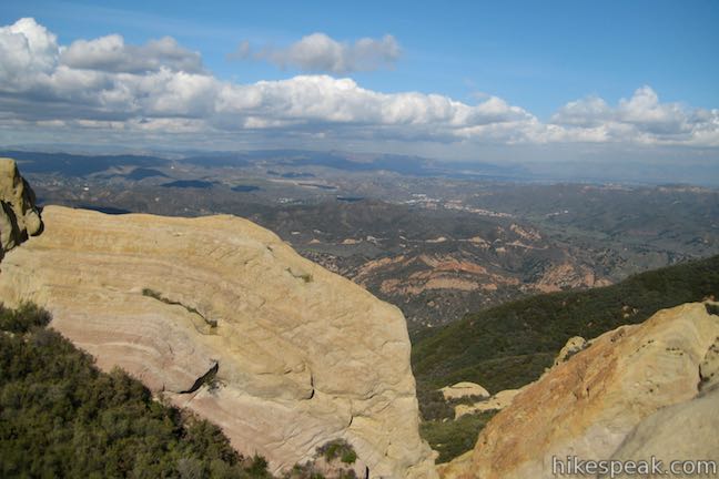
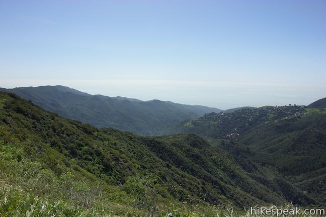
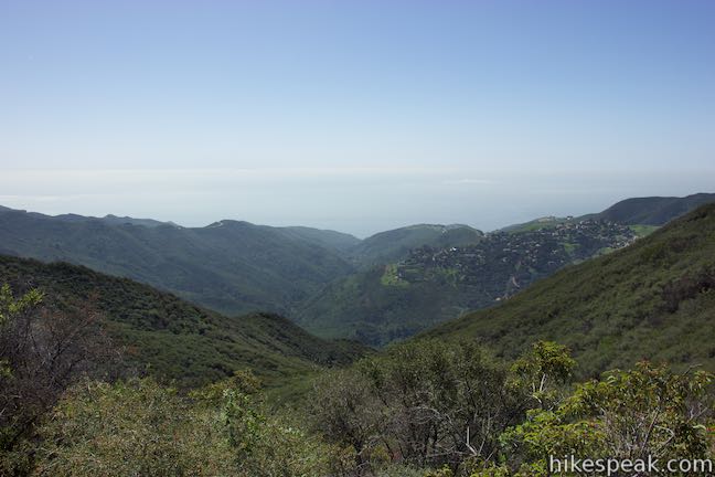
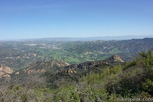
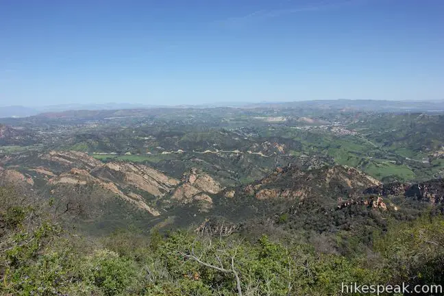
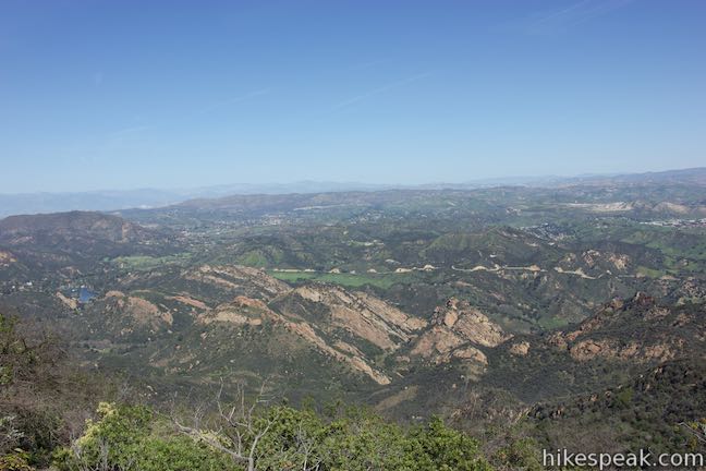
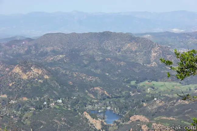
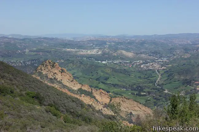
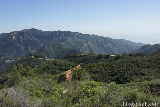
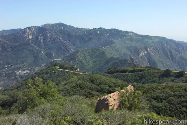
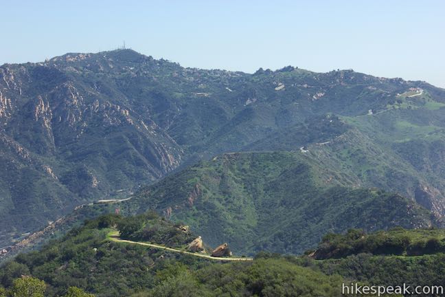
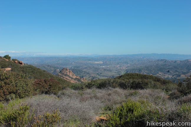
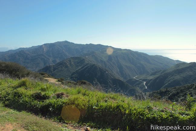
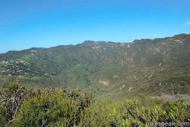
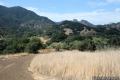
Continue up Mesa Peak Motorway to the highest point along the hike, which comes 1.55 miles from the start, at an elevation of 2,235 feet. There has been 250 feet of fairly gradual elevation change up to this point, but the road ahead has more dramatic highs and lows. Before heading downhill, enjoy a panoramic view to the north, looking out over Malibu Creek State Park and Agoura Hills. The pronounced cliffs of the Goat Buttes can be seen below. The route of Mulholland Highway along the north side of Malibu Creek State Park lies beyond that. Malibu Lake glistens to the northwest and Calabasas can be seen to the northeast. It is a big view on a clear day.
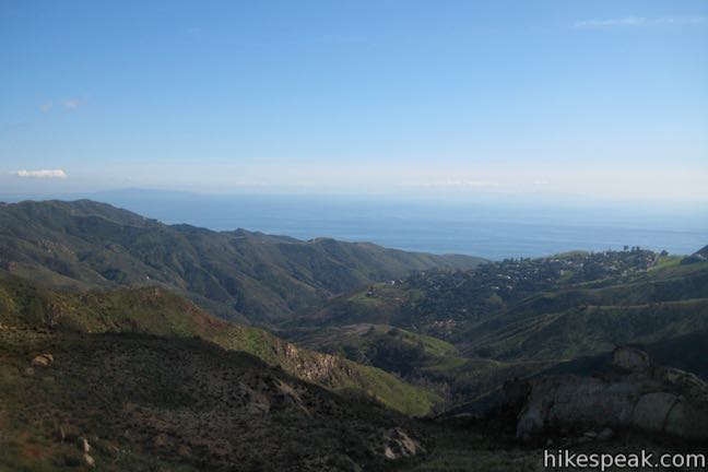
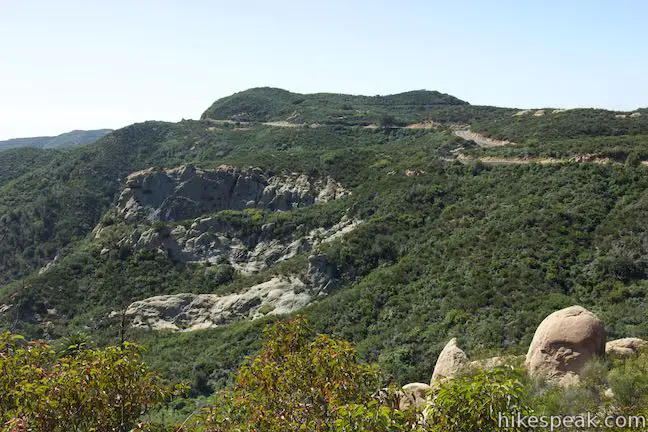
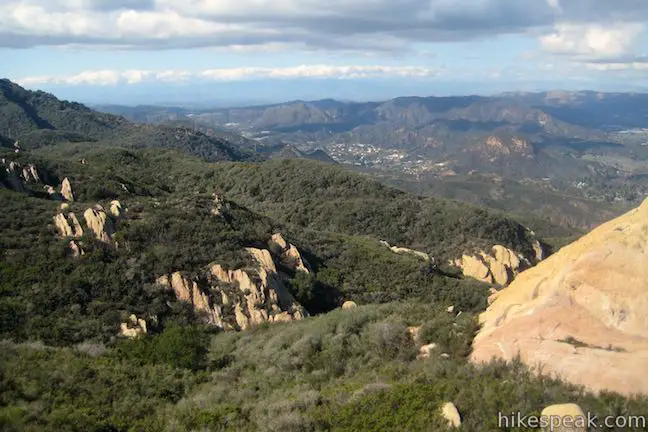
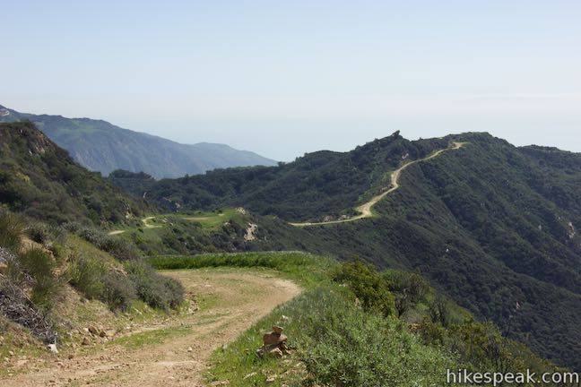
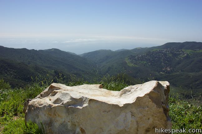
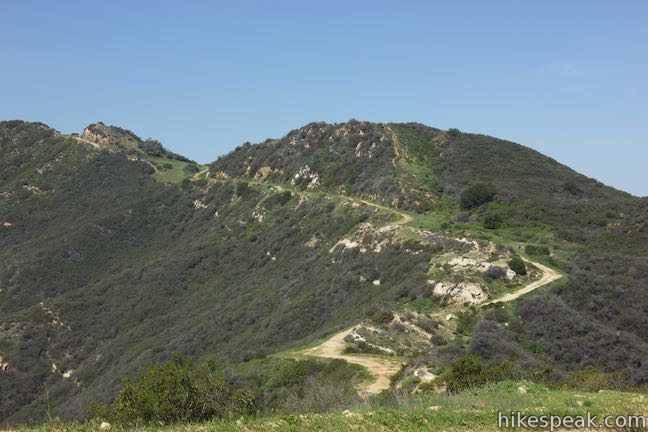
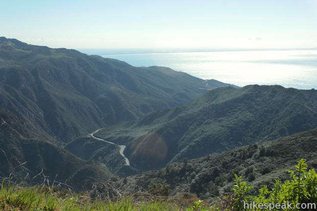
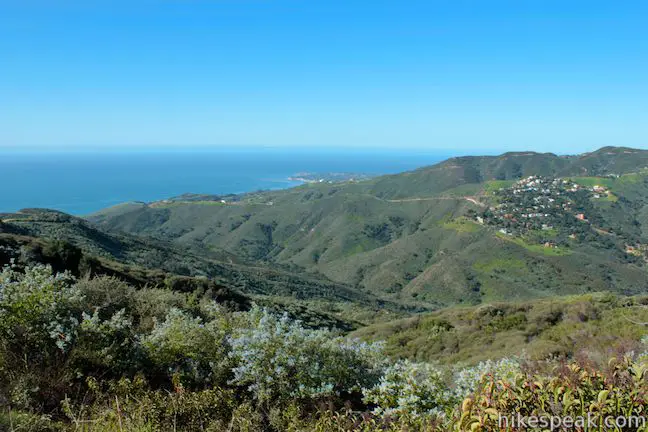
Mesa Peak Motorway heads downhill for the next 0.7 miles, sacrificing 375 feet of elevation as it plunges to 1,860 feet. As the ridge drops away, broad views open to the east down the trail toward Malibu Canyon. Rising on the other side, you’ll see Saddle Peak, which has pronounced sandstone stripes. At 1.95 miles from the start, pass a bench-shaped boulder on the right side of the trail. Have a seat if you wish and gaze down a green canyon toward the coast.
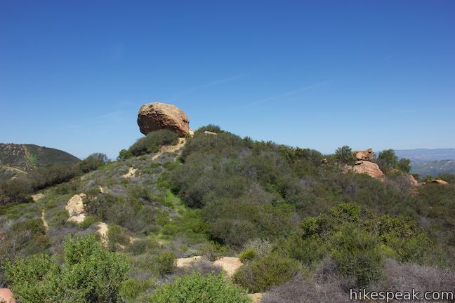
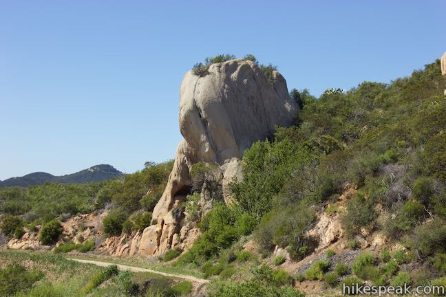
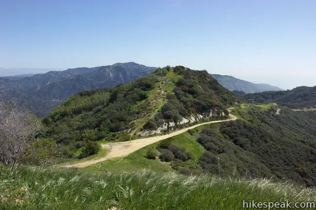
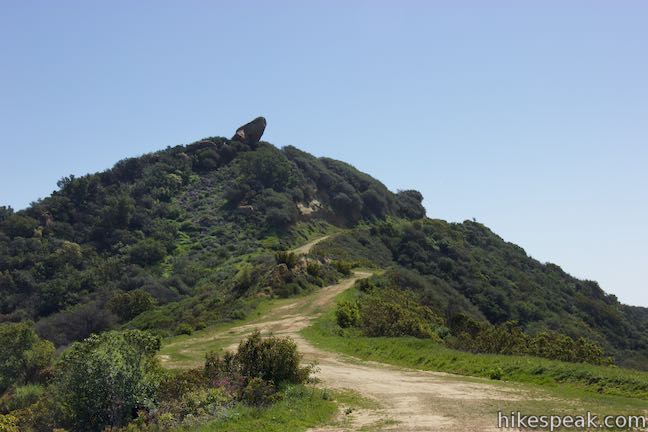
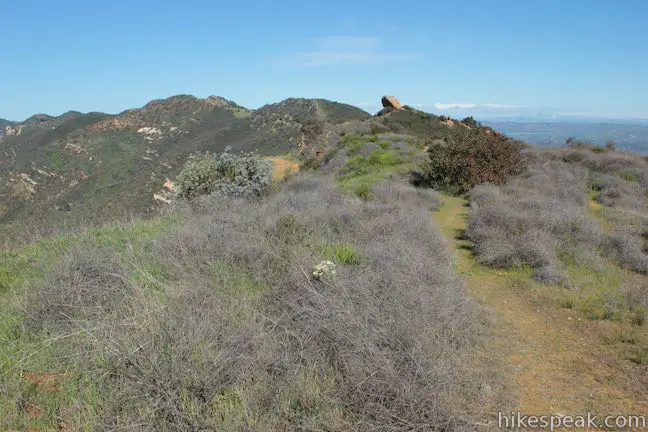
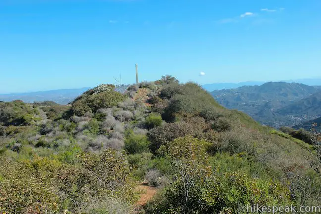
Cross the bottom of the saddle and head up a second major crest. A massive boulder juts out from the top of the crest, resembling a frog or a lizard’s head. This is McAuley Peak, named in honor of Milt McAuley, a champion of the Santa Monica Mountains, in 2015. Hike up Mesa Peak Motorway, getting closer and closer to, and eventually passing below, the large boulder.
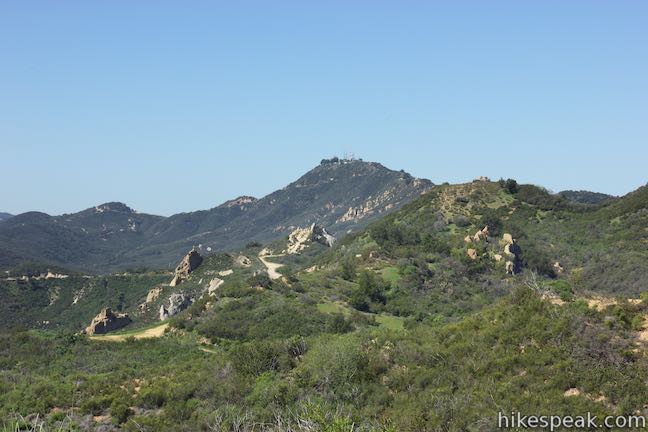
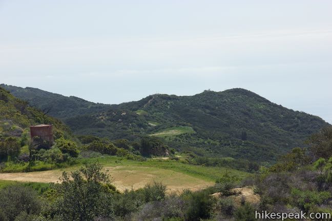
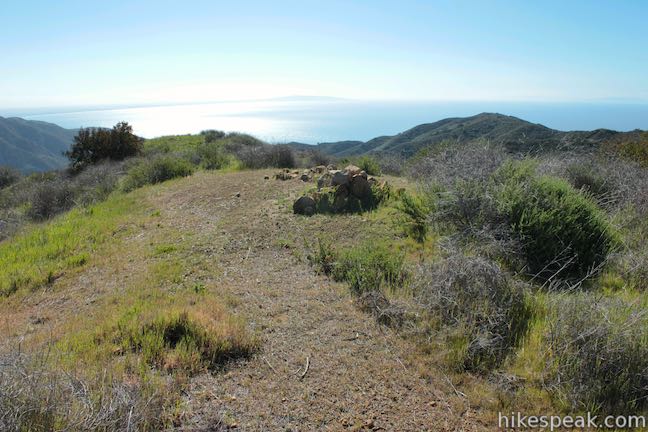
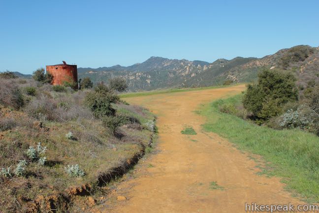
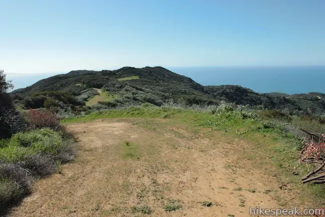
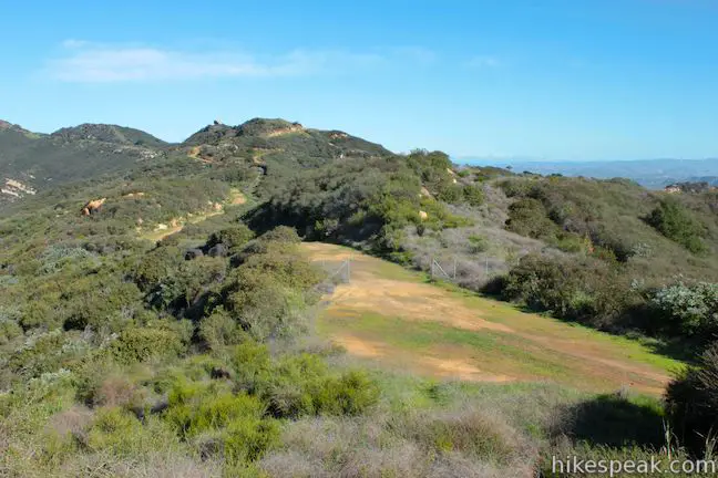
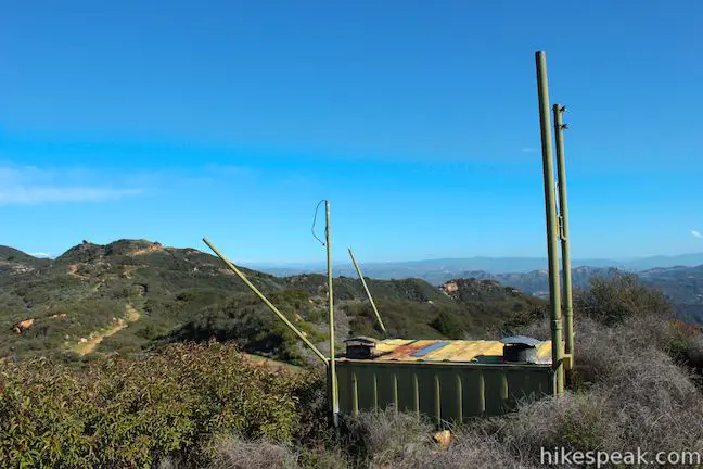
At 2.55 miles from the start, reach a clearing at the second crest on Mesa Peak Motorway. A rusting holding tank stands on the far side of the clearing. From this crest, the trail descends to a junction with Puerco Motorway, which leads to Mesa Peak. A path to the right goes behind the tank and crosses a short rise that Mesa Peak Motorway wraps around. This is an easy spot to grab panoramic views above Mesa Peak. Additionally, a path doubling back on the left ascends for 1/8 of a mile to the top of McAuley Peak and the big, jutting boulder (that resembled a frog or a lizard’s head from the other side). Hiking up to the boulder on McAuley Peak adds about a quarter mile round trip to your hike, offering panoramic views that rival those found on Mesa Peak. If you set McAuley Peak as your turnaround point, the hike would be 5.35 miles round trip.
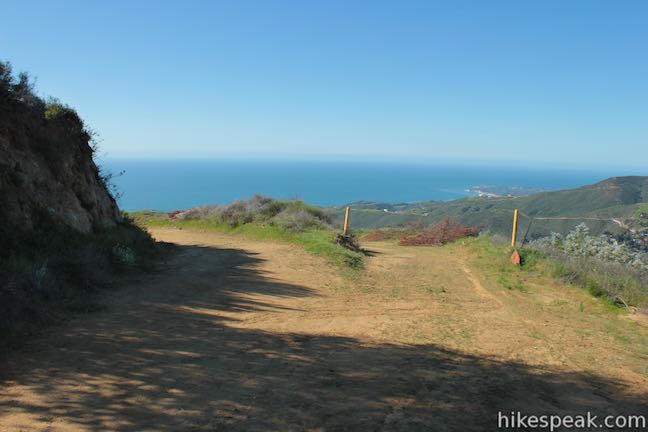
Continuing down Mesa Peak Motorway, the road wraps around the east side of the bump on the ridge and delivers nice views over Malibu Canyon on the east end of Mesa Peak Motorway. Come to a junction after another 0.2 miles (2.75 miles from the start). Mesa Peak Motorway proceeds to the left. Puerco Motorway descends to the right toward Mesa Peak. If you somehow pass this junction, there is another junction with an eastern branch of Puerco Motorway another 0.05 miles down Mesa Peak Motorway. From there, Mesa Peak Motorway descends 2.7 miles to Piuma Trailhead on Malibu Canyon Road.
Turn down Puerco Motorway. The not-so-prominent summit of Mesa Peak lies to the south, actually at a lower elevation across a shallow dip in a ridge. The western and eastern forks of Puerco Motorway unite after a tenth of a mile (bear right).
A short way down the wide dirt road, and just over three miles from the start, pass a state park boundary sign, letting you know that you are exiting Malibu Creek State Park, which preserves Mesa Peak Motorway and the top of Puerco Motorway.
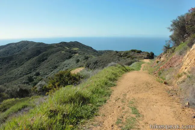
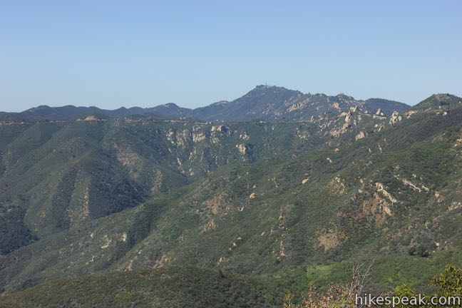
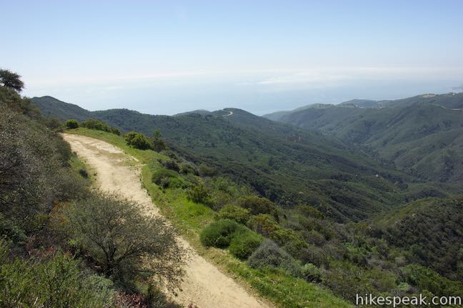
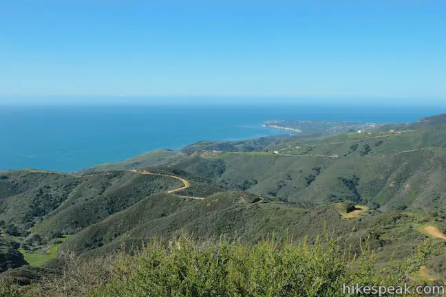
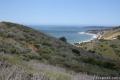
There are big ocean views from Puerco Motorway, gazing southwest down Corral Canyon toward the blue waters of the Pacific Ocean where Point Dume extends from the coastline. Across Corral Canyon, Corral Canyon Road is visible running along the top of the opposing ridge. Beyond that rises the 2,824-foot radio tower-covered crown of Castro Peak.
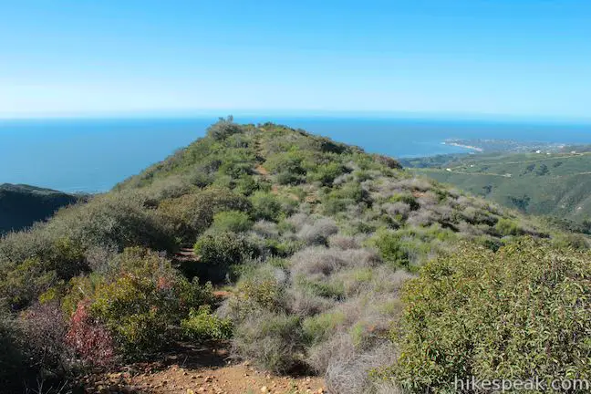
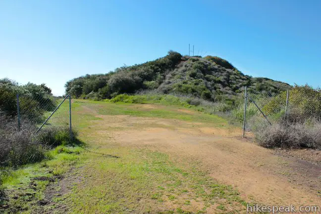
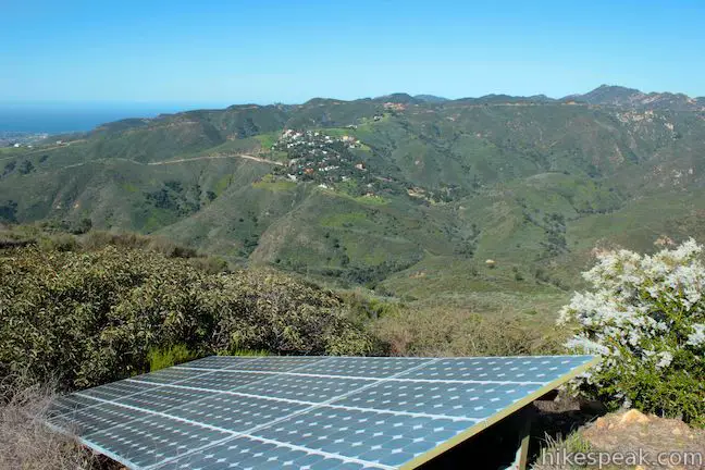
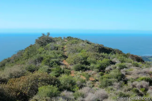
Pass through a fence after 0.45 miles on Puerco Motorway (3.2 miles from Corral Canyon Road). The small summit of Mesa Peak lies just ahead. Walk a few hundred feet, leave Puerco Motorway, and take the path to the right up the bump that is the summit of Mesa Peak. A small building sits on the 1,844-foot summit along with a solar panel.
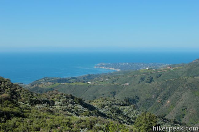
The top of Mesa Peak is 3.25 miles from Corral Canyon Road. Standing on the summit, you may feel compelled to walk down a footpath to a low point just to the south that offers a mighty view over the Pacific Ocean. You can look west over Corral Canyon, south over Puerco Canyon, southeast over Malibu Canyon and east toward Saddle Peak. This lower perch adds 0.15 miles round trip to the 6.5-mile hike to Mesa Peak.
When you’re through being mesmerized with the view from Mesa Peak, hike back the way you came. On the way back, you’ll descend 75 to the saddle on Puerco Motorway. Ascend from there back to Mesa Peak Motorway and up to the crest by the metal holding tank, gaining 205 feet. Cross the crest and descend 115 feet to the bottom of the next saddle. Make the big climb of 375 feet to the high point of Mesa Peak Motorway and then descend 250 feet back to Corral Canyon Road, crossing a few gentler dips.
This rollercoaster of a hike is an atypical approach to a subtle summit in the Santa Monica Mountains. There are sweeping views for most of Mesa Peak Motorway thanks to the high elevation of the trailhead and the closeness to the coast. Those wishing to hike farther on the Backbone Trail may continue west across Upper Solstice Canyon toward Castro Crest. No fee or permit is required to hike to Mesa Peak. Dogs are not allowed, but bikes are welcome on Mesa Peak Motorway, so get out and enjoy!
The basic directions for this hike to Mesa Peak are:
- Hike west from Corral Canyon Road on Mesa Peak Motorway (0 miles)
- Bear right to stay on Mesa Peak Motorway through a junction with the Backbone Trail (0.35 miles)
- pass a clearing on the left below sandstone outcroppings (0.5 miles)
- Come to a clearing by a rusting tank (2.55 miles)
- Venture up a path to the left to the top of McAuley Peak – adding an extra quarter mile round trip
- Proceed down Mesa Peak Motorway to a western junction with Puerto Motorway and turn right (2.75 miles)
- Bear right as the western fork joins an eastern fork of Puerto Motorway and proceed south (2.85 miles)
- Leave Puerco Motorway on a short path up to the summit (3.25 miles)
- Optionally: Continue past the summit down a short path to a point with great ocean views (3.33 miles)
Directions to the Trailhead
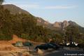
- Take PCH to Malibu and turn inland on Corral Canyon Road, which is 2.3 miles west of Malibu Canyon Road and Pepperdine University.
- There is a 76 Gas Station at the intersection.
- Drive past the entrance to Solstice Canyon Park and take Corral Canyon Road for 5 miles up into the mountains to the start of Mesa Peak Motorway, which is on the right.
- If you reach the end of the pavement, you need to turn around and drive back about a quarter mile.
- There is parking along the sides of Corral Canyon Road.
Trailhead Location
Trailhead address: 301 Corral Canyon Road, Malibu, CA 90265
Trailhead coordinates: 34.079, -118.75556 (34° 04′ 44.40″N 118° 45′ 20.01″W)
View Santa Monica Mountains in a larger map
Or view a regional map of surrounding Los Angeles trails and campgrounds.


 | Mesa Peak from Piuma Trailhead This 6.5-mile round trip hike ascends 1,375 feet up the Backbone Trail from Malibu Creek State Park to a subtle summit with substantial ocean views. |
 | McAuley Peak from Piuma Trailhead This 6.15-mile round trip hike goes even higher up the Backbone Trail to a panoramic summit with a cool rock formation. |
 | Upper Solstice Canyon This 5.5 to 6.5-mile hike travels the Backbone Trail across Upper Solstice Canyon from Corral Canyon Road to Castro Crest, with the option to hike an extra half mile up Newton Road toward Castro Peak. |
 | Corral Canyon This 2.5-mile loop offers ocean and canyon views from a unspoiled section of the Santa Monica Mountains in Malibu. |
 | Solstice Canyon This two-mile out and back hike is easy and level, and visits the ruins of a burned down ranch and a small waterfall. |
 | M*A*S*H Set This hike visits the site where the exteriors of the television show MASH were filmed, a 4.75-mile trek from the park entrance. |
 | Grassland Trail to Crags Road and Rock Pool This easy 3-mile hike enters Malibu Creek State Park on South Grassland Trail, then forms a loop around Crags Road to visit Rock Pool. |
 | Talepop Loop This 4.75-mile hike climbs 500 feet over a scenic mountain between Liberty Canyon and Las Virgenes Canyon on the north end of Malibu Creek State Park. |
 | Cistern, Lookout, and Cage Creek Trails This team of single tracks make a scenic descent to Century Lake in Malibu Creek State Park, providing a short loop or longer hikes to other destinations. |
 | More trails in the Santa Monica Mountains Explore other destinations in the range. |
 | Saddle Peak from Stunt High Trail This 7.5-mile hike combines Stunt High Trail and a section of the Backbone Trail to visit the 6th tallest summit in the Santa Monica Mountains. |
 | Eagle Rock from Santa Ynez Canyon This 7.4-mile hike takes the long route from a canyon in the Pacific Palisades up to the panoramic sandstone summit. |
 | Skull Rock This 1.5-mile hike descends Temescal Ridge to a head-shaped formation with great views over Santa Monica Bay. |
 | Calabasas Peak via Calabasas - Cold Creek Trail This 4.5-mile round trip hike starts up a scenic single track formerly know as the Secret Trail and ascends 750 feet to the summit of Calabasas Peak. |
 | Red Rock Canyon Park The trails in the beautifully sculpted Red Rock Canyon are 2.5 and 5.2 miles in length. |
 | Tuna Canyon Park This 1.6 to 5.1-mile hike offers spectacular ocean views from a less-visited park between Topanga and Malibu. |
 | Malibu Creek State Park The year-round campground has 63 sites with picnic tables, fire rings, flush toilets, coin showers, and a dump station. |
Common Questions about Mesa Peak via Mesa Peak Motorway from Corral Canyon Road in the Santa Monica Mountains
- Is the trail open?
- Yes. You should expect to find that Corral Canyon Road to Mesa Peak is open. There are no recent reports of trail closures. If you discover that the trail is closed, please help your fellow hikers by reporting a closure.
- Is this trail free to access?
- Yes, Corral Canyon Road to Mesa Peak is free to access. No entrance fee, pass, or permit is required. If you discover that access rules have changed, please provide feedback on your experience.
- How much time does this hike take?
- It takes approximately 3 hours to hike Corral Canyon Road to Mesa Peak. Individual hiking times vary. Add extra time for breaks and taking in the views.
- How long is this hike?
- The hike to Corral Canyon Road to Mesa Peak is a 6.5 mile out and back with 465 feet of elevation change.
- Are dogs allowed on this trail?
- No, dogs are likely not allowed on Corral Canyon Road to Mesa Peak. The trail is primarily open to hikers, bikes.
- Are there ocean views on this hike?
- Yes, Corral Canyon Road to Mesa Peak offers views of the ocean.
- Does this trail go to a summit?
- Yes, Corral Canyon Road to Mesa Peak reaches a summit with panoramic views.
- What mountain range is this trail in?
- Corral Canyon Road to Mesa Peak is located in the Santa Monica Mountains.
- Where is the trailhead located?
- The trailhead for Corral Canyon Road to Mesa Peak is located in Malibu, CA.
Trailhead Address:
301 Corral Canyon Road
Malibu, CA 90265
Trailhead Coordinates:
34.079, -118.75556 - What are the driving directions to the start of the hike?
To get to the trailhead: Take PCH to Malibu and turn inland on Corral Canyon Road, which is 2.3 miles west of Malibu Canyon Road and Pepperdine University. There is a 76 Gas Station at the intersection. Drive past the entrance to Solstice Canyon Park and take Corral Canyon Road for 5 miles up into the mountains to the start of Mesa Peak Motorway, which is on the right. If you reach the end of the pavement, you need to turn around and drive back about a quarter mile. There is parking along the sides of Corral Canyon Road.
View custom Google Maps directions from your current location.
- Are there other trails near Corral Canyon Road to Mesa Peak?
- Yes, you can find other nearby hikes using the Hikespeak Hike Finder Map.

Correction. This is not a dog legal trail. We got cited today. Sure enough there’s a sign posted that we missed at the trail head. Just fyi.
The post has been corrected. Sorry you ran into trouble.
I was there yesterday March 5 th, 2016. The labyrinth is completely gone. What the heck? Who would do that?
about to do this hike in two days but I’m worried about parking… can i simply park at the entrance to the trail or is there a designated spot?
The trailhead does not have a parking lot, so just park along the road near the start of the trail. Enjoy your hike!
will do thank you!