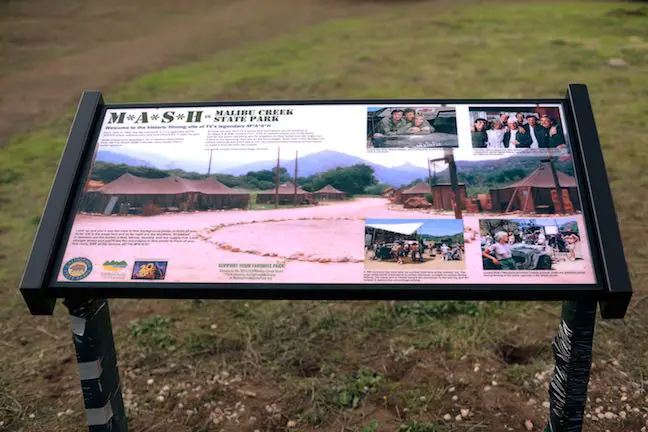
Far from the Hollywood Sign and the Walk of Fame, Malibu Creek State Park holds its own bit of Hollywood history. The exterior set for the long-running television show M*A*S*H was filmed in a Korea-resembling corner of park. While the medic tents have been removed, the location is still recognizable, and Malibu Creek State Park has gone above and beyond to create a rich experience for hikers.
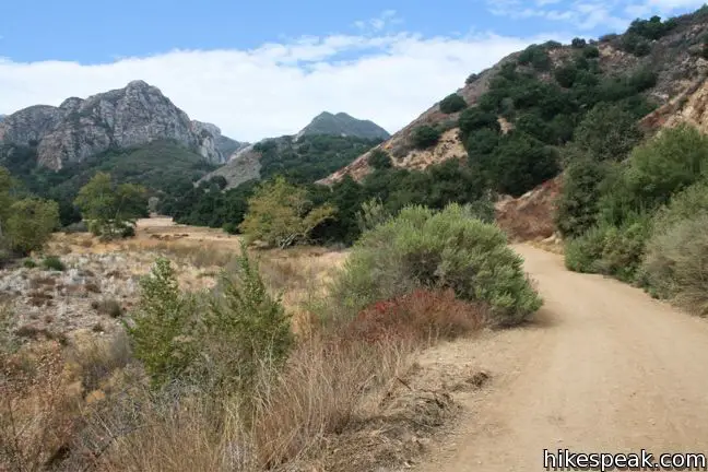
The MASH set is located along Crags Road, the main hiking trail through the park. It is 4.75-miles round trip with a mere 200 feet of elevation gain between the parking area at the park entrance and the old MASH set.
The hike to the MASH site can be extended to 5.7 miles by entering the park via South Grassland Trail, or abbreviated to 3.6 miles by entering on Cistern Trail.
Woolsey Fire Update: The MASH site and most of Malibu Creek State Park have reopened following the November 2018 Woolsey Fire, which burned areas of the park. Check the Malibu Creek State Park page for more information.
Where was MASH filmed?
Shooting for MASH took place on a movie ranch operated by Twentieth Century Fox. The filming lasted from 1972 to 1983. During this period, the Twentieth Century Fox Ranch was actually sold off and became Malibu Creek State Park. With the help of the Malibu Creek State Park Docents, the state park preserves the MASH site for visitors.

The basic hiking directions to the M*A*S*H site are:
- Leave the main parking area on Crags Road (0 miles)
- Stay to the left past the bottom of South Grassland Trail (0.2 miles)
- Come to a split between Crags Road and High Road and turn left to cross Malibu Creek and stay on Crags Road (0.3 miles)
- Staying to the right on High Road extends the distance by 0.1 miles – simply turn right when High Trail reunites with Crags Road
- After a meadow, Crags Trail crosses a bridge over Malibu Creek (0.7 miles)
- Pass the trail to Rock Pool to meet High Road again and proceed west (0.8 mile)
- Pass the bottom of Lookout Trail on the right (1.22 miles)
- Pass the top of Century Lake Trail on the left (1.25 miles)
- Optionally venture down to Century Lake and back, adding 0.3 miles to the hike
- Pass the bottom of Cage Creek Trail on the right (1.5 miles)
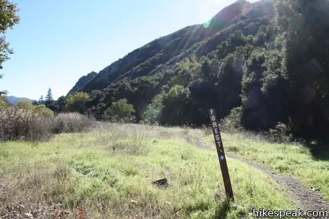
- Pass Forest Trail on the left (1.7 miles)
- Pass Lost Cabin Trail on the left and the edge of the MASH Site (2.3 miles)
- Explore the MASH site before returning the way you came (2.37 miles)
Hiking to the M*A*S*H site
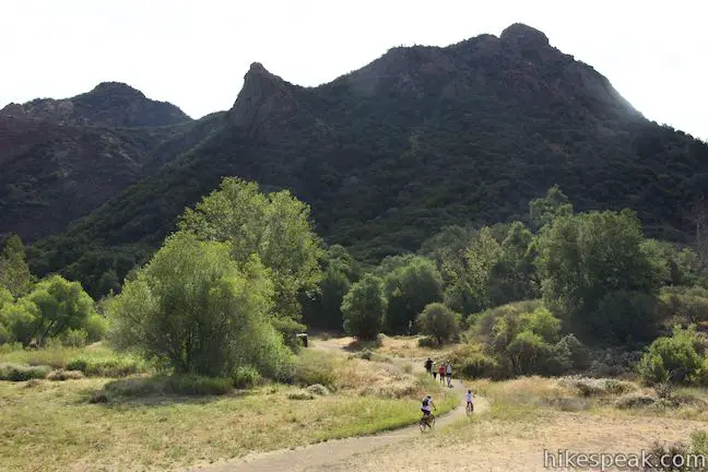
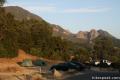
From the main parking lot (entrance fee required), begin hiking west on Crags Road into Malibu Creek State Park. After 0.2 miles, Grassland Trail joins Crags Road from the right. This is an alternate approach to the park, beginning from a trailhead along Mulholland Drive (with free roadside parking).
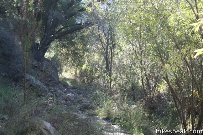
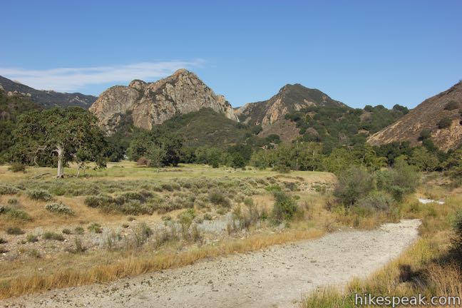
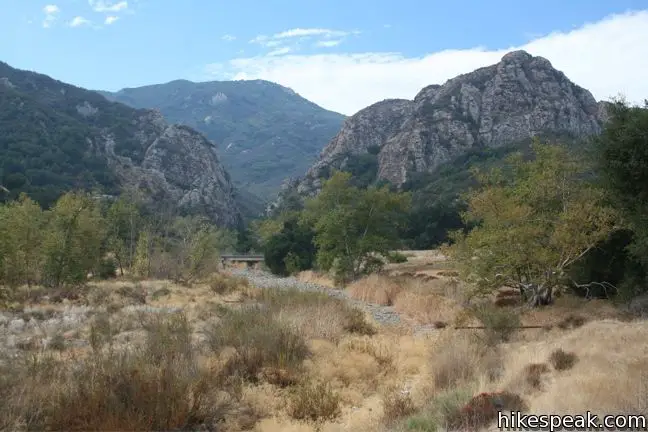
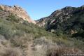
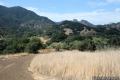
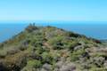
At 0.3 miles from the start, you will come to an important split. Crags Road parts to the left, crossing Malibu Creek. Despite being the largest watershed in the Santa Monica Mountains, areas of Malibu Creek dry out completely in the fall. The creek flows strong in the spring and summer, when you may prefer not to cross the creek.
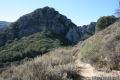
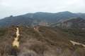
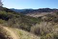
When the creek is running high, it is best to stay to the left on High Road, a branch of Crags Road. Staying to the left on High Road only extends the hike by a tenth of a mile each way. The level creek-side fire road provides pleasant shade from overhanging oaks, along with fine views of the impressive Goat Buttes and surrounding peaks. Even if you choose this route in dry months, the mountain range is picturesque year round. Staying with the High Road is also the less complication option.
Taking the High Road: At 0.6 miles from the split, High Road rejoins Crags Road at another marked junction. To the left, you will find the trail to Rock Pool and the park ranger station. To the right, Crags Road continues for another 1.5 miles to the MASH site.
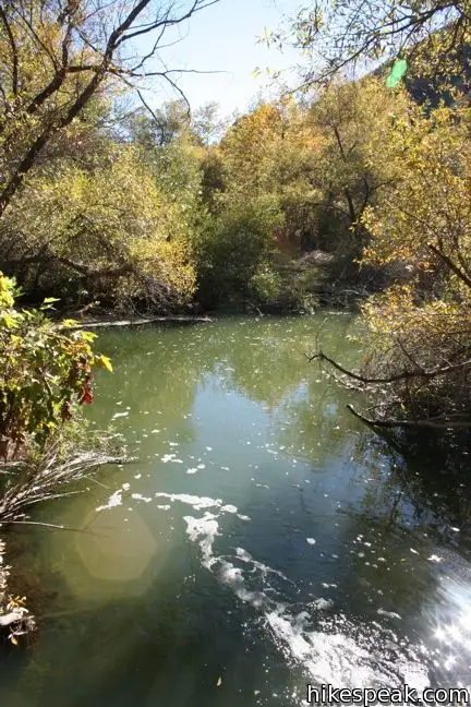
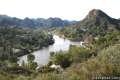
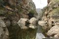
Taking Crags Road: Bearing Left at the split to follow Crags Road, the trail firs crosses Malibu Creek. Then make your way through a meadow toward the ranger station. Bear right at a couple splits with a trail heading south. After the ranger station, cross a bridge over Malibu Creek with a picturesque perspective up the gorge to the south. On the other side, find the trail to Rock Pool venturing up along the creek to the left. This is an awesome hiking destination, worthy of a short side trip (adding 0.4 miles round trip to this hike).
Not long after the bridge over Malibu Creek and the trail to Rock Pool, come to the junction with the west end of High Road. Bear left to proceed up Crags Road.
Crags Road to the MASH Site
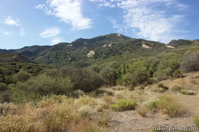
Leaving the junction, Crags Road angles to the right and then makes a sharp turn to the left to head gradually uphill. After another 0.42 miles, pass Lookout Trail which rises to the right. Heading downhill, Crags Road then passes a spur trail on the left that ventures down to Century Lake. A picnic area by this small, peaceful reservoir is 0.15 miles off Crags Road and worthy of a short detour.
A lot of side trails break off of Crags Road. Simply stick to the main corridor to reach the MASH site. The wide dirt trail passes Cage Creek Trail on the right, a quarter miles past Century Lake. This single track ascends to the other end of Lookout Trail below Mulholland Drive, which connects to Cistern Trail, another access route to Malibu Creek State Park.
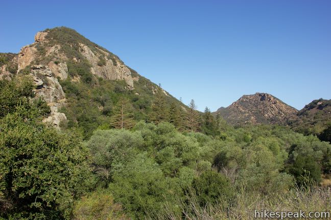
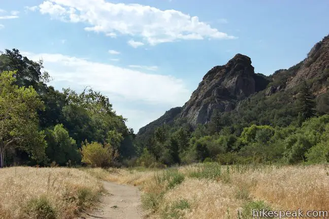
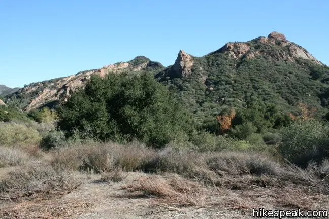
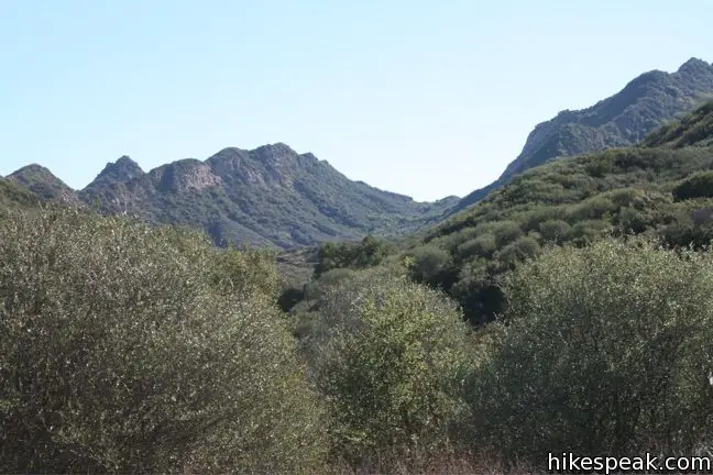
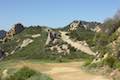
Crags Road continues through a grassy meadow, curving to the left and across the creek flowing into Century Lake. Just past the creek comes a junction with Forest Trail, which extends to the left down the backside of Century Lake. As usual, stay on Crags Road and continue toward the MASH set. The level road narrows suddenly into a rocky track. Steep rock to the left and dense woods to the right isolate this stretch of the hike, making the last 2/3 of a mile leading up to the destination quite secluded and enjoyable.
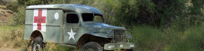
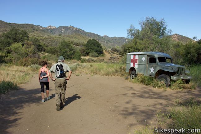
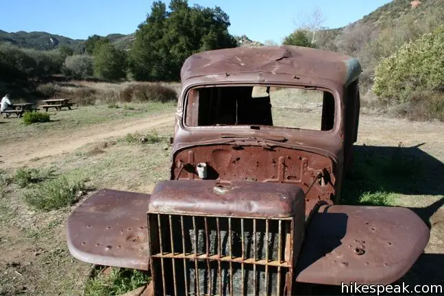
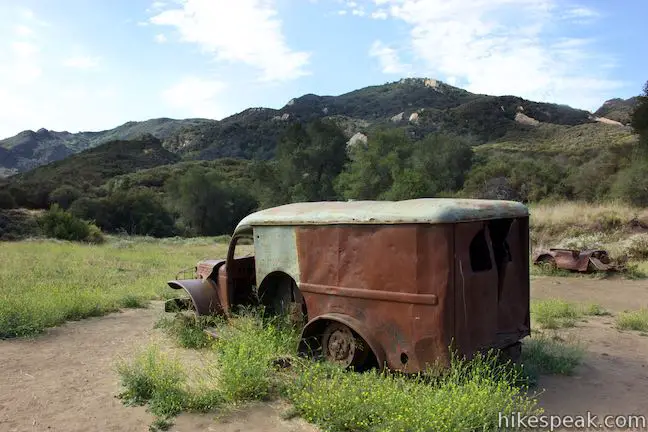
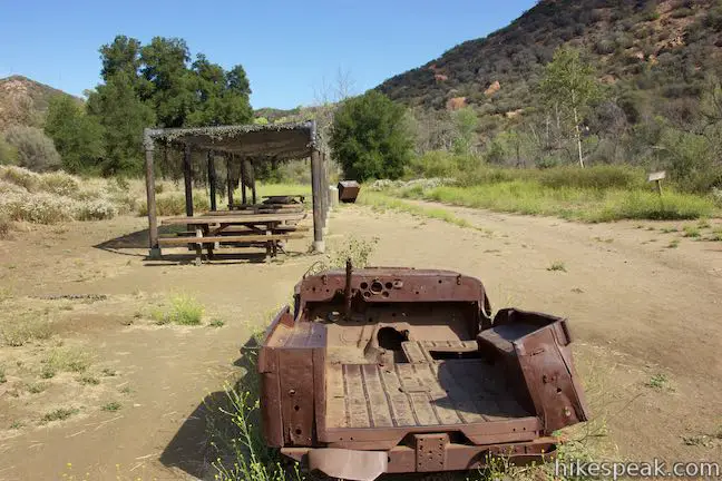
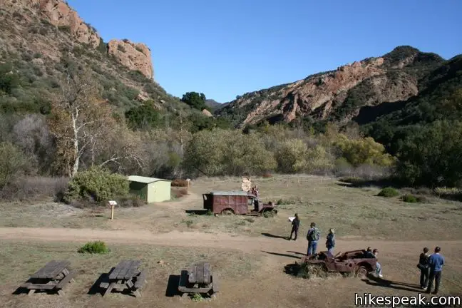
Crags Road exits the trees, coming to a junction with Lost Cabin Trail just before the MASH site. This less-traveled single track heads to the left, southeast, for 0.75 miles to the location of a now non-existent cabin. Across from Lost Cabin Trail is the first sign of the MASH Set, an old truck with a red cross painted on the side. This jeep has been added since 2010 and enhances the fantasy of visiting the MASH Site.
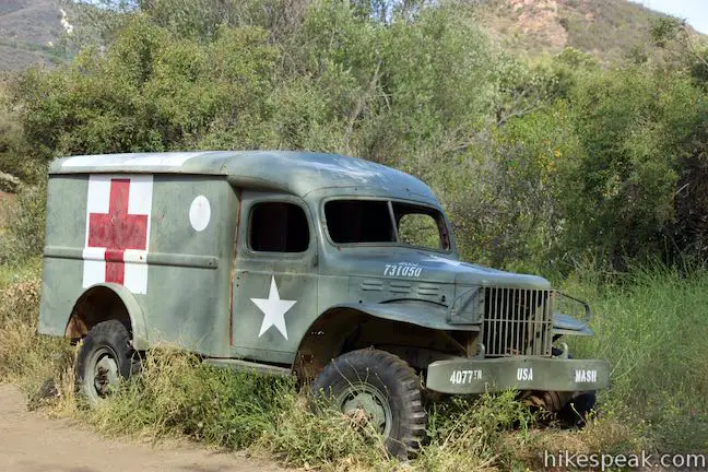
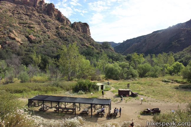
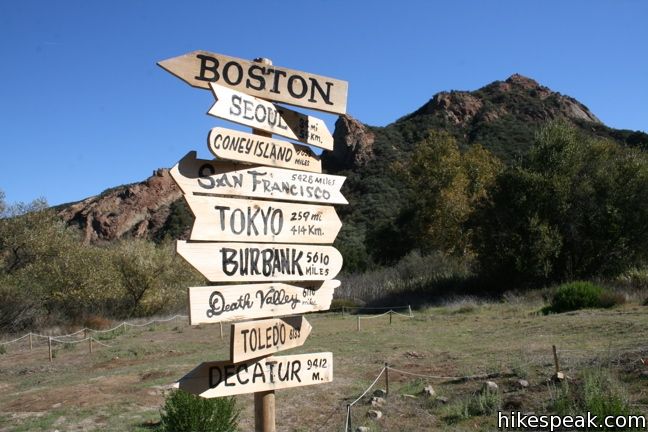
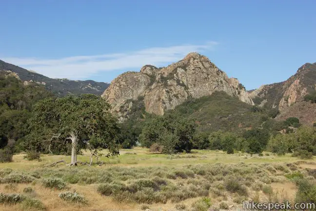
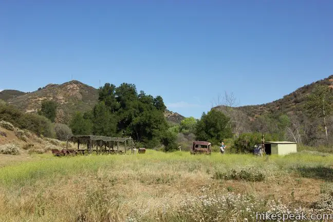
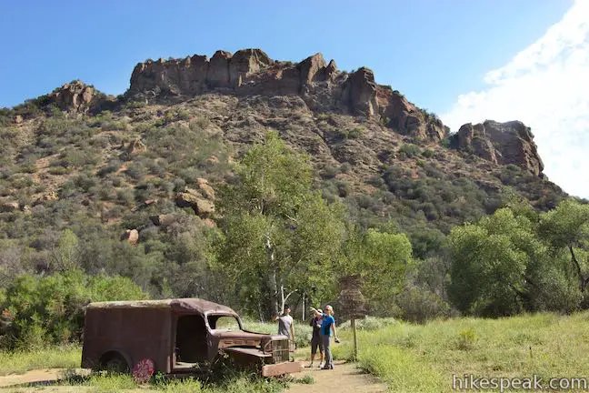
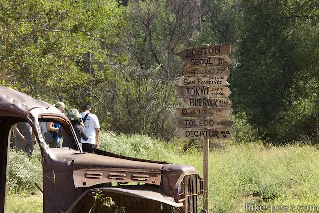
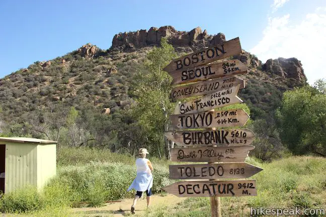
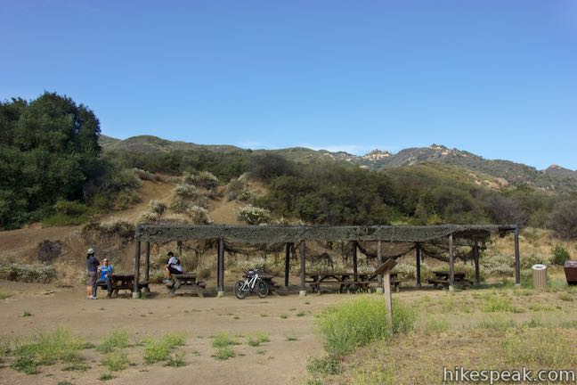
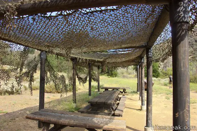
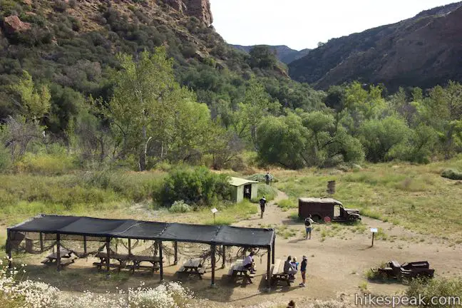
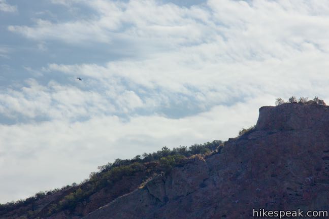
Just past this final junction, Crags Road arrives at the location where MASH was filmed from 1972 to 1983. A pair of rusting vehicles are left over from the TV production, along with picnic tables and numerous information panels. Rope outlines mark the footprints of the old medic tents, and provided photographs help revive the show in visitors’ imagination, further enriching the experience. Head up the slope to the west to the old helicopter landing area. The perch offers a great view of the recognizable rock formations surrounding the old TV set. The cast and crew may be gone, but the mountains haven’t changed, matching the memory of the popular television show.
Twentieth Century Fox operated a movie ranch in this area before donating the land to Malibu Creek State Park. In addition to Robert Altman’s classic 1970 film and the subsequent MASH television series, Butch Cassidy and the Sundance Kid and Planet of the Apes were also filmed in the park (among others).
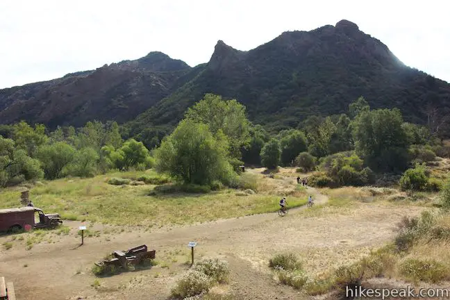
Beyond the MASH site, Crags Road continues to a junction with Bulldog Road and on to Malibu Lake. You may extend the hike deeper into the park on these trails or return the way you came.
A fee of $12 per vehicle is charged to park inside Malibu Creek State Park (price as of 2024). Parking is also available outside the park. Dogs are not allowed on this hike, but mountain bikes are permitted.
Directions to the Trailhead
- The entrance to Malibu Creek State Park is located on the west side of Las Virgenes/Malibu Canyon Road between the 101 and PCH, 6.1 miles from the coast (just south of Mulholland Highway).
Trailhead Location
Trailhead address: 1925 Las Virgenes Road, Malibu Creek State Park, Calabasas, CA 91301
Trailhead coordinates: 34.0964, -118.71673 (34° 05′ 47″N 118° 43′ 00.2″W)
View Santa Monica Mountains in a larger map
Or view a regional map of surrounding Los Angeles trails and campgrounds.


 | Lost Cabin Trail This 1.5-mile round trip extension to the MASH set hike dead-ends in a mountain canyon at the site of a now nonexistent cabin. |
 | Cistern, Lookout, and Cage Creek Trails This team of single tracks make a scenic descent to Century Lake in Malibu Creek State Park, providing a short loop or longer hikes to other park destinations. |
 | Lake Vista Trail This 4.1-mile hike crosses the west end of Malibu Creek State Park and climbs to a scenic view over Malibu Lake. |
 | Phantom Trail This 4.8-mile round trip hike crosses a panoramic ridge on the north side of Malibu Creek State Park. |
 | Grassland Trail to Crags Road and Rock Pool This easy 3-mile hike enters Malibu Creek State Park on South Grassland Trail, then forms a loop around Crags Road to visit Rock Pool, a popular park retreat. |
 | Talepop Loop This 4.75-mile hike climbs 500 feet over a scenic mountain between Liberty Canyon and Las Virgenes Canyon. |
 | Malibu Creek Traverse This adventure hike explores the C-shaped gorge between Rock Pool and Century Lake in Malibu Creek State Park. |
 | Las Virgenes View Trail This 4.95-mile hike patiently weaves its way across hills along Las Virgenes Road and rises up a canyon to ridgetop views over Malibu Creek State Park and mountains in Calabasas. |
 | Mesa Peak from Corral Canyon Road This 6.5-mile hike travels along a ridge adorned with sandstone outcroppings to approach a peak with ocean views over Malibu. Shorten the outing to 5.35 miles round trip by stopping at a crest above Mesa Peak with a prominent boulder. |
 | Mesa Peak from Malibu Canyon Road (Piuma Trailhead) This 6.5-mile round trip hike ascends 1,375 feet up the Backbone Trail from Malibu Creek State Park to a subtle summit with substantial ocean views. |
 | More trails in the Santa Monica Mountains Explore other destinations in the range. |
 | Paramount Ranch This segment of the Santa Monica Mountains National Recreation Area includes Western Town, an outdoor set cast as frontier towns in TV and film since the 1950s. There are also several miles of hiking trails to explore. |
 | Malibu Creek State Park The year-round campground has 63 sites with picnic tables, fire rings, flush toilets, coin showers, and a dump station. |
Common Questions about The MASH site in Malibu Creek State Park
- Is the trail open?
- Yes. You should expect to find that Crags Road is open. There are no recent reports of trail closures. If you discover that the trail is closed, please help your fellow hikers by reporting a closure.
- Do I need a permit for this hike?
- Yes. State Park Day Use Fee.
- How much time does this hike take?
- It takes approximately 2 hours 15 minutes to hike Crags Road. Individual hiking times vary. Add extra time for breaks and taking in the views.
- How long is this hike?
- The hike to Crags Road is a 4.75 mile out and back with 200 feet of elevation change.
- Are dogs allowed on this trail?
- No, dogs are likely not allowed on Crags Road. The trail is primarily open to hikers, bikes.
- What mountain range is this trail in?
- Crags Road is located in the Santa Monica Mountains.
- Where is the trailhead located?
- The trailhead for Crags Road is located in Calabasas, CA.
Trailhead Address:
1925 Las Virgenes Road
Calabasas, CA 91301
Trailhead Coordinates:
34.0964, -118.71673 - What are the driving directions to the start of the hike?
To get to the trailhead: The entrance to Malibu Creek State Park is located on the west side of Las Virgenes/Malibu Canyon Road between the 101 and PCH, 6.1 miles from the coast (just south of Mulholland Highway).
View custom Google Maps directions from your current location.
- Are there other trails near Crags Road?
- Yes, you can find other nearby hikes using the Hikespeak Hike Finder Map.

Are dogs on leash/off leash allowed on the hiking trails?
Hello-
In Malibu Creek State Park, dogs are allowed in campgrounds and day use areas, but not on the trails.
I was there on August 22,2020 took my daughter on her 11 bday awesome time can’t wait to go this summer
When I went there in 2005 there were only the two rusted vehicles, and the ambulance was almost completely hidden in bush. Nice to see that things have been upgraded.
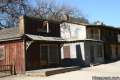
What is in the little building shown in one of your pictures, is that where one can view the photos you mentioned.
The small building is a utility shed used by the park. There are archival photos on the doors. The park has done a great job preserving and presenting the old set.
How did the actors get to the site
how else by helicopter!!!
At one time there were access roads to get into the site.
This is a great hike. It’s not terribly challenging, mostly flat, with a part that gets a bit rocky. Really cool to see the site of M.A.S.H. Note: if you start at the corner of Las Virgines & Mullholland, go west on Mullholland about 200 yards, just over a little bridge, on the left is where you will find the entrance. There will be a lot of cars parked in that area. If you go to the park entrance just a little further south on Las Virgines you can pick up a rangers map with all the hikes in the area for $12. There is also a camping area there for RVs
Is this where the free entrance to the park is?
You can start the hike from South Grassland Trail or Cistern Trail to get into the park for free.
yes
I have watched MASH since the 70’s and I wish it was back on television today but I love seeing all the re-runs on TVLand
Oh!!!!!! I am SO doing this hike!! I know the pictures of what I’m looking at here like the back of my hand!! How soon can I plan this??
Just want to warn people – the section between Cage Creek Trail junction and the MASH site floods easily during and after rains. This section of the trail is basically now the creek and not really Crags Rd anymore, it is still passable if you are willing to get your feet wet or pick your way through the area off to the side of where the water is running through. Worth it to make it to the MASH site though.
I have been trying to identify and find out what happened to what I thought was a Spanish Mission building that can be seen to the left of a mountain peek when seen in the opening credits of MASH. When I had taped the program once, I was able to plainly see it was really a building. It may have been destroyed in the fire, and I no longer can see it on any of the photographs I see, though it is hard to tell. This building made the mountain very distingishable from the others as in the right light it appeared to have two peaks. I have been trying to catch this photo for several years. If anyone knows, please email me. I watch the reruns constantly to see exactly where the mountain sits, but the camera crew did such a good job of changing angles and moving around that I have had no luck.
The building is still there…….seen in recent tourist photos. Can anyone, anybody, tell me more about it. I am still waiting for someone who knows.
Rick Simeone, again
I was there back in ’91…a nice hike. It was awfully nice of the a-holes at FOX to remove the show’s open (gee, think of all the money they were losing from a TV show open!). Corporate lawyers…you gotta love ’em (or, run them over).
This sounds like a reasonable hike to get to the location. I’m curious though – back when they were filming, how did they transport the film crews / actors / equipment back in there ? There must have been a more well travelled road back then. (?)
I used to visit here on a weekly basis when they filming, back in 1980-82. We used to fish the creek for bass before anyone ever knew about this place. We used to see the vans with Alan Alda and the rest of the cast come driving by us, and while we were fishing right behind the set you could here Col. Potter always yelling. We used to always laugh at that. They left the tents up and were guarded by a security guard named Carol. We used to visit here in the “Swamp” that is where she stayed while she was guarding the place. Very good memories of partying in the Swamp.
Fox owned the land back then and used it for filming. Naturally they simply drove to the site, on what I’m sure was a much more established and used network of roads. No private vehicles are allowed now on the roads, at least in that part of the park.
Yes – the roads to the east of the film set area were clearly in much better condition 30 years ago than they are today. When the ranch was actively in use, they were very necessary.
yes Crags Rd was lightly paved starting on the west side of the park (this is the opposite end of the park when you start the hike from las virgenes rd) that would take you to the filming site (about 200 or so yards before the MASH site Crags Rd turns into gravel trail); the paved road is still present but in many places it’s in very poor condition as it hasn’t been used in years (no public vehicles allowed) – just outside this entrance is secluded residential area. this was the road used by film crew to get to and from the filming site. Crags Rd turns into a residential street if you were to continue your hike out of the park. the film crew didn’t use the hiking trail that most hikers use today to get to the MASH site – its just not possible due to the terrain. google maps using satellite view is very good showing this.
I hike this trail once a year for the past 15 years and will be returning this Saturday June 23rd 2018 for my annual MASH hike. hopefully it hasn’t changed much…
[…] Hikespeak -Hiking info, maps, photos […]
we were there in the early 1981 and all the Mash Sets were around. The huts etc. The park was great and no one knew about it. Today it is over run with garage and people who don’t care. Please when you go to these places pick up after yourself and dogs?
Can’t find the MASH site on google maps can someone send me the GPS coordinates. mopsy_54@yahoo.com
The old set is visible easily on Google maps. Turn map labels on and and search Crags Road and Bulldog Lateral. The set is about 1000 ft east on Crags Road , at a sharp turn from NE/SW to E/W. Zoom in and you’ll be able to see the trucks and picnic tables
Is the Goodbye spelled out of rocks still there? If so would love to plan a trip. We live in Pa. So it is quite a trip.
The “goodbye” is not there anymore, I’m not sure, but from screen captures it looks like they used sandbags or something to spell it out as that would be fairly easy to assemble onsite instead of trucking in dirt/sand/rocks or something.
You can walk up on the hill that they used for the helicopter pad and where the “goodbye” was spelled out though.
My husband and I will be in CA in September and wanted to see the M*A*S*H site but my husband is handicapped. Any motorized tours available as he is unable to hike that distance?
I don’t believe so, but please check with Malibu Creek State Park just in case.
Can a person metal detect in this park ?
Had a great time biking to the set from Juan Bautista de Anza State Park (free parking). Check out our post on the experience, photos included!
http://mrandmrsadventure.com/2013/12/17/biking-to-the-set-of-mash/
I hiked there in 1981. was so cool. all the tents were up and the swap was closed off. I have about 6 pictures. I really like the park.
I hiked to the site in Fall of 2010. We traveled from North Bay in Ontario, Canada. Will never forget the trip. It was worth every penny. Hike was not bad at all I thought. Glad to see the site was upgraded and taken care of.
I am 58 yrs. old ….. I am NOT a hiker, but would really like to see this. Could horses bring you part of the way? If so, telephone numbers, anyone? I am concerned about being able to make it both ways.
Is this a trail you can bike with a mountain bike?
It is. Enjoy the ride!
I need direction to the mash site from the 210 freeway in La Crescenta
is there transport available from the car park to the MASH set
Just hiking or biking…
Would a Segway be appropriate?
Hiked to this location over the weekend and it was beautiful. Live over an 1 1/2 hr. south of this location and will definitely be back for more hiking!
Can you let me know what time the gate to the main parking area opens?
Thanks
I have been reading some on this wonderful place and learned that the Rifleman was filmed here early in production. Is this true? and any idea where in the park would this have taken place?
Approximately 1/4 mile north of where Grasslands Trail and Crags Rd intersect. On the east side of Crags Rd. If you have a photo of the McCain ranch it’s easy to match the trees and terrain to find the exact spot.
If I am traveling alone with my dogs, How can I go on the MASH hike?
I have done this hike 2 times. Such a fan that I cried the first time I arrived on site. The scenery along the way is spectacular, and from the site you can see the opening show scene with the chopper coming into land on the helo pad. I am not getting any younger, but hope to go out there again soon.
Hi, my 20 something daughter and friend may hike here. She is not an experienced hiker? Is that ok? Thank you.
The best show ever on TV. I have been to California a lots of times and on the 101 right there. I was suspecting it was filmed there, now i know! Wow! I am presently watching the show on AMC season 7 episode one. I am from Québec and wish to go back to California shortly. Hello to all the fans!
How did they get all of the vehicles used on the mash set. If there are no roads getting back to the set.
[…] Its not only a good hike but a great place to capture some shots. Here are some detailed steps on reaching the site M.A.S.H Hike […]
Is the site back up and running since the last fire a year or two ago?
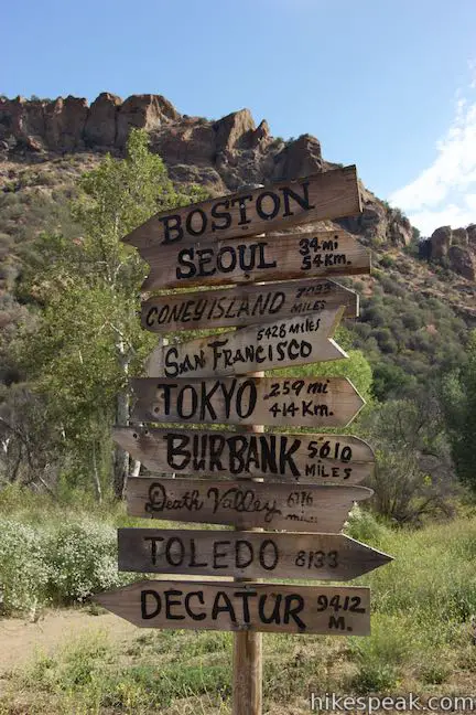
Yes, the site is open, and really crowded during COVID-19 pandemic. Everyone has the same idea! We were there yesterday (January 2 2020); most but not all hikers were masked. Someone rebuilt the signpost, which burned during the Woolsey Fire. Signs are up. The only tricky part is that we couldn’t find a bridge to cross the creek, and had to scramble over boards and logs. Some people were getting wet.
My wife and I watch two MASH shows every nite in NH on METV starting at 7:00 EST after ABC News at 6:30. We’ll see the whole 11 years of MASH. Great Entertainment to relieve those times with the MASH gang.
Is anyone able to verify if the trail is fixed to access the site? In 2020 it was inaccessible. I’d like to take my 85 y.o. Mother to see the spot and any info is appreciated.
Haven’t visited since late 70’s, early 80’s when I lived in LA. Watercress growing in the creek area was a bonus!
The pictures and the trucks on grounds are not the originals. I’m a mash fanatic and i reseaxed about them, the original ambulance is in a personal collection and the jeeps used in filming were keep in possession of the filming company and used in later tv shows and films until decommissioned, basically.
[…] Almost every winter we hike in the Malibu Creek State Park to the MASH site. We wanted to do something different this time, so our “leader” drove us into the Santa Monica Mountains […]