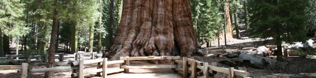
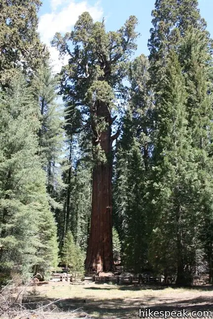
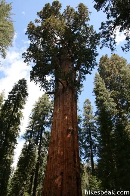
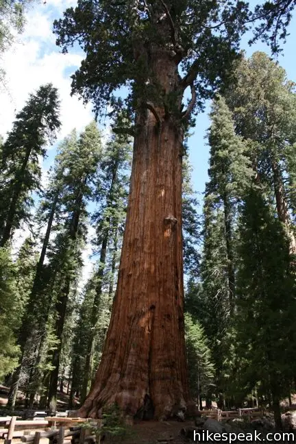
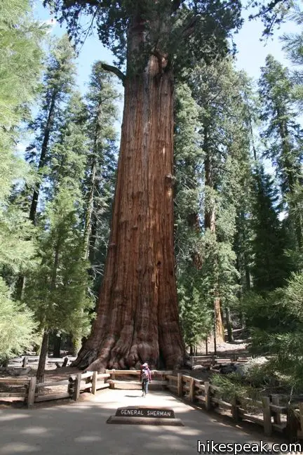
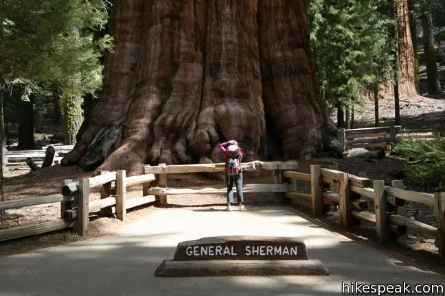
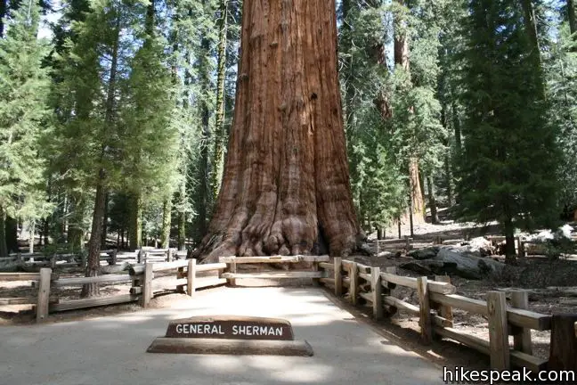
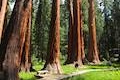
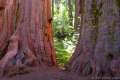
The General Sherman Tree is the most giant giant sequoia in the world. It is the largest tree by volume, measuring 275 feet tall and 36.5 feet across at the base. General Sherman Tree is believed to be 2,200 years old and weigh 1,385 tons. But those are numbers – numbers that a brain familiar with standard-sized trees cannot process. The only way to appreciate the unfathomable, almost unearthly size of the giant sequoias is the see one for yourself.
Named after Civil War General William Tecumseh Sherman, the star of the Giant Forest, General Sherman Tree, can be reached a few different ways. For the handicapped, parking is available adjacent to the tree just off the Generals Highway. For others, several trails lead to General Sherman Tree, including the most obvious choice, General Sherman Trail.
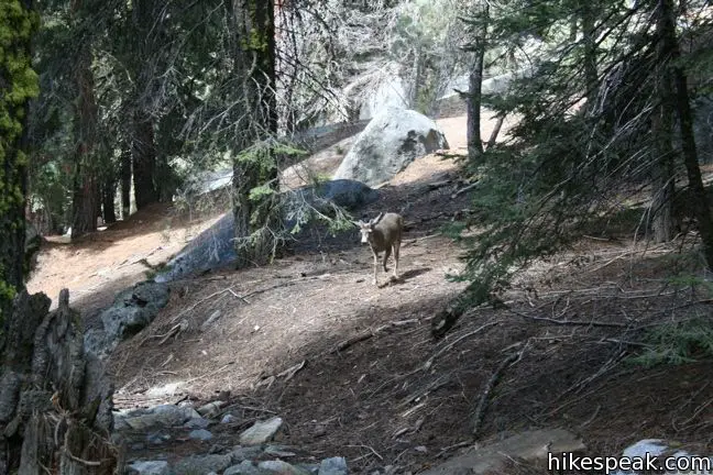
General Sherman Trail is pavedand half a mile long (each way), descending some 200 feet (which is less than the height of the Sherman Tree). The trail is wide with a few staircases. Benches and informative panels can be found throughout General Sherman Trail. Did you know the Sherman Tree has a volume of 52,500 cubic feet?
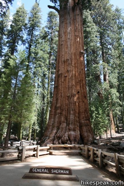
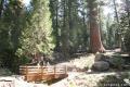
Halfway down, the trail crosses a brick “footprint” matching the base of the General Sherman. The footprint, like the tree has a circumference of 103 feet and offers a distinct visual of the enormity of Sherman.
If for some reason you can’t make it up to see General Sherman this year, worry not. It will be even bigger next year. The General Sherman is still growing, adding about 0.4 inches in diameter each year. According to the park brochure, this is enough to equal the mass of a typical sixty foot tree.
For an easy opportunity to see more giant sequoias, continue on the Congress Loop, which starts at the Sherman Tree. If you drive 30 miles north on the Generals Highway, you can visit the General Grant Tree, the world’s third largest giant sequoia. Dogs and bikes are not permitted on trails in Sequoia National Park.
Directions to the Trailhead
- From the Giant Forest Museum, head north on the Generals Highway.
- One mile past the handicapped parking area across from the General Sherman Tree, turn right (east) on Wolverton Road.
- Make the next right toward the Sherman Tree Trail.
- The road ends at the parking lot.
Trailhead Location
Trailhead address: Wolverton Road, Sequoia National Park, CA 93262
Trailhead coordinates: 36.5848, -118.74984 (36° 35′ 05.3″N 118° 44′ 59.04″W)
You may also view a regional map of surrounding Sierra Nevada trails and campgrounds.

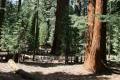 | Congress Loop This easy paved two mile loop visits the fourth and fifth tallest Sequoias in the world (among others). |
 | Big Trees Trail This 1.4-mile stroll explores giant sequoias around Round Meadow on a paved nature trail that is easy, educational, and beautiful. |
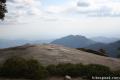
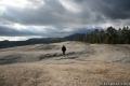 | Sunset Rock This 2-mile hike visits a large granite dome with great views to the west, possibly the best place to end your day in the Giant Forest. |
 | Beetle Rock This short walk from the Giant Forest Museum to Beetle Rock visits a granite dome with great views and stunning sunsets. |
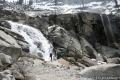 | Tokopah Falls This 4.2-mile hike reaches the base of the tallest waterfall in Sequoia National Park. |
 | Crescent Meadow This level 1.6-mile loop visits a Sequoia you can stand inside (Chimney Tree) and another that someone used to live in (Tharp's Log). |
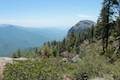 | Sugar Pine Trail and Bobcat Point Trail Loop This short but diverse 1.5-mile loop peaks at Bobcat Point, which presents a fierce perspective of Moro Rock and a massive canyon. |
 | Hanging Rock Trail This short 0.35-mile hike passes views of Moro Rock en route to a balancing boulder on a canyon rim at the edge of the Giant Forest. |
 | Moro Rock This 0.6 mile hike sports panoramic views and should be considered a mandatory hike for first time visitors to Sequoia National Park. |
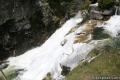 | Marble Falls This 8-mile hike takes a flower-lined path up a mountain canyon to a powerful waterfall. |
 | Paradise Creek This short stroll leaves Buckeye Flat Campground to visit the perfect swimming hole for a hot summer day in the Sierra. |
 | Panther Creek This 6-mile hike follows the Middle Fork Trail to a 100 foot waterfall that drops into the Middle Fork of Kaweah River. |
 | More trails in the Sierra Nevada Mountains Explore other destinations in Sequoia National Park and the rest of the range. |
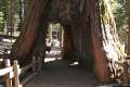
 | General Grant Tree Trail in Kings Canyon National Park This 0-8 mile loop in the Grant Grove passes through a Fallen Monarch to reach the General Grant Tree, one of the world's largest sequoias. |
 | Mariposa Grove in Yosemite National Park This 1.6-mile hike (or longer) visits the biggest trees in Yosemite. |
 | Trail of 100 Giants in Giant Sequoia National Monument This paved 0.5 to 1.3-mile loop visits a grove of giant sequoias alongside Western Divide Highway. |
 | North Grove - Big Trees Trail in Calaveras Big Trees State Park This easy 1.5-mile loop explores the first giant sequoias discovered by settlers in California. |
 | Sequoia and Kings Canyon National Parks Campgrounds There are 14 campgrounds with over 1,000 total sites spread throughout the park to facilitate your visit. |
Common Questions about General Sherman Tree in Sequoia National Park
- Is the trail open?
- Yes. You should expect to find that Sherman Tree Trail is open. There are no recent reports of trail closures. If you discover that the trail is closed, please help your fellow hikers by reporting a closure.
- Do I need a permit for this hike?
- Yes. National Park Entrance Fee.
- How much time does this hike take?
- It takes approximately 30 minutes to hike Sherman Tree Trail. Individual hiking times vary. Add extra time for breaks and taking in the views.
- How long is this hike?
- The hike to Sherman Tree Trail is a 1 mile out and back with 200 feet of elevation change.
- Are dogs allowed on this trail?
- No, dogs are likely not allowed on Sherman Tree Trail. The trail is primarily open to hikers.
- Is Sherman Tree Trail good for kids?
- Yes, this hike is likely suitable for children. It is relatively short (1 miles) with manageable elevation gain.
- Are there sequoia trees on this hike?
- Yes, Sherman Tree Trail visits a grove of giant sequoias.
- Where is the trailhead located?
- The trailhead for Sherman Tree Trail is located in Sequoia National Park, CA.
Trailhead Address:
Wolverton Road
Sequoia National Park, CA 93262
Trailhead Coordinates:
36.5848, -118.74984 - What are the driving directions to the start of the hike?
To get to the trailhead: From the Giant Forest Museum, head north on the Generals Highway. One mile past the handicapped parking area across from the General Sherman Tree, turn right (east) on Wolverton Road. Make the next right toward the Sherman Tree Trail. The road ends at the parking lot.
View custom Google Maps directions from your current location.
- Are there other trails near Sherman Tree Trail?
- Yes, you can find other nearby hikes using the Hikespeak Hike Finder Map.

How big is the Sentinel Tree at the Visitors Center?
While it looks big, the Sentinel Tree only weights seven hundred tons, and is about half the size of the General Sherman Tree. You can a photo of the Sentinel Tree on the post covering the Giant Forest Museum.
I like this website.
Do you think it will be possible to visit General Sherman tree
on the 6th or 7th of november 2012?
Unless a major winter storm temporarily closes the road at that time, you should have no problem visiting the General Sherman Tree.
Can I see General Sherman with my dog? The paved trail seems pretty developed.
Sorry, pets are not allowed on any trails in Sequoia or Kings Canyon N.P.
Will a small dog be allowed on the paved trail if they are kept in a pet stroller?
what is the correct address to get to The General Sherman tree , and how many hrs does it take from Elk Grove city, zip 95624, thank you
In the “About This Hike” box along the right side of this page, you can enter your address to create custom directions to the trailhead. Here are the directions you’d get for Elk Grove.
We are planning to go to Sequioa National Park this 3rd week of April. Is it possible to see General Sherman Tree during this period? Do we need to hike to be able to see it or we can just drive along? Thanks
Hi,
I will be visiting Sequoia National Park in September 2015. First of course I will go to see the General Sherman, but I was wondering if there are many trails and trees to visit by feet from that point? I would like to spend around 4 to 5 hours in Sequoia National Park, I don’t know if that is enough or too much?
Yes. There are lots of nearby trails. Big Trees Trail is quite nice and you can walk from the General Sherman Tree all the way to Crescent Meadow through a lot of other trails. Give this park as much time as you can!
We will be traveling to California in July and would love to spend the day in Sequoia National Park. We want to see the General Sherman Tree. If coming in from the San Francisco Bay Area, where is the best and closest place to enter the park to get to General Sherman? Also, what trail should we take and is the trail more of a leisure walk or more like a true hike? We have a 4 year old that likes to run as much as possible. We are curious to know if this is something we can take in with an active four year old.
What is the elevation above sea level at the base of Sherman?
My wife has limitations with elevation. What is the elevation along the path & at the tree?
The tree at trail are at an elevation around 7,000 feet.
How did the Fallen Monarch in Mariposa Grove fall
Can handicap see the tree by scooter?
I have seen people standing next to Sherman tree (is that legal or disrespectful?) hoping to visit this summer.
How many people could fit around the tree if they all held hands?