Munson Creek Falls Trail Tillamook Coast Range Waterfall Munson Creek Falls State Natural Site Oregon
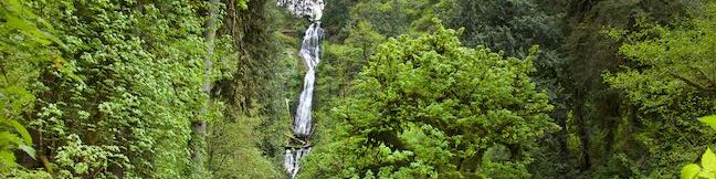
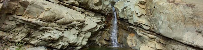
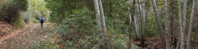
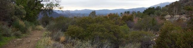
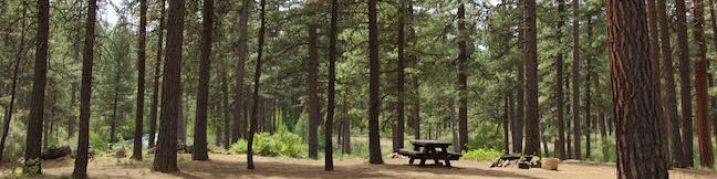
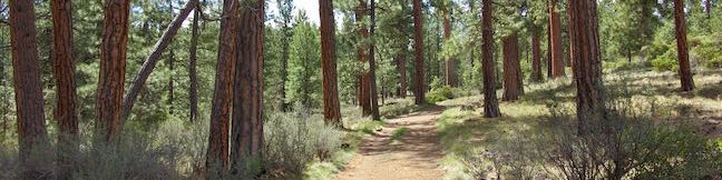
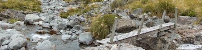
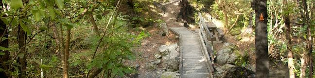
Measuring 319 feet tall, Munson Creek Falls is no tiny trickler. In fact, this is Oregon's tallest waterfall west of the Willamette River. Munson Creek Falls has picturesque silky tiers framed by canyon greenery. The trek to the waterfall, Munson Creek Falls Trail, is just a quarter mile long (half a mile round trip) with 90 feet of elevation change. ...Read more.
My Hikes: Completed hikeA green icon of shows a picture of a landscape with a check mark in the upper right corner, signifying that this is a hike you would like to put on your completed list.OK! Add to trails I've hiked
My Hikes: Want to hikeA green icon of shows a picture of a landscape with a heart in the upper right corner, signifying that this is a hike you would like to put on your to-do list.OK! Add to trails I want to hike
TagsA green icon depicting a tags represents a list of words and phrases that this content is tagged with Tagged with · Creeks · Free Trails · Oregon State Parks · Tillamook · Waterfalls
Hike DistanceA green icon of a hiker used to label information about the length of the hike Distance: 0.5 miles · Elevation change: 90 feet
By: Published: Last updated: December 5, 2025
Santa Paula Canyon Trail The Punchbowl Hike Santa Paula Canyon Punch Bowls Big Cone Camp East Fork Trail Los Padres National Forest Topatopa Mountains California
Framed by tall, rugged ridges in the Topatopa Mountains, Santa Paula Creek slices through the rockbed of Santa Paula Canyon, carving out alluring pools and cascades called the Punchbowl (or Punch Bowls). Finishing with a flourish, the Punchbowl has a 25-foot waterfall and a pool that you can relax beside. The Punchbowl is located between Big Cone Camp and Cross Camp, two Los Padres National Forest Campgrounds on the East Fork of Santa Paula Canyon. ...Read more.
My Hikes: Completed hikeA green icon of shows a picture of a landscape with a check mark in the upper right corner, signifying that this is a hike you would like to put on your completed list.OK! Add to trails I've hiked
My Hikes: Want to hikeA green icon of shows a picture of a landscape with a heart in the upper right corner, signifying that this is a hike you would like to put on your to-do list.OK! Add to trails I want to hike
TagsA green icon depicting a tags represents a list of words and phrases that this content is tagged with Tagged with · Creeks · Free Trails · Los Padres National Forest · Off Trail · Santa Paula · Topatopa Mountains · Trail Camp · Waterfalls
Hike DistanceA green icon of a hiker used to label information about the length of the hike Distance: 8 miles · Elevation change: 800 feet
By: Published: Last updated: December 5, 2025
Sisar Canyon Trail Hike Sisar Canyon Road Summit Ojai Santa Paula California Los Padres National Forest Sisar Creek Hike
Sisar Canyon cuts into the mountains above Upper Ojai Valley, halfway between Ojai and Santa Paula. A wide dirt trail travels up the canyon toward Topatopa Ridge, a striking bluff of striped rock. Rather than taking Sisar Canyon Trail (also known as Sisar Canyon Road) deep into the Topatopa Mountains, turn around at an overlook 2.75 miles up the trail for a picturesque day hike. ...Read more.
My Hikes: Completed hikeA green icon of shows a picture of a landscape with a check mark in the upper right corner, signifying that this is a hike you would like to put on your completed list.OK! Add to trails I've hiked
My Hikes: Want to hikeA green icon of shows a picture of a landscape with a heart in the upper right corner, signifying that this is a hike you would like to put on your to-do list.OK! Add to trails I want to hike
TagsA green icon depicting a tags represents a list of words and phrases that this content is tagged with Tagged with · Creeks · Free Trails · Los Padres National Forest · Ojai · Santa Paula · Topatopa Mountains · Upper Ojai Valley
Hike DistanceA green icon of a hiker used to label information about the length of the hike Distance: 6.5 miles · Elevation change: 1200 feet
By: Published: Last updated: December 5, 2025
Horn Canyon Trail Hike Ojai California Los Padres National Forest Thacher Creek Canyon Thacher School Trailhead
Horn Canyon Trail rises into the frontcountry of the Topatopa Mountains from Ojai, California. While you can spend a full day (and a full workout) hiking up Horn Canyon Trail, you can also opt for the shorter option described here, trekking up the trail's moderate opening mile, past multiple creek crossings and views down Ojai Valley, before venturing off trail up the canyon bottom past pools and a small cascade on Thacher Creek. ...Read more.
My Hikes: Completed hikeA green icon of shows a picture of a landscape with a check mark in the upper right corner, signifying that this is a hike you would like to put on your completed list.OK! Add to trails I've hiked
My Hikes: Want to hikeA green icon of shows a picture of a landscape with a heart in the upper right corner, signifying that this is a hike you would like to put on your to-do list.OK! Add to trails I want to hike
TagsA green icon depicting a tags represents a list of words and phrases that this content is tagged with Tagged with · Creeks · Free Trails · Los Padres National Forest · Off Trail · Ojai · Topatopa Mountains
Hike DistanceA green icon of a hiker used to label information about the length of the hike Distance: 2.9 miles · Elevation change: 750 feet
By: Published: Last updated: December 8, 2025
Old Main Trail Red Fox Trail Cedar Trail Middle Creek Trail Maple Ridge Trail Loop Hike Tryon Creek State Natural Area Portland Oregon
Located just five miles from downtown Portland, Tryon Creek State Natural Area preserves 658-acres of lush second-growth forest made up of mossy red cedars and Douglas firs. Many miles of trail and 8 bridges allow visitors to explore the Tryon Creek Watershed. At first glance, the web of trails on the park map is overwhelming, but it actually allows for numerous easy to moderate outings. ...Read more.
My Hikes: Completed hikeA green icon of shows a picture of a landscape with a check mark in the upper right corner, signifying that this is a hike you would like to put on your completed list.OK! Add to trails I've hiked
My Hikes: Want to hikeA green icon of shows a picture of a landscape with a heart in the upper right corner, signifying that this is a hike you would like to put on your to-do list.OK! Add to trails I want to hike
TagsA green icon depicting a tags represents a list of words and phrases that this content is tagged with Tagged with · Creeks · Free Trails · Oregon State Parks · Southwest Portland · Tryon Creek State Natural Area · Tualatin Mountains · West Hills of Portland
Hike DistanceA green icon of a hiker used to label information about the length of the hike Distance: 2 miles · Elevation change: 150 feet
By: Published: Last updated: December 5, 2025
Lower Canyon Creek Campground Deschutes National Forest Metolius River Camp Sherman Oregon
Seven sites are spread below ponderosa pines on a loop in Lower Canyon Creek Campground. This small and spacious campground is located in Deschutes National Forest near Camp Sherman and Sisters, Oregon. The campground borders the confluence of Canyon Creek and the Metolius River. Hikers can leave the campground on West Metolius River Trail to hike a short distance to a surprising springs and a fish hatchery. ...Read more.
TagsA green icon depicting a tags represents a list of words and phrases that this content is tagged with Tagged with · Camp Sherman · Cascade Range · Creeks · Deschutes National Forest · Tent Camping
By: Published: Last updated: July 25, 2025
Shevlin Loop Trail Bend Oregon Hike Shevlin Park Tumalo Creek
Shevlin Loop Trail explores pine forests along Tumalo Creek in Shevlin Park, which is just four miles west of downtown Bend. This pleasant woodland trail is mostly easy with a few rolling sections along the bluffs that border the creek. The loop is 4.75 miles long and explores much of Shevlin Park's 647 acres. The hike has 240 feet of elevation change and crosses lovely Tumalo Creek at two points. ...Read more.
My Hikes: Completed hikeA green icon of shows a picture of a landscape with a check mark in the upper right corner, signifying that this is a hike you would like to put on your completed list.OK! Add to trails I've hiked
My Hikes: Want to hikeA green icon of shows a picture of a landscape with a heart in the upper right corner, signifying that this is a hike you would like to put on your to-do list.OK! Add to trails I want to hike
TagsA green icon depicting a tags represents a list of words and phrases that this content is tagged with Tagged with · Bend · Cascade Range · Creeks · Free Trails · Shevlin Park · Tumalo Creek
Hike DistanceA green icon of a hiker used to label information about the length of the hike Distance: 4.75 miles · Elevation change: 240 feet
By: Published: Last updated: December 5, 2025
Otira Valley Track Arthur's Pass National Park Hike Arthur's Pass Village Hiking Track New Zealand
Just over the north side of Arthur's Pass and 5 kilometers from Arthur's Pass Village, you'll find Otira Valley Track, which ascends a trough-shaped valley off the west side of the pass. The track ends at Otira River Footbridge. Under normal circumstances, a bridge would be an odd place to end a hike (since a bridge lead to something on the other side). ...Read more.
My Hikes: Completed hikeA green icon of shows a picture of a landscape with a check mark in the upper right corner, signifying that this is a hike you would like to put on your completed list.OK! Add to trails I've hiked
My Hikes: Want to hikeA green icon of shows a picture of a landscape with a heart in the upper right corner, signifying that this is a hike you would like to put on your to-do list.OK! Add to trails I want to hike
TagsA green icon depicting a tags represents a list of words and phrases that this content is tagged with Tagged with · Arthur's Pass Village · Creeks · Free Trails · New Zealand Department of Conservation · New Zealand National Parks · Arthur's Pass National Park
Hike DistanceA green icon of a hiker used to label information about the length of the hike Distance: 3.8 kilometers / 2.35 miles · Elevation change: 125 meters / 410 feet
By: Published: Last updated: December 9, 2025
Bealey Chasm Walk Arthur's Pass National Park Hike Bealey River Hiking Track Bealey Valley Track Footbridge Arthur's Pass Village New Zealand
North of Arthur's Pass Village, Bealey River passes through a narrow gorge, creating a mix of tumbling white water and blue pools. A footbridge on Bealey Valley Track crosses over this point on the river, called Bealey Chasm. Visit the chasm on a short walk beginning from State Highway 73. Bealey Chasm Walk starts with a short section of Arthur's Pass Walking Track and connects to Bealey Valley Track. ...Read more.
My Hikes: Completed hikeA green icon of shows a picture of a landscape with a check mark in the upper right corner, signifying that this is a hike you would like to put on your completed list.OK! Add to trails I've hiked
My Hikes: Want to hikeA green icon of shows a picture of a landscape with a heart in the upper right corner, signifying that this is a hike you would like to put on your to-do list.OK! Add to trails I want to hike
TagsA green icon depicting a tags represents a list of words and phrases that this content is tagged with Tagged with · Arthur's Pass Village · Creeks · Free Trails · New Zealand Department of Conservation · New Zealand National Parks · Arthur's Pass National Park
Hike DistanceA green icon of a hiker used to label information about the length of the hike Distance: 0.65 kilometers / 0.4 miles · Elevation change: 12 meters / 40 feet
By: Published: Last updated: December 9, 2025
Kereru Loop Hike Mt Thomas Forest Wooded Gully Track Kereru Track Red Pine Track Mount Thomas Forest Conservation Area New Zealand
The shortest hike in Mount Thomas Forest is Kereru Loop, a 2.45 kilometer (1.5-mile) circuit that starts from Wooded Gully Campground. The loop employs three trails, Wooded Gully Track, Kereru Track, and Red Pine Track, for a quick walk through the forest. The loop doesn't offer any grand vistas and is highlighted by picnic spot along Wooded Gully Stream. ...Read more.
My Hikes: Completed hikeA green icon of shows a picture of a landscape with a check mark in the upper right corner, signifying that this is a hike you would like to put on your completed list.OK! Add to trails I've hiked
My Hikes: Want to hikeA green icon of shows a picture of a landscape with a heart in the upper right corner, signifying that this is a hike you would like to put on your to-do list.OK! Add to trails I want to hike
TagsA green icon depicting a tags represents a list of words and phrases that this content is tagged with Tagged with · Creeks · Free Trails · Mount Thomas Forest Conservation Area · New Zealand Department of Conservation · Okuku
Hike DistanceA green icon of a hiker used to label information about the length of the hike Distance: 2.45 kilometers / 1.5 miles · Elevation change: 95 meters / 310 feet
By: Published: Last updated: December 5, 2025

Tag!

You've come to a tag page, one of the blogiest ways to browse hikespeak.com.

Here are some more tags. The most common tags are the big ones at the top of the list. Have a look around. You may also find what you seek with the search feature on the Hike Finder Map.

Free TrailsNational ParksOcean ViewsCalifornia State ParksSummitsWaterfallsTent CampingCreeksLakesNature TrailsAngeles National ForestMalibuAdventure PassCascade RangeNew Zealand Department of ConservationDesert CanyonsOff TrailWildflowersBeachesLos Padres National ForestNew Zealand National ParksMountains Recreation and Conservation AuthoritySan Gabriel Mountains National MonumentGriffith ParkBig SurWheelchair-FriendlyCampervan CampingRuinsSequoia GrovesOregon State ParksLos OsosPacific Crest TrailHydrothermalCavesHollywoodBackpackingMontaña de Oro State ParkAustralian National ParksTopanga State ParkYosemite ValleyRedwood GrovesAltadenaSanta Ynez MountainsSanta Monica Mountains National Recreation AreaTopangaIrish HillsLone PineMalibu Creek State ParkBorrego SpringsAgoura HillsTrail CampArchesBureau of Land ManagementLookout TowersPacific PalisadesBoulderingDeschutes National ForestColumbia River Gorge National Scenic AreaBackbone TrailLavaWest Hills of PortlandMorrosTualatin MountainsArthur's Pass VillageMinesNevada State ParksTongariro National ParkMammoth LakesWalk-in CampingFruitaGrand JunctionArthur's Pass National ParkBendGiant ForestLa Cañada FlintridgeTide PoolsMorro BayCleveland National ForestRotoruaAzusaJohn Muir TrailAccommodationsOvertonArcadiaPasadenaZion CanyonLava TubesGoletaIsland in the SkyCalabasasTasmania's 60 Great Short WalksHot SpringsSanta Lucia MountainsClaremontGaviota State ParkBadlandsVerdugo MountainsBoardwalksGolden Trout WildernessClosedTillamookPhillip IslandAoraki Mount Cook National ParkRainforestsShasta-Trinity National ForestClosed SeasonallyVolcanoesNorthwest PortlandLas VegasSan Bernardino National ForestGrand Canyon of the YellowstoneForest ParkMount CookVolcanoNewbury ParkPetroglyphsGrant GroveGeyser BasinsStairsButtesBrentwoodGifford Pinchot National ForestFreycinet PeninsulaSan Ysidro MountainsColes BayMorro Bay State ParkTopatopa MountainsThousand OaksPalos Verdes PeninsulaSand DunesOakhurstOnondaga CountyAdirondack ParkAdirondack MountainsMorterosGiant Sequoia National MonumentAnsel Adams WildernessOhakuneOjaiMemorialsFreycinet National ParkLighthousesJohn Muir WildernessTasman PeninsulaTrabuco Ranger DistrictSan Bernardino MountainsWestern DivideSanta Ana MountainsSilver Moccasin TrailOrange County ParksPoint Mugu State ParkWestridge-Canyonback Wilderness ParkPaicinesSunriverWestern Divide Ranger DistrictNatural BridgesWill Rogers State ParkCratersNelder GroveTopanga CanyonStevensonWhakapapa VillageLava Butte Lava FlowWashington State ParksMount Hood National ForestCastle Crags State ParkMount ShastaThree Capes Scenic RouteNewberry National Volcanic MonumentWater SlidesMount HoodTarzanaContinental DivideSouth Lake TahoeSistersHobartReservoir Canyon Natural ReserveDomesPfeiffer Big Sur State ParkHumboldt Redwoods State ParkSouthwest PortlandOasesLeo Carrillo State ParkMoabGovernment CampNewhallLaguna BeachJulianSouth Coast WildernessTemescal Gateway ParkSilver Falls State ParkCambriaHutsSublimityGlacier LakesCliff JumpingGoing-to-the-Sun RoadPearblossomMontecitoHawaii State ParksKlamath MountainsSpringvilleRancho Palos VerdesWawonaDeschutes RiverCamp ShermanWildlife ViewingBeacon Rock State ParkLos Robles Open SpaceTanksYellowstone RiverSan Vicente Mountain ParkSwimming HolesObservatoriesIdyllwildSan Jacinto Ranger DistrictWaiotapuBurbankPalomar Ranger DistrictCalifornia Coastal TrailTasman National ParkLabrador Hollow Unique AreaCortland CountyTullyNew York State ForestsMount William National ParkVestalPicnic AreaWind CavesSan Jacinto MountainsSilver Peak WildernessBinghamton University Nature PreserveCedar GroveBlack HillsAvila BeachJulia Pfeiffer Burns State ParkCinder ConesLake ElsinoreMurrietaWenatche National ForestElephant SealsGlendaleSnowshoeingSan Mateo Canyon WildernessWilsons Promontory National ParkCrestlineEmma Wood State BeachWhananaki NorthCarpinteriaPlacerita Canyon Natural AreaPlacerita Canyon State ParkBike TrailSan PedroTujungaSanta Susana MountainsNew York State ParksSun ValleyCrescent CityRedwood Mountain GroveBishop Peak Natural ReserveAvila ValleySimi HillsSheep Mountain WildernessCrystal Cove State ParkSierra Pelona MountainsSanta MargaritaBeverly HillsConejo ValleyBlue Mountain LakeNicholas Flat Natural PreserveHume Lake Ranger DistrictGlaciersTe AwamutuRangitikeiSummit ValleySummit Valley Edmund D. Edelman ParkFish HatcheryWoodland HillsCastle Crags WildernessPepperwoodTryon Creek State Natural AreaTaurangaTaupoLodgeSanta PaulaTwentynine PalmsSherman OaksWillamette National ForestSouthern AlpsPortlandMount Thomas Forest Conservation AreaOkukuCusterCal PolyMacleay ParkWaimangu Volcanic ValleyPictographsOkere Falls Scenic ReserveOkere FallsArroyo GrandeMarvin Braude Mulholland Gateway ParkHood RiverEaglehawk NeckCampervan ReviewMount WellingtonWellington ParkTree MoldsLauncestonWaipio ValleyAndrew Molera State ParkCatalina IslandLimekiln State ParkHiloMount Field National ParkBritzRichardson Grove Redwoods State ParkColumbia River GorgeLake Tahoe Basin National Forest LandsPuakoCampervan RentalRocky MountainsLyleSaltwater RiverDeschutes River State Recreation AreaBlowholesWascoLord of the RingsBoat CruiseHarmony Headlands State ParkCayucosSanta Clarita Woodlands ParkAgua DulceCrazy Horse MemorialMonrovia Canyon ParkMonroviaRefugio State BeachPrimitive CampingSatellite CommunicatorsSOS BeaconsMount MaunganuiCulver CityHigh LineMatamataMount San Jacinto State ParkSan Jacinto WildernessMuruparaBanningFiscalini Ranch PreserveKings CanyonWhitewater RaftingTop 10 Holiday ParkPapamoaAerial GreenwayManhattanGPS NavigatorsPalomar MountainsAmboy Crater National Natural LandmarkPetrified LogsPowell Butte Nature ParkSoutheast PortlandBig Bear LakeCross Country SkiingCarpinteria Salt Marsh Nature ParkSonoraCarpinteria Bluffs Nature PreserveLas CrucesVentura RiverPilot Butte State ParkOak ParkMount Lowe RailwayLaguna Coast Wilderness ParkWarner SpringsOrangePeters Canyon Regional ParkSanta Lucia WildernessCarpinteria Seal SanctuaryGetty View ParkHearst San Simeon State ParkMalibu Lagoon State BeachKura Tawhiti / Castle Hill Conservation AreaCastle HillCentral ParkHuntington BeachAwbrey ButteHobbitonLiffeyFallbrookBerriedaleVasquez Rocks Natural Area ParkJamesvilleClark Reservation State ParkBeaver Lake Nature CenterBaldwinsvilleOnondaga County ParkWhitewater PreserveDocent-led HikesPlaya VistaAnaheimCataract Gorge ReserveSan SimeonTauwhara BayLiffey Falls State ReserveGreat Western TiersCape Woolamai State Faunal ReserveKoalasSaint Columba Falls State ReservePyenganaFallbrook Land ConservancyHokianga HarbourDouglas-Apsley National ParkBechinoOtamure BayOtamure Recreation ReserveYucca ValleySan Rafael HillsApp ReviewGuy W. Talbot State ParkEugeneMission Trails Regional ParkTurangiSanteeSanta Rosa and San Jacinto Mountains National MonumentGreen Lakes State ParkFayettevilleConcretionsMangawekaHuntervilleBel AirNewport BeachNewport BayJedediah Smith Redwoods State ParkSantiago Oaks Regional ParkMacKerricher State ParkSalt Point State ParkWeir Canyon Wilderness ParkB&BEl Capitán State BeachFreeride TrailsWest HillsBackpackers LodgeUpper Newport Bay Nature PreserveLake Tikitapu Scenic ReserveMotor LodgeSespe WildernessMyers FlatKlamath National ForestSeasideBaldwin Hills Scenic Overlook State ParkLaCrosseLas Virgines View ParkPalouse Falls State ParkArcoEl Chorro Regional ParkOregon CityWillamette RiverHappy ValleyCamassia Natural AreaWest LinnMontagueWeedCorbettGeorge Himes Nature ParkWeottOrickFort BraggJennerWhite SalmonCamasLacamas Lake Regional ParkPrairie Creek Redwoods State ParkMcKenzie BridgeDuartePalos Verdes EstatesThe Nature ConservancyLincoln CityDepoe BayCooke CityClatskanieGlenbrookCarson CityDevils TowerLake MichiganTuna Canyon ParkWelchesRhododendronOceansideNative American HeritageBass LakeStroller-FriendlyBisonDunsmuirSiletz Bay National Wildlife RefugeSanta ClaritaFishpondsKonaCastaicKohala Forest ReserveKenneth Hahn State Recreation AreaHonomuHollywood HillsStudio CityPu‘uhonua O Hōnaunau National Historical ParkHonaunauLongridge ParkYurtsBreaCape Meares State ParkArroyo Sequit ParkOceano Dunes State Vehicular Recreation AreaCape Lookout State ParkNipomoCannon BeachEldorado State ParkColorado State ParksBoulderMarquam Nature ParkShasta LakeCalaveras Big Trees State ParkMojave Trails National MonumentAtascaderoCape Kiwanda Natural AreaCucamonga WildernessPacific CityCarbon Canyon Regional ParkCape Meares State Scenic ViewpointEcola State ParkMosierSimi ValleyCanoe & KayakAdirondack High PeaksMonserate Mountain PreserveTumalo CreekMaricopaShevlin ParkKlamathPortervilleTualatin Hills Nature ParkBeavertonGarbervilleUpper Ojai ValleyArchie Briggs Natural AreaArboretumsPismo BeachAmboySan BernardinoSkyforestCascade LocksLake ArrowheadLake Placid